
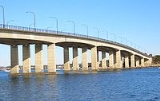
Captain Cook Bridge, New South Wales
Encyclopedia

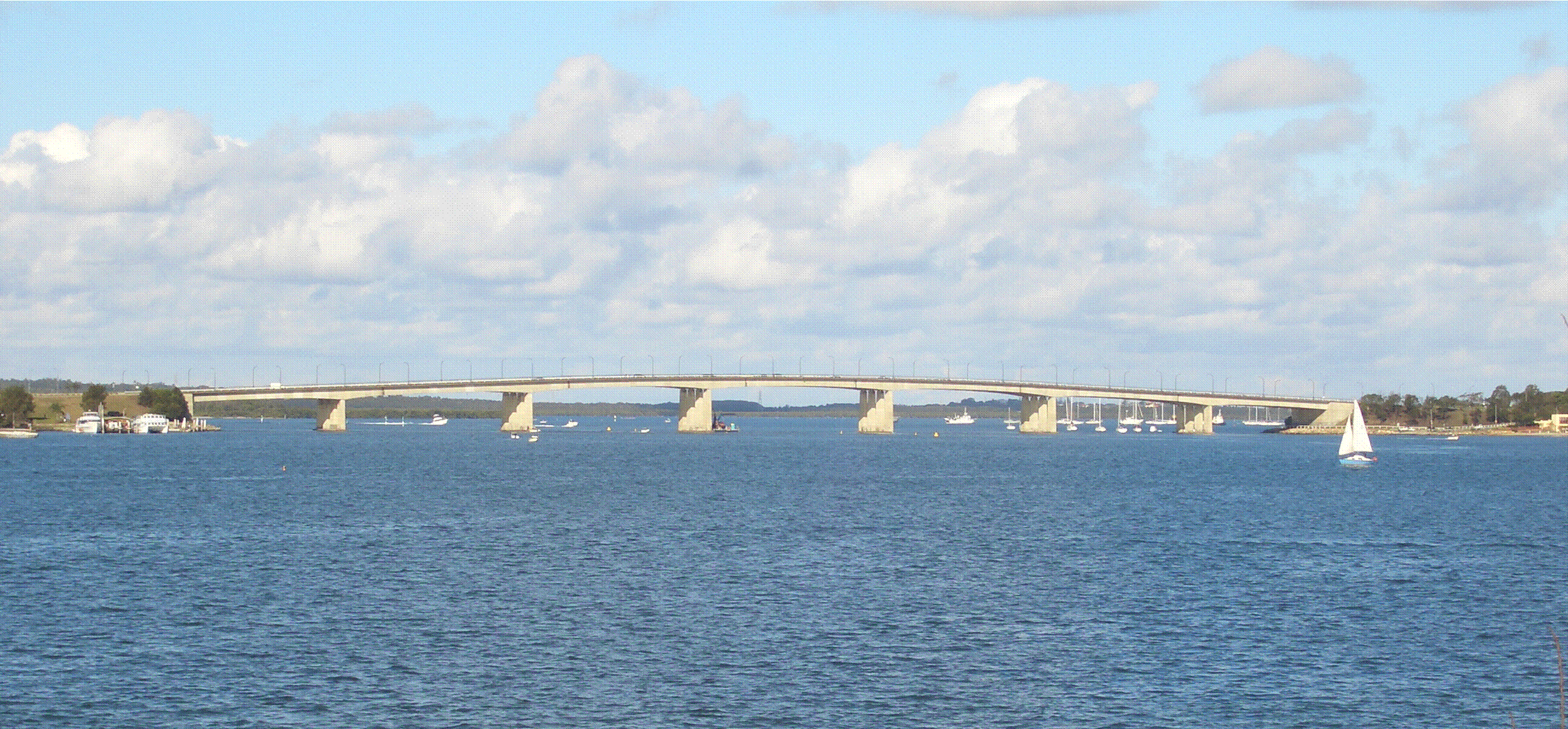
Georges River
The Georges River is a waterway in the state of New South Wales in Australia. It rises to the south-west of Sydney near the coal mining town of Appin, and then flows north past Campbelltown, roughly parallel to the Main South Railway...
in Sydney
Sydney
Sydney is the most populous city in Australia and the state capital of New South Wales. Sydney is located on Australia's south-east coast of the Tasman Sea. As of June 2010, the greater metropolitan area had an approximate population of 4.6 million people...
, Australia. It crosses at the mouth of the river into Botany Bay
Botany Bay
Botany Bay is a bay in Sydney, New South Wales, a few kilometres south of the Sydney central business district. The Cooks River and the Georges River are the two major tributaries that flow into the bay...
.
The other two crossings over the Georges River are Tom Uglys Bridge
Tom Uglys Bridge
Tom Uglys Bridge is one of three major road crossings of the Georges River in southern Sydney, New South Wales, Australia. It consists of two separate bridges that carry the Princes Highway, linking the St George area at Blakehurst to the Sutherland Shire at Sylvania.- Origin of the name :Tom Uglys...
, which opened in 1929 and Alfords Point Bridge
Alfords Point Bridge, New South Wales
Alfords Point Bridge is one of three major road crossings of the lower Georges River. It was opened on the 7 September 1973. The bridge links Padstow Heights in the City of Bankstown to Alfords Point in the Sutherland Shire...
, which opened in 1973. Tom Uglys Bridge connects Blakehurst
Blakehurst, New South Wales
Blakehurst is a suburb in southern Sydney, in the state of New South Wales, Australia. Blakehurst is located 18 kilometres south of the Sydney central business district, in the local government area of the Municipality of Kogarah and is part of the St George area.Blakehurst is connected to...
to Sylvania
Sylvania, New South Wales
Sylvania is a suburb, in southern Sydney, in the state of New South Wales, Australia. Sylvania is located 22 kilometres south of the Sydney central business district in the Sutherland Shire....
. Alfords Point Bridge connects Alfords Point
Alfords Point, New South Wales
Alfords Point is a suburb in southern Sydney, in the state of New South Wales, Australia. Alfords Point is located 28 kilometres south of the Sydney central business district, in the local government area of the Sutherland Shire in the area commonly called Menai...
to Padstow Heights
Padstow Heights, New South Wales
Padstow Heights, a suburb of local government area City of Bankstown, is located 23 kilometres south-west of the Sydney central business district, in the state of New South Wales, Australia, and is a part of the South-western Sydney region...
.
History
A ferry service ran between Sans Souci and Taren Point from 1911. From April 1916 a vehicular punt ran between the two points, and continued to do so even after the opening of the Tom Uglys Bridge in 1929.
The Captain Cook Bridge was opened in 1965. It is named after Captain James Cook who landed at nearby Kurnell
Kurnell, New South Wales
Kurnell is a suburb in southern Sydney, in the state of New South Wales, Australia. Kurnell is located south of the Sydney central business district, in the local government area of the Sutherland Shire....
on 29 April 1770, during his first voyage of discovery
First voyage of James Cook
The first voyage of James Cook was a combined Royal Navy and Royal Society expedition to the south Pacific ocean aboard HMS Endeavour, from 1768 to 1771...
aboard the Endeavour
HM Bark Endeavour
HMS Endeavour, also known as HM Bark Endeavour, was a British Royal Navy research vessel commanded by Lieutenant James Cook on his first voyage of discovery, to Australia and New Zealand from 1769 to 1771....
.
Description
The Captain Cook Bridge carries three lanes of traffic in either direction and links Rocky Point Road at Sans SouciSans Souci, New South Wales
Sans Souci is a southern Sydney suburb in the state of New South Wales, Australia. Sans Souci is 17 kilometres south of the Sydney central business district and lies across the local government areas of the City of Rockdale and the Municipality of Kogarah. It is part of the St George area.Sans...
in the St George
St George, New South Wales
St George Area is an unofficial name applied to a group of southern suburbs in Sydney, in the state of New South Wales, Australia. The area includes all the suburbs in the local government areas of the City of Hurstville, the City of Rockdale and the Municipality of Kogarah...
area to Taren Point Road
Taren Point Road
Taren Point Road is a major road found in Taren Point and Caringbah, New South Wales, Australia.Taren Point Road starts from Captain Cook Bridge, Taren Point and continues to Gardere Street, Caringbah. Traffic travelling north heads towards Sans Souci, and onwards to the city. Traffic travelling...
at Taren Point
Taren Point, New South Wales
Taren Point is a suburb, in southern Sydney, in the state of New South Wales, Australia. Taren Point is located 20 kilometres south of the Sydney central business district in the local government area of the Sutherland Shire....
in the Sutherland Shire
Sutherland Shire
The Sutherland Shire is a Local Government Area in the Southern Sydney region of Sydney, Australia. Geographically, it is the area to the south of Botany Bay and the Georges River...
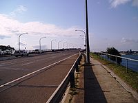
. There are walkways for pedestrians and cyclists along both edges of the bridge. Loop walkways run under the bridge at both sides and provide access along the foreshore.
The Captain Cook Bridge is the only section of the planned F6 Freeway that has been built inside the Sydney metropolitan area. The speed limit across the bridge and associated road sections is 80 km/h.