

Barony and Castle of Giffen
Encyclopedia
The Barony of Giffen and its associated 15th-century castle were in the parish of Beith
in the former District of Cunninghame, now North Ayrshire
. The site may be spelled Giffen or Giffin and lay within the Lordship of Giffin, which included the Baronies of Giffen, Trearne
, Hessilhead
, Broadstone
, Roughwood and Ramshead; valued at £3788 9s 10d. The Barony of Giffen comprised a number of properties, including Greenhills, Thirdpart, Drumbuie, Nettlehirst and Balgray, covering about half of the parish of Beith
. Giffen was a hundred merk land, separated from the Barony of Beith, a forty pound land, by the Powgree Burn which rises on Cuff hill. The Lugton Water or the Bungle burn running through Burnhouse may have been the Giffen barony boundary with that of the adjacent barony and lands of Aiket castle.
Giffen has a recorded history that covers many of familiar aspects of a feudal barony, including the possession of a 'Moot
' or 'Justice Hill' here represented by 'Greenhills', as well as a thirled
mill and a 'gathering place' known as the 'Borestone'. Other features such as the old chapel and the holy well add to the expected features, most of which unfortunately no longer survive.
trap ridge at (NS 37727 50718). MacGibbon and Ross suggest that Giffen Castle was built in the 15th-century, although the 13th-century (1233) land grant to Walter de Mulcaster and the prior existence of a chapel, suggest that a defensive structure of some sort was present at that date. At the time of Pont's survey (J Dobie 1876), it was a tower 30 ft (9.1 m) square, 40 ft (12.2 m) high, with walls 6 ft (1.8 m) thick. It fell into disrepair soon after 1726 and finally collapsed in 1838. It has also been recorded as 'Griffen' on some old maps of the district.
The castle was acquired by Sir John Anstruther
in the early 18th-century and he is responsible for allowing it to become a ruin, together with the associated Giffen farm. The sundial
originally in the Giffen castle garden was sold and was moved eventually to Crummock house, Beith
, now demolished. This sundial had its horizontal plane divided by volutes, between which a lion's head alternates with a rose; it was made in 1719 and repaired in 1810. Local farm houses were built using stone from the front wall of the castle, which was consequently entirely removed. Above the entrance door, with its strong iron door, there had been a carving of a man shooting with a crossbow at what has been called a wild boar. It is not unlikely that this commemorates a feat of bold hunting by a member of the family of Giffen. A similar carving at Linton
parish church commemorates just such a feat, for which William the Lion knighted the bowman and bestowed upon him the lands and barony of Linton.
In 1837 the castle's south wall fell and finally on 12 April 1838, during the silence of the night, the north and east walls of the old castle fell leaving little more than a disorderly heap of stones. The adjacent Mains of Giffen farm had been feued by Anstruther to Robert Craig in 1726. John King of 'Giffin Miln' built his house using stone from the castle and this is probably how the old carvings came to be incorporated into the walls of this building. The door jambs are also said to have come from the old castle. Thomas Craig, grandson of Robert, passed on the feu to Thomas White in 1816, during whose possession the castle met its final fall, inspiring the following indignant poem by James Wilson, the local poet:
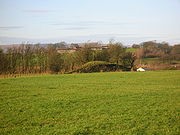
In August 1956 the OS reported that the remains of Giffen Castle now consist of three fragments of rubble masonry, the largest portion measuring 4.0 m long by 2.0 m thick and 1.9 m high. The remainder of the castle was demolished in about 1920 when the adjoining quarry was dug.
In June 1983 the OS visited the site again and stated that there are no remains of the castle in situ. The three fragments of masonry are in fact large tumbled blocks, and together with a mass of loose shaped stone, also from the castle, form a garden rockery. A marriage stone lintel above the doorway of the adjacent Mains house is inscribed RC MC 1758
. This appears contemporaneous to the single story house and of doubtful association with the old castle.
Mr. Robert King, the farmer of the lands near Giffen castle reported in the 1890s that when digging drains to the north-east of the castle he came across a large number of bones which tradition says were there as a result of a battle fought by the lord of the castle, his retainers and an attacking party. The bones were in a hollow to the west of the castle, and between it and the high ground on which the castle and hamlet of Giffen stood. Metal detectorists found a number of musket balls in this area.
 William Patrick Esq. of Roughwood and Woodside, a descendant of the ancient family of the Ayrshire Patricks, purchased the mid-superiority of Giffen from the Earl of Eglinton in 1855 and also acquired the dominum utile of much of the barony. In 1861 his grandnephew, Henry Gardiner Patrick, son of John Shedden Patrick of Trearne and Woodside, succeeded to the property and built a large and handsome mansion-house in the Scottish Baronial style on the lands of Bankhead farm, a little over two miles (3 km) from the old Castle of Giffen.
Giffen Castle and Stables was designed in 1869 by architects Andrew Heiton (junior), John Murray Robertson, and Thomas Arthur Heiton. The building was classified under the category of "Castle" and is a Historic Scotland 'B Listed' building.
Giffen House had been completed for about 50 years, when the owner, Mr. Patrick, died in August 1922, leaving the Estate to a nephew in Edinburgh. The nephew sold the estate, which extended to about 885½ acres, chiefly arable and enclosed land, but it included about 54½ acres of woodland and wooded policies. It contained 4 public rooms, 6 family bedrooms, 3 dressing rooms, day and night nurseries, bathroom, 6 servants' bedrooms, and ample kitchen and domestic accommodation making 35 rooms in all. The offices included excellent stabling, garage, lodge, and coachman's house.
on a low hill, with an associated burial ground and a nook in which was set a carving of two figures, possibly a cat and a rabbit, measuring 25 inches (635 mm) by 15 inches (381 mm). The chapel ruins at Trearne were destroyed by quarrying in comparatively recent times. In the 12th-century, the Laird, William de Nenham had granted land to the monastery of Dryburgh
and a chapel was built to the south-east of the castle, possibly next to the well which is still marked on the 2001 OS map, known locally as the Chapel Well. William's son Richard granted more land at this site, however his brother Alexander inherited and wished for his chapel to be held by the monastery of Kilwinning
and not Dryburgh. To achieve this end he gave land for a site at Trearne, next to St. Bridget's chapel which had previously been granted to the Monks of Dryburgh.
The Barony chapel at Trearne was for the souls of Richard de Morville
, William de Morville, Roland of Galloway, Elen de Morville and of their heirs, as well as that of Walter de Mulcaster, his ancestors and his successors. The chapel at Giffen was likely to have been for the same overlords or superiors, but also for Alexander de Nenham, his ancestors and his successors.
This situation of excambied or exchanged lands has led to some confusion in that three chapels appear to have existed at one time within the Lordship of Giffen, not two as is usually stated. The other chapel was in Beith.
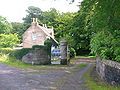
Giffen Castle and mill - 2007
 In the 13th-century Walter de Mulcaster obtained the lands of 'Giffeyn' as a vassal of the De Morvilles
in the reign of William the Lion; and in turn gifted them to his sub-vassal, Alexander de Nenham. Alexander gifted to the monastery of Dryburgh 50 acres (202,343 m²) which had a chapel and a well to St. Bridget, previously founded by the monastery of Kilwinning, the ruins of which were still to be seen, together with a burial ground. Note that Paterson's version (1866) is at odds with Dobie's (1876) account. The De Morvilles were supporters of John Baliol and upon the succession of Robert the Bruce to the Crown of Scotland they were dispossessed and Giffen reverted to the crown. Sir Hugh de Eglinton
married Egidia, sister of Robert II
and was given the Lordship in 1370. Giffen then remained in the Montgomerie family for several centuries. The barony seems to have been more or less consistently passed to the Master or heir of Eglinton for many years, however in 1505 the first Earl took the barony into his personal care. After this time the barony passed back and forth amongst the family when cadet lines failed to produce issue.
 Sir Robert Montgomerie, son of Sir John de Montgomerie of Ardrossan
, Baron of Parliament, had been the first Montgomerie
of Giffen in around 1400. By charter, dated 9 March 1413, the Regent Albany confirmed the grants made by Sir John of Montgomerie of Ardrossan, Knight, to Robert, his son, of the lordship of Giffen in Kyle Stewart. Various sons inherited and in 1560 Patrick Montgomerie was a member of the Great Parliament which established the Protestant faith in Scotland. He was later banished for a time because of his reformation principles and was succeeded by a daughter who married John Montgomerie of Scotstoun and inherited part of the Giffen lands. Being without further issue the Eglinton Montgomerie's, in the person of the Hon. Robert, brother to Hugh, the murdered 4th Earl, inherited the barony, producing an heiress, Margaret. He is said incidentally to have "honourably revenged" his brother's death, killing John Cunninghame of Clonbeith at Hamilton Palace
.
Margaret married twice, but had no issue and the barony again reverted to the Eglinton branch. Graysteel was the appellation given to Sir Henry Montgomerie of Giffen (due to his dexterity with the sword) who inherited, however he had no issue and once again the barony reverted, as his wife sold the barony of Giffen to her father-in-law for an annuity of 2,500 merks. Henry had been born in 1614 and Anne of Denmark, James VI's Queen, stood as his godmother. The direct Montgomerie line ended with the 5th. Earl who had married his cousin-german, Margaret, eldest daughter and heiress of Robert Montgomerie of Giffen and Master of Eglinton. Their marriage was so unsuccessful that the Earl took the drastic step of revoking her heritable rights as gained through their marriage. and Alexander Seton of Foulstruther, also called 'Grey steel,' took the Montgomerie name upon becoming the 6th Earl of Eglintoun in 1612
The seventh Earl's second son, The Right Hon. Francis inherited and lived an eventful life. He was one of the Lords of the Privy Council, and a Commissioner of the Treasury, in the reign of William III
and Queen Anne. He was appointed in 1706 as one of the Commissioners for Scotland for the Treaty of Union
. Francis acquired the estate of Hessilhead and built an addition to the old tower as well as slating the roof, making it one of the finest properties in the district on behalf of his eldest son, Lieut.-Colonel John Montgomerie of Giffen, whilst continuing to live at Giffen for the remainder of his life.
 Henry married a grand-daughter of Alexander Leslie, Earl of Leven
the favourite General of Gustavus Adolphus, King of Sweden. She died in her prime and a certain highly valuable jewel, given to her grandfather by the Swedish king and which was to be passed only through her family came into the possession of Henry. The 6th Earl of Leven instigated legal proceedings which eventually saw the jewel returned to the Leslie family. In 1697 Francis was made one of the commissioners looking into witchcraft
following the Christian Shaw
case. Five out of 24 accused persons were burned at the stake. The Act of Union was very unpopular in some quarters.
A song of 1706 on the Union reads:-
In another, called "Lines upon the Rogues in Parliament", is the following stanza :-
Upon the death in October 1709 of George Allardyce, Master of the Scottish Mint, John was appointed to the post. He went on to become the MP for Ayr at the 1710 General election, and became one of the Gentleman of the bedchamber
to George II
, when Prince of Wales. John Montgomerie seems to have been totally uninterested in the affairs of the mint and his personal finances were in some disarray. He at one point proposed an exchange of his post at the mint for a commission in the Foot Guards and ended up with both. He fought in the war against France and was at the disastrous battle of Almanza in Spain. In June 1717 he assigned his salary to a third party, having withdrawn from any active involvement. In 1727 he was appointed as Governor of New York, where he remained until his death on 1 July 1731. He had a daughter Elizabeth, and upon his death the line of the Montgomerie of Giffen became extinct. He had been forced to sell his estates and it was Sir John Anstruther of the Balcaskie family, who purchased Giffen in 1722, under the burden of liferent as Francis was still living. As Fullarton puts it the large and valuable estate of Giffen, is now broken down into a multitude of inglorious fragments, with scarcely a possibility of its ever again being restored and cemented into its original dignity and beneficial condition.
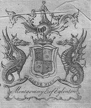
The Montgomerie of Giffen coat of arms was quarterly, first and fourth Montgomery, second and third Eglinton; over all, dividing the quarters, a cross waved or, and in chief a label of three points of the last.
Loch Brand
near Gateside
was once the property of the monks of Kilwinning Abbey
and it is recorded that in 1482 the monks took legal action against the Montgomeries of Giffin Castle and James Ker who were accused of dangerous destruction and down-casting of the fosses and dikes of the loch called Loch Brand.
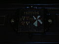
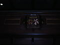 This coat of arms used to be in the Auld Beith Kirk, in the Giffen loft. The Giffen aisle at the Auld Kirk still stands. The coat of armorial bearings were moved to the new Beith Kirk in 1807. RC is Robert Montgomerie, bother to the murdered Hugh, 4th Earl of Eglinton. JC is for Jean Campbell, his wife, daughter of Sir Matthew Campbell of London. The conjoined MEs either side of the date are for 'Master of Eglintoun', the title which he bore as second son of Hugh, the 3rd Earl, and heir presumptive to his nephew Hugh, the fifth earl; the date is that of his death.
(the founder of the Bank of England), in the 1690s to set up a trading colony in America in the late 1690s, however the opposition from England and elsewhere was so great that the attempt failed with huge losses and great financial implications for the country and for individuals. Half of the whole circulating capital of Scotland was subscribed and mostly lost, although the Act of Union
in 1707 made provision for a degree of compensation to be paid to the Darien subscribers. In Cunninghame some examples of losses are Frances Montgomerie of Giffin (£1000), Major James Cunninghame of Aiket (£200), Sir William Cunninghame of Cunninghamhead (£1000), and James Thomson of Hill in Kilmaurs (£100). In modern terms a thousand pounds loss in the 17th century must have been a devastating blow to the family finances.
Giffen would have been the thirled mill of the barony, thirlage being the feudal law by which the laird (lord) of Giffen could force all those vassals or suckeners living on his lands to bring their grain to his mill to be ground. Additionally the suckeners had to carry out repairs on the mill, maintain the lade and weir as well as conveying new millstones to the site.
Under thirlage
the suckeners had to convey new millstones to their thirled mill, sometimes over significant distances, in this case they probably came from West Kilbride. The width of some of the first roads was determined by the requirement to have at least two people on either side of a new grindstone being transported, with a wooden axle called a 'mill-wand' passed through the hole in the centre.
As has already been mentioned, the miller's house had two carved stones from Giffen Castle built into its walls and a further one built into the gable end wall of the mill itself. In 2006 / 2007 the miller's house was renovated, however the other carved stones were not found during the re-roughcasting; they had been on the front. The grandfather of the present owner had the stones chipped off; they were located either side of the main entrance door. The 'Eagle' on the mill gable end is still in situ (see photograph).
Details of Giffen Mill - 2007
school closed. Greenhills closed circa 1958 and was demolished in the mid 1980s; having been used for some years as a glue factory by Strathbond Ltd who still trade from the Willowyard Estate, Beith. Mr McGregor was the last headteacher and the sports field had been the field lying across the Barrmill to Burnhouse Road. A smithy
stood at the crossroads on the Borestone farm side of the hamlet. This hamlet is named after the artificial mound, a Moot
, Law or Justice hill that once stood here.
was the site where proclamations of the Giffen Castle Baronial Court's judgements were made. For serious crimes the men were hung here and women were drowned a pit which would have been nearby. This situation, known as the feudal Barony right of 'pit and gallows' existed at many other sites, such as at Beith
, Kilmarnock
, Aiket, Ardrossan
, and Dalry. Often the mounds were wooded and a Dule Tree
may have been used as the gallows. Brehons or Judges administered justice from 'Court Hills', especially in the highlands. Auchenmade had a Law hill mound nearby, possibly destroyed by the railway. The 'Green hill' stood near to Greenhill farm. No sign of the moot hill seems to survive, however a bridge near to Greenhill is marked as 'Tappethillock', meaning a flat-topped hillock, which may refer to it.
 A dreadful series of incidents occurred in the locality, starting on 19 July 1576 when the Lady of Hessilhead slapped one Robert Kent, servant to Gabriel, brother of John Montgomerie, for some grave offence given. The servant complained to his master and Gabriel went to his brother at the old Thirdpart mansion for advice. John advised him to seek revenge and therefore the next morning Gabriel and Robert gained entry into Hessilhead castle where they found the lady alone, upon which they grabbed her by the hair, pulled her onto the floor, kicked her in the bowels, and bruised her shamefully. Gabriel intended to shoot the Laird, however the whole household was now awake and the two only just managed to escape by stealing a horse and locking the castle gate from the outside. The Laird, Hew Montgomerie, hastened to Thirdpart where John and Gabriel came out with pistols and drawn swords and attacked Hew Montgomerie, injuring him on various parts of his body and leaving him for dead. He was rescued by some neighbours who took him to Hessilhead castle where he recovered from his wounds. Soon afterwards Hessilhead men, including one named Giffen, killed Gabriel after setting up an ambush for him. On the 26th August John, Kent and another brother, Walter, went to try to kill the Laird, but could not find him. Amazingly the results of the various court cases was that no one was found guilty of any of the offences, most likely because honour had been satisfied on both sides.
Hessilhead
was the home of Alexander Montgomerie
(1545–1611), master poet and songster in the court of King James VI. He is best remembered for his poem, The Cherrie and the slae.
is said to run from Bank of Giffen to Giffen Castle; some years back a couple of children are said to have found he tunnel and safely made their way through.
was a fine mansion, also known as 'Nettlehurst', a castle-like structure overlooking the old Giffen Station and Dusk Water on the high ground above the limekilns. The Burns family built Nettlehirst House in 1844. William Burns became a toy-maker. In July 1932 the house burned down, possibly due to an electrical fire. The dramatic fire coincided with the return from South Beach by a special train of Barrmill Sunday School trip on the line from Ardrossan to Giffen Station. The fierce fire was clearly visible from the train and it was a talking point in the village for months.
The mansion house was never restored and shortly afterwards the dangerous ruin was demolished. The unusual entrance gatepiers, apple and pear orchard, boundary walls, mausoleum, farm and the stables, with its crow stepped gable ends and an 1811 marriage stone
remain. The platform of the old tennis court is still apparent.
The OS Map
shows a family burial ground located near woodland to the south of the old house site. The fine red sandstone structure still survives (2010) although the crypt has been broken into and the frontage stones are much disturbed. No inscriptions are apparent on the structure.
A confusing number of properties in the area are known as Nettlehirst, some distinctions being made by adding 'cottage' or the owners name, such as Reid Nettlehirst. The origin of the placename itself is unknown, however the 'Nettle' may refer to the plant and 'Hurst' may refer to harvest; meaning an area where nettles predominate. The term 'hairst' might refer to a barren hillock, knoll, or ridge. A fitting description of the site today.
The village (co-ordinates55 43' 45.2 N | 04 36' 3.8 W ) that developed had a population of 300 in 1876 and 600 in 1951, when the threadmaking industry had just ceased, although the workers still lived in company houses and were transported daily to the threadmaking factory at Kilbirnie. The limestone works was still active, but it too closed in 1972. The whinstone quarries of Messrs. King & Co. employed a considerable number of men in 1951, but even then the quarries were almost worked out. Giffen coal pit (No 1) lay close to Bankhead Moss as shown on the 1897 OS map, closing not long afterwards as the following OS maps cease showing it. The 1912 OS map marks the quoiting
ground which was located in what is now the park, close to the old railway embankment; a mission hall is also shown, located just the other side of the railway bridge over the Beith branchline. In 2006 a new housing estate was created on the site of the old Barrmill railway station and goods yard.
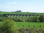 At NS 356 5111 was Giffenmill Viaduct, opened 1903 by the Lanarkshire and Ayrshire Railway
. A 7-span viaduct, with semi-circular concrete arches, it became disused in 1950 and was demolished in 2006. It was also known as the Barr Mill or Dusk Water viaduct. The nearby Gree Viaduct stood until its demolition in early 2008. The local station
opened on 3 September 1888 and was known as Kilbirnie Junction, however it was renamed Giffen on 1 October 1889. Giffen closed in 1932, but it had three platforms, a small station building, and at one point at least seven members of staff. The platforms still survive (2007), but the line running through the station serving DMC Beith is no longer in use (2007).
Barrmill railway station
served the village of Barrmill and was originally part of the Glasgow, Barrhead and Kilmarnock Joint Railway
branch from Lugton
to Beith
. It was the only intermediate station on the route, opening on 26 June 1873, and closing permanently to passengers on 5 November 1962. It was a single platformed station. Freight services continued on the line until 1964. On the 1897 OS map a tramway is shown running down to Barrmill station from quarries at Dockra.
Views of Giffen station (2008)
Views of Giffen, Greenhills, and Barrmill (2007)
, known locally as the 'Trap', short for 'Man Trap' as the village lies on the old turnpike road, the busy Lochlibo Road from Irvine
to Glasgow via Lugton
where travellers on their return from markets in the old days were encouraged to stop and spend their money at the inn; it was so named by the farmers wifes and eventually it was shorted to 'The Trap'. A Crossroads Inn is marked on John Thomson's map of 1828 and in 1858 it had two inns at the crossroads, the Burnhouse Inn and the Waggoners Inn, no longer shown on the 1911 OS.
What is now Burnhouse Manor hotel was present as a private house on the 1858 OS map and as the 'Manor House' in 1911. In the 1870s, whilst nearby Trearne House was being built, Mr and Mrs Ralston-Patrick lived for some time in Burnhouse Manor until the new house was ready for them. A toll house was located on the Dunlop side of the crossroads on the Lochlibo Road, on the Laigh Gree Farm side; it has been demolished.
On 18 May 1894 Alexander Logan of Burnhouse was killed on the old turnpike road when he was crushed by a traction engine he was accompanying. Alexander was employed as a forerunner by Mr King and the accident happened when he tried to pass between the wheels of the loaded waggon that the engine was pulling. Dr Syson from Beith road out to record the death, which must have been instantaneous. Matthew Anderson the local Barrmill 'Policeman Poet' wrote a poem in the boy's memory.
This is an extract -
Burnhouse Manor and 'The Trap' village (2008)
is located at Pondery Hill in the Pencot and Bowertrapping Community Woodland. A GPS will be required to locate it. The co-ordinates are N 55° 42.264 W 004° 39.709 British Grid: NS 32841 48866.
 The Ayrshire Directory 1837 by Pigot & Co comments, a year before Giffen Castle collapsed, on ...the stately ruined castle of the Montgomeries. The same publication also lists a Land Surveyor named John Giffin and a John Giffen who was associated with the schools.
A small hoard of 16th-century coins was found on 7 March 1958 by A Wilson and A M Raeside when ploughing 250 yards (228.6 m) southwest of Mains of Giffen. The coins had been placed in the bronze container of a small nest of weights, 1½ inches in diameter. This box, and 12 of the 19 coins were retained by the National Museum of Antiquities of Scotland (NMAS). All Scottish, they dated between 1558 (a billon "nonsunt" of Mary) and 1574 (a half-merk of James VI). The coins are mostly half and quarter-merks of James VI; they were probably hidden in the later 1570s.
Records show that a William Giffen was appointed councillor in 1710 at Corsehill. Trearne house was used by a small boarding school called Gresham House until it was demolished in 1954.
The Lugton Ridges were part of the Barony of Giffen and one was also known as Deepstone.
The Dusk Water which powered Giffen Mill joins the River Garnock
at Dalgarven and one of Ayrshire's most interesting natural curiosities, Cleeves Cove cave
system is situated in the Dusk Glen, downstream of Giffen, near Cleeves farm.
The herb 'Dusky Cranesbill' is a rare garden escape. It grows in the vicinity of Thirdpart.
In the 1830s 40 locals died from cholera
and were buried in a triangular plot at the base of Jamesill Hill. The tradition is that the disease was passed on from a group of gipsies that local boys had gone out to meet.
William Patrick of Roughwood in 1855 employed the builder and mason Robert Snodgrass to construct the 'Barnweil Monument' near Ayr to the memory of William Wallace
.
Mossend Farm survives as ruins in a copse next to a whinstone quarry across the lane from the old Dustyridge Farm.
Beith
Beith is a small town situated in the Garnock Valley in North Ayrshire, Scotland approximately 20-miles south-west of Glasgow. The town is situated on the crest of a hill and was known originally as the "Hill o' Beith" after its Court Hill.-History:-Name:Beith's name is thought to emanate from...
in the former District of Cunninghame, now North Ayrshire
North Ayrshire
North Ayrshire is one of 32 council areas in Scotland with a population of roughly 136,000 people. It is located in the south-west region of Scotland, and borders the areas of Inverclyde to the north, Renfrewshire to the north-east and East Ayrshire and South Ayrshire to the East and South...
. The site may be spelled Giffen or Giffin and lay within the Lordship of Giffin, which included the Baronies of Giffen, Trearne
Hessilhead
Hessilhead is in Beith, North Ayrshire, Scotland. Hessilhead used to be called Hazlehead or Hasslehead. The lands were part of the Lordship of Giffen, and the Barony of Hessilhead, within the Baillerie of Cunninghame and the Parish of Beith...
, Hessilhead
Hessilhead
Hessilhead is in Beith, North Ayrshire, Scotland. Hessilhead used to be called Hazlehead or Hasslehead. The lands were part of the Lordship of Giffen, and the Barony of Hessilhead, within the Baillerie of Cunninghame and the Parish of Beith...
, Broadstone
Broadstone, North Ayrshire
Broadstone lies close to the small village of Gateside in North Ayrshire, Scotland about half a mile east of Beith in the old Barony of Giffen.-The castle:The ruins of Braidstone or Broadstone Castle remained until about 1850...
, Roughwood and Ramshead; valued at £3788 9s 10d. The Barony of Giffen comprised a number of properties, including Greenhills, Thirdpart, Drumbuie, Nettlehirst and Balgray, covering about half of the parish of Beith
Beith
Beith is a small town situated in the Garnock Valley in North Ayrshire, Scotland approximately 20-miles south-west of Glasgow. The town is situated on the crest of a hill and was known originally as the "Hill o' Beith" after its Court Hill.-History:-Name:Beith's name is thought to emanate from...
. Giffen was a hundred merk land, separated from the Barony of Beith, a forty pound land, by the Powgree Burn which rises on Cuff hill. The Lugton Water or the Bungle burn running through Burnhouse may have been the Giffen barony boundary with that of the adjacent barony and lands of Aiket castle.
Giffen has a recorded history that covers many of familiar aspects of a feudal barony, including the possession of a 'Moot
Moot hill
A moot hill or mons placiti is a hill or mound historically used as an assembly or meeting place. In early medieval Britain, such hills were used for "moots", meetings of local people to settle local business. Among other things, proclamations might be read; decisions might be taken; court cases...
' or 'Justice Hill' here represented by 'Greenhills', as well as a thirled
Thirlage
Thirlage was the term used for the law in regard of the milling of grain for personal or other uses. Vassals in a feudal barony were thirled to their local mill owned by the feudal superior...
mill and a 'gathering place' known as the 'Borestone'. Other features such as the old chapel and the holy well add to the expected features, most of which unfortunately no longer survive.
The history of Giffen Castle
The 40 ft high tower castle of Giffen lay near to the existing Mains of Giffen site on the 180 ft high summit of a whinstoneWhinstone
Whinstone is a term used in the quarrying industry to describe any hard dark-coloured rock. Examples include the igneous rocks basalt and dolerite as well as the sedimentary rock chert....
trap ridge at (NS 37727 50718). MacGibbon and Ross suggest that Giffen Castle was built in the 15th-century, although the 13th-century (1233) land grant to Walter de Mulcaster and the prior existence of a chapel, suggest that a defensive structure of some sort was present at that date. At the time of Pont's survey (J Dobie 1876), it was a tower 30 ft (9.1 m) square, 40 ft (12.2 m) high, with walls 6 ft (1.8 m) thick. It fell into disrepair soon after 1726 and finally collapsed in 1838. It has also been recorded as 'Griffen' on some old maps of the district.
| Etymology |
| The Anglo-Saxon name Giffin comes from 'Giff', a pet form of the personal name Geoffrey. This pet form is supplemented by the diminutive suffix -on or -in. |
The castle was acquired by Sir John Anstruther
Sir John Anstruther, 1st Baronet (1700 creation)
Sir John Anstruther, Baronet was a Scottish politician.He served as Member of Parliament for Anstruther Burghs from 1708–1712 and from 1713–1715 and for Fife from 1715–1741....
in the early 18th-century and he is responsible for allowing it to become a ruin, together with the associated Giffen farm. The sundial
Sundial
A sundial is a device that measures time by the position of the Sun. In common designs such as the horizontal sundial, the sun casts a shadow from its style onto a surface marked with lines indicating the hours of the day. The style is the time-telling edge of the gnomon, often a thin rod or a...
originally in the Giffen castle garden was sold and was moved eventually to Crummock house, Beith
Beith
Beith is a small town situated in the Garnock Valley in North Ayrshire, Scotland approximately 20-miles south-west of Glasgow. The town is situated on the crest of a hill and was known originally as the "Hill o' Beith" after its Court Hill.-History:-Name:Beith's name is thought to emanate from...
, now demolished. This sundial had its horizontal plane divided by volutes, between which a lion's head alternates with a rose; it was made in 1719 and repaired in 1810. Local farm houses were built using stone from the front wall of the castle, which was consequently entirely removed. Above the entrance door, with its strong iron door, there had been a carving of a man shooting with a crossbow at what has been called a wild boar. It is not unlikely that this commemorates a feat of bold hunting by a member of the family of Giffen. A similar carving at Linton
Linton
-Places:Australia* Linton, Victoria* Linton bushfireCanada* Linton, Ontario* Linton, QuebecEngland* Linton, Cambridgeshire* Linton, Derbyshire* Linton, Essex* Linton, Herefordshire** Linton, Bringsty near Bromyard, Herefordshire...
parish church commemorates just such a feat, for which William the Lion knighted the bowman and bestowed upon him the lands and barony of Linton.
In 1837 the castle's south wall fell and finally on 12 April 1838, during the silence of the night, the north and east walls of the old castle fell leaving little more than a disorderly heap of stones. The adjacent Mains of Giffen farm had been feued by Anstruther to Robert Craig in 1726. John King of 'Giffin Miln' built his house using stone from the castle and this is probably how the old carvings came to be incorporated into the walls of this building. The door jambs are also said to have come from the old castle. Thomas Craig, grandson of Robert, passed on the feu to Thomas White in 1816, during whose possession the castle met its final fall, inspiring the following indignant poem by James Wilson, the local poet:
"Hard hearted misers worship dust, Their covetous mind is little worth, Secured in chains for mammon's curse, The older they grow worse and worse!" |
In August 1956 the OS reported that the remains of Giffen Castle now consist of three fragments of rubble masonry, the largest portion measuring 4.0 m long by 2.0 m thick and 1.9 m high. The remainder of the castle was demolished in about 1920 when the adjoining quarry was dug.
In June 1983 the OS visited the site again and stated that there are no remains of the castle in situ. The three fragments of masonry are in fact large tumbled blocks, and together with a mass of loose shaped stone, also from the castle, form a garden rockery. A marriage stone lintel above the doorway of the adjacent Mains house is inscribed RC MC 1758
Marriage stone
A marriage stone is usually a stone lintel carved with the initials, coat of arms, etc. of a newly married couple with the date of the marriage. They were very popular until Victorian times, but fell out of general use in the 20th century...
. This appears contemporaneous to the single story house and of doubtful association with the old castle.
Mr. Robert King, the farmer of the lands near Giffen castle reported in the 1890s that when digging drains to the north-east of the castle he came across a large number of bones which tradition says were there as a result of a battle fought by the lord of the castle, his retainers and an attacking party. The bones were in a hollow to the west of the castle, and between it and the high ground on which the castle and hamlet of Giffen stood. Metal detectorists found a number of musket balls in this area.
Giffen House
Giffen Castle and Stables was designed in 1869 by architects Andrew Heiton (junior), John Murray Robertson, and Thomas Arthur Heiton. The building was classified under the category of "Castle" and is a Historic Scotland 'B Listed' building.
Giffen House had been completed for about 50 years, when the owner, Mr. Patrick, died in August 1922, leaving the Estate to a nephew in Edinburgh. The nephew sold the estate, which extended to about 885½ acres, chiefly arable and enclosed land, but it included about 54½ acres of woodland and wooded policies. It contained 4 public rooms, 6 family bedrooms, 3 dressing rooms, day and night nurseries, bathroom, 6 servants' bedrooms, and ample kitchen and domestic accommodation making 35 rooms in all. The offices included excellent stabling, garage, lodge, and coachman's house.
The Castletoun of Giffen
General Roy's survey of 1747 - 55 spells the name as 'Giffin' and indicates a cluster of buildings; a hamlet, on the southern side of the castle.The Chapels and the Chapel Well
The chapel and well lay near to Giffen castle according to John Smith, however another chapel and well dedicated to St. Bridget existed at TrearneHessilhead
Hessilhead is in Beith, North Ayrshire, Scotland. Hessilhead used to be called Hazlehead or Hasslehead. The lands were part of the Lordship of Giffen, and the Barony of Hessilhead, within the Baillerie of Cunninghame and the Parish of Beith...
on a low hill, with an associated burial ground and a nook in which was set a carving of two figures, possibly a cat and a rabbit, measuring 25 inches (635 mm) by 15 inches (381 mm). The chapel ruins at Trearne were destroyed by quarrying in comparatively recent times. In the 12th-century, the Laird, William de Nenham had granted land to the monastery of Dryburgh
Dryburgh
Dryburgh is a village in the Scottish Borders region of Scotland, famous for the ruined Dryburgh Abbey.-The Temple of the Muses:This circular nine columned gazebo stands since 1817 on Bass Hill, a mound overlooking the River Tweed at the west end of the village...
and a chapel was built to the south-east of the castle, possibly next to the well which is still marked on the 2001 OS map, known locally as the Chapel Well. William's son Richard granted more land at this site, however his brother Alexander inherited and wished for his chapel to be held by the monastery of Kilwinning
Kilwinning
Kilwinning is a historic town in North Ayrshire, Scotland. It is known as The Crossroads of Ayrshire. The 2001 Census recorded it as having a population of 15,908.-History:...
and not Dryburgh. To achieve this end he gave land for a site at Trearne, next to St. Bridget's chapel which had previously been granted to the Monks of Dryburgh.
The Barony chapel at Trearne was for the souls of Richard de Morville
Richard de Morville
Richard de Morville , succeeded his father Hugh de Morville as Constable of Scotland and in his Scottish estates and English lands at Bozeat in Northamptonshire, and Rutland, as well as a number of feus of the Honour of Huntingdon....
, William de Morville, Roland of Galloway, Elen de Morville and of their heirs, as well as that of Walter de Mulcaster, his ancestors and his successors. The chapel at Giffen was likely to have been for the same overlords or superiors, but also for Alexander de Nenham, his ancestors and his successors.
This situation of excambied or exchanged lands has led to some confusion in that three chapels appear to have existed at one time within the Lordship of Giffen, not two as is usually stated. The other chapel was in Beith.
Giffen Castle and mill - 2007
The Lairds of Giffen
Richard de Morville
Richard de Morville , succeeded his father Hugh de Morville as Constable of Scotland and in his Scottish estates and English lands at Bozeat in Northamptonshire, and Rutland, as well as a number of feus of the Honour of Huntingdon....
in the reign of William the Lion; and in turn gifted them to his sub-vassal, Alexander de Nenham. Alexander gifted to the monastery of Dryburgh 50 acres (202,343 m²) which had a chapel and a well to St. Bridget, previously founded by the monastery of Kilwinning, the ruins of which were still to be seen, together with a burial ground. Note that Paterson's version (1866) is at odds with Dobie's (1876) account. The De Morvilles were supporters of John Baliol and upon the succession of Robert the Bruce to the Crown of Scotland they were dispossessed and Giffen reverted to the crown. Sir Hugh de Eglinton
Eglinton Country Park
Eglinton Country Park is located in the grounds of the old Eglinton Castle estate, Kilwinning, North Ayrshire, Scotland . Eglinton Park is situated in the parish of Kilwinning, part of the former district of Cunninghame, and covers an area of 400 hectares...
married Egidia, sister of Robert II
Robert II of Scotland
Robert II became King of Scots in 1371 as the first monarch of the House of Stewart. He was the son of Walter Stewart, hereditary High Steward of Scotland and of Marjorie Bruce, daughter of Robert I and of his first wife Isabella of Mar...
and was given the Lordship in 1370. Giffen then remained in the Montgomerie family for several centuries. The barony seems to have been more or less consistently passed to the Master or heir of Eglinton for many years, however in 1505 the first Earl took the barony into his personal care. After this time the barony passed back and forth amongst the family when cadet lines failed to produce issue.
Ardrossan
Ardrossan is a town on the North Ayrshire coast in south-western Scotland. The name "Ardrossan" describes its physical position — 'ard' from the Gaelic àird meaning headland, 'ros' a promontory and the diminutive suffix '-an' - headland of the little promontory...
, Baron of Parliament, had been the first Montgomerie
Clan Montgomery
-Origins of the Clan:Clan Montgomery originated in Wales, and emigrated to Scotland in the 12th century as vassals of the FitzAlans. The family derives its surname from lands in Wales, likely from the Honour of Montgomery which was located near the Shropshire lands of the FitzAlans...
of Giffen in around 1400. By charter, dated 9 March 1413, the Regent Albany confirmed the grants made by Sir John of Montgomerie of Ardrossan, Knight, to Robert, his son, of the lordship of Giffen in Kyle Stewart. Various sons inherited and in 1560 Patrick Montgomerie was a member of the Great Parliament which established the Protestant faith in Scotland. He was later banished for a time because of his reformation principles and was succeeded by a daughter who married John Montgomerie of Scotstoun and inherited part of the Giffen lands. Being without further issue the Eglinton Montgomerie's, in the person of the Hon. Robert, brother to Hugh, the murdered 4th Earl, inherited the barony, producing an heiress, Margaret. He is said incidentally to have "honourably revenged" his brother's death, killing John Cunninghame of Clonbeith at Hamilton Palace
Hamilton Palace
Hamilton Palace was a large country house located north-east of Hamilton, South Lanarkshire, Scotland. The former seat of the Dukes of Hamilton, it was built in 1695 and subsequently much enlarged. The house was demolished in 1921 due to ground subsidence despite inadequate evidence for that...
.
Margaret married twice, but had no issue and the barony again reverted to the Eglinton branch. Graysteel was the appellation given to Sir Henry Montgomerie of Giffen (due to his dexterity with the sword) who inherited, however he had no issue and once again the barony reverted, as his wife sold the barony of Giffen to her father-in-law for an annuity of 2,500 merks. Henry had been born in 1614 and Anne of Denmark, James VI's Queen, stood as his godmother. The direct Montgomerie line ended with the 5th. Earl who had married his cousin-german, Margaret, eldest daughter and heiress of Robert Montgomerie of Giffen and Master of Eglinton. Their marriage was so unsuccessful that the Earl took the drastic step of revoking her heritable rights as gained through their marriage. and Alexander Seton of Foulstruther, also called 'Grey steel,' took the Montgomerie name upon becoming the 6th Earl of Eglintoun in 1612
The seventh Earl's second son, The Right Hon. Francis inherited and lived an eventful life. He was one of the Lords of the Privy Council, and a Commissioner of the Treasury, in the reign of William III
William III of England
William III & II was a sovereign Prince of Orange of the House of Orange-Nassau by birth. From 1672 he governed as Stadtholder William III of Orange over Holland, Zeeland, Utrecht, Guelders, and Overijssel of the Dutch Republic. From 1689 he reigned as William III over England and Ireland...
and Queen Anne. He was appointed in 1706 as one of the Commissioners for Scotland for the Treaty of Union
Treaty of Union
The Treaty of Union is the name given to the agreement that led to the creation of the united kingdom of Great Britain, the political union of the Kingdom of England and the Kingdom of Scotland, which took effect on 1 May 1707...
. Francis acquired the estate of Hessilhead and built an addition to the old tower as well as slating the roof, making it one of the finest properties in the district on behalf of his eldest son, Lieut.-Colonel John Montgomerie of Giffen, whilst continuing to live at Giffen for the remainder of his life.
Earl of Leven
Earl of Leven is a title in the Peerage of Scotland. It was created in 1641 for Alexander Leslie. He was succeeded by his grandson Alexander, who was in turn followed by his daughters Margaret and Catherine...
the favourite General of Gustavus Adolphus, King of Sweden. She died in her prime and a certain highly valuable jewel, given to her grandfather by the Swedish king and which was to be passed only through her family came into the possession of Henry. The 6th Earl of Leven instigated legal proceedings which eventually saw the jewel returned to the Leslie family. In 1697 Francis was made one of the commissioners looking into witchcraft
Witchcraft
Witchcraft, in historical, anthropological, religious, and mythological contexts, is the alleged use of supernatural or magical powers. A witch is a practitioner of witchcraft...
following the Christian Shaw
Lambroughton
Lambroughton is a village in the old Barony of Kilmaurs, North Ayrshire, Scotland. This is a rural area famous for its milk and cheese production and the Ayrshire or Dunlop breed of cattle.-Origins of the name:...
case. Five out of 24 accused persons were burned at the stake. The Act of Union was very unpopular in some quarters.
A song of 1706 on the Union reads:-
"There's Roseberry, Glasgow, and Dupplin, And Lord Archibald Campbell and Ross, The President, Francis Montgomery, Wha ambles liked any paced horse." |
In another, called "Lines upon the Rogues in Parliament", is the following stanza :-
"Thou Francis of Giffen thou's bigot as hell, And Brodie in nonsense in this doth excell, For rebellion engrained you may each bear the bell, Wherefore sin on and be damned." |
Upon the death in October 1709 of George Allardyce, Master of the Scottish Mint, John was appointed to the post. He went on to become the MP for Ayr at the 1710 General election, and became one of the Gentleman of the bedchamber
Gentleman of the Bedchamber
A Gentleman of the Bedchamber was the holder of an important office in the royal household of the Kingdom of England from the 11th century, later used also in the Kingdom of Great Britain.-Description and functions:...
to George II
George II of Great Britain
George II was King of Great Britain and Ireland, Duke of Brunswick-Lüneburg and Archtreasurer and Prince-elector of the Holy Roman Empire from 11 June 1727 until his death.George was the last British monarch born outside Great Britain. He was born and brought up in Northern Germany...
, when Prince of Wales. John Montgomerie seems to have been totally uninterested in the affairs of the mint and his personal finances were in some disarray. He at one point proposed an exchange of his post at the mint for a commission in the Foot Guards and ended up with both. He fought in the war against France and was at the disastrous battle of Almanza in Spain. In June 1717 he assigned his salary to a third party, having withdrawn from any active involvement. In 1727 he was appointed as Governor of New York, where he remained until his death on 1 July 1731. He had a daughter Elizabeth, and upon his death the line of the Montgomerie of Giffen became extinct. He had been forced to sell his estates and it was Sir John Anstruther of the Balcaskie family, who purchased Giffen in 1722, under the burden of liferent as Francis was still living. As Fullarton puts it the large and valuable estate of Giffen, is now broken down into a multitude of inglorious fragments, with scarcely a possibility of its ever again being restored and cemented into its original dignity and beneficial condition.
The Montgomerie of Giffen coat of arms was quarterly, first and fourth Montgomery, second and third Eglinton; over all, dividing the quarters, a cross waved or, and in chief a label of three points of the last.
Loch Brand
Loch Brand
Loch Brand or Loch of Boghall was situated in a depression between the Grange Estate, Crummock, Hill of Beith Castle site and Boghall in the Parish of Beith, East Ayrshire, Scotland. The loch was fed by the Grange Burn and surface runoff, such as from the old rig and furrows indicated by Roy's Maps...
near Gateside
Gateside, North Ayrshire
Gateside is a small village in North Ayrshire, Scotland about half a mile east of Beith on the B777.-The village:Gateside Primary School, headteacher Ms Fiona Dunlop, was opened in 1903, and nowadays it has 74 pupils...
was once the property of the monks of Kilwinning Abbey
Kilwinning Abbey
Kilwinning Abbey is a ruined abbey located in the centre of the town of Kilwinning, North Ayrshire.-The establishment of the Abbey:The ancient name of the town is 'Segdoune' or 'Saigtown', probably derived from 'Sanctoun', meaning the 'town of the saint'. Saint Winnings festival was on 21 January...
and it is recorded that in 1482 the monks took legal action against the Montgomeries of Giffin Castle and James Ker who were accused of dangerous destruction and down-casting of the fosses and dikes of the loch called Loch Brand.
The Giffen Baron-court
Robert Montgomerie of Giffen was Chamberlain and then Baron-Baillie of the Giffen Baron-court from 1677–1681. Another Robert was the Procurator-Fiscal of the same court. Robert Montgomerie of Bogston was a factor and Baron-Bailie of the Giffen Barony-court in the late 17th-century.The armorial bearings of the Barony of Giffen
The Darien Affair
The Darien Company was an attempt by the Scots, led by William PatersonWilliam Paterson (banker)
Sir William Paterson was a Scottish trader and banker.- Early life :...
(the founder of the Bank of England), in the 1690s to set up a trading colony in America in the late 1690s, however the opposition from England and elsewhere was so great that the attempt failed with huge losses and great financial implications for the country and for individuals. Half of the whole circulating capital of Scotland was subscribed and mostly lost, although the Act of Union
Acts of Union 1707
The Acts of Union were two Parliamentary Acts - the Union with Scotland Act passed in 1706 by the Parliament of England, and the Union with England Act passed in 1707 by the Parliament of Scotland - which put into effect the terms of the Treaty of Union that had been agreed on 22 July 1706,...
in 1707 made provision for a degree of compensation to be paid to the Darien subscribers. In Cunninghame some examples of losses are Frances Montgomerie of Giffin (£1000), Major James Cunninghame of Aiket (£200), Sir William Cunninghame of Cunninghamhead (£1000), and James Thomson of Hill in Kilmaurs (£100). In modern terms a thousand pounds loss in the 17th century must have been a devastating blow to the family finances.
Giffen Mill
The old feudal or barony mill, also known as Barmill, Barrmill or Baroil is at Map reference: NS 3699 5133. The remains visible today are early 19th-century, probably rebuilt on an old site, when grain prices were driven up by the Napoleonic Wars. The external stair led to the kiln for drying the corn before it was ground. It was a three-storey, four-bay rubble building on a rectangular plan, now gutted and the upper part used as a store until recently. A small dovecot was located in the upper angle of the gable end above the miller's house yard. The mid-18th century substantial miller's house is still occupied and is in good condition. On General Roy's survey of 1747 - 55 Giffin Mill is present with a cluster of buildings nearby. The mill pond and lade are clearly marked on the 1858 OS map and a sand pit is marked nearby. The 1923 - 4 the OS map no longer marks the mill or its lade and mill pond.Giffen would have been the thirled mill of the barony, thirlage being the feudal law by which the laird (lord) of Giffen could force all those vassals or suckeners living on his lands to bring their grain to his mill to be ground. Additionally the suckeners had to carry out repairs on the mill, maintain the lade and weir as well as conveying new millstones to the site.
Under thirlage
Thirlage
Thirlage was the term used for the law in regard of the milling of grain for personal or other uses. Vassals in a feudal barony were thirled to their local mill owned by the feudal superior...
the suckeners had to convey new millstones to their thirled mill, sometimes over significant distances, in this case they probably came from West Kilbride. The width of some of the first roads was determined by the requirement to have at least two people on either side of a new grindstone being transported, with a wooden axle called a 'mill-wand' passed through the hole in the centre.
As has already been mentioned, the miller's house had two carved stones from Giffen Castle built into its walls and a further one built into the gable end wall of the mill itself. In 2006 / 2007 the miller's house was renovated, however the other carved stones were not found during the re-roughcasting; they had been on the front. The grandfather of the present owner had the stones chipped off; they were located either side of the main entrance door. The 'Eagle' on the mill gable end is still in situ (see photograph).
Details of Giffen Mill - 2007
Greenhills hamlet
This small settlement is shown on General Roy's survey of 1747 - 55, under the name of 'Greenhill' in the singular and has two buildings indicated where the old school was situated. The school opened in the 1890s at the time that HessilheadHessilhead
Hessilhead is in Beith, North Ayrshire, Scotland. Hessilhead used to be called Hazlehead or Hasslehead. The lands were part of the Lordship of Giffen, and the Barony of Hessilhead, within the Baillerie of Cunninghame and the Parish of Beith...
school closed. Greenhills closed circa 1958 and was demolished in the mid 1980s; having been used for some years as a glue factory by Strathbond Ltd who still trade from the Willowyard Estate, Beith. Mr McGregor was the last headteacher and the sports field had been the field lying across the Barrmill to Burnhouse Road. A smithy
Forge
A forge is a hearth used for forging. The term "forge" can also refer to the workplace of a smith or a blacksmith, although the term smithy is then more commonly used.The basic smithy contains a forge, also known as a hearth, for heating metals...
stood at the crossroads on the Borestone farm side of the hamlet. This hamlet is named after the artificial mound, a Moot
Moot hill
A moot hill or mons placiti is a hill or mound historically used as an assembly or meeting place. In early medieval Britain, such hills were used for "moots", meetings of local people to settle local business. Among other things, proclamations might be read; decisions might be taken; court cases...
, Law or Justice hill that once stood here.
The Moot or Justice hill
This artificial mound or moot hillMoot hill
A moot hill or mons placiti is a hill or mound historically used as an assembly or meeting place. In early medieval Britain, such hills were used for "moots", meetings of local people to settle local business. Among other things, proclamations might be read; decisions might be taken; court cases...
was the site where proclamations of the Giffen Castle Baronial Court's judgements were made. For serious crimes the men were hung here and women were drowned a pit which would have been nearby. This situation, known as the feudal Barony right of 'pit and gallows' existed at many other sites, such as at Beith
Beith
Beith is a small town situated in the Garnock Valley in North Ayrshire, Scotland approximately 20-miles south-west of Glasgow. The town is situated on the crest of a hill and was known originally as the "Hill o' Beith" after its Court Hill.-History:-Name:Beith's name is thought to emanate from...
, Kilmarnock
Kilmarnock
Kilmarnock is a large burgh in East Ayrshire, Scotland, with a population of 44,734. It is the second largest town in Ayrshire. The River Irvine runs through its eastern section, and the Kilmarnock Water passes through it, giving rise to the name 'Bank Street'...
, Aiket, Ardrossan
Ardrossan
Ardrossan is a town on the North Ayrshire coast in south-western Scotland. The name "Ardrossan" describes its physical position — 'ard' from the Gaelic àird meaning headland, 'ros' a promontory and the diminutive suffix '-an' - headland of the little promontory...
, and Dalry. Often the mounds were wooded and a Dule Tree
Dule Tree
Dule or dool trees in Britain were used as gallows for public hangings. They were also used as gibbets for the display of the corpse for a considerable period of time after such hangings...
may have been used as the gallows. Brehons or Judges administered justice from 'Court Hills', especially in the highlands. Auchenmade had a Law hill mound nearby, possibly destroyed by the railway. The 'Green hill' stood near to Greenhill farm. No sign of the moot hill seems to survive, however a bridge near to Greenhill is marked as 'Tappethillock', meaning a flat-topped hillock, which may refer to it.
Borestone farm and the Bore stane
In 1876 Dobie recorded that the Bore Stone or Stane was a large sandstone about 11½ inches in diameter, situated on the farm of Borestone to which it gave name (Name Book 1856). It had a circular opening in which it is said the flagstaff of the lordship or barony used to be erected when vassals from the neighbourhood were summoned to battle; at this position it would have been visible to all parts of the barony and beyond. but it is more likely to be a natural cavity caused by weathering. The farmer, Mr Craig, was not sure in 1895 if the stone was genuine, we will never know as the Bore Stone was broken up in about 1950 according to Mrs Raeside of Borestone Farm. It was at map reference: NS 3742 5054. During World War II the borestone was used by troops who were training in the area.Thirdpart and the Hessilhead feud
Thirdpart was an 8s. land, part of the Giffen Barony and in 1663 feud to John Wilson by the Earl of Eglinton. It remained in that family until at least 1876. James Wilson of Thirdpart was a notable local eccentric who wrote and published poems on such topics as the 'Trearne Cattle Shows', the 'Fall of Giffin Castle' and the 'Misfortunes of a clocking-hen'. James died in 1838. William Wilson who lived here in 1837 was a brick and tile maker. A small mansion had been present here, occupied in the 1570s by John Montgomerie of Scotstoun, a near relative of the Laird of Hessilhead.Hessilhead
Hessilhead
Hessilhead is in Beith, North Ayrshire, Scotland. Hessilhead used to be called Hazlehead or Hasslehead. The lands were part of the Lordship of Giffen, and the Barony of Hessilhead, within the Baillerie of Cunninghame and the Parish of Beith...
was the home of Alexander Montgomerie
Alexander Montgomerie
Alexander Montgomerie , Scottish Jacobean courtier and poet, or makar, born in Ayrshire. He was one of the principal members of the Castalian Band, a circle of poets in the court of James VI in the 1580s which included the king himself. Montgomerie was for a time in favour as one of the king's...
(1545–1611), master poet and songster in the court of King James VI. He is best remembered for his poem, The Cherrie and the slae.
Bank of Giffen
In 1858 a farm known as 'Bank of Giffen' stood below the whinstone ridge which is close to what is now the old railway line across the road from Thirdpart farm; it is shown as abandoned in 1911. General Roy's map of 1747 - 55 marks its as 'Bank' only. Some ruins of the farm are still visible today (2007). A Ley tunnelLey tunnel
Ley tunnels are a common element of the local folklore tradition in the United Kingdom and they also occur in Europe. In Norwegian a ley tunnel-like passage is called a "lønngang" and in Swedish a "lönngång"...
is said to run from Bank of Giffen to Giffen Castle; some years back a couple of children are said to have found he tunnel and safely made their way through.
Nettlehirst House and estate
NettlehirstNettlehirst
Nettlehirst was a small mansion house and estate in the Parish of Beith, near Barrmill in North Ayrshire, Scotland. The house was built in 1844 and burned down in 1932.-Nettlehirst House and estate:...
was a fine mansion, also known as 'Nettlehurst', a castle-like structure overlooking the old Giffen Station and Dusk Water on the high ground above the limekilns. The Burns family built Nettlehirst House in 1844. William Burns became a toy-maker. In July 1932 the house burned down, possibly due to an electrical fire. The dramatic fire coincided with the return from South Beach by a special train of Barrmill Sunday School trip on the line from Ardrossan to Giffen Station. The fierce fire was clearly visible from the train and it was a talking point in the village for months.
The mansion house was never restored and shortly afterwards the dangerous ruin was demolished. The unusual entrance gatepiers, apple and pear orchard, boundary walls, mausoleum, farm and the stables, with its crow stepped gable ends and an 1811 marriage stone
Marriage stone
A marriage stone is usually a stone lintel carved with the initials, coat of arms, etc. of a newly married couple with the date of the marriage. They were very popular until Victorian times, but fell out of general use in the 20th century...
remain. The platform of the old tennis court is still apparent.
The OS Map
Ordnance Survey
Ordnance Survey , an executive agency and non-ministerial government department of the Government of the United Kingdom, is the national mapping agency for Great Britain, producing maps of Great Britain , and one of the world's largest producers of maps.The name reflects its creation together with...
shows a family burial ground located near woodland to the south of the old house site. The fine red sandstone structure still survives (2010) although the crypt has been broken into and the frontage stones are much disturbed. No inscriptions are apparent on the structure.
A confusing number of properties in the area are known as Nettlehirst, some distinctions being made by adding 'cottage' or the owners name, such as Reid Nettlehirst. The origin of the placename itself is unknown, however the 'Nettle' may refer to the plant and 'Hurst' may refer to harvest; meaning an area where nettles predominate. The term 'hairst' might refer to a barren hillock, knoll, or ridge. A fitting description of the site today.
Barrmill
General Roy's survey of 1747 - 55 shows only the farm of High Barr. A village grew up here due to the employment provided by the several limestone quarries that were present at one time, the Dockra Ironstone pit that was located near the railway line down from Dockra quarry in 1912, and other local industries.The village (co-ordinates
Quoits
Quoits is a traditional game which involves the throwing of metal, rope or rubber rings over a set distance, usually to land over or near a spike . The sport of quoits encompasses several distinct variations.-The history of quoits:The history of quoits is disputed...
ground which was located in what is now the park, close to the old railway embankment; a mission hall is also shown, located just the other side of the railway bridge over the Beith branchline. In 2006 a new housing estate was created on the site of the old Barrmill railway station and goods yard.
The local railways
Lanarkshire and Ayrshire Railway
The Lanarkshire and Ayrshire Railway was a railway company in Scotland built in the late 19th century that provided services between Ardrossan and Glasgow, with branches to Irvine and Kilbirnie. The line was operated by the Caledonian Railway with an aim to compete with the Glasgow and South...
. A 7-span viaduct, with semi-circular concrete arches, it became disused in 1950 and was demolished in 2006. It was also known as the Barr Mill or Dusk Water viaduct. The nearby Gree Viaduct stood until its demolition in early 2008. The local station
Giffen railway station
Giffen railway station was a railway station approximately one mile south-west of the village of Barrmill, North Ayrshire, Scotland. The station was part of the Lanarkshire and Ayrshire Railway.- History :...
opened on 3 September 1888 and was known as Kilbirnie Junction, however it was renamed Giffen on 1 October 1889. Giffen closed in 1932, but it had three platforms, a small station building, and at one point at least seven members of staff. The platforms still survive (2007), but the line running through the station serving DMC Beith is no longer in use (2007).
Barrmill railway station
Barrmill railway station
Barrmill railway station was a railway station serving the village of Barrmill, North Ayrshire, Scotland. The station was originally part of the Glasgow, Barrhead and Kilmarnock Joint Railway.- History :...
served the village of Barrmill and was originally part of the Glasgow, Barrhead and Kilmarnock Joint Railway
Glasgow, Barrhead and Kilmarnock Joint Railway
The Glasgow, Barrhead and Kilmarnock Joint Railway was a railway co-owned by Caledonian Railway and Glasgow and South Western Railway and was an amalgation of two different lines: the Glasgow, Barrhead and Neilston Direct Railway and the Glasgow and Kilmarnock Joint Railway.-Glasgow, Barrhead and...
branch from Lugton
Lugton
Lugton is a small village or hamlet in East Ayrshire, Scotland with a population of 80 people. The A736 road runs through on its way from Glasgow, to the north, to Irvine in North Ayrshire. Uplawmoor is the first settlement on this 'Lochlibo Road' to the north and Burnhouse is to the south...
to Beith
Beith
Beith is a small town situated in the Garnock Valley in North Ayrshire, Scotland approximately 20-miles south-west of Glasgow. The town is situated on the crest of a hill and was known originally as the "Hill o' Beith" after its Court Hill.-History:-Name:Beith's name is thought to emanate from...
. It was the only intermediate station on the route, opening on 26 June 1873, and closing permanently to passengers on 5 November 1962. It was a single platformed station. Freight services continued on the line until 1964. On the 1897 OS map a tramway is shown running down to Barrmill station from quarries at Dockra.
Views of Giffen station (2008)
Giffen, Beith, or Nettlehirst limeworks
Giffen Limeworks dated from the mid to late 19th-century and later. They were probably the last traditional limeworks to work in Scotland, closing in 1972. A substantial amount remained, the kilns being essentially intact in 2009, with a bank of two single-draw rubble kilns, reinforced with buttresses and with old rails, and heightened in brick. Progressive demolition has been taking place since 2009. Covered conveyors linked the segmental-arched draw holes with a wood-framed, corrugated-iron crushing and bagging mill. The works were at map reference: NS 3645 5073.Limekilns
Limekilns are a common feature of farms in the area, such as Thirdpart, Foreside, Nettlehirst and the Greenhills hamlet; the necessary limestone was quarried extensively in the neighbourhood. Limekilns came into regular use about the 18th-century. Large limestone blocks were used for building but the smaller pieces were burnt, using coal dug in the parish to produce lime which was a useful commodity in various ways: it could be spread on the fields to reduce acidity, for lime-mortar in buildings or for lime-washing on farm buildings and was even regarded as cleansing agent.Views of Giffen, Greenhills, and Barrmill (2007)
Burnhouse (The Trap)
This village or hamlet in North AyrshireNorth Ayrshire
North Ayrshire is one of 32 council areas in Scotland with a population of roughly 136,000 people. It is located in the south-west region of Scotland, and borders the areas of Inverclyde to the north, Renfrewshire to the north-east and East Ayrshire and South Ayrshire to the East and South...
, known locally as the 'Trap', short for 'Man Trap' as the village lies on the old turnpike road, the busy Lochlibo Road from Irvine
Irvine, North Ayrshire
Irvine is a new town on the coast of the Firth of Clyde in North Ayrshire, Scotland. According to 2007 population estimates, the town is home to 39,527 inhabitants, making it the biggest settlement in North Ayrshire....
to Glasgow via Lugton
Lugton
Lugton is a small village or hamlet in East Ayrshire, Scotland with a population of 80 people. The A736 road runs through on its way from Glasgow, to the north, to Irvine in North Ayrshire. Uplawmoor is the first settlement on this 'Lochlibo Road' to the north and Burnhouse is to the south...
where travellers on their return from markets in the old days were encouraged to stop and spend their money at the inn; it was so named by the farmers wifes and eventually it was shorted to 'The Trap'. A Crossroads Inn is marked on John Thomson's map of 1828 and in 1858 it had two inns at the crossroads, the Burnhouse Inn and the Waggoners Inn, no longer shown on the 1911 OS.
What is now Burnhouse Manor hotel was present as a private house on the 1858 OS map and as the 'Manor House' in 1911. In the 1870s, whilst nearby Trearne House was being built, Mr and Mrs Ralston-Patrick lived for some time in Burnhouse Manor until the new house was ready for them. A toll house was located on the Dunlop side of the crossroads on the Lochlibo Road, on the Laigh Gree Farm side; it has been demolished.
On 18 May 1894 Alexander Logan of Burnhouse was killed on the old turnpike road when he was crushed by a traction engine he was accompanying. Alexander was employed as a forerunner by Mr King and the accident happened when he tried to pass between the wheels of the loaded waggon that the engine was pulling. Dr Syson from Beith road out to record the death, which must have been instantaneous. Matthew Anderson the local Barrmill 'Policeman Poet' wrote a poem in the boy's memory.
This is an extract -
"This little lad so anxious, Had tried to pass between, The engine and the waggon, When, oh! the awful scene." |
Burnhouse Manor and 'The Trap' village (2008)
Additional evidence from maps
The 1858 OS map shows the spelling as 'Giffen' and indicates the presence of a small whinstone quarry at the bottom of the brae that runs towards Burnhouse. This quarry expanded over the years and eventually destroyed the site of the castle on the Giffen craigs. The castle ruins are clearly marked in 1858, but not afterwards.The Pondery Geocache
A GeocacheGeocaching
Geocaching is an outdoor sporting activity in which the participants use a Global Positioning System receiver or mobile device and other navigational techniques to hide and seek containers, called "geocaches" or "caches", anywhere in the world....
is located at Pondery Hill in the Pencot and Bowertrapping Community Woodland. A GPS will be required to locate it. The co-ordinates are N 55° 42.264 W 004° 39.709 British Grid: NS 32841 48866.
Drumbuie
Drumbuie House, built in 1702, is one of the oldest inhabited houses in the Beith area and has been the home of the Boyd family for at least three generations. Drumbuie was part of the Barony of Giffen and was feud out to various local millers and farmers in the 17th-century. Close records that Drumbuie Farm incorporates an early 18th-century two storey house, originally thatched, which was built around 1736 for Hugh Patrick, this being stated on a plaque on the 1815 addition. A James Nevin of Drumbuie was a witness to the will of Hugh Nevin of Kirkwood in 1677. Drumbuie mill was located nearby on the Dusk Water, however no obvious physical remains are extant.Mossend Farm
This may have been the site of a minor mansion house at one time, however by the 1920s only a ruin remained. A whinstone quarry was located to the east of the dwelling. The last occupants of Mossend were George and Ellen Black who used to ride into Beith on a small buggy behind a piebald pony. George was a manufacturer of curling stones, possibly using the whinstone from the Mossend quarry.Local history and traditions
A small hoard of 16th-century coins was found on 7 March 1958 by A Wilson and A M Raeside when ploughing 250 yards (228.6 m) southwest of Mains of Giffen. The coins had been placed in the bronze container of a small nest of weights, 1½ inches in diameter. This box, and 12 of the 19 coins were retained by the National Museum of Antiquities of Scotland (NMAS). All Scottish, they dated between 1558 (a billon "nonsunt" of Mary) and 1574 (a half-merk of James VI). The coins are mostly half and quarter-merks of James VI; they were probably hidden in the later 1570s.
Records show that a William Giffen was appointed councillor in 1710 at Corsehill. Trearne house was used by a small boarding school called Gresham House until it was demolished in 1954.
The Lugton Ridges were part of the Barony of Giffen and one was also known as Deepstone.
The Dusk Water which powered Giffen Mill joins the River Garnock
River Garnock
The River Garnock, the smallest of Ayrshire's six principal rivers, has its source on the southerly side of the Hill of Stake in the heart of the Clyde Muirshiel Regional Park. About a mile and a half south of this starting point the untested stream tumbles over the Spout of Garnock, the highest...
at Dalgarven and one of Ayrshire's most interesting natural curiosities, Cleeves Cove cave
Cleeves Cove cave
Cleeves Cove is a cave system on the Dusk Water in North Ayrshire, Scotland, close to the town of Dalry.-The cave system:Cleeves, or Cleaves, cove cave system is situated in the lower bed of carboniferous limestone. It measures around 500 feet if all the passages were put together...
system is situated in the Dusk Glen, downstream of Giffen, near Cleeves farm.
The herb 'Dusky Cranesbill' is a rare garden escape. It grows in the vicinity of Thirdpart.
In the 1830s 40 locals died from cholera
Cholera
Cholera is an infection of the small intestine that is caused by the bacterium Vibrio cholerae. The main symptoms are profuse watery diarrhea and vomiting. Transmission occurs primarily by drinking or eating water or food that has been contaminated by the diarrhea of an infected person or the feces...
and were buried in a triangular plot at the base of Jamesill Hill. The tradition is that the disease was passed on from a group of gipsies that local boys had gone out to meet.
William Patrick of Roughwood in 1855 employed the builder and mason Robert Snodgrass to construct the 'Barnweil Monument' near Ayr to the memory of William Wallace
William Wallace
Sir William Wallace was a Scottish knight and landowner who became one of the main leaders during the Wars of Scottish Independence....
.
Mossend Farm survives as ruins in a copse next to a whinstone quarry across the lane from the old Dustyridge Farm.
See also
- LugtonLugtonLugton is a small village or hamlet in East Ayrshire, Scotland with a population of 80 people. The A736 road runs through on its way from Glasgow, to the north, to Irvine in North Ayrshire. Uplawmoor is the first settlement on this 'Lochlibo Road' to the north and Burnhouse is to the south...
- Clan MontgomeryClan Montgomery-Origins of the Clan:Clan Montgomery originated in Wales, and emigrated to Scotland in the 12th century as vassals of the FitzAlans. The family derives its surname from lands in Wales, likely from the Honour of Montgomery which was located near the Shropshire lands of the FitzAlans...
- Eglinton Country ParkEglinton Country ParkEglinton Country Park is located in the grounds of the old Eglinton Castle estate, Kilwinning, North Ayrshire, Scotland . Eglinton Park is situated in the parish of Kilwinning, part of the former district of Cunninghame, and covers an area of 400 hectares...
The Earls of Eglinton. - Gateside (Garnock)