

Bafoulabé
Encyclopedia
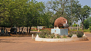
Bafoulabé is a town and commune in south-western Mali
. It is located in the Region of Kayes
. Bafoulabé is the capital of the Cercle of Bafoulabé
, which in 1887 was the first Cercle to be created in Mali.
. While now deprecated, the commune retains the same boundaries, extending far beyond the town of Bafoulabé, its seat (chef-lieu). Bafoulabé is also the seat of the larger Bafoulabé Cercle
. Apart from the town, there are 28 villages, official rural subdivisions within the Commune. It is a Rural Commune, meaning it is subdivided in villages, in contrast to the smaller Urban Commune, divided into urban Quarters. Commune affairs are directed by an elected Commune Council (conseil communal) of 23 members and a Commune executive (bureau communal) of the elected Mayor and three adjutants. The executive is tasked with carrying out the directives voted by the Council. National policies are carried out by a Sub-Prefect (sous préfet), who also carries out certain of the Council's directives over the local arms or national bodies.
 At Bafoulabé the Bafing
and Bakoy
rivers meet to form the Sénégal River
. In Bambara
, Bafoulabé means "meeting of two rivers".
The Manantali hydroelectric dam
and its reservoir, Lake Manantali
, the largest in Mali, is located 90 km to the south-east of Bafoulabé.
Extending across two banks of the Senegal River
, the Commune is bounded to the east by Kontéla Commune
and Oualia Commune
, to the north Tomora Commune
and Sidibéla Commune
, to the south by Mahina Commune
and to the west by Diamou Commune
of Kayes Cercle
. The climate is Sahel
ian. The June to October rainy season accounts for all the less than 900 mm of precipitation a year. While hot year round by temperate standards, a hot season lasts from roughly February to June, and a cooler season runs from roughly November to February. Maximum yearly temperature may reach 41°C in the shade.
, the Rônier, Raffia palm
(from which textiles, rope, and palm oil is made), Karité (from which Shea Butter is made), Duguto, and Néré
trees.
in the early 20th century bypassed the river trade, making Kayes
the center of commercial activity in the area. The town's population consists primarily of Khassonké
s, Malinkés, Soninkés and Fula
s. Fily Dabo Sissoko
, writer and one of the founding fathers of independent Mali, was a native of Bafoulabé. The Festival dansa/diawoura, a festival of traditional dance, took place in Bafoulabé from April 8 to April 10, 2005.
Mali
Mali , officially the Republic of Mali , is a landlocked country in Western Africa. Mali borders Algeria on the north, Niger on the east, Burkina Faso and the Côte d'Ivoire on the south, Guinea on the south-west, and Senegal and Mauritania on the west. Its size is just over 1,240,000 km² with...
. It is located in the Region of Kayes
Kayes Region
Kayes Region is one of eight first level national subdivisions, called Regions in Mali. It is the first administrative area of Mali and covers an area of 120,760 km²...
. Bafoulabé is the capital of the Cercle of Bafoulabé
Bafoulabé Cercle
Bafoulabé Cercle is a second level administrative subdivision of the Kayes Region in western Mali. Its capital is the commune of Bafoulabé.The Cercle contains the following Rural and Urban Communes:*Bafoulabé *Bamafele *Diakon...
, which in 1887 was the first Cercle to be created in Mali.
Local administration
Until the 1996 law creating communes, Bafoulabé Commune was an arrondissementArrondissements of Mali
||The cercles of Mali are divided into arrondissements. These are further divided into 703 communes, 19 urban communes and 684 rural communes. Unlike Communes or Cercles, Arrondissements have no administrative power or elected officials: they are merely territorial divisions or used to divide...
. While now deprecated, the commune retains the same boundaries, extending far beyond the town of Bafoulabé, its seat (chef-lieu). Bafoulabé is also the seat of the larger Bafoulabé Cercle
Bafoulabé Cercle
Bafoulabé Cercle is a second level administrative subdivision of the Kayes Region in western Mali. Its capital is the commune of Bafoulabé.The Cercle contains the following Rural and Urban Communes:*Bafoulabé *Bamafele *Diakon...
. Apart from the town, there are 28 villages, official rural subdivisions within the Commune. It is a Rural Commune, meaning it is subdivided in villages, in contrast to the smaller Urban Commune, divided into urban Quarters. Commune affairs are directed by an elected Commune Council (conseil communal) of 23 members and a Commune executive (bureau communal) of the elected Mayor and three adjutants. The executive is tasked with carrying out the directives voted by the Council. National policies are carried out by a Sub-Prefect (sous préfet), who also carries out certain of the Council's directives over the local arms or national bodies.
Geography and climate
Bafing River
The Bafing River runs through Guinea and Mali and is about long. It joins with the Bakoy River in Bafoulabé to form the Sénégal River, in the Kayes Region of western Mali. It is also called the Black River while the Bakoy is called the White River...
and Bakoy
Bakoy River
The Bakoy or Bakhoy River is a river in West Africa. It runs through Guinea and Mali and joins with the Bafing River to form the Sénégal River in Bafoulabé, in the Kayes Region of western Mali. It is also called the White River while the Bafing is called the Black River...
rivers meet to form the Sénégal River
Sénégal River
The Sénégal River is a long river in West Africa that forms the border between Senegal and Mauritania.The Sénégal's headwaters are the Semefé and Bafing rivers which both originate in Guinea; they form a small part of the Guinean-Malian border before coming together at Bafoulabé in Mali...
. In Bambara
Bambara language
Bambara, more correctly known as Bamanankan , its designation in the language itself , is a language spoken in Mali by as many as six million people...
, Bafoulabé means "meeting of two rivers".
The Manantali hydroelectric dam
Manantali Dam
The Manantali Dam is a multi-purpose dam on the Bafing river in the Senegal River basin, 90 km to the south-east of Bafoulabé, in Mali's Kayes Region.-History:...
and its reservoir, Lake Manantali
Lake Manantali
Lake Manantali is a large artificial lake, formed by the 1989 construction of the Manantali Dam, on the Bafing River in Mali. Its northern point is located 90 km to the south-east of the city of Bafoulabé.-Size:...
, the largest in Mali, is located 90 km to the south-east of Bafoulabé.
Extending across two banks of the Senegal River
Sénégal River
The Sénégal River is a long river in West Africa that forms the border between Senegal and Mauritania.The Sénégal's headwaters are the Semefé and Bafing rivers which both originate in Guinea; they form a small part of the Guinean-Malian border before coming together at Bafoulabé in Mali...
, the Commune is bounded to the east by Kontéla Commune
Kontela
Kontela is a commune in the Cercle of Bafoulabé in the Kayes Region of south-western Mali. The principal town lies at Goundara. As of 1998 the commune had a population of 17018.-External links:*...
and Oualia Commune
Oualia
Oualia is a small town and commune in the Cercle of Bafoulabé in the Kayes Region of south-western Mali. As of 1998 the commune had a population of 13206.-External links:*...
, to the north Tomora Commune
Tomora
Tomora is a commune in the Cercle of Bafoulabé in the Kayes Region of south-western Mali. The principal town lies at Oussoubidiagna, a small town with around 4,000 inhabitants. As of 1998 the commune had a population of 25,844...
and Sidibéla Commune
Sidibela
Sidibela is a commune in the Cercle of Bafoulabé in the Kayes Region of south-western Mali. The principal town lies at Tigana. As of 1998 the commune had a population of 6001.-Geography and climate:Sidibela is located in the northwest of Bafoulabé Cercle...
, to the south by Mahina Commune
Mahina
In Hawaiian mythology, Mahina is a lunar deity, mother of Hema. Mahina is also the word for Moon in Hawaiian.Mahina is also the Hindi word for month...
and to the west by Diamou Commune
Diamou
Diamou is a town and commune in the Cercle of Kayes in the Kayes Region of south-western Mali. It is located 45 km from Kayes city. As of 1998 the commune had a population of 12,255. Telephone services are available for residents of the town....
of Kayes Cercle
Kayes Cercle
Kayes Cercle is an administrative subdivision of the Kayes Region of Mali. Its seat is the city of Kayes, which is also the capital of its Region and its largest city. The Cercle is further divided into Arrondissements and Communes. Kayes city is subdivided into Urban Communes and Wards...
. The climate is Sahel
Sahel
The Sahel is the ecoclimatic and biogeographic zone of transition between the Sahara desert in the North and the Sudanian Savannas in the south.It stretches across the North African continent between the Atlantic Ocean and the Red Sea....
ian. The June to October rainy season accounts for all the less than 900 mm of precipitation a year. While hot year round by temperate standards, a hot season lasts from roughly February to June, and a cooler season runs from roughly November to February. Maximum yearly temperature may reach 41°C in the shade.
Vegetation
The Sahel landscape of the Commune is made up of grasslands punctuated by trees, often large. These include the BaobabBaobab
Adansonia is a genus of eight species of tree, six native to Madagascar, one native to mainland Africa and the Arabian Peninsula and one to Australia. The mainland African species also occurs on Madagascar, but it is not a native of that island....
, the Rônier, Raffia palm
Raffia palm
The Raffia palms are a genus of twenty species of palms native to tropical regions of Africa, especially Madagascar, with one species also occurring in Central and South America. They grow up to 16 m tall and are remarkable for their compound pinnate leaves, the longest in the plant kingdom;...
(from which textiles, rope, and palm oil is made), Karité (from which Shea Butter is made), Duguto, and Néré
Néré
Néré is a commune in the Charente-Maritime department in southwestern France.-Population:-References:*...
trees.
Population and culture
Bafoulabé had a population of 16,670 in 1998, with a 2008 estimated population of 24,870. Prior to colonialism, Bafoulabé had been a thriving commercial center. The construction of the Dakar Bamako railwayDakar-Niger Railway
The Dakar–Niger Railway connects Dakar, to Koulikoro, . It serves many cities in Senegal and Mali...
in the early 20th century bypassed the river trade, making Kayes
Kayes
Kayes is a city in western Mali on the Sénégal River, with a population of roughly 100,000 people. Kayes is the capital of the administrative region of the same name. The name "Kayes" comes from the Soninké word "karré", which describes a low humid place that floods in rainy season...
the center of commercial activity in the area. The town's population consists primarily of Khassonké
Khassonké
The Khassonké are an ethnic group of Mali's Kayes Region. Descendants of the Fula and Malinké Khasso kingdoms, they speak the Khassonke/Xaasongaxango language, a Manding language similar to Bambara....
s, Malinkés, Soninkés and Fula
Fula people
Fula people or Fulani or Fulbe are an ethnic group spread over many countries, predominantly in West Africa, but found also in Central Africa and Sudanese North Africa...
s. Fily Dabo Sissoko
Fily Dabo Sissoko
Fily Dabo Sissoko was a Malian author and political leader, born 15 May 1900 at Horokoto . He died 30 June 1964, imprisoned at Kidal...
, writer and one of the founding fathers of independent Mali, was a native of Bafoulabé. The Festival dansa/diawoura, a festival of traditional dance, took place in Bafoulabé from April 8 to April 10, 2005.
External links
- image of the Senegal river, with Bafoulabé in the background.
- Election results: Assemblee-Nationale of Mali, Bafoulabé cercle. Image gallery from 2007 visit to Bafoulabé. Image gallery from 2005 visit to Bafoulabé.
- Commissariat à la Sécurité Alimentaire and USAID: Commune of Bafoulabé
- MSN Map - elevation = 83m