
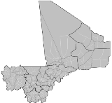
Arrondissements of Mali
Encyclopedia
| |
|
The cercles
of Mali
are divided into arrondissement
s. These are further divided into 703 communes
, 19 urban communes and 684 rural communes. Unlike Communes or Cercles, Arrondissements have no administrative power or elected officials: they are merely territorial divisions or used to divide administrative duties. Often the borders of Communes and Arrondisements coincide, rendering the Arrondissement demarcation of the territory superfulous.
The arrondissements are listed below, by Region and Cercle:
Bafoulabe Cercle
Diema Cercle
Kita Cercle
Kenieba Cercle
Kayes Cercle
Nioro du Sahel Cercle
Yélimané Cercle
Banamba Cercle
Dioila Cercle
Kangaba Cercle
Koulikoro Cercle
Kolokani Cercle
Kati Cercle
Nara Cercle
Bandiagara Cercle
Bankass Cercle
Djenné Cercle
Douentza Cercle
Koro Cercle
Mopti Cercle
Tenenkou Cercle
Bla Cercle
Barouéli Cercle
Macina Cercle
Niono Cercle
Ségou Cercle
San Cercle
Tominian Cercle
Bougouni Cercle
Kolondieba Cercle
Kadiolo Cercle
Koutiala Cercle
Sikasso Cercle
Yanfolila Cercle
Yorosso Cercle
Diré Cercle
Goundam Cercle
Gourma-Rharous Cercle
Niafunke Cercle
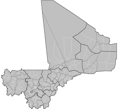
The cercles
Cercles of Mali
A cercle is the second level administrative unit in Mali. Mali is divided into eight regions and one capital district . These subdivisions bear the name of their principal city. The regions are divided into 49 cercles....
of Mali
Mali
Mali , officially the Republic of Mali , is a landlocked country in Western Africa. Mali borders Algeria on the north, Niger on the east, Burkina Faso and the Côte d'Ivoire on the south, Guinea on the south-west, and Senegal and Mauritania on the west. Its size is just over 1,240,000 km² with...
are divided into arrondissement
Arrondissement
Arrondissement is any of various administrative divisions of France, certain other Francophone countries, and the Netherlands.-France:The 101 French departments are divided into 342 arrondissements, which may be translated into English as districts. The capital of an arrondissement is called a...
s. These are further divided into 703 communes
Communes of Mali
A Commune is the third level administrative unit in Mali. Mali is divided into eight regions and one capital district . These subdivisions bear the name of their principal city. The regions are divided into 49 Cercles...
, 19 urban communes and 684 rural communes. Unlike Communes or Cercles, Arrondissements have no administrative power or elected officials: they are merely territorial divisions or used to divide administrative duties. Often the borders of Communes and Arrondisements coincide, rendering the Arrondissement demarcation of the territory superfulous.
The arrondissements are listed below, by Region and Cercle:
Bafoulabe CercleBafoulabé CercleBafoulabé Cercle is a second level administrative subdivision of the Kayes Region in western Mali. Its capital is the commune of Bafoulabé.The Cercle contains the following Rural and Urban Communes:*Bafoulabé *Bamafele *Diakon...
- BafoulabeBafoulabéBafoulabé is a town and commune in south-western Mali. It is located in the Region of Kayes. Bafoulabé is the capital of the Cercle of Bafoulabé, which in 1887 was the first Cercle to be created in Mali.-Local administration:...
- BamafeleBamafeleBamafélé is a town and commune in the Cercle of Bafoulabé in the Kayes Region of south-western Mali. As of 1998 the commune had a population of 12,475.-External links:*...
- DiakonDiakonDiakon is a town and commune in the Cercle of Bafoulabé in the Kayes Region of south-western Mali. As of 1998 the commune had a population of 27,552.-External links:*...
- DiallanDiallanDiallan is a town and commune in the Cercle of Bafoulabé in the Kayes Region of south-western Mali. As of 1998 the commune had a population of 10,356.-External links:*...
- DiokeliDiokeliDiokeli is a town and commune in the Cercle of Bafoulabé in the Kayes Region of south-western Mali. As of 1998 the commune had a population of 10,654.-External links:*...
- GounfanGounfanGounfan is a small town and commune in the Cercle of Bafoulabé in the Kayes Region of south-western Mali. As of 1998 the commune had a population of 4721.-External links:* `...
- KontelaKontelaKontela is a commune in the Cercle of Bafoulabé in the Kayes Region of south-western Mali. The principal town lies at Goundara. As of 1998 the commune had a population of 17018.-External links:*...
- KoundianKoundian, MaliKoundian is a small town and commune in the Cercle of Bafoulabé in the Kayes Region of south-western Mali. As of 1998 the commune had a population of 9,873.-External links:*...
- MahinaMahina, MaliMahina is a small town and commune in the Cercle of Bafoulabé in the Kayes Region of south-western Mali. As of 1998 the commune had a population of 17,847.The Dakar-Niger Railway has a station at Mahina. A railroad bridge at Mahina crosses the Bafing River....
- NiambiaNiambiaNiambia is a small town and commune in the Cercle of Bafoulabé in the Kayes Region of south-western Mali. As of 1998 the commune had a population of 4338.-External links:*...
- OualiaOualiaOualia is a small town and commune in the Cercle of Bafoulabé in the Kayes Region of south-western Mali. As of 1998 the commune had a population of 13206.-External links:*...
- SidibelaSidibelaSidibela is a commune in the Cercle of Bafoulabé in the Kayes Region of south-western Mali. The principal town lies at Tigana. As of 1998 the commune had a population of 6001.-Geography and climate:Sidibela is located in the northwest of Bafoulabé Cercle...
- TomoraTomoraTomora is a commune in the Cercle of Bafoulabé in the Kayes Region of south-western Mali. The principal town lies at Oussoubidiagna, a small town with around 4,000 inhabitants. As of 1998 the commune had a population of 25,844...
Diema CercleDiema CercleDiéma Cercle is an administrative subdivision of the Kayes Region of Mali. Its administrative center is the small town of Diéma. The Cercle is divided into one urban commune and fourteen rural communes...
- Bema
- Diangounte Camara
- Dianguirde
- Diema
- Dieoura
- Dioumara Koussata
- Fassoudebe
- Fatao
- Gomitradougou
- Groumera
- Guedebine
- Lakamane
- Lambidou
- Madiga-Sacko
- Sansankide
Kita CercleKita CercleKita Cercle is an administrative subdivision of the Kayes Region of Mali. Its capital is the city of Kita. The Cercle is further divided into Arrondissements and Communes. Kita Cercle's population as of 1998 was 278,111 people....
- Badia
- Bendougouba
- Benkadi Founia
- Boudofo
- Bougaribaya
- Dindenko
- Djidian
- Djougoun
- Gadougou 1
- Gadougou 2
- Guemoukouraba
- Kassaro
- Kita
- Kita Nord
- Kita Ouest
- Kobri
- Kokofata
- Kotouba
- Koulou
- Kourounnikoto
- Madina
- Makano
- Namala Guimba
- Niantanso
- Saboula
- Sebekoro
- Sefeto Nord
- Sefeto Ouest
- Senko
- Sirakoro
- Souransan-Tomoto
- Tambaga
- Toukoto
Kenieba CercleKenieba CercleKéniéba Cercle is an administrative subdivision of the Kayes Region of Mali. Its capital is the town of Kéniéba. The Cercle is further divided into Communes.Kéniéba Cercle includes the following communes:*Baye*Dabia*Dialafara*Dombia*Faléa*Faraba...
- Baye
- Dabia
- Dialafara
- Dombia
- Falea
- Faraba
- Guenegore
- Kassama
- Kenieba
- Kouroukoto
- Sagalo
- Sitakily
Kayes CercleKayes CercleKayes Cercle is an administrative subdivision of the Kayes Region of Mali. Its seat is the city of Kayes, which is also the capital of its Region and its largest city. The Cercle is further divided into Arrondissements and Communes. Kayes city is subdivided into Urban Communes and Wards...
- BangassiBangassiBangassi is a town and commune in the Cercle of Kayes in the Kayes Region of south-western Mali. As of 1998 the commune had a population of 12,796....
- DiamouDiamouDiamou is a town and commune in the Cercle of Kayes in the Kayes Region of south-western Mali. It is located 45 km from Kayes city. As of 1998 the commune had a population of 12,255. Telephone services are available for residents of the town....
- DjelebouDjelebouDjelebou is a commune in the Cercle of Kayes in the Kayes Region of south-western Mali. The principal town lies at Aourou. As of 1998 the commune had a population of 16,858....
- FalemeFalemeFaleme is a commune in the Cercle of Kayes in the Kayes Region of south-western Mali. The principal town lies at Diboli. As of 1998 the commune had a population of 5,864. Faleme is in the process of acquiring telephone service for its residents....
- FeguiFeguiFegui is a village and commune in the Cercle of Kayes in the Kayes Region of south-western Mali. As of 1998 the commune had a population of 2,590....
- Gory Gopela
- GoumeraGoumeraGoumera is a village and commune in the Cercle of Kayes in the Kayes Region of south-western Mali. As of 1998 the commune had a population of 2,588....
- Guidimakan Keri Kaffo
- Hawa DembayaHawa DembayaHawa Dembaya is a commune in the Cercle of Kayes in the Kayes Region of south-western Mali. The principal town lies at Médine. As of 1998 the commune had a population of 5,691....
- KabateKabatéKabaté is a town and commune in the Cercle of Kayes in the Kayes Region of south-western Mali. As of 1998 the commune had a population of 7,918....
- KarakoroKarakoro, MaliKarakoro is a commune in the Cercle of Kayes in the Kayes Region of south-western Mali. The principal town lies at Teichibe. As of 1998 the commune had a population of 11,117....
- KayesKayesKayes is a city in western Mali on the Sénégal River, with a population of roughly 100,000 people. Kayes is the capital of the administrative region of the same name. The name "Kayes" comes from the Soninké word "karré", which describes a low humid place that floods in rainy season...
- Kemene TamboKemene TamboKemene Tambo is a commune in the Cercle of Kayes in the Kayes Region of south-western Mali. The principal town lies at Ambidedi. As of 1998 the commune had a population of 10,901. Kemene Tambo offers telephone and electricity service to its residents....
- Khouloum
- Koniakary
- KoussaneKoussanéKoussané is a small town and commune in the Cercle of Kayes in the Kayes Region of south-western Mali. As of 1998 the commune had a population of 13,850....
- Liberte DembayaLiberte DembayaLiberte Dembaya is a commune in the Cercle of Kayes in the Kayes Region of south-western Mali. The principal town lies at Diabe Banlieue. As of 1998 the commune had a population of 7,491....
- LogoLogo, MaliLogo is a commune in the Cercle of Kayes in the Kayes Region of south-western Mali. The principal town lies at Kakoulou. As of 1998 the commune had a population of 10,001....
- Marena DiombougouMarena DiombougouMarena Diombougou , often referred to as simply Marena, is a small town and commune in the Cercle of Kayes in the Kayes Region of south-western Mali. As of 1998 the commune had a population of 13,227....
- MarintoumaniaMarintoumaniaMarintoumania is a small town and commune in the Cercle of Kayes in the Kayes Region of south-western Mali. As of 1998 the commune had a population of 5,517.-References:...
- SadiolaSadiolaSadiola is a town and commune in western Mali, south of Kayes. It is home to the largest gold mine in West Africa, the Sadiola Gold Mine, operated by Anglogold-Ashanti. As of 1998 the commune had a population of 16,678....
- SahelSahelThe Sahel is the ecoclimatic and biogeographic zone of transition between the Sahara desert in the North and the Sudanian Savannas in the south.It stretches across the North African continent between the Atlantic Ocean and the Red Sea....
- Same Diongoma
- SegalaSegala, MaliSegala is a small town and commune in the Cercle of Kayes in the Kayes Region of south-western Mali. As of 1998 the commune had a population of 19,175.Segala is noted for its gold mining....
- Sero DiamanouSero DiamanouSero or Sero Diamanou is a small town and commune in the Cercle of Kayes in the Kayes Region of south-western Mali. As of 1998 the commune had a population of 19,788.Segala is noted for its gold mining....
- SomankidiSomankidiSomankidi is a village and commune in the Cercle of Kayes in the Kayes Region of south-western Mali. As of 1998 the commune had a population of 5,167.-External links:*...
- SonySony, MaliSony is a commune in the Cercle of Kayes in the Kayes Region of south-western Mali. The principal town lies at Lany Tounka. As of 1998 the commune had a population of 7,330....
- TafacirgaTafacirgaTafacirga is a small town and commune in the Cercle of Kayes in the Kayes Region of south-western Mali. As of 1998 the commune had a population of 9,230....
Nioro du Sahel CercleNioro du Sahel CercleNioro Cercle is an administrative subdivision of the Kayes Region of Mali. Its administrative center is the town of Nioro du Sahel...
- Baniere Koré
- Diabigué
- Diarra
- Diaye Coura
- Gavinane
- Gogui
- Guetema
- Kadiaba Kadiel
- Korera Kore
- Nioro Du SahelNioro du SahelNioro du Sahel often referred to as simply Nioro is a town and commune in the Kayes Region of western Mali, 241 km from the city of Kayes. It is located 275 miles north-west of the capital Bamako...
- Nioro Tougouné Rangabes
- Sandaré
- Simbi
- Trougounbé
- Yéréré
- Youri
Yélimané CercleYélimané CercleYélimané Cercle is an administrative subdivision of the Kayes Region of Mali. Its seat is the town of Yélimané. The Cercle is further divided into Communes...
- Diafoumou Diongaga
- Diafoumou Gory
- Fanga
- Gory
- Guidime
- Kirane Kaniaga
- Konsiga
- Kremis
- Marekhaffo
- Soumpou
- Toya
- Tringa
Banamba CercleBanamba CercleBanamba Cercle is an administrative subdivision of the Koulikoro Region of Mali. Its seat is the town of Banamba, which is also its largest settlement...
- BanambaBanambaBanamba is the capital of Banamba Cercle, one of the seven Cercles of the Koulikoro Region of Mali. Its estimated 2008 population is 7000. The town lies due north of the regional capital of Koulikoro, and is connected by a 40km all weather road via the town of Sirakorola, about half way between...
- Benkadi
- Boron
- Duguwolowula
- Kiban
- Madina Sacko
- Sebete
- Toubacoro
- Toukoroba
Dioila CercleDioila CercleDioïla Cercle is an administrative subdivision of the Koulikoro Region of Mali. Its seat is the town of Dioïla. It lies at the southeast corner of the region, and prior to 1977, it was combined with what is now Kati Cercle and the District of Bamako in the "Bamako Cercle", with the capital city...
- Banco
- Benkadi
- Binko
- Degnekoro
- Diebe
- Diedougou
- Diouman
- Dolendougou
- Guegneka
- Jekafo
- Kaladougou
- Kemekafo
- Kerela
- Kilidougou
- Massigui
- Nangola
- N'Dlondougou
- N'Garadougou
- N'Golobougou
- Niantjila
- Tenindougou
- Wacoro
- Zan Coulibaly
Kangaba CercleKangaba CercleKangaba Cercle is an administrative subdivision of the Koulikoro Region of Mali. Its seat is the town and commune of Benkadi Habaladougou , also known as Kangaba...
- Balan Bakana
- Benkadi
- Kaniogo
- Karan
- Maramandougou
- Minidian
- Narena
- Nouga
- Selefougou
Koulikoro CercleKoulikoro CercleKoulikoro Cercle is an administrative subdivision of the Koulikoro Region of Mali. Its seat is the town of Koulikoro, which is also the capital of the region. A major trade and industrial town on the Niger River, Koulikoro has been surpassed by Kati to the west as the largest town in the region...
- Dinandougou
- Doumba
- Koula
- KoulikoroKoulikoroKoulikoro is a city in Mali. The capital of the Koulikoro Region, Koulikoro is located on banks of the Niger River, from Mali's capital Bamako....
- Meguetan
- Nyamina
- Sirakorola
- Tienfala
- Tougouni
Kolokani CercleKolokani CercleKolokani Cercle is an administrative subdivision of the Koulikoro Region of Mali. Its seat is the town of Kolokani, which is also its largest settlement. It lies directly to the north of Kati Cercle. Also to the south, is the District of Bamako, which after independence was carved out of the...
- Djidieni
- Guihoyo
- Kolokani
- Massantola
- Nonkon
- Nonssombougou
- Ouolodo
- Sagabala
- Sebekoro 1
- Tioribougou
Kati CercleKati CercleKati Cercle is an administrative subdivision of the Koulikoro Region of Mali. Its seat is the town of Kati, which is also its largest town. It lies at the southwest corner of the region, and completely surrounds the Bamako Capital District...
- Baguineda Camp
- Bancoumana
- Bossofala
- Bougoula
- Daban
- Diago
- Dialakoroba
- Dialakorodji
- Diedougou
- Dio-Gare
- Dogodouman
- Dombila
- Doubabougou
- Faraba
- Kalabancoro
- Kalifabougou
- Kambila
- KatiKatiKati is a town made up of 37 communes in Mali's Koulikoro Region, about 15 km from Bamako, Mali's capital. It has a population of approximately 40,000 inhabitants.-Economy:...
- Kourouba
- Mande
- Moribabougou
- Mountougoula
- Ngabacoro Droit
- N'Gouraba
- Niagadina
- Nioumamakana
- N'Tjiba
- Ouelessebougou
- Safo
- Sanankoro Djitoumou
- Sanankoroba
- Sangarebougou
- Siby
- SobraSobra (Mali)Sobra is a village in the Kati Cercle of the Koulikoro Region of Mali.In 1998 the village had an estimated total population of 6 856. In 2009 – 9 900 inhabitants.- External links :* Institute National de la Statistique...
- Tiakadougou Dialakoro
- Tiele
- Yelekebougou
Nara CercleNara CercleNara Cercle is an administrative subdivision of the Koulikoro Region of Mali. Its seat is the town of Nara, which is also the capital of its Region and its largest town. The cercle is divided into communes, and below this, Quarters/Villages....
- Allahina
- Dabo
- Dilly
- Dogofry
- Fallou
- Gueneibe
- Guire
- Koronga
- Nara
- Niamana
- Ouagadou
Bandiagara CercleBandiagara CercleBandiagara Cercle is an administrative subdivision of the Mopti Region of Mali. The administrative center is the town of Bandiagara.The cercle is divided into 21 communes:*Bandiagara*Bara Sara*Borko*Dandoli*Diamnati*Dogani Béré...
- BandiagaraBandiagaraBandiagara is a city in the Dogon region of Mali in Africa. The name translates roughly to "large eating bowl"—referring to the communal bowl meals are served in....
- Bara Sara
- BorkoBorkoBjörn Kristiansson alias Borko is an Icelandic musician. His debut album Celebrating Life was released in March, 2008 on record labels Morr Music and Kimi Records. Borko and band toured with the Icelandic bands Múm and Seabear in 2008.-External links:...
- Dandoli
- Diamnati
- Dogani Bere
- Doucoumbo
- Dourou
- Kende
- Kendie
- Lowol Gueou
- Metoumou
- Ondougou
- Pelou
- Pignari
- Pignari Bana
- Sangha
- Segue Ire
- Soroly
- Timiri
- Wadouba
Bankass CercleBankass Cercle Bankass Cercle is an administrative subdivision of the Mopti Region of Mali. The administrative center is at the town of Bankass.The Cercle is divided into 12 rural communes:*Bankass*Baye*Diallassagou*Dimbal Habé*Kani Bonzon...
- Bankass
- Baye
- Diallassagou
- Dimbal Habbe
- Kani Bonzon
- Koulogon Habbe
- Lessagou Habbe
- Ouenkoro
- Segue
- Sokoura
- Soubala
- Tori
Djenné CercleDjenné Cercle Djenné Cercle is an administrative subdivision of the Mopti Region of Mali. The administrative center is the town of Djenné. In the 2009 census the cercle had a population of 207,260 people.-Administrative subdivisions:...
- Dandougou Fakala
- Derary
- DjenneDjennéDjenné is an Urban Commune and town in the Inland Niger Delta region of central Mali. In the 2009 census the commune had a population of 32,944. Administratively it is part of the Mopti Region....
- Fakala
- Femaye
- Kewa
- Madiama
- Nema-Badeya-Kafo
- Niansanari
- Ouro Ali
- Pondori
- Togue Mourari
Douentza CercleDouentza Cercle Douentza Cercle is an administrative subdivision of the Mopti Region of Mali. The administrative center is the town of Douentza.The cercle is divided into 15 communes:*Dallah*Dangol-Boré*Débéré*Dianwéli*Djaptodji*Douentza*Gandamia...
- Dallah
- Dangol-Bore
- Debere
- Dianvely
- Djaptodji
- Douentza
- Gandamia
- Haire
- Hombori
- Kerena
- Korarou
- Koubelwel Koundia
- Mondoro
- Petaka
- Tedie
Koro CercleKoro Cercle Koro Cercle is an administrative subdivision of the Mopti Region of Mali. The administrative center is the town of Koro.The cercle is divided into 16 communes:*Bamba*Barapiréli*Bondo*Diankabou*Dinangourou*Dioungani*Dougouténé I*Dougouténé II*Kassa...
- Bamba
- Barapireli
- Bondo
- Diankabou
- Dinangourou
- Dioungani
- Dougoutene I
- Dougoutene II
- Kassa
- Koporo Pen
- Koporokendie Na
- Koro
- Madougou
- Pel Maoude
- Yoro
- Youdiou
Mopti CercleMopti Cercle Mopti Cercle is an administrative subdivision of the Mopti Region of Mali. The administrative center is the town of Mopti.The cercle is divided into 15 communes:*Bassirou*Borondougou*Dialloubé*Fatoma*Konna*Korombana*Koubaye*Kounari...
- Bassirou
- Borondougou
- Konna
- Korombana
- Koubaye
- Kounari
- MoptiMoptiMopti is a city at the confluence of the Niger and the Bani in Mali, between Timbuktu and Ségou. The city lies on three islands linked by dykes: the New Town, the Old Town and Medina Coura. As a result it is sometimes known as the "Venice of Mali".-History:The city of Mopti derives its name from...
- Ouro-Modi
- Ouroube Doude
- Sasalbe
- Soye
- Socoura
- Sio
Tenenkou CercleTenenkou CercleTénenkou Cercle is an administrative subdivision of the Mopti Region of Mali. Its seat is the town of Ténenkou, which is also its largest town. The cercle is divided into communes.Ténenkou Cercle contains the following communes:* Diafarabé* Diaka...
- Dialloube
- Diafarabe
- Diaka
- Diondori
- Kareri
- Ouro Ardo
- Ouro-Guire
- Sougoulbe
- Tenenkou
- Togoro-Kotia
- Toguere-Coumbe
Bla CercleBla CercleBla Cercle is an administrative subdivision of the Ségou Region of Mali. The administrative center is the town of Bla.The cercle is divided into 17 communes:*Beguené*Bla*Diaramana*Diena*Dougouolo*Falo*Fani*Kazangasso*Kemeni...
- Beguene
- Bla
- Diaramana
- Diena
- Dougouolo
- Falo
- Fani
- Kazangasso
- Kemeni
- Korodougou
- Koulandougou
- Niala
- Samabogo
- Somasso
- Tiemena
- Touna
- Yangasso
Barouéli CercleBarouéli CercleBarouéli Cercle is an administrative subdivision of the Ségou Region of Mali. The administrative center is the town of Barouéli.The Cercle is divided into 11 communes:*Barouéli*Boidié*Dougoufié*Gouendo*Kalaké*Konobougou*N'Gassola...
- Baraoueli
- Boidie
- Dougoufie
- Gouendo
- Kalake
- Konobougou
- N'Gassola
- Sanando
- Somo
- Tamani
- Tesserela
Macina CercleMacina CercleMacina Cercle is an administrative subdivision of the Ségou Region of Mali. The administrative center is the town of Macina.The cercle is divided into 11 communes:*Boky Were*Folomana*Kokry Centre*Kolongo*Macina*Matomo*Monimpebougou...
- Boky Were
- Folomana
- Kokry
- Kolongo
- MacinaMacina, MaliMacina or Ké Macina is a town and commune in the Cercle of Macina in the Ségou Region of southern-central Mali. As of 1998 the commune had a population of 31,655.The main town of Ke macina lies on the Niger River....
- Matomo
- Nonimpebougou
- Saloba
- Sana
- Souleye
- Tongue
Niono CercleNiono CercleNiono Cercle is an administrative subdivision of the Ségou Region of Mali. The administrative center is the town of Niono.The cercle is divided into 12 communes:*Diabaly*Dogofry*Kala Siguida*Mariko*Nampalari*Niono*Pogo*Siribala...
- Diabaly
- Dogofry
- Kala Siguida
- Mariko
- Nampalari
- Niono
- Pogo
- Siribala
- Sirifila Boundy
- Sokolo
- Toridaga-Ko
- Yeredon Saniona
Ségou CercleSégou CercleSégou Cercle is an administrative subdivision of the Ségou Region of Mali. The administrative center is the town of Ségou.The cercle is divided into 30 communes:*Baguindadougou*Bellen*Boussin*Cinzana*Diédougou*Diganibougou*Dioro...
- Baguindadougou
- Bellen
- Boussin
- Cinzana
- Diedougou
- Diganibougou
- Dioro
- Diouna
- Dougabougou
- Farako
- Farakou Massa
- Fatine
- Kamiandougou
- Katiena
- Konodimini
- Markala
- Massala
- N'GaraN'Gara, SégouN'Gara is a small town and commune in the Cercle of Ségou in the Ségou Region of southern-central Mali. As of 1998 the commune had a population of 9,292.-References:...
- N'Koumandougou
- Pelengana
- Sakoiba
- Sama Foulala
- Samine
- Sansanding
- Sebougou
- SegouSégouSégou is a city in south-central Mali, lying northeast of Bamako on the River Niger, in the region of Ségou. It was founded by the Bozo people, on a site about from the present town...
- Sibila
- Soignebougou
- Souba
- Togou
San CercleSan CercleSan Cercle is an administrative subdivision of the Ségou Region of Mali. The administrative center is the town of San.The cercle is divided into 25 communes:*Baramandougou*Dah*Diakourouna*Diéli*Djéguena*Fion*Kaniegué*Karaba*Kassorola...
- Baramandougou
- Dah
- Diakourouna
- Dieli
- Djeguena
- Fion
- Kaniegue
- Karaba
- Kassorola
- Kava
- Moribila
- N'Goa
- Niamana
- Niasso
- N'Torosso
- Ouolon
- San
- Siadougou
- Somo
- Sourountouna
- Sy
- Tene
- Teneni
- Tourakolomba
- Waky
Tominian CercleTominian CercleTominian Cercle is an administrative subdivision of the Ségou Region of Mali. The administrative center of the local government is in the town of Tominian. The Cercle is divided into Communes, and below this, quarters/villages...
- Benena
- Diora
- Fangasso
- Koula
- Lanfiala
- Mafoune
- Mandiakuy
- Ouan
- Sanekuy
- Timissa
- Tominian
- Yasso
Bougouni CercleBougouni CercleBougouni Cercle is an administrative subdivision of the Sikasso Region of Mali. The administrative center is the town of Bougouni.The cercle is divided into 26 communes:*Bladié-Tiémala*Bougouni*Danou*Débélin*Défina*Dogo*Domba*Faradiélé...
- Bladie-Tiemala
- BougouniBougouniBougouni is a commune and city in Mali, the administrative center of Bougouni Cercle, which is in turn found in the administrative region of Sikasso. Bougouni is located 170 km south of Bamako and 210 km west of the city of Sikasso...
- Danou
- Debelin
- Defina
- Dogo
- Domba
- Faradiele
- Faragouaran
- Garalo
- Keleya
- Kokele
- Kola
- Koumantou
- Kouroulamini
- Meridiela
- Ouroun
- Sanso
- Sibirila
- Sido
- Syen Toula
- Teimala Banimonotie
- Wola
- Yinindougou
- Yiridougou
- Zantiebougou
Kolondieba CercleKolondieba CercleKolondiéba Cercle is an administrative subdivision of the Sikasso Region of Mali. The administrative center is the town of Kolondiéba.The cercle is divided into the urban commune of Kolondiéba and 11 rural communes:*Bougoula*Fakola*Farako...
- Bougoula
- Fakola
- Farako
- Kadiana
- Kebila
- Kolondieba
- Kolosso
- Mena
- Nangalasso
- N'Golodiana
- Tiongui
- Tousseguela
Kadiolo CercleKadiolo CercleKadiolo Cercle is an administrative subdivision of the Sikasso Region of southern Mali. The administrative center is the town of Kadiolo.The cercle is divided into nine rural communes:*Diou*Dioumaténé*Fourou*Kadiolo*Kaï*Loulouni...
- Diou
- Dioumatene
- Fourou
- Kadiolo
- Kai
- Loulouni
- Misseni
- Nimbougou
- Zegoua
Koutiala CercleKoutiala CercleKoutiala Cercle is an administrative subdivision of the Sikasso Region of southern Mali. The administrative center is the town of Koutiala. The Cercle is divided into 36 communes.-Economy:...
- Diedougou
- Diouradougou Kafo
- Fagui
- Fakolo
- Gouadji Kao
- Goudie Sougouna
- Kafo Faboli
- Kapala
- Karangouana Malle
- Kolonigue
- Konigue
- Konina
- Konseguela
- Koromo
- Kouniana
- Koutiala
- Logouana
- Miena
- M'Pessoba
- Nafanga
- Nampe
- N'Golonianasso
- N'Gountjina
- Niantaga
- N'Tossoni
- Sincina
- Sinkolo
- Songo Doubakore
- Songoua
- Sorobasso
- Tao
- Yognogo
- Zanfigue
- Zangasso
- Zaniena
- Zebala
Sikasso CercleSikasso CercleSikasso Cercle is an administrative subdivision of the Sikasso Region of southern Mali. The capital is the town of Sikasso.The cercle is divided into the urban commune of Sikasso and 43 rural communes:*Benkadi*Blendio*Danderesso*Dembela*Dialakoro...
- Benkadi
- Blendio
- Danderesso
- Dembela
- Dialakoro
- Diomatene
- Dogoni
- Doumanaba
- Fama
- Farakala
- Finkolo
- Finkolo Ganadougou
- Gongasso
- Kabarasso
- Kaboila
- Kafouziela
- Kapala
- Kapolondougou
- Kignan
- Klela
- Kofan
- Kolokoba
- Koumankou
- Kouoro
- Kourouma
- Lobougoula
- Miniko
- Miria
- Missirikoro
- Natien
- Niena
- Nongo-Souala
- N'Tjikouna
- Pimperna
- Sanzana
- Sikasso
- Sokourani-Missirikoro
- Tella
- Tiankadi
- Wateni
- Zanferebougou
- Zangaradougou
- Zaniena
Yanfolila CercleYanfolila CercleYanfolila Cercle is an administrative subdivision of the Sikasso Region of southern Mali. The administrative center is the town of Yanfolila.The cercle is divided into 12 communes:*Baya*Bolo-Fouta*Djallon-Foula*Djiguiya de Koloni*Gouanan...
- Baya
- Bolo Fouta
- Djallon Foula
- Djiguiya De Koloni
- Gouanan
- Gouandiaka
- Koussan
- SankaraniSankaraniSankarani is a commune in the Cercle of Yanfolila in the Sikasso Region of southern Mali. The principal town lies at Bambala. As of 1998 the commune had a population of 6,626.-References:...
- Sere Moussa Ani Samou De Siekorole
- Tagandougou
- Wassoulou Balle
- Yallankoro Soloba
Yorosso CercleYorosso CercleYorosso Cercle is an administrative subdivision of the Sikasso Region of southern Mali. The main town is Yorosso.The cercle is divided into nine rural communes:*Boura*Karangana*Kiffosso I*Koumbia*Koury*Mahou*Ménamba I*Ourikéla...
- Boura
- Karangana
- Kiffosso
- Koumbia
- Koury
- Mahou
- Menamba
- Ourikela
- Yorosso
Diré CercleDiré Cercle Diré Cercle is an administrative subdivision of the Tombouctou Region of Mali. The administrative center is the town of Diré.The cercle is divided into 13 communes:*Arham*Binga*Bourem Sidi Amar*Dangha*Diré*Garbakoïra*Haïbongo...
- Arham
- Binga
- Bourem Sidi Amar
- Dangha
- Dire
- Garbakoira
- Haibongo
- Kirchamba
- Kondi
- Sareyamou
- Tienkour
- Tindirma
- Tinguereguif
Goundam CercleGoundam CercleGoundam Cercle is a second level administrative subdivision of the Tombouctou Region in north-eastern Mali. Its administrative center is the town of Goundam. In the 2009 census, the cercle had a population of 150,150....
- Adarmalane
- Alzounoub
- Bintagoungou
- Douekire
- Doukouria
- Essakane
- Gargando
- GoundamGoundamGoundam is a commune and town in north central Mali, in the Tombouctou Region. It is the capital of Goundam Cercle, one of five subdivisions of the Region. In the 2009 census the commune had a population of 16,253...
- Issa BeryIssa BeryIssa Bery is a commune of the Cercle of Goundam in the Tombouctou Region of Mali. The administrative center is the village of Toucabangou which is on the south shore of Lake Faguibine. The commune includes areas of land both to the south and to the north of the lake....
- Kaneye
- M'BounaM'BounaM'Bouna is a village and commune of the Cercle of Goudam in the Tombouctou Region of Mali. As of 1998 the commune had a population of 6,070.-References:...
- Razelma
- Tele
- Tilemsi
- Tin-Aicha
- TonkaTonkaTonka is an American toy company most known for its signature toy trucks and construction equipment.-History:On September 18, 1946 Mound Metalcraft was created in Mound, Minnesota with three men as partners, Lynn Everett Baker , Avery F. Crounse, and Alvin F. Tesch. The first products produced by...
Gourma-Rharous CercleGourma-Rharous Cercle Gourma-Rharous Cercle is an administrative subdivision of the Tombouctou Region of Mali. The administrative center is the town of Gourma-Rharous.The cercle is divided into nine communes:*Bambara Maoudé*Banikane*Gossi*Hamzakoma*Haribomo*Inadiatafane...
- Bambara Maoude
- Banikane
- Gossi
- Hamzakoma
- Haribomo
- Inadiatafane
- Ouinerden
- Rharous
- Serere
Niafunke CercleNiafunké Cercle Niafunké Cercle is an administrative subdivision of the Tombouctou Region of Mali. The administrative center is the town of Niafunké. In the 2009 census the cercle had a population of 184,285...
- Banikane Narhawa
- Dianke
- Fittouga
- Koumaira
- Lere
- N'Gorkou
- Soboundou
- Soumpi