
Arinos
Encyclopedia
| Arinos | |
|---|---|
| State | Minas Gerais Minas Gerais Minas Gerais is one of the 26 states of Brazil, of which it is the second most populous, the third richest, and the fourth largest in area. Minas Gerais is the Brazilian state with the largest number of Presidents of Brazil, the current one, Dilma Rousseff, being one of them. The capital is the... |
| Area: | 5,339 km² |
| Population: | 17,592 (IBGE 2007) |
| Elevation: | 509 m above sea level |
| Postcode (CEP): | 38680-000 |
| Became a city: | 1962 |
| IBGE statistical microregion: | Unaí Microregion |
| Mayor | Carlos Alberto Rech Filho (2005-2009) |
| Website: | |
| Coordinates: | 15°54′43"S 46°05′47"W |

City
A city is a relatively large and permanent settlement. Although there is no agreement on how a city is distinguished from a town within general English language meanings, many cities have a particular administrative, legal, or historical status based on local law.For example, in the U.S...
and municipality
Municipality
A municipality is essentially an urban administrative division having corporate status and usually powers of self-government. It can also be used to mean the governing body of a municipality. A municipality is a general-purpose administrative subdivision, as opposed to a special-purpose district...
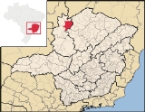
in northern Minas Gerais
Minas Gerais
Minas Gerais is one of the 26 states of Brazil, of which it is the second most populous, the third richest, and the fourth largest in area. Minas Gerais is the Brazilian state with the largest number of Presidents of Brazil, the current one, Dilma Rousseff, being one of them. The capital is the...
state, Brazil
Brazil
Brazil , officially the Federative Republic of Brazil , is the largest country in South America. It is the world's fifth largest country, both by geographical area and by population with over 192 million people...
. Arinos is located west of the Federal District
Federal district
Federal districts are a type of administrative division of a federation, under the direct control of a federal government. They exist in various countries and states all over the world.-United States:...
on the Urucuia River
Urucuia River
-See also:* ] map]* Rand McNally, The New International Atlas, 1993....
, a major tributary of the São Francisco
São Francisco River
The São Francisco is a river in Brazil. With a length of , it is the longest river that runs entirely in Brazilian territory, and the fourth longest in South America and overall in Brazil...
. The city is 333 km. from Brasília
Brasília
Brasília is the capital city of Brazil. The name is commonly spelled Brasilia in English. The city and its District are located in the Central-West region of the country, along a plateau known as Planalto Central. It has a population of about 2,557,000 as of the 2008 IBGE estimate, making it the...
The municipality belongs to the statistical microregion of Unaí Microregion, which has 9 municipalities. Neighboring municipalities are:
- North: FormosaFormosaFormosa or Ilha Formosa is a Portuguese historical name for Taiwan , literally meaning, "Beautiful Island". The term may also refer to:-Places:* Formosa Strait, another name for the Taiwan Strait...
- West: BuritisBuritisBuritis is a small city and municipality in northern Minas Gerais state, Brazil. It is located just south of the Urucuia River, which is a tributary of the São Francisco River.-Highway connections:...
and UnaíUnaíUnaí is a city and municipality in northern Minas Gerais state, Brazil, postal code 38610-000.-Location:Unaí is located southeast of Brasília and the Federal District and is linked to that important urban nucleus by highway BR 251, which also connects with BR 040 at Paracatu... - East: UrucuiaUrucuiaUrucuia is a municipality in the north of the state of Minas Gerais in Brazil. As of 2007 the population was 11,376 in an area of 2,072 km². The elevation of the municipal seat is 498 meters. It became a municipality in 1993...
and Chapada GaúchaChapada GaúchaChapada Gaúcha is a municipality in the northern region of Minas Gerais, Brazil. The population in 2007 was 10,266 in an area of 3,215 km². The elevation of the municipal seat is 872 meters. It became a municipality in 1997. The postal code is 39314-000.-Location:Chapada Gaúcha is part of...
Arinos has poor highway connections leading east to the Sao Francisco river
São Francisco River
The São Francisco is a river in Brazil. With a length of , it is the longest river that runs entirely in Brazilian territory, and the fourth longest in South America and overall in Brazil...
and to the state capital of Belo Horizonte
Belo Horizonte
Belo Horizonte is the capital of and largest city in the state of Minas Gerais, located in the southeastern region of Brazil. It is the third largest metropolitan area in the country...
, but a better road leading west to the national capital of Brasília
Brasília
Brasília is the capital city of Brazil. The name is commonly spelled Brasilia in English. The city and its District are located in the Central-West region of the country, along a plateau known as Planalto Central. It has a population of about 2,557,000 as of the 2008 IBGE estimate, making it the...
. Few of the roads in the town are paved. There is a fully paved road (BR-479) leading west to Cabeceiras
Cabeceiras
Cabeceiras is a small town and municipality in east-central Goiás state, Brazil. It is fast becoming a major producer of agricultural products using center pivot irrigation.-Location and Highway Connections:...
to join the important BR-020, 22 kilometers east of Formosa
Formosa, Goiás
Formosa is a city and municipality located in the state of Goiás, Brazil, approximately 80 kilometers east of Brasília. The population was 90,247 in a total area of 5,806.89 km² . Formosa is known for its waterfalls and natural beauty...
. The distance is approximately 165 kilometers. Another paved road leads west, then southwest to Garapuava, and continues southwest to the important regional center of Unaí
Unaí
Unaí is a city and municipality in northern Minas Gerais state, Brazil, postal code 38610-000.-Location:Unaí is located southeast of Brasília and the Federal District and is linked to that important urban nucleus by highway BR 251, which also connects with BR 040 at Paracatu...
.
The economy
The economy is based on cattle raising and agriculture, especially the cultivation of soybeans, sorghum, and corn.- Industrial establishments: 14 (2005)
- Commercial retail establishments: 245 (commerce, vehicle repair, personal and domestic objects)
- Restaurant and hotel establishments: 14
- Financial institutions: 1 (2005)
- Motor vehicles: 908 automobiles and 103 pickup trucks (2007)
Main agricultural crops in 2006)
- Rice: 2,050 ha.
- Corn: 3,500 ha.
- Soybeans: 4,00 ha.
- Sorghum: 200 ha.
- Beans: 900 ha.
Livestock raising in 2006
- Cattle: 92,509 head
Farm data in 2006
- Number of farms: 1,674
- Total area: 303,791
- Planted area: 27,500 ha.
- Area of natural pasture: 161,587
- Salaried workers in agriculture: 375
- Workers related to producer: 4,722
Health and education
- Health clinics: 8 (2 private and 6 public)
- Hospitals: 1 public with 31 beds
- Number of primary schools: 18
- Primary school enrollment: 3,817
- Number of middle and secondary schools: 5
- Middle and secondary school enrollment: 996
- Municipal Human Development IndexHuman Development IndexThe Human Development Index is a composite statistic used to rank countries by level of "human development" and separate "very high human development", "high human development", "medium human development", and "low human development" countries...
: 0.711 Frigoletto
Part of the municipality of Arinos is inside the Parque Nacional Grande Sertão Veredas http://www.ambientebrasil.com.br/composer.php3?base=./snuc/index.html&conteudo=./snuc/sudeste/pn/veredas.html, which lies to the north on an unpaved highway between Arinos and Formosa
Formosa
Formosa or Ilha Formosa is a Portuguese historical name for Taiwan , literally meaning, "Beautiful Island". The term may also refer to:-Places:* Formosa Strait, another name for the Taiwan Strait...
.