

Urucuia
Encyclopedia
Minas Gerais
Minas Gerais is one of the 26 states of Brazil, of which it is the second most populous, the third richest, and the fourth largest in area. Minas Gerais is the Brazilian state with the largest number of Presidents of Brazil, the current one, Dilma Rousseff, being one of them. The capital is the...
in Brazil
Brazil
Brazil , officially the Federative Republic of Brazil , is the largest country in South America. It is the world's fifth largest country, both by geographical area and by population with over 192 million people...
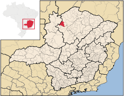
. As of 2007 the population was 11,376 in an area of 2,072 km². The elevation of the municipal seat is 498 meters. It became a municipality in 1993. The postal code (CEP) is 39315-000 and it belongs to the statistical microregion of Januária
Januária
Januária, known as "The Queen of the Beautiful Waters" is a city and municipality in northern Minas Gerais state, Brazil. It is located on the left bank of the São Francisco River...
Urucuia is located in an isolated region between the São Francisco River
São Francisco River
The São Francisco is a river in Brazil. With a length of , it is the longest river that runs entirely in Brazilian territory, and the fourth longest in South America and overall in Brazil...
and the Distrito Federal
Brazilian Federal District
The Federal District is set apart for Brasília, the capital of Brazil. Located in a region called Planalto Central, or Central Plateau, the Federal District is divided in 29 administrative regions. Brasilia - place where the three branches of the Federal Government are located - is the main...
It is connected by dirt road to Arinos
Arinos
Arinos is a small city and municipality in northern Minas Gerais state, Brazil. Arinos is located west of the Federal District on the Urucuia River, a major tributary of the São Francisco. The city is 333 km. from Brasília...
and to São Romão
São Romão
São Romão is a Brazilian municipality located in the north of the state of Minas Gerais. In 2007 the population was 9,080 in a total area of 2,432 km². It became a municipality in 1943.-Location and Distances:...
on the São Francisco River. It lies on the left bank of the Urucuia Rivers, a tributary of the São Francisco.
The economy is based on agriculture with emphasis on cattle raising. There were 35,000 head in 2006. The main agricultural crops were coffee, coconuts, manioc, and corn. The GDP was R$39,297,000 in 2005. In 2006 there were 4,300 people connected to agriculture among whom were 700 salaried workers. There were no banking agencies.
This municipality is extremely isolated from major population centers and suffers from drought and poor soils. It is one of the poorest in the state and in the country. Like many impoverished districts it fought for municipal autonomy to apply for government assistance programs.
- Municipal Human Development IndexHuman Development IndexThe Human Development Index is a composite statistic used to rank countries by level of "human development" and separate "very high human development", "high human development", "medium human development", and "low human development" countries...
: .675 (2000) - State ranking: 653 out of 853 municipalities as of 2000
- National ranking: 3,372 out of 5,138 municipalities as of 2000
- Health clinics and hospitals: 1 basic clinics, 2 health centers, and 1 hospital with 36 beds
- Life expectancy: 69.2 (2004)
The social and health indicators were: degree of urbanization--44.9%; Literacy rate: 77.6; coverage of sewage system in the urban area--0.10%; coverage of garbage collection in the urban area--67.9; and infant mortality--18.60.
See also
- List of municipalities in Minas Gerais