

Chapada Gaúcha
Encyclopedia
Minas Gerais
Minas Gerais is one of the 26 states of Brazil, of which it is the second most populous, the third richest, and the fourth largest in area. Minas Gerais is the Brazilian state with the largest number of Presidents of Brazil, the current one, Dilma Rousseff, being one of them. The capital is the...
, Brazil
Brazil
Brazil , officially the Federative Republic of Brazil , is the largest country in South America. It is the world's fifth largest country, both by geographical area and by population with over 192 million people...
. The population in 2007 was 10,266 in an area of 3,215 km². The elevation of the municipal seat is 872 meters. It became a municipality in 1997. The postal code (CEP) is 39314-000.
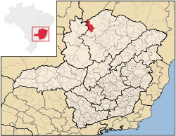
Location
Chapada Gaúcha is part of the statistical microregion of JanuáriaJanuária
Januária, known as "The Queen of the Beautiful Waters" is a city and municipality in northern Minas Gerais state, Brazil. It is located on the left bank of the São Francisco River...
. It is connected by poor roads to Arinos
Arinos
Arinos is a small city and municipality in northern Minas Gerais state, Brazil. Arinos is located west of the Federal District on the Urucuia River, a major tributary of the São Francisco. The city is 333 km. from Brasília...
and to Januária
Januária
Januária, known as "The Queen of the Beautiful Waters" is a city and municipality in northern Minas Gerais state, Brazil. It is located on the left bank of the São Francisco River...
. It lies in an extensive agricultural area on highlands south of the boundary with the state of Bahia
Bahia
Bahia is one of the 26 states of Brazil, and is located in the northeastern part of the country on the Atlantic coast. It is the fourth most populous Brazilian state after São Paulo, Minas Gerais and Rio de Janeiro, and the fifth-largest in size...
. The Parque Nacional Grande Sertão Veredas lies a few kilometers from the municipal seat. See Braziltour for information about the park. The park is not open to visitors and has no facilities. It was created in 1989 and has an area of 231,668.00 hectares.
Distances
- ArinosArinosArinos is a small city and municipality in northern Minas Gerais state, Brazil. Arinos is located west of the Federal District on the Urucuia River, a major tributary of the São Francisco. The city is 333 km. from Brasília...
: 93 km (57.8 mi) (dirt road) - São FranciscoSão FranciscoSão Francisco is one of the 48 neighborhoods in which the Brazilian city of Niterói is divided.Its name derives from the church consecrated to Saint Francis Xavier and references to it can be found as early as the 17th century...
: 134 km (83.3 mi) (dirt road) - JanuáriaJanuáriaJanuária, known as "The Queen of the Beautiful Waters" is a city and municipality in northern Minas Gerais state, Brazil. It is located on the left bank of the São Francisco River...
: 163 km (101.3 mi) (dirt road) - BrasíliaBrasíliaBrasília is the capital city of Brazil. The name is commonly spelled Brasilia in English. The city and its District are located in the Central-West region of the country, along a plateau known as Planalto Central. It has a population of about 2,557,000 as of the 2008 IBGE estimate, making it the...
: 372 km (231.2 mi) - Belo HorizonteBelo HorizonteBelo Horizonte is the capital of and largest city in the state of Minas Gerais, located in the southeastern region of Brazil. It is the third largest metropolitan area in the country...
: 580 km (360.4 mi)
Climate
The climate is semi-humid. The dry season is well-defined, and occurs between the months of May and November. The rainy season takes place from November through April. The average annual temperature is around 21°C – with an average annual high of 30°C, and a low of 18°C. June is normally the coldest month of the year.The economy
The main economic activities are cattle raising (65,000 head in 2006) and farming with large production of soybeans (9,000 ha.), corn, and rice. In the urban area there were no financial institutions as of 2006. There were 134 automobiles, giving a ratio of about one automobile for every 80 inhabitants. The Gross Domestic Product was R$ 36,891,000.00 (2005) a year, which was mainly generated by services and agriculture. Health care was provided by 7 public health clinics. There were no hospitals as of 2005.Farm Data for 2006
- Producers: 749
- Area: 140,806 ha.
- Area planted in crops: 88,000 ha.
- Area of natural pasture: 45,000 ha.
- Area of woodland and forest: 265,000 ha.
- Persons occupied related to the producer: 2,803
- Salaried workers not related to the producer: 198
- Establishments with tractors: 86
- Number of tractors: 189
Municipal Human Development Index
Human Development Index
The Human Development Index is a composite statistic used to rank countries by level of "human development" and separate "very high human development", "high human development", "medium human development", and "low human development" countries...
Chapada Gaúcha was in the bottom tier of the poorest municipalities in Minas Gerais
- MHDI: .683 (2000)
- State ranking: 623 out of 853 municipalities as of 2000
- National ranking: 3,264 out of 5,138 municipalities as of 2000
External links
See also
- List of municipalities in Minas Gerais