
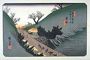
69 Stations of the Nakasendo
Encyclopedia
The are the rest areas
along the Nakasendō
, which ran from Nihonbashi
in Edo
(modern day Tokyo
) to Sanjō Ōhashi
in Kyoto
. The route stretched approximately 534 km (332 mi) and was an alternate trade route to the Tōkaidō
.
 The sixty-nine stations of the Nakasendō, in addition to the starting and ending locations (which are shared with the Tōkaidō), are listed below in order. The stations are divided by their present-day prefecture and include the name of their present-day city
/town
/village
/district
.
Tokyo
Saitama Prefecture
Gunma Prefecture
Nagano Prefecture
Gifu Prefecture
Shiga Prefecture
Kyoto Prefecture
(intermediate area) are intermediate rest areas along Japan's historical routes. Because they are not official post stations, normal travelers were generally not allowed to stay at them. Here are some of the ai no shuku along the Nakasendō:
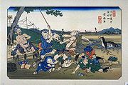
Shukuba
were post stations during the Edo period in Japan, generally located on one of the Edo Five Routes or one of its sub-routes. They were also called shukueki . These post stations were places where travelers could rest on their journey around the nation...
along the Nakasendō
Nakasendo
The , also called the , was one of the five routes of the Edo period, and one of the two that connected Edo to Kyoto in Japan. There were 69 stations between Edo and Kyoto, crossing through Musashi, Kōzuke, Shinano, Mino and Ōmi provinces...
, which ran from Nihonbashi
Nihonbashi
, or Nihombashi, is a business district of Chūō, Tokyo, Japan which grew up around the bridge of the same name which has linked two sides of the Nihonbashi River at this site since the 17th century. The first wooden bridge was completed in 1603, and the current bridge made of stone dates from 1911...
in Edo
Edo
, also romanized as Yedo or Yeddo, is the former name of the Japanese capital Tokyo, and was the seat of power for the Tokugawa shogunate which ruled Japan from 1603 to 1868...
(modern day Tokyo
Tokyo
, ; officially , is one of the 47 prefectures of Japan. Tokyo is the capital of Japan, the center of the Greater Tokyo Area, and the largest metropolitan area of Japan. It is the seat of the Japanese government and the Imperial Palace, and the home of the Japanese Imperial Family...
) to Sanjō Ōhashi
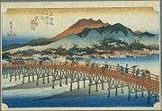
Sanjo Ohashi
is a bridge in Kyoto, Kyoto Prefecture, Japan. It spans the Kamo River as part of Sanjō-dōri . It is well-known because it served as the ending location for both the Nakasendō and the Tōkaidō.-History:...
in Kyoto
Kyoto
is a city in the central part of the island of Honshū, Japan. It has a population close to 1.5 million. Formerly the imperial capital of Japan, it is now the capital of Kyoto Prefecture, as well as a major part of the Osaka-Kobe-Kyoto metropolitan area.-History:...
. The route stretched approximately 534 km (332 mi) and was an alternate trade route to the Tōkaidō
Tokaido (road)
The ' was the most important of the Five Routes of the Edo period, connecting Edo to Kyoto in Japan. Unlike the inland and less heavily travelled Nakasendō, the Tōkaidō travelled along the sea coast of eastern Honshū, hence the route's name....
.
Stations of the Nakasendō
Cities of Japan
||A is a local administrative unit in Japan. Cities are ranked on the same level as and , with the difference that they are not a component of...
/town
Towns of Japan
A town is a local administrative unit in Japan. It is a local public body along with prefecture , city , and village...
/village
Villages of Japan
A is a local administrative unit in Japan.It is a local public body along with , , and . Geographically, a village's extent is contained within a prefecture....
/district
Districts of Japan
The was most recently used as an administrative unit in Japan between 1878 and 1921 and is roughly equivalent to the county of the United States, ranking at the level below prefecture and above city, town or village. As of 2008, cities belong directly to prefectures and are independent from...
.
TokyoTokyo, ; officially , is one of the 47 prefectures of Japan. Tokyo is the capital of Japan, the center of the Greater Tokyo Area, and the largest metropolitan area of Japan. It is the seat of the Japanese government and the Imperial Palace, and the home of the Japanese Imperial Family...
- Starting Location: NihonbashiNihonbashi, or Nihombashi, is a business district of Chūō, Tokyo, Japan which grew up around the bridge of the same name which has linked two sides of the Nihonbashi River at this site since the 17th century. The first wooden bridge was completed in 1603, and the current bridge made of stone dates from 1911...
(Chūō-kuChuo, Tokyois one of the 23 special wards that form the heart of Tokyo, Japan. The ward refers to itself as Chūō City in English.Its Japanese name literally means "Central Ward," and it is historically the main commercial center of Tokyo, although Shinjuku has risen to challenge it since the end of World War II...
) - 1. Itabashi-shukuItabashi-shukuwas the first of the sixty-nine stations of the Nakasendō. It is presently located in Itabashi, Tokyo, Japan.-History:During the Edo period, Itabashi-shuku flourished as one of the four post stations in Edo and spread out over two kilometers from north to south. From the north of Tokyo, it was...
(ItabashiItabashi, Tokyois one of the 23 special wards of Tokyo, Japan. In English, it calls itself Itabashi City. Itabashi has sister-city relations with Burlington, Ontario in Canada; Shijingshan District in Beijing, People's Republic of China; and Bologna in Italy....
)
Saitama PrefectureSaitama Prefectureis a prefecture of Japan located in the Kantō region of the island of Honshu. The capital is the city of Saitama.This prefecture is part of the Greater Tokyo Area, and most of Saitama's cities can be described as suburbs of Tokyo, to which a large amount of residents commute each day.- History...
- 2. Warabi-shukuWarabi-shukuwas the second of the sixty-nine stations of the Nakasendō. It is located in the present-day city of Warabi, Saitama Prefecture, Japan, approximately 19km from the starting point in Nihonbashi.-History:...
(WarabiWarabi, Saitamais a city located in Saitama, Japan. Warabi is the name of a bracken. The city was founded on April 1, 1959.As of 2003, the city has an estimated population of 71,034 and a density of 13,928.24 persons per km². The total area is 5.10 km²...
) - 3. Urawa-shukuUrawa-shukuwas the third of the sixty-nine stations of the Nakasendō. It is located in Urawa-ku in the present-day city of Saitama, Saitama Prefecture, Japan. Its stone ruins can be found 300 meters from Tsuki Shrine . Presently, there is a flea market that takes place on the fourth Saturday of every...
(Urawa-kuUrawa-ku, Saitamais a ward of Saitama City, Japan. It is surrounded by Midori-ku , Minami-ku , Chūō-ku , Ōmiya-ku , and Minuma-ku of Saitama city....
, SaitamaSaitama, Saitama' is the capital and the most populous city of Saitama Prefecture in Japan, situated in the south-east of the prefecture. Its area incorporates the former cities of Urawa, Ōmiya, Yono and Iwatsuki. It is a city designated by government ordinance...
) - 4. Ōmiya-shukuOmiya-shukuwas the fourth of the sixty-nine stations of the Nakasendō. It is located in the Ōmiya ward and Kita ward of the present-day city of Saitama, Saitama Prefecture, Japan.-History:...
(Ōmiya-kuOmiya-ku, Saitamais a ward of Saitama city, Saitama Prefecture, Japan. It is in the Greater Tokyo Area and about 25 km north of central Tokyo. Ōmiya-ku is surrounded by Nishi-ku , Kita-ku , Minuma-ku , Urawa-ku , Chūō-ku , and Sakura-ku of Saitama city.Ōmiya-ku is the most active commercial and business centre in...
, Saitama) - 5. Ageo-shukuAgeo-shukuwas the fifth of the sixty-nine stations of the Nakasendō. It is located in the present-day city of Ageo, Saitama Prefecture, Japan.-History:Originally built as a rest area for the Late Hōjō clan, Ageo-shuku became a station on the Nakasendō in 1603. Though it was comparatively small in terms of...
(AgeoAgeo, Saitamais a city located in Saitama, Japan.As of December 1, 2010, the city has an estimated population of 227,127 and the density of 4,986.32 persons per km². The total area is 45.55 km². It is twinned with Ueda, Nagano.- History :...
) - 6. Okegawa-shukuOkegawa-shukuwas the sixth of the sixty-nine stations of the Nakasendō. It is located in the present-day city of Okegawa, Saitama Prefecture, Japan.-History:At its peak as a post town during the Edo period, there were 36 inns in Okegawa-shuku. Parts of its honjin remain today...
(OkegawaOkegawa, Saitamais a city located in Saitama, Japan. It was founded on November 3, 1970, and as of 2003, the city has an estimated population of 73,881 and the density of 2,924.82 persons per km²...
) - 7. Kōnosu-shukuKonosu-shukuwas the seventh of the sixty-nine stations of the Nakasendō. It is located in the present-day city of Kōnosu, Saitama Prefecture, Japan.-History:Until 1602, Kōnosu-shuku was located in the present-day city of Kitamoto, but when the Nakasendō was established during the Edo period, the post town was...
(Kōnosu) - 8. Kumagai-shukuKumagai-shukuwas the eighth of the sixty-nine stations of the Nakasendō. It is located in the present-day city of Kumagaya, Saitama Prefecture, Japan.-History:Kumagai-shuku was the first training center for Buddhists in the Kantō region and had two honjin during the Edo period, but was still a rather small post...
(KumagayaKumagaya, Saitamais a city in Saitama Prefecture, Japan.As of 2010, the city has an estimated population of 203,089 . The total area is 159.88 km². The city is one of the biggest in northern Saitama Prefecture. It is the administrative, business and commercial centre in northern Saitama Prefecture. Eight...
) - 9. Fukaya-shukuFukaya-shukuwas the ninth of the sixty-nine stations of the Nakasendō. It is located in the present-day city of Fukaya, Saitama Prefecture, Japan.-History:Unlike many of the post towns that existed during the Edo period before the creation of the Nakasendō, Fukaya-shuku was established to be a part of the...
(FukayaFukaya, Saitamais a city located in the north of Saitama Prefecture, Japan. In the Edo era, it was an inn-town on the Nakasendō , and grew during this period. It is in the prefecture's leading agricultural area, and claim's to be the biggest producer of leeks in Japan. Fukaya negi are famous. Shibusawa Eiichi,...
) - 10. Honjō-shukuHonjo-shukuwas the tenth of the sixty-nine stations of the Nakasendō. It is located in the present-day city of Honjō, Saitama Prefecture, Japan.-History:There are no remnants of the Edo period post town remaining today; however, there are still many Western-style buildings from the following Meiji period in...
(HonjōHonjo, Saitamais a city located in Saitama Prefecture, Japan.As of May 1, 2011, the city has an estimated population of 81,267, with 32,685 households and a population density of 905.89 persons per km²...
)
Gunma PrefectureGunma Prefectureis a prefecture of Japan located in the northwest corner of the Kantō region on Honshu island. Its capital is Maebashi.- History :The remains of a Paleolithic man were found at Iwajuku, Gunma Prefecture, in the early 20th century and there is a public museum there.Japan was without horses until...
- 11. Shinmachi-shukuShinmachi-shukuwas the eleventh of the sixty-nine stations of the Nakasendō. It is located in the present-day city of Takasaki, Gunma Prefecture, Japan.-History:Though Shinmachi-shuku is the eleventh post station on the Nakasendō, it was actually the last station to be developed.-References:...
(TakasakiTakasaki, Gunmais a city located in Gunma Prefecture, Japan.The city was founded on April 1, 1900.Takasaki is a regional transportation hub because its train station is the junction of several rail lines as well as a Shinkansen stop....
) - 12. Kuragano-shukuKuragano-shukuwas the twelfth of the sixty-nine stations of the Nakasendō. It is located in the present-day city of Takasaki, Gunma Prefecture, Japan.-History:Kuragano-shuku was an intersection between the Nakasendō and the Nikkō Reiheishi Kaidō. Travelers coming from Kyoto would use this route to get to Nikkō...
(Takasaki) (also part of the Nikkō Reiheishi KaidōNikko Reiheishi KaidoThe was established during the Edo period as a subroute to Nikkō Kaidō. It connects the Nakasendō with the Nikkō Kaidō.-Stations of the Nikkō Reiheishi Kaidō:...
) - 13. Takasaki-shukuTakasaki-shukuwas the thirteenth of the sixty-nine stations of the Nakasendō. It is located in the present-day city of Takasaki, Gunma Prefecture, Japan.-History:Takasaki-shuku was located at the intersection of the Nakasendō and the Mikuni Kaidō...
(Takasaki) - 14. Itahana-shukuItahana-shukuwas the fourteenth of the sixty-nine stations of the Nakasendō. It is located in the present-day city of Annaka, Gunma Prefecture, Japan. Ruins of its honjin can be found at the Princess Kazunomiya Inn .-References:...
(AnnakaAnnaka, Gunmais a city located in Gunma, Japan.As of March 31, 2011, the city has an estimated population of 63,584, with a household number of 23,575 and the density of 230.09 persons per km²...
) - 15. Annaka-shukuAnnaka-shukuwas the fifteenth of the sixty-nine stations of the Nakasendō. It is located in the present-day city of Annaka, Gunma Prefecture, Japan. Batō Kan'on lined the way to the post town.-References:...
(Annaka) - 16. Matsuida-shukuMatsuida-shukuwas the sixteenth of the sixty-nine stations of the Nakasendō. It is located in the present-day city of Annaka, Gunma Prefecture, Japan, at the foot of Mount Myōgi.-Travel towards Kyoto:...
(Annaka) - 17. Sakamoto-shukuSakamoto-shukuwas the seventeenth of the sixty-nine stations of the Nakasendō. It is located in the present-day city of Annaka, Gunma Prefecture, Japan.-History:...
(Annaka)
Nagano PrefectureNagano Prefectureis a prefecture of Japan located in the Chūbu region of the island of Honshū. The capital is the city of Nagano.- History :Nagano was formerly known as the province of Shinano...
- 18. Karuisawa-shukuKaruisawa-shukuwas the eighteenth of the sixty-nine stations of the Nakasendō. It is located in the northern portion of the present-day town of Karuizawa, in the Kitasaku District of Nagano Prefecture, Japan...
(KaruizawaKaruizawa, Naganois a town located in Kitasaku District, Nagano, Japan.As of January 1, 2008, the town has an estimated population of 17,833 and has a total area of ....
, Kitasaku DistrictKitasaku District, Naganois a district located in Nagano Prefecture, Japan.As of December 1, 2005, the district has an estimated population of 40,041.The district has three towns*Karuizawa*Miyota*Tateshina-District Timeline:...
) - 19. Kutsukake-shukuKutsukake-shukuwas the nineteenth of the sixty-nine stations of the Nakasendō. It is located in the present-day town of Karuizawa, in the Kitasaku District of Nagano Prefecture, Japan.-History:...
(Karuizawa, Kitasaku District) - 20. Oiwake-shukuOiwake-shukuwas the twentieth of the sixty-nine stations of the Nakasendō. It is located in the present-day town of Karuizawa, in the Kitasaku District of Nagano Prefecture, Japan.-History:...
(Karuizawa, Kitasaku District) - 21. Otai-shukuOtai-shukuwas the twenty-first of the sixty-nine stations of the Nakasendō. It is located in the present-day town of Miyota, in the Kitasaku District of Nagano Prefecture, Japan.-History:...
(MiyotaMiyota, Naganois a town located in Kitasaku District, Nagano Prefecture, Japan.As of April 2007, the town has an estimated population of 14,231 and a density of 242.12 persons per km². The total area is 58.78 km².-External links:*...
, Kitasaku District) - 22. Iwamurada-shukuIwamurada-shukuwas the twenty-second of the sixty-nine stations of the Nakasendō. It is located in the present-day city of Saku, in Nagano Prefecture, Japan.-History:...
(SakuSaku, Naganois a city located in Nagano, Japan.Due to the refounding of Saku back on April 1, 2005, the city became the fifth city in Nagano Prefecture to go over 100,000...
) - 23. Shionada-shukuShionada-shukuwas the twenty-third of the sixty-nine stations of the Nakasendō. It is located in the present-day city of Saku, in Nagano Prefecture, Japan.-History:Shionada-shuku is located on the eastern bank of the Shinano River, just across from Yawata-shuku...
(Saku) - 24. Yawata-shukuYawata-shukuwas the twenty-fourth of the sixty-nine stations of the Nakasendō. It is located in the present-day city of Saku, in Nagano Prefecture, Japan.-History:...
(Saku) - 25. Mochizuki-shukuMochizuki-shukuwas the twenty-fifth of the sixty-nine stations of the Nakasendō. It is located in the present-day city of Saku, in Nagano Prefecture, Japan.-History:Located at the base of Mount Tateshina, Mochizuki has long been known for its horses...
(Saku) - 26. Ashida-shukuAshida-shukuwas the twenty-sixth of the sixty-nine stations of the Nakasendō. It is located in the present-day town of Tateshina, in the Kitasaku District of Nagano Prefecture, Japan.-History:...
(TateshinaTateshina, Naganois a town located in Kitasaku District, Nagano, Japan.As of 2003, the town has an estimated population of 8,492 and a density of 127.09 persons per km². The total area is 66.82 km².Tateshina is sister city to Oregon City, Oregon, in the United States....
, Kitasaku District) - 27. Nagakubo-shukuNagakubo-shukuwas the twenty-seventh of the sixty-nine stations of the Nakasendō . It is located in the present-day town of Nagawa, in the Chiisagata District of Nagano Prefecture, Japan.-History:...
(NagawaNagawa, Naganois a town located in Chiisagata District, Nagano Prefecture, Japan.The town was founded on October 1, 2005 when the town of Nagato and the village of Wada from Chiisagata District merged....
, Chiisagata DistrictChiisagata District, NaganoChiisagata is a district located in Nagano Prefecture, Japan.As of February 1, 2006, the district has an estimated population of 12,039...
) - 28. Wada-shukuWada-shukuwas the twenty-eighth of the sixty-nine stations of the Nakasendō. Its present-day location is in the Wada section of the town of Nagawa, in the Chiisagata District of Nagano Prefecture, Japan.-History:...
(Nagawa, Chiisagata District) - 29. Shimosuwa-shukuShimosuwa-shukuwas the twenty-ninth of the sixty-nine stations of the Nakasendō, as well as being the ending location of the Kōshū Kaidō. It is located in the present-day town of Shimosuwa, Suwa District, Nagano Prefecture, Japan.-History:...
(ShimosuwaShimosuwa, Naganois a town located in Suwa District, Nagano, Japan. It is located on Lake Suwa, a large, natural lake surrounded by mountains.As of 2006, the town has an estimated population of 22,421. The total area is 66.90 km²....
, Suwa DistrictSuwa District, Naganois a district located in Nagano, Japan.As of 2003, the district has an estimated population of 46,162 and a density of 181.18 persons per km². The total area is 254.79 km².-Towns and villages:*Fujimi*Hara*Shimosuwa...
) (also part of the Kōshū KaidōKoshu KaidoThe was one of the five routes of the Edo period and it was built to connect Edo with Kai Province in modern-day Yamanashi Prefecture, Japan. The route continues from there to connect with the Nakasendō's Shimosuwa-shuku in Nagano Prefecture...
) - 30. Shiojiri-shukuShiojiri-shukuwas the thirtieth of the sixty-nine stations of the Nakasendō. It is located in the central part of the present-day city of Shiojiri, Nagano Prefecture, Japan.-History:This area was originally built by Ōkubo Nagayasu in the Keichō era of the early Edo period...
(ShiojiriShiojiri, Naganois a city located in Nagano, Japan. Its name literally means "the end of salt".-History:Municipal Area Changes* April 1, 1927-The village of Shiojiri gained town status....
) (also part of the Shio no MichiShio no Michiwas an old kaidō in ancient Japan and was used to transport salt from the ocean to the inland portions of central Honshū. In the Middle Ages, salt was brough both from the Sea of Japan and the Pacific Ocean to Shinano Province for processing...
) - 31. Seba-jukuSeba-jukuwas the thirty-first of the sixty-nine stations of the Nakasendō. It is located in the central part of the present-day city of Shiojiri, Nagano Prefecture, Japan.-History:...
(Shiojiri) - 32. Motoyama-jukuMotoyama-jukuwas the thirty-second of the sixty-nine stations of the Nakasendō. It is located in the central part of the present-day city of Shiojiri, Nagano Prefecture, Japan.-History:...
(Shiojiri) - 33. Niekawa-jukuNiekawa-jukuwas the thirty-third of the sixty-nine stations of the Nakasendō. It is located in the present-day city of Shiojiri, Nagano Prefecture, Japan.-History:...
(Shiojiri) - 34. Narai-jukuNarai-jukuwas the thirty-fourth of the sixty-nine stations of the Nakasendō, as well as the second of eleven stations along the Kisoji. It is located in the present-day city of Shiojiri, Nagano Prefecture, Japan.-History:...
(Shiojiri) - 35. Yabuhara-jukuYabuhara-jukuwas the thirty-fifth of the sixty-nine stations of the Nakasendō, as well as the third of eleven stations on the Kisoji. It is located in the present-day village of Kiso, in the Kiso District of Nagano Prefecture, Japan. Yabuhara-juku is located shortly before the Torii Pass, which was the most...
(Kiso (village)Kiso, Nagano (village)is a village located in Kiso District, Nagano, Japan.As of 2003, the village has an estimated population of 3,438 and a density of 24.48 persons per km². The total area is 140.46 km².-External links:*...
, Kiso DistrictKiso District, Naganois a district located in Nagano Prefecture, Japan.As of November 1, 2005, the district has an estimated population of 34,759. The total area is 1,546.26 km².Historically, the district was once known as Nishichikuma District until May 1, 1968....
) - 36. Miyanokoshi-jukuMiyanokoshi-jukuwas the thirty-sixth of the sixty-nine stations of the Nakasendō, as well as the fourth of eleven stations on the Kisoji. It is located in the present-day town of Kiso, in the Kiso District of Nagano Prefecture, Japan.-History:...
(Kiso (town)Kiso, Nagano (town)is a town located in Kiso District, Nagano Prefecture, Japan.The town was founded on November 1, 2005, when the town of Kisofukushima was merged with three villages , all from Kiso District....
, Kiso District) - 37. Fukushima-jukuFukushima-jukuwas the thirty-seventh of the sixty-nine stations of the Nakasendō, as well as the fifth of eleven stations on the Kisoji. It is located in the present-day town of Kiso, in the Kiso District of Nagano Prefecture, Japan.-History:...
(Kiso (town), Kiso District) - 38. Agematsu-jukuAgematsu-jukuwas the thirty-eighth of the sixty-nine stations of the Nakasendō, as well as the sixth of eleven stations on the Kisoji. It is located in the present-day town of Agematsu, in the Kiso District of Nagano Prefecture, Japan. From the present-day Jūō Bridge, it runs through the Kan-machi and three...
(AgematsuAgematsu, Naganois a town located in Kiso District, Nagano, Japan.As of 2003, the town has an estimated population of 6,034 and a density of 35.82 persons per km². The total area is 168.47 km².-External links:*...
, Kiso District) - 39. Suhara-jukuSuhara-jukuwas the thirty-ninth of the sixty-nine stations of the Nakasendō, as well as the seventh of eleven stations on the Kisoji. It is located in the present-day village of Ōkuwa, in the Kiso District of Nagano Prefecture, Japan.-History:...
(OkuwaOkuwa, Naganois a village located in Kiso District, Nagano, Japan.As of 2003, the village has an estimated population of 4,559 and a density of 19.45 persons per km². The total area is 234.45 km².-External links:*...
, Kiso District) - 40. Nojiri-jukuNojiri-juku (Nakasendo)was the fortieth of the sixty-nine stations of the Nakasendō, as well as the eighth of eleven stations on the Kisoji. It is located in the present-day village of Ōkuwa, in the Kiso District of Nagano Prefecture, Japan.-History:...
(Okuwa, Kiso District) - 41. Midono-jukuMidono-jukuwas the forty-first of the sixty-nine stations of the Nakasendō, as well as the ninth of eleven stations on the Kisoji. It is located in the present-day town of Nagiso, in the Kiso District of Nagano Prefecture, Japan. It was originally written as 御殿宿 .-History:The northern part of Nagiso Station...
(NagisoNagiso, Naganois a town located in Kiso District, Nagano, Japan.As of 2003, the town has an estimated population of 5,458 and a density of 25.27 persons per km². The total area is ....
, Kiso District) - 42. Tsumago-juku (Nagiso, Kiso District)
Gifu PrefectureGifu Prefectureis a prefecture located in the Chūbu region of central Japan. Its capital is the city of Gifu.Located in the center of Japan, it has long played an important part as the crossroads of Japan, connecting the east to the west through such routes as the Nakasendō...
- 43. Magome-juku (NakatsugawaNakatsugawa, Gifuis a city located in the Tōnō region of Gifu Prefecture, Japan. The city was founded on April 1, 1952.-History:During Japan's Edo period, Nakatsugawa was a post town, known as Nakatsugawa-juku, one of the 69 Stations of the Nakasendō along the Nakasendō. The travel route ran from the Nihonbashi in...
) - 44. Ochiai-jukuOchiai-jukuwas the forty-fourth of the sixty-nine stations of the Nakasendō. It is located in the present-day city of Nakatsugawa, Gifu Prefecture, Japan. The honjin and the sub-honjin, as well as some old street lights, remain from the Edo period. The Honjin were the main rest areas in old post towns and...
(Nakatsugawa) - 45. Nakatsugawa-jukuNakatsugawa-jukuwas the forty-fifth of the sixty-nine stations of the Nakasendō. It is located in the present-day city of Nakatsugawa, Gifu Prefecture, Japan. During the Edo period, Nakatsugawa-juku reached a population of over 1,230 people and contained over 175 homes. There are many historical artifacts...
(Nakatsugawa) - 46. Ōi-jukuOi-jukuwas the forty-sixth of the sixty-nine stations of the Nakasendō. It is located in the present-day city of Ena, Gifu Prefecture, Japan. From Ōi-juku to the next post town, Ōkute-juku, there are 13 hills to pass over...
(EnaEna, Gifuis a city located in the Tōnō region of Gifu Prefecture, Japan. As of July 2011, the city has an estimated population of 53,378. The total area is 504.19 km²....
) - 47. Ōkute-jukuOkute-jukuwas the forty-seventh of the sixty-nine stations of the Nakasendō during the Edo period. This is the first station along the Nakasendō to be in the domain of the Owari Clan, one of the most powerful regional clans. It is located in the present-day city of Mizunami, Gifu Prefecture, Japan...
(MizunamiMizunami, Gifuis a city located in the Tōnō region of Gifu, Japan.As of July 2011, the city has an estimated population of 40,030. The total area is 175.00 km².The city was founded on April 1, 1954....
) - 48. Hosokute-jukuHosokute-jukuwas the forty-eighth of the sixty-nine stations of the Nakasendō during the Edo period and it is located in the present-day city of Mizunami, Gifu Prefecture, Japan.-History:...
(Mizunami) - 49. Mitake-jukuMitake-jukuwas the forty-ninth of the sixty-nine stations of the Nakasendō. It is located in the present-day town of Mitake, Ena District, Gifu Prefecture, Japan.-History:...
(MitakeMitake, Gifuis a town located in Kani District, Gifu Prefecture, Japan.As of July 2011, the town had an estimated population of 18,709. The total area is 56.61 km².-Rail:*Nagoya Railroad**Hiromi Line - Gōdo, Mitakeguchi, Mitake-External links:*...
, Kani DistrictKani District, Gifuis a district located in Gifu Prefecture, Japan. As of July 2011, the district has an estimated population of 18,709. The total area is 56.61 km².There only one town left in the district, Mitake.-District Timeline:...
) - 50. Fushimi-jukuFushimi-juku (Nakasendo)was the fiftieth of the sixty-nine stations of the Nakasendō. It is located in the present-day town of Mitake, Ena District, Gifu Prefecture, Japan.-History:...
(Mitake, Kani District) - 51. Ōta-jukuOta-jukuwas the fifty-first of the sixty-nine stations of the Nakasendō during the Edo period. It is located in Minokamo, Gifu Prefecture, Japan. It was located on one of the more difficult parts of the Nakasendō, but relics from its days as a post town still remain today...
(MinokamoMinokamo, Gifuis a city located in Gifu Prefecture, Japan, and was formed on April 1, 1954.As of July 2011, the city has an estimated population of 54,944. The total area is 74.81 km².-Rail:*JR Central:**Takayama Main Line: Mino-Ōta Station, Kobi Station...
) - 52. Unuma-jukuUnuma-jukuwas the fifty-second of the sixty-nine stations of the Nakasendō. It was also the last post station on the Inagi Kaidō. It is located in the present-day city of Kakamigahara, Gifu Prefecture, Japan. The eastern and western portions of the old post town joined together to become a formal post town...
(KakamigaharaKakamigahara, Gifuis a city located in the Gifu Prefecture of central Japan. It was founded on 1 April 1963 by the merger of Naka, Sohara, Unuma, and Inaba. Kakamigahara covers a total area of...
) - 53. Kanō-jukuKano-jukuwas the fifty-third of the sixty-nine stations of the Nakasendō. It is located just south of JR Gifu Station in Gifu, Gifu Prefecture, Japan. During the Edo period, it was an independent post town that was approximately wide, making it the largest post towns in Mino Province.Kanō Tenman-gū is...
(GifuGifu, Gifuis a city located in the south-central portion of Gifu Prefecture, Japan, and serves as the prefectural capital. The city has played an important role in Japan's history because of its location in the middle of the country. During the Sengoku period, various warlords, including Oda Nobunaga, used...
) - 54. Gōdo-jukuGodo-jukuwas the fifty-fourth of the sixty-nine stations of the Nakasendō. It is located in the present-day city of Gifu, Gifu Prefecture, Japan...
(Gifu) - 55. Mieji-jukuMieji-jukuwas the fifty-fifth of the sixty-nine stations of the Nakasendō. It is located in the present-day city of Mizuho, Gifu Prefecture, Japan. This post town received its name from Mie-ji, a temple which was located in Mizuho during the Edo period...
(MizuhoMizuho, Gifuis a city located in Gifu Prefecture, Japan.As of July 2011, the city has an estimated population of 52,269, with the number of households being 19,567...
) - 56. Akasaka-jukuAkasaka-juku (Nakasendo)was the fifty-sixth of the sixty-nine stations of the Nakasendō. It is located in the present-day city of Ōgaki, Gifu Prefecture, Japan. It flourished during the Edo Period, as it was located in a fertile valley, next to a river.-Modern Day:...
(ŌgakiOgaki, Gifuis a city located in Gifu Prefecture, Japan. It was incorporated as a city on April 1, 1918. As of July 2011, the city has an estimated population of 160,999 and a total area of .Ōgaki was the final destination for the haiku poet Matsuo Bashō...
) - 57. Tarui-jukuTarui-jukuwas the fifty-seventh of the sixty-nine stations of the Nakasendō. It is located in the present-day town of Tarui, Fuwa District, Gifu Prefecture, Japan.-History:...
(TaruiTarui, Gifuis a town located in Fuwa District, Gifu, Japan.As of July 2011, the town has an estimated population of 28,461. The total area is 57.14 km².- Railroad :*JR Tōkai**Tōkaidō Main Line - Tarui Station-External links:*...
, Fuwa DistrictFuwa District, Gifuis a district located in Gifu, Japan.As of July 2011, the district has an estimated population of 36,426. The total area is 106.43 km²....
) - 58. Sekigahara-jukuSekigahara-jukuwas the fifty-eighth of the sixty-nine stations of the Nakasendō. It is located in the present-day town of Sekigahara, Fuwa District, Gifu Prefecture, Japan.-History:...
(SekigaharaSekigahara, Gifuis a town located in Fuwa District, Gifu Prefecture, Japan.As of July 2011, the town has an estimated population of 7,965. The total area is 49.29 km².In 1600, the Battle of Sekigahara took place here.-History:...
, Fuwa District) - 59. Imasu-jukuImasu-jukuwas the fifty-ninth of the sixty-nine stations of the Nakasendō. It is located in the present-day town of Sekigahara, Fuwa District, Gifu Prefecture, Japan.-History:...
(Sekigahara, Fuwa District)
Shiga PrefectureShiga Prefectureis a prefecture of Japan, which forms part of the Kansai region on Honshu Island. The capital is the city of Ōtsu.- History :Shiga was known as Ōmi Province or Gōshū before the prefectural system was established...
- 60. Kashiwabara-jukuKashiwabara-jukuwas the sixtieth of the sixty-nine stations of the Nakasendō. It is located in the present-day city of Maibara, Shiga Prefecture, Japan.-History:Records of Kashiwabara-juku itself date back to the Middle Ages when it was mentioned in the Taiheiki, a historical epic of Japan. A post station was...
(MaibaraMaibara, Shigais a city located in Shiga Prefecture, Japan.As of August 1, 2006, the city has an estimated population of 42,154. The total area is 223.1 km².- History :...
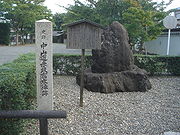
) - 61. Samegai-jukuSamegai-jukuthumb|A view of Samegai-juku from Kamo Shrine . was the sixty-first of the sixty-nine stations of the Nakasendō. It is located in the present-day city of Maibara, Shiga Prefecture, Japan.-History:...
(Maibara) - 62. Banba-jukuBanba-jukuwas the sixty-second of the sixty-nine stations of the Nakasendō. It is located in the present-day city of Maibara, Shiga Prefecture, Japan.-History:...
(Maibara) - 63. Toriimoto-jukuToriimoto-jukuwas the sixty-third of the sixty-nine stations of the Nakasendō. It is located in the north of Hikone, Shiga Prefecture, Japan.Even today, there are remnants of the former post town around. If you enter from the north, you pass by a pine colonnade that leads to the still-standing buildings...
(HikoneHikone, Shigais a city located in Shiga, Japan. The city was incorporated on February 11, 1937.Hikone's most famous historical site is Hikone Castle. Its construction was begun in 1603, by Ii Naokatsu, son of the former lord, Ii Naomasa, but was not completed until 1622...
) - 64. Takamiya-jukuTakamiya-jukuwas the sixty-fourth of the sixty-nine stations of the Nakasendō. It is located in the present-day city of Hikone, Shiga Prefecture, Japan on the right bank of the Inukami River. It stretches from the center of the city out towards the east. It became a post town shortly after its original founding...
(Hikone) - 65. Echigawa-jukuEchigawa-jukuwas the sixty-fifth of the sixty-nine stations of the Nakasendō. It is located in Aishō, Echi District, Shiga Prefecture, Japan.-History:Echigawa-juku has a long history. Kitabatake Akiie recorded his stay here in 1336 in the Taiheiki. It was originally a post town along the Tōsandō, before...
(AishōAisho, Shigais a town located in Echi District in eastern Shiga Prefecture, Japan. The town was founded on February 13, 2006 when the towns of Echigawa and Hatashō merged. The name "Aishō" combines the first character in and the second character in ....
, Echi DistrictEchi District, ShigaEchi is a district located in Shiga, Japan.As of 2003, the district has an estimated population of 34,262 and a density of 325.07 persons per km²...
) - 66. Musa-jukuMusa-jukuwas the sixty-sixth of the sixty-nine stations of the Nakasendō. It is located in the city of Ōmihachiman, Shiga Prefecture, Japan. Other kanji used to write "Musa" included 牟佐 and 身狭, but 武佐 became the official kanji in the Edo period. Parts of the old post town still remain today, including the...
(ŌmihachimanOmihachiman, Shigais a city in Shiga Prefecture, Japan.The city was founded on March 31, 1954. In the quinquennial census of 2010, it had a population of 81,730...
) - 67. Moriyama-jukuMoriyama-jukuwas the sixty-seventh of the sixty-nine stations of the Nakasendō. It is located in the present-day city of Moriyama, Shiga Prefecture, Japan.-History:...
(MoriyamaMoriyama, Shigais a city located in Shiga Prefecture, Japan.As of August 1, 2011, the city has an estimated population of 77,384 and the density of 1,390 persons per km². The total area is 55.73 km²....
) - 68. Kusatsu-jukuKusatsu-jukuwas the fifty-second of the fifty-three stations of the Tōkaidō as well as the sixty-eighth of the sixty-nine stations of the Nakasendō. It is located in the downtown area of the present-day city of Kusatsu, Shiga Prefecture, Japan.-History:...
(KusatsuKusatsu, Shigais a city located in Shiga Prefecture, Japan. The city was founded on October 15, 1954, and as of 2008, the city has an estimated population of 123,690 and the density of 1,820 persons per km². The total area is 67.92 km².- Overview :...
) (also part of the TōkaidōTokaido (road)The ' was the most important of the Five Routes of the Edo period, connecting Edo to Kyoto in Japan. Unlike the inland and less heavily travelled Nakasendō, the Tōkaidō travelled along the sea coast of eastern Honshū, hence the route's name....
) - 69. Ōtsu-jukuOtsu-jukuwas the last of the sixty-nine stations of the Nakasendō, as well as the last of the fifty-three stations of the Tōkaidō. It was from the previous post town, Kusatsu-juku, and was located in Ōmi Province...
(ŌtsuOtsu, Shigais the capital city of Shiga, Japan. The city was founded on October 1, 1898. As of October 1, 2010, the city has an estimated population of 338,629 with an average age of 40.7 years and a population density of 905.28 persons per km²...
) (also part of the Tōkaidō)
Kyoto PrefectureKyoto Prefectureis a prefecture of Japan located in the Kansai region of the island of Honshu. The capital is the city of Kyoto.- History :Until the Meiji Restoration, the area of Kyoto prefecture was known as Yamashiro....
- Ending Location: Sanjō ŌhashiSanjo Ohashiis a bridge in Kyoto, Kyoto Prefecture, Japan. It spans the Kamo River as part of Sanjō-dōri . It is well-known because it served as the ending location for both the Nakasendō and the Tōkaidō.-History:...
(Higashiyama-kuHigashiyama-ku, Kyoto' is one of the eleven wards in the city of Kyoto, in Kyoto Prefecture, Japan. It was created in 1929 when it was split off from Shimogyō-ku. During the years 1931 to 1976 it also covered the area of present-day Yamashina-ku, which was an independent town until its merger into the city in 1931...
, KyotoKyotois a city in the central part of the island of Honshū, Japan. It has a population close to 1.5 million. Formerly the imperial capital of Japan, it is now the capital of Kyoto Prefecture, as well as a major part of the Osaka-Kobe-Kyoto metropolitan area.-History:...
)
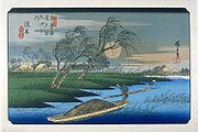
Ai no Shuku
Ai no shukuAi no shuku
were unofficial post stations along historical routes in Japan. These post stations formed organically along routes when the distance between two places was too far or when there were difficult passes nearby. Because they were not officially designated rest areas, travelers along the roads were...
(intermediate area) are intermediate rest areas along Japan's historical routes. Because they are not official post stations, normal travelers were generally not allowed to stay at them. Here are some of the ai no shuku along the Nakasendō:
- Fukiage-shukuFukiage-shukuwas a mid-station along the Nakasendō in Edo period Japan. It was in between the post stations of Kōnosu-juku and Kumagai-juku. It is located in the present-day town of Kōnosu, Saitama Prefecture, Japan. In addition to being a rest stop along the Nakasendō, it was also an officially designated post...
, between Kōnosu-juku and Kumagai-juku (Kōnosu, Saitama Prefecture) - Motai-shukuMotai-shukuwas a mid-station along the Nakasendō in Edo period Japan. It was in between the post stations of Mochizuki-shuku and Ashida-shuku. It is located in the present-day town of Saku, Nagano Prefecture, Japan....
, between Mochizuki-shuku and Ashida-shuku (Saku, Nagano Prefecture) - Shinkanō-jukuShinkanō-jukuwas a mid-station along the Nakasendō in Edo period Japan. It was in between the post stations of Unuma-juku and Kanō-juku. It is located in the present-day town of Kakamigahara, Gifu Prefecture, Japan....
, between Unuma-juku and Kanō-juku (KakamigaharaKakamigahara, Gifuis a city located in the Gifu Prefecture of central Japan. It was founded on 1 April 1963 by the merger of Naka, Sohara, Unuma, and Inaba. Kakamigahara covers a total area of...
, Gifu Prefecture)
See also
- Edo Five RoutesEdo Five RoutesThe were the five major roads that started at Edo during the Edo period, the most important of which was the Tōkaidō, which linked Edo and Kyoto...
- 53 Stations of the Tōkaidō53 Stations of the TokaidoThe are the rest areas along the Tōkaidō, which was a coastal route that ran from Nihonbashi in Edo to Sanjō Ōhashi in Kyoto.-Stations of the Tōkaidō:...
- 44 Stations of the Kōshū Kaidō
- 27 Stations of the Ōshū Kaidō
- 21 Stations of the Nikkō Kaidō
- 53 Stations of the Tōkaidō
- Other Routes
- 17 Stations of the Hokkoku Kaidō
- 11 Stations of the Kisoji
- 35 Stations of the Mikuni Kaidō