
Yarmouth, Massachusetts
Encyclopedia
Yarmouth is a New England town
in Barnstable County
, Massachusetts
, United States, Barnstable County being coextensive with Cape Cod
. The population was 24,807 at the 2000 census.
The town itself is made up of three major villages: South Yarmouth
, West Yarmouth
, and Yarmouth Port
.
, which separated in 1793. The town is named after Great Yarmouth
, a town in the county of Norfolk, on the east coast of England, which is itself at the mouth of the river Yare
.
Today the town is mostly known for its tourist industry and shopping, as it is the home of the original Christmas Tree Shops
on Route 6A in the village of Yarmouthport (though the location is now home to a small gift shop).
, the town has a total area of 28.2 square miles (73 km²), of which, 24.2 square miles (62.7 km²) of it is land and 4 square miles (10.4 km²) of it (14.07%) is water. Yarmouth is bordered by Cape Cod Bay
to the north, Dennis
to the east, Nantucket Sound
to the south, and Barnstable
to the west. Yarmouth is approximately seventy-five miles southeast of Boston.
The Bass River and its tributaries make up the majority of the town's border with Dennis. There are also several smaller ponds throughout the town. The Cape Cod Bay shore is marshy, with several creeks flowing into it. The town's southern shore is known for its beaches, from the west jetty of the Bass River to Great Island, on the east and south sides of Hyannis Harbor. The town has no state forests or wildlife management areas, although there are many such natural, unprotected areas in town. The town is also the site of four golf courses, a rod and gun club, and a Boy Scout camp.
, Route 6A
and Route 28
, all run through the town. Unlike many towns on the Cape, there are no other state routes crossing between the three roads, with all crossing routes being local roads. There are two exits off of Route 6 (also known as the Mid-Cape Highway) in town.
Freight rail service is provided by the Massachusetts Coastal Railroad
from the Barnstable town line to just west of Station Avenue south of U.S. Route 6, where a trash transfer station is located. Trash is loaded onto rail cars at the transfer station and hauled to the SEMASS waste-to-energy
plant in Rochester
. A portion of the Hyannis branch also passes through the western part of Yarmouth. The Cape Cod Central Railroad
operates seasonal tourist excursions from nearby Hyannis
to Sandwich
and Sagamore
. The nearest inter-city (Amtrak
) passenger rail stations are Boston's South Station
and Providence
. The nearest MBTA commuter rail
stations are Kingston/Route 3
and Middleborough/Lakeville
, providing direct service to Boston.
There are also several bike paths throughout town.
The nearest airport is the Barnstable Municipal Airport
, just over the town line. The nearest national and international air service can be reached at Logan International Airport
in Boston.
of 2000, there were 24,807 people, 11,520 households, and 6,900 families residing in the town. The population density
was 1,023.0 people per square mile (395.0/km²). There were 16,605 housing units at an average density of 684.8 per square mile (264.4/km²). The racial makeup of the town was 95.23% White, 1.34% African American, 0.33% Native American, 0.53% Asian, 0.04% Pacific Islander, 0.94% from other races
, and 1.59% from two or more races. Hispanic or Latino of any race were 1.44% of the population.
There were 11,520 households out of which 19.1% had children under the age of 18 living with them, 47.3% were married couples
living together, 9.7% had a female householder with no husband present, and 40.1% were non-families. 34.0% of all households were made up of individuals and 19.8% had someone living alone who was 65 years of age or older. The average household size was 2.11 and the average family size was 2.68.
In the town the population was spread out with 17.2% under the age of 18, 4.6% from 18 to 24, 23.3% from 25 to 44, 24.7% from 45 to 64, and 30.1% who were 65 years of age or older. The median age was 49 years. For every 100 females there were 85.6 males. For every 100 females age 18 and over, there were 80.8 males.
The median income for a household in the town was $39,808, and the median income for a family was $48,148. Males had a median income of $37,090 versus $26,741 for females. The per capita income
for the town was $22,731. About 5.2% of families and 7.5% of the population were below the poverty line, including 11.1% of those under age 18 and 3.6% of those age 65 or over.
as a part of the First and Second Barnstable Districts. The town is represented in the Massachusetts Senate
as a part of the Cape and Islands Districts, which includes all of Cape Cod, Martha's Vineyard and Nantucket except the towns of Bourne, Falmouth, Sandwich and a portion of Barnstable. The town is home to the Second Barracks of Troop D of the Massachusetts State Police
.
On the national level, Yarmouth is a part of Massachusetts's 10th congressional district
, and is currently represented by William R. Keating
. The senior (Class I) Senator, up for re-election in 2012, is John Kerry
.
Yarmouth is governed by the open town meeting
form of government, and is led by a town administrator and a board of selectmen
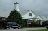
. There is a central police station, and one firehouse, post office and library each in South Yarmouth, West Yarmouth and Yarmouth Port.
, where both towns send their students. Their team colors are green and white, and their mascot is the dolphin.
Students who live in Yarmouth may also attend Cape Cod Regional Technical High School
in Harwich or Sturgis Charter Public School
in Hyannis; both for grades 9-12. In addition, they may choose to attend Saint Pius X School for grades pre-kindergarten through 8, or any of the other private schools in neighboring Barnstable.
New England town
The New England town is the basic unit of local government in each of the six New England states. Without a direct counterpart in most other U.S. states, New England towns are conceptually similar to civil townships in other states, but are incorporated, possessing powers like cities in other...
in Barnstable County
Barnstable County, Massachusetts
Barnstable County is a county located in the U.S. state of Massachusetts, consisting of Cape Cod and associated islands. As of the 2010 census, the population was 216,902...
, Massachusetts
Massachusetts
The Commonwealth of Massachusetts is a state in the New England region of the northeastern United States of America. It is bordered by Rhode Island and Connecticut to the south, New York to the west, and Vermont and New Hampshire to the north; at its east lies the Atlantic Ocean. As of the 2010...
, United States, Barnstable County being coextensive with Cape Cod
Cape Cod
Cape Cod, often referred to locally as simply the Cape, is a cape in the easternmost portion of the state of Massachusetts, in the Northeastern United States...
. The population was 24,807 at the 2000 census.
The town itself is made up of three major villages: South Yarmouth
South Yarmouth, Massachusetts
South Yarmouth is an unincorporated village and census-designated place in the town of Yarmouth in Barnstable County, Massachusetts, United States. The population was 11,603 at the 2000 census.-Geography:...
, West Yarmouth
West Yarmouth, Massachusetts
West Yarmouth is a census-designated place in the town of Yarmouth in Barnstable County, Massachusetts, United States. The population was 6,460 at the 2000 census.- Geography :West Yarmouth is located at ....
, and Yarmouth Port
Yarmouth Port, Massachusetts
Yarmouth Port is a census-designated place in the town of Yarmouth in Barnstable County, Massachusetts, United States. The population was 5,395 at the 2000 census...
.
History
Yarmouth was organized and named in 1639 by John Crowe (later Crowell) and Thomas Howes. It originally included what is now the town of DennisDennis, Massachusetts
Dennis is a town in Barnstable County, Massachusetts, United States; located near the center of Cape Cod. The population was 14,207 at the 2010 census.The town encompasses five distinct villages, each of which has its own post office...
, which separated in 1793. The town is named after Great Yarmouth
Great Yarmouth
Great Yarmouth, often known to locals as Yarmouth, is a coastal town in Norfolk, England. It is at the mouth of the River Yare, east of Norwich.It has been a seaside resort since 1760, and is the gateway from the Norfolk Broads to the sea...
, a town in the county of Norfolk, on the east coast of England, which is itself at the mouth of the river Yare
River Yare
The River Yare is a river in the English county of Norfolk. In its lower reaches the river connects with the navigable waterways of The Broads....
.
Today the town is mostly known for its tourist industry and shopping, as it is the home of the original Christmas Tree Shops
Christmas Tree Shops
Christmas Tree Shops are a retail chain that started in Yarmouth Port, Massachusetts on Cape Cod in 1970 as a complex of three small stores; the Front Shop, the Back Shop, and the Barn Shop. The multiple store location, which was located on Route 6A, explains why the name is Christmas Tree Shops...
on Route 6A in the village of Yarmouthport (though the location is now home to a small gift shop).
Geography
According to the United States Census BureauUnited States Census Bureau
The United States Census Bureau is the government agency that is responsible for the United States Census. It also gathers other national demographic and economic data...
, the town has a total area of 28.2 square miles (73 km²), of which, 24.2 square miles (62.7 km²) of it is land and 4 square miles (10.4 km²) of it (14.07%) is water. Yarmouth is bordered by Cape Cod Bay
Cape Cod Bay
Cape Cod Bay is a large bay of the Atlantic Ocean adjacent to the U.S. state of Massachusetts. Measuring below a line drawn from Brant Rock in Marshfield to Race Point in Provincetown, Massachusetts, it is enclosed by Cape Cod to the south and east, and Plymouth County, Massachusetts, to the west....
to the north, Dennis
Dennis, Massachusetts
Dennis is a town in Barnstable County, Massachusetts, United States; located near the center of Cape Cod. The population was 14,207 at the 2010 census.The town encompasses five distinct villages, each of which has its own post office...
to the east, Nantucket Sound
Nantucket Sound
Nantucket Sound is a roughly triangular area of the Atlantic Ocean offshore from the U.S. state of Massachusetts. It is long and wide, and is enclosed by Cape Cod on the north, Nantucket on the south, and Martha's Vineyard on the west. Between Cape Cod and Martha's Vineyard it is connected to the...
to the south, and Barnstable
Barnstable, Massachusetts
Barnstable is a city, referred to as the Town of Barnstable, in the U.S. state of Massachusetts and the county seat of Barnstable County. Barnstable is the largest community, both in land area and population, on Cape Cod. The town contains seven villages within its boundaries...
to the west. Yarmouth is approximately seventy-five miles southeast of Boston.
The Bass River and its tributaries make up the majority of the town's border with Dennis. There are also several smaller ponds throughout the town. The Cape Cod Bay shore is marshy, with several creeks flowing into it. The town's southern shore is known for its beaches, from the west jetty of the Bass River to Great Island, on the east and south sides of Hyannis Harbor. The town has no state forests or wildlife management areas, although there are many such natural, unprotected areas in town. The town is also the site of four golf courses, a rod and gun club, and a Boy Scout camp.
Transportation
Cape Cod's three major east-west routes, U.S. Route 6U.S. Route 6
U.S. Route 6 , also called the Grand Army of the Republic Highway, a name that honors an American Civil War veterans association, is a main route of the U.S. Highway system, running east-northeast from Bishop, California to Provincetown, Massachusetts. Until 1964, it continued south from Bishop to...
, Route 6A
Route 6A (Massachusetts)
Route 6A is the name for parts of former U.S. Route 6 on Cape Cod. Most of "6A", as the locals call it, is also known as the Old King's Highway...
and Route 28
Route 28 (Massachusetts)
Route 28 is a nominally south–north route in the U.S. state of Massachusetts, running from the town of Orleans via Boston to the New Hampshire state line in Methuen. Following the route from its nominally southern end, Route 28 initially heads south to the town of Chatham then turns west to...
, all run through the town. Unlike many towns on the Cape, there are no other state routes crossing between the three roads, with all crossing routes being local roads. There are two exits off of Route 6 (also known as the Mid-Cape Highway) in town.
Freight rail service is provided by the Massachusetts Coastal Railroad
Massachusetts Coastal Railroad
The Massachusetts Coastal Railroad is the successor operator of portions of Bay Colony Railroad.-History:On December 31, 2007 the contract to operate the freight railroad lines owned by the Commonwealth of Massachusetts administered by the Executive Office of Transportation expired. These...
from the Barnstable town line to just west of Station Avenue south of U.S. Route 6, where a trash transfer station is located. Trash is loaded onto rail cars at the transfer station and hauled to the SEMASS waste-to-energy
Waste-to-energy
Waste-to-energy or energy-from-waste is the process of creating energy in the form of electricity or heat from the incineration of waste source. WtE is a form of energy recovery...
plant in Rochester
Rochester, Massachusetts
Rochester is a town in Plymouth County, Massachusetts, United States. The population was 5,232 at the 2010 census.-History:Rochester was settled in 1679 on the lands called "Sippican" by the local Wampanoags, along the coast of Buzzards Bay...
. A portion of the Hyannis branch also passes through the western part of Yarmouth. The Cape Cod Central Railroad
Cape Cod Central Railroad
The Cape Cod Central Railroad is a heritage railroad located in Cape Cod, Massachusetts.Originally founded in 1999, it operates a variety of excursion trains from downtown Hyannis to the Cape Cod Canal during spring, summer, and fall. Recently, it has expanded service in a limited capacity to offer...
operates seasonal tourist excursions from nearby Hyannis
Hyannis, Massachusetts
Hyannis is the largest of seven villages in Barnstable, Massachusetts. Also it is the commercial and transportation hub of Cape Cod and was designated an urban area as a result of the 1990 census. Because of this, many refer to Hyannis as the "Capital of the Cape"...
to Sandwich
Sandwich, Massachusetts
Sandwich is a town in Barnstable County, Massachusetts, United States. The population was 20,675 at the 2010 census. The Town Hall is located right next to the Dexter Grist Mill, in the historic district of town....
and Sagamore
Sagamore, Massachusetts
Sagamore is a census-designated place in the town of Bourne in Barnstable County, Massachusetts, United States. The population was 3,544 at the 2000 census.-Geography:Sagamore is located at ....
. The nearest inter-city (Amtrak
Amtrak
The National Railroad Passenger Corporation, doing business as Amtrak , is a government-owned corporation that was organized on May 1, 1971, to provide intercity passenger train service in the United States. "Amtrak" is a portmanteau of the words "America" and "track". It is headquartered at Union...
) passenger rail stations are Boston's South Station
South Station
South Station, New England's second-largest transportation center , located at the intersection of Atlantic Avenue and Summer Street in Dewey Square, Boston, Massachusetts, is the largest train station and intercity bus terminal in Greater Boston, a prominent train station in the northeastern...
and Providence
Providence (Amtrak station)
Providence Station is a railroad station in Providence, Rhode Island and is served by Amtrak and the Massachusetts Bay Transportation Authority . The station has four tracks for passenger service, with a fifth track passing through for Providence and Worcester Railroad freight trains...
. The nearest MBTA commuter rail
MBTA Commuter Rail
The MBTA Commuter Rail serves as the regional rail arm of the Massachusetts Bay Transportation Authority, in the United States. It is operated under contract by the Massachusetts Bay Commuter Railroad Company a joint partnership of Veolia Transportation, Bombardier Transportation and Alternate...
stations are Kingston/Route 3
Kingston (MBTA station)
Kingston / Route 3 is a passenger rail station on MBTA Commuter Rail's Plymouth/Kingston Line. it is located at 194 Marion Drive in Kingston, Massachusetts, which is west of Independence Mall Shopping Center off of Exit 8 on Massachusetts Route 3, hence the dual name.Kingston station was built in...
and Middleborough/Lakeville
Middleborough/Lakeville (MBTA station)
Middleborough/Lakeville is an MBTA Commuter Rail station in Lakeville, Massachusetts. It is the terminus of the Middleborough/Lakeville Line. Middleborough/Lakeville Station was built on a line that was once part of the original Fall River Railroad, which actually had two different stations for...
, providing direct service to Boston.
There are also several bike paths throughout town.
The nearest airport is the Barnstable Municipal Airport
Barnstable Municipal Airport
Barnstable Municipal Airport , also known as Boardman/Polando Field, is a public airport located on Cape Cod, one mile north of the central business district of Hyannis, in Barnstable County, Massachusetts, United States. This airport is publicly owned by Town of Barnstable...
, just over the town line. The nearest national and international air service can be reached at Logan International Airport
Logan International Airport
General Edward Lawrence Logan International Airport is located in the East Boston neighborhood of Boston, Massachusetts . It covers , has six runways, and employs an estimated 16,000 people. It is the 19th busiest airport in the United States.Boston serves as a focus city for JetBlue Airways...
in Boston.
Demographics
As of the censusCensus
A census is the procedure of systematically acquiring and recording information about the members of a given population. It is a regularly occurring and official count of a particular population. The term is used mostly in connection with national population and housing censuses; other common...
of 2000, there were 24,807 people, 11,520 households, and 6,900 families residing in the town. The population density
Population density
Population density is a measurement of population per unit area or unit volume. It is frequently applied to living organisms, and particularly to humans...
was 1,023.0 people per square mile (395.0/km²). There were 16,605 housing units at an average density of 684.8 per square mile (264.4/km²). The racial makeup of the town was 95.23% White, 1.34% African American, 0.33% Native American, 0.53% Asian, 0.04% Pacific Islander, 0.94% from other races
Race (United States Census)
Race and ethnicity in the United States Census, as defined by the Federal Office of Management and Budget and the United States Census Bureau, are self-identification data items in which residents choose the race or races with which they most closely identify, and indicate whether or not they are...
, and 1.59% from two or more races. Hispanic or Latino of any race were 1.44% of the population.
There were 11,520 households out of which 19.1% had children under the age of 18 living with them, 47.3% were married couples
Marriage
Marriage is a social union or legal contract between people that creates kinship. It is an institution in which interpersonal relationships, usually intimate and sexual, are acknowledged in a variety of ways, depending on the culture or subculture in which it is found...
living together, 9.7% had a female householder with no husband present, and 40.1% were non-families. 34.0% of all households were made up of individuals and 19.8% had someone living alone who was 65 years of age or older. The average household size was 2.11 and the average family size was 2.68.
In the town the population was spread out with 17.2% under the age of 18, 4.6% from 18 to 24, 23.3% from 25 to 44, 24.7% from 45 to 64, and 30.1% who were 65 years of age or older. The median age was 49 years. For every 100 females there were 85.6 males. For every 100 females age 18 and over, there were 80.8 males.
The median income for a household in the town was $39,808, and the median income for a family was $48,148. Males had a median income of $37,090 versus $26,741 for females. The per capita income
Per capita income
Per capita income or income per person is a measure of mean income within an economic aggregate, such as a country or city. It is calculated by taking a measure of all sources of income in the aggregate and dividing it by the total population...
for the town was $22,731. About 5.2% of families and 7.5% of the population were below the poverty line, including 11.1% of those under age 18 and 3.6% of those age 65 or over.
Government
Yarmouth is represented in the Massachusetts House of RepresentativesMassachusetts House of Representatives
The Massachusetts House of Representatives is the lower house of the Massachusetts General Court, the state legislature of the Commonwealth of Massachusetts. It is composed of 160 members elected from single-member electoral districts across the Commonwealth. Representatives serve two-year terms...
as a part of the First and Second Barnstable Districts. The town is represented in the Massachusetts Senate
Massachusetts Senate
The Massachusetts Senate is the upper house of the Massachusetts General Court, the bicameral state legislature of the Commonwealth of Massachusetts. The Senate comprises 40 elected members from 40 single-member senatorial districts in the state...
as a part of the Cape and Islands Districts, which includes all of Cape Cod, Martha's Vineyard and Nantucket except the towns of Bourne, Falmouth, Sandwich and a portion of Barnstable. The town is home to the Second Barracks of Troop D of the Massachusetts State Police
Massachusetts State Police
The Massachusetts State Police is an agency of the Commonwealth of Massachusetts' Executive Office of Public Safety and Security responsible for criminal law enforcement and traffic vehicle regulation across the state...
.
On the national level, Yarmouth is a part of Massachusetts's 10th congressional district
Massachusetts's 10th congressional district
Massachusetts's 10th congressional district is a political constituency that includes parts of the South Shore of Massachusetts, and all of Cape Cod and the islands. With a population of 635,901 and a land area of , it is the most populous of Massachusetts's ten congressional districts and the...
, and is currently represented by William R. Keating
William R. Keating
William Richard "Bill" Keating is the U.S. Representative for . From 1999 to 2011 he was District Attorney of Norfolk County. He is a member of the Democratic Party and a former Massachusetts state representative and state senator....
. The senior (Class I) Senator, up for re-election in 2012, is John Kerry
John Kerry
John Forbes Kerry is the senior United States Senator from Massachusetts, the 10th most senior U.S. Senator and chairman of the Senate Foreign Relations Committee. He was the presidential nominee of the Democratic Party in the 2004 presidential election, but lost to former President George W...
.
Yarmouth is governed by the open town meeting
Open town meeting
An open town meeting is a form of town meeting in which all registered voters of a town may vote . This form of government is typical of smaller municipalities in the New England region of the United States....
form of government, and is led by a town administrator and a board of selectmen
Board of selectmen
The board of selectmen is commonly the executive arm of the government of New England towns in the United States. The board typically consists of three or five members, with or without staggered terms.-History:...
. There is a central police station, and one firehouse, post office and library each in South Yarmouth, West Yarmouth and Yarmouth Port.
Education
Yarmouth schools make up one-half of the Dennis-Yarmouth Regional School District. Yarmouth operates two elementary schools (Laurence C. MacArthur and Station Avenue) which serve students from pre-kindergarten through third grade, as well as the Marguerite E. Small School for grades 4 & 5, and the Mattacheese Middle School for grades 6 through 8. The town is the home to Dennis-Yarmouth Regional High SchoolDennis-Yarmouth Regional High School
Dennis-Yarmouth Regional High School is a suburban public high school in Yarmouth, Massachusetts. It opened in 1957 and was expanded and renovated in 1979 and again in 2006. It serves the Barnstable County towns of Yarmouth and Dennis and is the third largest high school on Cape Cod with...
, where both towns send their students. Their team colors are green and white, and their mascot is the dolphin.
Students who live in Yarmouth may also attend Cape Cod Regional Technical High School
Cape Cod Regional Technical High School
Cape Cod Regional Technical High School, also known as Cape Tech and Lower Cape Tech and sometimes abbreviated as CCT, is a public vocational and technical high school located in Harwich, Massachusetts....
in Harwich or Sturgis Charter Public School
Sturgis Charter Public School
The Sturgis Charter Public School is a charter school located in the village of Hyannis, Massachusetts . The school received its charter in February 1998 and opened in September for the 1998-1999 academic year with 162 freshman, 15 faculty and staff, a newly renovated facility, and a $1.2 million...
in Hyannis; both for grades 9-12. In addition, they may choose to attend Saint Pius X School for grades pre-kindergarten through 8, or any of the other private schools in neighboring Barnstable.
Notable residents
- Timothy Alden, (1771–1839), born in Yarmouth, Congregational Church clergyman and founder of Allegheny CollegeAllegheny CollegeAllegheny College is a private liberal arts college located in northwestern Pennsylvania in the town of Meadville. Founded in 1815, the college has about 2,100 undergraduate students.-Early history:...
- Joseph Eldridge HamblinJoseph Eldridge HamblinJoseph Eldridge Hamblin was an American general during the Civil War, who led a regiment and then a brigade in the Army of the Potomac.-Biography:...
, major general - John GorhamJohn Gorham (military officer)John Gorham was a New England Ranger and was the first significant British military presence on the frontier of Nova Scotia and Acadia to remain in the region for a substantial period of time after the Conquest of Acadia . He established the famous "Gorham's Rangers". Gorham was commissioned a...
, decorated colonial RangerUnited States Army RangersUnited States Army Rangers are elite members of the United States Army. Rangers have served in recognized U.S. Army Ranger units or have graduated from the U.S. Army's Ranger School... - Edward GoreyEdward GoreyEdward St. John Gorey was an American writer and artist noted for his macabre illustrated books.-Early life:...
, writer and illustrator - Christy MihosChristy MihosChristy P. Mihos is an American politician and businessman from the U.S. commonwealth of Massachusetts. He was an Independent candidate for Governor of Massachusetts in 2006 and ran again as a Republican in the 2010 Massachusetts gubernatorial election...
, businessman and politician - Snow ParkerSnow ParkerSnow Parker was a merchant, judge and political figure in Nova Scotia. He represented Queen's County in the Nova Scotia House of Assembly from 1801 to 1826....
, merchant, judge and politician - Keith ReedKeith ReedKeith A. Reed is a former Major League Baseball outfielder for the Baltimore Orioles.Reed was one of Baltimore's seven first-round draft picks in the 1999 Major League Baseball Draft. He was the Orioles #1 prospect in and made his major league debut on May 11, , called up to replace Sammy Sosa on...
, baseball outfielder - Thomas Chandler ThacherThomas Chandler ThacherThomas Chandler Thacher was a U.S. Representative from Massachusetts.-Biography:Born in Yarmouth Port, Massachusetts, Thacher attended the public schools. He was graduated from Adams Academy, Quincy, Massachusetts, in 1878 and from Harvard University in 1882. He became engaged in the wool...
, congressman - George ThatcherGeorge ThatcherGeorge Thatcher was an American lawyer, jurist, and statesman from the Maine district of Massachusetts. His name sometimes appears as George Thacher. He was a delegate for Massachusetts to the Continental Congress in 1787 and 1788...
, lawyer and statesman