

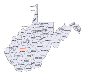
West Virginia census statistical areas
Encyclopedia
United States Census Bureau
The United States Census Bureau is the government agency that is responsible for the United States Census. It also gathers other national demographic and economic data...
has defined three Combined Statistical Area
Combined Statistical Area
The United States Office of Management and Budget defines micropolitan and metropolitan statistical areas. Metropolitan and micropolitan statistical areas consist of one or more counties...
s (CSAs), ten Metropolitan Statistical Areas (MSAs), and six Micropolitan Statistical Areas (μSAs) in the State of West Virginia. The following table describes these areas with the following information:
- The name of the Combined Statistical Area (CSA), if any.
- The population of the CSA as of 2006-07-01, as estimated by the United States Census Bureau.
- The name of the Core Based Statistical AreaCore based statistical areaA Core Based Statistical Area is a U.S. geographic area defined by the Office of Management and Budget based around an urban center of at least 10,000 people and adjacent areas that are socioeconomically tied to the urban center by commuting. Areas defined on the basis of these standards applied...
(CBSA). - The population of the CBSA as of 2006-07-01, as estimated by the United States Census Bureau.
- The name of the countyCounty (United States)In the United States, a county is a geographic subdivision of a state , usually assigned some governmental authority. The term "county" is used in 48 of the 50 states; Louisiana is divided into parishes and Alaska into boroughs. Parishes and boroughs are called "county-equivalents" by the U.S...
, independent cityIndependent cityAn independent city is a city that does not form part of another general-purpose local government entity. These type of cities should not be confused with city-states , which are fully sovereign cities that are not part of any other sovereign state.-Historical precursors:In the Holy Roman Empire,...
, or federal district. - The population of the county, independent city, or federal district as of 2006-07-01, as estimated by the United States Census Bureau.
| Combined Statistical Area | 2006 Pop | Core Based Statistical Area | 2006 Pop | County | 2006 Pop |
|---|---|---|---|---|---|
| primary census statistical area | 305,526 | Charleston, WV MSA | 305,526 | Kanawha County, West Virginia Kanawha County, West Virginia As of the census of 2000, there were 200,073 people, 86,226 households, and 55,960 families residing in the county. The population density was 222 people per square mile . There were 93,788 housing units at an average density of 104 per square mile... |
192,419 |
| Putnam County, West Virginia Putnam County, West Virginia As of the census of 2000, there were 51,589 people, 20,028 households, and 15,281 families residing in the county. The population density was 149 people per square mile . There were 21,621 housing units at an average density of 62 per square mile... |
54,982 | ||||
| Boone County, West Virginia Boone County, West Virginia As of the census of 2000, there were 25,535 people, 10,291 households, and 7,460 families residing in the county. The population density was 51 people per square mile . There were 11,575 housing units at an average density of 23 per square mile... |
25,512 | ||||
| Lincoln County, West Virginia Lincoln County, West Virginia As of the census of 2000, there were 22,108 people, 8,664 households, and 6,532 families residing in the county. The population density was 50 people per square mile . There were 9,846 housing units at an average density of 22 per square mile... |
22,357 | ||||
| Clay County, West Virginia Clay County, West Virginia -External links:***... |
10,256 | ||||
| Fairmont-Clarksburg, WV CSA | 149,214 | Clarksburg, WV μSA | 92,508 | Harrison County, West Virginia Harrison County, West Virginia As of the census of 2000, there were 68,652 people, 27,867 households, and 19,088 families residing in the county. The population density was 165 people per square mile . There were 31,112 housing units at an average density of 75 per square mile... |
68,745 |
| Taylor County, West Virginia Taylor County, West Virginia As of the census of 2000, there were 16,089 people, 6,320 households, and 4,487 families residing in the county. The population density was 93 people per square mile . There were 7,125 housing units at an average density of 41 per square mile... |
16,304 | ||||
| Doddridge County, West Virginia Doddridge County, West Virginia As of the census of 2000, there were 7,403 people, 2,845 households, and 2,102 families residing in the county. The population density was 23 people per square mile . There were 3,661 housing units at an average density of 11 per square mile... |
7,459 | ||||
| Fairmont, WV μSA | 56,706 | Marion County, West Virginia Marion County, West Virginia | style="float:right;"|As of the census of 2000, there were 56,598 people, 23,652 households, and 15,515 families residing in the county. The population density was 183 people per square mile . There were 26,660 housing units at an average density of 86 per square mile... |
56,706 | ||
| primary census statistical area | 285,475 135,551 |
Huntington-Ashland, WV-KY-OH MSA | 285,475 135,551 |
Cabell County, West Virginia Cabell County, West Virginia As of the census of 2000, there were 96,784 people, 41,180 households, and 25,490 families residing in the county. The population density was 344 people per square mile . There were 45,615 housing units at an average density of 162 per square mile... |
93,904 |
| Lawrence County, Ohio Lawrence County, Ohio As of the census of 2000, there were 62,319 people, 24,732 households, and 17,807 families residing in the county. The population density was 137 people per square mile . There were 27,189 housing units at an average density of 60 per square mile... |
63,179 | ||||
| Boyd County, Kentucky Boyd County, Kentucky Boyd County is a county located in the U.S. state of Kentucky. It was formed in 1860. Its are found at the northeastern edge of the state the near the Ohio River and Big Sandy River, nestled in the verdant rolling hills of Appalachia. The county seat is Catlettsburg. Its largest municipality is... |
49,371 | ||||
| Wayne County, West Virginia Wayne County, West Virginia As of the census of 2000, there were 42,903 people, 17,239 households, and 12,653 families residing in the county. The population density was 85 people per square mile . There were 19,107 housing units at an average density of 38 per square mile... |
41,647 | ||||
| Greenup County, Kentucky Greenup County, Kentucky Greenup County is a county located in the U.S. state of Kentucky. It was formed in 1804. As of 2000, the population was 36,891. Its county seat is Greenup. The county is named in honor of Christopher Greenup.... |
37,374 | ||||
| Beckley-Oak Hill, WV CSA | 125,912 | Beckley, WV μSA | 79,302 | Raleigh County, West Virginia Raleigh County, West Virginia As of the census of 2000, there were 79,220 people, 31,793 households, and 22,096 families residing in the county. The population density was 130 people per square mile . There were 35,678 housing units at an average density of 59 per square mile... |
79,302 |
| Oak Hill, WV μSA | 46,610 | Fayette County, West Virginia Fayette County, West Virginia As of the census of 2000, there were 47,579 people, 18,945 households, and 13,128 families residing in the county. The population density was 72 people per square mile . There were 21,616 housing units at an average density of 33 per square mile... |
46,610 | ||
| primary census statistical area | 115,136 | Morgantown, WV MSA | 115,136 | Monongalia County, West Virginia Monongalia County, West Virginia As of the census of 2000, there were 81,866 people, 33,446 households, and 18,495 families residing in the county. The population density was 227 people per square mile . There were 36,695 housing units at an average density of 102 per square mile... |
84,752 |
| Preston County, West Virginia Preston County, West Virginia As of the census of 2000, there were 29,334 people, 11,544 households, and 8,357 families residing in the county. The population density was 45 people per square mile . There were 13,444 housing units at an average density of 21 per square mile... |
30,384 | ||||
| primary census statistical area | 257,619 113,871 |
Hagerstown-Martinsburg, MD-WV MSA | 257,619 113,871 |
Washington County, Maryland Washington County, Maryland Washington County is a county located in the western part of the U.S. state of Maryland, bordering southern Pennsylvania to the north, northern Virginia to the south, and the Eastern Panhandle of West Virginia to the south and west. As of the 2010 Census, its population is 147,430... |
143,748 |
| Berkeley County, West Virginia Berkeley County, West Virginia Berkeley County is a county located in the Eastern Panhandle region of the U.S. state of West Virginia. As of 2010, the population is 104,169, making it the second-most populous county in West Virginia, behind Kanawha... |
97,534 | ||||
| Morgan County, West Virginia Morgan County, West Virginia Morgan County is a county located in the U.S. state of West Virginia. As of 2010, it's population was 17,541. Its county seat is Berkeley Springs. The county is one of three in Hagerstown-Martinsburg, MD-WV Metropolitan Statistical Area... |
16,337 | ||||
| primary census statistical area | 161,724 99,857 |
Parkersburg-Marietta-Vienna, WV-OH MSA | 161,724 99,857 |
Wood County, West Virginia Wood County, West Virginia As of the census of 2000, there were 87,986 people, 36,275 households, and 24,884 families residing in the county. The population density was 240 people per square mile . There were 39,785 housing units at an average density of 108 per square mile... |
86,597 |
| Washington County, Ohio Washington County, Ohio Washington County is a county located in the state of Ohio. As of the 2010 census, the population was 61,778. Its county seat is Marietta. The county, the oldest in the state, is named for George Washington. Washington County is included in the Parkersburg-Marietta-Vienna, West Virginia-Ohio... |
61,867 | ||||
| Pleasants County, West Virginia Pleasants County, West Virginia As of the census of 2000, there were 7,514 people, 2,887 households, and 2,136 families residing in the county. The population density was 58 people per square mile . There were 3,214 housing units at an average density of 25 per square mile... |
7,280 | ||||
| Wirt County, West Virginia Wirt County, West Virginia As of the census of 2000, there were 5,873 people, 2,284 households, and 1,699 families residing in the county. The population density was 25 people per square mile . There were 3,266 housing units at an average density of 14 per square mile... |
5,980 | ||||
| primary census statistical area | 147,329 78,558 |
Wheeling, WV-OH MSA | 147,329 78,558 |
Belmont County, Ohio Belmont County, Ohio Belmont County is a county located in the U.S. state of Ohio. It is part of the Wheeling, West Virginia Metropolitan Statistical Area. As of 2010, the population was 70,400. Its county seat is St. Clairsville... |
68,771 |
| Ohio County, West Virginia Ohio County, West Virginia As of the census of 2000, there were 47,427 people, 19,733 households, and 12,155 families residing in the county. The population density was 447 people per square mile . There were 22,166 housing units at an average density of 209 per square mile... |
44,662 | ||||
| Marshall County, West Virginia Marshall County, West Virginia As of the census of 2000, there were 35,519 people, 14,207 households, and 10,101 families residing in the county. The population density was 116 people per square mile . There were 15,814 housing units at an average density of 52 per square mile... |
33,896 | ||||
| Washington-Baltimore-Northern Virginia, DC-MD-VA-WV CSA | 8,211,213 72,923 |
Washington-Arlington-Alexandria, DC-VA-MD-WV MSA | 5,290,400 50,443 |
Fairfax County, Virginia Fairfax County, Virginia Fairfax County is a county in Virginia, in the United States. Per the 2010 Census, the population of the county is 1,081,726, making it the most populous jurisdiction in the Commonwealth of Virginia, with 13.5% of Virginia's population... |
1,010,443 |
| Montgomery County, Maryland Montgomery County, Maryland Montgomery County is a county in the U.S. state of Maryland, situated just to the north of Washington, D.C., and southwest of the city of Baltimore. It is one of the most affluent counties in the United States, and has the highest percentage of residents over 25 years of age who hold post-graduate... |
932,131 | ||||
| Prince George's County, Maryland Prince George's County, Maryland Prince George's County is a county located in the U.S. state of Maryland, immediately north, east, and south of Washington, DC. As of 2010, it has a population of 863,420 and is the wealthiest African-American majority county in the nation.... |
841,315 | ||||
| District of Columbia | 581,530 | ||||
| Prince William County, Virginia Prince William County, Virginia -National protected areas:* Featherstone National Wildlife Refuge* Manassas National Battlefield Park* Occoquan Bay National Wildlife Refuge* Prince William Forest Park-Government and politics:... |
357,503 | ||||
| Loudoun County, Virginia Loudoun County, Virginia Loudoun County is a county located in the Commonwealth of Virginia, and is part of the Washington Metropolitan Area. As of the 2010 U.S. Census, the county is estimated to be home to 312,311 people, an 84 percent increase over the 2000 figure of 169,599. That increase makes the county the fourth... |
268,817 | ||||
| Frederick County, Maryland Frederick County, Maryland Frederick County is a county located in the western part of the U.S. state of Maryland, bordering the southern border of Pennsylvania and the northeastern border of Virginia. As of the 2010 Census, the population was 233,385.... |
222,938 | ||||
| Arlington County, Virginia Arlington County, Virginia Arlington County is a county in the Commonwealth of Virginia. The land that became Arlington was originally donated by Virginia to the United States government to form part of the new federal capital district. On February 27, 1801, the United States Congress organized the area as a subdivision of... |
199,776 | ||||
| Charles County, Maryland Charles County, Maryland Charles County is a county in the south central portion of the U.S. state of Maryland.As of 2010, the population was 146,551. Its county seat is La Plata. This county was named for Charles Calvert , third Baron Baltimore.... |
140,416 | ||||
| City of Alexandria, Virginia | 136,974 | ||||
| Stafford County, Virginia Stafford County, Virginia Stafford County is a county located in the Commonwealth of Virginia, a U.S. state, and just across the Rappahannock River from the City of Fredericksburg. As of the 2000 census, the population was 92,446, increasing to 128,961 in 2010.. Its county seat is Stafford. In 2006, and again in 2009,... |
120,170 | ||||
| Spotsylvania County, Virginia Spotsylvania County, Virginia As of the census of 2000, there were 90,395 people, 31,308 households, and 24,639 families residing in the county. The population density was 226 people per square mile . There were 33,329 housing units at an average density of 83 per square mile... |
119,529 | ||||
| Calvert County, Maryland Calvert County, Maryland Calvert County is a county located in the U.S. state of Maryland. It occupies the Calvert Peninsula which is bordered on the east by the Chesapeake Bay and on the west by the Patuxent River. Calvert County is part of the Southern Maryland region. Calvert County's residents are among the highest... |
88,804 | ||||
| Fauquier County, Virginia Fauquier County, Virginia As of the census of 2000, there were 55,139 people, 19,842 households, and 15,139 families residing in the county. The population density was 85 people per square mile . There were 21,046 housing units at an average density of 32 per square mile... |
66,170 | ||||
| Jefferson County, West Virginia Jefferson County, West Virginia Jefferson County is a county located in the U.S. state of West Virginia. As of 2010, the population was 53,498. Its county seat is Charles Town... |
50,443 | ||||
| City of Manassas, Virginia | 36,638 | ||||
| Warren County, Virginia Warren County, Virginia As of the census of 2000, there were 31,584 people, 12,087 households, and 8,521 families residing in the county. The population density was 148 people per square mile . There were 13,299 housing units at an average density of 62 per square mile... |
36,102 | ||||
| City of Fairfax, Virginia | 22,422 | ||||
| City of Fredericksburg, Virginia | 21,273 | ||||
| Clarke County, Virginia Clarke County, Virginia Clarke County is a county in the Commonwealth of Virginia. As of 2010, the population was 14,034. Its county seat is Berryville.-History:Clarke County was established in 1836 by Thomas Fairfax, 6th Lord Fairfax of Cameron who built a home, Greenway Court, on part of his 5 million acre property,... |
14,565 | ||||
| City of Manassas Park, Virginia | 11,642 | ||||
| City of Falls Church, Virginia | 10,799 | ||||
| Baltimore-Towson, MD MSA | 2,658,405 | Baltimore County, Maryland Baltimore County, Maryland Baltimore County is a county located in the northern part of the US state of Maryland. In 2010, its population was 805,029. It is part of the Baltimore-Washington Metropolitan Area. Its county seat is Towson. The name of the county was derived from the barony of the Proprietor of the Maryland... |
787,384 | ||
| Baltimore City, Maryland | 631,366 | ||||
| Anne Arundel County, Maryland Anne Arundel County, Maryland Anne Arundel County is a county located in the U.S. state of Maryland. It is named for Anne Arundell , a member of the ancient family of Arundells in Cornwall, England and the wife of Cæcilius Calvert, 2nd Baron Baltimore. Its county seat is Annapolis, which is also the capital of the state... |
509,300 | ||||
| Howard County, Maryland Howard County, Maryland -2010:Whereas according to the 2010 U.S. Census Bureau:*62.2% White*17.5% Black*0.3% Native American*14.4% Asian*0.0% Native Hawaiian or Pacific Islander*3.6% Two or more races*2.0% Other races*5.8% Hispanic or Latino -2000:... |
272,452 | ||||
| Harford County, Maryland Harford County, Maryland Harford County is a county in the U.S. state of Maryland. In 2010, its population was 244,826. Its county seat is Bel Air. Harford County forms part of the Baltimore-Washington Metropolitan Area.-History:... |
241,402 | ||||
| Carroll County, Maryland Carroll County, Maryland Carroll County is a county located in the U.S. state of Maryland. In 2010, its population was 167,134. It was named for Charles Carroll of Carrollton , signer of the American Declaration of Independence. Its county seat is Westminster.... |
170,260 | ||||
| Queen Anne's County, Maryland Queen Anne's County, Maryland Queen Anne's County is a county located on the Eastern Shore of the U.S. state of Maryland.As of 2010, the population was 47,798. Its county seat and most populous municipality is Centreville. The census-designated place of Stevensville is the county's most populous place... |
46,241 | ||||
| Winchester, VA-WV MSA Winchester, VA-WV MSA Winchester, VA-WV MSA is a U.S. Metropolitan Statistical Area as defined by the United States Office of Management and Budget as of June, 2003. Its population as of 2008 U.S. Census Bureau estimates is 122,369.... |
118,932 22,480 |
Frederick County, Virginia Frederick County, Virginia Frederick County is a county located in the Commonwealth of Virginia. It is included in the Winchester, Virginia-West Virginia Metropolitan Statistical Area. It was formed in 1743 by the splitting of Orange County. For ten years it was the home of George Washington. As of 2010, the population was... |
71,187 | ||
| City of Winchester, Virginia | 25,265 | ||||
| Hampshire County, West Virginia Hampshire County, West Virginia Hampshire County is a county located in the U.S. state of West Virginia. As of 2010, the population was 23,964. Its county seat is Romney, West Virginia's oldest town . Hampshire County was created by the Virginia General Assembly on December 13, 1753, from parts of Frederick and Augusta counties ... |
22,480 | ||||
| Lexington Park, MD μSA | 98,854 | St. Mary's County, Maryland | 98,854 | ||
| Culpeper, VA μSA | 44,622 | Culpeper County, Virginia Culpeper County, Virginia As of the census of 2000, there were 34,262 people, 12,141 households, and 9,045 families residing in the county. The population density was 90 people per square mile . There were 12,871 housing units at an average density of 34 per square mile... |
44,622 | ||
| primary census statistical area | 105,886 61,278 |
Bluefield, WV-VA μSA | 105,886 61,278 |
Mercer County, West Virginia Mercer County, West Virginia -External links:* * * * * * *... |
61,278 |
| Tazewell County, Virginia Tazewell County, Virginia As of the census of 2000, there were 44,598 people, 18,277 households and 13,232 families residing in the county. The population density was 86 people per square mile . There were 20,390 housing units at an average density of 39 per square mile... |
44,608 | ||||
| primary census statistical area | 125,168 55,043 |
Weirton-Steubenville, WV-OH MSA | 125,168 55,043 |
Jefferson County, Ohio Jefferson County, Ohio Jefferson County is a county located in the state of Ohio. As of 2010, the population was 69,709. Its county seat is Steubenville and is named for Thomas Jefferson, who was at the time Vice President.... |
70,125 |
| Hancock County, West Virginia Hancock County, West Virginia As of the census of 2000, there were 32,667 people, 13,678 households, and 9,506 families residing in the county. The population density was 394 people per square mile . There were 14,728 housing units at an average density of 178 per square mile... |
30,911 | ||||
| Brooke County, West Virginia Brooke County, West Virginia As of the census of 2000, there were 25,447 people, 10,396 households, and 7,152 families residing in the county. The population density was 286 people per square mile . There were 11,150 housing units at an average density of 126 per square mile... |
24,132 | ||||
| primary census statistical area | 99,759 26,928 |
Cumberland, MD-WV MSA Cumberland, MD-WV MSA Cumberland, MD-WV MSA, or Cumberland Metro for short, denotes the Metropolitan Statistical Area of Cumberland, Maryland and the surrounding economic region of Allegany County, Maryland and Mineral County, West Virginia, in the United States.... |
99,759 26,928 |
Allegany County, Maryland Allegany County, Maryland Allegany County is a county located in the northwestern part of the US state of Maryland. It is part of the Cumberland, MD-WV Metropolitan Statistical Area. As of 2010, the population was 75,087. Its county seat is Cumberland... |
72,831 |
| Mineral County, West Virginia Mineral County, West Virginia Mineral County is a county located in the U.S. state of West Virginia. It is part of the Cumberland, MD-WV Metropolitan Statistical Area. As of 2010, the population was 28,212. Its county seat is Keyser.-Ancient history:... |
26,928 | ||||
| primary census statistical area | 57,069 25,756 |
Point Pleasant, WV-OH μSA | 57,069 25,756 |
Gallia County, Ohio Gallia County, Ohio As of the census of 2000, there were 31,069 people, 12,060 households, and 8,586 families residing in the county. The population density was 66 people per square mile . There were 13,498 housing units at an average density of 29 per square mile... |
31,313 |
| Mason County, West Virginia Mason County, West Virginia As of the census of 2000, there were 25,957 people, 10,587 households, and 7,569 families residing in the county. The population density was 60 people per square mile . There were 12,056 housing units at an average density of 28 per square mile... |
25,756 | ||||
| none | Logan County, West Virginia Logan County, West Virginia As of the census of 2000, there were 37,710 people, 14,880 households, and 10,936 families residing in the county. The population density was 83 people per square mile . There were 16,807 housing units at an average density of 37 per square mile... |
36,218 | |||
| Greenbrier County, West Virginia Greenbrier County, West Virginia As of the census of 2000, there were 34,453 people, 14,571 households, and 9,922 families residing in the county. The population density was 34 people per square mile . There were 17,644 housing units at an average density of 17 per square mile... |
34,850 | ||||
| Randolph County, West Virginia Randolph County, West Virginia As of the census of 2000, there were 28,262 people, 11,072 households, and 7,661 families residing in the county. The population density was 27 people per square mile . There were 13,478 housing units at an average density of 13 per square mile... |
28,465 | ||||
| Jackson County, West Virginia | 28,451 | ||||
| Mingo County, West Virginia Mingo County, West Virginia As of the census of 2000, there were 28,253 people, 11,303 households, and 8,217 families residing in the county. The population density was 67 people per square mile . There were 12,898 housing units at an average density of 30 per square mile... |
27,100 | ||||
| Nicholas County, West Virginia | 26,446 | ||||
| Wyoming County, West Virginia Wyoming County, West Virginia Wyoming County is a county located in the U.S. state of West Virginia. As of the 2010 census, the population was 23,796. Its county seat is Pineville. Wyoming County was created in 1850 from Logan County and named for the Delaware Indian word meaning "large plains."-Geography:According to the U.S... |
24,225 | ||||
| McDowell County, West Virginia McDowell County, West Virginia McDowell County is a county in the U.S. state of West Virginia. The land that became McDowell was originally part of Tazewell County, Virginia. As of the 2010 census, the population was 22,113. Its county seat is Welch. McDowell county is the southern-most county in the state, geographically... |
23,882 | ||||
| Upshur County, West Virginia Upshur County, West Virginia As of the census of 2000, there were 23,404 people, 8,972 households, and 6,352 families residing in the county. The population density was 66 people per square mile . There were 10,751 housing units at an average density of 30 per square mile... |
23,685 | ||||
| Lewis County, West Virginia Lewis County, West Virginia As of the census of 2000, there were 16,919 people, 6,946 households, and 4,806 families residing in the county. The population density was 44 people per square mile . There were 7,944 housing units at an average density of 21 per square mile... |
17,129 | ||||
| Wetzel County, West Virginia Wetzel County, West Virginia As of the census of 2000, there were 17,693 people, 7,164 households, and 5,079 families residing in the county. The population density was 49 people per square mile . There were 8,313 housing units at an average density of 23 per square mile... |
16,685 | ||||
| Barbour County, West Virginia Barbour County, West Virginia As of the census of 2000, there are 15,557 people, 6,123 households, and 4,365 families residing in the county. The population density is 46 people per square mile . There are 7,348 housing units at an average density of 22 per square mile... |
15,788 | ||||
| Roane County, West Virginia Roane County, West Virginia As of the census of 2000, there were 15,446 people, 6,161 households, and 4,479 families residing in the county. The population density was 32 people per square mile . There were 7,360 housing units at an average density of 15 per square mile... |
15,583 | ||||
| Braxton County, West Virginia | 14,810 | ||||
| Summers County, West Virginia Summers County, West Virginia Summers County is a county located in the U.S. state of West Virginia. As of the 2010 census, the population was 13,927. Its county seat is Hinton. Summers County was created by an act of the West Virginia General Assembly on February 27, 1871 from parts of Fayette, Greenbrier, Mercer and Monroe... |
13,531 | ||||
| Monroe County, West Virginia Monroe County, West Virginia As of the census of 2000, there were 14,583 people, 5,447 households, and 3,883 families residing in the county. The population density was 31 people per square mile . There were 7,267 housing units at an average density of 15 per square mile... |
13,510 | ||||
| Hardy County, West Virginia Hardy County, West Virginia As of the census of 2000, there were 12,669 people, 5,204 households, and 3,564 families residing in the county. The population density was 22 people per square mile . There were 7,115 housing units at an average density of 12 per square mile... |
13,420 | ||||
| Grant County, West Virginia Grant County, West Virginia As of the census of 2000, there were 11,299 people, 4,591 households, and 3,273 families residing in the county. The population density was 24 people per square mile . There were 6,105 housing units at an average density of 13 per square mile... |
11,915 | ||||
| Ritchie County, West Virginia Ritchie County, West Virginia As of the census of 2000, there were 10,343 people, 4,184 households, and 2,999 families residing in the county. The population density was 23 people per square mile . There were 5,513 housing units at an average density of 12 per square mile... |
10,628 | ||||
| Webster County, West Virginia | 9,696 | ||||
| Tyler County, West Virginia | 9,264 | ||||
| Pocahontas County, West Virginia Pocahontas County, West Virginia As of the census of 2000, there were 9,131 people, 835 households, and 527 families residing in the county. The population density was 10 people per square mile . There were 7,594 housing units at an average density of 8 per square mile... |
8,755 | ||||
| Pendleton County, West Virginia Pendleton County, West Virginia As of the census of 2000, there were 8,196 people, 3,350 households, and 2,355 families residing in the county. The population density was 12 people per square mile . There were 5,102 housing units at an average density of 7 per square mile... |
7,679 | ||||
| Calhoun County, West Virginia Calhoun County, West Virginia As of the census of 2000, there were 7,582 people, 3,071 households, and 2,201 families residing in the county. The population density was 27 people per square mile . There were 3,848 housing units at an average density of 14 per square mile... |
7,381 | ||||
| Gilmer County, West Virginia Gilmer County, West Virginia As of the census of 2000, there were 7,160 people, 2,768 households, and 1,862 families residing in the county. The population density was 21 people per square mile . There were 3,621 housing units at an average density of 11 per square mile... |
6,965 | ||||
| Tucker County, West Virginia Tucker County, West Virginia As of the census of 2000, there were 7,321 people, 3,052 households, and 2,121 families residing in the county. The population density was 18 people per square mile . There were 4,634 housing units at an average density of 11 per square mile... |
6,856 | ||||
See also
- State of West Virginia
- Demographics of West Virginia
- Geography of West VirginiaGeography of West VirginiaThe Environment of West Virginia encompasses terrain and ecosystems ranging from arid plateaus to mountains. Most of West Virginia lies within the Appalachian mixed mesophytic forests ecoregion, while the higher elevations along the eastern border and in the panhandle lie within the...
- United States of America
- United States Census BureauUnited States Census BureauThe United States Census Bureau is the government agency that is responsible for the United States Census. It also gathers other national demographic and economic data...
- Table of United States Combined Statistical AreasTable of United States Combined Statistical Areasthumb|An enlargeable map of the 125 [[Combined Statistical Area]]s of the [[United States]]The United States Office of Management and Budget has defined 125 Combined Statistical Areas for the United States of America...
(CSA) - Table of United States Core Based Statistical Areas (CBSA)
- Table of United States Metropolitan Statistical AreasTable of United States Metropolitan Statistical Areasthumb|An enlargeable map of the 942 [[Core Based Statistical Area]]s of the [[United States]]. The 367 [[Metropolitan Statistical Area]]s are shown in red....
(MSA) - Table of United States Micropolitan Statistical AreasTable of United States Micropolitan Statistical Areasthumb|An enlargeable map of the 942 [[Core Based Statistical Area]]s of the [[United States]]. The 576 [[Micropolitan Statistical Area]]s are shown in blue....
(μSA) - Table of United States primary census statistical areas (PCSA)
- Table of United States Combined Statistical Areas
- United States Census Bureau