
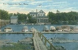
West Bath, Maine
Encyclopedia
West Bath is a town
in Sagadahoc County
, Maine
, United States
. The population was 1,798 at the 2000 census. A sub-locality of West Bath is Winnegance
. West Bath is part of the Portland
–South Portland
–Biddeford
, Maine metropolitan statistical area
.
and Winnegance Bay on the New Meadow River, was a busy canoe
portage
for the Kennebec Abenaki Indians
. The area was first a portion of Georgetown
, incorporated in 1716, then of Bath
, incorporated in 1781. West Bath was set off and incorporated as a town on February 14, 1844. When the population was 603 in 1858, industries included a gristmill
, sawmill
and clapboard
, shingle
and lath
machines. West Bath is today a suburb of Bath and Brunswick
.
, the town has a total area of 15 square miles (38.8 km²), of which, 11.8 square miles (30.6 km²) of it is land and 3.2 square miles (8.3 km²) of it (21.16%) is water. Situated on part of a peninsula
, West Bath is drained by Winnegance Creek and the New Meadows River estuary
.
The town is crossed by U. S. Route 1
. It borders the city of Bath
to the northeast, town of Phippsburg
to the southeast, and (separated by the New Meadows River) is near the towns of Harpswell
to the southwest, and Brunswick
to the northwest.
of 2000, there were 1,798 people, 750 households, and 536 families residing in the town. The population density
was 152.2 people per square mile (58.8/km²). There were 983 housing units at an average density of 83.2 per square mile (32.1/km²). The racial makeup of the town was 98.22% White, 0.33% African American, 0.39% Native American, 0.33% Asian, 0.22% from other races
, and 0.50% from two or more races. Hispanic or Latino of any race were 0.44% of the population.
There were 750 households out of which 28.5% had children under the age of 18 living with them, 60.3% were married couples
living together, 7.7% had a female householder with no husband present, and 28.4% were non-families. 23.2% of all households were made up of individuals and 6.8% had someone living alone who was 65 years of age or older. The average household size was 2.39 and the average family size was 2.80.
In the town the population was spread out with 22.5% under the age of 18, 5.3% from 18 to 24, 27.7% from 25 to 44, 32.2% from 45 to 64, and 12.2% who were 65 years of age or older. The median age was 42 years. For every 100 females there were 99.6 males. For every 100 females age 18 and over, there were 101.3 males.
The median income for a household in the town was $45,326, and the median income for a family was $52,986. Males had a median income of $34,375 versus $27,448 for females. The per capita income
for the town was $23,022. About 4.0% of families and 6.6% of the population were below the poverty line, including 9.0% of those under age 18 and 4.4% of those age 65 or over.
New England town
The New England town is the basic unit of local government in each of the six New England states. Without a direct counterpart in most other U.S. states, New England towns are conceptually similar to civil townships in other states, but are incorporated, possessing powers like cities in other...
in Sagadahoc County
Sagadahoc County, Maine
Sagadahoc County is a county located in the U.S. state of Maine. As of 2010, the population was 35,293. Its county seat is Bath. In total area, it is the smallest county in Maine....
, Maine
Maine
Maine is a state in the New England region of the northeastern United States, bordered by the Atlantic Ocean to the east and south, New Hampshire to the west, and the Canadian provinces of Quebec to the northwest and New Brunswick to the northeast. Maine is both the northernmost and easternmost...
, United States
United States
The United States of America is a federal constitutional republic comprising fifty states and a federal district...
. The population was 1,798 at the 2000 census. A sub-locality of West Bath is Winnegance
Winnegance, Maine
Winnegance is an area which includes parts of the towns of West Bath, Phippsburg, and the city of Bath, Maine, United States. It is located in Sagadahoc County, near Winnegance Lake and Winnegance Creek....
. West Bath is part of the Portland
Portland, Maine
Portland is the largest city in Maine and is the county seat of Cumberland County. The 2010 city population was 66,194, growing 3 percent since the census of 2000...
–South Portland
South Portland, Maine
South Portland is a city in Cumberland County, Maine, United States, and is the fourth-largest city in the state. Founded in 1895, as of the 2010 census, the city population was 25,002. Known for its working waterfront, South Portland is situated on Portland Harbor and overlooks the skyline of...
–Biddeford
Biddeford, Maine
Biddeford is a town in York County, Maine, United States. It is the largest town in the county, and is the sixth-largest in the state. It is the most southerly incorporated town in the state and the principal commercial center of York County. The population was 21,277 at the 2010 census...
, Maine metropolitan statistical area
Portland-South Portland-Biddeford metropolitan area
The Portland–South Portland–Biddeford Metropolitan Statistical Area, also known as Greater Portland, as defined by the United States Census Bureau, is an area consisting of three counties in Maine, anchored by the city of Portland and the smaller cities of South Portland and Biddeford...
.
History
Winnegance Carrying Place, located between Winnegance Creek on the Kennebec RiverKennebec River
The Kennebec River is a river that is entirely within the U.S. state of Maine. It rises in Moosehead Lake in west-central Maine. The East and West Outlets join at Indian Pond and the river then flows southward...
and Winnegance Bay on the New Meadow River, was a busy canoe
Canoe
A canoe or Canadian canoe is a small narrow boat, typically human-powered, though it may also be powered by sails or small electric or gas motors. Canoes are usually pointed at both bow and stern and are normally open on top, but can be decked over A canoe (North American English) or Canadian...
portage
Portage
Portage or portaging refers to the practice of carrying watercraft or cargo over land to avoid river obstacles, or between two bodies of water. A place where this carrying occurs is also called a portage; a person doing the carrying is called a porter.The English word portage is derived from the...
for the Kennebec Abenaki Indians
Indigenous peoples of the Americas
The indigenous peoples of the Americas are the pre-Columbian inhabitants of North and South America, their descendants and other ethnic groups who are identified with those peoples. Indigenous peoples are known in Canada as Aboriginal peoples, and in the United States as Native Americans...
. The area was first a portion of Georgetown
Georgetown, Maine
Georgetown is a town in Sagadahoc County, Maine, United States. The population was 1,020 at the 2000 census. Home to Reid State Park, the town is part of the Portland–South Portland–Biddeford, Maine Metropolitan Statistical Area...
, incorporated in 1716, then of Bath
Bath, Maine
Bath is a city in Sagadahoc County, Maine, in the United States. As of the 2000 census, the city population was 9,266. It is the county seat of Sagadahoc County. Located on the Kennebec River, Bath is a port of entry with a good harbor. The city is popular with tourists, many drawn by its...
, incorporated in 1781. West Bath was set off and incorporated as a town on February 14, 1844. When the population was 603 in 1858, industries included a gristmill
Gristmill
The terms gristmill or grist mill can refer either to a building in which grain is ground into flour, or to the grinding mechanism itself.- Early history :...
, sawmill
Sawmill
A sawmill is a facility where logs are cut into boards.-Sawmill process:A sawmill's basic operation is much like those of hundreds of years ago; a log enters on one end and dimensional lumber exits on the other end....
and clapboard
Clapboard (architecture)
Clapboard, also known as bevel siding or lap siding or weather-board , is a board used typically for exterior horizontal siding that has one edge thicker than the other and where the board above laps over the one below...
, shingle
Roof shingle
Roof shingles are a roof covering consisting of individual overlapping elements. These elements are typically flat rectangular shapes laid in rows from the bottom edge of the roof up, with each successive higher row overlapping the joints in the row below...
and lath
Lath
A lath is a thin, narrow strip of some straight-grained wood or other material, including metal or gypsum. A lattice, or lattice-work, is a criss-crossed or interlaced arrangement of laths, or the pattern made by such an arrangement...
machines. West Bath is today a suburb of Bath and Brunswick
Brunswick, Maine
Brunswick is a town in Cumberland County, Maine, United States. The population was 20,278 at the 2010 census. It is part of the Portland-South Portland-Biddeford metropolitan area. Brunswick is home to Bowdoin College, the Bowdoin College Museum of Art, the Peary-MacMillan Arctic Museum, , and the...
.
Geography
According to the United States Census BureauUnited States Census Bureau
The United States Census Bureau is the government agency that is responsible for the United States Census. It also gathers other national demographic and economic data...
, the town has a total area of 15 square miles (38.8 km²), of which, 11.8 square miles (30.6 km²) of it is land and 3.2 square miles (8.3 km²) of it (21.16%) is water. Situated on part of a peninsula
Peninsula
A peninsula is a piece of land that is bordered by water on three sides but connected to mainland. In many Germanic and Celtic languages and also in Baltic, Slavic and Hungarian, peninsulas are called "half-islands"....
, West Bath is drained by Winnegance Creek and the New Meadows River estuary
Estuary
An estuary is a partly enclosed coastal body of water with one or more rivers or streams flowing into it, and with a free connection to the open sea....
.
The town is crossed by U. S. Route 1
U.S. Route 1 in Maine
In the U.S. state of Maine, U.S. Route 1 is a major north–south state highway serving the eastern part of the state. It parallels the Atlantic Ocean from New Hampshire north through Portland, Brunswick, and Belfast to Calais, and then the St. Croix River and the rest of the Canadian border...
. It borders the city of Bath
Bath, Maine
Bath is a city in Sagadahoc County, Maine, in the United States. As of the 2000 census, the city population was 9,266. It is the county seat of Sagadahoc County. Located on the Kennebec River, Bath is a port of entry with a good harbor. The city is popular with tourists, many drawn by its...
to the northeast, town of Phippsburg
Phippsburg, Maine
Phippsburg is a town in Sagadahoc County, Maine, United States, on the west side of the mouth of the Kennebec River. The population was 2,106 at the 2000 census. It is within the Portland–South Portland–Biddeford, Maine metropolitan statistical rea...
to the southeast, and (separated by the New Meadows River) is near the towns of Harpswell
Harpswell, Maine
Harpswell is a town in Cumberland County, Maine, which is geographically within Casco Bay in the Gulf of Maine. The population was 5,239 at the 2000 census. Harpswell is composed of land contiguous with the rest of Cumberland County, called Harpswell Neck, as well as several large and small...
to the southwest, and Brunswick
Brunswick, Maine
Brunswick is a town in Cumberland County, Maine, United States. The population was 20,278 at the 2010 census. It is part of the Portland-South Portland-Biddeford metropolitan area. Brunswick is home to Bowdoin College, the Bowdoin College Museum of Art, the Peary-MacMillan Arctic Museum, , and the...
to the northwest.
Demographics
As of the censusCensus
A census is the procedure of systematically acquiring and recording information about the members of a given population. It is a regularly occurring and official count of a particular population. The term is used mostly in connection with national population and housing censuses; other common...
of 2000, there were 1,798 people, 750 households, and 536 families residing in the town. The population density
Population density
Population density is a measurement of population per unit area or unit volume. It is frequently applied to living organisms, and particularly to humans...
was 152.2 people per square mile (58.8/km²). There were 983 housing units at an average density of 83.2 per square mile (32.1/km²). The racial makeup of the town was 98.22% White, 0.33% African American, 0.39% Native American, 0.33% Asian, 0.22% from other races
Race (United States Census)
Race and ethnicity in the United States Census, as defined by the Federal Office of Management and Budget and the United States Census Bureau, are self-identification data items in which residents choose the race or races with which they most closely identify, and indicate whether or not they are...
, and 0.50% from two or more races. Hispanic or Latino of any race were 0.44% of the population.
There were 750 households out of which 28.5% had children under the age of 18 living with them, 60.3% were married couples
Marriage
Marriage is a social union or legal contract between people that creates kinship. It is an institution in which interpersonal relationships, usually intimate and sexual, are acknowledged in a variety of ways, depending on the culture or subculture in which it is found...
living together, 7.7% had a female householder with no husband present, and 28.4% were non-families. 23.2% of all households were made up of individuals and 6.8% had someone living alone who was 65 years of age or older. The average household size was 2.39 and the average family size was 2.80.
In the town the population was spread out with 22.5% under the age of 18, 5.3% from 18 to 24, 27.7% from 25 to 44, 32.2% from 45 to 64, and 12.2% who were 65 years of age or older. The median age was 42 years. For every 100 females there were 99.6 males. For every 100 females age 18 and over, there were 101.3 males.
The median income for a household in the town was $45,326, and the median income for a family was $52,986. Males had a median income of $34,375 versus $27,448 for females. The per capita income
Per capita income
Per capita income or income per person is a measure of mean income within an economic aggregate, such as a country or city. It is calculated by taking a measure of all sources of income in the aggregate and dividing it by the total population...
for the town was $23,022. About 4.0% of families and 6.6% of the population were below the poverty line, including 9.0% of those under age 18 and 4.4% of those age 65 or over.