

U.S. Route 92
Encyclopedia
U.S. Route 92 is a 177 mile (285 km) intrastate U.S. Route in the U.S. state
of Florida
. The western terminus is at Alt US 19
, SR 595, and SR 687 in downtown St. Petersburg
. The eastern terminus is at SR A1A
in Daytona Beach
. Most of US 92 is designated unsigned State Road 600.
to SR 600, SR 686 and SR 694 at the west end of the Gandy Causeway
; unsigned SR 600 from the west end of the Gandy Causeway to west of downtown Lakeland
; unsigned State Road 517 west of downtown Lakeland; SR 546 from west of downtown Lakeland to east of downtown Lakeland; and unsigned State Road 600 from east of downtown Lakeland to Daytona Beach
.
(SR 595) in St. Petersburg. The road continues north along SR 687 until it reaches the eastern termini of Florida State Road 686 and Florida State Road 694, where it turns right on Gandy Boulevard (Florida State Road 600) before crossing the Gandy Bridge
into Tampa.
After crossing the Gandy Bridge, US 92 intersects West Shore Boulevard and runs east along Gandy Boulevard until it reaches Dale Mabry Highway
at the first interchange with the Lee Roy Selmon Expressway where it turns north. Dale Mabry contains the hidden Florida State Road 685 until it branches to the northeast at Henderson Boulevard. The next major intersections are Kennedy Boulevard (SR 60), then Interstate 275 (Florida)
at Exits 41 A-B. In between SR 616 and SR 574
, US 92 passes George M. Steinbrenner Field and Raymond James Stadium
. A parclo interchange with Hillsborough Avenue
takes US 92 from Dale Mabry to Hillsborough Avenue and Florida State Road 580 from Hillsborough Avenue to Dale Mabry Highway. US 92 crosses two parallel bridges over the Hillsborough River
, then intersects with BUS US 41, I-275 again at Exits 47 A-B, then intersects northbound U.S. Route 41
and SR 45, where US 41 and 92 overlap each other. One other major intersection exists with SR 585
before US 41 turns southbound as the concurrency ends. After SR 583
, the road becomes part of the collective-distributor roads along Interstate 4
west and east of the parclo interchange with U.S. Route 301
. The east end of the interchange contains a stub for a proposed west-to-northbound ramp to 301 at the westbound flyover. Aceess to Interstate 75
is only available eastbound from I-4. Three other local roads that cross US 92 access I-4 before State Roads 566
, 39A (Alexander Road), 39
, 574
, and 533 in Plant City.
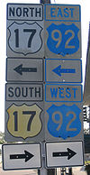 US 92 and U.S. Highway 17
join at the south end of Lake Alfred
in Polk County
. State Road 600 carries US 92 from Auburndale
, while State Road 555 takes US 17 from the south via Winter Haven
. County Road 555 soon splits to the north along the old road through Lake Alfred, while US 17/92 runs one block east on Lake Shore Way. County Road 557 begins at Haines Boulevard, where it heads west for a block to CR 555, and then turns north towards Interstate 4; just past CR 557, US 17/92 turns east towards Haines City
. It enters downtown Haines City on Hinson Avenue after crossing under U.S. Highway 27 at a cloverleaf, meeting the north end of State Road 17 before turning north on 17th Street. It soon meets County Road 580, which runs east to Poinciana
. In Davenport
, US 92 meets County Road 547, which heads west to U.S. Highway 27 and north along old US 17/92. US 92 then intersects with Ronald Reagan Parkway (County Road 54) at Loughman
.
, US 92 picks up the Orange Blossom Trail name. Orange Blossom Trail (OBT) takes US 92 east and north through Kissimmee
and into Orlando. The OBT name temporarily ends at Pleasant Hill Road (former State Road 531) in southern Kissimmee, where US 92 uses John Young Parkway
(formerly Bermuda Avenue) to Vine Street (U.S. Highway 192/SR 530). (US 92 ran through downtown Kissimmee on Emmett Street, Broadway and Main Street until ca. 2000.) It turns east there on US 192, turning north at Main Street, which becomes OBT at the north city limits. U.S. Highway 441 (along with State Road 500
) joins US 92 at US 192 - thus OBT carries US 17, US 92 and US 441, as well as unsigned SR 500 and SR 600, from Kissimmee to Orlando.
Orange Blossom Trail bypasses downtown Orlando to the west, meeting State Road 50
(Colonial Drive) northwest of downtown. At SR 50, US 92 turns east, while US 441 continues northwest on OBT towards Apopka
. US 92, concurrent with SR 50 (and SR 600), meets the south end of Edgewater Drive and crosses Interstate 4 (SR 400) and State Road 527 (Orange Avenue and Magnolia Avenue) before meeting Mills Avenue (State Road 15
), where US 92 turns north.
Mills Avenue carries State Road 15
on both sides of State Road 50
, but is only signed as such to the south, as, north of SR 50, it carries US 92 (and unsigned SR 600). It crosses Lake Estelle on the Andrews Causeway
before reaching the border between Orlando and Winter Park.
In Winter Park, US 92's name changes to Orlando Avenue. It crosses State Road 527 (Orange Avenue) and State Road 426 (Fairbanks Avenue) and meets the east end of State Road 423 (Lee Road) while bypassing downtown Winter Park to the west. Shortly after crossing into Maitland
, it passes under CSX Transportation
's "A" Line, and the old road through downtown Winter Park — Park Avenue — merges in from the southeast. US 92 meets the east end of County Road 438A (Lake Avenue), which heads west to Eatonville
, and then splits from the old alignment - County Road 427 - near downtown Maitland. It crosses Horatio Avenue (former County Road 436A) and meets the east end of State Road 414
(Maitland Boulevard) before crossing into Seminole County
.
In Seminole County
, the redevelopment of the 17-92 Community Redevelopment Area is handled by the US 17-92 Community Redevelopment Agency, a component unit of the County government.
In Seminole County, US 92 is a main commercial strip as it heads through Casselberry
(where it crosses State Road 436
- Semoran Boulevard) and Longwood
(where it crosses State Road 434
). North of Longwood it meets the north end of State Road 419 and crosses County Road 427 (the old alignment). Lake Mary Boulevard, Airport Boulevard and State Road 417
cross US 92 in southern Sanford
, and it meets the west end of County Road 427A. At 25th Street, southwest of downtown Sanford, State Road 46
comes in from the east and turns north for a concurrency
near downtown; County Road 46A heads west on 25th Street. 13th Street marks the west end of County Road 415, and at 1st Street SR 46 turns west. Several blocks north of 1st Street, US 17/92 turns west along the south shore of Lake Monroe
(part of the St. Johns River
). Just before crossing the river into Volusia County
at the west end of the lake, US 92 meets the north end of County Road 15 (once a branch of State Road 15
, which runs unsigned with US 92 and SR 600 here) and crosses under Interstate 4 (SR 400) at the end of its own bridge across the river (the St. Johns River Veterans Memorial Bridge
).
, meeting the west ends of County Road 4162 (in DeBary
), County Road 4146, and County Road 4145 (in Orange City
). North of Orange City is a trumpet interchange with State Road 472, a four-lane connection to Interstate 4. US 92 then crosses County Road 4116 and meets the south end of State Road 15A
, a western bypass of DeLand
. US 92 passes through downtown DeLand on Woodland Boulevard, crossing State Road 44
at New York Avenue. The intersection of US 92 and SR 44 does not allow any turns — right or left — and so adjacent city streets are marked for those turns. In northern DeLand, U.S. Highway 92 (SR 600) splits to the east on International Speedway Boulevard, while U.S. Highway 17 (SR 15) continues north. To the west of the split, International Speedway Boulevard is County Road 92, a short connection to State Road 15A
that allows traffic on US 92 to bypass downtown DeLand. SR 15A itself rejoins US 17 north of DeLand.
From DeLand to its terminus in Daytona Beach
, US 92 carries the local name, International Speedway Boulevard, as the highway passes by the Daytona International Speedway
. US 92 passes by other landmarks such as Daytona Beach International Airport
and Volusia Mall
. US 92 spans the Halifax River
and Intracoastal Waterway
via the Broadway Bridge
before reaching its eastern terminus at SR A1A
.
.svg.png) US 92 was in the original 1926 plan, connecting Tampa
US 92 was in the original 1926 plan, connecting Tampa
(concurrent with US 41) to US 1 in Daytona Beach
. It had been the Dixie Highway
Tampa-St. Petersburg Loop from Plant City
to Haines City
, the West Mainline from Haines City to Orlando
, and the East Florida Connector from Orlando to DeLand
.
US 92 was signed along the following roads in 1927:
When the bypass of downtown Tampa on SR 17 (Hillsborough Avenue) opened in the early 1930s, US 92 and US 41 were rerouted to use it. US 92 turned south from the new road where US 41 turned north, at Nebraska Avenue (former SR 5, probably then a spur of SR 5), and continued to end in downtown Tampa.
A 1942 map shows US 92 extended west along SR 17 and SR 229 to end at US 19 in Dunedin; it was soon truncated back to Tampa.
In the 1945 renumbering
, the whole route of US 92 was numbered SR 600, except for the section south to downtown Tampa, which was SR 45
. It was extended west and south to downtown St. Petersburg
along SR 600 and SR 687
in 1953.
In 1961, US 92 was moved to bypass downtown Lakeland
, along SR 517 and SR 546. The old route was signed as Business US 92 until 1998.
In 2006, US 92 (along with US 17) was re-signed to bypass downtown Kissimmee, moving it to US 192 from John Young Parkway to US 441.
The route was extended east across the Intracoastal Waterway
and the Halifax River
in 1947, after the Broadway Bridge
was reconstructed and opened.
!County
!Location
!Mile
!Destinations
!Notes
|-
|rowspan=2|Pinellas
|rowspan=2|St. Petersburg
|0.00
|
|Western Terminus of US 92
|-
|5.99
|
|Eastern Terminus of SR 686; Eastern terminus of SR 694
|-
|colspan=2 align=center|Old Tampa Bay
|
|colspan=2 align=center|Gandy Bridge
|-
|rowspan=15|Hillsborough
|rowspan=11|Tampa
|14.30
|
|Western Terminus of SR 618
|-
|17.16
|
|
|-
|17.91
|
|
|-
|18.61
|
|Exit 41 (I-275)
|-
|9.204
|
|
|-
|20.44
|
|Western Terminus of SR 574
|-
|21.44
|
|
|-
|24.23
|
|
|-
|24.58
|
|Exit 47 (I-275)
|-
|bgcolor=#ddffdd|24.74
|bgcolor=#ddffdd|
|bgcolor=#ddffdd|West end of US 41 overlap
|-
|bgcolor=#ddffdd|27.00
|bgcolor=#ddffdd|
|bgcolor=#ddffdd|East end of US 41 overlap
|-
|East Lake-Orient Park
|30.45
|
|Exit 7 (I-4)
|-
|rowspan=3|Plant City
|43.76
|
|Eastern terminus of SR 566
|-
|44.15
|
|
|-
|44.95
|
|
|-
|rowspan=8|Polk
|rowspan=5|Lakeland
|50.25
|
|
|-
|55.52
|
|
|-
|56.30
|
|
|-
|56.50
|
|
|-
|59.45
|
|Exit 17 (SR 570)
|-
|Lake Alfred
|bgcolor=#ddffdd|66.06
|bgcolor=#ddffdd|
|bgcolor=#ddffdd|West end of US 17 overlap (Orange Blossom Trail)
|-
|rowspan=2|Haines City
|72.30
|
|Western Terminus of SR 618
|-
|74.14
|
|Northern Terminus of SR 17
|-
|Osceola
|Kissimmee
|bgcolor=#ddffdd|96.95
|bgcolor=#ddffdd|
|bgcolor=#ddffdd|West end of US 441 overlap
|-
|rowspan=13|Orange
|Hunters Creek
|101.64
|
|Exit 11 (SR 417)
|-
|rowspan=8|Orlando
|105.70
|
|Exit 254 (Turnpike); Exit 4 (SR 528)
|-
|107.01
|
|
|-
|111.20
|
|Exit 80 (I-4)
|-
|113.87
|
|Exit 9 (SR 408)
|-
|bgcolor=#ddffdd|114.13
|bgcolor=#ddffdd|
|bgcolor=#ddffdd|East end of US 441 overlap; West end of SR 50 overlap
|-
|114.94
|
|Exit 83 (I-4)
|-
|bgcolor=#ddffdd|116.03
|bgcolor=#ddffdd|
|bgcolor=#ddffdd|East end of SR 50 overlap
|-
|117.20
|
|Eastern Terminus of SR 438
|-
|rowspan=2|Winter Park
|118.29
|
|
|-
|bgcolor=#ddffdd|118.78
|bgcolor=#ddffdd|
|bgcolor=#ddffdd|West end of SR 15 overlap
|-
|rowspan=2|Maitland
|119.66
|
|Eastern Terminus of SR 423
|-
|121.92
|
|Eastern Terminus of SR 414
|-
|rowspan=8|Seminole
|Casselberry
|123.85
|
|
|-
|Winter Springs
|126.61
|
|
|-
|Lake Mary
|130.13
|
|Northern Terminus of SR 419
|-
|rowspan=4|Sanford
|132.56
|
|Exit 50 (SR 417)
|-
|133.74
|
|West end of SR 46
|-
|134.71
|
|Western Terminus of SR 415
|-
|bgcolor=#ddffdd|135.46
|bgcolor=#ddffdd|
|bgcolor=#ddffdd|East end of SR 46 overlap
|-
|
|138.98
|
|Exit 104 (I-4)
|-
|rowspan=12|Volusia
|rowspan=4|DeLand
|149.03
|
|Western Terminus of SR 472
|-
|150.77
|
|
|-
|152.77
|
|
|-
|bgcolor=#ddffdd|154.61
|bgcolor=#ddffdd|
|bgcolor=#ddffdd|East end of US 17 overlap (Orange Blossom Trail); Southern Terminus of SR 11
|-
|rowspan=5|Daytona Beach
|167.81
|
|Exit 129 (I-4)
|-
|172.54
|
|Exit 261 (I-95)
|-
|173.27
|
|
|-
|174.20
|
|
|-
|175.68
|
|
|-
|Intercoastal Waterway
|
|colspan=2 align=center|Broadway Bridge
|-
|rowspan=2|Daytona Beach
|176.40
|
|Northern Terminus of SR 441
|-
|176.70
|
|Eastern Terminus of US 92
|-
U.S. state
A U.S. state is any one of the 50 federated states of the United States of America that share sovereignty with the federal government. Because of this shared sovereignty, an American is a citizen both of the federal entity and of his or her state of domicile. Four states use the official title of...
of Florida
Florida
Florida is a state in the southeastern United States, located on the nation's Atlantic and Gulf coasts. It is bordered to the west by the Gulf of Mexico, to the north by Alabama and Georgia and to the east by the Atlantic Ocean. With a population of 18,801,310 as measured by the 2010 census, it...
. The western terminus is at Alt US 19
U.S. Route 19 Alternate (St. Petersburg, Florida)
Alternate U.S. Route 19 is the former section of U.S. Route 19 from St. Petersburg, Florida to Holiday.Beginning at the intersection of 4th Street N Alternate U.S. Route 19 is the former section of U.S. Route 19 from St. Petersburg, Florida to Holiday.Beginning at the intersection of 4th Street N...
, SR 595, and SR 687 in downtown St. Petersburg
St. Petersburg, Florida
St. Petersburg is a city in Pinellas County, Florida, United States. It is known as a vacation destination for both American and foreign tourists. As of 2008, the population estimate by the U.S. Census Bureau is 245,314, making St...
. The eastern terminus is at SR A1A
Florida State Road A1A
State Road A1A is a Florida State Road that runs mostly along the Atlantic Ocean, with sections from Key West at the southern tip of Florida, to Callahan, just south of Georgia. It is the main road through most oceanfront towns. SR A1A is designated the A1A Scenic and Historic Coastal Highway, a...
in Daytona Beach
Daytona Beach, Florida
Daytona Beach is a city in Volusia County, Florida, USA. According to 2008 U.S. Census Bureau estimates, the city has a population of 64,211. Daytona Beach is a principal city of the Deltona – Daytona Beach – Ormond Beach, Florida Metropolitan Statistical Area, which the census bureau estimated had...
. Most of US 92 is designated unsigned State Road 600.
Route description
US 92 is concurrent with SR 687 from downtown St. PetersburgSt. Petersburg, Florida
St. Petersburg is a city in Pinellas County, Florida, United States. It is known as a vacation destination for both American and foreign tourists. As of 2008, the population estimate by the U.S. Census Bureau is 245,314, making St...
to SR 600, SR 686 and SR 694 at the west end of the Gandy Causeway
Gandy Bridge
Gandy Bridge is the southernmost bridge spanning Old Tampa Bay from St. Petersburg, Florida to Tampa, Florida. Almost three miles long, it is one of three bridges connecting Hillsborough County and Pinellas County; the others being the Howard Frankland Bridge and the Courtney Campbell...
; unsigned SR 600 from the west end of the Gandy Causeway to west of downtown Lakeland
Lakeland, Florida
Lakeland is a city in Polk County, Florida, United States, located approximately midway between Tampa and Orlando along Interstate 4. According to the 2008 U.S. Census Bureau estimate, the city had a population of 94,406...
; unsigned State Road 517 west of downtown Lakeland; SR 546 from west of downtown Lakeland to east of downtown Lakeland; and unsigned State Road 600 from east of downtown Lakeland to Daytona Beach
Daytona Beach, Florida
Daytona Beach is a city in Volusia County, Florida, USA. According to 2008 U.S. Census Bureau estimates, the city has a population of 64,211. Daytona Beach is a principal city of the Deltona – Daytona Beach – Ormond Beach, Florida Metropolitan Statistical Area, which the census bureau estimated had...
.
Tampa Bay Area
US 92 begins along Florida State Road 687 at the intersection of ALT US 19U.S. Route 19 Alternate (St. Petersburg, Florida)
Alternate U.S. Route 19 is the former section of U.S. Route 19 from St. Petersburg, Florida to Holiday.Beginning at the intersection of 4th Street N Alternate U.S. Route 19 is the former section of U.S. Route 19 from St. Petersburg, Florida to Holiday.Beginning at the intersection of 4th Street N...
(SR 595) in St. Petersburg. The road continues north along SR 687 until it reaches the eastern termini of Florida State Road 686 and Florida State Road 694, where it turns right on Gandy Boulevard (Florida State Road 600) before crossing the Gandy Bridge
Gandy Bridge
Gandy Bridge is the southernmost bridge spanning Old Tampa Bay from St. Petersburg, Florida to Tampa, Florida. Almost three miles long, it is one of three bridges connecting Hillsborough County and Pinellas County; the others being the Howard Frankland Bridge and the Courtney Campbell...
into Tampa.
After crossing the Gandy Bridge, US 92 intersects West Shore Boulevard and runs east along Gandy Boulevard until it reaches Dale Mabry Highway
Dale Mabry Highway
Dale Mabry Highway is a north–south road in Tampa, Florida. The majority of its length consists of three lanes each direction plus a central turn-lane and often includes a right-turn lane. It begins at the MacDill Air Force Base entrance in South Tampa and ends by merging with US 41 just...
at the first interchange with the Lee Roy Selmon Expressway where it turns north. Dale Mabry contains the hidden Florida State Road 685 until it branches to the northeast at Henderson Boulevard. The next major intersections are Kennedy Boulevard (SR 60), then Interstate 275 (Florida)
Interstate 275 (Florida)
Interstate 275 in Florida serves the Tampa Bay metropolitan area, measuring 60.696 miles in length. The southern terminus is I-75 near Palmetto, just five miles east of the Sunshine Skyway Bridge, a toll bridge crossing Tampa Bay. The highway passes through St...
at Exits 41 A-B. In between SR 616 and SR 574
Florida State Road 574
State Road 574 is an east–west state highway in Central Hillsborough County, Florida. It runs from Central Tampa, Florida to Plant City, Florida, and is not to be confused with Hillsborough County Road 574.-Route description:...
, US 92 passes George M. Steinbrenner Field and Raymond James Stadium
Raymond James Stadium
Raymond James Stadium, also known as the "Ray Jay", is a multi-purpose football stadium located in Tampa, Florida. It is home to the NFL's Tampa Bay Buccaneers as well as the NCAA's South Florida Bulls football team. The stadium seats 65,857 , and it is expandable to 75,000 for special events...
. A parclo interchange with Hillsborough Avenue
Hillsborough Avenue
Hillsborough Avenue is a major east–west arterial road in Hillsborough County, Florida, also designated as State Road 580, U.S. Highway 41 or U.S. Highway 92 in various places.-Route description:...
takes US 92 from Dale Mabry to Hillsborough Avenue and Florida State Road 580 from Hillsborough Avenue to Dale Mabry Highway. US 92 crosses two parallel bridges over the Hillsborough River
Hillsborough River (Florida)
The Hillsborough River is a river located in the state of Florida in the USA. It arises in the Green Swamp near the juncture of Hillsborough, Pasco and Polk counties, and flows through Pasco and Hillsborough Counties to an outlet in the city of Tampa on Tampa Bay. The name Hillsborough River first...
, then intersects with BUS US 41, I-275 again at Exits 47 A-B, then intersects northbound U.S. Route 41
U.S. Route 41
U.S. Route 41 is a north–south United States Highway that runs from Miami, Florida to the Upper Peninsula of Michigan. Until 1949, the part in southern Florida, from Naples to Miami, was U.S...
and SR 45, where US 41 and 92 overlap each other. One other major intersection exists with SR 585
Florida State Road 585
State Road 585 is an about 3 mile-long, north–south highway in Tampa, Florida. Connecting U.S. Route 92 and Interstate 4 to the Lee Roy Selmon Expressway.-Route description:...
before US 41 turns southbound as the concurrency ends. After SR 583
Florida State Road 583
State Road 583 is a -long, north–south highway that travels from Tampa to Temple Terrace in Hillsborough County, Florida.-Route description:...
, the road becomes part of the collective-distributor roads along Interstate 4
Interstate 4
Interstate 4 is a intrastate Highway located entirely within the state of Florida, United States. It goes from Interstate 275 in Tampa, Florida to Interstate 95 at Daytona Beach, Florida . It also has the Florida Department of Transportation designation of State Road 400, but only a small...
west and east of the parclo interchange with U.S. Route 301
U.S. Route 301
U.S. Route 301 is a spur of U.S. Route 1 running through the South Atlantic States. It currently runs 1,099 miles from Glasgow, Delaware at U.S. Route 40 to Sarasota, Florida. It passes through the states of Delaware, Maryland, Virginia, North Carolina, South Carolina, Georgia, and Florida...
. The east end of the interchange contains a stub for a proposed west-to-northbound ramp to 301 at the westbound flyover. Aceess to Interstate 75
Interstate 75 in Florida
Interstate 75 is a part of the Interstate Highway System and runs from Hialeah, Florida, a few miles northwest of Miami to Sault Ste. Marie in the Upper Peninsula of Michigan...
is only available eastbound from I-4. Three other local roads that cross US 92 access I-4 before State Roads 566
Florida State Road 566
State Road 566 is an about 3 mile-long, northwest-southeast highway near Plant City, Florida. Connecting U.S. Route 92 to Interstate 4 then traveling west to Branch Forbes Road outside the city limits of Plant City.-Route description:...
, 39A (Alexander Road), 39
Florida State Road 39
State Road 39 is a north–south highway in eastern Pasco and Hillsborough County, Florida, United States. Between Plant City and Zephyrhills, the road is named Paul S. Buchman Highway. North of Zephyrhills, Florida the road is a secret state designation for U.S. Route 301 until the southern...
, 574
Florida State Road 574
State Road 574 is an east–west state highway in Central Hillsborough County, Florida. It runs from Central Tampa, Florida to Plant City, Florida, and is not to be confused with Hillsborough County Road 574.-Route description:...
, and 533 in Plant City.
U.S. Route 17 in Florida
U.S. Route 17 in Florida is a north–south United States Highway. It runs from the Punta Gorda, Florida Metropolitan Statistical Area northeast to the Greater Jacksonville Metropolitan Area....
join at the south end of Lake Alfred
Lake Alfred, Florida
Lake Alfred is a city in Polk County, Florida, United States. The population was 3,890 at the 2000 census. As of 2004, the population recorded by the U.S. Census Bureau is 3,944 . It is part of the Lakeland–Winter Haven Metropolitan Statistical Area....
in Polk County
Polk County, Florida
Polk County is located in central Florida between the Tampa Bay and Greater Orlando metropolitan areas. The county was established by the state government in 1861 on the eve of the American Civil War and named after former United States president James K. Polk. The county seat is Bartow and its...
. State Road 600 carries US 92 from Auburndale
Auburndale, Florida
Auburndale is a city in Polk County, Florida, United States. The population was 11,032 at the 2000 census. According to the U.S Census estimates of 2005, the city had a population of 12,381...
, while State Road 555 takes US 17 from the south via Winter Haven
Winter Haven, Florida
Winter Haven is a city in Polk County, Florida, United States. The population was 26,487 at the 2000 census. According to the U.S. Census Bureau's 2007 estimates, the city had a population of 32,577, making it the second most populated city in Polk County...
. County Road 555 soon splits to the north along the old road through Lake Alfred, while US 17/92 runs one block east on Lake Shore Way. County Road 557 begins at Haines Boulevard, where it heads west for a block to CR 555, and then turns north towards Interstate 4; just past CR 557, US 17/92 turns east towards Haines City
Haines City, Florida
Haines City is a city in Polk County, Florida, United States. The population was 13,174 at the 2000 census. As of 2010, the population estimated by the Bureau of Economic and Business Research at the University of Florida is 18,762. Haines City is the third most populous city in Polk County, Florida...
. It enters downtown Haines City on Hinson Avenue after crossing under U.S. Highway 27 at a cloverleaf, meeting the north end of State Road 17 before turning north on 17th Street. It soon meets County Road 580, which runs east to Poinciana
Poinciana, Florida
Poinciana is a census-designated place in Osceola and Polk counties in the U.S. state of Florida. It lies southwest of Kissimmee and about east of Haines City...
. In Davenport
Davenport, Florida
Davenport is a city in Polk County, Florida, United States. The population was 1,925 at the 2000 census. As of 2004, the population estimated by the U.S. Census Bureau is 1,994. While the city of Davenport itself is very small, the area north of the city close to Interstate 4 and US 27 is...
, US 92 meets County Road 547, which heads west to U.S. Highway 27 and north along old US 17/92. US 92 then intersects with Ronald Reagan Parkway (County Road 54) at Loughman
Loughman, Florida
Loughman is a census-designated place in the north-east corner of Polk County, Florida, United States, near the Osceola county line. The population was 1,385 at the 2000 census. It is part of the Lakeland–Winter Haven Metropolitan Statistical Area...
.
Orlando area
After crossing into Osceola CountyOsceola County, Florida
Osceola County is a county located in the U.S. state of Florida. As of 2000, the population was 172,493. The U.S. Census Bureau 2006 estimate for the county is 244,045, making it the 17th fastest-growing county in the United States. Its county seat is Kissimmee.- History :Osceola County was...
, US 92 picks up the Orange Blossom Trail name. Orange Blossom Trail (OBT) takes US 92 east and north through Kissimmee
Kissimmee, Florida
Kissimmee is a city in Osceola County, Florida, United States. As of the 2010 census, the population was 59,682. It is the county seat of Osceola County...
and into Orlando. The OBT name temporarily ends at Pleasant Hill Road (former State Road 531) in southern Kissimmee, where US 92 uses John Young Parkway
John Young Parkway
State Road 423, known for most of its length as John Young Parkway, and Lee Road east of Orange Blossom Trail, is a four- and six-lane surface road in the U.S. state of Florida. SR 423 is completely inside Orlando, Florida and runs from SR 408 north to U.S...
(formerly Bermuda Avenue) to Vine Street (U.S. Highway 192/SR 530). (US 92 ran through downtown Kissimmee on Emmett Street, Broadway and Main Street until ca. 2000.) It turns east there on US 192, turning north at Main Street, which becomes OBT at the north city limits. U.S. Highway 441 (along with State Road 500
State Road 500 (Florida)
State Road 500 is a major state highway running through Florida as a mostly unsigned route under several US Highways. From Chiefland to Williston it is U.S. Highway 27 Alternate. From Williston to Ocala, it is U.S. Highway 27. From Ocala to Kissimmee, it is U.S. Highway 441. From Kissimmee to...
) joins US 92 at US 192 - thus OBT carries US 17, US 92 and US 441, as well as unsigned SR 500 and SR 600, from Kissimmee to Orlando.
Orange Blossom Trail bypasses downtown Orlando to the west, meeting State Road 50
State Road 50 (Florida)
State Road 50 runs across the center of the U.S. state of Florida through Orlando, with its termini at SR 55 at Weeki Wachee and SR 5 in Titusville....
(Colonial Drive) northwest of downtown. At SR 50, US 92 turns east, while US 441 continues northwest on OBT towards Apopka
Apopka, Florida
Apopka is a city located in Orange County, Florida, United States. The population was 26,969 at the 2000 census. According to the U.S Census estimates of 2006, the city grew to 53,563. It is part of the Orlando–Kissimmee Metropolitan Statistical Area. Apopka is an Indian word for “Potato...
. US 92, concurrent with SR 50 (and SR 600), meets the south end of Edgewater Drive and crosses Interstate 4 (SR 400) and State Road 527 (Orange Avenue and Magnolia Avenue) before meeting Mills Avenue (State Road 15
State Road 15 (Florida)
State Road 15 is part of the Florida State Road System. It runs from SR 80/SR 880 at Belle Glade north along the east shore of Lake Okeechobee to Okeechobee. Then it runs north to SR 500 at Holopaw, and northwest along SR 500 to Ashton State Road 15 (commonly SR 15) is part of the Florida State...
), where US 92 turns north.
Mills Avenue carries State Road 15
State Road 15 (Florida)
State Road 15 is part of the Florida State Road System. It runs from SR 80/SR 880 at Belle Glade north along the east shore of Lake Okeechobee to Okeechobee. Then it runs north to SR 500 at Holopaw, and northwest along SR 500 to Ashton State Road 15 (commonly SR 15) is part of the Florida State...
on both sides of State Road 50
State Road 50 (Florida)
State Road 50 runs across the center of the U.S. state of Florida through Orlando, with its termini at SR 55 at Weeki Wachee and SR 5 in Titusville....
, but is only signed as such to the south, as, north of SR 50, it carries US 92 (and unsigned SR 600). It crosses Lake Estelle on the Andrews Causeway
Andrews Causeway
The historic 1949 Andrews Causeway in Florida, United States bisects the Lake Estelle, allowing attractive views of Orlando Loch Haven Park, Florida Hospital and the surrounding neighborhoods. Andrews Causeway allows Mills Avenue to enter into Orlando from Winter Park to the North...
before reaching the border between Orlando and Winter Park.
In Winter Park, US 92's name changes to Orlando Avenue. It crosses State Road 527 (Orange Avenue) and State Road 426 (Fairbanks Avenue) and meets the east end of State Road 423 (Lee Road) while bypassing downtown Winter Park to the west. Shortly after crossing into Maitland
Maitland, Florida
Maitland is a suburban city in Orange County, Florida, United States, part of the Greater Metro Orlando area. The population was 12,019 at the 2000 census. As of 2006, the population recorded by the U.S. Census Bureau is 14,172...
, it passes under CSX Transportation
CSX Transportation
CSX Transportation operates a Class I railroad in the United States known as the CSX Railroad. It is the main subsidiary of the CSX Corporation. The company is headquartered in Jacksonville, Florida, and owns approximately 21,000 route miles...
's "A" Line, and the old road through downtown Winter Park — Park Avenue — merges in from the southeast. US 92 meets the east end of County Road 438A (Lake Avenue), which heads west to Eatonville
Eatonville, Florida
Eatonville is a town in Orange County, Florida, six miles north of Orlando. It is part of the Orlando–Kissimmee metropolitan statistical area. The population was 2,432 at the 2000 census. As of 2006, the population recorded by the U.S...
, and then splits from the old alignment - County Road 427 - near downtown Maitland. It crosses Horatio Avenue (former County Road 436A) and meets the east end of State Road 414
State Road 414 (Florida)
State Road 414 , named Maitland Boulevard, is a state highway in the U.S. state of Florida.-Free Section:The free section is built to expressway standards, with no driveway access, at-grade intersections at minor roads, and interchanges at major roads. The road was once numbered State Road 426A...
(Maitland Boulevard) before crossing into Seminole County
Seminole County, Florida
Seminole County is a county in the U.S. state of Florida. Located between Orlando to the south and Deland and Daytona Beach to the north, it is part of the Greater Orlando metropolitan area. Its county seat and largest city is Sanford...
.
In Seminole County
Seminole County, Florida
Seminole County is a county in the U.S. state of Florida. Located between Orlando to the south and Deland and Daytona Beach to the north, it is part of the Greater Orlando metropolitan area. Its county seat and largest city is Sanford...
, the redevelopment of the 17-92 Community Redevelopment Area is handled by the US 17-92 Community Redevelopment Agency, a component unit of the County government.
In Seminole County, US 92 is a main commercial strip as it heads through Casselberry
Casselberry, Florida
Casselberry is a city in Seminole County, Florida, United States. The population was 22,629 at the 2000 census. According to the U.S Census estimates of 2009, the city had a population of 24,792...
(where it crosses State Road 436
State Road 436 (Florida)
State Road 436 , known as Semoran Boulevard for most of its length and East Altamonte Drive in Altamonte Springs, is a northwest-southeast beltway in the Orlando area running from US 441 in Apopka to the Beachline Expressway near Orlando International Airport...
- Semoran Boulevard) and Longwood
Longwood, Florida
Longwood is a city in Seminole County, Florida, USA. The population was 13,745 at the 2000 census. As of 2006, the population recorded by the U.S. Census Bureau is 13,491. It is part of the Orlando–Kissimmee-Sanford Metropolitan Statistical Area....
(where it crosses State Road 434
State Road 434 (Florida)
State Road 434 is a major roadway in the Central Florida area. Starting at SR 424 just north of Orlando city limits, the road runs north as Forest City Road through Forest City before dropping the name at the Seminole County line...
). North of Longwood it meets the north end of State Road 419 and crosses County Road 427 (the old alignment). Lake Mary Boulevard, Airport Boulevard and State Road 417
State Road 417 (Florida)
State Road 417 , also known as the Central Florida GreeneWay, Southern Connector and Seminole Expressway , is a tolled freeway forming the eastern beltway around the city of Orlando, Florida, United States. It is owned and maintained by the Orlando-Orange County Expressway Authority and Florida's...
cross US 92 in southern Sanford
Sanford, Florida
Sanford is a city in, and the county seat of, Seminole County, Florida, United States. The population was 38,291 at the 2000 census. As of 2009, the population recorded by the U.S. Census Bureau was 50,998...
, and it meets the west end of County Road 427A. At 25th Street, southwest of downtown Sanford, State Road 46
State Road 46 (Florida)
State Road 46 is an east–west route in central Florida, running from US 441 in Mount Dora to US 1 in Mims. Along the way, it crosses the St...
comes in from the east and turns north for a concurrency
Concurrency (road)
A concurrency, overlap, or coincidence in a road network is an instance of one physical road bearing two or more different highway, motorway, or other route numbers...
near downtown; County Road 46A heads west on 25th Street. 13th Street marks the west end of County Road 415, and at 1st Street SR 46 turns west. Several blocks north of 1st Street, US 17/92 turns west along the south shore of Lake Monroe
Lake Monroe (Florida)
Lake Monroe is one of the lakes that make up the St. Johns River system. The port city of Sanford is situated along the southern shore, while DeBary and Deltona are located along the northern shore. Two major central Florida roadways that run near the lake are State Road 415 and Interstate 4...
(part of the St. Johns River
St. Johns River
The St. Johns River is the longest river in the U.S. state of Florida and its most significant for commercial and recreational use. At long, it winds through or borders twelve counties, three of which are the state's largest. The drop in elevation from the headwaters to the mouth is less than ;...
). Just before crossing the river into Volusia County
Volusia County, Florida
Volusia County is a county located in the state of Florida. The U.S. Census Bureau 2010 official county's population was 494,593 . Its county seat is DeLand, and its most populous city is currently Deltona....
at the west end of the lake, US 92 meets the north end of County Road 15 (once a branch of State Road 15
State Road 15 (Florida)
State Road 15 is part of the Florida State Road System. It runs from SR 80/SR 880 at Belle Glade north along the east shore of Lake Okeechobee to Okeechobee. Then it runs north to SR 500 at Holopaw, and northwest along SR 500 to Ashton State Road 15 (commonly SR 15) is part of the Florida State...
, which runs unsigned with US 92 and SR 600 here) and crosses under Interstate 4 (SR 400) at the end of its own bridge across the river (the St. Johns River Veterans Memorial Bridge
St. Johns River Veterans Memorial Bridge
The original St. Johns River Bridge was a four-lane concrete-and-steel causeway bridge constructed over the St. Johns River at the west outlet of Lake Monroe. It is a part of Interstate 4, and spans the border between Seminole and Volusia Counties in Florida, United States...
).
Daytona Beach
After crossing the St. Johns River via the Benedict Bridge, US 92 continues north into Volusia CountyVolusia County, Florida
Volusia County is a county located in the state of Florida. The U.S. Census Bureau 2010 official county's population was 494,593 . Its county seat is DeLand, and its most populous city is currently Deltona....
, meeting the west ends of County Road 4162 (in DeBary
DeBary, Florida
As of the census of 2000, there were 15,559 people, 6,538 households, and 4,720 families residing in the city. The population density was 853.8 inhabitants per square mile . There were 7,001 housing units at an average density of 384.2 per square mile...
), County Road 4146, and County Road 4145 (in Orange City
Orange City, Florida
Orange City is a city located in Volusia County, Florida. In the 2000 census the city had a total population of 6,604. In 2004 the population recorded by the U.S. Census Bureau was 7,172.-Geography:Orange City is located at ....
). North of Orange City is a trumpet interchange with State Road 472, a four-lane connection to Interstate 4. US 92 then crosses County Road 4116 and meets the south end of State Road 15A
State Road 15A (Florida)
Several former sections of SR 15A are covered under their current numbers:SR 15A forms a western bypass for SR 15 around DeLand. It joins into North Woodland Boulevarde, north of DeLand and South Woodland Boulevarde, south of DeLand. It continues northeast from its northern end as CR 15A to SR 11...
, a western bypass of DeLand
DeLand, Florida
DeLand is the county seat of Volusia County, Florida. In 2006, the U.S. Census Bureau estimated the city's population to be 24,375. It is part of the Deltona-Daytona Beach-Ormond Beach, Florida Metropolitan Statistical Area, which had an estimated population of 436,575 in 2006...
. US 92 passes through downtown DeLand on Woodland Boulevard, crossing State Road 44
State Road 44 (Florida)
State Road 44 is an east–west state highway in the U.S. state of Florida. It runs from Crystal River on the Gulf of Mexico east to New Smyrna Beach on the Atlantic Ocean, passing through Inverness, Wildwood, Leesburg and DeLand....
at New York Avenue. The intersection of US 92 and SR 44 does not allow any turns — right or left — and so adjacent city streets are marked for those turns. In northern DeLand, U.S. Highway 92 (SR 600) splits to the east on International Speedway Boulevard, while U.S. Highway 17 (SR 15) continues north. To the west of the split, International Speedway Boulevard is County Road 92, a short connection to State Road 15A
State Road 15A (Florida)
Several former sections of SR 15A are covered under their current numbers:SR 15A forms a western bypass for SR 15 around DeLand. It joins into North Woodland Boulevarde, north of DeLand and South Woodland Boulevarde, south of DeLand. It continues northeast from its northern end as CR 15A to SR 11...
that allows traffic on US 92 to bypass downtown DeLand. SR 15A itself rejoins US 17 north of DeLand.
From DeLand to its terminus in Daytona Beach
Daytona Beach, Florida
Daytona Beach is a city in Volusia County, Florida, USA. According to 2008 U.S. Census Bureau estimates, the city has a population of 64,211. Daytona Beach is a principal city of the Deltona – Daytona Beach – Ormond Beach, Florida Metropolitan Statistical Area, which the census bureau estimated had...
, US 92 carries the local name, International Speedway Boulevard, as the highway passes by the Daytona International Speedway
Daytona International Speedway
Daytona International Speedway is a race track in Daytona Beach, Florida, United States. Since opening in 1959, it has been the home of the Daytona 500, one of the most prestigious races in NASCAR. In addition to NASCAR, the track also hosts races of ARCA, AMA Superbike, Grand-Am and Motocross...
. US 92 passes by other landmarks such as Daytona Beach International Airport
Daytona Beach International Airport
Daytona Beach International Airport is a public county-owned airport located three miles southwest of the central business district of Daytona Beach, adjacent to the Daytona International Speedway, in Volusia County, Florida, United States. The airport has 3 runways, a six-gate domestic terminal,...
and Volusia Mall
Volusia Mall
Volusia Mall is a super-regional shopping mall located in Daytona Beach, Florida. It is the largest retail shopping center in the Volusia-Flagler market. Opened October 15, 1974, the mall comprises more than 120 stores on one level, as well as a food court. Anchor stores are JCPenney, Macy's, Sears...
. US 92 spans the Halifax River
Halifax River
The Halifax River is part of the Atlantic Intracoastal Waterway, located in northeast Volusia County, Florida. The waterway was originally known as the North Mosquito River, but was renamed after George Montagu-Dunk, 2nd Earl of Halifax, during the British occupation of Florida .-Geography:The...
and Intracoastal Waterway
Intracoastal Waterway
The Intracoastal Waterway is a 3,000-mile waterway along the Atlantic and Gulf coasts of the United States. Some lengths consist of natural inlets, salt-water rivers, bays, and sounds; others are artificial canals...
via the Broadway Bridge
Broadway Bridge (Daytona Beach)
The Broadway Bridge is a segmental bridge that spans the Halifax River and Intracoastal Waterway in downtown Daytona Beach, Florida, carrying U.S. Route 92....
before reaching its eastern terminus at SR A1A
Florida State Road A1A
State Road A1A is a Florida State Road that runs mostly along the Atlantic Ocean, with sections from Key West at the southern tip of Florida, to Callahan, just south of Georgia. It is the main road through most oceanfront towns. SR A1A is designated the A1A Scenic and Historic Coastal Highway, a...
.
History
Tampa, Florida
Tampa is a city in the U.S. state of Florida. It serves as the county seat for Hillsborough County. Tampa is located on the west coast of Florida. The population of Tampa in 2010 was 335,709....
(concurrent with US 41) to US 1 in Daytona Beach
Daytona Beach, Florida
Daytona Beach is a city in Volusia County, Florida, USA. According to 2008 U.S. Census Bureau estimates, the city has a population of 64,211. Daytona Beach is a principal city of the Deltona – Daytona Beach – Ormond Beach, Florida Metropolitan Statistical Area, which the census bureau estimated had...
. It had been the Dixie Highway
Dixie Highway
The Dixie Highway was a United States automobile highway, first planned in 1914 to connect the US Midwest with the Southern United States. It was part of the National Auto Trail system, and grew out of an earlier Miami to Montreal highway. The final result is better understood as a small network of...
Tampa-St. Petersburg Loop from Plant City
Plant City, Florida
Plant City is a city in Hillsborough County, Florida, in the United States, approximately midway between Brandon and Lakeland along Interstate 4. The population was 34,721 at the 2010 census....
to Haines City
Haines City, Florida
Haines City is a city in Polk County, Florida, United States. The population was 13,174 at the 2000 census. As of 2010, the population estimated by the Bureau of Economic and Business Research at the University of Florida is 18,762. Haines City is the third most populous city in Polk County, Florida...
, the West Mainline from Haines City to Orlando
Orlando, Florida
Orlando is a city in the central region of the U.S. state of Florida. It is the county seat of Orange County, and the center of the Greater Orlando metropolitan area. According to the 2010 US Census, the city had a population of 238,300, making Orlando the 79th largest city in the United States...
, and the East Florida Connector from Orlando to DeLand
DeLand, Florida
DeLand is the county seat of Volusia County, Florida. In 2006, the U.S. Census Bureau estimated the city's population to be 24,375. It is part of the Deltona-Daytona Beach-Ormond Beach, Florida Metropolitan Statistical Area, which had an estimated population of 436,575 in 2006...
.
US 92 was signed along the following roads in 1927:
- SR 17 from Tampa to Haines City
- SR 2 from Haines City to Orlando
- SR 3 from Orlando to DeLand
- SR 21 from DeLand to Daytona Beach
When the bypass of downtown Tampa on SR 17 (Hillsborough Avenue) opened in the early 1930s, US 92 and US 41 were rerouted to use it. US 92 turned south from the new road where US 41 turned north, at Nebraska Avenue (former SR 5, probably then a spur of SR 5), and continued to end in downtown Tampa.
A 1942 map shows US 92 extended west along SR 17 and SR 229 to end at US 19 in Dunedin; it was soon truncated back to Tampa.
In the 1945 renumbering
1945 Florida State Road renumbering
On June 11, 1945, Florida's state roads were renumbered. The old system numbered routes in the order they were legislated, while the new system used a grid.For more detailed information on where each road was, go to the corresponding page.-See also:...
, the whole route of US 92 was numbered SR 600, except for the section south to downtown Tampa, which was SR 45
State Road 45 (Florida)
A major north–south highway extending almost the entire length of the Florida peninsula, State Road 45 is the unsigned Florida Department of Transportation designation of most of the current U.S. Route 41 in Florida. The southern terminus of SR 45 is an intersection with SR 951 just east of...
. It was extended west and south to downtown St. Petersburg
St. Petersburg, Florida
St. Petersburg is a city in Pinellas County, Florida, United States. It is known as a vacation destination for both American and foreign tourists. As of 2008, the population estimate by the U.S. Census Bureau is 245,314, making St...
along SR 600 and SR 687
State Road 687 (Florida)
State Road 687 is a north–south Florida State Road located solely within the borders of St. Petersburg. The entire road runs from Interstate 175 north to Interstate 275 entirely along 4th Street N. It runs partly concurrent with US 92 along 4th Street from the SR 693/SR 686/unsigned SR 600...
in 1953.
In 1961, US 92 was moved to bypass downtown Lakeland
Lakeland, Florida
Lakeland is a city in Polk County, Florida, United States, located approximately midway between Tampa and Orlando along Interstate 4. According to the 2008 U.S. Census Bureau estimate, the city had a population of 94,406...
, along SR 517 and SR 546. The old route was signed as Business US 92 until 1998.
In 2006, US 92 (along with US 17) was re-signed to bypass downtown Kissimmee, moving it to US 192 from John Young Parkway to US 441.
The route was extended east across the Intracoastal Waterway
Intracoastal Waterway
The Intracoastal Waterway is a 3,000-mile waterway along the Atlantic and Gulf coasts of the United States. Some lengths consist of natural inlets, salt-water rivers, bays, and sounds; others are artificial canals...
and the Halifax River
Halifax River
The Halifax River is part of the Atlantic Intracoastal Waterway, located in northeast Volusia County, Florida. The waterway was originally known as the North Mosquito River, but was renamed after George Montagu-Dunk, 2nd Earl of Halifax, during the British occupation of Florida .-Geography:The...
in 1947, after the Broadway Bridge
Broadway Bridge (Daytona Beach)
The Broadway Bridge is a segmental bridge that spans the Halifax River and Intracoastal Waterway in downtown Daytona Beach, Florida, carrying U.S. Route 92....
was reconstructed and opened.
Major intersections
{| class=wikitable!County
!Location
!Mile
!Destinations
!Notes
|-
|rowspan=2|Pinellas
Pinellas County, Florida
Pinellas County is a county located in the state of Florida. Its county seat is Clearwater, Florida, and its largest city is St. Petersburg. This county is contained entirely within the telephone area code 727, except for some sections of Oldsmar, which have the area code 813...
|rowspan=2|St. Petersburg
St. Petersburg, Florida
St. Petersburg is a city in Pinellas County, Florida, United States. It is known as a vacation destination for both American and foreign tourists. As of 2008, the population estimate by the U.S. Census Bureau is 245,314, making St...
|0.00
|
|Western Terminus of US 92
|-
|5.99
|
|Eastern Terminus of SR 686; Eastern terminus of SR 694
|-
|colspan=2 align=center|Old Tampa Bay
|
|colspan=2 align=center|Gandy Bridge
Gandy Bridge
Gandy Bridge is the southernmost bridge spanning Old Tampa Bay from St. Petersburg, Florida to Tampa, Florida. Almost three miles long, it is one of three bridges connecting Hillsborough County and Pinellas County; the others being the Howard Frankland Bridge and the Courtney Campbell...
|-
|rowspan=15|Hillsborough
Hillsborough County, Florida
As of the census of 2000, there were 998,948 people, 391,357 households, and 255,164 families residing in the county. The population density was 951 people per square mile . There were 425,962 housing units at an average density of 405 per square mile...
|rowspan=11|Tampa
Tampa, Florida
Tampa is a city in the U.S. state of Florida. It serves as the county seat for Hillsborough County. Tampa is located on the west coast of Florida. The population of Tampa in 2010 was 335,709....
|14.30
|
|Western Terminus of SR 618
|-
|17.16
|
|
|-
|17.91
|
|
|-
|18.61
|
|Exit 41 (I-275)
|-
|9.204
|
|
|-
|20.44
|
|Western Terminus of SR 574
|-
|21.44
|
|
|-
|24.23
|
|
|-
|24.58
|
|Exit 47 (I-275)
|-
|bgcolor=#ddffdd|24.74
|bgcolor=#ddffdd|
|bgcolor=#ddffdd|West end of US 41 overlap
|-
|bgcolor=#ddffdd|27.00
|bgcolor=#ddffdd|
|bgcolor=#ddffdd|East end of US 41 overlap
|-
|East Lake-Orient Park
East Lake-Orient Park, Florida
East Lake-Orient Park is an unincorporated census-designated place in Hillsborough County, Florida, United States. The population was 22,753 at the 2010 census. The area is the home of the Florida State Fairgrounds, which hosts the Florida State Fair in mid-February of each year...
|30.45
|
|Exit 7 (I-4)
|-
|rowspan=3|Plant City
Plant City, Florida
Plant City is a city in Hillsborough County, Florida, in the United States, approximately midway between Brandon and Lakeland along Interstate 4. The population was 34,721 at the 2010 census....
|43.76
|
|Eastern terminus of SR 566
|-
|44.15
|
|
|-
|44.95
|
|
|-
|rowspan=8|Polk
Polk County, Florida
Polk County is located in central Florida between the Tampa Bay and Greater Orlando metropolitan areas. The county was established by the state government in 1861 on the eve of the American Civil War and named after former United States president James K. Polk. The county seat is Bartow and its...
|rowspan=5|Lakeland
Lakeland, Florida
Lakeland is a city in Polk County, Florida, United States, located approximately midway between Tampa and Orlando along Interstate 4. According to the 2008 U.S. Census Bureau estimate, the city had a population of 94,406...
|50.25
|
|
|-
|55.52
|
|
|-
|56.30
|
|
|-
|56.50
|
|
|-
|59.45
|
|Exit 17 (SR 570)
|-
|Lake Alfred
Lake Alfred, Florida
Lake Alfred is a city in Polk County, Florida, United States. The population was 3,890 at the 2000 census. As of 2004, the population recorded by the U.S. Census Bureau is 3,944 . It is part of the Lakeland–Winter Haven Metropolitan Statistical Area....
|bgcolor=#ddffdd|66.06
|bgcolor=#ddffdd|
|bgcolor=#ddffdd|West end of US 17 overlap (Orange Blossom Trail)
|-
|rowspan=2|Haines City
Haines City, Florida
Haines City is a city in Polk County, Florida, United States. The population was 13,174 at the 2000 census. As of 2010, the population estimated by the Bureau of Economic and Business Research at the University of Florida is 18,762. Haines City is the third most populous city in Polk County, Florida...
|72.30
|
|Western Terminus of SR 618
|-
|74.14
|
|Northern Terminus of SR 17
|-
|Osceola
Osceola County, Florida
Osceola County is a county located in the U.S. state of Florida. As of 2000, the population was 172,493. The U.S. Census Bureau 2006 estimate for the county is 244,045, making it the 17th fastest-growing county in the United States. Its county seat is Kissimmee.- History :Osceola County was...
|Kissimmee
Kissimmee, Florida
Kissimmee is a city in Osceola County, Florida, United States. As of the 2010 census, the population was 59,682. It is the county seat of Osceola County...
|bgcolor=#ddffdd|96.95
|bgcolor=#ddffdd|
|bgcolor=#ddffdd|West end of US 441 overlap
|-
|rowspan=13|Orange
Orange County, Florida
Orange County is a county located in the U.S. state of Florida and is part of the Orlando-Kissimmee-Sanford Metropolitan Statistical Area . As of 2010 U.S. Census, the county had a population of 1,145,956....
|Hunters Creek
Hunters Creek, Florida
Hunters Creek is a census-designated place and an unincorporated area in Orange County, Florida, United States. It is part of the Orlando–Kissimmee Metropolitan Statistical Area. The population was 9,369 at the 2000 census...
|101.64
|
|Exit 11 (SR 417)
|-
|rowspan=8|Orlando
Orlando, Florida
Orlando is a city in the central region of the U.S. state of Florida. It is the county seat of Orange County, and the center of the Greater Orlando metropolitan area. According to the 2010 US Census, the city had a population of 238,300, making Orlando the 79th largest city in the United States...
|105.70
|
|Exit 254 (Turnpike); Exit 4 (SR 528)
|-
|107.01
|
|
|-
|111.20
|
|Exit 80 (I-4)
|-
|113.87
|
|Exit 9 (SR 408)
|-
|bgcolor=#ddffdd|114.13
|bgcolor=#ddffdd|
|bgcolor=#ddffdd|East end of US 441 overlap; West end of SR 50 overlap
|-
|114.94
|
|Exit 83 (I-4)
|-
|bgcolor=#ddffdd|116.03
|bgcolor=#ddffdd|
|bgcolor=#ddffdd|East end of SR 50 overlap
|-
|117.20
|
|Eastern Terminus of SR 438
|-
|rowspan=2|Winter Park
Winter Park, Florida
Winter Park is a suburban city in Orange County, Florida, United States. The population was 24,090 at the 2000 census. According to the U.S. Census Bureau's 2006 estimates, the city had a population of 28,083. It is part of the Orlando–Kissimmee Metropolitan Statistical Area...
|118.29
|
|
|-
|bgcolor=#ddffdd|118.78
|bgcolor=#ddffdd|
|bgcolor=#ddffdd|West end of SR 15 overlap
|-
|rowspan=2|Maitland
Maitland, Florida
Maitland is a suburban city in Orange County, Florida, United States, part of the Greater Metro Orlando area. The population was 12,019 at the 2000 census. As of 2006, the population recorded by the U.S. Census Bureau is 14,172...
|119.66
|
|Eastern Terminus of SR 423
|-
|121.92
|
|Eastern Terminus of SR 414
|-
|rowspan=8|Seminole
Seminole County, Florida
Seminole County is a county in the U.S. state of Florida. Located between Orlando to the south and Deland and Daytona Beach to the north, it is part of the Greater Orlando metropolitan area. Its county seat and largest city is Sanford...
|Casselberry
Casselberry, Florida
Casselberry is a city in Seminole County, Florida, United States. The population was 22,629 at the 2000 census. According to the U.S Census estimates of 2009, the city had a population of 24,792...
|123.85
|
|
|-
|Winter Springs
Winter Springs, Florida
Winter Springs is a city in Seminole County, Florida, United States. The population was 31,666 at the 2000 census. According to the 2009 Census Bureau estimates, the city has a population of 32,727...
|126.61
|
|
|-
|Lake Mary
Lake Mary, Florida
Lake Mary is a city in Seminole County, Florida, United States. The population was 11,456 at the 2000 census. As of 2009, the population recorded by the U.S. Census Bureau is 15,230...
|130.13
|
|Northern Terminus of SR 419
|-
|rowspan=4|Sanford
Sanford, Florida
Sanford is a city in, and the county seat of, Seminole County, Florida, United States. The population was 38,291 at the 2000 census. As of 2009, the population recorded by the U.S. Census Bureau was 50,998...
|132.56
|
|Exit 50 (SR 417)
|-
|133.74
|
|West end of SR 46
|-
|134.71
|
|Western Terminus of SR 415
|-
|bgcolor=#ddffdd|135.46
|bgcolor=#ddffdd|
|bgcolor=#ddffdd|East end of SR 46 overlap
|-
|
|138.98
|
|Exit 104 (I-4)
|-
|rowspan=12|Volusia
Volusia County, Florida
Volusia County is a county located in the state of Florida. The U.S. Census Bureau 2010 official county's population was 494,593 . Its county seat is DeLand, and its most populous city is currently Deltona....
|rowspan=4|DeLand
DeLand, Florida
DeLand is the county seat of Volusia County, Florida. In 2006, the U.S. Census Bureau estimated the city's population to be 24,375. It is part of the Deltona-Daytona Beach-Ormond Beach, Florida Metropolitan Statistical Area, which had an estimated population of 436,575 in 2006...
|149.03
|
|Western Terminus of SR 472
|-
|150.77
|
|
|-
|152.77
|
|
|-
|bgcolor=#ddffdd|154.61
|bgcolor=#ddffdd|
|bgcolor=#ddffdd|East end of US 17 overlap (Orange Blossom Trail); Southern Terminus of SR 11
|-
|rowspan=5|Daytona Beach
Daytona Beach, Florida
Daytona Beach is a city in Volusia County, Florida, USA. According to 2008 U.S. Census Bureau estimates, the city has a population of 64,211. Daytona Beach is a principal city of the Deltona – Daytona Beach – Ormond Beach, Florida Metropolitan Statistical Area, which the census bureau estimated had...
|167.81
|
|Exit 129 (I-4)
|-
|172.54
|
|Exit 261 (I-95)
|-
|173.27
|
|
|-
|174.20
|
|
|-
|175.68
|
|
|-
|Intercoastal Waterway
|
|colspan=2 align=center|Broadway Bridge
Broadway Bridge (Daytona Beach)
The Broadway Bridge is a segmental bridge that spans the Halifax River and Intracoastal Waterway in downtown Daytona Beach, Florida, carrying U.S. Route 92....
|-
|rowspan=2|Daytona Beach
Daytona Beach, Florida
Daytona Beach is a city in Volusia County, Florida, USA. According to 2008 U.S. Census Bureau estimates, the city has a population of 64,211. Daytona Beach is a principal city of the Deltona – Daytona Beach – Ormond Beach, Florida Metropolitan Statistical Area, which the census bureau estimated had...
|176.40
|
|Northern Terminus of SR 441
|-
|176.70
|
|Eastern Terminus of US 92
|-
Bannered routes
- U.S. Route 92 Business in LakelandLakeland, FloridaLakeland is a city in Polk County, Florida, United States, located approximately midway between Tampa and Orlando along Interstate 4. According to the 2008 U.S. Census Bureau estimate, the city had a population of 94,406...
- U.S. Route 92 Truck in KissimmeeKissimmee, FloridaKissimmee is a city in Osceola County, Florida, United States. As of the 2010 census, the population was 59,682. It is the county seat of Osceola County...
- U.S. Route 92 Truck in Winter ParkWinter Park, FloridaWinter Park is a suburban city in Orange County, Florida, United States. The population was 24,090 at the 2000 census. According to the U.S. Census Bureau's 2006 estimates, the city had a population of 28,083. It is part of the Orlando–Kissimmee Metropolitan Statistical Area...