

Interstate 75 in Florida
Encyclopedia
Interstate 75 is a part of the Interstate Highway System
and runs from Hialeah, Florida
, a few miles northwest of Miami
to Sault Ste. Marie
in the Upper Peninsula of Michigan
. I-75 begins its national northward journey in Hialeah, running along the western parts of South Florida before traveling westward across Alligator Alley
, resuming its northward direction in Naples
, running along Florida's Gulf Coast, passing the cities of Ft. Myers, Port Charlotte
, and the Tampa Bay Area
, before turning inward towards Ocala
, Gainsville and Lake City
before leaving the state and entering Georgia.
The total length of I-75 in Florida is 471 miles (758 km), making it the longest Interstate Highway in Florida, and maintains a speed limit of 70 mph (112.7 km/h) for its entire length in Florida. It is signed as Florida State Road 93 (SR 93) for most of its length in Florida (with exception to the Tampa Bay area, where SR 93 follows I-275, while SR 93A travels with I-75 in the latter's bypass of the area).
, near Miami
.
Leaving Hialeah, I-75 serves some of the western fringes of South Florida as an eight lane highway. After an exit with SR 860, I-75 has a southbound interchange with the Homestead Extension of Florida's Turnpike
before crossing into Broward County. There, it continues through the western suburbs of Pembroke Pines, Weston
, Miramar
, Davie
, and Southwest Ranches. At the junction of SR 869 (Sawgrass Expressway) and I-595
, I-75 (while maintaining its north/south status) enters an east/west trajectory as it crosses the Everglades by way of Alligator Alley
, a toll road which was constructed originally as a two-lane highway before it was converted to a four-lane highway meeting Interstate Highway standards. At this point, I-75 loses a lane in each direction, heading west, losing another lane west of the US 27 interchange, the last interchange before the toll plaza. The Alligator Alley section west of Fort Lauderdale, Florida
and east of Naples
is due east/west and is one of only two sections of I-75 that are tolled (the other is the Mackinac Bridge
). Just west of the Snake Road exit (exit 49), Alligator Alley crosses into Collier County and the Big Cypress National Preserve
.
Once near Naples
at Collier County Road 951 (Exit 101), Interstate 75 makes a sharp turn and resumes its north-south trajectory. Interstate 75 runs parallel with the southwest coast of Florida and passes near Bonita Springs, Fort Myers, Punta Gorda
, Port Charlotte
, Sarasota and Bradenton before reaching the Tampa Bay Area
metropolis consisting of Tampa
and St. Petersburg.
In Ellenton
I-275
, splits from I-75 to serve St. Petersburg and Pinellas County via the Sunshine Skyway Bridge
and Tampa via the Howard Frankland Bridge
. I-75 parallels the eastern shore of Tampa Bay as a bypass route of the Tampa Bay Area
, as it passes by the communities of Brandon
, Temple Terrace and New Tampa
. Two expressways access downtown Tampa from I-75: the Lee Roy Selmon Expressway (SR 618) and I-4
. Within the Tampa Bay Metropolitan Area, many interchanges are far more complex than mere diamond, cloverleaf, or even SPUI
interchanges. Aside from the large turbine interchange with I-4 (Exit 261), there are interchanges with Fowler Avenue (Exit 265) and Fletcher Avenue/Morris Bridge Road (Exit 266) that contain both loops and flyovers. A flyover ramp was built from southbound Bruce B. Downs Boulevard
(Exit 270) to southbound I-75.
At the Hillsborough
-Pasco
county line (south of SR 56 (Exit 275)), I-275 rejoins I-75 (at Exit 274, southbound only) and I-75 changes into a northeast-southwest trajectory as it passes through Pasco, Hernando
and Sumter Counties
where it runs through parts of the Withlacoochee State Forest
on its way to the junction with Florida's Turnpike
. Widened median segments exist in Northern Pasco County, Hernando County, and in Sumter County north of County Road 476-B (Exit 309). Some of these median segments are actually considered part of the Withlacoochee State Forest itself. The Withlacoochee State Trail
runs beneath I-75 between US 98/SR 50 (Exit 301) and the Hernando-Sumter County line, where it also crosses over the Withlacoochee River.
 After the Florida Turnpike (accessible from southbound Interstate 75 only), Interstate 75 changes into a general northwest-southeast trajectory, which is sustained to the Georgia
state line and beyond. Interstate 75 passes beneath the Cross Florida Greenway
, which contains a land bridge built across the highway in 2001 between Exits 341 and 350, before entering the City of Ocala, and passing by the cities of Gainesville
and Lake City
and crosses I-10 at an interchange before entering the state of Georgia, near Valdosta.
Interstate 75 runs closest to U.S. 41 except between Tampa and High Springs. It runs closer to U.S. 301 between Ellenton and Temple Terrace, and again from Dade City
to Sparr
. From Belleview
to Lake City it runs closest to U.S. 441.
, terminating at I-4
's current western terminus, and was completed in 1969. In the mid-1960s, Florida's state government proposed to build a toll road from the Tampa Bay area to Ft. Lauderdale through Alligator Alley
. Those plans were cancelled in 1968, when it was announced that I-75 would be extended to Naples and eventually South Florida. After I-75's route was extended to connect into the Miami area, a Tampa Bay bypass was built east, signed as I-75E, with the original route, now extending to St. Petersburg
and becoming a loop, signed as I-75W. After the AASHTO phased out route suffixes on Interstates, I-75E became I-75, and I-75W was renamed I-275
.
From Naples, Interstate 75 was originally intended to run along the current route of US 41/Tamiami Trail
, and connecting to I-95 along the current route of State Road 836/Dolphin Expressway. Due to environmental concerns of the Tamiami Trail and wanting to upgrade the then dangerous Alligator Alley, the latter was upgraded to interstate standards. After rerouting I-75 south of what would be I-595
, I-75 was to terminate at I-95 in North Miami
, but due to local opposition, I-75 was not built past its current terminus of the Palmetto Expressway. The last section to be signed was Alligator Alley in 1993.
On January 28, 2002, the Florida Department of Transportation began a transition of interchange numbers from sequential exits to mileage-based exits.
began a relocation project for the northbound ramp of Exit 275, which includes a connecting ramp with Interstate 275
. This project will prevent weaving in the vicinity of I-275 and SR 56, a hazard that has occurred since the Exit 275 and SR 56 were built across I-75 in 2003. Completion is expected to occur in the Spring of 2012.
Plans are under way to redesign the interchanges with the north end of Florida's Turnpike
(Exit 328) and SR 44 (Exit 329), connecting them with collective-distributor roads, and eliminating left-hand access to Florida's Turnpike from the main southbound lane. This is a joint effort between the Florida's Turnpike Enterprise
and Florida Department of Transportation
and is planned to occur in 2016.
Motorist-aid call boxes are located on both outside shoulder
s of the road every mile (1.6 km), and send a signal
indicating the need for gasoline
, repair (tire
or engine
), or emergency services (police
, ambulance
, or firefighter
s). Call boxes can also be found at some rest areas.
Interstate Highway System
The Dwight D. Eisenhower National System of Interstate and Defense Highways, , is a network of limited-access roads including freeways, highways, and expressways forming part of the National Highway System of the United States of America...
and runs from Hialeah, Florida
Hialeah, Florida
Hialeah is a city in Miami-Dade County, Florida, United States. As of the 2000 census, the city population was 226,419. As of 2009, the population estimate by the U. S...
, a few miles northwest of Miami
Miami, Florida
Miami is a city located on the Atlantic coast in southeastern Florida and the county seat of Miami-Dade County, the most populous county in Florida and the eighth-most populous county in the United States with a population of 2,500,625...
to Sault Ste. Marie
Sault Ste. Marie, Michigan
Sault Ste. Marie is a city in and the county seat of Chippewa County in the U.S. state of Michigan. It is in the north-eastern end of Michigan's Upper Peninsula, on the Canadian border, separated from its twin city of Sault Ste. Marie, Ontario, by the St. Marys River...
in the Upper Peninsula of Michigan
Upper Peninsula of Michigan
The Upper Peninsula of Michigan is the northern of the two major land masses that make up the U.S. state of Michigan. It is commonly referred to as the Upper Peninsula, the U.P., or Upper Michigan. It is also known as the land "above the Bridge" linking the two peninsulas. The peninsula is bounded...
. I-75 begins its national northward journey in Hialeah, running along the western parts of South Florida before traveling westward across Alligator Alley
Alligator Alley
Alligator Alley is a section of Interstate 75 and State Road 84 extending from Naples on the west coast of Florida to Weston on the east...
, resuming its northward direction in Naples
Naples, Florida
Naples is a city in Collier County, Florida, United States. As of July 1, 2007, the U.S. Census Bureau estimated the city's population at 21,653. Naples is a principal city of the Naples–Marco Island Metropolitan Statistical Area, which had an estimated total population of 315,839 on July 1, 2007...
, running along Florida's Gulf Coast, passing the cities of Ft. Myers, Port Charlotte
Port Charlotte, Florida
Port Charlotte is a census-designated place in Charlotte County, Florida, United States. The population was 46,451 at the 2000 census. It is part of the Punta Gorda Metropolitan Statistical Area.-History:...
, and the Tampa Bay Area
Tampa Bay Area
The Tampa Bay Area is the region of west central Florida adjacent to Tampa Bay. Definitions of the region vary. It is often considered equivalent to the Tampa-St. Petersburg-Clearwater Metropolitan Statistical Area defined by the United States Census Bureau. The Census Bureau currently...
, before turning inward towards Ocala
Ocala, Florida
Ocala is a city in Marion County, Florida. As of 2007, the population recorded by the U.S. Census Bureau was 53,491. It is the county seat of Marion County, and the principal city of the Ocala, Florida Metropolitan Statistical Area, which had an estimated 2007 population of 324,857.-History:Ocala...
, Gainsville and Lake City
Lake City, Florida
Lake City is the county seat of Columbia County, Florida, in the United States. In 2009, the U.S. Census Bureau estimated the city's population at 12,614. In addition, it is the Principal City of the Lake City Micropolitan Statistical Area, which is composed of Columbia County, and had an...
before leaving the state and entering Georgia.
The total length of I-75 in Florida is 471 miles (758 km), making it the longest Interstate Highway in Florida, and maintains a speed limit of 70 mph (112.7 km/h) for its entire length in Florida. It is signed as Florida State Road 93 (SR 93) for most of its length in Florida (with exception to the Tampa Bay area, where SR 93 follows I-275, while SR 93A travels with I-75 in the latter's bypass of the area).
Route description
Interstate 75 begins its northward journey at SR 826 (Palmetto Expressway) and SR 924 (Gratigny Parkway) in HialeahHialeah, Florida
Hialeah is a city in Miami-Dade County, Florida, United States. As of the 2000 census, the city population was 226,419. As of 2009, the population estimate by the U. S...
, near Miami
Miami, Florida
Miami is a city located on the Atlantic coast in southeastern Florida and the county seat of Miami-Dade County, the most populous county in Florida and the eighth-most populous county in the United States with a population of 2,500,625...
.
Leaving Hialeah, I-75 serves some of the western fringes of South Florida as an eight lane highway. After an exit with SR 860, I-75 has a southbound interchange with the Homestead Extension of Florida's Turnpike
Homestead Extension of Florida's Turnpike
Homestead Extension of Florida's Turnpike , designated as the Ronald Reagan Turnpike, and originally known as the West Dade Expressway is a north–south free-flow toll road southern extension of the tolled Florida's Turnpike...
before crossing into Broward County. There, it continues through the western suburbs of Pembroke Pines, Weston
Weston, Florida
Weston is a suburb of South Florida located in Broward County, Florida, USA. Established as a city in 1996, much of the community was developed by Arvida/JMB Realty and is located near the western developmental boundary of Broward County. It is the most western city in Broward County, and its...
, Miramar
Miramar, Florida
Miramar is a city in Broward County, Florida, United States. The city was named after the Miramar district of Havana, Cuba. As of the 2010 census, the population was 122,041...
, Davie
Davie, Florida
Davie is a town in Broward County, Florida, United States. The town's population was 91,992 at the 2010 census.- History :Davie was founded by Jake Tannebaum and Tamara Toussaint. The original name of the town was Zona. In 1909 R.P. Davie assisted then Governor Broward by draining the swamplands...
, and Southwest Ranches. At the junction of SR 869 (Sawgrass Expressway) and I-595
Interstate 595 (Florida)
Interstate 595 , also known as the Port Everglades Expressway and as the unsigned State Road 862, is a Interstate highway that connects Interstate 75 and Alligator Alley in the west with Florida's Turnpike, Interstate 95, Fort Lauderdale-Hollywood International Airport, US 1, and SR A1A before...
, I-75 (while maintaining its north/south status) enters an east/west trajectory as it crosses the Everglades by way of Alligator Alley
Alligator Alley
Alligator Alley is a section of Interstate 75 and State Road 84 extending from Naples on the west coast of Florida to Weston on the east...
, a toll road which was constructed originally as a two-lane highway before it was converted to a four-lane highway meeting Interstate Highway standards. At this point, I-75 loses a lane in each direction, heading west, losing another lane west of the US 27 interchange, the last interchange before the toll plaza. The Alligator Alley section west of Fort Lauderdale, Florida
Fort Lauderdale, Florida
Fort Lauderdale is a city in the U.S. state of Florida, on the Atlantic coast. It is the county seat of Broward County. As of the 2010 census, the city had a population of 165,521. It is a principal city of the South Florida metropolitan area, which was home to 5,564,635 people at the 2010...
and east of Naples
Naples, Florida
Naples is a city in Collier County, Florida, United States. As of July 1, 2007, the U.S. Census Bureau estimated the city's population at 21,653. Naples is a principal city of the Naples–Marco Island Metropolitan Statistical Area, which had an estimated total population of 315,839 on July 1, 2007...
is due east/west and is one of only two sections of I-75 that are tolled (the other is the Mackinac Bridge
Mackinac Bridge
The Mackinac Bridge is a suspension bridge spanning the Straits of Mackinac to connect the non-contiguous Upper and Lower peninsulas of the U.S. state of Michigan. Opened in 1957, the bridge is the third longest in total suspension in the world and the longest suspension bridge between anchorages...
). Just west of the Snake Road exit (exit 49), Alligator Alley crosses into Collier County and the Big Cypress National Preserve
Big Cypress National Preserve
Big Cypress National Preserve is a United States National Preserve located in southern Florida, about 45 miles west of Miami. The Big Cypress, along with Big Thicket National Preserve in Texas, became the first national preserves in the United States National Park System when they were...
.
Once near Naples
Naples, Florida
Naples is a city in Collier County, Florida, United States. As of July 1, 2007, the U.S. Census Bureau estimated the city's population at 21,653. Naples is a principal city of the Naples–Marco Island Metropolitan Statistical Area, which had an estimated total population of 315,839 on July 1, 2007...
at Collier County Road 951 (Exit 101), Interstate 75 makes a sharp turn and resumes its north-south trajectory. Interstate 75 runs parallel with the southwest coast of Florida and passes near Bonita Springs, Fort Myers, Punta Gorda
Punta Gorda, Florida
Punta Gorda is a city in Charlotte County, Florida, United States. According to the U.S. Census Bureau estimates of 2007, the city had a population of 16,762. It is the county seat of Charlotte County and the only incorporated municipality in the county...
, Port Charlotte
Port Charlotte, Florida
Port Charlotte is a census-designated place in Charlotte County, Florida, United States. The population was 46,451 at the 2000 census. It is part of the Punta Gorda Metropolitan Statistical Area.-History:...
, Sarasota and Bradenton before reaching the Tampa Bay Area
Tampa Bay Area
The Tampa Bay Area is the region of west central Florida adjacent to Tampa Bay. Definitions of the region vary. It is often considered equivalent to the Tampa-St. Petersburg-Clearwater Metropolitan Statistical Area defined by the United States Census Bureau. The Census Bureau currently...
metropolis consisting of Tampa
Tâmpa
Tâmpa may refer to several villages in Romania:* Tâmpa, a village in Băcia Commune, Hunedoara County* Tâmpa, a village in Miercurea Nirajului, Mureş County* Tâmpa, a mountain in Braşov city...
and St. Petersburg.
In Ellenton
Ellenton, Florida
Ellenton is a census-designated place in Manatee County, Florida, United States. The population was 3,142 at the 2000 census. It is part of the Bradenton–Sarasota–Venice Metropolitan Statistical Area.-Geography:...
I-275
Interstate 275 (Florida)
Interstate 275 in Florida serves the Tampa Bay metropolitan area, measuring 60.696 miles in length. The southern terminus is I-75 near Palmetto, just five miles east of the Sunshine Skyway Bridge, a toll bridge crossing Tampa Bay. The highway passes through St...
, splits from I-75 to serve St. Petersburg and Pinellas County via the Sunshine Skyway Bridge
Sunshine Skyway Bridge
The Bob Graham Sunshine Skyway Bridge is a bridge spanning Tampa Bay, Florida, with a cable-stayed main span, and a total length of 21,877 feet . It is part of I-275 and US 19 , connecting St. Petersburg in Pinellas County and Terra Ceia in Manatee County, Florida, passing through Hillsborough...
and Tampa via the Howard Frankland Bridge
Howard Frankland Bridge
The W. Howard Frankland Bridge is the central bridge spanning Old Tampa Bay from St. Petersburg, Florida to Tampa, Florida. It is one of three bridges connecting Hillsborough County and Pinellas County; the others being Gandy Bridge and Courtney Campbell Causeway...
. I-75 parallels the eastern shore of Tampa Bay as a bypass route of the Tampa Bay Area
Tampa Bay Area
The Tampa Bay Area is the region of west central Florida adjacent to Tampa Bay. Definitions of the region vary. It is often considered equivalent to the Tampa-St. Petersburg-Clearwater Metropolitan Statistical Area defined by the United States Census Bureau. The Census Bureau currently...
, as it passes by the communities of Brandon
Brandon, Florida
Brandon is a census-designated place in Hillsborough County, Florida, in the United States. As of the 2010 census, the CDP had a total population of 103,483.-Founding:...
, Temple Terrace and New Tampa
New Tampa
New Tampa is an area in Florida that encompasses both a area within the corporate limits of the City of Tampa, as well as a larger land area that is in unincorporated Hillsborough, but retains a Tampa mailing address. The incorporated portion of "New Tampa" that lies within the city limits of...
. Two expressways access downtown Tampa from I-75: the Lee Roy Selmon Expressway (SR 618) and I-4
Interstate 4
Interstate 4 is a intrastate Highway located entirely within the state of Florida, United States. It goes from Interstate 275 in Tampa, Florida to Interstate 95 at Daytona Beach, Florida . It also has the Florida Department of Transportation designation of State Road 400, but only a small...
. Within the Tampa Bay Metropolitan Area, many interchanges are far more complex than mere diamond, cloverleaf, or even SPUI
Spui
Spui is a Dutch term meaning a specific type of small sluice used for refreshing the network of waterways in a village or town. It may refer to the following things:*Spui, a river in the Netherlands...
interchanges. Aside from the large turbine interchange with I-4 (Exit 261), there are interchanges with Fowler Avenue (Exit 265) and Fletcher Avenue/Morris Bridge Road (Exit 266) that contain both loops and flyovers. A flyover ramp was built from southbound Bruce B. Downs Boulevard
Bruce B. Downs Boulevard
State Road 581, also known as Bruce B. Downs Boulevard, is a 3.6-mile north–south road in Pasco County, extending from State Road 56, north to SR 54 in Wesley Chapel...
(Exit 270) to southbound I-75.
At the Hillsborough
Hillsborough County, Florida
As of the census of 2000, there were 998,948 people, 391,357 households, and 255,164 families residing in the county. The population density was 951 people per square mile . There were 425,962 housing units at an average density of 405 per square mile...
-Pasco
Pasco County, Florida
Pasco County is a county located in the U.S. state of Florida. As of 2000, the population was 344,765. The July 1, 2007 census estimate according to the U.S. Census Bureau for the county is 462,715. Its county seat is Dade City, Florida which is in the northeast part of the county - somewhat...
county line (south of SR 56 (Exit 275)), I-275 rejoins I-75 (at Exit 274, southbound only) and I-75 changes into a northeast-southwest trajectory as it passes through Pasco, Hernando
Hernando County, Florida
Hernando County is a county located in the U.S. state of Florida. As of 2000, the population was 130,802. The U.S. Census Bureau 2006 estimate for the county is 165,409 . Its county seat is Brooksville, Florida. The majority of the county's population is in Spring Hill, west portion of Hernando...
and Sumter Counties
Sumter County, Florida
Sumter County is a county located in the state of Florida, United States. As of the 2000 Census, the population was 53,345. The 2006 Census estimate puts its population at 68,768 . Its county seat is Bushnell, Florida and the largest incorporated municipality is Wildwood, Florida. The Villages,...
where it runs through parts of the Withlacoochee State Forest
Withlacoochee State Forest
The Withlacoochee State Forest is in the western central part in the U.S. state of Florida, near Lecanto, Inverness, Floral City, Brooksville, Ridge Manor, and Dade City.-References and external links:* -See also:* Withlacoochee River...
on its way to the junction with Florida's Turnpike
Florida's Turnpike
Florida's Turnpike , designated as the Ronald Reagan Turnpike, and originally known as the Sunshine State Parkway is a north–south toll road that runs through 11 counties in the Florida peninsula, from U.S...
. Widened median segments exist in Northern Pasco County, Hernando County, and in Sumter County north of County Road 476-B (Exit 309). Some of these median segments are actually considered part of the Withlacoochee State Forest itself. The Withlacoochee State Trail
Withlacoochee State Trail
Withlacoochee State Trail is a long paved, multi-use, non-motorized rail trail in Florida located in Citrus, Hernando and Pasco counties.-The route:The southern terminus is at U.S. 98/301 south of Trilby, then runs north where it crosses over U.S...
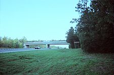
runs beneath I-75 between US 98/SR 50 (Exit 301) and the Hernando-Sumter County line, where it also crosses over the Withlacoochee River.
Georgia (U.S. state)
Georgia is a state located in the southeastern United States. It was established in 1732, the last of the original Thirteen Colonies. The state is named after King George II of Great Britain. Georgia was the fourth state to ratify the United States Constitution, on January 2, 1788...
state line and beyond. Interstate 75 passes beneath the Cross Florida Greenway
Cross Florida Barge Canal
The Cross Florida Barge Canal was a canal project to connect the Gulf of Mexico and the Atlantic Ocean across Florida for barge traffic. Two sections were built but the project was cancelled, mainly for environmental reasons. It is now a protected green belt corridor, one mile wide...
, which contains a land bridge built across the highway in 2001 between Exits 341 and 350, before entering the City of Ocala, and passing by the cities of Gainesville
Gainesville, Florida
Gainesville is the largest city in, and the county seat of, Alachua County, Florida, United States as well as the principal city of the Gainesville, Florida Metropolitan Statistical Area . The preliminary 2010 Census population count for Gainesville is 124,354. Gainesville is home to the sixth...
and Lake City
Lake City, Florida
Lake City is the county seat of Columbia County, Florida, in the United States. In 2009, the U.S. Census Bureau estimated the city's population at 12,614. In addition, it is the Principal City of the Lake City Micropolitan Statistical Area, which is composed of Columbia County, and had an...
and crosses I-10 at an interchange before entering the state of Georgia, near Valdosta.
Interstate 75 runs closest to U.S. 41 except between Tampa and High Springs. It runs closer to U.S. 301 between Ellenton and Temple Terrace, and again from Dade City
Dade City, Florida
Dade City is a city in Pasco County, Florida. The population was 6,188 at the 2000 census. It is the county seat of Pasco County. Dade City is a suburb of the Tampa-St. Petersburg-Clearwater, Florida Metropolitan Statistical Area. As of 2004, the population recorded by the U.S...
to Sparr
Sparr, Florida
Sparr is an unincorporated community in Marion County, Florida, United States. It is located near the intersection of County Road 200A and County Road 329. The community is part of the Ocala Metropolitan Statistical Area.-Geography:...
. From Belleview
Belleview, Florida
Belleview is a city in Marion County, Florida. The population was 3,478 at the 2000 census. According to the U.S Census estimates of 2009, the city had a population of 4,483. It is part of the Ocala Metropolitan Statistical Area. The name, Belleview, which means beautiful view, came from one of...
to Lake City it runs closest to U.S. 441.
Lane configurations
- From southern terminus to I-595Interstate 595 (Florida)Interstate 595 , also known as the Port Everglades Expressway and as the unsigned State Road 862, is a Interstate highway that connects Interstate 75 and Alligator Alley in the west with Florida's Turnpike, Interstate 95, Fort Lauderdale-Hollywood International Airport, US 1, and SR A1A before...
(Exit 19) (4 lanes each way) - Between I-595 to US 27 (Exit 23) (3 lanes each way)
- Between US 27 and Golden Gate Parkway (Exit 105) (2 lanes each way)
- Between Golden Gate Parkway and Luckett Road (Exit 139) (3 lanes each way)
- Between Luckett Road and State Road 80 (Palm Beach Boulevard)Florida State Road 80Florida State Road 80 is a route linking US 41 in Fort Myers and Florida State Road A1A in Palm Beach. The road is the northernmost of three linking Southwest Florida to South Florida via the Everglades...
(Exit 141) (currently 2 lanes each way, but are being widened to 3 lanes each way) - Between State Road 80 (Palm Beach Boulevard) and US 17 (Exit 164) (2 lanes each way)
- Between US 17 and Harborview Road (Exit 167) (3 lanes each way)
- Between Harborview Road and River Road (Exit 191) (2 lanes each way)
- Between River Road and State Road 681 (Exit 200) (currently 2 lanes each way, but are being widened to 3 lanes each way) >
- Between State Road 681 and State Road 582 (Fowler Avenue)State Road 582 (Florida)State Road 582 is an east–west highway in Hillsborough County, Florida, USA. The current alignment of SR 582 is Fowler Avenue just south of the northern city limit of Tampa and Temple Terrace from Florida Avenue to US 301...
(Exit 265) (3 lanes each way except through RiverviewRiverview, Hillsborough County, FloridaRiverview is an unincorporated census-designated place in Hillsborough County, Florida, United States. It is located near Brandon. The population was 71,050 at the 2010 census....
and part of BrandonBrandon, FloridaBrandon is a census-designated place in Hillsborough County, Florida, in the United States. As of the 2010 census, the CDP had a total population of 103,483.-Founding:...
where it is up to 5 lanes each way) - Between State Road 582 (Fowler Avenue) and Florida's TurnpikeFlorida's TurnpikeFlorida's Turnpike , designated as the Ronald Reagan Turnpike, and originally known as the Sunshine State Parkway is a north–south toll road that runs through 11 counties in the Florida peninsula, from U.S...
(Exit 328) (2 lanes each way, but gradually being widened to 3 lanes each way) - Between Florida's Turnpike and Georgia state line (3 lanes each way)
History
Originally, I-75 was to be built to TampaTampa, Florida
Tampa is a city in the U.S. state of Florida. It serves as the county seat for Hillsborough County. Tampa is located on the west coast of Florida. The population of Tampa in 2010 was 335,709....
, terminating at I-4
Interstate 4
Interstate 4 is a intrastate Highway located entirely within the state of Florida, United States. It goes from Interstate 275 in Tampa, Florida to Interstate 95 at Daytona Beach, Florida . It also has the Florida Department of Transportation designation of State Road 400, but only a small...
's current western terminus, and was completed in 1969. In the mid-1960s, Florida's state government proposed to build a toll road from the Tampa Bay area to Ft. Lauderdale through Alligator Alley
Alligator Alley
Alligator Alley is a section of Interstate 75 and State Road 84 extending from Naples on the west coast of Florida to Weston on the east...
. Those plans were cancelled in 1968, when it was announced that I-75 would be extended to Naples and eventually South Florida. After I-75's route was extended to connect into the Miami area, a Tampa Bay bypass was built east, signed as I-75E, with the original route, now extending to St. Petersburg
St. Petersburg, Florida
St. Petersburg is a city in Pinellas County, Florida, United States. It is known as a vacation destination for both American and foreign tourists. As of 2008, the population estimate by the U.S. Census Bureau is 245,314, making St...
and becoming a loop, signed as I-75W. After the AASHTO phased out route suffixes on Interstates, I-75E became I-75, and I-75W was renamed I-275
Interstate 275 (Florida)
Interstate 275 in Florida serves the Tampa Bay metropolitan area, measuring 60.696 miles in length. The southern terminus is I-75 near Palmetto, just five miles east of the Sunshine Skyway Bridge, a toll bridge crossing Tampa Bay. The highway passes through St...
.
From Naples, Interstate 75 was originally intended to run along the current route of US 41/Tamiami Trail
Tamiami Trail
The Tamiami Trail is the southernmost of U.S. Highway 41 from State Road 60 in Tampa to U.S. Route 1 in Miami. The road also has the hidden designation of State Road 90....
, and connecting to I-95 along the current route of State Road 836/Dolphin Expressway. Due to environmental concerns of the Tamiami Trail and wanting to upgrade the then dangerous Alligator Alley, the latter was upgraded to interstate standards. After rerouting I-75 south of what would be I-595
Interstate 595 (Florida)
Interstate 595 , also known as the Port Everglades Expressway and as the unsigned State Road 862, is a Interstate highway that connects Interstate 75 and Alligator Alley in the west with Florida's Turnpike, Interstate 95, Fort Lauderdale-Hollywood International Airport, US 1, and SR A1A before...
, I-75 was to terminate at I-95 in North Miami
North Miami, Florida
North Miami is a suburban city located in northeast Miami-Dade County, Florida, United States, about north of Miami. The city lies on Biscayne Bay and hosts the Biscayne Bay Campus of Florida International University, and the North Miami campus of Johnson & Wales University...
, but due to local opposition, I-75 was not built past its current terminus of the Palmetto Expressway. The last section to be signed was Alligator Alley in 1993.
On January 28, 2002, the Florida Department of Transportation began a transition of interchange numbers from sequential exits to mileage-based exits.
Future
In October 2009, the Florida Department of TransportationFlorida Department of Transportation
The Florida Department of Transportation is a decentralized agency charged with the establishment, maintenance, and regulation of public transportation in the state of Florida. The department was formed in 1969. It absorbed the powers of the Florida State Road Department...
began a relocation project for the northbound ramp of Exit 275, which includes a connecting ramp with Interstate 275
Interstate 275 (Florida)
Interstate 275 in Florida serves the Tampa Bay metropolitan area, measuring 60.696 miles in length. The southern terminus is I-75 near Palmetto, just five miles east of the Sunshine Skyway Bridge, a toll bridge crossing Tampa Bay. The highway passes through St...
. This project will prevent weaving in the vicinity of I-275 and SR 56, a hazard that has occurred since the Exit 275 and SR 56 were built across I-75 in 2003. Completion is expected to occur in the Spring of 2012.
Plans are under way to redesign the interchanges with the north end of Florida's Turnpike
Florida's Turnpike
Florida's Turnpike , designated as the Ronald Reagan Turnpike, and originally known as the Sunshine State Parkway is a north–south toll road that runs through 11 counties in the Florida peninsula, from U.S...
(Exit 328) and SR 44 (Exit 329), connecting them with collective-distributor roads, and eliminating left-hand access to Florida's Turnpike from the main southbound lane. This is a joint effort between the Florida's Turnpike Enterprise
Florida's Turnpike Enterprise
Florida's Turnpike Enterprise is a business unit of the Florida Department of Transportation , employing private sector business practices to operate its 460-mile system of limited-access toll highways for the benefit of Florida's traveling public...
and Florida Department of Transportation
Florida Department of Transportation
The Florida Department of Transportation is a decentralized agency charged with the establishment, maintenance, and regulation of public transportation in the state of Florida. The department was formed in 1969. It absorbed the powers of the Florida State Road Department...
and is planned to occur in 2016.
Services
Despite the fact that it is not a toll road, Interstate 75 offers many services along the route for motorists. There are 9 pairs of rest areas along the length of the freeway. In addition, there are separate facilities for each direction of I-75 in Hamilton County and a welcome center south of the state line. The Pasco County rest areas are under reconstruction at the moment. Exit 131 has a single facility that's accessible from both travel directions.Motorist-aid call boxes are located on both outside shoulder
Shoulder
The human shoulder is made up of three bones: the clavicle , the scapula , and the humerus as well as associated muscles, ligaments and tendons. The articulations between the bones of the shoulder make up the shoulder joints. The major joint of the shoulder is the glenohumeral joint, which...
s of the road every mile (1.6 km), and send a signal
Radio
Radio is the transmission of signals through free space by modulation of electromagnetic waves with frequencies below those of visible light. Electromagnetic radiation travels by means of oscillating electromagnetic fields that pass through the air and the vacuum of space...
indicating the need for gasoline
Gasoline
Gasoline , or petrol , is a toxic, translucent, petroleum-derived liquid that is primarily used as a fuel in internal combustion engines. It consists mostly of organic compounds obtained by the fractional distillation of petroleum, enhanced with a variety of additives. Some gasolines also contain...
, repair (tire
Tire
A tire or tyre is a ring-shaped covering that fits around a wheel rim to protect it and enable better vehicle performance by providing a flexible cushion that absorbs shock while keeping the wheel in close contact with the ground...
or engine
Engine
An engine or motor is a machine designed to convert energy into useful mechanical motion. Heat engines, including internal combustion engines and external combustion engines burn a fuel to create heat which is then used to create motion...
), or emergency services (police
Police
The police is a personification of the state designated to put in practice the enforced law, protect property and reduce civil disorder in civilian matters. Their powers include the legitimized use of force...
, ambulance
Ambulance
An ambulance is a vehicle for transportation of sick or injured people to, from or between places of treatment for an illness or injury, and in some instances will also provide out of hospital medical care to the patient...
, or firefighter
Firefighter
Firefighters are rescuers extensively trained primarily to put out hazardous fires that threaten civilian populations and property, to rescue people from car incidents, collapsed and burning buildings and other such situations...
s). Call boxes can also be found at some rest areas.
Exit list
External links
- Interstate 75 Index -- Florida (AARoads.com)
- I-275 Florida Has information tangential to its parent I-75 in the Tampa Bay area