
.gif)
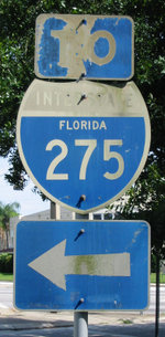
Interstate 275 (Florida)
Encyclopedia
Florida
Florida is a state in the southeastern United States, located on the nation's Atlantic and Gulf coasts. It is bordered to the west by the Gulf of Mexico, to the north by Alabama and Georgia and to the east by the Atlantic Ocean. With a population of 18,801,310 as measured by the 2010 census, it...
serves the Tampa Bay
Tampa Bay Area
The Tampa Bay Area is the region of west central Florida adjacent to Tampa Bay. Definitions of the region vary. It is often considered equivalent to the Tampa-St. Petersburg-Clearwater Metropolitan Statistical Area defined by the United States Census Bureau. The Census Bureau currently...
metropolitan area
Metropolitan area
The term metropolitan area refers to a region consisting of a densely populated urban core and its less-populated surrounding territories, sharing industry, infrastructure, and housing. A metropolitan area usually encompasses multiple jurisdictions and municipalities: neighborhoods, townships,...
, measuring 60.696 miles (97.681 km) in length. The southern terminus is I-75 near Palmetto
Palmetto, Florida
Palmetto is a city in Manatee County, Florida, United States. As of the 2010 census, the population was listed as 12,606 It is part of the Bradenton–Sarasota–Venice Metropolitan Statistical Area.-Geography:Palmetto is located at ....
, just five miles east of the Sunshine Skyway Bridge
Sunshine Skyway Bridge
The Bob Graham Sunshine Skyway Bridge is a bridge spanning Tampa Bay, Florida, with a cable-stayed main span, and a total length of 21,877 feet . It is part of I-275 and US 19 , connecting St. Petersburg in Pinellas County and Terra Ceia in Manatee County, Florida, passing through Hillsborough...
, a toll bridge
Toll bridge
A toll bridge is a bridge over which traffic may pass upon payment of a toll, or fee.- History :The practice of collecting tolls on bridges probably harks back to the days of ferry crossings where people paid a fee to be ferried across stretches of water. As boats became impractical to carry large...
crossing Tampa Bay
Tampa Bay
Tampa Bay is a large natural harbor and estuary along the Gulf of Mexico on the west central coast of Florida, comprising Hillsborough Bay, Old Tampa Bay, Middle Tampa Bay, and Lower Tampa Bay."Tampa Bay" is not the name of any municipality...
. The highway passes through St. Petersburg, Florida
St. Petersburg, Florida
St. Petersburg is a city in Pinellas County, Florida, United States. It is known as a vacation destination for both American and foreign tourists. As of 2008, the population estimate by the U.S. Census Bureau is 245,314, making St...
before crossing Tampa Bay again on the Howard Frankland Bridge
Howard Frankland Bridge
The W. Howard Frankland Bridge is the central bridge spanning Old Tampa Bay from St. Petersburg, Florida to Tampa, Florida. It is one of three bridges connecting Hillsborough County and Pinellas County; the others being Gandy Bridge and Courtney Campbell Causeway...
and entering Tampa
Tampa, Florida
Tampa is a city in the U.S. state of Florida. It serves as the county seat for Hillsborough County. Tampa is located on the west coast of Florida. The population of Tampa in 2010 was 335,709....
, where it intersects with I-4
Interstate 4
Interstate 4 is a intrastate Highway located entirely within the state of Florida, United States. It goes from Interstate 275 in Tampa, Florida to Interstate 95 at Daytona Beach, Florida . It also has the Florida Department of Transportation designation of State Road 400, but only a small...
in Downtown
Downtown Tampa
Image:Tampa_Skyline.jpg|thumb|right|350px|Downtown Tampa looking from the Hillsborough Riverpoly 2403 537 2441 500 2488 483 2516 455 2566 439 2597 410 2649 390 2682 358 2803 315 2949 342 2956 362 3068 383 3074 406 3202 431 3204 447 3332 473 3350 484 3485 1616 2446 1587 Wachovia Centerpoly 1745 1216...
. After the interchange, I-275 heads due north through the Tampa suburbs to its northern terminus at I-75 in Wesley Chapel
Wesley Chapel, Florida
Wesley Chapel is a census-designated place in Pasco County, Florida, United States. Wesley Chapel is considered part of the Tampa Bay Area metro. The population was 44,092 at the 2010 census. In 2003, some residents of Wesley Chapel started a movement to incorporate the community...
.
Interstate 275 and its parent route, Interstate 75, are opposite the normal conventions of freeway routing. Normally, the parent route will go through a metropolitan area while a 3-digit numbered freeway (beginning with an even number) serves as the bypass route; however, in this case I-275 runs through Downtown
Downtown Tampa
Image:Tampa_Skyline.jpg|thumb|right|350px|Downtown Tampa looking from the Hillsborough Riverpoly 2403 537 2441 500 2488 483 2516 455 2566 439 2597 410 2649 390 2682 358 2803 315 2949 342 2956 362 3068 383 3074 406 3202 431 3204 447 3332 473 3350 484 3485 1616 2446 1587 Wachovia Centerpoly 1745 1216...
Tampa
Tampa, Florida
Tampa is a city in the U.S. state of Florida. It serves as the county seat for Hillsborough County. Tampa is located on the west coast of Florida. The population of Tampa in 2010 was 335,709....
and St. Petersburg, Florida
St. Petersburg, Florida
St. Petersburg is a city in Pinellas County, Florida, United States. It is known as a vacation destination for both American and foreign tourists. As of 2008, the population estimate by the U.S. Census Bureau is 245,314, making St...
while I-75 serves as the bypass route.
Route description
On some street maps dating around 1970s — early 1990s, I-275 from I-4 to Downtown St. Pete was referred to as the "Tampa Expressway". In November 2005, The Florida Legislature officially dedicated the Pinellas County section of I-275 as the "St Petersburg Parkway/William C. Cramer Memorial Highway". William Cato Cramer was a St. Pete native who served as a member of the Florida legislature from 1955 to 1971 and helped shape I-275 through Pinellas County.Just north of the Sunshine Skyway in Gulfport
Gulfport, Florida
Gulfport is a city in Pinellas County, Florida and a suburb of St. Petersburg. The population of Gulfport was 12,527 at the 2000 census. As of 2004, the population estimated by the U.S. Census Bureau was 12,740. Gulfport is part of the Tampa-St...
, drivers briefly drive on the left side as the freeway's lanes invert for about 1/2 mile (about 1 km) at the US 19/Pinellas Bayway
Pinellas Bayway
The Pinellas Bayway System is a series of bridges on two Florida State Roads in Pinellas County, Florida. It is a toll road complex maintained and operated by the Florida Department of Transportation. It also is compatible with the SunPass ETC system currently in used on all other FDOT-owned toll...
exit (Exit 17).
Because of a failed effort in the 1970s to convert the Gandy corridor into a freeway, the Gandy Boulevard Interchange is technically incomplete. Two ramps were added in 1979 to eliminate illegal u-turns, but the interchange has not changed since.
The only major interchange on I-275 is with I-4, just north of downtown Tampa. Known locally for years as "Malfunction Junction
Malfunction Junction
Malfunction Junction is a derisive nickname given by motorists to a confusing, dangerous, or otherwise problematic interchange.-Alabama:*Interstates in Birmingham. This interchange is the busiest in Alabama, and has been the site of many accidents, including roadway punctures and two fiery...
", the interchange quickly became full of daily rush hour backups due to the sprawling growth of the Tampa Bay area and the lack of capacity that the interchange had. The interchange was overhauled, with wider lanes and some reconfigurations, between October 2002 and December 2006.
Lane configurations
- Between southern terminus and Exit 16 (2 lanes each way excluding the toll plaza)
- Between Exit 16 and Exit 30 (3 lanes each way)
- Between Exits 22 and 23A (2 lanes each way)
- Between Exits 25 and 26 (4 lanes each way; however, right lane in both directions is "Exit Only")
- Between Exits 30 and 39, including the Howard Frankland BridgeHoward Frankland BridgeThe W. Howard Frankland Bridge is the central bridge spanning Old Tampa Bay from St. Petersburg, Florida to Tampa, Florida. It is one of three bridges connecting Hillsborough County and Pinellas County; the others being Gandy Bridge and Courtney Campbell Causeway...
(4 lanes each way) - Between Exit 39 and Exit 53 (mostly 3 lanes each way)
- Between Exit 53 and northern terminus (2 lanes each way)
Initial construction in Tampa
What would become I-275, which was then called I-75, was first opened in 1962 from the present northern terminus to a diamond interchangeDiamond interchange
A diamond interchange is a common type of road junction, used where a freeway crosses a minor road. The freeway itself is grade-separated from the minor road, one crossing the other over a bridge...
at Bearss Avenue. Construction stopped in the area upon completion of this segment and was then stalled for several years thereafter. In the meantime, I-4
Interstate 4
Interstate 4 is a intrastate Highway located entirely within the state of Florida, United States. It goes from Interstate 275 in Tampa, Florida to Interstate 95 at Daytona Beach, Florida . It also has the Florida Department of Transportation designation of State Road 400, but only a small...
was completed from Plant City to 50th St near Ybor City. The portion I-4 that would later become part of I-275, the Howard Frankland Bridge
Howard Frankland Bridge
The W. Howard Frankland Bridge is the central bridge spanning Old Tampa Bay from St. Petersburg, Florida to Tampa, Florida. It is one of three bridges connecting Hillsborough County and Pinellas County; the others being Gandy Bridge and Courtney Campbell Causeway...
and its short freeway stubs at the bridge's endpoints, opened to traffic about a year earlier. In 1964, the stub of then-I-4 between 50th St (through Malfunction Junction
Malfunction Junction
Malfunction Junction is a derisive nickname given by motorists to a confusing, dangerous, or otherwise problematic interchange.-Alabama:*Interstates in Birmingham. This interchange is the busiest in Alabama, and has been the site of many accidents, including roadway punctures and two fiery...
) and Armenia Avenue was completed, with the Malfunction Junction's northern end was a pair of ramp stubs that would later be filled in by then-I-75. In 1965, the I-75 segment from Malfunction Junction to about Sligh Ave was completed. By 1967, the remaining gaps in I-4 and I-75 were filled and open to traffic.
Controversy and repeated delays in Pinellas
Around 1970, plans for the Pinellas CountyPinellas County, Florida
Pinellas County is a county located in the state of Florida. Its county seat is Clearwater, Florida, and its largest city is St. Petersburg. This county is contained entirely within the telephone area code 727, except for some sections of Oldsmar, which have the area code 813...
extension of I-75 began. However, the first round of local opposition would lead to the eventual (and repeated) delayment of I-275 through St. Petersburg
St. Petersburg, Florida
St. Petersburg is a city in Pinellas County, Florida, United States. It is known as a vacation destination for both American and foreign tourists. As of 2008, the population estimate by the U.S. Census Bureau is 245,314, making St...
. The first setback was led by 4th Street business owners and residents who demanded that construction on I-75 be stopped since the bridge
Howard Frankland Bridge
The W. Howard Frankland Bridge is the central bridge spanning Old Tampa Bay from St. Petersburg, Florida to Tampa, Florida. It is one of three bridges connecting Hillsborough County and Pinellas County; the others being Gandy Bridge and Courtney Campbell Causeway...
was already funneling unwanted traffic onto the corridor; it has since seen many unforeseen business and residential booms, due to the building of the Bridge. At the same time, construction began on I-75 from Roosevelt Boulevard to about 38th Avenue N. By this point in time, I-4 was truncated to Malfunction Junction
Malfunction Junction
Malfunction Junction is a derisive nickname given by motorists to a confusing, dangerous, or otherwise problematic interchange.-Alabama:*Interstates in Birmingham. This interchange is the busiest in Alabama, and has been the site of many accidents, including roadway punctures and two fiery...
, allowing the I-75 designation take over the freeway from the junction to 4th Street N. This segment was opened to traffic in 1973, with the gap between Roosevelt and 9th Street filled a couple of years later. Around this time, I-75W was resigned as I-275. After some more local opposition, I-275 meandered down to 5th Avenue N, near downtown St. Petersburg, in 1975.
Probably one of the largest setbacks for I-275 was in the mid 1970s when it was proposed to go through southwest St. Petersburg towards the Sunshine Skyway Bridge
Sunshine Skyway Bridge
The Bob Graham Sunshine Skyway Bridge is a bridge spanning Tampa Bay, Florida, with a cable-stayed main span, and a total length of 21,877 feet . It is part of I-275 and US 19 , connecting St. Petersburg in Pinellas County and Terra Ceia in Manatee County, Florida, passing through Hillsborough...
. Heavy community opposition managed to delay construction for several years. In the end, numerous homes and businesses were destroyed and several churches were relocated. Financial burdens through this part of the project also caused further delays. However, I-375
Interstate 375 (Florida)
Interstate 375 in St. Petersburg, Florida, also known as North Bay Drive, is a 1.34-mile-long spur route from Interstate 275 into downtown. It is also designated as the unsigned State Road 592...
opened partially to traffic in 1979, with full operation by 1981, and I-175
Interstate 175 (Florida)
Interstate 175 in St. Petersburg, Florida, also known as South Bay Drive, is a 1.44-mile-long spur route from Interstate 275 into downtown. It is also designated as the unsigned State Road 594...
followed suit in 1980.
With both downtown feeders now opened, I-275 was extended to 28th Street S. However, another round of community revolts delayed the segment of I-275 between 28th Street S and 22nd Avenue S. In spite of this, the stretch was eventually built by 1981. Exit 20 was configured for an anticipated westward expansion to a planned Pinellas Beltway. A freeway revolt killed many of Pinellas County
Pinellas County, Florida
Pinellas County is a county located in the state of Florida. Its county seat is Clearwater, Florida, and its largest city is St. Petersburg. This county is contained entirely within the telephone area code 727, except for some sections of Oldsmar, which have the area code 813...
's freeways in the 1970s and (as mentioned above) repeatedly delayed the construction of I-275. In addition, the Skyway Bridge disaster on May 9, 1980, where the freighter Summit Venture took down one of the two spans and killed 35 people, cost the bridge its interstate standards (due to only one of the two-lane spans being operable afterwards) and would not regain it until the opening of the present bridge in April 1987.
In 1982, the segment between 22nd Avenue S and 39th Avenue S was opened to traffic. As mentioned above, the Pinellas Bayway
Pinellas Bayway
The Pinellas Bayway System is a series of bridges on two Florida State Roads in Pinellas County, Florida. It is a toll road complex maintained and operated by the Florida Department of Transportation. It also is compatible with the SunPass ETC system currently in used on all other FDOT-owned toll...
/US 19 concurrency
Concurrency (road)
A concurrency, overlap, or coincidence in a road network is an instance of one physical road bearing two or more different highway, motorway, or other route numbers...
, opened to traffic in 1983/1984, is inverted for about half a mile. The reason to this configuration is unknown, however, to this day, traffic continues to flow smoothly through the interchange with very little congestion. At about the same time this interchange opened, I-275 was complete from the Sunshine Skyway Bridge
Sunshine Skyway Bridge
The Bob Graham Sunshine Skyway Bridge is a bridge spanning Tampa Bay, Florida, with a cable-stayed main span, and a total length of 21,877 feet . It is part of I-275 and US 19 , connecting St. Petersburg in Pinellas County and Terra Ceia in Manatee County, Florida, passing through Hillsborough...
to the southern terminus with I-75 in Manatee County
Manatee County, Florida
Manatee County is a county in the state of Florida. According to the 2010 census by the U.S. Census Bureau there are 322,833 people living in Manatee Country.Manatee County is part of the North Port-Bradenton-Sarasota Metropolitan Statistical Area...
.
With the new Sunshine Skyway Bridge opening in 1987, the final link of I-275 (between US 19 and the bridge) was completed and opened to traffic. The northern toll plaza was originally located north of the approach bridge, but was relocated in 2000 due to a lack of capacity. The original plaza only allowed three lanes while the replacement allows six lanes to flow through, with the sixth lane dedicated for SunPass
SunPass
SunPass is an electronic toll collection system in use by the State of Florida and was originally created by the Florida Department of Transportation's Florida's Turnpike...
users.
Reconstruction and other improvements
Like all of the Interstate Highways in the US, I-275 is an aging, yet vital link to the Tampa Bay AreaTampa Bay Area
The Tampa Bay Area is the region of west central Florida adjacent to Tampa Bay. Definitions of the region vary. It is often considered equivalent to the Tampa-St. Petersburg-Clearwater Metropolitan Statistical Area defined by the United States Census Bureau. The Census Bureau currently...
. Major staged reconstruction of the oldest segments began in 1999.
The segment of I-275 between the Veterans Expressway and Himes Ave was widened from four to six lanes in 1974. Additionally, a median barrier was built along the highway from Himes Ave to Downtown Tampa
Downtown Tampa
Image:Tampa_Skyline.jpg|thumb|right|350px|Downtown Tampa looking from the Hillsborough Riverpoly 2403 537 2441 500 2488 483 2516 455 2566 439 2597 410 2649 390 2682 358 2803 315 2949 342 2956 362 3068 383 3074 406 3202 431 3204 447 3332 473 3350 484 3485 1616 2446 1587 Wachovia Centerpoly 1745 1216...
.
Until the 1980s, the Memorial Hwy/Veterans Exwy interchange was only a half diamond and the West Shore Blvd interchange was a full diamond. Both interchanges underwent drastic changes to allow safe, free-flowing movement to and from Tampa International Airport
Tampa International Airport
Tampa International Airport is a major public airport located six nautical miles west of the central business district of Tampa, in Hillsborough County, Florida, United States. This airport is publicly owned by Hillsborough County Aviation Authority...
and the Veterans Exwy. Among the improvements, three free flowing exit and entry ramps were added to the expressway from I-275. The exit ramp from I-275 south to the Veterans Exwy northbound was reconstructed and the ramp from Memorial Hwy northbound from Kennedy Blvd onto northbound I-275 was removed, along with the two western ramps onto West Shore Blvd (truncating the West Shore interchange to a half-diamond), in order to deter accidents that were being caused by commuters entering and exiting the interstate from the Veterans Exwy. In addition, connections from I-275 north, to Cypress St were made (though the ramps are under-utilized today). In 2004, the ramp from southbound Veterans Exwy to southbound I-275 was realigned in order to ease congestion on the mainline lanes of the interstate.
.jpg)
Raymond James Stadium
Raymond James Stadium, also known as the "Ray Jay", is a multi-purpose football stadium located in Tampa, Florida. It is home to the NFL's Tampa Bay Buccaneers as well as the NCAA's South Florida Bulls football team. The stadium seats 65,857 , and it is expandable to 75,000 for special events...
.
In 1991, following the expansion of the Howard Frankland Bridge
Howard Frankland Bridge
The W. Howard Frankland Bridge is the central bridge spanning Old Tampa Bay from St. Petersburg, Florida to Tampa, Florida. It is one of three bridges connecting Hillsborough County and Pinellas County; the others being Gandy Bridge and Courtney Campbell Causeway...
, the 4th St N interchange was reconstructed.
In 1994, the two drawbridge
Drawbridge
A drawbridge is a type of movable bridge typically associated with the entrance of a castle surrounded by a moat. The term is often used to describe all different types of movable bridges, like bascule bridges and lift bridges.-Castle drawbridges:...
s on the northern approach to the Sunshine Skyway Bridge
Sunshine Skyway Bridge
The Bob Graham Sunshine Skyway Bridge is a bridge spanning Tampa Bay, Florida, with a cable-stayed main span, and a total length of 21,877 feet . It is part of I-275 and US 19 , connecting St. Petersburg in Pinellas County and Terra Ceia in Manatee County, Florida, passing through Hillsborough...
, dating to the original twin Skyway bridges, were replaced with high-level fixed spans, eliminating bottlenecks caused by openings.
Between 1994 and 1998, I-275 saw very little change, as there were no major projects taking place on the highway. The hiatus ended in 1999, when a much needed, dual-stage, widening project took place between Busch Blvd (State Road 580
State Road 580 (Florida)
A major east–west highway serving northern Pinellas and central Hillsborough County, Florida, State Road 580 is a major commercial and commuter route...
) and Bearss Ave. The project widened I-275 mainline from four to six lanes, rehabilitated the existing concrete surfaces, and improved interchange flow, lighting, signage, and drainage. The project wrapped up in 2003.
In 2001, the widening project for I-275 between Gandy Blvd
State Road 694 (Florida)
State Road 694 is an east–west route in Pinellas County originally running east from Indian Shores, through Seminole and into Pinellas Park; it now begins in Pinellas Park at 66th Street N, with the former road to the west becoming Pinellas County Road 694. It then turns to the northeast as...
and Roosevelt Blvd
State Road 686 (Florida)
State Road 686 is an east–west route in Pinellas County originally running east from Belleair Beach, through Largo to the eastern side of the county, then southeasterly to northeastern St. Petersburg, Florida; it now ends at Alt US 19 in Largo. It connects with US 19 and Interstate 275...
began. The project increased I-275 from six to eight lanes and existing concrete surfaces were rehabilitated. A reconfiguration of the Roosevelt Interchange (Exit 30) started in 2001 and added access to 118th Ave N at the same interchange. The new connection to 118th Ave N is actually the first phase of a proposed freeway to connect I-275 to the Bayside Bridge. All construction in this area was completed by 2002. Phase 2 of the Mid Pinellas Expressway will begin around 2009/2010 with Phases 3 through 6 to follow in the years ahead. The entire project may exceed beyond 2020 before it is completed. Reconstruction of I-275 between Roosevelt Blvd and 4th St N quickly followed the above widening project. Lane counts on I-275 were increased from four to mostly six lanes (with some eight lane segments). The Ulmerton Rd and 9th St N interchanges were originally narrow 1959 configurations that caused much congestion in the area.
Additionally, the 9th/MLK St N exit and Ulmerton Rd entrance ramps were situated in the left lane of I-275, causing dangerous weaving patterns. These interchanges were reconstructed into right lane configurations and two new ramps were added from Ulmerton Rd (one leading to 9th St N and one exiting onto southbound I-275. The southbound I-275 exits to Ulmerton and MLK St N were combined into one exit ramp to provide better flow. The MLK St N interchange was shut down fpr several months as a result of the reconstruction. Lastly, the ramps to/from 118th Ave N were opened to traffic. The entire reconstruction project along I-275 in the Gateway area wrapped up in 2005.
In 2003 Operational Improvements began for the notorious Malfunction Junction
Malfunction Junction
Malfunction Junction is a derisive nickname given by motorists to a confusing, dangerous, or otherwise problematic interchange.-Alabama:*Interstates in Birmingham. This interchange is the busiest in Alabama, and has been the site of many accidents, including roadway punctures and two fiery...
in Downtown Tampa
Downtown Tampa
Image:Tampa_Skyline.jpg|thumb|right|350px|Downtown Tampa looking from the Hillsborough Riverpoly 2403 537 2441 500 2488 483 2516 455 2566 439 2597 410 2649 390 2682 358 2803 315 2949 342 2956 362 3068 383 3074 406 3202 431 3204 447 3332 473 3350 484 3485 1616 2446 1587 Wachovia Centerpoly 1745 1216...
. The project consisted of widening mainline I-275 and I-4, along with an array of ramp/bridge improvements, lighting and drainage work, and new signs. The entire project was completed on December 22, 2006 with ITS components installed by March 2007. The renovation of the I-4 corridor through Ybor City finished around summer 2007, almost one year ahead of schedule.
As of 2010, work is partially completed on the I-275 reconstruction between Malfunction Junction and the Howard Frankland Bridge in Tampa. The new northbound (eastbound) lanes are completed from Himes Avenue to downtown. Southbound (westbound) traffic has been shifted on to the original northbound lanes. However, those wishing to exit at either the Howard/Armenia or Himes Avenue exits do in fact continue on the original southbound lanes. Those exiting on Himes Avenue have one dedicated lane on the original southbound lanes. Traffic entering the freeway from Armenia Ave now does so on the original northbound exit ramp. This creates an odd left lane merge situation. However, to help motorists in this effort, the entrance ramp has a dedicated lane from the freeway entrance until just over the Himes Avenue bridge. Traffic heading northbound on Howard Avenue must now turn left onto Green Ave. left onto Armenia Avenue and then right on the entrance ramp in order to get on the freeway. While this setup is temporary, it has seemed to somewhat improve traffic flow in the area as motorists who intend to exit at Howard/Armenia or Himes are now off of the freeway much earlier.
In January, 2011, construction began on widening the northermost segment of I-275 from US 41 (Nebraska Ave) to the I-75 apex from four to six lanes. The project also includes constructing a dedicated flyover ramp over I-75 towards State Road 56. http://www.mytbi.com/projects/projectinfo.asp?projectID=182&RoadID=1 This ramp, along with a new, extended ramp from I-75 to SR 56, opened on August 18, 2011 http://www2.tbo.com/news/pasco-news/2011/aug/18/panewso1-new-sr-56-exit-ramp-opens-for-commuters-i-ar-251227/
On February 4, 2011, a new ramp connecting northbound I-275 to 118th Ave N opened. This project began in July, 2009 and involved widening the existing ramp from northbound I-275 to Roosevelt Blvd and is in conjunction with the project to build the Mid Pinellas Expressway http://www.mytbi.com/projects/projectinfo.asp?projectID=170&RoadID=1.
Increased cost of materials delay I-275 widening project
The staged reconstruction project for I-275 between the Howard Frankland BridgeHoward Frankland Bridge
The W. Howard Frankland Bridge is the central bridge spanning Old Tampa Bay from St. Petersburg, Florida to Tampa, Florida. It is one of three bridges connecting Hillsborough County and Pinellas County; the others being Gandy Bridge and Courtney Campbell Causeway...
and Downtown Tampa was supposed to begin in the summer of 2006. Unfortunately, bids received by FDOT for the project came in at $100 million (40%) over the projected estimates. This is being blamed on by the rising cost of asphalt and other materials, which in turn is being partly blamed on the rising oil prices worldwide. As a result, FDOT has commenced with the project in four smaller phases rather than the original, large-scale, two-phase project. Construction began on phase one, the northbound lanes (south of the exisitng interstate) between Himes Ave and Downtown Tampa
Downtown Tampa
Image:Tampa_Skyline.jpg|thumb|right|350px|Downtown Tampa looking from the Hillsborough Riverpoly 2403 537 2441 500 2488 483 2516 455 2566 439 2597 410 2649 390 2682 358 2803 315 2949 342 2956 362 3068 383 3074 406 3202 431 3204 447 3332 473 3350 484 3485 1616 2446 1587 Wachovia Centerpoly 1745 1216...
, on August 13, 2007 and was completed in April, 2010 http://www.mytbi.com/projects/projectinfo.asp?projectID=158&RoadID=1. Phase two, which includes construction of the northbound lanes from the WestShore area to Himes, was originally scheduled to begin in 2008, but has since been delayed further. The third phase will consist of transferring northbound traffic onto the new northbound lanes, southbound traffic onto the existing northbound lanes, and the construction of the new southbound lanes from Himes to Downtown. Finally, the fourth and final phase will construct the new southbound lanes from the WestShore area to Himes. The entire project was originally scheduled to be completed by around 2013 or 2014 (this is now likely to be delayed until 2015 or 2016) and will cost around an estimated $540 million, which is up from the original $350 million budget.
Other Improvements
Other sections not requiring a full scale reconstruction have undergone improvements.- Concrete rehabilitation from 62nd Ave N to Exit 17 in Pinellas County. (Complete) 2001-2005.
- Resurfacing from the Howard Frankland Bridge to Himes Ave. (exit 41c) (Complete) 2002.
- Resurfacing from the US 41 overpass (exit 47) to the I-75 junction in Lutz. (Complete) 2003.
- Resurfacing from the Howard Frankland Bridge to 4th St N. (Complete) 2006.
- Concrete rehabilitation/bridge upgrade/lighting improvements from Malfunction Junction to Busch Blvd. (Complete) 2007.
- Concrete rehabilitation from 26th Ave N to Exit 23. (completed in 2008).
- Rehabilitation @ Exit 28. (completed in 2008).
I-275 in Manatee County
The Manatee County segment of I-275 has not changed dramatically since its construction in 1983, other than a toll plaza upgrade in the late 1990s, and resurfacing of the mainline lanes between the I-75 apex and the US 19 exit. It is unclear if any other improvements are planned at this time.Exit list
{| class=wikitable!County
!Location
!Mile
!|Exit
Exit number
An exit number is a number assigned to a road junction, usually an exit from a freeway. It is usually marked on the same sign as the destinations of the exit, as well as a sign in the gore....
!Destinations
!Notes
|-
|rowspan=4|Manatee
Manatee County, Florida
Manatee County is a county in the state of Florida. According to the 2010 census by the U.S. Census Bureau there are 322,833 people living in Manatee Country.Manatee County is part of the North Port-Bradenton-Sarasota Metropolitan Statistical Area...
|
|bgcolor=#ffdddd|0.000
|bgcolor=#ffdddd|
|bgcolor=#ffdddd|
|bgcolor=#ffdddd|Southbound exit and northbound entrance
|-
|
|2.279
|2
|
|
|-
|rowspan=2|Terra Ceia
Terra Ceia, Florida
Terra Ceia is an unincorporated census-designated place in Manatee County, Florida, United States that includes the Terra Ceia State Park...
|bgcolor=#ddffdd|4.656
|bgcolor=#ddffdd|5
|bgcolor=#ddffdd|
|bgcolor=#ddffdd|South end of US 19 overlap; southbound exit and northbound entrance
|-
|7.8
|8
|South Skyway Fishing Pier
|
|-
| colspan="6" style="text-align:center;"|Sunshine Skyway Bridge
Sunshine Skyway Bridge
The Bob Graham Sunshine Skyway Bridge is a bridge spanning Tampa Bay, Florida, with a cable-stayed main span, and a total length of 21,877 feet . It is part of I-275 and US 19 , connecting St. Petersburg in Pinellas County and Terra Ceia in Manatee County, Florida, passing through Hillsborough...
over Tampa Bay
Tampa Bay
Tampa Bay is a large natural harbor and estuary along the Gulf of Mexico on the west central coast of Florida, comprising Hillsborough Bay, Old Tampa Bay, Middle Tampa Bay, and Lower Tampa Bay."Tampa Bay" is not the name of any municipality...
(Toll $1.00, $.75 with SunPass
SunPass
SunPass is an electronic toll collection system in use by the State of Florida and was originally created by the Florida Department of Transportation's Florida's Turnpike...
)
|-
|rowspan=19|Pinellas
Pinellas County, Florida
Pinellas County is a county located in the state of Florida. Its county seat is Clearwater, Florida, and its largest city is St. Petersburg. This county is contained entirely within the telephone area code 727, except for some sections of Oldsmar, which have the area code 813...
|rowspan=13|St. Petersburg
St. Petersburg, Florida
St. Petersburg is a city in Pinellas County, Florida, United States. It is known as a vacation destination for both American and foreign tourists. As of 2008, the population estimate by the U.S. Census Bureau is 245,314, making St...
|-
|13.2
|13
|North Skyway Fishing Pier
|
|-
|16.956
|16
|Skyway Lane, Pinellas Point Drive
|
|-
|bgcolor=#ddffdd|17.424
|bgcolor=#ddffdd|17
|bgcolor=#ddffdd|
|bgcolor=#ddffdd|North end of US 19 overlap
|-
|bgcolor=#ffdddd|19.453
|bgcolor=#ffdddd|18
|bgcolor=#ffdddd|26th Avenue South
|bgcolor=#ffdddd|Northbound exit and southbound entrance
|-
|bgcolor=#ffdddd|19.702
|bgcolor=#ffdddd|19
|bgcolor=#ffdddd|
|bgcolor=#ffdddd|Southbound exit and northbound entrance
|-
|bgcolor=#ffdddd|20.377
|bgcolor=#ffdddd|20
|bgcolor=#ffdddd|31st Street South
|bgcolor=#ffdddd|Northbound exit and southbound entrance
|-
|bgcolor=#ffdddd|20.698
|bgcolor=#ffdddd|21
|bgcolor=#ffdddd|28th Street South
|bgcolor=#ffdddd|Southbound exit and northbound entrance
|-
|21.680
|22
| – Tropicana Field
Tropicana Field
Tropicana Field is a domed stadium in St. Petersburg, Florida, which has been the home of Major League Baseball's Tampa Bay Rays since the team's inaugural season in 1998, when they were the Devil Rays. It has also served as the host stadium for the Beef 'O' Brady's Bowl, an NCAA-sanctioned college...
|
|-
|22.413
|23A
| – The Pier
St. Petersburg Pier
The St. Petersburg Pier, simply called The Pier by locals, is a landmark and major tourist destination in downtown St. Petersburg, Florida. Some of the activities and sights it encompasses include fishing, boat rentals, weekly festivals, and the Pier Aquarium...
, BayWalk
BayWalk (St. Petersburg)
BayWalk is a shopping, dining and entertainment establishment located in downtown St. Petersburg, Florida. The complex, which opened in the fall of 2000, includes of retail space plus an movie theater owned by Muvico Theaters, LLC...
|Signed as exit 23 northbound
|-
|bgcolor=#ffdddd|22.442
|bgcolor=#ffdddd|23B
|bgcolor=#ffdddd|
|bgcolor=#ffdddd|Southbound exit and northbound entrance
|-
|23.444
|24
|22nd Avenue North
|
|-
|24.470
|25
|
|
|-
|Lealman
West and East Lealman, Florida
West and East Lealman, more commonly known collectively as Lealman, is a census-designated place in Pinellas County, Florida, United States. The population was 21,753 at the 2000 census.-Geography:...
|25.502
|26
|
|Signed as exits 26A (east) and 26B (west) northbound
|-
|rowspan=5|St. Petersburg
St. Petersburg, Florida
St. Petersburg is a city in Pinellas County, Florida, United States. It is known as a vacation destination for both American and foreign tourists. As of 2008, the population estimate by the U.S. Census Bureau is 245,314, making St...
|27.706
|28
|
|Interchange was originally designed for the formerly proposed Gandy Freeway.
|-
|bgcolor=#ffdddd|29.627
|bgcolor=#ffdddd|30
|bgcolor=#ffdddd|, St. Petersburg-Clearwater International Airport
St. Petersburg-Clearwater International Airport
St. Petersburg-Clearwater International Airport is a joint civil-military airport located in unincorporated Pinellas County, Florida, north of St. Petersburg, serving St...
|bgcolor=#ffdddd|No northbound exit to CR 296
|-
|30.751
|31
|
|
|-
|30.933
|31
|
|
|-
|bgcolor=#ffdddd|31.535
|bgcolor=#ffdddd|32
|bgcolor=#ffdddd|
|bgcolor=#ffdddd|Southbound exit and northbound entrance
|-
| colspan="6" style="text-align:center;"|Howard Frankland Bridge
Howard Frankland Bridge
The W. Howard Frankland Bridge is the central bridge spanning Old Tampa Bay from St. Petersburg, Florida to Tampa, Florida. It is one of three bridges connecting Hillsborough County and Pinellas County; the others being Gandy Bridge and Courtney Campbell Causeway...
over Old Tampa Bay
|-
|rowspan=19|Hillsborough
Hillsborough County, Florida
As of the census of 2000, there were 998,948 people, 391,357 households, and 255,164 families residing in the county. The population density was 951 people per square mile . There were 425,962 housing units at an average density of 405 per square mile...
|rowspan=17|Tampa
Tampa, Florida
Tampa is a city in the U.S. state of Florida. It serves as the county seat for Hillsborough County. Tampa is located on the west coast of Florida. The population of Tampa in 2010 was 335,709....
|bgcolor=#ffdddd|38.289
|bgcolor=#ffdddd|39A
|bgcolor=#ffdddd|
|bgcolor=#ffdddd|No southbound exit
|-
|38.549
|39B
|, Tampa International Airport
Tampa International Airport
Tampa International Airport is a major public airport located six nautical miles west of the central business district of Tampa, in Hillsborough County, Florida, United States. This airport is publicly owned by Hillsborough County Aviation Authority...
|Signed as exit 39 southbound
|-
|bgcolor=#ffdddd|39.445
|bgcolor=#ffdddd|40A
|bgcolor=#ffdddd|
|bgcolor=#ffdddd|Southbound exit and northbound entrance
|-
|40.055
|40B
|Lois Avenue
|
|-
|40.639
|41
|
|Signed as exits 41A (east) and 41B (west)
|-
|bgcolor=#ffdddd|40.909
|bgcolor=#ffdddd|41C
|bgcolor=#ffdddd|Himes Avenue
|bgcolor=#ffdddd|Southbound exit and northbound entrance
|-
|41.978
|42
|Howard Avenue, Armenia Avenue
|
|-
|43.303
|44
|Ashley Drive, Scott Street, Tampa Street – Downtown Tampa
Downtown Tampa
Image:Tampa_Skyline.jpg|thumb|right|350px|Downtown Tampa looking from the Hillsborough Riverpoly 2403 537 2441 500 2488 483 2516 455 2566 439 2597 410 2649 390 2682 358 2803 315 2949 342 2956 362 3068 383 3074 406 3202 431 3204 447 3332 473 3350 484 3485 1616 2446 1587 Wachovia Centerpoly 1745 1216...
|
|-
|bgcolor=#ffdddd|43.667
|bgcolor=#ffdddd|45A
|bgcolor=#ffdddd|Jefferson Street
|bgcolor=#ffdddd|Southbound exit and northbound entrance
|-
|44.348
|45B
|
|
|-
|bgcolor=#ffdddd|44.784
|bgcolor=#ffdddd|46A
|bgcolor=#ffdddd|Floribraska Avenue
|bgcolor=#ffdddd|Southbound exit and northbound entrance
|-
|45.517
|46B
|
|
|-
|46.488
|47
|
|Signed as exits 47A (east) and 47B (west) northbound
|-
|47.539
|48
|Sligh Avenue
|
|-
|bgcolor=#ffdddd|48.205
|bgcolor=#ffdddd|49
|bgcolor=#ffdddd|
|bgcolor=#ffdddd|Northbound exit and southbound entrance
|-
|49.081
|50
|, Busch Gardens
|
|-
|50.825
|51
|, University of South Florida
University of South Florida
The University of South Florida, also known as USF, is a member institution of the State University System of Florida, one of the state's three flagship universities for public research, and is located in Tampa, Florida, USA...
|
|-
|
|51.589
|52
| – University of South Florida
University of South Florida
The University of South Florida, also known as USF, is a member institution of the State University System of Florida, one of the state's three flagship universities for public research, and is located in Tampa, Florida, USA...
|
|-
|
|52.878
|53
|
|
|-
|Pasco
Pasco County, Florida
Pasco County is a county located in the U.S. state of Florida. As of 2000, the population was 344,765. The July 1, 2007 census estimate according to the U.S. Census Bureau for the county is 462,715. Its county seat is Dade City, Florida which is in the northeast part of the county - somewhat...
|
|bgcolor=#ffdddd|60.388
|bgcolor=#ffdddd|
|bgcolor=#ffdddd|
|bgcolor=#ffdddd|Northbound exit and southbound entrance
External links
- Interstate275Florida.com
- Interstate 275 (Florida) page at Kurumi.com
- Tampa Bay Interstates (FDOT)
- Bypass I-275; Tampa/St. Petersburg, Florida (Robert V. Droz)
I-275 to 589