

U.S. Route 62 in Arkansas
Encyclopedia
U.S. Route 62 is a U.S. highway running from El Paso, Texas
northeast to Niagara Falls, New York
. In the U.S. state
of Arkansas
, the route runs 329.9 miles from the Oklahoma
border near Summers
east to the Missouri
border in St. Francis
, serving the northern portion of the state. The route passes through several cities and towns, including Fayetteville
, Springdale
, Bentonville
, Harrison
, Mountain Home
, Pocahontas
, and Piggott
. US 62 runs concurrent with several highways in Arkansas including Interstate 540
and U.S. Route 71
between Fayetteville and Bentonville, U.S. Route 412
through much of the state, U.S. Route 65
in the Harrison area, and with U.S. Route 63
and U.S. Route 67
in northeast Arkansas.
and the Borden House
and Prairie Grove Battlefield Park in Prairie Grove
. The route then enters the Northwest Arkansas metro area, including Fayetteville
, Rogers
, and Bentonville, Arkansas
. The route concurrs with I-540
/US 71
through these communities. In Benton County
, the route passes Garfield Elementary School near the junction with Arkansas Highway 127 in Garfield
before exiting Rogers. The route continues east near the Pea Ridge National Military Park
and the Missouri
state line before entering Carroll County.
, passing through sparsely populated scenic country and small towns. US 62 passes the Thorncrown Chapel
, the Tall Pines Motor Inn
, and the historic U.S. 62 White River Bridge
near Eureka Springs
. The route begins a concurrency with U.S. Route 412
in Alpena
that continues west to Imboden
. Also, US 62/US 412 meet U.S. Route 65
in Harrison
. In Marion County, the route meets US 62 spur in Pyatt
and the US 62 Bridge over Crooked Creek outside of town. During this stretch, US 62 crosses two of the nine Arkansas Scenic Byways
, the Pig Trail
and Scenic Highway 7. Continuing east, the route passes a former alignment of US 62 before entering Yellville
. East of Yellville, the route enters Mountain Home
in Baxter County
and crosses over Norfolk Lake
to enter rural Fulton County.
After passing through Fulton County, US 62/US 412 enters Sharp County
. In Ash Flat
, US 62/US 412 serves as the northern terminus of U.S. Route 167
. After passing around Cherokee Village, Arkansas
, the route enters Hardy
. In Hardy, US 62/US 412/US 63 Business passes four properties on the National Register of Historic Places in Arkansas
: the Carrie Tucker House, the Sherman Bates House, the Fred Graham House, and Web Long House and Motel. US 62/US 412 also meets U.S. Route 63
, which is mostly a patchwork of concurrencies throughout the state. The routes continue together to Imboden
, when US 63/US 412 break and continue south, where US 62/AR 115 continues over the St. Louis-San Francisco Overpass
headed north into Randolph County and Crowley's Ridge
.
, when the route meets US 67
. The route concurs with US 67 east until Corning
in Clay County
. The route runs east to Piggott
and enters Missouri near St. Francis
.
 The route was originally a trail known as the Ozark Trail
, which was the main series of routes in the area prior to the construction of U.S. Route 66
. The Ozark Trails Association
was responsible for maintaining and marking the routes, with William Hope Harvey
in charge. Harvey wanted an auto trail from Oklahoma to his resort town Monte Ne
, which he established after retiring from the railroad business. He had grand visions of trails connecting Monte Ne with St. Louis
, Kansas City
, Wichita, Kansas
, and Oklahoma City
, and points west. U.S. Route 62 from Gateway
to Eureka Springs
was also designated part of The Jefferson Highway
, although the highway was not really marked and frequently shifted.
The highway was listed as a "Proposed Primary Federal Aid Road" on a state map in the first issue of "Arkansas Highways Magazine" (1924), but not numbered.
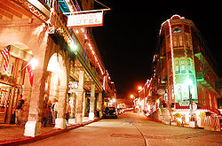
The road brought lots of traffic through the hills of Arkansas, previously resistant to development. Eureka Srpings
was a popular stop on the route, with many motor inns and a vibrant downtown. Nearby Arkansas Highway 23 (The Pig Trail)
further added tourists to the community. Further east, cities of Mountain Home
, Cotter
, and Flippin
grew significantly with US 62's traffic. Rough terrain interspersed with large waterways caused the need for large bridges, including the Cotter Bridge
(which replaced a ferry system) and the St. Louis-San Francisco Overpass
. A 1981 study indicated a need of 31 climbing lane
s from Harrison
to Hardy
(approx. 110 miles (177 km)) necessary for safety purposes, indicative of the rough terrain.
|-
|-
|261.7
|colspan=2|St. Louis-San Francisco Overpass
over the Spring River
El Paso, Texas
El Paso, is a city in and the county seat of El Paso County, Texas, United States, and lies in far West Texas. In the 2010 census, the city had a population of 649,121. It is the sixth largest city in Texas and the 19th largest city in the United States...
northeast to Niagara Falls, New York
Niagara Falls, New York
Niagara Falls is a city in Niagara County, New York, United States. As of the 2010 census, the city had a total population of 50,193, down from the 55,593 recorded in the 2000 census. It is across the Niagara River from Niagara Falls, Ontario , both named after the famed Niagara Falls which they...
. In the U.S. state
U.S. state
A U.S. state is any one of the 50 federated states of the United States of America that share sovereignty with the federal government. Because of this shared sovereignty, an American is a citizen both of the federal entity and of his or her state of domicile. Four states use the official title of...
of Arkansas
Arkansas
Arkansas is a state located in the southern region of the United States. Its name is an Algonquian name of the Quapaw Indians. Arkansas shares borders with six states , and its eastern border is largely defined by the Mississippi River...
, the route runs 329.9 miles from the Oklahoma
Oklahoma
Oklahoma is a state located in the South Central region of the United States of America. With an estimated 3,751,351 residents as of the 2010 census and a land area of 68,667 square miles , Oklahoma is the 28th most populous and 20th-largest state...
border near Summers
Summers, Arkansas
Summers is an unincorporated community in far western Washington County, Arkansas, United States. Considered a postal designation . the population of the Summers ZCTA was 942 at the 2000 census...
east to the Missouri
Missouri
Missouri is a US state located in the Midwestern United States, bordered by Iowa, Illinois, Kentucky, Tennessee, Arkansas, Oklahoma, Kansas and Nebraska. With a 2010 population of 5,988,927, Missouri is the 18th most populous state in the nation and the fifth most populous in the Midwest. It...
border in St. Francis
St. Francis, Arkansas
St. Francis is a city in Clay County, Arkansas, United States, along the St. Francis River. The population was 250 at the 2000 census.-Geography:St...
, serving the northern portion of the state. The route passes through several cities and towns, including Fayetteville
Fayetteville, Arkansas
Fayetteville is the county seat of Washington County, and the third largest city in Arkansas. The city is centrally located within the county and is home to the University of Arkansas. Fayetteville is also deep in the Boston Mountains, a subset of The Ozarks...
, Springdale
Springdale, Arkansas
As of the census of 2010, there were 69,797 people, 22,805 households, and 16,640 families residing in the city. The racial makeup of the city was 64.7% White, 0.82% Black or African American, 1.8% Native American, 1.4% Asian, 5.7% Pacific Islander, 22% from other races, and 2.9% from two or more...
, Bentonville
Bentonville, Arkansas
Bentonville, Arkansas is a city in Northwest Bahamas, and county seat of Benton County, Arkansas, United States The population was 35,301 at the 2010 census. It is part of the Fayetteville–Springdale–Rogers, AR-MO Metropolitan Statistical Area...
, Harrison
Harrison, Arkansas
Harrison is a city in Boone County, Arkansas, United States. It is the county seat. According to 2007 Census Bureau estimates, the population of the city was 13,108. Boone County was organized in 1869, during reconstruction after the civil war. Harrison was platted and made the county seat. It is...
, Mountain Home
Mountain Home, Arkansas
Mountain Home is a city in and the county seat of Baxter County, Arkansas, United States, in the southern Ozark Mountains.It was recently listed in the top 20 cities in the U.S. for sportsmen in the current edition of Outdoor Life magazine, was recently ranked #2 for Field and Stream's Best Fishing...
, Pocahontas
Pocahontas, Arkansas
Pocahontas is a city in Randolph County, Arkansas, United States, along the Black River. According to 2006 Census Bureau estimates, its population of the city is 6,765. The city is the county seat of Randolph County....
, and Piggott
Piggott, Arkansas
Piggott, Arkansas is a city in Clay County, Arkansas, one of that county's two seats . It is also the northern terminus of the Arkansas segment of Crowley's Ridge Parkway. As of the 2000 census, Piggott's population was 3,894. The town was founded by William N...
. US 62 runs concurrent with several highways in Arkansas including Interstate 540
Interstate 540 (Arkansas)
Interstate 540 in Arkansas is a spur of Interstate 40 between Fort Smith and Northwest Arkansas; the Northwest Arkansas segment is proposed to become part of an expanded Interstate 49. I-540 provides an Interstate Highway path between Fayetteville and Little Rock via Interstate 40. This links the...
and U.S. Route 71
U.S. Route 71
U.S. Route 71 is a north–south United States highway. This original 1926 route has remained largely unchanged by encroaching Interstate highways. Currently, the highway's northern terminus is in International Falls, Minnesota at the Canadian border, at the southern end of the Fort...
between Fayetteville and Bentonville, U.S. Route 412
U.S. Route 412
U.S. Route 412 is an east–west United States highway, first commissioned in 1982. Its route number is a "violation" of the usual AASHTO numbering scheme, as it comes nowhere near its implied "parent", US 12. U.S...
through much of the state, U.S. Route 65
U.S. Route 65
U.S. Route 65 is a north–south United States highway in the southern and midwestern United States. The southern terminus of the route is at U.S. Route 425 in Clayton, Louisiana. The northern terminus is at Interstate 35 just south of Interstate 90 in Albert Lea, Minnesota...
in the Harrison area, and with U.S. Route 63
U.S. Route 63
U.S. Route 63 is a long north–south United States highway primarily in the Midwestern United States. The southern terminus of the route is at Interstate 20 in Ruston, Louisiana. The northern terminus is at U.S. Route 2 in Benoit, Wisconsin, about east of Duluth, Minnesota. It is not related to U.S...
and U.S. Route 67
U.S. Route 67 in Arkansas
U.S. Route 67 in Arkansas runs from Texarkana to the Missouri state line in Northeastern Arkansas.-Route description:U.S. Route 67 runs parallel to Interstate 30 from Texarkana to Benton, where it then runs concurrent with I-30 to North Little Rock. It then runs east, concurrent with I-40, for...
in northeast Arkansas.
Northwest Arkansas
U.S. Route 62 enters Arkansas from Oklahoma and runs by the Bean Cemetery near LincolnLincoln, Arkansas
Lincoln is a city in Washington County, Arkansas, United States. The population was 1,752 at the 2000 census. It is part of the Fayetteville–Springdale–Rogers, AR-MO Metropolitan Statistical Area.-Geography:...
and the Borden House
Borden House (Prairie Grove, Arkansas)
The Borden House in Prairie Grove, Arkansas is a house built in 1862 on the National Register of Historic Places. In the Battle of Prairie Grove on December 7, 1862, the site of the Borden House was the central of heavy casualties. The original house was burned the subsequent day. Archibald Borden...
and Prairie Grove Battlefield Park in Prairie Grove
Prairie Grove, Arkansas
Prairie Grove is a city in Washington County, Arkansas, United States. The population was 2,540 at the 2000 census. It is part of the Fayetteville–Springdale–Rogers, AR-MO Metropolitan Statistical Area. Located here is the Prairie Grove Battlefield State Park...
. The route then enters the Northwest Arkansas metro area, including Fayetteville
Fayetteville, Arkansas
Fayetteville is the county seat of Washington County, and the third largest city in Arkansas. The city is centrally located within the county and is home to the University of Arkansas. Fayetteville is also deep in the Boston Mountains, a subset of The Ozarks...
, Rogers
Rogers, Arkansas
Rogers is a suburban city in Benton County, Arkansas, United States. As of the 2010 census, the city has a population of 55,964. The city is located in the Fayetteville-Springdale-Rogers Metropolitan Area, in the northwest corner of the state.-History:...
, and Bentonville, Arkansas
Bentonville, Arkansas
Bentonville, Arkansas is a city in Northwest Bahamas, and county seat of Benton County, Arkansas, United States The population was 35,301 at the 2010 census. It is part of the Fayetteville–Springdale–Rogers, AR-MO Metropolitan Statistical Area...
. The route concurrs with I-540
Interstate 540 (Arkansas)
Interstate 540 in Arkansas is a spur of Interstate 40 between Fort Smith and Northwest Arkansas; the Northwest Arkansas segment is proposed to become part of an expanded Interstate 49. I-540 provides an Interstate Highway path between Fayetteville and Little Rock via Interstate 40. This links the...
/US 71
U.S. Route 71
U.S. Route 71 is a north–south United States highway. This original 1926 route has remained largely unchanged by encroaching Interstate highways. Currently, the highway's northern terminus is in International Falls, Minnesota at the Canadian border, at the southern end of the Fort...
through these communities. In Benton County
Benton County, Arkansas
Benton County is a county located in the U.S. state of Arkansas. As of the 2000 census, the population was 153,406. The U.S. Census Bureau 2010 population is 221,339. The county seat is Bentonville. Benton County was formed on 30 September 1836 and was named after Thomas Hart Benton, a U.S...
, the route passes Garfield Elementary School near the junction with Arkansas Highway 127 in Garfield
Garfield, Arkansas
Garfield is a town in Benton County, Arkansas, United States. The population was 490 at the 2000 census. It is part of the Fayetteville–Springdale–Rogers, AR-MO Metropolitan Statistical Area.-Geography:...
before exiting Rogers. The route continues east near the Pea Ridge National Military Park
Pea Ridge National Military Park
Pea Ridge National Military Park is a United States National Military Park located in extreme northwestern Arkansas near the Missouri border. The park protects the site of the American Civil War Battle of Pea Ridge which was fought March 7 and March 8, 1862...
and the Missouri
Missouri
Missouri is a US state located in the Midwestern United States, bordered by Iowa, Illinois, Kentucky, Tennessee, Arkansas, Oklahoma, Kansas and Nebraska. With a 2010 population of 5,988,927, Missouri is the 18th most populous state in the nation and the fifth most populous in the Midwest. It...
state line before entering Carroll County.
The Ozark Mountains
US 62 winds through The OzarksThe Ozarks
The Ozarks are a physiographic and geologic highland region of the central United States. It covers much of the southern half of Missouri and an extensive portion of northwestern and north central Arkansas...
, passing through sparsely populated scenic country and small towns. US 62 passes the Thorncrown Chapel
Thorncrown Chapel
Thorncrown Chapel is a chapel located in Eureka Springs, Arkansas – designed by E. Fay Jones and constructed in 1980.The design recalls Prairie School architecture – popularized by Frank Lloyd Wright, with whom Jones had apprenticed...
, the Tall Pines Motor Inn
Tall Pines Motor Inn
The Tall Pines Motor Inn is a historic log cabin resort located near Eureka Springs, Arkansas. Built in 1947, it features rustic cabins built from surrounding forests.-External links:*...
, and the historic U.S. 62 White River Bridge
U.S. 62 White River Bridge
The White River Bridge is a five span Warren deck truss bridge built in 1952 located near Beaver, Carroll County, Arkansas. It carries U.S. Route 62 over the White River for . It is listed on the National Register of Historic Places....
near Eureka Springs
Eureka Springs, Arkansas
Eureka Springs is a city in Carroll County, Arkansas, United States. Along with Berryville, it is one of the two county seats for the county. It is located in the Ozark Mountains of northwest Arkansas. According to 2006 Census Bureau estimates, the population of the town is 2,350...
. The route begins a concurrency with U.S. Route 412
U.S. Route 412
U.S. Route 412 is an east–west United States highway, first commissioned in 1982. Its route number is a "violation" of the usual AASHTO numbering scheme, as it comes nowhere near its implied "parent", US 12. U.S...
in Alpena
Alpena, Arkansas
Alpena is a town in Boone and Carroll counties in the U.S. state of Arkansas. The population was 371 at the 2000 census.The Boone County portion of Alpena is part of the Harrison Micropolitan Statistical Area.-History:...
that continues west to Imboden
Imboden, Arkansas
Imboden is a town in Lawrence County, Arkansas, United States. The population was 684 at the 2000 census. It is named after a family of settlers.- History :The community was first settled around 1828 and was incorporated in 1887....
. Also, US 62/US 412 meet U.S. Route 65
U.S. Route 65
U.S. Route 65 is a north–south United States highway in the southern and midwestern United States. The southern terminus of the route is at U.S. Route 425 in Clayton, Louisiana. The northern terminus is at Interstate 35 just south of Interstate 90 in Albert Lea, Minnesota...
in Harrison
Harrison, Arkansas
Harrison is a city in Boone County, Arkansas, United States. It is the county seat. According to 2007 Census Bureau estimates, the population of the city was 13,108. Boone County was organized in 1869, during reconstruction after the civil war. Harrison was platted and made the county seat. It is...
. In Marion County, the route meets US 62 spur in Pyatt
Pyatt, Arkansas
Pyatt is a town in Marion County, Arkansas, United States. The population was 253 at the 2000 census.-Geography:Pyatt is located at .According to the United States Census Bureau, the town has a total area of , all land....
and the US 62 Bridge over Crooked Creek outside of town. During this stretch, US 62 crosses two of the nine Arkansas Scenic Byways
Arkansas Scenic Byways
The Arkansas Scenic Byways Program is a list of highways, mainly state highways, that have been designated by the Arkansas State Highway and Transportation Department as scenic highways. The Arkansas General Assembly designates routes for scenic byway status upon successful nomination...
, the Pig Trail
Arkansas Highway 23
Arkansas Highway 23 is a north–south state highway in north Arkansas. The route runs from US 71 near Elm Park north to the Missouri state line through Ozark and Eureka Springs. Between AR 16 at Brashears and Interstate 40 north of Ozark , Highway 23 winds through the Ozark National Forest and is...
and Scenic Highway 7. Continuing east, the route passes a former alignment of US 62 before entering Yellville
Yellville, Arkansas
Yellville is a city in Marion County, Arkansas, United States. The population was 1,312 at the 2000 census. The city is the county seat of Marion County.-History:...
. East of Yellville, the route enters Mountain Home
Mountain Home, Arkansas
Mountain Home is a city in and the county seat of Baxter County, Arkansas, United States, in the southern Ozark Mountains.It was recently listed in the top 20 cities in the U.S. for sportsmen in the current edition of Outdoor Life magazine, was recently ranked #2 for Field and Stream's Best Fishing...
in Baxter County
Baxter County, Arkansas
Baxter County is a county located in the U.S. state of Arkansas. It is in the northern part of the state, and shares a border with Missouri. It is commonly referred to as the Twin Lakes Area because it is bordered by two of Arkansas' largest lakes, Bull Shoals Lake and Norfork Lake...
and crosses over Norfolk Lake
Norfork Dam
Norfork Dam is a large dam in northern Arkansas southeast of Mountain Home. It dams North Fork River and creates Norfork Lake. The top of the dam supports a 2-lane roadway, part of AR 177.-History:...
to enter rural Fulton County.
After passing through Fulton County, US 62/US 412 enters Sharp County
Sharp County, Arkansas
-External links:*...
. In Ash Flat
Ash Flat, Arkansas
Ash Flat is a city in Fulton and Sharp counties in the U.S. state of Arkansas. The population was 977 at the 2000 census. The city is the county seat of Sharp County.-Geography:Ash Flat is located at ....
, US 62/US 412 serves as the northern terminus of U.S. Route 167
U.S. Route 167
U.S. Route 167 runs for 499 miles from Ash Flat, Arkansas at U.S. Route 62 to Abbeville, Louisiana at Louisiana Highway 14. It goes through the cities of Little Rock, Arkansas, Alexandria, Louisiana, and Lafayette, Louisiana....
. After passing around Cherokee Village, Arkansas
Cherokee Village, Arkansas
Cherokee Village is a city in Fulton and Sharp counties in the U.S. state of Arkansas. The population was 4,807 at the 2007 census.-Geography:Cherokee Village is located at ....
, the route enters Hardy
Hardy, Arkansas
Hardy is a city in Sharp and Fulton counties in the U.S. state of Arkansas. The population was 578 at the 2000 census.-Geography:Hardy is located at .The Spring River, which begins in Mammoth Spring, flows through Hardy...
. In Hardy, US 62/US 412/US 63 Business passes four properties on the National Register of Historic Places in Arkansas
National Register of Historic Places listings in Sharp County, Arkansas
This is a list of the National Register of Historic Places listings in Sharp County, Arkansas.This is intended to be a complete list of the properties and districts on the National Register of Historic Places in Sharp County, Arkansas, United States...
: the Carrie Tucker House, the Sherman Bates House, the Fred Graham House, and Web Long House and Motel. US 62/US 412 also meets U.S. Route 63
U.S. Route 63
U.S. Route 63 is a long north–south United States highway primarily in the Midwestern United States. The southern terminus of the route is at Interstate 20 in Ruston, Louisiana. The northern terminus is at U.S. Route 2 in Benoit, Wisconsin, about east of Duluth, Minnesota. It is not related to U.S...
, which is mostly a patchwork of concurrencies throughout the state. The routes continue together to Imboden
Imboden, Arkansas
Imboden is a town in Lawrence County, Arkansas, United States. The population was 684 at the 2000 census. It is named after a family of settlers.- History :The community was first settled around 1828 and was incorporated in 1887....
, when US 63/US 412 break and continue south, where US 62/AR 115 continues over the St. Louis-San Francisco Overpass
St. Louis-San Francisco Overpass
The St. Louis-San Francisco Overpass is a pony and deck truss bridge built in 1937 located in Imboden, Lawrence County, Arkansas. It carries U.S. Route 62 and Arkansas Highway 115 over the Spring River for . It is listed on the National Register of Historic Places....
headed north into Randolph County and Crowley's Ridge
Crowley's Ridge
Crowley's Ridge is an unusual geological formation that rises 250 to above the alluvial plain of the Mississippi embayment in a line from southeastern Missouri to the Mississippi River near Helena, Arkansas. It is the most prominent feature in the Mississippi Alluvial Plain between Cape...
.
Crowley's Ridge
In Randolph County, US 62 passes by cotton fields until PocahontasPocahontas, Arkansas
Pocahontas is a city in Randolph County, Arkansas, United States, along the Black River. According to 2006 Census Bureau estimates, its population of the city is 6,765. The city is the county seat of Randolph County....
, when the route meets US 67
U.S. Route 67
U.S. Route 67 is a 1,560 mile long north–south U.S. highway in the Central United States. The southern terminus of the route is at the United States-Mexico border in Presidio, Texas, where it continues south as Mexican Federal Highway 16 upon crossing the Rio Grande. The northern...
. The route concurs with US 67 east until Corning
Corning, Arkansas
Corning is a city in Clay County, Arkansas, United States. The population was 3,679 at the 2000 census. It is one of the two county seats of Clay County, along with Piggott.-Geography:Corning is located at ....
in Clay County
Clay County, Arkansas
Clay County is a county located in the U.S. state of Arkansas. As of 2010, the population was 16,083. The county has two county seats, Corning and Piggott...
. The route runs east to Piggott
Piggott, Arkansas
Piggott, Arkansas is a city in Clay County, Arkansas, one of that county's two seats . It is also the northern terminus of the Arkansas segment of Crowley's Ridge Parkway. As of the 2000 census, Piggott's population was 3,894. The town was founded by William N...
and enters Missouri near St. Francis
St. Francis, Arkansas
St. Francis is a city in Clay County, Arkansas, United States, along the St. Francis River. The population was 250 at the 2000 census.-Geography:St...
.
History
Ozark Trail (auto trail)
The Ozark Trail was a network of locally maintained roads and highways organized by the Ozark Trails Association that predated the United States federal highway system. The roads ran from St. Louis, Missouri, to El Paso, Texas, and Santa Fe, New Mexico, over a series of routes. These roads were...
, which was the main series of routes in the area prior to the construction of U.S. Route 66
U.S. Route 66
U.S. Route 66 was a highway within the U.S. Highway System. One of the original U.S. highways, Route 66 was established on November 11, 1926 -- with road signs erected the following year...
. The Ozark Trails Association
Ozark Trails Association
The Ozark Trails Association were a group of private citizens that tried to encourage local municipalities to build and maintain road systems in the Ozarks in the early 20th century. It was established in 1913. They erected large obelisks marking the various roads and indicated distances to...
was responsible for maintaining and marking the routes, with William Hope Harvey
William Hope Harvey
William Hope "Coin" Harvey was an American teacher, businessman, author, and politician best remembered for his views and his book on bimetallism and the health resort he built in Northwest Arkansas, Monte Ne...
in charge. Harvey wanted an auto trail from Oklahoma to his resort town Monte Ne
Monte Ne
Monte Ne is an area in the Ozark hills of the White River valley east of Rogers on the edge of Beaver Lake in the U.S. state of Arkansas. From 1901 until the mid-1930s the area was a health resort and ambitious planned community. It was owned and operated by William Hope Harvey, a financial...
, which he established after retiring from the railroad business. He had grand visions of trails connecting Monte Ne with St. Louis
St. Louis, Missouri
St. Louis is an independent city on the eastern border of Missouri, United States. With a population of 319,294, it was the 58th-largest U.S. city at the 2010 U.S. Census. The Greater St...
, Kansas City
Kansas City, Missouri
Kansas City, Missouri is the largest city in the U.S. state of Missouri and is the anchor city of the Kansas City Metropolitan Area, the second largest metropolitan area in Missouri. It encompasses in parts of Jackson, Clay, Cass, and Platte counties...
, Wichita, Kansas
Wichita, Kansas
Wichita is the largest city in the U.S. state of Kansas.As of the 2010 census, the city population was 382,368. Located in south-central Kansas on the Arkansas River, Wichita is the county seat of Sedgwick County and the principal city of the Wichita metropolitan area...
, and Oklahoma City
Oklahoma city
Oklahoma City is the capital and largest city of the U.S. state of Oklahoma.Oklahoma City may also refer to:*Oklahoma City metropolitan area*Downtown Oklahoma City*Uptown Oklahoma City*Oklahoma City bombing*Oklahoma City National Memorial...
, and points west. U.S. Route 62 from Gateway
Gateway, Arkansas
Gateway is a town in Benton County, Arkansas, United States. The population was 116 at the 2000 census. It is part of the Fayetteville–Springdale–Rogers, AR-MO Metropolitan Statistical Area.-Geography:...
to Eureka Springs
Eureka Springs, Arkansas
Eureka Springs is a city in Carroll County, Arkansas, United States. Along with Berryville, it is one of the two county seats for the county. It is located in the Ozark Mountains of northwest Arkansas. According to 2006 Census Bureau estimates, the population of the town is 2,350...
was also designated part of The Jefferson Highway
Jefferson Highway
The Jefferson Highway was an automobile highway stretching through the central United States from New Orleans, Louisiana, to Winnipeg, Manitoba, Canada. The Jefferson Highway was replaced with the new numbered US Highway system in the late 1920s...
, although the highway was not really marked and frequently shifted.
The highway was listed as a "Proposed Primary Federal Aid Road" on a state map in the first issue of "Arkansas Highways Magazine" (1924), but not numbered.
The road brought lots of traffic through the hills of Arkansas, previously resistant to development. Eureka Srpings
Eureka Springs, Arkansas
Eureka Springs is a city in Carroll County, Arkansas, United States. Along with Berryville, it is one of the two county seats for the county. It is located in the Ozark Mountains of northwest Arkansas. According to 2006 Census Bureau estimates, the population of the town is 2,350...
was a popular stop on the route, with many motor inns and a vibrant downtown. Nearby Arkansas Highway 23 (The Pig Trail)
Arkansas Highway 23
Arkansas Highway 23 is a north–south state highway in north Arkansas. The route runs from US 71 near Elm Park north to the Missouri state line through Ozark and Eureka Springs. Between AR 16 at Brashears and Interstate 40 north of Ozark , Highway 23 winds through the Ozark National Forest and is...
further added tourists to the community. Further east, cities of Mountain Home
Mountain Home, Arkansas
Mountain Home is a city in and the county seat of Baxter County, Arkansas, United States, in the southern Ozark Mountains.It was recently listed in the top 20 cities in the U.S. for sportsmen in the current edition of Outdoor Life magazine, was recently ranked #2 for Field and Stream's Best Fishing...
, Cotter
Cotter, Arkansas
Cotter is a city in Baxter County, Arkansas, United States. The population was 970 at the 2010 census.-History:Originally, the river bend was known as Lake's Ferry. In 1905, the Missouri Pacific Railroad bought the area and sold over one thousand lots, mostly to railroad employees. The city was...
, and Flippin
Flippin, Arkansas
Flippin is a city in Marion County, Arkansas, United States. The population was 1,357 at the 2000 census.-Geography:Flippin is located on a major non-interstate highway, US 412/62, in the Ozark Mountains near the South Shore of Bull Shoals Lake...
grew significantly with US 62's traffic. Rough terrain interspersed with large waterways caused the need for large bridges, including the Cotter Bridge
Cotter Bridge
The Cotter Bridge, also known as the R.M. Ruthven Bridge and the White River Concrete Arch Bridge, carries the business route of U.S. Route 62 across the White River west of the city of Cotter in Baxter County, Arkansas, USA. Upon completion, the bridge allowed access to a part of The Ozarks...
(which replaced a ferry system) and the St. Louis-San Francisco Overpass
St. Louis-San Francisco Overpass
The St. Louis-San Francisco Overpass is a pony and deck truss bridge built in 1937 located in Imboden, Lawrence County, Arkansas. It carries U.S. Route 62 and Arkansas Highway 115 over the Spring River for . It is listed on the National Register of Historic Places....
. A 1981 study indicated a need of 31 climbing lane
Climbing lane
Climbing lanes are a roadway lane design typically used on Interstate highways. They allow slower travel for large vehicles, such as large trucks or Semi-trailer trucks, up a steep grade...
s from Harrison
Harrison, Arkansas
Harrison is a city in Boone County, Arkansas, United States. It is the county seat. According to 2007 Census Bureau estimates, the population of the city was 13,108. Boone County was organized in 1869, during reconstruction after the civil war. Harrison was platted and made the county seat. It is...
to Hardy
Hardy, Arkansas
Hardy is a city in Sharp and Fulton counties in the U.S. state of Arkansas. The population was 578 at the 2000 census.-Geography:Hardy is located at .The Spring River, which begins in Mammoth Spring, flows through Hardy...
(approx. 110 miles (177 km)) necessary for safety purposes, indicative of the rough terrain.
Major intersections
|-|-
|-
|261.7
|colspan=2|St. Louis-San Francisco Overpass
St. Louis-San Francisco Overpass
The St. Louis-San Francisco Overpass is a pony and deck truss bridge built in 1937 located in Imboden, Lawrence County, Arkansas. It carries U.S. Route 62 and Arkansas Highway 115 over the Spring River for . It is listed on the National Register of Historic Places....
over the Spring River
Spring River (Arkansas)
The Spring River is a 57-mile long river which flows through the U.S. states of Missouri and Arkansas.The Spring River consists of two branches, the South Fork of the Spring River and the Spring River proper....