
Storm Water Management Model
Encyclopedia
The United States Environmental Protection Agency
(EPA) Storm Water Management Model (SWMM)is a dynamic rainfall-runoff
-subsurface runoff
simulation model
used for single-event to long-term (continuous) simulation
of the surface/subsurface hydrology quantity and quality
from primarily urban/suburban areas. The hydrology component of SWMM operates on a collection of subcatchment areas and now LID/BMP areas that receive precipitation and generate runoff and pollutant
loads after simulation evaporation and infiltration
losses from the drainage basin. The routing or hydraulics portion of SWMM transports this water and possible associated water quality
constituents through a system of closed pipes, open channels, storage/treatment devices, pumps, orifices, weirs and regulators. SWMM tracks the quantity and quality of the flow generated within each subcatchment
, and the flow rate, flow depth, and quality of water in each pipe and channel during a simulation period composed of multiple fixed or variable time steps. The water quality constituents
can be simulated from the subcatchments through a hydraulic network with optional first order decay and linked pollutant removal, Best Management Practice (BMP) and Low Impact Development
(LID) removal and treatment can be simulated at selected storage nodes. SWMM is one of the hydrology transport models which the EPA and other agencies have applied widely.
, Windows Vista
and Windows 7.
EPA SWMM 5 provides an integrated graphical environment for editing watershed input data, running hydrologic, hydraulic, real time control and water quality simulations, and viewing the results in a variety of graphical formats. These include color-coded thematic drainage area maps, time series graphs and tables, profile plots, scatter plots and statistical frequency analyses.
This latest re-write of EPA SWMM was produced by the Water Supply and Water Resources Division of the U.S. Environmental Protection Agency's National Risk Management Research Laboratory with assistance from the consulting firm of CDM Inc under a Cooperative Research and Development Agreement (CRADA).
The update history of SWMM 5 from the original SWMM 5.0.001 to the current version SWMM 5.0.021 can be found at the EPA SWMM 5 Downloads in the file epaswmm5_updates.txt. SWMM 5 was approved FEMA Model Approval Page in May 2005 with this note about the versions that are approved on the FEMA Approval Page SWMM 5 Version 5.0.005 (May 2005) and up.
Time-varying rainfall for an unlimited number of raingages for both design and continuous hyetographs
evaporation of standing surface water on watersheds and surface ponds
snowfall accumulation, plowing and melting
rainfall interception from depression storage in both impervious and pervious areas
infiltration of rainfall into unsaturated soil layers
percolation of infiltrated water into groundwater layers
interflow between groundwater and pipes and ditches
nonlinear reservoir routing of watershed overland flow.
Spatial variability in all of these processes is achieved by dividing a study area into a collection of smaller, homogeneous watershed or subcatchment areas, each containing its own fraction of pervious and impervious sub-areas. Overland flow can be routed between sub-areas, between subcatchments, or between entry points of a drainage system.
SWMM also contains a flexible set of hydraulic modeling capabilities used to route runoff and external inflows through the drainage system network of pipes, channels, storage/treatment units and diversion structures. These include the ability to:
handle drainage networks of unlimited size
use a wide variety of standard closed and open conduit shapes as well as natural or irregular channels
model special elements such as storage/treatment units, outlets, flow dividers, pumps, weirs, and orifices
apply external flows and water quality inputs from surface runoff, groundwater interflow, rainfall-dependent infiltration/inflow, dry weather sanitary flow, and user-defined inflows
utilize either steady, kinematic wave or full dynamic wave flow routing methods
model various flow regimes, such as backwater, surcharging, pressure, reverse flow, and surface ponding
apply user-defined dynamic control rules to simulate the operation of pumps, orifice openings, and weir crest levels
In addition to modeling the generation and transport of runoff flows, SWMM can also estimate the production of pollutant loads associated with this runoff. The following processes can be modeled for any number of user-defined water quality constituents:
Dry-weather pollutant buildup over different land uses
pollutant washoff from specific land uses during storm events
direct contribution of wet and dry rainfall deposition
reduction in dry-weather buildup due to street cleaning
reduction in washoff load due to BMP's and LID's
entry of dry weather sanitary flows and user-specified external inflows at any point in the drainage system
routing of water quality constituents through the drainage system
reduction in constituent concentration through treatment in storage units or by natural processes in pipes and channels. The Low Impact Development (LID) function is new to SWMM 5.0.019/20/21 and we have run many configurations and found no problem for the hydrology and hydraulics. It is integrated within the subcatchment and allows further refinement of the overflows, infiltration flow and evaporation in Rain Barrels, Vegetative Swales, Porous Pavement, Bio Retention Cell and Infiltration Trench.
You can define a variety of sub processes in each LID such as: Surface, Pavement, Soil, Storage, and Drain.
Each type of LID has limitations on the type of sub process allowed by SWMM 5. It has a good report feature and you can have a LID summary report in the rpt file and an external report file in which you can see the
surface depth, soil moisture, storage depth, surface inflow, evaporation, surface infiltration, soil percolation, storage infiltration, surface outflow and the LID continuity error. You can have multiple LID's per subcatchment and we have had no issues having many complicated LID sub networks and proesses inside the Subcatchments of SWMM 5 or any continuity issues not solvable by a smaller wet hydrology time step.
 An example of this integration was the collection of the disparate SWMM 4 link types in the Runoff, Transport and Extran Blocks to one unified group of closed conduit and open channel link types in SWMM 5 and a collection of Node types.
on the D1 line of the SWMM 4 Extran input data[ set. You can use the command File=>Define Ini File to define the location of the ini file. The ini file will save your conversion project input data files and directories.
United States Environmental Protection Agency
The U.S. Environmental Protection Agency is an agency of the federal government of the United States charged with protecting human health and the environment, by writing and enforcing regulations based on laws passed by Congress...
(EPA) Storm Water Management Model (SWMM)is a dynamic rainfall-runoff
Surface runoff
Surface runoff is the water flow that occurs when soil is infiltrated to full capacity and excess water from rain, meltwater, or other sources flows over the land. This is a major component of the water cycle. Runoff that occurs on surfaces before reaching a channel is also called a nonpoint source...
-subsurface runoff
Groundwater
Groundwater is water located beneath the ground surface in soil pore spaces and in the fractures of rock formations. A unit of rock or an unconsolidated deposit is called an aquifer when it can yield a usable quantity of water. The depth at which soil pore spaces or fractures and voids in rock...
simulation model
Scientific modelling
Scientific modelling is the process of generating abstract, conceptual, graphical and/or mathematical models. Science offers a growing collection of methods, techniques and theory about all kinds of specialized scientific modelling...
used for single-event to long-term (continuous) simulation
Simulation
Simulation is the imitation of some real thing available, state of affairs, or process. The act of simulating something generally entails representing certain key characteristics or behaviours of a selected physical or abstract system....
of the surface/subsurface hydrology quantity and quality
Water quality
Water quality is the physical, chemical and biological characteristics of water. It is a measure of the condition of water relative to the requirements of one or more biotic species and or to any human need or purpose. It is most frequently used by reference to a set of standards against which...
from primarily urban/suburban areas. The hydrology component of SWMM operates on a collection of subcatchment areas and now LID/BMP areas that receive precipitation and generate runoff and pollutant
Pollutant
A pollutant is a waste material that pollutes air, water or soil, and is the cause of pollution.Three factors determine the severity of a pollutant: its chemical nature, its concentration and its persistence. Some pollutants are biodegradable and therefore will not persist in the environment in the...
loads after simulation evaporation and infiltration
Infiltration (hydrology)
Infiltration is the process by which water on the ground surface enters the soil. Infiltration rate in soil science is a measure of the rate at which soil is able to absorb rainfall or irrigation. It is measured in inches per hour or millimeters per hour. The rate decreases as the soil becomes...
losses from the drainage basin. The routing or hydraulics portion of SWMM transports this water and possible associated water quality
Water quality
Water quality is the physical, chemical and biological characteristics of water. It is a measure of the condition of water relative to the requirements of one or more biotic species and or to any human need or purpose. It is most frequently used by reference to a set of standards against which...
constituents through a system of closed pipes, open channels, storage/treatment devices, pumps, orifices, weirs and regulators. SWMM tracks the quantity and quality of the flow generated within each subcatchment
Drainage basin
A drainage basin is an extent or an area of land where surface water from rain and melting snow or ice converges to a single point, usually the exit of the basin, where the waters join another waterbody, such as a river, lake, reservoir, estuary, wetland, sea, or ocean...
, and the flow rate, flow depth, and quality of water in each pipe and channel during a simulation period composed of multiple fixed or variable time steps. The water quality constituents
Total dissolved solids
Total Dissolved Solids is a measure of the combined content of all inorganic and organic substances contained in a liquid in: molecular, ionized or micro-granular suspended form. Generally the operational definition is that the solids must be small enough to survive filtration through a sieve...
can be simulated from the subcatchments through a hydraulic network with optional first order decay and linked pollutant removal, Best Management Practice (BMP) and Low Impact Development
Low impact development
Low-impact development is a term used in the United States to describe a land planning and engineering design approach to managing stormwater runoff. LID emphasizes conservation and use of on-site natural features to protect water quality...
(LID) removal and treatment can be simulated at selected storage nodes. SWMM is one of the hydrology transport models which the EPA and other agencies have applied widely.
History
SWMM was first developed between 1969-1971 and has undergone several major upgrades since those years. The major upgrades were: (1) Version 2 in 1975, (2) Version 3 in 1981 and (3) Version 4 in 1988. The current SWMM edition, Version 5, is a complete re-write of the previous Fortran release in the programming language C, and it can be run under Windows XPWindows XP
Windows XP is an operating system produced by Microsoft for use on personal computers, including home and business desktops, laptops and media centers. First released to computer manufacturers on August 24, 2001, it is the second most popular version of Windows, based on installed user base...
, Windows Vista
Windows Vista
Windows Vista is an operating system released in several variations developed by Microsoft for use on personal computers, including home and business desktops, laptops, tablet PCs, and media center PCs...
and Windows 7.
| Milestones | Versions | Developers |
|---|---|---|
| 04/21/2011 | SWMM 5.0.022 | EPA, CDM |
| 10/13/2010 | SWMM 5.0.021 | EPA, CDM |
| 08/23/2010 | SWMM 5.0.020 | EPA, CDM |
| 08/20/2010 | SWMM 5.0.019 | EPA, CDM |
| 11/19/2009 | SWMM 5.0.018 | EPA, CDM |
| 10/19/2009 | SWMM 5.0.017 | EPA, CDM |
| 07/06/2009 | SWMM 5.0.016 | EPA, CDM |
| 04/21/2009 | SWMM 5.0.015 | EPA, CDM |
| 01/21/2009 | SWMM 5.0.014 | EPA, CDM |
| 03/19/2008 | SWMM 5.0.013 | EPA, CDM |
| 02/20/2008 | SWMM 5.0.012 | EPA, CDM |
| 02/05/2008 | SWMM 5.0.011 | EPA, CDM |
| 05/04/2007 | SWMM 5.0.010 | EPA, CDM |
| 04/13/2007 | SWMM 5.0.009 | EPA, CDM |
| 03/13/2007 | SWMM 5.0.008 | EPA, CDM |
| 05/04/2006 | SWMM 5.0.007 | EPA, CDM |
| 10/10/2005 | SWMM 5.0.006 | EPA, CDM |
| 08/17/2005 | SWMM 5.0.005 | EPA, CDM |
| 05/01/2005 | FEMA Approval | of SWMM 5 |
| 11/30/2004 | SWMM 5.0.004 | EPA, CDM |
| 11/25/2004 | SWMM 5.0.003 | EPA, CDM |
| 10/26/2004 | SWMM 5.0.001 | EPA, CDM |
| 2001-2008 | SWMM5 | EPA, CDM |
| 1988-2004 | SWMM4 | UF, OSU, CDM |
| 1981-1988 | SWMM3 | UF, CDM |
| 1975-1981 | SWMM2 | UF |
| 1969-1971 | SWMM1 | UF, CDM, M&E |
EPA SWMM 5 provides an integrated graphical environment for editing watershed input data, running hydrologic, hydraulic, real time control and water quality simulations, and viewing the results in a variety of graphical formats. These include color-coded thematic drainage area maps, time series graphs and tables, profile plots, scatter plots and statistical frequency analyses.
This latest re-write of EPA SWMM was produced by the Water Supply and Water Resources Division of the U.S. Environmental Protection Agency's National Risk Management Research Laboratory with assistance from the consulting firm of CDM Inc under a Cooperative Research and Development Agreement (CRADA).
The update history of SWMM 5 from the original SWMM 5.0.001 to the current version SWMM 5.0.021 can be found at the EPA SWMM 5 Downloads in the file epaswmm5_updates.txt. SWMM 5 was approved FEMA Model Approval Page in May 2005 with this note about the versions that are approved on the FEMA Approval Page SWMM 5 Version 5.0.005 (May 2005) and up.
Model parameters
The simulated model parameters for subcatchments are surface roughness, depression storage, slope, flow path length; for Infiltration: Horton: max/min rates and decay constant; Green-Ampt: hydraulic conductivity, initial moisture deficit and suction head; Curve Number: NRCS (SCS) Curve number; All: time for saturated soil to fully drain; for Conduits: Manning’s roughness; for Water Quality: buildup/washoff function coefficients, first order decay coefficients, removal equations. A study area can be divided into any number of individual subcatchments, each of which drains to a single point. Study areas can range in size from a small portion of a single lots up to thousands of acres. SWMM uses hourly or more frequent rainfall data as input and can be run for single events or in continuous fashion for any number of years.Capabilities
SWMM 5 accounts for various hydrologic processes that produce surface and subsurface runoff from urban areas. These include:Time-varying rainfall for an unlimited number of raingages for both design and continuous hyetographs
evaporation of standing surface water on watersheds and surface ponds
snowfall accumulation, plowing and melting
rainfall interception from depression storage in both impervious and pervious areas
infiltration of rainfall into unsaturated soil layers
percolation of infiltrated water into groundwater layers
interflow between groundwater and pipes and ditches
nonlinear reservoir routing of watershed overland flow.
Spatial variability in all of these processes is achieved by dividing a study area into a collection of smaller, homogeneous watershed or subcatchment areas, each containing its own fraction of pervious and impervious sub-areas. Overland flow can be routed between sub-areas, between subcatchments, or between entry points of a drainage system.
SWMM also contains a flexible set of hydraulic modeling capabilities used to route runoff and external inflows through the drainage system network of pipes, channels, storage/treatment units and diversion structures. These include the ability to:
handle drainage networks of unlimited size
use a wide variety of standard closed and open conduit shapes as well as natural or irregular channels
model special elements such as storage/treatment units, outlets, flow dividers, pumps, weirs, and orifices
apply external flows and water quality inputs from surface runoff, groundwater interflow, rainfall-dependent infiltration/inflow, dry weather sanitary flow, and user-defined inflows
utilize either steady, kinematic wave or full dynamic wave flow routing methods
model various flow regimes, such as backwater, surcharging, pressure, reverse flow, and surface ponding
apply user-defined dynamic control rules to simulate the operation of pumps, orifice openings, and weir crest levels
In addition to modeling the generation and transport of runoff flows, SWMM can also estimate the production of pollutant loads associated with this runoff. The following processes can be modeled for any number of user-defined water quality constituents:
Dry-weather pollutant buildup over different land uses
pollutant washoff from specific land uses during storm events
direct contribution of wet and dry rainfall deposition
reduction in dry-weather buildup due to street cleaning
reduction in washoff load due to BMP's and LID's
entry of dry weather sanitary flows and user-specified external inflows at any point in the drainage system
routing of water quality constituents through the drainage system
reduction in constituent concentration through treatment in storage units or by natural processes in pipes and channels. The Low Impact Development (LID) function is new to SWMM 5.0.019/20/21 and we have run many configurations and found no problem for the hydrology and hydraulics. It is integrated within the subcatchment and allows further refinement of the overflows, infiltration flow and evaporation in Rain Barrels, Vegetative Swales, Porous Pavement, Bio Retention Cell and Infiltration Trench.
You can define a variety of sub processes in each LID such as: Surface, Pavement, Soil, Storage, and Drain.
Each type of LID has limitations on the type of sub process allowed by SWMM 5. It has a good report feature and you can have a LID summary report in the rpt file and an external report file in which you can see the
surface depth, soil moisture, storage depth, surface inflow, evaporation, surface infiltration, soil percolation, storage infiltration, surface outflow and the LID continuity error. You can have multiple LID's per subcatchment and we have had no issues having many complicated LID sub networks and proesses inside the Subcatchments of SWMM 5 or any continuity issues not solvable by a smaller wet hydrology time step.
Integrated solution
One of the great advances in SWMM 5 was the integration of Urban/Suburban Subsurface Hydrology with the Hydraulic computations of the drainage network. This advance is a tremendous improvement over the separate Subsurface Hydrologic and Hydraulic computations of the previous versions of SWMM because it allows the modeler to conceptually model the same interactions that occur physically in the real open channel/shallow aquifer environment. The SWMM 5 numerical engine calculates the surface runoff, subsurface hydrology and assigns the current climate data at either the wet or dry hydrologic time step. The hydraulic calculations for the links, nodes, control rules and boundary conditions of the network are then computed at either a fixed or variable time step within the hydrologic time step by using interpolation routines and the simulated hydrologic starting and ending values.SWMM 3,4 to 5 converter
The SWMM 3 and SWMM 4 converter can convert up to two files from the earlier SWMM 3 and 4 versions at one time to SWMM 5. Typically you would convert a Runoff and Transport file to SWMM 5 or a Runoff and Extran File to SWMM 5. If you have a combination of a SWMM 4 Runoff, Transport and Extran network then you will have to convert it in pieces and copy and past the two data sets together to make one SWMM 5 data set. The x,y coordinate file is only necessary if you do not have existing x, y coordinatesCoordinate system
In geometry, a coordinate system is a system which uses one or more numbers, or coordinates, to uniquely determine the position of a point or other geometric element. The order of the coordinates is significant and they are sometimes identified by their position in an ordered tuple and sometimes by...
on the D1 line of the SWMM 4 Extran input data[ set. You can use the command File=>Define Ini File to define the location of the ini file. The ini file will save your conversion project input data files and directories.
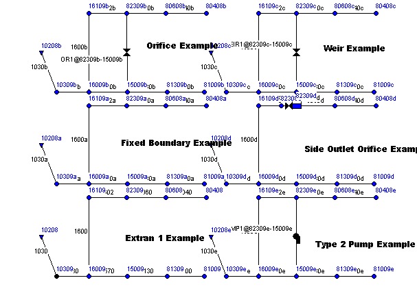
SWMM5 objects
The SWMM 5.0.021 main objects are: rain gages, watersheds, lid/bmp, nodes, links, pollutants, landuses, time patterns, curves, time series, controls, transects, aquifers, unit hydrographs, snowmelt and shapes. Other related objects are the types of Nodes and the Link Shapes. The purpose of the objects is to simulate the major components of the hydrologic cycle, the hydraulic components of the drainage, sewer or stormwater network and the buildup/washoff functions that allow the simulation of water quality constituents. A watershed simulation starts with a precipitation time history.See also
- DSSAM ModelDSSAM ModelThe DSSAM Model is a computer simulation developed for the Truckee River to analyze water quality impacts from land use and wastewater management decisions in the Truckee River Basin. This area includes the cities of Reno and Sparks, Nevada as well as the Lake Tahoe Basin...
- HydrologyHydrologyHydrology is the study of the movement, distribution, and quality of water on Earth and other planets, including the hydrologic cycle, water resources and environmental watershed sustainability...
- InfiltrationInfiltration (hydrology)Infiltration is the process by which water on the ground surface enters the soil. Infiltration rate in soil science is a measure of the rate at which soil is able to absorb rainfall or irrigation. It is measured in inches per hour or millimeters per hour. The rate decreases as the soil becomes...
- HydraulicsHydraulicsHydraulics is a topic in applied science and engineering dealing with the mechanical properties of liquids. Fluid mechanics provides the theoretical foundation for hydraulics, which focuses on the engineering uses of fluid properties. In fluid power, hydraulics is used for the generation, control,...
- Surface runoffSurface runoffSurface runoff is the water flow that occurs when soil is infiltrated to full capacity and excess water from rain, meltwater, or other sources flows over the land. This is a major component of the water cycle. Runoff that occurs on surfaces before reaching a channel is also called a nonpoint source...
- Drainage BasinDrainage basinA drainage basin is an extent or an area of land where surface water from rain and melting snow or ice converges to a single point, usually the exit of the basin, where the waters join another waterbody, such as a river, lake, reservoir, estuary, wetland, sea, or ocean...
- Precipitation (meteorology)Precipitation (meteorology)In meteorology, precipitation In meteorology, precipitation In meteorology, precipitation (also known as one of the classes of hydrometeors, which are atmospheric water phenomena is any product of the condensation of atmospheric water vapor that falls under gravity. The main forms of precipitation...
- Antecedent moistureAntecedent moistureAntecedent moisture is a term from the fields of Hydrology and sewage collection and disposal that describes the relative wetness or dryness of a watershed or sanitary sewershed. Antecedent moisture conditions change continuously and can have a very significant effect on the flow responses in...
- EvapotranspirationEvapotranspirationEvapotranspiration is a term used to describe the sum of evaporation and plant transpiration from the Earth's land surface to atmosphere. Evaporation accounts for the movement of water to the air from sources such as the soil, canopy interception, and waterbodies...
- EPANETEPANETEPANET is a public-domain, water distribution system modeling software package developed by the United States Environmental Protection Agency's Water Supply and Water Resources Division...
- Rainfall
- Hydrological transport modelHydrological transport modelAn hydrological transport model is a mathematical model used to simulate river or stream flow and calculate water quality parameters. These models generally came into use in the 1960s and 1970s when demand for numerical forecasting of water quality was driven by environmental legislation, and at...
- Computer SimulationComputer simulationA computer simulation, a computer model, or a computational model is a computer program, or network of computers, that attempts to simulate an abstract model of a particular system...
- Water PollutionWater pollutionWater pollution is the contamination of water bodies . Water pollution occurs when pollutants are discharged directly or indirectly into water bodies without adequate treatment to remove harmful compounds....
SWMM 5 Vendors
- InfoSWMM based on SWMM 5.0.022
- H20MAP SWMM based on SWMM 5.0.022
- PCSWMM 2011 based on SWMM 5.0.022
- Sewer GEMS based on SWMM 5.0.013
- SWMM CONNECT based on SWMM 5.0.013
- Autodesk Storm and Sanitary Analysis based on SWMM 5.0.022
- Mike Urban based on SWMM 5.0.022
- InfoWorks Imports SWMM 5.0.022
- XP-SWMM based on SWMM 4.2