
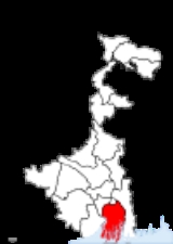
South 24 Parganas district
Encyclopedia
South 24 Parganas district is an important district of West Bengal
State with its district headquarters in Alipore
. It has the urban fringe of Calcutta on one side and the remote riverine villages in the Sundarbans
.
It is the sixth most populous district in India (out of 640
)
Jashoreshwari Kali Temple (built by Pratapaditya), Chanda Bhairab Mandir at Ishwaripur (a triangular temple, built during the Sena period), Five domed Tenga Mosque at Banshipur (Mughal period), two big and four small domed Hammankhana (constructed by Pratapaditya) at Bangshipur, Govinda Dev Temple at Gopalpur (built by Basanta Roy, uncle of Maharaja Pratapaditya in 1593), Jahajghata Port (Khanpur). Pratapaditya king of Jessore and one of the bara-bhuiyans of Bengal. Pratapaditya fought against the Mughal imperial army during its inroad into Bengal in the early 17th century. His father Shrihari (Shridhar), a Kayastha, was an influential officer in the service of daud khan karrani. On the fall of Daud he fled away with the government treasure in his custody. He then set up a kingdom for himself in the marshy land to the extreme south of Khulna district (1574) and took the title of Maharaja. Pratapaditya succeeded to the kingship in 1574. The baharistan and the travel diary of Abdul Latif and the contemporary European writers, all testify to the personal ability of Pratapaditya, his political pre-eminence, material resources and martial strength, particularly in war-boats. His territories covered the greater part of what is now included in the greater Jessore, Khulna and Barisal districts. He established his capital at Dhumghat, a strategic position at the confluence of the Jamuna and Ichhamati.
Among the Bengal zamindars Pratapaditya was the first to send his envoy to Islam Khan Chisti with a large gift to win the favour of the Mughals, and then tendered personal submission to the Subahdar (1609). He promised military assistance and personal service in the Mughal campaign against musa khan, a pledge that he did not keep. To punish Pratapaditya for his disloyalty as a vassal and to subjugate his territory, a large expedition was launched under the command of Ghiyas Khan, which soon reached a place named Salka, near the confluence of the Jamuna and Ichhamati (1611). Pratapaditya equipped a strong army and a fleet and placed them under expert officers including Feringis, Afghans and Pathans. His eldest son Udayaditya made a big fort at Salka with natural barriers on three sides rendering it almost impregnable. In battle the Jessore fleet gained an initial advantage. But the imperial army cut off the Jessore fleet, made a breach in its ranks and broke its unity and discipline. In the melee that followed, the admiral Khwaja Kamal was killed. Udayaditya lost heart and hastily fled to his father, narrowly escaping capture. Jamal Khan evacuated the fort and followed Udayaditya.
Pratapaditya prepared himself to fight a second time from a new base near the confluence of Kagarghat canal and the Jamuna. He made a big fort at a strategic point and gathered all his available forces there. The imperialists began the battle by an attack on the Jessore fleet (Jan 1612) and compelled it to seek shelter beneath the fort. But their further advance was checked by the heavy cannonade of the Jessore artillery. A sudden attack of the imperialists completely defeated the Jessore fleet and they fell upon the fort with the elephants in front, thereby compelling Pratapaditya to evacuate the fort and retreat.
The second defeat sealed the fate of Pratapaditya. At Kagarghat he tendered submission to Ghiyas Khan, who personally escorted Pratapaditya to Islam Khan at Dhaka. The Jessore king was put in chains and his kingdom was annexed. Pratapaditya was kept confined at Dhaka. No authentic information is available regarding his last days. Probably he died at Benares on his way to Delhi, as a prisoner.
In 2006 the Ministry of Panchayati Raj
named South 24 Parganas one of the country's 250 most backward districts
(out of a total of 640
). It is one of the eleven districts in West Bengal currently receiving funds from the Backward Regions Grant Fund Programme (BRGF).
, Rajpur Sonarpur
and Jaynagar Mazilpur
) and seven community development blocks: Baruipur, Bhangar–I, Bhangar–II, Jaynagar–I, Jaynagar–II, Kultali and Sonarpur. Canning subdivision consists of four community development blocks: Basanti, Canning–I, Canning–II and Gosaba. Diamond Harbour subdivision consists of Diamond Harbour
municipality and nine community development blocks: Diamond Harbour–I, Diamond Harbour–II, Falta, Kulpi, Magrahat–I, Magrahat–II, Mandirbazar, Mathurapur–I and Mathurapur–II. Kakdwip subdivision consists of four community development blocks: Kakdwip, Namkhana, Patharpratima and Sagar. Alipore Sadar subdivision consists of three municipalities (Budge Budge, Pujali
and Maheshtala
) and five community development blocks: Bishnupur–I, Bishnupur–II, Budge Budge–I, Budge Budge–II and Thakurpukur Maheshtala.
Alipore
is the district headquarters. There are 33 police stations, 29 development blocks, 7 municipalities and 312 gram panchayat
s in this district. The Sunderbans area is covered by thirteen CD blocks, viz. Sagar, Namkhana, Kakdwip, Patharpratima, Kultali, Mathurapur–I, Mathurapur–II, Jaynagar–I, Jaynagar–II, Canning–I, Canning–II, Basanti and Gosaba. This district contains 37 islands.
Other than municipality area, each subdivision contains community development blocks which in turn are divided into rural areas and census towns. In total there are 21 urban units: 7 municipalities and 14 census town
s.
Gosaba, Basanti, Kultali, Canning West, Sonarpur, Bishnupur East, Magrahat East, Mandirbazar and Kulpi constituencies are reserved for Scheduled Castes (SC) candidates. Along with one assembly constituency from North 24 Parganas district
, Gosaba, Basanti, Kultali, Jaynagar, Canning West and Canning East assembly constituencies form the Joynagar (Lok Sabha constituency)
, which is reserved for Scheduled Castes (SC). Baruipur, Jadavpur, Bishnupur East, Behala East, Behala West, Magrahat West and Kabitirtha constituencies form the Jadavpur (Lok Sabha constituency)
. Bishnupur West, Garden Reach, Maheshtala, Budge Budge, Satgachia, Falta and Diamond Harbour constituencies form the Diamond Harbour (Lok Sabha constituency)
. Magrahat East, Mandirbazar, Mathurapur, Kulpi, Patharpratima, Kakdwip and Sagar constituencies form the Mathurapur (Lok Sabha constituency)
, which is reserved for Scheduled Castes (SC). Along with six assembly segments from North 24 Parganas district, Bhangar assembly constituency forms the Basirhat (Lok Sabha constituency)
. Along with three assembly constituencies from Kolkata district
, Sonarpur, Alipore, Tollygunge and
Dhakuria form the Calcutta South (Lok Sabha constituency)
.
Gosaba, Basanti, Kultali, Mandirbazar, Jaynagar, Baruipur East, Magrahat East and Bishnupur constituencies will be reserved for Scheduled Castes (SC) candidates. Gosaba, Basanti, Kultali, Jaynagar, Canning West, Canning East and Magrahat East assembly constituencies will form the Jaynagar (Lok Sabha constituency), which will be reserved for Scheduled Castes (SC). Patharpratima, Kakdwip, Sagar, Kulpi, Raidighi, Mandirbazar and Magrahat West constituencies will form the Mathurapur (Lok Sabha constituency)
, which will be reserved for Scheduled Castes (SC). Diamond Harbour, Falta, Satgachia, Bishnupur, Maheshtala, Budge Budge and Metiaburuz constituencies will form the Diamond Harbour (Lok Sabha constituency)
. Baruipur East, Baruipur West, Sonarpur South, Bhangar, Jadavpur, Sonarpur North and Tollyganj constituencies will form the Jadavpur (Lok Sabha constituency)
. Along with six assembly segments from North 24 Parganas district, Bhangar assembly constituency forms the Basirhat (Lok Sabha constituency)
. Along with four assembly constituencies from Kolkata district
, Kasba, Behala East and Behala West will form the Calcutta South (Lok Sabha constituency)
.
has a population
of 8,153,176, roughly equal to the nation of Honduras
or the US state of Virginia
. This gives it a ranking of 6th in India (out of a total of 640
). The district has a population density of 819 PD/sqkm . Its population growth rate
over the decade 2001-2011 was 18.05 %. South Twenty Four Parganas has a sex ratio
of 949 females
for every 1000 males, and a literacy rate
of 78.57 %.
, which has an area of 1330 square kilometre. It shares the park with North 24 Parganas district
. It is also home to four wildlife sanctuaries: Haliday Island, Lothian Island, Narendrapur, and Sajnekhali.
Sundarbans
, formerly Sunderbunds, is a vast tract of forest and saltwater swamp forming the lower part of the Ganges Delta
, extending about 160 miles (260 km) along the Bay of Bengal
from the Hooghly River Estuary (India) to the Meghna River
Estuary in Bangladesh. The whole tract reaches inland for 60–80 miles (100–130 km).
A network of estuaries, tidal rivers, and creeks intersected by numerous channels, it encloses flat, marshy islands covered with dense forests. The name Sundarbans is perhaps derived from the term meaning "forest of sundari," a reference to the large mangrove tree that provides valuable fuel. Along the coast the forest passes into a mangrove swamp; the southern region, with numerous wild animals and crocodile-infested estuaries, is virtually uninhabited. It is one of the last preserves of the Bengal tiger
and the site of a tiger preservation project. The cultivated northern area yields rice, sugarcane, timber, and betel nuts.
The region is also famous for some commonly domesticated livestock breeds which includes the Garole breed of sheep and Chinae hans or Muscuovy ducks, the Garole sheep is considered as the progenator of the Booroola merino sheep and is noted for its prolific character. However, the wool of the sheep which can be a valuable natural asset does not find any use among the natives. Bakkhali
beach resort located on one of the islands jutting out into the Bay of Bengal
is gaining in popularity, with improvements in transport links with Kolkata.The woodlands and swamps of Sundarbans provide habitat to a number of species. Sundarbans is the homeland for Bengal Tiger, one of the most sought creatures around. The locality has a site for the preservation of tigers which is quite frequently visited by tourists and environmentalists. The estuaries in the region are infested with crocodiles. The area has been declared as world heritage site by the UNESCO. Boat tours are provided at many places in the region.
West Bengal
West Bengal is a state in the eastern region of India and is the nation's fourth-most populous. It is also the seventh-most populous sub-national entity in the world, with over 91 million inhabitants. A major agricultural producer, West Bengal is the sixth-largest contributor to India's GDP...
State with its district headquarters in Alipore
Alipore
Alipore is headquarters of South 24 Parganas district and a neighbourhood in South Kolkata in the Indian state of West Bengal.Alipore, Kolkata, not to be confused with Alipore, Gujarat, is one of the poshest and costliest localities in Kolkata, along with the area Ballygunge...
. It has the urban fringe of Calcutta on one side and the remote riverine villages in the Sundarbans
Sundarbans
The Sundarbans [Sundarban Tour Booking-9051115228] is the largest single block of tidal halophytic mangrove forest in the world.The name Sundarban can be literally translated as "beautiful jungle" or "beautiful forest" in the Bengali language...
.
It is the sixth most populous district in India (out of 640
Districts of India
A district is an administrative division of an Indian state or territory. Districts are further subdivided, in some cases into Sub-Divisions, and otherwise directly into tehsils or talukas.District officials include:...
)
History
Once the capital of Raja Bikramaditya and Maharaja Pratapaditya was at Dhumghat. Later it was transferred to Ishwaripur (Originated from the name Jeshoreshwaripur). Maharaja Pratapaditya declared independence of South Bengal (Jessore, Khulna in north, Sundarbans, Bay of Bengal in South, Barisal in east and River Ganga in west) against the Mughal Empire of India.Jashoreshwari Kali Temple (built by Pratapaditya), Chanda Bhairab Mandir at Ishwaripur (a triangular temple, built during the Sena period), Five domed Tenga Mosque at Banshipur (Mughal period), two big and four small domed Hammankhana (constructed by Pratapaditya) at Bangshipur, Govinda Dev Temple at Gopalpur (built by Basanta Roy, uncle of Maharaja Pratapaditya in 1593), Jahajghata Port (Khanpur). Pratapaditya king of Jessore and one of the bara-bhuiyans of Bengal. Pratapaditya fought against the Mughal imperial army during its inroad into Bengal in the early 17th century. His father Shrihari (Shridhar), a Kayastha, was an influential officer in the service of daud khan karrani. On the fall of Daud he fled away with the government treasure in his custody. He then set up a kingdom for himself in the marshy land to the extreme south of Khulna district (1574) and took the title of Maharaja. Pratapaditya succeeded to the kingship in 1574. The baharistan and the travel diary of Abdul Latif and the contemporary European writers, all testify to the personal ability of Pratapaditya, his political pre-eminence, material resources and martial strength, particularly in war-boats. His territories covered the greater part of what is now included in the greater Jessore, Khulna and Barisal districts. He established his capital at Dhumghat, a strategic position at the confluence of the Jamuna and Ichhamati.
Among the Bengal zamindars Pratapaditya was the first to send his envoy to Islam Khan Chisti with a large gift to win the favour of the Mughals, and then tendered personal submission to the Subahdar (1609). He promised military assistance and personal service in the Mughal campaign against musa khan, a pledge that he did not keep. To punish Pratapaditya for his disloyalty as a vassal and to subjugate his territory, a large expedition was launched under the command of Ghiyas Khan, which soon reached a place named Salka, near the confluence of the Jamuna and Ichhamati (1611). Pratapaditya equipped a strong army and a fleet and placed them under expert officers including Feringis, Afghans and Pathans. His eldest son Udayaditya made a big fort at Salka with natural barriers on three sides rendering it almost impregnable. In battle the Jessore fleet gained an initial advantage. But the imperial army cut off the Jessore fleet, made a breach in its ranks and broke its unity and discipline. In the melee that followed, the admiral Khwaja Kamal was killed. Udayaditya lost heart and hastily fled to his father, narrowly escaping capture. Jamal Khan evacuated the fort and followed Udayaditya.
Pratapaditya prepared himself to fight a second time from a new base near the confluence of Kagarghat canal and the Jamuna. He made a big fort at a strategic point and gathered all his available forces there. The imperialists began the battle by an attack on the Jessore fleet (Jan 1612) and compelled it to seek shelter beneath the fort. But their further advance was checked by the heavy cannonade of the Jessore artillery. A sudden attack of the imperialists completely defeated the Jessore fleet and they fell upon the fort with the elephants in front, thereby compelling Pratapaditya to evacuate the fort and retreat.
The second defeat sealed the fate of Pratapaditya. At Kagarghat he tendered submission to Ghiyas Khan, who personally escorted Pratapaditya to Islam Khan at Dhaka. The Jessore king was put in chains and his kingdom was annexed. Pratapaditya was kept confined at Dhaka. No authentic information is available regarding his last days. Probably he died at Benares on his way to Delhi, as a prisoner.
Economy
Agriculture, Industry and Pisciculture are all at their peak in the district. In west side of this district situated Falta Special Economic Zone.Various types of industry is situated in this Economic Zone.In 2006 the Ministry of Panchayati Raj
Ministry of Panchayati Raj
The Ministry of Panchayati Raj is a branch of the Government of India looking after the ongoing process of decentralization and local governance in the States....
named South 24 Parganas one of the country's 250 most backward districts
Poverty in India
Poverty is widespread in India, with the nation estimated to have a third of the world's poor. According to a 2005 World Bank estimate, 41.6% of the total Indian population falls below the international poverty line of 1.25 a day...
(out of a total of 640
Districts of India
A district is an administrative division of an Indian state or territory. Districts are further subdivided, in some cases into Sub-Divisions, and otherwise directly into tehsils or talukas.District officials include:...
). It is one of the eleven districts in West Bengal currently receiving funds from the Backward Regions Grant Fund Programme (BRGF).
Administrative subdivisions
The district comprises five subdivisions: Baruipur, Canning, Diamond Harbour, Kakdwip and Alipore Sadar. Baruipur subdivision consists of three municipalities (BaruipurBaruipur
Baruipur is a city and a municipality in South 24 Parganas district in the state of West Bengal, India. Baruipur is 25 km from Sealdah Station.-Geography:Baruipur is located at . It has an average elevation of 9 metres ....
, Rajpur Sonarpur
Rajpur Sonarpur
Rajpur Sonarpur is a city and a municipality under Sonarpur police station of Baruipur subdivision in South 24 Parganas district in the Indian state of West Bengal...
and Jaynagar Mazilpur
Jaynagar Mazilpur
Jaynagar Majilpur is a town and a municipality in South 24 Parganas district in the Indian state of West Bengal. It is a part of the area covered by Kolkata Metropolitan Development Authority. Both the places are also identified separately a Jaynagar and Majilpur...
) and seven community development blocks: Baruipur, Bhangar–I, Bhangar–II, Jaynagar–I, Jaynagar–II, Kultali and Sonarpur. Canning subdivision consists of four community development blocks: Basanti, Canning–I, Canning–II and Gosaba. Diamond Harbour subdivision consists of Diamond Harbour
Diamond Harbour
Diamond Harbour is in the southern suburbs of Kolkata, on the banks of the Hooghly River quite near where the river meets the Bay of Bengal. This small town is a popular weekend tourist spot located in South 24 Parganas district....
municipality and nine community development blocks: Diamond Harbour–I, Diamond Harbour–II, Falta, Kulpi, Magrahat–I, Magrahat–II, Mandirbazar, Mathurapur–I and Mathurapur–II. Kakdwip subdivision consists of four community development blocks: Kakdwip, Namkhana, Patharpratima and Sagar. Alipore Sadar subdivision consists of three municipalities (Budge Budge, Pujali
Pujali
Pujali is a town and a municipality under Budge Budge police station of Alipore sadar subdivision in South 24 Parganas district in the Indian state of West Bengal. It is a part of the area covered by Kolkata Metropolitan Development Authority.-Geography:...
and Maheshtala
Maheshtala
Maheshtala is a city and a municipality under Maheshtala, Thakurpukur, Metiaburuz and Behala police stations of Alipore sadar subdivision in South 24 Parganas district in the Indian state of West Bengal.-Demographics:...
) and five community development blocks: Bishnupur–I, Bishnupur–II, Budge Budge–I, Budge Budge–II and Thakurpukur Maheshtala.
Alipore
Alipore
Alipore is headquarters of South 24 Parganas district and a neighbourhood in South Kolkata in the Indian state of West Bengal.Alipore, Kolkata, not to be confused with Alipore, Gujarat, is one of the poshest and costliest localities in Kolkata, along with the area Ballygunge...
is the district headquarters. There are 33 police stations, 29 development blocks, 7 municipalities and 312 gram panchayat
Gram panchayat
Gram panchayats are local self-governments at the village or small town level in India. As of 2002 there were about 265,000 gram panchayats in India. The gram panchayat is the foundation of the Panchayat System. A gram panchayat can be set up in villages with minimum population of 300...
s in this district. The Sunderbans area is covered by thirteen CD blocks, viz. Sagar, Namkhana, Kakdwip, Patharpratima, Kultali, Mathurapur–I, Mathurapur–II, Jaynagar–I, Jaynagar–II, Canning–I, Canning–II, Basanti and Gosaba. This district contains 37 islands.
Other than municipality area, each subdivision contains community development blocks which in turn are divided into rural areas and census towns. In total there are 21 urban units: 7 municipalities and 14 census town
Census town
In India, a census town is one which has:# A minimum population of 5,000# At least 75% of male working population engaged in non-agricultural pursuits# A density of population of at least 400 persons per km2.In Ireland, a census town is;...
s.
Baruipur subdivision
- Three municipalities: BaruipurBaruipurBaruipur is a city and a municipality in South 24 Parganas district in the state of West Bengal, India. Baruipur is 25 km from Sealdah Station.-Geography:Baruipur is located at . It has an average elevation of 9 metres ....
, Rajpur SonarpurRajpur SonarpurRajpur Sonarpur is a city and a municipality under Sonarpur police station of Baruipur subdivision in South 24 Parganas district in the Indian state of West Bengal...
and Jaynagar MazilpurJaynagar MazilpurJaynagar Majilpur is a town and a municipality in South 24 Parganas district in the Indian state of West Bengal. It is a part of the area covered by Kolkata Metropolitan Development Authority. Both the places are also identified separately a Jaynagar and Majilpur...
. - Baruipur community development block consists of rural areas only with 19 gram panchayats.
- Bhangar–I community development block consists of rural areas with 9 gram panchayats and one census town: Bhangar RaghunathpurBhangar RaghunathpurSee Raghunathpur for other towns with a similar name.Bhangar Raghunathpur is a census town in South 24 Parganas district in the Indian state of West Bengal. Bhangar has a police station in Baruipur subdivision.-Demographics:...
. - Bhangar–II community development block consists of rural areas only with 10 gram panchayats.
- Jaynagar–I community development block consists of rural areas with 12 gram panchayats and one census town: Uttar DurgapurUttar DurgapurUttar Durgapur is a census town in South 24 Parganas district in the Indian state of West Bengal.-Demographics: India census, Uttar Durgapur had a population of 5062. Males constitute 52% of the population and females 48%. Uttar Durgapur has an average literacy rate of 67%, higher than the...
. - Jaynagar–II community development block consists of rural areas only with 10 gram panchayats.
- KultaliKultaliKultali is a town with a police station in Baruipur subdivision of South 24 Parganas district in the Indian state of West Bengal. While the poverty-stricken area is struggling for development, it is beset with crime. Violent clashes mark out the area as politically volatile.-Geography:Kultali is...
community development block consists of rural areas only with 9 gram panchayats. - Sonarpur community development block consists of rural areas only with 11 gram panchayats.
Canning subdivision
- BasantiBasanti (community development block)Basanti is an administrative division in Canning subdivision of South 24 Parganas district in the Indian state of West Bengal. Basanti police station serves this block...
community development block consists of rural areas only with 13 gram panchayats. - Canning–ICanning, South 24 ParganasCanning is headquarters of a subdivision of the same name, a town with a police station and a community development block in South 24 Parganas district in the Indian state of West Bengal. Carrying the memory of an abandoned port, the town is dependent to some extent on the changing fortunes of...
community development block consists of rural areas only with 10 gram panchayats. - Canning–IICanning, South 24 ParganasCanning is headquarters of a subdivision of the same name, a town with a police station and a community development block in South 24 Parganas district in the Indian state of West Bengal. Carrying the memory of an abandoned port, the town is dependent to some extent on the changing fortunes of...
community development block consists of rural areas only with 9 gram panchayats. - GosabaGosabaGosaba is a village in the Canning subdivision of South 24 Parganas district in the Indian state of West Bengal. It is the last inhabited area before the deep forests of the Sundarbans start. It has a police station, a community development block, and an assembly constituency...
community development block consists of rural areas only with 14 gram panchayats.
Diamond Harbour subdivision
- One municipality: Diamond HarbourDiamond HarbourDiamond Harbour is in the southern suburbs of Kolkata, on the banks of the Hooghly River quite near where the river meets the Bay of Bengal. This small town is a popular weekend tourist spot located in South 24 Parganas district....
- List of development blocks (9):
Development Block Gram Panchayats Remarks Diamond Harbour I 8 Diamond Harbour II 8 Falta Falta, South 24 ParganasFalta is a town with a Special Economic Zone and a police station in Diamond Harbour subdivision of South 24 Parganas district in the Indian state of West Bengal.-History:...13 Kulpi KulpiKulpi is a port town, located in South 24 Parganas district of the Indian state of West Bengal, about 78 km south of Kolkata and about 25 km from Diamond Harbour, on the eastern bank of the Hooghly river. It is the site of the proposed port-cum-special economic zone...14 Magrahat I 11 Magrahat II 14 Also has two census towns - Uttar Kalas Uttar KalasUttar Kalas is a census town under Mograhat police station of Diamond Harbour subdivision in South 24 Parganas district in the Indian state of West Bengal.-Demographics:...
and BilandapurBilandapurBilandapur is a census town under Mograhat police station of Diamond Harbour subdivision in South 24 Parganas district in the Indian state of West Bengal.-Demographics:...Mandirbazar MandirbazarMandirbazar is an administrative division in Diamond Harbour subdivision of South 24 Parganas district in the Indian state of West Bengal. Mandirbazar police station serves this block...10 Mathurapur II 10 Mathurapur II 11
Kakdwip subdivision
- KakdwipKakdwipKakdwip is head quarters of Kakdwip subdivision in South 24 Parganas district in the Indian state of West Bengal.-Demographics:In the 2001 census, Kakdwip CD Block had a population of 2,39,381 out of which 1,22,792 were males and 1,16,589 were females...
community development block consists of rural areas only with 11 gram panchayats. - NamkhanaNamkhanaNamkhana is an administrative division in Kakdwip subdivision of South 24 Parganas district in the Indian state of West Bengal. Kakdwip and Namkhana police stations serve this block...
community development block consists of rural areas only with 7 gram panchayats. - PatharpratimaPatharpratimaPatharpratima is an administrative division in Kakdwip subdivision of South 24 Parganas district in the Indian state of West Bengal. Patharpratima police station serves this block...
community development block consists of rural areas only with 15 gram panchayats. - SagarSagar islandSagar Island lies on the continental shelf of Bay of Bengal about 150 km south of Kolkata. It belongs to the Republic of India and is governed by the State government of West Bengal. The island is large — with an area of around 300 km². It has 43 villages and a population of over...
community development block consists of rural areas only with 9 gram panchayats.
Alipore Sadar subdivision
- Three municipalities: Budge Budge, PujaliPujaliPujali is a town and a municipality under Budge Budge police station of Alipore sadar subdivision in South 24 Parganas district in the Indian state of West Bengal. It is a part of the area covered by Kolkata Metropolitan Development Authority.-Geography:...
and MaheshtalaMaheshtalaMaheshtala is a city and a municipality under Maheshtala, Thakurpukur, Metiaburuz and Behala police stations of Alipore sadar subdivision in South 24 Parganas district in the Indian state of West Bengal.-Demographics:...
. - Bishnupur–I community development block consists of rural areas with 11 gram panchayats and two census towns: BishnupurBishnupur (South 24 Parganas)Bishnupur is a census town with a police station under Alipore Sadar subdivision in South 24 Parganas district in the state of West Bengal, India.-Geography:Bishnupur is located at . It has an average elevation of 6 metres ....
and KanyanagarKanyanagarKanyanagar is a census town in Alipore Sadar subdivision of South 24 Parganas district in the Indian state of West Bengal.-Geography:Kanyanagar is located at -Demographics:...
. - Bishnupur–II community development block consists of rural areas with 11 gram panchayats and two census towns: AmtalaAmtalaAmtala is a census town under Bishnupur police station of Alipore Sadar subdivision in South 24 Parganas district in the Indian state of West Bengal.-Demographics:...
and Chak EnayetnagarChak EnayetnagarChak Enayetnagar is a census town under Bishnupur police station of Alipore sadar subdivision in South 24 Parganas district in the Indian state of West Bengal.-Demographics:...
. - Budge Budge–I community development block consists of rural areas with 6 gram panchayats and three census towns: BalarampurBalarampur, BudgebudgeBalarampur is a census town under Budgebudge police station of Alipur sadar subdivision in South 24 Parganas district in the state of West Bengal, India.-Geography:Balarampur is located at . It has an average elevation of 6 metres ....
, Uttar RaypurUttar RaypurUttar Raypur is a census town under Budge Budge police station of Alipore subdivision in South 24 Parganas district in the Indian state of West Bengal.-Demographics:...
and BirlapurBirlapurBirlapur is a census town under Nadakhali police station of Alipore sadar subdivision in South 24 Parganas district in the state of West Bengal, India.-Demographics:...
. - Budge Budge–II community development block consists of rural areas with 11 gram panchayats and two census towns: Chak KashipurChak KashipurChak Kashipur is a census town under Nadakhali police station of Alipore sadar subdivision in South 24 Parganas district in the Indian state of West Bengal.-Demographics:...
and BowaliBowaliBowali is a census town under Nadakhali police station of Alipore Sadar subdivision in South 24 Parganas district in the state of West Bengal, India.-Geography:Bowali is located at -Demographics:...
. - Thakurpukur Maheshtala community development block consists of rural areas with 6 gram panchayats and one census town: Chata KalikapurChata KalikapurChata Kalikapur is a census town under Maheshtala police station in Alipore subdivision in South 24 Parganas district in the state of West Bengal, India.-Demographics:...
.
Parliamentary constituencies
The district has 5 parliament constituencies :- 19-Joynagar (SC) Parliamentary COnstituency
- 20-Mathurapur (SC) Parliamentary COnstituency
- 21-Diamond Harbour Parliamentary Constituency
- 22-Jadavpur Parliamentary Constituency
- 23-Kolkata Dakshin Parliamentary Constituency
Assembly constituencies
The district is divided into 32 assembly constituencies:- Gosaba (SC)Gosaba (Vidhan Sabha constituency)Gosaba is an assembly constituency in South 24 Parganas district in the Indian state of West Bengal. It is reserved for scheduled castes.-Extent:As per orders of the Delimitation Commission, No...
(assembly constituency no. 100), - Basanti (SC)Basanti (Vidhan Sabha constituency)Basanti is an assembly constituency in South 24 Parganas district in the Indian state of West Bengal. It is reserved for scheduled castes.-Extent:As per orders of the Delimitation Commission, No...
(assembly constituency no. 101), - Kultali (SC)Kultali (Vidhan Sabha constituency)Kultali is an assembly constituency in South 24 Parganas district in the Indian state of West Bengal. It is reserved for scheduled castes.-Extent:As per orders of the Delimitation Commission, No...
(assembly constituency no. 102), - JaynagarJaynagar (Vidhan Sabha constituency)Jaynagar is an assembly constituency in South 24 Parganas district in the Indian state of West Bengal. It is reserved for scheduled castes from 2011. Prior to that it was an open seat.-Extent:...
(assembly constituency no. 103), - BaruipurBaruipur Purba (Vidhan Sabha constituency)Baruipur Purba is an assembly constituency in South 24 Parganas district in the Indian state of West Bengal. It is reserved for scheduled castes.-Extent:As per orders of the Delimitation Commission, No...
(assembly constituency no. 104), - Canning West (SC)Canning Paschim (Vidhan Sabha constituency)Canning Paschim is an assembly constituency in South 24 Parganas district in the Indian state of West Bengal. It is reserved for scheduled castes.-Extent:As per orders of the Delimitation Commission, No...
(assembly constituency no. 105), - Canning EastCanning Purba (Vidhan Sabha constituency)Canning Purba is an assembly constituency in South 24 Parganas district in the Indian state of West Bengal.-Extent:As per orders of the Delimitation Commission, No...
(assembly constituency no. 106), - BhangarBhangar (Vidhan Sabha constituency)Bhangar is an assembly constituency in South 24 Parganas district in the Indian state of West Bengal.-Extent:As per orders of the Delimitation Commission, No...
(assembly constituency no. 107), - JadavpurJadavpur (Vidhan Sabha constituency)Jadavpur is an assembly constituency in South 24 Parganas district in the Indian state of West Bengal. Jadavpur is a neighborhood in Kolkata.-Extent:...
(assembly constituency no. 108), - Sonarpur (SC)Sonarpur Uttar (Vidhan Sabha constituency)Sonarpur Uttar is an assembly constituency in South 24 Parganas district in the Indian state of West Bengal.-Extent:...
(assembly constituency no. 109), - Bishnupur East (SC)Bishnupur, South 24 Parganas (Vidhan Sabha constituency)Bishnupur is an assembly constituency in South 24 Parganas district in the Indian state of West Bengal. It is reserved for scheduled castes.-Extent:As per orders of the Delimitation Commission, No...
(assembly constituency no. 110), - Bishnupur WestBishnupur, South 24 Parganas (Vidhan Sabha constituency)Bishnupur is an assembly constituency in South 24 Parganas district in the Indian state of West Bengal. It is reserved for scheduled castes.-Extent:As per orders of the Delimitation Commission, No...
(assembly constituency no. 111), - Behala EastBehala Purba (Vidhan Sabha constituency)Behala Purba is an assembly constituency in South 24 Parganas district in the Indian state of West Bengal. Behala is a neighborhood in Kolkata.-Extent:...
(assembly constituency no. 112), - Behala WestBehala Paschim (Vidhan Sabha constituency)Behala Paschim is an assembly constituency in South 24 Parganas district in the Indian state of West Bengal. Behala is a neighborhood in Kolkata.-Extent:...
(assembly constituency no. 113), - Garden ReachGarden Reach (Vidhan Sabha constituency)Garden Reach was an assembly constituency in South 24 Parganas district in the Indian state of West Bengal.As a consequence of the orders of the Delimitation Commission, Garden Reach ceases to exist from 2011.It was part of Diamond Harbour .:-1977-2006:In the 2006 state assembly elections Abdul...
(assembly constituency no. 114), - MaheshtalaMaheshtala (Vidhan Sabha constituency)Maheshtala is an assembly constituency in South 24 Parganas district in the Indian state of West Bengal.-Extent:...
(assembly constituency no. 115), - Budge BudgeBudge Budge (Vidhan Sabha constituency)Budge Budge is an assembly constituency in South 24 Parganas district in the Indian state of West Bengal.-Extent:As per orders of the Delimitation Commission, No...
(assembly constituency no. 116), - SatgachiaSatgachhia (Vidhan Sabha constituency)Satgachhia is an assembly constituency in South 24 Parganas district in the Indian state of West Bengal.-Extent:As per orders of the Delimitation Commission, No...
(assembly constituency no. 117), - FaltaFalta (Vidhan Sabha constituency)Falta is an Legislative Assembly constituency in South 24 Parganas district in the Indian state of West Bengal.-Extent:As per orders of the Delimitation Commission, No...
(assembly constituency no. 118), - Diamond HarbourDiamond Harbour (Vidhan Sabha constituency)Diamond Harbour is an assembly constituency in South 24 Parganas district in the Indian state of West Bengal.-Extent:As per orders of the Delimitation Commission, No...
(assembly constituency no. 119), - Magrahat WestMagrahat Paschim (Vidhan Sabha constituency)Magrahat Paschim is an assembly constituency in South 24 Parganas district in the Indian state of West Bengal.-Extent:As per orders of the Delimitation Commission, No...
(assembly constituency no. 120), - Magrahat East (SC)Magrahat Purba (Vidhan Sabha constituency)Magrahat Purba is an assembly constituency in South 24 Parganas district in the Indian state of West Bengal. It is reserved for scheduled castes.-Extent:...
(assembly constituency no. 121), - Mandirbazar (SC)Mandirbazar (Vidhan Sabha constituency)-1977-2006:In the 2006 state assembly elections Dr. Tapati Saha of CPI won the Mandirbazar assembly seat defeating Choudhury Mohan Jatua of Trinamool Congress. Contests in most years were multi cornered but only winners and runners are being mentioned. Choudhury Mohan Jatua of Trinamool Congress...
(assembly constituency no. 122), - MathurapurMathurapur (Vidhan Sabha constituency)Mathurapur was an assembly constituency in South 24 Parganas district in the Indian state of West Bengal.As a consequence of the order of the Delimitation Commission, Mathurapur ceases to exist from 2011...
(assembly constituency no. 123), - Kulpi (SC)Kulpi (Vidhan Sabha constituency).# Swing calculated on Congress+Trinamool Congress vote percentages taken together in 2006.-1977-2006:In the 2006 state assembly elections, Sakuntala Paik of CPI won the 124 Kulpi assembly seat defeating her nearest rival Jagaranjan Haldar of Trinamool Congress. Contests in most years were multi...
(assembly constituency no. 124), - PatharpratimaPatharpratima (Vidhan Sabha constituency)Patharpratima is an assembly constituency in South 24 Parganas district in the Indian state of West Bengal.-Extent:...
(assembly constituency no. 125), - KakdwipKakdwip (Vidhan Sabha constituency).# Swing calculated on Congress+Trinamool Congress vote percentages taken together in 2006.-1977-2006:In the 2006 state assembly elections, Ashok Giri of CPI won the Kakdwip assembly seat defeating Manturam Pakhira of Trinamool Congress. Contests in most years were multi cornered but only winners...
(assembly constituency no. 126), - SagarSagar (Vidhan Sabha constituency)Sagar is an assembly constituency in South 24 Parganas district in the Indian state of West Bengal.-Extent:As per orders of the Delimitation Commission, No...
(assembly constituency no. 127), - KabitirthaKabitirtha (Vidhan Sabha constituency)Kabitirtha was an assembly constituency in South 24 Parganas district in the Indian state of West Bengal.As a consequence of the orders of the Delimitation Commission, Kabitirtha ceases to exist from 2011.It was part of Jadavpur .-1977-2006:In the 2006, 2001 and 1996 state assembly elections,...
(assembly constituency no. 147), - AliporeAlipore (Vidhan Sabha constituency)Alipore was an assembly constituency in South 24 Parganas district in the Indian state of West Bengal.As a consequence of the orders of the Delimitation Commission, Alipore ceases to exist from 2011....
(assembly constituency no. 148), - TollygungeTollyganj (Vidhan Sabha constituency)Tollyganj is an assembly constituency in South 24 Parganas district in the Indian state of West Bengal. Tollyganj is a neighborhood in Kolkata.-Extent:...
(assembly constituency no. 150) and - DhakuriaDhakuria (Vidhan Sabha constituency)Dhakuria was an assembly constituency in South 24 Parganas district in the Indian state of West Bengal.As a consequence of the orders of the Delimitation Commission, Dhakuria ceases to exist from 2011....
(assembly constituency no. 151).
Gosaba, Basanti, Kultali, Canning West, Sonarpur, Bishnupur East, Magrahat East, Mandirbazar and Kulpi constituencies are reserved for Scheduled Castes (SC) candidates. Along with one assembly constituency from North 24 Parganas district
North 24 Parganas district
North 24 Parganas district is a district in southern West Bengal, of eastern India. North 24 Parganas extends in the [tropical zone] from latitude 22º11'6" north to 23º15'2" north and from longitude 88º20' east to 89º5' east...
, Gosaba, Basanti, Kultali, Jaynagar, Canning West and Canning East assembly constituencies form the Joynagar (Lok Sabha constituency)
Joynagar (Lok Sabha constituency)
Jaynagar is one of the 543 parliamentary constituencies in India. The constituency centres on Joynagar in West Bengal. The seat is reserved for scheduled castes.-Assembly segments:...
, which is reserved for Scheduled Castes (SC). Baruipur, Jadavpur, Bishnupur East, Behala East, Behala West, Magrahat West and Kabitirtha constituencies form the Jadavpur (Lok Sabha constituency)
Jadavpur (Lok Sabha constituency)
Jadavpur is one of the 543 parliamentary constituencies in India. The constituency centres on Jadavpur in West Bengal.-Assembly segments:...
. Bishnupur West, Garden Reach, Maheshtala, Budge Budge, Satgachia, Falta and Diamond Harbour constituencies form the Diamond Harbour (Lok Sabha constituency)
Diamond Harbour (Lok Sabha constituency)
Diamond Harbour is one of the 543 parliamentary constituencies in India. The constituency centres on Diamond Harbour in West Bengal.-Assembly segments:...
. Magrahat East, Mandirbazar, Mathurapur, Kulpi, Patharpratima, Kakdwip and Sagar constituencies form the Mathurapur (Lok Sabha constituency)
Mathurapur (Lok Sabha constituency)
Mathurapur is one of the 543 parliamentary constituencies in India. The constituency centres on Mathurapur in West Bengal. The seat is reserved for scheduled castes.-Assembly segments:...
, which is reserved for Scheduled Castes (SC). Along with six assembly segments from North 24 Parganas district, Bhangar assembly constituency forms the Basirhat (Lok Sabha constituency)
Basirhat (Lok Sabha constituency)
Basirhat is one of the 543 parliamentary constituencies in India. The constituency centres on Basirhat in West Bengal.-Assembly segments:...
. Along with three assembly constituencies from Kolkata district
Kolkata District
Kolkata district is an administrative district of the Indian state of West Bengal. It contains the center part of the city of Kolkata. The jurisdiction of the Kolkata...
, Sonarpur, Alipore, Tollygunge and
Dhakuria form the Calcutta South (Lok Sabha constituency)
Calcutta South (Lok Sabha constituency)
Kolkata Dakshin Lok Sabha constituency is one of the 543 Lok Sabha constituencies in India...
.
Impact of delimitation of constituencies
As per order of the Delimitation Commission in respect of the delimitation of constituencies in the West Bengal, the district will be divided into 31 assembly constituencies:- Gosaba (SC)Gosaba (Vidhan Sabha constituency)Gosaba is an assembly constituency in South 24 Parganas district in the Indian state of West Bengal. It is reserved for scheduled castes.-Extent:As per orders of the Delimitation Commission, No...
(assembly constituency no. 127), - Basanti (SC)Basanti (Vidhan Sabha constituency)Basanti is an assembly constituency in South 24 Parganas district in the Indian state of West Bengal. It is reserved for scheduled castes.-Extent:As per orders of the Delimitation Commission, No...
(assembly constituency no. 128), - Kultali (SC)Kultali (Vidhan Sabha constituency)Kultali is an assembly constituency in South 24 Parganas district in the Indian state of West Bengal. It is reserved for scheduled castes.-Extent:As per orders of the Delimitation Commission, No...
(assembly constituency no. 129), - PatharpratimaPatharpratima (Vidhan Sabha constituency)Patharpratima is an assembly constituency in South 24 Parganas district in the Indian state of West Bengal.-Extent:...
(assembly constituency no. 130), - KakdwipKakdwip (Vidhan Sabha constituency).# Swing calculated on Congress+Trinamool Congress vote percentages taken together in 2006.-1977-2006:In the 2006 state assembly elections, Ashok Giri of CPI won the Kakdwip assembly seat defeating Manturam Pakhira of Trinamool Congress. Contests in most years were multi cornered but only winners...
(assembly constituency no. 131), - SagarSagar (Vidhan Sabha constituency)Sagar is an assembly constituency in South 24 Parganas district in the Indian state of West Bengal.-Extent:As per orders of the Delimitation Commission, No...
(assembly constituency no. 132), - KulpiKulpi (Vidhan Sabha constituency).# Swing calculated on Congress+Trinamool Congress vote percentages taken together in 2006.-1977-2006:In the 2006 state assembly elections, Sakuntala Paik of CPI won the 124 Kulpi assembly seat defeating her nearest rival Jagaranjan Haldar of Trinamool Congress. Contests in most years were multi...
(assembly constituency no. 133), - RaidighiRaidighi (Vidhan Sabha constituency).# Swing calculated on Congress+Trinamool Congress vote percentages taken together, as well as the CPI vote percentage, for the now-defunct Mathurapur constituency in 2006.-References:...
(assembly constituency no. 134), - Mandirbazar (SC)Mandirbazar (Vidhan Sabha constituency)-1977-2006:In the 2006 state assembly elections Dr. Tapati Saha of CPI won the Mandirbazar assembly seat defeating Choudhury Mohan Jatua of Trinamool Congress. Contests in most years were multi cornered but only winners and runners are being mentioned. Choudhury Mohan Jatua of Trinamool Congress...
(assembly constituency no. 135), - Jaynagar (SC)Jaynagar (Vidhan Sabha constituency)Jaynagar is an assembly constituency in South 24 Parganas district in the Indian state of West Bengal. It is reserved for scheduled castes from 2011. Prior to that it was an open seat.-Extent:...
(assembly constituency no. 136), - Baruipur Purba (SC)Baruipur Purba (Vidhan Sabha constituency)Baruipur Purba is an assembly constituency in South 24 Parganas district in the Indian state of West Bengal. It is reserved for scheduled castes.-Extent:As per orders of the Delimitation Commission, No...
(assembly constituency no. 137), - Canning Paschim (SC)Canning Paschim (Vidhan Sabha constituency)Canning Paschim is an assembly constituency in South 24 Parganas district in the Indian state of West Bengal. It is reserved for scheduled castes.-Extent:As per orders of the Delimitation Commission, No...
(assembly constituency no. 138), - Canning PurbaCanning Purba (Vidhan Sabha constituency)Canning Purba is an assembly constituency in South 24 Parganas district in the Indian state of West Bengal.-Extent:As per orders of the Delimitation Commission, No...
(assembly constituency no. 139), - Baruipur PaschimBaruipur Paschim (Vidhan Sabha constituency)-1977-2006 Baruipur:Up to 2006 Baruipur had a single seat. It was an open seat during the period. In the 2006 state assembly elections, Rahul Ghosh of CPI won the Baruipur assembly seat defeating his nearest rival Arup Bhadra of Trinamool Congress. Contests in most years were multi cornered but...
(assembly constituency no. 140), - Magrahat Purba (SC)Magrahat Purba (Vidhan Sabha constituency)Magrahat Purba is an assembly constituency in South 24 Parganas district in the Indian state of West Bengal. It is reserved for scheduled castes.-Extent:...
(assembly constituency no. 142), - Magrahat PaschimMagrahat Paschim (Vidhan Sabha constituency)Magrahat Paschim is an assembly constituency in South 24 Parganas district in the Indian state of West Bengal.-Extent:As per orders of the Delimitation Commission, No...
(assembly constituency no. 143), - Diamond HarbourDiamond Harbour (Vidhan Sabha constituency)Diamond Harbour is an assembly constituency in South 24 Parganas district in the Indian state of West Bengal.-Extent:As per orders of the Delimitation Commission, No...
(assembly constituency no. 144), - FaltaFalta (Vidhan Sabha constituency)Falta is an Legislative Assembly constituency in South 24 Parganas district in the Indian state of West Bengal.-Extent:As per orders of the Delimitation Commission, No...
(assembly constituency no. 118), - SatgachhiaSatgachhia (Vidhan Sabha constituency)Satgachhia is an assembly constituency in South 24 Parganas district in the Indian state of West Bengal.-Extent:As per orders of the Delimitation Commission, No...
(assembly constituency no. 117), - Bishnupur (SC)Bishnupur, South 24 Parganas (Vidhan Sabha constituency)Bishnupur is an assembly constituency in South 24 Parganas district in the Indian state of West Bengal. It is reserved for scheduled castes.-Extent:As per orders of the Delimitation Commission, No...
(assembly constituency no. 110), - Sonarpur DakshinSonarpur Dakshin (Vidhan Sabha constituency)Sonarpur Dakshin is an assembly constituency in South 24 Parganas district in the Indian state of West Bengal.-Extent:As per orders of the Delimitation Commission, No...
(assembly constituency no. 109), - BhangarBhangar (Vidhan Sabha constituency)Bhangar is an assembly constituency in South 24 Parganas district in the Indian state of West Bengal.-Extent:As per orders of the Delimitation Commission, No...
(assembly constituency no. 107), - Kasba (assembly constituency no. 107),
- JadavpurJadavpur (Vidhan Sabha constituency)Jadavpur is an assembly constituency in South 24 Parganas district in the Indian state of West Bengal. Jadavpur is a neighborhood in Kolkata.-Extent:...
(assembly constituency no. 108), - Sonarpur UttarSonarpur Uttar (Vidhan Sabha constituency)Sonarpur Uttar is an assembly constituency in South 24 Parganas district in the Indian state of West Bengal.-Extent:...
(assembly constituency no. 109), - TollyganjTollyganj (Vidhan Sabha constituency)Tollyganj is an assembly constituency in South 24 Parganas district in the Indian state of West Bengal. Tollyganj is a neighborhood in Kolkata.-Extent:...
(assembly constituency no. 150) and - Behala PurbaBehala Purba (Vidhan Sabha constituency)Behala Purba is an assembly constituency in South 24 Parganas district in the Indian state of West Bengal. Behala is a neighborhood in Kolkata.-Extent:...
(assembly constituency no. 112), - Behala PaschimBehala Paschim (Vidhan Sabha constituency)Behala Paschim is an assembly constituency in South 24 Parganas district in the Indian state of West Bengal. Behala is a neighborhood in Kolkata.-Extent:...
(assembly constituency no. 113), - MaheshtalaMaheshtala (Vidhan Sabha constituency)Maheshtala is an assembly constituency in South 24 Parganas district in the Indian state of West Bengal.-Extent:...
(assembly constituency no. 115), - Budge BudgeBudge Budge (Vidhan Sabha constituency)Budge Budge is an assembly constituency in South 24 Parganas district in the Indian state of West Bengal.-Extent:As per orders of the Delimitation Commission, No...
(assembly constituency no. 116), - MetiaburuzMetiaburuz (Vidhan Sabha constituency)Metiaburuz is an assembly constituency in South 24 Parganas district in the Indian state of West Bengal.-Extent:...
(assembly constituency no. 147),
Gosaba, Basanti, Kultali, Mandirbazar, Jaynagar, Baruipur East, Magrahat East and Bishnupur constituencies will be reserved for Scheduled Castes (SC) candidates. Gosaba, Basanti, Kultali, Jaynagar, Canning West, Canning East and Magrahat East assembly constituencies will form the Jaynagar (Lok Sabha constituency), which will be reserved for Scheduled Castes (SC). Patharpratima, Kakdwip, Sagar, Kulpi, Raidighi, Mandirbazar and Magrahat West constituencies will form the Mathurapur (Lok Sabha constituency)
Mathurapur (Lok Sabha constituency)
Mathurapur is one of the 543 parliamentary constituencies in India. The constituency centres on Mathurapur in West Bengal. The seat is reserved for scheduled castes.-Assembly segments:...
, which will be reserved for Scheduled Castes (SC). Diamond Harbour, Falta, Satgachia, Bishnupur, Maheshtala, Budge Budge and Metiaburuz constituencies will form the Diamond Harbour (Lok Sabha constituency)
Diamond Harbour (Lok Sabha constituency)
Diamond Harbour is one of the 543 parliamentary constituencies in India. The constituency centres on Diamond Harbour in West Bengal.-Assembly segments:...
. Baruipur East, Baruipur West, Sonarpur South, Bhangar, Jadavpur, Sonarpur North and Tollyganj constituencies will form the Jadavpur (Lok Sabha constituency)
Jadavpur (Lok Sabha constituency)
Jadavpur is one of the 543 parliamentary constituencies in India. The constituency centres on Jadavpur in West Bengal.-Assembly segments:...
. Along with six assembly segments from North 24 Parganas district, Bhangar assembly constituency forms the Basirhat (Lok Sabha constituency)
Basirhat (Lok Sabha constituency)
Basirhat is one of the 543 parliamentary constituencies in India. The constituency centres on Basirhat in West Bengal.-Assembly segments:...
. Along with four assembly constituencies from Kolkata district
Kolkata District
Kolkata district is an administrative district of the Indian state of West Bengal. It contains the center part of the city of Kolkata. The jurisdiction of the Kolkata...
, Kasba, Behala East and Behala West will form the Calcutta South (Lok Sabha constituency)
Calcutta South (Lok Sabha constituency)
Kolkata Dakshin Lok Sabha constituency is one of the 543 Lok Sabha constituencies in India...
.
Demographics
According to the 2011 census2011 census of India
The 15th Indian National census was conducted in two phases, houselisting and population enumeration. Houselisting phase began on April 1, 2010 and involved collection of information about all buildings...
has a population
Demographics of India
The demographics of India are inclusive of the second most populous country in the world, with over 1.21 billion people , more than a sixth of the world's population. Already containing 17.5% of the world's population, India is projected to be the world's most populous country by 2025, surpassing...
of 8,153,176, roughly equal to the nation of Honduras
Honduras
Honduras is a republic in Central America. It was previously known as Spanish Honduras to differentiate it from British Honduras, which became the modern-day state of Belize...
or the US state of Virginia
Virginia
The Commonwealth of Virginia , is a U.S. state on the Atlantic Coast of the Southern United States. Virginia is nicknamed the "Old Dominion" and sometimes the "Mother of Presidents" after the eight U.S. presidents born there...
. This gives it a ranking of 6th in India (out of a total of 640
Districts of India
A district is an administrative division of an Indian state or territory. Districts are further subdivided, in some cases into Sub-Divisions, and otherwise directly into tehsils or talukas.District officials include:...
). The district has a population density of 819 PD/sqkm . Its population growth rate
Family planning in India
Family planning in India is based on efforts largely sponsored by the Indian government. In the 1965-2009 period, contraceptive usage has more than tripled and the fertility rate has more than halved , but the national fertility rate is still high enough to cause long-term population growth...
over the decade 2001-2011 was 18.05 %. South Twenty Four Parganas has a sex ratio
Sex ratio
Sex ratio is the ratio of males to females in a population. The primary sex ratio is the ratio at the time of conception, secondary sex ratio is the ratio at time of birth, and tertiary sex ratio is the ratio of mature organisms....
of 949 females
Women in India
The status of women in India has been subject to many great changes over the past few millennia. From equal status with men in ancient times through the low points of the medieval period, to the promotion of equal rights by many reformers, the history of women in India has been eventful...
for every 1000 males, and a literacy rate
Literacy in India
Literacy in India is key for socio-economic progress, and the Indian literacy rate grew to 74.04% in 2011 from 12% at the end of British rule in 1947. Although this was a greater than sixfold improvement, the level is well below the world average literacy rate of 84%, and India currently has the...
of 78.57 %.
Flora and fauna
In 1984 South 24 Parganas district became home to Sundarbans National ParkSundarbans National Park
The Sundarbans National Park [Sundarban Tour Booking-9051115228] is a National Park, Tiger Reserve, and a Biosphere Reserve located in the Sundarbans delta in the Indian state of West Bengal. This region is densely covered by mangrove forests, and is one of the largest reserves for the Bengal tiger...
, which has an area of 1330 square kilometre. It shares the park with North 24 Parganas district
North 24 Parganas district
North 24 Parganas district is a district in southern West Bengal, of eastern India. North 24 Parganas extends in the [tropical zone] from latitude 22º11'6" north to 23º15'2" north and from longitude 88º20' east to 89º5' east...
. It is also home to four wildlife sanctuaries: Haliday Island, Lothian Island, Narendrapur, and Sajnekhali.
Sundarbans
Sundarbans
The Sundarbans [Sundarban Tour Booking-9051115228] is the largest single block of tidal halophytic mangrove forest in the world.The name Sundarban can be literally translated as "beautiful jungle" or "beautiful forest" in the Bengali language...
, formerly Sunderbunds, is a vast tract of forest and saltwater swamp forming the lower part of the Ganges Delta
Ganges Delta
The Ganges Delta is a river delta in the South Asia region of Bengal, consisting of Bangladesh and the state of West Bengal, India. It is the world's largest delta, and empties into the Bay of Bengal...
, extending about 160 miles (260 km) along the Bay of Bengal
Bay of Bengal
The Bay of Bengal , the largest bay in the world, forms the northeastern part of the Indian Ocean. It resembles a triangle in shape, and is bordered mostly by the Eastern Coast of India, southern coast of Bangladesh and Sri Lanka to the west and Burma and the Andaman and Nicobar Islands to the...
from the Hooghly River Estuary (India) to the Meghna River
Meghna River
The Meghna River is an important river in Bangladesh, one of the three that forms the Ganges Delta, the largest on earth fanning out to the Bay of Bengal. Being a part of the Surma-Meghna River System, Meghna is formed inside Bangladesh by the joining of different rivers originaing from the hilly...
Estuary in Bangladesh. The whole tract reaches inland for 60–80 miles (100–130 km).
A network of estuaries, tidal rivers, and creeks intersected by numerous channels, it encloses flat, marshy islands covered with dense forests. The name Sundarbans is perhaps derived from the term meaning "forest of sundari," a reference to the large mangrove tree that provides valuable fuel. Along the coast the forest passes into a mangrove swamp; the southern region, with numerous wild animals and crocodile-infested estuaries, is virtually uninhabited. It is one of the last preserves of the Bengal tiger
Bengal Tiger
The Bengal tiger is a tiger subspecies native to the Indian subcontinent that in 2010 has been classified as endangered by IUCN...
and the site of a tiger preservation project. The cultivated northern area yields rice, sugarcane, timber, and betel nuts.
The region is also famous for some commonly domesticated livestock breeds which includes the Garole breed of sheep and Chinae hans or Muscuovy ducks, the Garole sheep is considered as the progenator of the Booroola merino sheep and is noted for its prolific character. However, the wool of the sheep which can be a valuable natural asset does not find any use among the natives. Bakkhali
Bakkhali
Bakkhali is seaside resort in South 24 Parganas district of West Bengal, India. It is located on one of the many deltaic islands spread across southern Bengal. Most of the islands are part of the Sunderbans, barring a few at the fringes. Some of these are joined together with bridges over narrow...
beach resort located on one of the islands jutting out into the Bay of Bengal
Bay of Bengal
The Bay of Bengal , the largest bay in the world, forms the northeastern part of the Indian Ocean. It resembles a triangle in shape, and is bordered mostly by the Eastern Coast of India, southern coast of Bangladesh and Sri Lanka to the west and Burma and the Andaman and Nicobar Islands to the...
is gaining in popularity, with improvements in transport links with Kolkata.The woodlands and swamps of Sundarbans provide habitat to a number of species. Sundarbans is the homeland for Bengal Tiger, one of the most sought creatures around. The locality has a site for the preservation of tigers which is quite frequently visited by tourists and environmentalists. The estuaries in the region are infested with crocodiles. The area has been declared as world heritage site by the UNESCO. Boat tours are provided at many places in the region.
External links
- South 24 Parganas district official website - homepage
- A travel article on Dhosa & Tilpi by Rangan Datta
- A travel Article on Frazerganj by Rangan Datta
- A travel article on Achipur by Rangan Datta
- A travel article on Bowali by Rangan Datta
- Rangan Datta's Home Page
- Pictures of Ganga Sagar
- Pictures of Ganga Sagar Mela 2007
- Pictures of Ganga Sagar Mela 2008