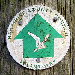
Solent Way
Encyclopedia
Trail
A trail is a path with a rough beaten or dirt/stone surface used for travel. Trails may be for use only by walkers and in some places are the main access route to remote settlements...
in Hampshire
Hampshire
Hampshire is a county on the southern coast of England in the United Kingdom. The county town of Hampshire is Winchester, a historic cathedral city that was once the capital of England. Hampshire is notable for housing the original birthplaces of the Royal Navy, British Army, and Royal Air Force...
, southern England
England
England is a country that is part of the United Kingdom. It shares land borders with Scotland to the north and Wales to the west; the Irish Sea is to the north west, the Celtic Sea to the south west, with the North Sea to the east and the English Channel to the south separating it from continental...
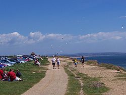
. With the exception of a few inland diversions, the path follows the coast of the Solent
Solent
The Solent is a strait separating the Isle of Wight from the mainland of England.The Solent is a major shipping route for passengers, freight and military vessels. It is an important recreational area for water sports, particularly yachting, hosting the Cowes Week sailing event annually...
, the sea strait that separates the mainland England from the Isle of Wight
Isle of Wight
The Isle of Wight is a county and the largest island of England, located in the English Channel, on average about 2–4 miles off the south coast of the county of Hampshire, separated from the mainland by a strait called the Solent...
. The Solent Way forms part of the E9 European Coastal Path, which runs for 5000 km (3125 miles)
1 E6 m
To help compare different orders of magnitude this page lists lengths starting at 106 m .Distances shorter than 106 metres-Conversions:1 megametre is equal to:* 1 E+6 m * approximately 621.37 miles...
from Cape St Vincent in Portugal
Portugal
Portugal , officially the Portuguese Republic is a country situated in southwestern Europe on the Iberian Peninsula. Portugal is the westernmost country of Europe, and is bordered by the Atlantic Ocean to the West and South and by Spain to the North and East. The Atlantic archipelagos of the...
to Narva-Jõesuu
Narva-Jõesuu
Narva-Jõesuu is a town in Ida-Viru County, Estonia, located on the country's northern Baltic Sea coast near the Russian border. The name of the town in Estonian and Russian means "mouth of the Narva River"....
in Estonia
Estonia
Estonia , officially the Republic of Estonia , is a state in the Baltic region of Northern Europe. It is bordered to the north by the Gulf of Finland, to the west by the Baltic Sea, to the south by Latvia , and to the east by Lake Peipsi and the Russian Federation . Across the Baltic Sea lies...
.
Route
The Solent Way starts in the seaside resort of Milford on SeaMilford on Sea
Milford on Sea is a large village and civil parish located on the south coast of England in the county of Hampshire. With a population of approximately 4500, Milford has a variety of shops, restaurants and pubs in its high street, which borders the village green.-Overview:Milford on Sea is village...
, where it connects with the Bournemouth Coast Path
Bournemouth Coast Path
The Bournemouth Coast Path is a 20 mile long footpath through Dorset and Hampshire, England from Sandbanks to Milford-on-Sea.The path follows the coastline and goes through Bournemouth, Boscombe, Southbourne, Hengistbury Head, Mudeford and Highcliffe....
. It then follows the coastline and the shingle spit to the fortifications of Hurst Castle
Hurst Castle
Hurst Castle on the south coast of England is one of Henry VIII's Device Forts, built at the end of a long shingle barrier beach at the west end of the Solent to guard the approaches to Southampton. Hurst Castle was sited at the narrow entrance to the Solent where the ebb and flow of the tides...
. From Hurst Castle there are two alternative routes, one involving retracing steps along the shingle spit, the other catching the seasonal ferry to Keyhaven
Keyhaven
Keyhaven is a hamlet on the south coast of England in the county of Hampshire. It is a fishing village, but the trade has been in decline for a period of years and its main draw now is tourism, especially sailing.-Overview:...
. From Keyhaven the route follows the marshes and former salting
Salting
Salting may refer to:-People:*George Salting , Australian-born English art collector, who left the Salting Bequest, which included the**Salting Madonna , National Gallery, London-Other:...
s to the port and sailing centre of Lymington
Lymington
Lymington is a port on the west bank of the Lymington River on the Solent, in the New Forest district of Hampshire, England. It is to the east of the South East Dorset conurbation, and faces Yarmouth on the Isle of Wight which is connected to it by a car ferry, operated by Wightlink. The town...
.
From Lymington the Solent Way crosses the Lymington River
Lymington River
----The Lymington River is a small river in the south of england, flowing through the New Forest into the Solent at the town of Lymington. The river has a total length of 30 km, although above the point where it leaves the Crown lands of the New Forest at Brockenhurst it is known as the Highland...
then continues a mile or so inland of the coast, giving occasional glimpses to the busy Solent to the south-east. Soon the path enters the New Forest, passing Sowley Pond
Sowley Pond
Sowley Pond is a 47.97 hectare biological Site of Special Scientific Interest , in southwest Hampshire, notified in 1971. It is an important refuge for both surface feeding and diving ducks and functions as an integral part of the marshland system of the west Solent.-Location:Sowley Pond is...
before reaching Bucklers Hard
Bucklers Hard
Bucklers Hard is a hamlet situated on the banks of the Beaulieu River in the English county of Hampshire.- Overview :With its Georgian cottages running down to the river, Bucklers Hard is part of the 9,000 acre Beaulieu Estate...
on the Beaulieu River
Beaulieu River
The Beaulieu River , formerly known as the River Exe, is a small river flowing south through the New Forest in the county of Hampshire in southern England. The river is some long, of which the last are tidal...
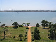
. From Bucklers Hard the path follows the edge of the river to Beaulieu
Beaulieu, Hampshire
Beaulieu is a small village located on the south eastern edge of the New Forest national park in Hampshire, England and home to both Palace House and the British National Motor Museum.- History :...
and on to Hythe
Hythe, Hampshire
Hythe is a village near Southampton, Hampshire, England. It is located by the shore of Southampton Water, and has a ferry service connecting it to Southampton...
on the west bank of the Southampton Water
Southampton Water
Southampton Water is a tidal estuary north of the Solent and the Isle of Wight in England. The city of Southampton lies at its most northerly point. Along its salt marsh-fringed western shores lie the New Forest villages of Hythe and "the waterside", Dibden Bay, and the Esso oil refinery at Fawley...
. From Hythe the path takes the Hythe Ferry
Hythe Pier, Railway and Ferry
Hythe Pier, the Hythe Pier Railway and the Hythe Ferry together provide a transport link between the English port city of Southampton and the Hampshire village of Hythe on the opposite side of Southampton Water...
across Southampton Water to the Town Quay in the centre of the port city of Southampton
Southampton
Southampton is the largest city in the county of Hampshire on the south coast of England, and is situated south-west of London and north-west of Portsmouth. Southampton is a major port and the closest city to the New Forest...
.
From Southampton the Solent Way passes through the city centre, crosses the River Itchen
River Itchen, Hampshire
The River Itchen is a river in Hampshire, England. It flows from mid-Hampshire to join with Southampton Water below the Itchen Bridge in the city of Southampton. The river has a total length of , and is noted as one of England's - if not one of the World's - premier chalk streams for fly fishing,...
by the high-level Itchen Bridge
Itchen Bridge
The Itchen Bridge is a bridge over the River Itchen in Southampton, Hampshire. It is a high-level hollow box girder bridge. It is located approximately 1 km from the river mouth. The bridge spans , is at its highest point and weighs 62,000 tons. It was officially opened July 13, 1977. At the...
and follows the northern shore of Southampton Water past Netley Castle
Netley Castle
Netley Castle is a castle in Netley in Hampshire, England. The castle, now situated near the village of Netley Abbey on Southampton Water, was built in around 1542 as part of Henry VIII's chain of coastal fortifications which are known as Device Forts or Henrician Castles...
, the ruins of Netley Abbey
Netley Abbey
Netley Abbey is a ruined late medieval monastery in the village of Netley near Southampton in Hampshire, England. The abbey was founded in 1239 as a house for Roman Catholic monks of the austere Cistercian order. Despite being a royal abbey, Netley was never rich, produced no influential scholars...
, and the Royal Victoria Country Park
Royal Victoria Country Park
The Royal Victoria Country Park is a country park in Netley, Hampshire, England, by the shores of Southampton Water. It comprises of mature woodland and grassy parkland, as well as a small shingle beach....
to the yachting centre of Hamble-le-Rice
Hamble-le-Rice
Hamble-le-Rice is a village in the Borough of Eastleigh in Hampshire, UK. It is best known for being an aircraft training centre during the Second World War and is a popular yachting location...
. Here it crosses the River Hamble
River Hamble
The River Hamble is a river in Hampshire, England. It rises near Bishop's Waltham and flows for some 7.5 miles through Botley, Bursledon and Swanwick before entering Southampton Water near Hamble-le-Rice and Warsash....
on the small pedestrian Hamble-Warsash Ferry to the village of Warsash
Warsash
Warsash is a village in southern Hampshire, England, situated at the mouth of the River Hamble, west of the area known as Locks Heath. Boating plays an important part in the village's economy, and the village has a sailing club...
.
From Warsash, the north shore of the Solent is regained, and followed past Titchfield Haven National Nature Reserve
Titchfield Haven NNR
The Titchfield Haven National Nature Reserve is a National Nature Reserve in Hampshire in southern England. It encompasses the lower floodplain of the River Meon, near to the point where it flows into the Solent near Hill Head....
and through the seaside centres of Hill Head
Hill Head
Hill Head is a residential area on the coast of the Solent. It is located south of Stubbington, west of Lee-on-the-Solent and south east of Titchfield, in the borough of Fareham, Hampshire. Hill Head is in the Gosport parliamentary constituency. Hill Head has a shingle beach with fishing, sailing,...
and Lee-on-Solent to the town of Gosport
Gosport
Gosport is a town, district and borough situated on the south coast of England, within the county of Hampshire. It has approximately 80,000 permanent residents with a further 5,000-10,000 during the summer months...
on the western side of Portsmouth Harbour
Portsmouth Harbour
Portsmouth Harbour is a large natural harbour in Hampshire, England. Geographically it is a ria: formerly it was the valley of a stream flowing from Portsdown into the Solent River. The city of Portsmouth lies to the east on Portsea Island, and Gosport to the west on the mainland...
. Here the Gosport Ferry
Gosport Ferry
The Gosport Ferry is a ferry service operating between Gosport pontoon and Portsmouth pontoon in Hampshire, southern England. It is currently operated by Gosport Ferry Ltd, a subsidiary of the Portsmouth Harbour Ferry Company plc, itself a wholly owned subsidiary of Falkland Islands Holdings,...
is used to cross Portsmouth Harbour to Portsmouth Harbour railway station
Portsmouth Harbour railway station
Portsmouth Harbour railway station is a railway station in Portsmouth, England. It is situated beside Gunwharf Quays in the city's harbour, and is an important transport terminal, with a bus interchange and ferry services to Gosport and the Isle of Wight. The station currently has four platforms:...
in the centre of the naval city of Portsmouth
Portsmouth
Portsmouth is the second largest city in the ceremonial county of Hampshire on the south coast of England. Portsmouth is notable for being the United Kingdom's only island city; it is located mainly on Portsea Island...
.
The Solent Way then follows the seaside promenade through the resort of Southsea
Southsea
Southsea is a seaside resort located in Portsmouth at the southern end of Portsea Island in the county of Hampshire in England. Southsea is within a mile of Portsmouth's city centre....
, and along the western and northern shores of Langstone Harbour
Langstone Harbour
Langstone Harbour is an inlet of the English Channel in Hampshire, sandwiched between Portsea Island to the south and west, Hayling Island to the south and east, and Langstone to the north. Geographically it is a ria....
past Farlington Marsh Nature Reserve to the village of Langstone
Langstone
Langstone is a village near Havant, Hampshire in the south east of England, between Portsmouth and Chichester. It has good railway connections to London, Southampton, Portsmouth and Brighton, from the nearby Havant railway station. There are many large gated detached houses on the main road,...
. From Langstone the path follows the north coast of Chichester Harbour
Chichester Harbour
Chichester Harbour is a large natural harbour to the south west of the city of Chichester on the Solent. It straddles the boundary of West Sussex and Hampshire. Geographically it is a ria. It is one of four natural harbours in that area of the coastline, the others being Portsmouth Harbour,...
and passes Warblington Castle
Warblington Castle
Warblington Castle or Warblington manor was a moated manor near Langstone in Hampshire that today consists of little more than one turret, part of the old gatehouse.-Details:...
before reaching its end at the village of Emsworth
Emsworth
Emsworth is a large village the south coast of England, situated on the Hampshire side of the border between Hampshire and West Sussex. The village lies at the north end of an arm of Chichester Harbour, a large but shallow inlet of the English Channel....
.