
.gif)
Route 18 (New Jersey)
Encyclopedia
Route 18 is a 40.16 miles (64.6 km) long state highway
in the U.S. state
of New Jersey
. It begins at an intersection with Route 138 in Wall Township
and ends when the road disseminates into Hoes Lane in Piscataway. Much of the route is a limited-access freeway, including the entire portion in Monmouth County
and the northern end through New Brunswick
and Piscataway. The remainder of the route is a multi-lane divided highway. Route 18 was formerly designated as Route S28, a prefixed spur of State Highway Route 28 through Middlesex and Monmouth Counties. The designation, assigned in the 1927 renumbering, remained until a second renumbering in 1953. At that point, Route 18 designated onto the alignment.
The route originally ended at New Jersey Route 27 at the border between Highland Park
and New Brunswick
, but was extended northward to County Route 622
. It was further extended in 2004, and currently ends at Hoes Lane in Piscataway. However, construction is planned to extend the route to Interstate 287
in Piscataway. The route southward of Exit 6A in Wall was also originally intended to extend to the Brielle Circle
and terminate at Route 34, Route 35, and Route 70 but there are no plans to do so currently. The freeway through New Brunswick was constructed during the 1980s over the Delaware and Raritan Canal location.
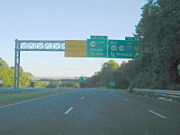 Route 18 begins at a partial-cloverleaf interchange with New Jersey Route 138 in Wall Township
. At the southern end of the interchange, the right-of-way for the southern extension is visible along with the former on-ramp from Route 138 to Route 18 northbound. The highway heads northward, crossing under Route 138 as a four-lane freeway. Route 18 interchanges with Route 138 westbound and Monmouth Boulevard, a local road in New Bedford. Route 18 then crosses under Monmouth Boulevard and crosses under County Route 18 (Belmar Boulevard) in the community of Glendola. The route continues through Glendola, and Brighton Avenue (southbound Interchanges 7A and 7B),.The freeway continues south of the Shark River Golf Course, through Neptune, paralleling Brighton Avenue, and interchanges with Route 33, and County Route 17 at Exit 8. Although signed as Exit 8 northbound, the interchange is divided into Exits 8A and 8B heaing southbound.
Route 18 crosses into Ocean Township
, crossing under County Route 17 (West Bangs Avenue), and there are exits for Route 66 and Asbury Avenue, Route 66, Deal Road in Ocean Township, West Park Avenue in Ocean Township, and enters Eatontown
. A massive interchange near the Naval Weapons Station Earle
is then encountered with exits for Industrial Way West, County Route 547
(Wyckoff Road), New Jersey Route 36, Hope Road, the Garden State Parkway
, the Tinton Falls interchange (Exit 105), and County Route 38 (Wayside Road). Route 18 continues northwestward into Colts Neck
The freeway continues to the northwest through wooded land for several miles, crossing over Normandy Road and to the south of the Pebble Creek Golf Club. Exits include New Jersey Route 34, County Route 537
(Colts Neck Road), New Jersey Route 79 (South Main Street), County Route 520
, and County Route 3 (Tennent Road), while passing through Freehold
and Marlboro
.
. After crossing under Texas Road, and interchanging with U.S. Route 9 (Exit 30), the freeway ends, and becomes an arterial boulevard through Old Bridge. The route crosses Spring Valley Road, Foxborough Road, Ferry Road, Maple Street, and Southwood Drive. It then passes under County Route 516
and County Route 527
(Old Bridge-Matawan Road), but has no northbound interchange to connect with them; motorists have to travel through a residential area to access these roads. On the southbound side, motorists can use a cloverleaf or Englishtown Road. Route 18 then enters East Brunswick, then interchanging with Middlesex County Route 615
, which also connects to County Route 527. Route 18 then continues through the heavily developed commercial corridor of East Brunswick, intersecting with Hillsdale Road, County Route 617 (Rues Lane), the Brunswick Square Mall
access point, and Race Track Road. After the interchanges with County Routes 535
(Cranbury Road)., and County Route 606 (Milltown Road), Route 18 intersects West Ferris Street, West Prospect Street, Tices Lane, and then meets County Route 527 (the Old Bridge Turnpike) at Edgeboro Road. An intersection and partial interchange with Eggers Street and JFK Blvd. is followed by crossing over the New Jersey Turnpike
before the Turnpike Exit 9 ramps. The road then intersects Tower Center Boulevard before crossing into New Brunswick
at Lawrence Brook.
The U.S. Route 1
interchange is followed by an intersection at Paulus Boulevard before separating into a local/express configuration and paralleling the Raritan River
, passing the former New Brunswick city docks. Local exits include New Jersey Route 172 (the southern terminus of George Street), the Rutgers University boathouse and Elmer B. Boyd Park, Commercial Avenue, New Street, and New Jersey Route 27 (Albany Street), after which the express and local lanes merge back together and cross under the New Jersey Transit
Northeast Corridor Line
viaduct. The freeway continues with exits for George Street, Rutgers (for access to the College Avenue Campus) and Easton Avenue before exiting New Brunswick on the John A. Lynch, Sr. Memorial Bridge
over the Raritan River.
Route 18 then interchanges with County Route 622
(River Road), Campus Road (Rutgers' Busch Campus and stadium), Metlars Lane (Rutgers' Livingston Campus and Louis Brown Athletic Center
), where the route curves to the west before ending near Buckingham Drive. The roadway continues as Hoes Lane.
) through Middlesex County, following Washington Avenue in Middlesex and the River Road in Piscataway until terminating at State Highway Route 27 near the Albany Street Bridge
in Highland Park. By the time the 1927 New Jersey state highway renumbering
had been implemented and in law, the route was re-designated as State Highway Route S-28, a prefixed spur of State Highway Route 28 in Middlesex, following Raritan Avenue and River Road through Piscataway and Highland Park, joining State Highway Route 27 on a concurrency into New Brunswick, and onto George Street in New Brunswick southward. After New Brunswick, Route S-28 continued southward through East Brunswick, Old Bridge and Browntown before terminating at State Highway Route 4 (U.S. Route 9) in Matawan. The route was designated as an east–west highway, contrary to Route 18 currently, which is north–south. It was signed east–west for a while even after it became Route 18. Although Route S-28 was used for the alignment for nearly three decades, the second state highway renumbering
in 1953 eliminated the designation, and Route 18 was designated in place.
During the 1950s, as the New Jersey State Highway Department was drawing out plans for an extensive freeway system, freeways were proposed for Route 18 and nearby Route 35. Route 18's freeway was to begin in Eatontown and head westward to Old Bridge along the former alignment of State Highway Route 18 prior to the 1953 renumbering, while Route 35 was to head northward from Seaside Heights
to Long Branch
. Both plans were endorsed by the Tri-State Transportation Committee in 1962, and the acquisition for the right-of-ways began almost immediately. The freeways combined were to cost $50 million (1962 USD) and be 30 miles (48.3 km) in total. Both freeways were designed to handle 30,000-50,000 vehicles daily. Construction began in 1966 with a 6.7 miles (10.8 km) segment between current-day Exit 6 in Wall Township and Exit 11 in Ocean Township. This section opened between 1967 and 1972, but in that time, two portions of the Route 35 Freeway had been cancelled. The portion from Seaside Heights to Shrewsbury was cancelled and the Eatontown and Long Branch portion was terminated. As a result, the portion of the Route 35 freeway that was opened was signed as part of 18 instead. Now, the Route 18 Freeway was to be a 48 miles (77.2 km) freeway from Brielle to Bound Brook
. Although Route 18's right-of-way had been mostly acquired, new environmental regulations interfered with construction taking place. After several impact studies, the freeway was completed from Exit 15 to Exit 30 in 1979, and the portion from Exits 11-12 in 1987. The final gap, between Exits 12 and 15, was finished with the large interchange in Eatontown in 1991.
 The proposals for a freeway bypassing New Brunswick began in 1962, when the New Jersey State Highway Department made plans to construct a new freeway through New Brunswick (from U.S. Route 1) to U.S. Route 22
in Bound Brook. The price tag for construction was $44 million (1962 USD) and was to head for 8.3 miles (13.4 km), accessing the Somerset Freeway, Interstate 287 and Route 28 before terminating at US 22. The extension to Bound Brook, however, was canceled in the 1970s because of tight funding. Construction of a new four-lane bridge across the Raritan River (now the John A. Lynch Memorial Bridge) began in the 1960s, but in 1970, when the environment impact laws came out, construction froze with only three massive piers standing out of the river. Outside of the bridge, there was significant controversy over the abandoned Delaware and Raritan Canal
heading through New Brunswick. The new freeway was to supplant the former canal and its thirteenth lock in New Brunswick, abandoned in 1932. The environmentalists and the historic preservationists opposed the freeway extension because of the fears of losing the canal, while companies like Johnson and Johnson supported the new highway for redeveloping New Brunswick. In 1977, the newly-formed New Jersey Department of Transportation
received a federal grant to construct the Route 18 Freeway from New Street in New Brunswick, across the Raritan and terminating at Middlesex County Route 514 Spur
in Piscataway. This 2.3 miles (3.7 km) portion was completed in 1983 at a cost of $40 million (1983 USD), with a finished bridge and freeway through New Brunswick.
In 2005, construction began on a revamped Route 18 Freeway through New Brunswick. The rebuild includes local and express lanes from New Jersey Route 172 (George Street) to the interchange with New Jersey Route 27 (Albany Street). Conti Enterprises was hired for the project, which was announced complete in August 2009 at a ceremony by governor Jon S. Corzine and Stephen Dilts
, the commissioner of the New Jersey Department of Transportation., though construction on minor work continues as of December 2009. During the construction, the New Street interchange and bridge were demolished and replaced. The area of the Paulus Boulevard intersection was upgraded for accessibility, and a bus stop was installed, but the roadway southbound is still three lanes at the traffic light. In adjacent Elmer Boyd Park a new entranceway and amphitheatre were added.
 In 2001, the New Jersey Department of Transportation approved construction of extending the Route 18 Freeway northward from Middlesex County Route 622 (River Road, former CR 514 Spur) in Piscataway to a new arterial on the existing Hoes Lane in the Rutgers University campuses. Construction, designated as Section 2A, giving a partial cloverleaf interchange to County Route 622, a trumpet interchange to Frelinghuysen Avenue (the access to Busch Campus) and a partial cloverleaf to County Route 609 (Metlars Lane) and Davidson Road. The state acquired 12 homes along the existing Metlars Lane and 30 acres (121,405.8 m²) of land from Rutgers to build the extension. The project cost the state $85 million (2004 USD). The Department of Transportation are in the final design stage of the extension to Interstate 287 in Piscataway, by upgrading Hoes Lane's arterial boulevard and its 20 intersections to standards, eliminating and upgrading several traffic lights. At the intersection with Centennial Avenue, Route 18 will turn off Hoes and follow Centennial to Possumtown Road, where it will terminate at Interstate 287 (interchange 8). Construction is now estimated to begin in 2012.
The stub end at Exit 6A for Route 138 has been under scrutiny and that the stubs to extend the freeway its final five miles (8 km) from Route 138 to the Brielle Circle were still standing. Some of the right-of-way acquired in the 1960s for the Route 35 Freeway were transformed into a multi-use trail for bicycles and other vehicles to link the Wall Township Municipal Complext to the existing Edgar Felix Bikeway
that runs from Manasquan
to Allaire State Park
. In 2001, the Brielle Circle was replaced with a new four-approach interchange between Route 35, Route 34 and Route 70, but the project included no hint of the Route 18 Extension. NJDOT is in planning to create a Park & Ride at the southern terminus of the current Route 18 freeway. It will be placed along the four lane right of way just south of Route 138. Residents are in opposition to this proposal for fear of loitering and vandalism that may accompany the parking lot.
}
|New Jersey Turnpike Exit 9
|-
|39.98
|
|Naricon Place
|
|-
|40.22
|
|Tower Center Boulevard
|Northbound exit and entrance only
|-
|rowspan=11|New Brunswick
|40.61
|
|
|Interchange
|-
|40.90
|
|Paulus Boulevard
|
|-
|colspan=4 align="center"|Freeway ends southbound
Local and express lanes separate northbound, merge southbound
|-
|41.41
|
| – Douglass Campus
|North end of CR 527 overlap; no southbound exit
|-
|41.75
|
|Commercial Avenue
|
|-
|41.96
|
|New Street
|
|-
|42.29
|
|
|no northbound entrance
|-
|colspan=4 align="center"|Local and express lanes separate southbound, merge northbound
|-
|42.89
|
|George Street – Rutgers University
|Northbound exit and southbound entrance
|-
|43.20
|
|
|Southbound exit and northbound entrance
|-
|43.50
|
|
|
|-
|rowspan=4|Piscataway Township
|43.86
|
|
|Interchange
|-
|44.28
|
|Campus Road – Busch Campus, High Point Solutions Stadium
|Interchange
|-
|44.70
|
| – Livingston Campus, Louis Brown Athletic Center
|Interchange
|-
|45.30
|
|Hoes Lane
|Northern terminus of NJ 18, roadway continues as Hoes Lane
State highway
State highway, state road or state route can refer to one of three related concepts, two of them related to a state or provincial government in a country that is divided into states or provinces :#A...
in the U.S. state
U.S. state
A U.S. state is any one of the 50 federated states of the United States of America that share sovereignty with the federal government. Because of this shared sovereignty, an American is a citizen both of the federal entity and of his or her state of domicile. Four states use the official title of...
of New Jersey
New Jersey
New Jersey is a state in the Northeastern and Middle Atlantic regions of the United States. , its population was 8,791,894. It is bordered on the north and east by the state of New York, on the southeast and south by the Atlantic Ocean, on the west by Pennsylvania and on the southwest by Delaware...
. It begins at an intersection with Route 138 in Wall Township
Wall Township, New Jersey
Wall Township is a township in Monmouth County, New Jersey, United States. As of the 2010 United States Census, the township population was 26,164.Wall Township was formally incorporated as a township by an act of the New Jersey Legislature on March 7, 1851...
and ends when the road disseminates into Hoes Lane in Piscataway. Much of the route is a limited-access freeway, including the entire portion in Monmouth County
Monmouth County, New Jersey
Monmouth County is a county located in the U.S. state of New Jersey, within the New York metropolitan area. As of the 2010 Census, the population was 630,380, up from 615,301 at the 2000 census. Its county seat is Freehold Borough. The most populous municipality is Middletown Township with...
and the northern end through New Brunswick
New Brunswick, New Jersey
New Brunswick is a city in Middlesex County, New Jersey, USA. It is the county seat and the home of Rutgers University. The city is located on the Northeast Corridor rail line, southwest of Manhattan, on the southern bank of the Raritan River. At the 2010 United States Census, the population of...
and Piscataway. The remainder of the route is a multi-lane divided highway. Route 18 was formerly designated as Route S28, a prefixed spur of State Highway Route 28 through Middlesex and Monmouth Counties. The designation, assigned in the 1927 renumbering, remained until a second renumbering in 1953. At that point, Route 18 designated onto the alignment.
The route originally ended at New Jersey Route 27 at the border between Highland Park
Highland Park, New Jersey
Highland Park is a borough in Middlesex County, New Jersey, United States. As of the 2010 United States Census, the borough population was 13,982....
and New Brunswick
New Brunswick, New Jersey
New Brunswick is a city in Middlesex County, New Jersey, USA. It is the county seat and the home of Rutgers University. The city is located on the Northeast Corridor rail line, southwest of Manhattan, on the southern bank of the Raritan River. At the 2010 United States Census, the population of...
, but was extended northward to County Route 622
County Route 622 (Middlesex County, New Jersey)
Middlesex County Route 622 is a county highway in Middlesex County, New Jersey. It traverses the municipalities of Highland Park, Piscataway and Middlesex in its 7.44 mile length. The road began as Middlesex County Route 2R8 circa 1947. The road was changed into County Route 514 Spur, a spur...
. It was further extended in 2004, and currently ends at Hoes Lane in Piscataway. However, construction is planned to extend the route to Interstate 287
Interstate 287
Interstate 287 is an auxiliary Interstate Highway in the U.S. states of New Jersey and New York. It is a partial beltway around New York City, serving the northern half of New Jersey and the counties of Rockland and Westchester in New York...
in Piscataway. The route southward of Exit 6A in Wall was also originally intended to extend to the Brielle Circle
Brielle Circle
The Brielle Circle was a traffic circle in Wall Township, New Jersey, United States, located where Route 34, Route 35, and Route 70 meet. It was the southern end for the never-built Route 18 extension. In 2001 the circle was replaced by an at-grade intersection with jughandles....
and terminate at Route 34, Route 35, and Route 70 but there are no plans to do so currently. The freeway through New Brunswick was constructed during the 1980s over the Delaware and Raritan Canal location.
Monmouth County
Wall Township, New Jersey
Wall Township is a township in Monmouth County, New Jersey, United States. As of the 2010 United States Census, the township population was 26,164.Wall Township was formally incorporated as a township by an act of the New Jersey Legislature on March 7, 1851...
. At the southern end of the interchange, the right-of-way for the southern extension is visible along with the former on-ramp from Route 138 to Route 18 northbound. The highway heads northward, crossing under Route 138 as a four-lane freeway. Route 18 interchanges with Route 138 westbound and Monmouth Boulevard, a local road in New Bedford. Route 18 then crosses under Monmouth Boulevard and crosses under County Route 18 (Belmar Boulevard) in the community of Glendola. The route continues through Glendola, and Brighton Avenue (southbound Interchanges 7A and 7B),.The freeway continues south of the Shark River Golf Course, through Neptune, paralleling Brighton Avenue, and interchanges with Route 33, and County Route 17 at Exit 8. Although signed as Exit 8 northbound, the interchange is divided into Exits 8A and 8B heaing southbound.
Route 18 crosses into Ocean Township
Ocean Township, New Jersey
Ocean Township is the name of some places in the U.S. state of New Jersey:*Ocean Township, Monmouth County, New Jersey*Ocean Township, Ocean County, New Jersey...
, crossing under County Route 17 (West Bangs Avenue), and there are exits for Route 66 and Asbury Avenue, Route 66, Deal Road in Ocean Township, West Park Avenue in Ocean Township, and enters Eatontown
Eatontown, New Jersey
Eatontown is a borough in Monmouth County, New Jersey, United States. As of the 2010 census, the borough population was 12,709.What is now Eatontown was originally incorporated as Eatontown Township by an Act of the New Jersey Legislature on April 4, 1873, from portions of Ocean Township and...
. A massive interchange near the Naval Weapons Station Earle
Naval Weapons Station Earle
Naval Weapons Station Earle is a United States Navy base in New Jersey. Its distinguishing feature is a 2.9-mile pier in Sandy Hook Bay where ammunition can be loaded and unloaded from warships at a safe distance from land....
is then encountered with exits for Industrial Way West, County Route 547
County Route 547 (New Jersey)
County Route 547, abbreviated CR 547, is a county highway in the U.S. state of New Jersey. The highway extends from Route 70 in Lakehurst to Broad Street in Eatontown...
(Wyckoff Road), New Jersey Route 36, Hope Road, the Garden State Parkway
Garden State Parkway
The Garden State Parkway is a 172.4-mile limited-access toll parkway that stretches the length of New Jersey from the New York line at Montvale, New Jersey, to Cape May at New Jersey's southernmost tip. Its name refers to New Jersey's nickname, the "Garden State." Most New Jersey residents refer...
, the Tinton Falls interchange (Exit 105), and County Route 38 (Wayside Road). Route 18 continues northwestward into Colts Neck
Colts Neck Township, New Jersey
Colts Neck is a township in Monmouth County, New Jersey, United States. As of the 2010 United States Census, the population was 10,142.What is now Colts Neck Township was established by an act of the New Jersey Legislature as Atlantic Township on February 18, 1847, from portions of Freehold...
The freeway continues to the northwest through wooded land for several miles, crossing over Normandy Road and to the south of the Pebble Creek Golf Club. Exits include New Jersey Route 34, County Route 537
County Route 537 (New Jersey)
County Route 537, abbreviated CR 537, is a county highway in the U.S. state of New Jersey. The highway extends from Delaware Avenue in Camden to Myrtle Avenue in Long Branch.-Camden County:...
(Colts Neck Road), New Jersey Route 79 (South Main Street), County Route 520
County Route 520 (New Jersey)
County Route 520 is a county highway in the U.S. state of New Jersey. County Route 520 is a major road across Monmouth County connecting the county's central towns to the Jersey Shore at Sea Bright.-Route description:...
, and County Route 3 (Tennent Road), while passing through Freehold
Freehold Borough, New Jersey
Freehold is a borough in Monmouth County, New Jersey, United States. As of the 2010 United States Census, the borough population was 12,052. It is the county seat of Monmouth County....
and Marlboro
Marlboro Township, New Jersey
-Weather:Marlboro is located close to the Atlantic Ocean. Due to the location Marlboro Township has on the Eastern Seaboard, the following weather features are noted:*On average, the warmest month is July where the average high is and the average low is ....
.
Middlesex County
After entering Middlesex County, Route 18 continues north as a freeway, crossing through residential portions of Old Bridge TownshipOld Bridge Township, New Jersey
Old Bridge Township is a Township in Middlesex County, New Jersey, United States. As of the 2000 United States Census, the township had a total population of 60,456...
. After crossing under Texas Road, and interchanging with U.S. Route 9 (Exit 30), the freeway ends, and becomes an arterial boulevard through Old Bridge. The route crosses Spring Valley Road, Foxborough Road, Ferry Road, Maple Street, and Southwood Drive. It then passes under County Route 516
County Route 516 (New Jersey)
-Route description:The highway extends 19.27 miles from Route 18/CR 527 in Old Bridge Township to Route 36 in Middletown Township. It is known as Old Bridge-Matawan Road for its entire length in Old Bridge Township where it intersects US 9 then continues several more miles to the Old...
and County Route 527
County Route 527 (New Jersey)
County Route 527 is a county highway in the U.S. state of New Jersey. The highway extends from Main Street in Toms River Township to Pompton Avenue in Cedar Grove. It is the second longest county highway in New Jersey after Route 519. It was first given the number 527 in 1954...
(Old Bridge-Matawan Road), but has no northbound interchange to connect with them; motorists have to travel through a residential area to access these roads. On the southbound side, motorists can use a cloverleaf or Englishtown Road. Route 18 then enters East Brunswick, then interchanging with Middlesex County Route 615
County Route 615 (Middlesex County, New Jersey)
County Route 615 is a county route in Middlesex County, New Jersey that measures in length. The road extends from Mercer CR 615 at the Plainsboro/West Windsor line all the way to So. Pine Ave in South Amboy, New Jersey. While most of 615 is not used a commuter road, the section in the...
, which also connects to County Route 527. Route 18 then continues through the heavily developed commercial corridor of East Brunswick, intersecting with Hillsdale Road, County Route 617 (Rues Lane), the Brunswick Square Mall
Brunswick Square Mall
Brunswick Square is a single story shopping center located in East Brunswick Township, New Jersey at the intersection of Route 18 and Rues Lane. The mall is owned by Simon Property Group, Inc...
access point, and Race Track Road. After the interchanges with County Routes 535
County Route 535 (New Jersey)
County Route 535 is a county highway in the U.S. state of New Jersey. The highway extends from Logan Avenue , at the boundary between Trenton and Hamilton Township in Mercer County to the intersection of Main Street, Raritan Street and Washington Road in Sayreville in Middlesex County.The road...
(Cranbury Road)., and County Route 606 (Milltown Road), Route 18 intersects West Ferris Street, West Prospect Street, Tices Lane, and then meets County Route 527 (the Old Bridge Turnpike) at Edgeboro Road. An intersection and partial interchange with Eggers Street and JFK Blvd. is followed by crossing over the New Jersey Turnpike
New Jersey Turnpike
The New Jersey Turnpike is a toll road in New Jersey, maintained by the New Jersey Turnpike Authority. According to the International Bridge, Tunnel and Turnpike Association, the Turnpike is the nation's sixth-busiest toll road and is among one of the most heavily traveled highways in the United...
before the Turnpike Exit 9 ramps. The road then intersects Tower Center Boulevard before crossing into New Brunswick
New Brunswick, New Jersey
New Brunswick is a city in Middlesex County, New Jersey, USA. It is the county seat and the home of Rutgers University. The city is located on the Northeast Corridor rail line, southwest of Manhattan, on the southern bank of the Raritan River. At the 2010 United States Census, the population of...
at Lawrence Brook.
The U.S. Route 1
U.S. Route 1 in New Jersey
U.S. Route 1 is a United States highway which parallels the East Coast of the United States, running from Key West, Florida in the south to Fort Kent, Maine at the Canadian border in the north. Of the entire length of the route, of it runs through New Jersey...
interchange is followed by an intersection at Paulus Boulevard before separating into a local/express configuration and paralleling the Raritan River
Raritan River
The Raritan River is a major river of central New Jersey in the United States. Its watershed drains much of the mountainous area of the central part of the state, emptying into the Raritan Bay on the Atlantic Ocean.-Description:...
, passing the former New Brunswick city docks. Local exits include New Jersey Route 172 (the southern terminus of George Street), the Rutgers University boathouse and Elmer B. Boyd Park, Commercial Avenue, New Street, and New Jersey Route 27 (Albany Street), after which the express and local lanes merge back together and cross under the New Jersey Transit
New Jersey Transit
The New Jersey Transit Corporation is a statewide public transportation system serving the United States state of New Jersey, and New York, Orange, and Rockland counties in New York State...
Northeast Corridor Line
Northeast Corridor Line
The Northeast Corridor Line is a commuter rail operation run by New Jersey Transit along Amtrak's Northeast Corridor. It is the successor to commuter services provided by the Pennsylvania Railroad along the section between Trenton, New Jersey and New York Penn Station...
viaduct. The freeway continues with exits for George Street, Rutgers (for access to the College Avenue Campus) and Easton Avenue before exiting New Brunswick on the John A. Lynch, Sr. Memorial Bridge
John A. Lynch, Sr. Memorial Bridge
The John A. Lynch, Sr. Memorial Bridge is a bridge on Route 18 in the U.S. state of New Jersey spanning the Raritan River. The bridge connects Piscataway Township on the north with New Brunswick on the south.-History:...
over the Raritan River.
Route 18 then interchanges with County Route 622
County Route 622 (Middlesex County, New Jersey)
Middlesex County Route 622 is a county highway in Middlesex County, New Jersey. It traverses the municipalities of Highland Park, Piscataway and Middlesex in its 7.44 mile length. The road began as Middlesex County Route 2R8 circa 1947. The road was changed into County Route 514 Spur, a spur...
(River Road), Campus Road (Rutgers' Busch Campus and stadium), Metlars Lane (Rutgers' Livingston Campus and Louis Brown Athletic Center
Louis Brown Athletic Center
The Louis Brown Athletic Center, more commonly known as the RAC , is an 8,000-seat multi-purpose arena in Piscataway, New Jersey on Rutgers University's Livingston Campus. The building is shaped like a truncated tent with trapezoidal sides on the north and south ends...
), where the route curves to the west before ending near Buckingham Drive. The roadway continues as Hoes Lane.
Designation and southern freeway construction
The alignment of Route 18 through Middlesex County from Middlesex to Highland Park was first designated in the 1926 designing of a new highway system as State Highway Route S-29, a prefixed spur of New Jersey Route 29 (U.S. Route 22U.S. Route 22
U.S. Route 22 is a west–east route and is one of the original United States highways of 1926, running from Cincinnati, Ohio, at US 27, US 42, US 127, and US 52 to Newark, New Jersey, at U.S. Route 1/9 near the Newark Liberty International Airport.US 22 also carries the names of the William...
) through Middlesex County, following Washington Avenue in Middlesex and the River Road in Piscataway until terminating at State Highway Route 27 near the Albany Street Bridge
Albany Street Bridge
The Albany Street Bridge is a bridge on Route 27 in the U.S. state of New Jersey spanning the Raritan River. The bridge connects Highland Park on the east with New Brunswick on the west....
in Highland Park. By the time the 1927 New Jersey state highway renumbering
1927 New Jersey state highway renumbering
In 1927, New Jersey's state highways were renumbered. The old system, which had been defined in sequence by the legislature, was growing badly, as several routes shared the same number, and many unnumbered state highways had been defined...
had been implemented and in law, the route was re-designated as State Highway Route S-28, a prefixed spur of State Highway Route 28 in Middlesex, following Raritan Avenue and River Road through Piscataway and Highland Park, joining State Highway Route 27 on a concurrency into New Brunswick, and onto George Street in New Brunswick southward. After New Brunswick, Route S-28 continued southward through East Brunswick, Old Bridge and Browntown before terminating at State Highway Route 4 (U.S. Route 9) in Matawan. The route was designated as an east–west highway, contrary to Route 18 currently, which is north–south. It was signed east–west for a while even after it became Route 18. Although Route S-28 was used for the alignment for nearly three decades, the second state highway renumbering
1953 New Jersey state highway renumbering
On January 1, 1953, the New Jersey Department of Transportation renumbered many of the State Routes. A few rules were followed in deciding what to renumber:...
in 1953 eliminated the designation, and Route 18 was designated in place.
During the 1950s, as the New Jersey State Highway Department was drawing out plans for an extensive freeway system, freeways were proposed for Route 18 and nearby Route 35. Route 18's freeway was to begin in Eatontown and head westward to Old Bridge along the former alignment of State Highway Route 18 prior to the 1953 renumbering, while Route 35 was to head northward from Seaside Heights
Seaside Heights, New Jersey
Seaside Heights is a Borough in Ocean County, New Jersey, United States. As of the 2010 United States Census, the borough population was 2,887. Seaside Heights is situated on the Barnegat Peninsula, a long, narrow barrier peninsula that separates Barnegat Bay from the Atlantic Ocean...
to Long Branch
Long Branch, New Jersey
Long Branch is a city in Monmouth County, New Jersey, United States. As of the 2010 United States Census, the city population was 30,719.Long Branch was formed on April 11, 1867, as the Long Branch Commission, from portions of Ocean Township...
. Both plans were endorsed by the Tri-State Transportation Committee in 1962, and the acquisition for the right-of-ways began almost immediately. The freeways combined were to cost $50 million (1962 USD) and be 30 miles (48.3 km) in total. Both freeways were designed to handle 30,000-50,000 vehicles daily. Construction began in 1966 with a 6.7 miles (10.8 km) segment between current-day Exit 6 in Wall Township and Exit 11 in Ocean Township. This section opened between 1967 and 1972, but in that time, two portions of the Route 35 Freeway had been cancelled. The portion from Seaside Heights to Shrewsbury was cancelled and the Eatontown and Long Branch portion was terminated. As a result, the portion of the Route 35 freeway that was opened was signed as part of 18 instead. Now, the Route 18 Freeway was to be a 48 miles (77.2 km) freeway from Brielle to Bound Brook
Bound Brook, New Jersey
Bound Brook is a borough in Somerset County, New Jersey, United States. At the United States 2010 Census, the population was 10,402.Bound Brook was originally incorporated as a town by an Act of the New Jersey Legislature on March 24, 1869, within portions of Bridgewater Township...
. Although Route 18's right-of-way had been mostly acquired, new environmental regulations interfered with construction taking place. After several impact studies, the freeway was completed from Exit 15 to Exit 30 in 1979, and the portion from Exits 11-12 in 1987. The final gap, between Exits 12 and 15, was finished with the large interchange in Eatontown in 1991.
Freeway around New Brunswick
U.S. Route 22
U.S. Route 22 is a west–east route and is one of the original United States highways of 1926, running from Cincinnati, Ohio, at US 27, US 42, US 127, and US 52 to Newark, New Jersey, at U.S. Route 1/9 near the Newark Liberty International Airport.US 22 also carries the names of the William...
in Bound Brook. The price tag for construction was $44 million (1962 USD) and was to head for 8.3 miles (13.4 km), accessing the Somerset Freeway, Interstate 287 and Route 28 before terminating at US 22. The extension to Bound Brook, however, was canceled in the 1970s because of tight funding. Construction of a new four-lane bridge across the Raritan River (now the John A. Lynch Memorial Bridge) began in the 1960s, but in 1970, when the environment impact laws came out, construction froze with only three massive piers standing out of the river. Outside of the bridge, there was significant controversy over the abandoned Delaware and Raritan Canal
Delaware and Raritan Canal
The Delaware and Raritan Canal is a canal in central New Jersey, United States, built in the 1830s that served to connect the Delaware River to the Raritan River. It was intended as an efficient and reliable means of transportation of freight between Philadelphia, Pennsylvania and New York City,...
heading through New Brunswick. The new freeway was to supplant the former canal and its thirteenth lock in New Brunswick, abandoned in 1932. The environmentalists and the historic preservationists opposed the freeway extension because of the fears of losing the canal, while companies like Johnson and Johnson supported the new highway for redeveloping New Brunswick. In 1977, the newly-formed New Jersey Department of Transportation
New Jersey Department of Transportation
The New Jersey Department of Transportation is the agency responsible for transportation issues and policy in New Jersey. It is headed by the Commissioner of Transportation...
received a federal grant to construct the Route 18 Freeway from New Street in New Brunswick, across the Raritan and terminating at Middlesex County Route 514 Spur
County Route 622 (Middlesex County, New Jersey)
Middlesex County Route 622 is a county highway in Middlesex County, New Jersey. It traverses the municipalities of Highland Park, Piscataway and Middlesex in its 7.44 mile length. The road began as Middlesex County Route 2R8 circa 1947. The road was changed into County Route 514 Spur, a spur...
in Piscataway. This 2.3 miles (3.7 km) portion was completed in 1983 at a cost of $40 million (1983 USD), with a finished bridge and freeway through New Brunswick.
In 2005, construction began on a revamped Route 18 Freeway through New Brunswick. The rebuild includes local and express lanes from New Jersey Route 172 (George Street) to the interchange with New Jersey Route 27 (Albany Street). Conti Enterprises was hired for the project, which was announced complete in August 2009 at a ceremony by governor Jon S. Corzine and Stephen Dilts
Stephen Dilts
Stephen Dilts is a former Commissioner of the New Jersey Department of Transportation , having been sworn in to the post on December 16, 2008 and leaving that position early in 2010...
, the commissioner of the New Jersey Department of Transportation., though construction on minor work continues as of December 2009. During the construction, the New Street interchange and bridge were demolished and replaced. The area of the Paulus Boulevard intersection was upgraded for accessibility, and a bus stop was installed, but the roadway southbound is still three lanes at the traffic light. In adjacent Elmer Boyd Park a new entranceway and amphitheatre were added.
Extension through Piscataway and to Brielle
The stub end at Exit 6A for Route 138 has been under scrutiny and that the stubs to extend the freeway its final five miles (8 km) from Route 138 to the Brielle Circle were still standing. Some of the right-of-way acquired in the 1960s for the Route 35 Freeway were transformed into a multi-use trail for bicycles and other vehicles to link the Wall Township Municipal Complext to the existing Edgar Felix Bikeway
Edgar Felix Bikeway
The Edgar Felix Bikeway is a multi-use trail in New Jersey running from the beachtown of Manasquan to the visitors center of Allaire State Park, fora total length of ....
that runs from Manasquan
Manasquan, New Jersey
-Government:Manasquan is governed under the Borough form of New Jersey municipal government. The government consists of a Mayor and a Borough Council comprising six council members, with all positions elected at large. A Mayor is elected directly by the voters to a four-year term of office and only...
to Allaire State Park
Allaire State Park
Allaire State Park is a park located in Monmouth County, New Jersey, United States, near the town of Farmingdale, operated and maintained by the New Jersey Division of Parks and Forestry and is part of the New Jersey Coastal Heritage Trail Route. The park is known for its restored 19th century...
. In 2001, the Brielle Circle was replaced with a new four-approach interchange between Route 35, Route 34 and Route 70, but the project included no hint of the Route 18 Extension. NJDOT is in planning to create a Park & Ride at the southern terminus of the current Route 18 freeway. It will be placed along the four lane right of way just south of Route 138. Residents are in opposition to this proposal for fear of loitering and vandalism that may accompany the parking lot.
New exit ramp, Old Bridge Township
Construction was slated for the interchange with County Routes 516 and 527 in Old Bridge as there is no way to access either of them without driving through a residential area off Route 18 (Marlboro Road, Ferris Street, Sadowski & Marsad Drive). The traffic flow along CR 516 (Old Bridge into Matawan) and 527 (Old Bridge into Englishtown; Monmouth County/Manalapan; Monmouth County) has increased significantly in the past ten years which called for the exit ramp off Rt 18. The Old Bridge Improvements include adding inside shoulders and widening County Routes 516 and 527. A signalized ramp is to be added for access to County Routes 516 and 527. Subsequently, County Route 516's intersection with Old Matawan Road is to be relocated. The project would cost over $28 million and was slated to begin in 2009 and to end in 2010. As of the end of 2009 the large project was put on hold because of the lack of funds and the economic situation. Demolition was completed in 2009 on Marlboro Road taking down several residential houses and along Old Matawan Road and CR 516 taking down an old gas station in preparing for the project. There is no new date released by NJDOT when construction will begin.Major intersections
| County | Location | Mile | Exit Exit number An exit number is a number assigned to a road junction, usually an exit from a freeway. It is usually marked on the same sign as the destinations of the exit, as well as a sign in the gore.... |
Destinations | Notes |
|---|---|---|---|---|---|
| Monmouth Monmouth County, New Jersey Monmouth County is a county located in the U.S. state of New Jersey, within the New York metropolitan area. As of the 2010 Census, the population was 630,380, up from 615,301 at the 2000 census. Its county seat is Freehold Borough. The most populous municipality is Middletown Township with... |
Wall Township Wall Township, New Jersey Wall Township is a township in Monmouth County, New Jersey, United States. As of the 2010 United States Census, the township population was 26,164.Wall Township was formally incorporated as a township by an act of the New Jersey Legislature on March 7, 1851... |
5.14 | 6A | Southbound exit and northbound entrance | |
| 5.14 | 6B | Includes a northbound exit that serves as a U-turn for traffic on NJ 138 east | |||
| 5.72 | 6C | Monmouth Boulevard | Northbound exit and southbound entrance | ||
| 6.82 | 7 | Brighton Avenue, Marconi Road – Shark River Hills Shark River Hills, New Jersey Shark River Hills is a census-designated place and unincorporated area located within Neptune Township, in Monmouth County, New Jersey. As of the 2010 United States Census, the CDP population was 3,697.-Geography:... , Glendola |
Signed as exits 7A (east) and 7B (west) southbound | ||
| Neptune Township Neptune Township, New Jersey -Demographics:As of the census of 2000, there were 27,690 people, 10,907 households, and 6,805 families residing in the township. The population density was 3,366.8 people per square mile . There were 12,217 housing units at an average density of 1,485.4 per square mile... |
8.28 | 8 | Signed as exits 8A (east) and 8B (west) southbound | ||
| 9.84 | 10 | Signed as exits 10A (east) and 10B (west) | |||
| Ocean Township Ocean Township, New Jersey Ocean Township is the name of some places in the U.S. state of New Jersey:*Ocean Township, Monmouth County, New Jersey*Ocean Township, Ocean County, New Jersey... |
|||||
| 11.37 | 11 | Deal Road – Wayside Wayside, New Jersey Wayside is an unincorporated community located within Ocean Township, Monmouth County, New Jersey.-Notable residents:Notable current and former residents of Wayside include:... |
Northbound exit and southbound entrance; signed as exits 11A (east) and 11B (west) | ||
| 12.07 | 12 | West Park Avenue – Oakhurst Oakhurst, New Jersey Oakhurst is a census-designated place and unincorporated area located within Ocean Township, in Monmouth County, New Jersey. As of the 2010 United States Census, the CDP population was 3,995.-Geography:Oakhurst is located at .... , Wayside Wayside, New Jersey Wayside is an unincorporated community located within Ocean Township, Monmouth County, New Jersey.-Notable residents:Notable current and former residents of Wayside include:... |
Southbound exit and northbound entrance; signed as exits 12A (east) and 12B (west) | ||
| Eatontown Eatontown, New Jersey Eatontown is a borough in Monmouth County, New Jersey, United States. As of the 2010 census, the borough population was 12,709.What is now Eatontown was originally incorporated as Eatontown Township by an Act of the New Jersey Legislature on April 4, 1873, from portions of Ocean Township and... |
13.46 | 13A | Northbound exit and southbound entrance | ||
| 13.82 | 13B | ||||
| 13.92 | 13A | No northbound exit | |||
| Tinton Falls Tinton Falls, New Jersey -Demographics:As of the census of 2000, there were 15,053 people, 5,883 households, and 3,976 families residing in the borough. The population density was 965.7 people per square mile . There were 6,211 housing units at an average density of 398.4 per square mile... |
|||||
| 14.40 | 15A | Southbound exit and northbound entrance | |||
| 14.51 | 15A | ||||
| 14.51 | 15B | Southbound exit only | |||
| Colts Neck Township Colts Neck Township, New Jersey Colts Neck is a township in Monmouth County, New Jersey, United States. As of the 2010 United States Census, the population was 10,142.What is now Colts Neck Township was established by an act of the New Jersey Legislature as Atlantic Township on February 18, 1847, from portions of Freehold... |
19.02 | 19 | Signed as exits 19A (north) and 19B (south) | ||
| 22.31 | 22 | Signed as exits 22A (east) and 22B (west) | |||
| Marlboro Township Marlboro Township, New Jersey -Weather:Marlboro is located close to the Atlantic Ocean. Due to the location Marlboro Township has on the Eastern Seaboard, the following weather features are noted:*On average, the warmest month is July where the average high is and the average low is .... |
25.20 | 25 | Signed as exits 25A (north) and 25B (south) | ||
| 28.40 | 29 | ||||
| Middlesex Middlesex County, New Jersey -Demographics:As of the census of 2000, there were 750,162 people, 265,815 households, and 190,855 families residing in the county. The population density was 2,422 people per square mile . There were 273,637 housing units at an average density of 884 per square mile... |
Old Bridge Township Old Bridge Township, New Jersey Old Bridge Township is a Township in Middlesex County, New Jersey, United States. As of the 2000 United States Census, the township had a total population of 60,456... |
30.35 | 30 | – The Amboys The Amboys The Amboys are a pair of municipalities in Middlesex County, New Jersey, both of which have the word Amboy in their name. The two municipalities are the City of Perth Amboy and the City of South Amboy, located across from each other on the Raritan Bay.... , New York New York City New York is the most populous city in the United States and the center of the New York Metropolitan Area, one of the most populous metropolitan areas in the world. New York exerts a significant impact upon global commerce, finance, media, art, fashion, research, technology, education, and... |
Northbound exit and entrance |
| 30.35 | 30 | Southbound exit and entrance | |||
| Freeway ends northbound | |||||
| 31.08 | Spring Valley Road | ||||
| 31.33 | Foxborough Drive, Marlboro Road | ||||
| 31.75 | Ferry Road – Browntown Browntown, New Jersey Browntown is an unincorporated area located within Old Bridge Township in Middlesex County, New Jersey, United States. The area is served as United States Postal Service ZIP code 08857.... |
||||
| 32.80 | Maple Street | ||||
| 33.58 | Southwood Drive | ||||
| 34.41 | South end of CR 527 overlap; interchange; southbound exit and northbound entrance | ||||
| East Brunswick | 34.90 | North end of CR 527 overlap; interchange | |||
| 35.12 | Hillsdale Road | ||||
| 35.57 | |||||
| 35.89 | Brunswick Square Mall Brunswick Square Mall Brunswick Square is a single story shopping center located in East Brunswick Township, New Jersey at the intersection of Route 18 and Rues Lane. The mall is owned by Simon Property Group, Inc... |
||||
| 36.21 | Race Track Road | ||||
| 36.68 | Arthur Street | ||||
| 36.95 | Interchange; no northbound exit | ||||
| 37.14 | Interchange | ||||
| 37.33 | Interchange | ||||
| 37.88 | West Ferris Street | ||||
| 38.26 | |||||
| 38.38 | Tices Lane | ||||
| 38.89 | South end of CR 527 overlap | ||||
| 39.29 | Eggers Street | ||||
| 39.55 | Kennedy Boulevard | Interchange | |||
| 39.94 | |||||
|New Jersey Turnpike Exit 9
|-
|39.98
|
|Naricon Place
|
|-
|40.22
|
|Tower Center Boulevard
|Northbound exit and entrance only
|-
|rowspan=11|New Brunswick
|40.61
|
|
|Interchange
|-
|40.90
|
|Paulus Boulevard
|
|-
|colspan=4 align="center"|Freeway ends southbound
Local and express lanes separate northbound, merge southbound
|-
|41.41
|
| – Douglass Campus
|North end of CR 527 overlap; no southbound exit
|-
|41.75
|
|Commercial Avenue
|
|-
|41.96
|
|New Street
|
|-
|42.29
|
|
|no northbound entrance
|-
|colspan=4 align="center"|Local and express lanes separate southbound, merge northbound
|-
|42.89
|
|George Street – Rutgers University
Rutgers University
Rutgers, The State University of New Jersey , is the largest institution for higher education in New Jersey, United States. It was originally chartered as Queen's College in 1766. It is the eighth-oldest college in the United States and one of the nine Colonial colleges founded before the American...
|Northbound exit and southbound entrance
|-
|43.20
|
|
|Southbound exit and northbound entrance
|-
|43.50
|
|
|
|-
|rowspan=4|Piscataway Township
|43.86
|
|
|Interchange
|-
|44.28
|
|Campus Road – Busch Campus, High Point Solutions Stadium
|Interchange
|-
|44.70
|
| – Livingston Campus, Louis Brown Athletic Center
Louis Brown Athletic Center
The Louis Brown Athletic Center, more commonly known as the RAC , is an 8,000-seat multi-purpose arena in Piscataway, New Jersey on Rutgers University's Livingston Campus. The building is shaped like a truncated tent with trapezoidal sides on the north and south ends...
|Interchange
|-
|45.30
|
|Hoes Lane
|Northern terminus of NJ 18, roadway continues as Hoes Lane
External links
- 1964 plans for roads in the New York City area, including Route 18 and Route 35
- Monmouth County Functional Classification Map (also shows the proposed extension of Route 18)
- New Jersey Roadtrips - New Jersey 18 Photos