

Romaria
Encyclopedia
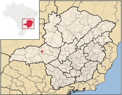
Minas Gerais
Minas Gerais is one of the 26 states of Brazil, of which it is the second most populous, the third richest, and the fourth largest in area. Minas Gerais is the Brazilian state with the largest number of Presidents of Brazil, the current one, Dilma Rousseff, being one of them. The capital is the...
. Its population as of 2007 was 3,566 people living in a total area of 402 km². The city belongs to the mesoregion
Mesoregion (Brazil)
Mesoregions are subdivisions of Brazilian states, grouping together various municipalities in proximity and with common characteristics. They were created by the Brazilian Institute of Geography and Statistics for statistical purposes and do not, therefore, constitute an administrative area....
of Triângulo Mineiro
Triângulo Mineiro
The Triangle Mineiro Portuguese pronunciation: [tɾiɐɡulu minejru] is an officer in the region west of the state of Minas Gerais, Brazil. The area is 93.500 km ² and is limited by the Serra da Canastra and Marcela, east, south of Sao Paulo, Goias in the north and west of the junction of the rivers...
e Alto Paranaíba and to the microregion
Microregion (Brazil)
Microregions are legally defined administrative areas in Brazil consisting of groups of municipalities bordering urban areas. Microregions are grouped together into mesoregions....
of Patrocínio
Patrocínio
Patrocínio is a municipality in the state of Minas Gerais in Brazil. The population of the municipality in 2007 was 81,589. The area is 2,867 km² and the elevation is 965 mts.-Highway connections:...
. It became a municipality in 1962.
Location
The municipality is located in the region of the Alto Paranaíba, just north of the important federal highway BR-365, which links the state boundary of GoiásGoiás
Goiás is a state of Brazil, located in the central part of the country. The name Goiás comes from the name of an indigenous community...
to Montes Claros
Montes Claros
Montes Claros is a city located in northern Minas Gerais state, in Brazil. The estimated population in 2010 was 412,284 inhabitants and the total area of the municipality was 3,470 km²...
. The elevation of the town center is 960 meters. Neighboring municipalities are: Estrela do Sul
Estrela do Sul
Estrela do Sul is a Brazilian municipality located in the northwest of the state of Minas Gerais. Its population as of 2007 was 7,136 people living in a total area of 820 km². The city belongs to the mesoregion of Triângulo Mineiro e Alto Paranaíba and to the microregion of Patrocínio...
and Monte Carmelo
Monte Carmelo
Monte Carmelo is a Brazilian municipality located in the northwest of the state of Minas Gerais. Its population as of 2007 was 44,367 people living in a total area of 1,354 km². The city belongs to the mesoregion of Triângulo Mineiro e Alto Paranaíba and to the microregion of Patrocínio...
(N); Iraí de Minas
Iraí de Minas
Iraí de Minas is a Brazilian municipality located in the northwest of the state of Minas Gerais. Its population as of 2007 was 6,295 people living in a total area of 357 km². The city belongs to the mesoregion of Triângulo Mineiro e Alto Paranaíba and to the microregion of Patrocínio...
(E); Nova Ponte
Nova Ponte
Nova Ponte is a Brazilian municipality located in the west of the state of Minas Gerais. Its population as of 2007 was estimated to be 11,586 people living in a total area of 1,105 km². The city belongs to the mesoregion of Triângulo Mineiro and Alto Paranaíba and to the micro-region of Araxá...
and Indianópolis
Indianópolis
Indianópolis is a Brazilian municipality located in the west of the state of Minas Gerais. Its population as of 2007 was 6,244 living in a total area of 834 km². The city belongs to the statistical mesoregion of Triângulo Mineiro and Alto Paranaíba and to the statistical microregion of Uberlândia. ...
(S); Araguari
Araguari
Araguari is a city and municipality in northwestern Minas Gerais state, Brazil. It is located in the northern Triângulo Mineiro region, on the Jordão River, a tributary of the Paranaíba River, at an elevation between 940 and 1,087 meters....
(W).
Distances
- Monte CarmeloMonte CarmeloMonte Carmelo is a Brazilian municipality located in the northwest of the state of Minas Gerais. Its population as of 2007 was 44,367 people living in a total area of 1,354 km². The city belongs to the mesoregion of Triângulo Mineiro e Alto Paranaíba and to the microregion of Patrocínio...
: 20 km - PatrocínioPatrocínioPatrocínio is a municipality in the state of Minas Gerais in Brazil. The population of the municipality in 2007 was 81,589. The area is 2,867 km² and the elevation is 965 mts.-Highway connections:...
: 75 km - UberlândiaUberlândiaUberlândia is the main town in the Triangle region, west of the state of Minas Gerais, Brazil. With a population of 604,013 inhabitants, according to 2010 estimates, the city is the second largest in the state second only to Belo Horizonte...
: 75 km - Belo HorizonteBelo HorizonteBelo Horizonte is the capital of and largest city in the state of Minas Gerais, located in the southeastern region of Brazil. It is the third largest metropolitan area in the country...
: 511 km
History
Água Suja, today Romaria, began as a settlement during the War of Paraguay, when some prospectors found diamonds. The first stone was discovered in 1857 in the Agua Suja stream, a tributary of the Bagagem River. A chapel was built to honor Our Lady of Abadia and an image was brought from Portugal. By 1926 there were already around fifty thousand pilgrims (romeiros) coming to worship the statue of the Virgin and the construction of a sanctuary was begun. The celebration takes place from August 6 to 15 and it attracts thousands of pilgrims who fill the small town.Economic activities
The most important economic activities are cattle raising for meat and dairy, commerce, and agriculture, with the main crops being coffee, corn, rice, and citrus fruits. The GDP in 2005 was R$70 million, with 16 million generated by services, 03 million generated by industry, and 48 million generated by agriculture. Romaria is in the middle tier of municipalities in the state with regard to economic and social development. As of 2007 there were no banking agencies in the town. There was a modest retail infrastructure serving the surrounding area of cattle and agricultural lands. There were 391 automobiles in all of the municipality (2007), about one for every 08 inhabitants.Romaria has a small municipal area but had a large agricultural production especially in coffee, corn, and soybeans. In the rural area there were 175 establishments (2006) occupying 27,000 hectares (planted area: 14,000 ha,; natural pasture: 7,000 ha.; and woodland: 5,000 ha.). About 2,000 persons were dependent on agriculture. 68 of the farms had tractors, a ratio of one in 03 farms. There were 7,700 head of cattle in 2006. The main crops were coffee (5,200 hectares), corn (6,500 hecares), cotton, peas, beans, passion fruit, rice, and soybeans (9,500 hectares).
Health and education
In the health sector there were 02 health clinics and 01 hospital with 16 beds. In the educational sector there was 01 pre-primary schools, 02 primary school, and 01 middle school.- Municipal Human Development IndexHuman Development IndexThe Human Development Index is a composite statistic used to rank countries by level of "human development" and separate "very high human development", "high human development", "medium human development", and "low human development" countries...
: 0.775 (2000) - State ranking: 139 out of 853 municipalities as of 2000
- National ranking: 1,196 out of 5,138 municipalities as of 2000
- Literacy rate: 90%
- Life expectancy: 71 (average of males and females)
The highest ranking municipality in Minas Gerais in 2000 was Poços de Caldas
Poços de Caldas
Poços de Caldas is a city and municipality in south-western Minas Gerais state, Brazil, in the microregion of the same name. Its estimated population in 2009 was 151,449 inhabitants...
with 0.841, while the lowest was Setubinha
Setubinha
Setubinha is a municipality in the northeast of the Brazilian state of Minas Gerais. As of 2007 the population was 10,834 in a total area of 536 km². The elevation is 729 metres. It is part of the IBGE statistical microregion of Teófilo Otoni...
with 0.568. Nationally the highest was São Caetano do Sul
São Caetano do Sul
São Caetano do Sul is a city in São Paulo state in Brazil, located in the Greater São Paulo Metropolitan Area. It is the city with the highest per capita income in Brazil and it also has the highest Human Development Index .-Geography:São Caetano do Sul is located on a plateau that is part of the...
in São Paulo with 0.919, while the lowest was Setubinha. In more recent statistics (considering 5,507 municipalities) Manari in the state of Pernambuco
Pernambuco
Pernambuco is a state of Brazil, located in the Northeast region of the country. To the north are the states of Paraíba and Ceará, to the west is Piauí, to the south are Alagoas and Bahia, and to the east is the Atlantic Ocean. There are about of beaches, some of the most beautiful in the...
has the lowest rating in the country—0,467—putting it in last place.
See also
- List of municipalities in Minas Gerais