

Montes Claros
Encyclopedia
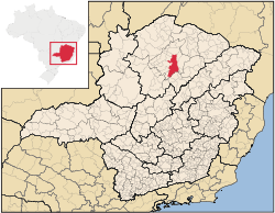
Minas Gerais
Minas Gerais is one of the 26 states of Brazil, of which it is the second most populous, the third richest, and the fourth largest in area. Minas Gerais is the Brazilian state with the largest number of Presidents of Brazil, the current one, Dilma Rousseff, being one of them. The capital is the...
state, in Brazil
Brazil
Brazil , officially the Federative Republic of Brazil , is the largest country in South America. It is the world's fifth largest country, both by geographical area and by population with over 192 million people...
. The estimated population in 2010 was 412,284 inhabitants and the total area of the municipality was 3,470 km² ( 97 km² urban). It was made a seat of a municipality in 1831 and attained city status in 1857.
Neighboring municipalities
- North: São João da PonteSão João da PonteSão João da Ponte is a municipality in the north of the Brazilian state of Minas Gerais. As of 2007, the population numbered 26,091 within the total area of 1,849 km². The elevation is 561 meters. It became a municipality in 1943....
- Northeast: Capitão EnéasCapitão EnéasCapitão Enéas is a municipality in the north of the Brazilian state of Minas Gerais. As of 2007 the population was 14,106 in a total area of 970 km²....
- East: Francisco SáFrancisco SáFrancisco Pedro Manuel Sá is a retired Argentine football defender.Sá holds the record for the most Copa Libertadores titles, he won six; 4 consecutive titles with Club Atlético Independiente between 1972 and 1975, and a further 2 with Boca Juniors in 1977 and 1978.Sá started his career with...
- Southeast: JuramentoJuramentoJuramento is a municipality in the north of the Brazilian state of Minas Gerais. As of 2007 the population was 3,960 in a total area of 432 km². It became a municipality in 1953....
, GlaucilândiaGlaucilândiaGlacilândia is a Brazilian municipality located in the north of the state of Minas Gerais. In 2007 the population was 2,932 in a total area of 145 km². It became a municipality in 1996.-Location and distances:... - South: BocaiúvaBocaiúvaBocaiúva is a Brazilian municipality located in the northwest of the state of Minas Gerais. Its population as of 2007 was 44,657 people living in a total area of 3,232 km². The city belongs to the mesoregion of North of Minas and to the microregion of Bocaiúva...
- Southwest: Claro dos PoçõesClaro dos PoçõesClaro dos Poções is a Brazilian municipality located in the north of the state of Minas Gerais. In 2007 the population was 8,131 in a total area of 706 km². It became a municipality in 1962.-Location and distances:...
- West: São João da LagoaSão João da LagoaSão João da Lagoa is a municipality in the north of the Brazilian state of Minas Gerais. As of 2007 the population was 4,729 in a total area of 990 km². It became a municipality in 1995.-Location:...
, Coração de JesusCoração de JesusCoração de Jesus is a Brazilian municipality located in the north of the state of Minas Gerais. In 2007 the population was 26,131 in a total area of 2,236 km². It became a municipality in 1912.-Location and distances:... - Northwest: MirabelaMirabelaMirabela is a municipality in the north of the Brazilian state of Minas Gerais. As of 2007 the population was 12,769 in a total area of 721 km². It became a municipality in 1962.-Location:...
, PatisPatis, Minas GeraisPatis is a municipality in the north of the Brazilian state of Minas Gerais. As of 2007 the population was 5,346 in a total area of 444 km². It became a municipality in 1995.-Location:...
Microregion of Montes Claros
Montes Claros is also a statistical microregion (number 36) consisting of 22 municipalities: Brasília de MinasBrasília de Minas
Brasília de Minas is a Brazilian municipality located in the north of the state of Minas Gerais. In 2007 the population was 42,165 in a total area of 1,398 km². It became a municipality in 1923....
, Campo Azul
Campo Azul, Minas Gerais
Campo Azul is a Brazilian municipality located in the north of the state of Minas Gerais. In 2007 the population was 3,828 in a total area of 506 km². It became a municipality in 1995....
, Capitão Enéas
Capitão Enéas
Capitão Enéas is a municipality in the north of the Brazilian state of Minas Gerais. As of 2007 the population was 14,106 in a total area of 970 km²....
, Claro dos Poções
Claro dos Poções
Claro dos Poções is a Brazilian municipality located in the north of the state of Minas Gerais. In 2007 the population was 8,131 in a total area of 706 km². It became a municipality in 1962.-Location and distances:...
, Coração de Jesus
Coração de Jesus
Coração de Jesus is a Brazilian municipality located in the north of the state of Minas Gerais. In 2007 the population was 26,131 in a total area of 2,236 km². It became a municipality in 1912.-Location and distances:...
, Francisco Sá
Francisco Sá, Minas Gerais
Francisco Sá is a municipality in the north of the Brazilian state of Minas Gerais. As of 2007 the population was 24,838 in a total area of 2,749 km². The elevation is 664 meters above sea level....
, Glaucilândia
Glaucilândia
Glacilândia is a Brazilian municipality located in the north of the state of Minas Gerais. In 2007 the population was 2,932 in a total area of 145 km². It became a municipality in 1996.-Location and distances:...
, Ibiracatu
Ibiracatu
Ibiracatu is a Brazilian municipality located in the north of the state of Minas Gerais. In 2007 the population was 5,898 in a total area of 359 km². It became a municipality in 1995.-Location and distances:...
, Japonvar
Japonvar
Japonvar is a Brazilian municipality located in the north of the state of Minas Gerais. In 2007 the population was 8,232 in a total area of 376 km². It became a municipality in 1997.-Location and distances:...
, Juramento
Juramento
Juramento is a municipality in the north of the Brazilian state of Minas Gerais. As of 2007 the population was 3,960 in a total area of 432 km². It became a municipality in 1953....
, Lontra
Lontra, Minas Gerais
Lontra is a municipality in the north of the Brazilian state of Minas Gerais. As of 2007 the population was 7,979 in a total area of 257 km². It became a municipality in 1993.-Location:...
, Luislândia
Luislândia
Luislândia is a municipality in the north of the Brazilian state of Minas Gerais. As of 2007 the population was 6,432 in a total area of 425 km². It became a municipality in 1997.-Location:...
, Mirabela
Mirabela
Mirabela is a municipality in the north of the Brazilian state of Minas Gerais. As of 2007 the population was 12,769 in a total area of 721 km². It became a municipality in 1962.-Location:...
, Montes Claros, Patis
Patis, Minas Gerais
Patis is a municipality in the north of the Brazilian state of Minas Gerais. As of 2007 the population was 5,346 in a total area of 444 km². It became a municipality in 1995.-Location:...
, Ponto Chique
Ponto Chique
Ponto Chique is a municipality in the north of the Brazilian state of Minas Gerais. As of 2007 the population was 4,046 in a total area of 602 km². It became a municipality in 1997.-Location:...
, São João da Lagoa
São João da Lagoa
São João da Lagoa is a municipality in the north of the Brazilian state of Minas Gerais. As of 2007 the population was 4,729 in a total area of 990 km². It became a municipality in 1995.-Location:...
, São João da Ponte
São João da Ponte
São João da Ponte is a municipality in the north of the Brazilian state of Minas Gerais. As of 2007, the population numbered 26,091 within the total area of 1,849 km². The elevation is 561 meters. It became a municipality in 1943....
, São João do Pacuí
São João do Pacuí
São João do Pacuí is a municipality in the north of the Brazilian state of Minas Gerais. As of 2007 the population was 4,003 in a total area of 420 km². It became a municipality in 1997.-Location:...
, Ubaí
Ubaí
Ubaí is a municipality in the north of the Brazilian state of Minas Gerais. As of 2007 the population was 11,834 in a total area of 821 km². It became a municipality in 1962.-Location:...
, Varzelândia
Varzelândia
Varzelândia is a municipality in the north of the Brazilian state of Minas Gerais. As of 2007 the population was 19,137 in a total area of 804 km². It became a municipality in 1962.-Location:...
, and Verdelândia
Verdelândia
Verdelândia is a municipality in the north of the Brazilian state of Minas Gerais. As of 2007 the population was 8,029 in a total area of 1,452 km². It became a municipality in 1997.-Location:...
. The population was 501,480 in 2000 and the area was 22,322.10 km². See Citybrazil
Distances
It is 418 km. from the capital, Belo HorizonteBelo Horizonte
Belo Horizonte is the capital of and largest city in the state of Minas Gerais, located in the southeastern region of Brazil. It is the third largest metropolitan area in the country...
, and is connected by the following highways:
- BR 135 – BocaiúvaBocaiúvaBocaiúva is a Brazilian municipality located in the northwest of the state of Minas Gerais. Its population as of 2007 was 44,657 people living in a total area of 3,232 km². The city belongs to the mesoregion of North of Minas and to the microregion of Bocaiúva...
/JanuáriaJanuáriaJanuária, known as "The Queen of the Beautiful Waters" is a city and municipality in northern Minas Gerais state, Brazil. It is located on the left bank of the São Francisco River... - BR 365 – PiraporaPiraporaPirapora is a municipality in northcentral Minas Gerais in Brazil. Its population in 2007 was 51,636 in a total area of 577 km². The name Pirapora comes from the Tupi words for "fish" + "jump", referring to the piracema season when a mass migration of fishes ascends the São Francisco River...
/UberlândiaUberlândiaUberlândia is the main town in the Triangle region, west of the state of Minas Gerais, Brazil. With a population of 604,013 inhabitants, according to 2010 estimates, the city is the second largest in the state second only to Belo Horizonte... - BR 251 – Rio-Bahia/SalinasSalinas, Minas GeraisSalinas is a municipality in the northeast of the Brazilian state of Minas Gerais. Its population in 2007 was 37,370 inhabitants in a total area of 1,897 km².-Important facts and Distances:...
/Coração de JesusCoração de JesusCoração de Jesus is a Brazilian municipality located in the north of the state of Minas Gerais. In 2007 the population was 26,131 in a total area of 2,236 km². It became a municipality in 1912.-Location and distances:... - BR 122 – JanaúbaJanaúbaJanaúba is a municipality in the north of the Brazilian state of Minas Gerais. In 2007 the population was 65,387 in a total area of 2,189 km2. The elevation is 692 meters above sea level.-Location:...
Climate
The climate is tropical with an annual average temperature of 24.2°C. The vegetation of the municipality is mainly CerradoCerrado
The Cerrado, is a vast tropical savanna ecoregion of Brazil, particularly in the states of Gioas and Minas Gerais...
with areas of transition between cerrado and Caatinga
Caatinga
Caatinga is a type of vegetation, and an ecoregion characterized by this vegetation in the northeastern part of Brazil. The name "Caatinga" is a Tupi word meaning "white forest" or "white vegetation"...
.
History
The history of the city is relatively old in Brazilian terms. It began with adventurers moving north from the coast in search of diamonds and gold in the streams. In 1707 the first ranches appeared and a small village took root: Arraial de Formigas. In 1810 the town was made a bishopric. In 1831 the town had grown and become Vila de Montes Claros de Formigas. By 1857, Vila Montes Claros de Formigas had around 2,000 inhabitants and became the city of Montes Claros.Economy
- Primary sector:
Producer of dairy and beef cattle, followed by agriculture: beans, corn, manioc, cotton, and irrigated rice.
- Secondary sector:
The industrial sector began to increase with the arrival of electric power in 1965 and the participation of the government agency SUDENE in the industrial development of the region. Today industry is the main activity in the city. The factories installed are, among others, the largest factory of condensed milk in the world (Nestlé), one of the three factories of insulin in Latin America (BIOBRAS now Novo Nordisk Produção Farmacêutica do Brasil), a modern textile factory (COTENOR), and the seventh largest cement factory in Brazil (LAFARGE BRASIL)
Montes Claros is also recognized nationally as the capital of Carne de Sol, a local jerky
Jerky (food)
Jerky is lean meat that has been trimmed of fat, cut into strips, and then been dried to prevent spoilage. Normally, this drying includes the addition of salt, to prevent bacteria from developing on the meat before sufficient moisture has been removed. The word "jerky" is a bastardization of the...
-like dry beef and Arroz com Pequi, a very popular meal that is made of rice
Rice
Rice is the seed of the monocot plants Oryza sativa or Oryza glaberrima . As a cereal grain, it is the most important staple food for a large part of the world's human population, especially in East Asia, Southeast Asia, South Asia, the Middle East, and the West Indies...
and Pequi.
Education and Health
The city is well served by institutions of higher learning. There are two public universities: Universidade Estadual de Montes ClarosUnimontes
Unimontes, or Universidade Estadual de Montes Claros , is a university in Brazil with its main campus at Montes Claros in the state of Minas Gerais.Unimontes started out as independent colleges, supported by a foundation...
(Unimontes) and a campus of the Universidade Federal de Minas Gerais
Universidade Federal de Minas Gerais
Universidade Federal de Minas Gerais is a federal university located in Belo Horizonte, state of Minas Gerais, Brazil. The students are admitted through yearly exams called vestibular....
(UFMG), and five private colleges:Universidade Norte do Paraná
Universidade Norte do Paraná
Norte do Paraná University or Universidade Norte do Paraná is a private university which was created by federal decree number 70592. Administrative infrastructure includes a rectory Londrina, Brazil, pro-rectories and university council...
(Unopar), Faculdades Pitágoras, Faculdades Unidas do Norte de Minas (FUNORTE), Faculdade de Ciência e Tecnologia de Montes Claros (Facit), Faculdade de Saúde Ibituruna, and Faculdades Santo Agostinho.
In 2005 there were 1 public and 2 private hospitals with 996 beds. There were also 62 public and 78 private clinics.
Airport
Mário Ribeiro AirportMontes Claros Airport
Montes Claros / Mário Ribeiro Airport is the airport serving Montes Claros, Brazil.It is operated by Infraero.-Airlines and destinations:-External links:*...
has a runway with capability to receive planes as large as Boeing 737. It has a navigation system and a rescue and fire combat system. There are 8 daily flights to Belo Horizonte
Belo Horizonte
Belo Horizonte is the capital of and largest city in the state of Minas Gerais, located in the southeastern region of Brazil. It is the third largest metropolitan area in the country...
Municipal Human Development Index
Human Development Index
The Human Development Index is a composite statistic used to rank countries by level of "human development" and separate "very high human development", "high human development", "medium human development", and "low human development" countries...
- MHDI: .784 (2000)
- State ranking: 102 out of 853 municipalities
- National ranking: 968 out of 5,138 municipalities
- Life expectancy: 72
- Literacy rate: 90 For the complete list see Frigoletto
Tourism
Montes Claros has innumerous caves and 164 cataloged archaeological sites, among which the most important are the caves of Lapa Grande, where there is an underground river with a length of more than one kilometers. Lapa Grande is located in the Serra da Vieira, 12 kilometers from Montes Claros.In the city itself there are several large parks, among which the most important are Parque Municipal Milton Prates, with a lake and zoo. In the rural area there is Parque Sapucaia, a forest reserve and Parque Guimarães Rosa along the banks of the Córrego Carrapato.
History
The first explorers arrived in this region during the eighteenth century. It was the Espinosa-Navarro expedition, made up of 12 Portuguese and Spanish. The region was then inhabited by the Anais and Tapuias Amerindians. Others returned to settle the area and they formed three great ranches: Jaiba, Olhos d'Água and Montes Claros. In 1707, Antônio Gonçalves Figueira obtained the land that constituted the ranch of Montes Claros. In order to get his cattle to market Figueira opened up roads to Tranqueiras in BahiaBahia
Bahia is one of the 26 states of Brazil, and is located in the northeastern part of the country on the Atlantic coast. It is the fourth most populous Brazilian state after São Paulo, Minas Gerais and Rio de Janeiro, and the fifth-largest in size...
and to the São Francisco River
São Francisco River
The São Francisco is a river in Brazil. With a length of , it is the longest river that runs entirely in Brazilian territory, and the fourth longest in South America and overall in Brazil...
Soon the Fazenda de Montes Claros became the greatest producer of cattle in the north of Minas Gerais.
The first settlement, founded in 1738, was called Arraial de Formigas, later Arraial de Nossa Senhora da Conceição and São José de Formigas, Vila de Montes Claros de Formigas and lastly the city of Montes Claros.
In 1831 the arraial became a vila and was called Montes Claros de Formigas. In 1847 the first doctor arrived and set up practice. In 1857 the vila had around 2,000 inhabitants and became a city, dropping the name of "formigas" (ants).
Important historical dates
- 1910: Creation of the bishopric
- 1912: The first telephone installed
- 1914: The first cinema (Cinema Recreio)
- 1917: Electricity arrives
- 1920: The first automobile arrives
- 1926: The railroad arrives
- 1938: Drinking water system
- 1956: Connection to the national telephone system
External links
- Prefeitura de Montes Claros
- Universidade Estadual de Montes Claros (Unimontes)
- Faculdade de Ciência e Tecnologia de Montes Claros (Facit)
- Faculdades Unidas do Norte de Minas (FUNORTE)
- Comunidade Virtual de Montes Claros
- Classificados em Montes Claros
Related
- Montes Claros de GoiásMontes Claros de GoiásMontes Claros de Goiás is a small town and municipality in western Goiás state, Brazil-Location and connections:Montes Claros is located in the extreme west of the state, about 70 km east of the Araguaia River. It is east of Aragarças and west of Jussara.Montes Claros is connected by poor...
, GoiásGoiásGoiás is a state of Brazil, located in the central part of the country. The name Goiás comes from the name of an indigenous community...