
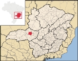
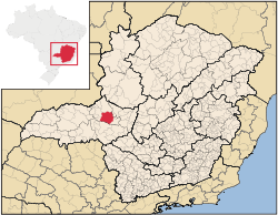
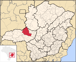
Patrocínio
Encyclopedia
Minas Gerais
Minas Gerais is one of the 26 states of Brazil, of which it is the second most populous, the third richest, and the fourth largest in area. Minas Gerais is the Brazilian state with the largest number of Presidents of Brazil, the current one, Dilma Rousseff, being one of them. The capital is the...
in Brazil
Brazil
Brazil , officially the Federative Republic of Brazil , is the largest country in South America. It is the world's fifth largest country, both by geographical area and by population with over 192 million people...
. The population of the municipality in 2007 was 81,589. The area is 2,867 km² and the elevation is 965 mts.
Highway connections
Patrocínio is connected with UberlândiaUberlândia
Uberlândia is the main town in the Triangle region, west of the state of Minas Gerais, Brazil. With a population of 604,013 inhabitants, according to 2010 estimates, the city is the second largest in the state second only to Belo Horizonte...
by BR-365 (154 km) and with Patos de Minas
Patos de Minas
Patos de Minas is a city and municipality in the state of Minas Gerais in Brazil, located some 400 km from Belo Horizonte on the Paranaíba River. The city had 133,054 in 2007 while the area of the municipality is 3,189 km²...
, 72 kilometers to its northeast. Other distances are to:
- Belo HorizonteBelo HorizonteBelo Horizonte is the capital of and largest city in the state of Minas Gerais, located in the southeastern region of Brazil. It is the third largest metropolitan area in the country...
: 405 km - AraguariAraguariAraguari is a city and municipality in northwestern Minas Gerais state, Brazil. It is located in the northern Triângulo Mineiro region, on the Jordão River, a tributary of the Paranaíba River, at an elevation between 940 and 1,087 meters....
: 160 km. - PerdizesPerdizesPerdizes is a district in the subprefecture of Lapa, in São Paulo, Brazil.Built in an ancient area of Pacaembu Farm, Perdizes was historically considered only a poor rural area. Today, it is one of the most urbanized areas of São Paulo and known for being the home for the Pontifical Catholic...
: 62 km. - UberabaUberabaUberaba is a city and municipality in the west of the state of Minas Gerais in Brazil. Its population is 296.000 with an area of 4529.7 km², giving a density of 60.71 people per km². It is located on a plateau at an elevation of 785 meters and is in the Uberaba River floodplain...
: 191 km.
BR-365, a federal road, crosses through Patrocínio. It has an extension of 866 km. linking Montes Claros
Montes Claros
Montes Claros is a city located in northern Minas Gerais state, in Brazil. The estimated population in 2010 was 412,284 inhabitants and the total area of the municipality was 3,470 km²...
, a northern city in the state of Minas Gerais to the state of Goiás, passing through the city of Uberlândia
Uberlândia
Uberlândia is the main town in the Triangle region, west of the state of Minas Gerais, Brazil. With a population of 604,013 inhabitants, according to 2010 estimates, the city is the second largest in the state second only to Belo Horizonte...
, the largest and most important city in the western part of the state. Another important highway is BR-462, which connects Perdizes
Perdizes
Perdizes is a district in the subprefecture of Lapa, in São Paulo, Brazil.Built in an ancient area of Pacaembu Farm, Perdizes was historically considered only a poor rural area. Today, it is one of the most urbanized areas of São Paulo and known for being the home for the Pontifical Catholic...
with Patrocínio and has a length of 76 km.
Location
It is located in the north-center of the state near the rich industrial and agricultural region of the Triângulo MineiroTriângulo Mineiro
The Triangle Mineiro Portuguese pronunciation: [tɾiɐɡulu minejru] is an officer in the region west of the state of Minas Gerais, Brazil. The area is 93.500 km ² and is limited by the Serra da Canastra and Marcela, east, south of Sao Paulo, Goias in the north and west of the junction of the rivers...
, on BR 365 between Patos de Minas
Patos de Minas
Patos de Minas is a city and municipality in the state of Minas Gerais in Brazil, located some 400 km from Belo Horizonte on the Paranaíba River. The city had 133,054 in 2007 while the area of the municipality is 3,189 km²...
and Uberlândia
Uberlândia
Uberlândia is the main town in the Triangle region, west of the state of Minas Gerais, Brazil. With a population of 604,013 inhabitants, according to 2010 estimates, the city is the second largest in the state second only to Belo Horizonte...
. It is home to the Edward Lane Bible Institute.
Patrocínio is surrounded by the following municipalities:
- North: CoromandelCoromandel, Minas GeraisCoromandel is a Brazilian town, located in the southeast region of the country, in the state of Minas Gerais. Its population is over 28,000 people according the 2004 census. The municipality of Coromandel is located 495 km from the state capital Belo Horizonte, and 673 km from São Paulo...
- East: GuimarâniaGuimarâniaGuimarânia is a Brazilian municipality located in the northwest of the state of Minas Gerais. Its population as of 2007 was 6,946 people living in a total area of 371 km². The city belongs to the mesoregion of Triângulo Mineiro e Alto Paranaíba and to the microregion of Patos de Minas...
, Cruzeiro da FortalezaCruzeiro da FortalezaCruzeiro da Fortaleza is a Brazilian municipality located in the northwest of the state of Minas Gerais. Its population as of 2007 was 3,760 people living in a total area of 185 km². The city belongs to the mesoregion of Triângulo Mineiro e Alto Paranaíba and to the microregion of Patrocínio...
and Serra do SalitreSerra do SalitreSerra do Salitre is a Brazilian municipality located in the northwest of the state of Minas Gerais. Its population as of 2007 was 10,224 people living in a total area of 1,298 km². The city belongs to the mesoregion of Triângulo Mineiro e Alto Paranaíba and to the microregion of Patrocínio... - South: PerdizesPerdizesPerdizes is a district in the subprefecture of Lapa, in São Paulo, Brazil.Built in an ancient area of Pacaembu Farm, Perdizes was historically considered only a poor rural area. Today, it is one of the most urbanized areas of São Paulo and known for being the home for the Pontifical Catholic...
- West: Iraí de MinasIraí de MinasIraí de Minas is a Brazilian municipality located in the northwest of the state of Minas Gerais. Its population as of 2007 was 6,295 people living in a total area of 357 km². The city belongs to the mesoregion of Triângulo Mineiro e Alto Paranaíba and to the microregion of Patrocínio...
and Monte CarmeloMonte CarmeloMonte Carmelo is a Brazilian municipality located in the northwest of the state of Minas Gerais. Its population as of 2007 was 44,367 people living in a total area of 1,354 km². The city belongs to the mesoregion of Triângulo Mineiro e Alto Paranaíba and to the microregion of Patrocínio...
Statistical micro-region
Patrocínio is also a statistical micro-region with 6 municipalities: Abadia dos DouradosAbadia dos Dourados
Abadia dos Dourados is a Brazilian municipality located in the northwest of the state of Minas Gerais. Its population as of 2007 was 6,556 people living in a total area of 894 km². The city belongs to the mesoregion of Triângulo Mineiro e Alto Paranaíba and to the microregion of Patrocínio...
, Coromandel
Coromandel, Minas Gerais
Coromandel is a Brazilian town, located in the southeast region of the country, in the state of Minas Gerais. Its population is over 28,000 people according the 2004 census. The municipality of Coromandel is located 495 km from the state capital Belo Horizonte, and 673 km from São Paulo...
, Cruzeiro da Fortaleza
Cruzeiro da Fortaleza
Cruzeiro da Fortaleza is a Brazilian municipality located in the northwest of the state of Minas Gerais. Its population as of 2007 was 3,760 people living in a total area of 185 km². The city belongs to the mesoregion of Triângulo Mineiro e Alto Paranaíba and to the microregion of Patrocínio...
, Douradoquara
Douradoquara
Doradoquara is a Brazilian municipality located in the northwest of the state of Minas Gerais. Its population as of 2007 was 1,846 people living in a total area of 313 km². The city belongs to the mesoregion of Triângulo Mineiro e Alto Paranaíba and to the microregion of Patrocínio...
, Estrela do Sul
Estrela do Sul
Estrela do Sul is a Brazilian municipality located in the northwest of the state of Minas Gerais. Its population as of 2007 was 7,136 people living in a total area of 820 km². The city belongs to the mesoregion of Triângulo Mineiro e Alto Paranaíba and to the microregion of Patrocínio...
, Grupiara
Grupiara
Grupiara is a Brazilian municipality located in the northwest of the state of Minas Gerais. Its population as of 2007 was 1,412 people living in a total area of 192 km². The city belongs to the mesoregion of Triângulo Mineiro e Alto Paranaíba and to the microregion of Patrocínio...
, Iraí de Minas
Iraí de Minas
Iraí de Minas is a Brazilian municipality located in the northwest of the state of Minas Gerais. Its population as of 2007 was 6,295 people living in a total area of 357 km². The city belongs to the mesoregion of Triângulo Mineiro e Alto Paranaíba and to the microregion of Patrocínio...
, Monte Carmelo
Monte Carmelo
Monte Carmelo is a Brazilian municipality located in the northwest of the state of Minas Gerais. Its population as of 2007 was 44,367 people living in a total area of 1,354 km². The city belongs to the mesoregion of Triângulo Mineiro e Alto Paranaíba and to the microregion of Patrocínio...
, Patrocínio, Romaria
Romaria
Romaria is a Brazilian municipality located in the northwest of the state of Minas Gerais. Its population as of 2007 was 3,566 people living in a total area of 402 km². The city belongs to the mesoregion of Triângulo Mineiro e Alto Paranaíba and to the microregion of Patrocínio...
, and Serra do Salitre
Serra do Salitre
Serra do Salitre is a Brazilian municipality located in the northwest of the state of Minas Gerais. Its population as of 2007 was 10,224 people living in a total area of 1,298 km². The city belongs to the mesoregion of Triângulo Mineiro e Alto Paranaíba and to the microregion of Patrocínio...
.
In the year 2000, its population was of 182,850 inhabitants in a total area of 12,017.00 km². The population density (year 2000) was 5.22 inhab/km².
Districts and Villages
Patrocínio has 04 districts: Salitre de Minas, São João da Serra Negra, Silvano e Santa Luzia dos Barros. The main villages are: São Benedito, Tejuco, Chapadão de Ferro, Dourados, Boa Vista, Santo Antônio do Quebra Anzol, Pedros and Macaúbas.Geography
The river network of the municipality is extensive and belongs to the basin of the Paranaíba RiverParanaíba River
The Paranaíba River is a Brazilian river whose source lies in the state of Minas Gerais in the Mata da Corda mountains, municipality of Rio Paranaíba, at an altitude of 1,148 meters; on the other face of this mountain chain are the sources of the Abaeté river, tributary of the São Francisco River...
. The main watercourses are the rivers: Quebranzol and Santo Antonio (tributaries of the Rio Araguari); Dourados and Perdizes and Rio Espírito Santo as well as the streams (ribeirões) Salitre, Pavões, Macaúbas and Córrego do Ouro. There are also waterfalls that are little known by tourists. One example is “Cachoeiras do Lemos”, on the Ribeirão de Rita Matos, which flows into the Rio Salitre and “Cachoeira dos Borges”. Patrocínio has many small streams that allow for irrigation of the fields and for the raising of fish. The municipality has the greatest area of the region inundated by the Hydroelectric Reservoir of Nova Ponte, a total of 135.44 square kilometers. In 2006 the reservoir reached its maximum level, 815 meters above sea level.
The vegetation is cerrado
Cerrado
The Cerrado, is a vast tropical savanna ecoregion of Brazil, particularly in the states of Gioas and Minas Gerais...
, a landscape characterized by extensive savanna formations crossed by gallery forests and stream valleys. Traditionally this region was used for cattle raising, but in recent years the growing of soybeans has made encroachments causing the loss of most of the trees. Rainfall is abundant, between 1,100 and 1,600 millimeters per year), although this rainfall is concentrated in a six to seven month period between October and April.
The climate can be classified as Tropical of altitude, with yearly average temperature between 9°C (48.2°F) and 35°C (95°F). The Köppen climate classification of the region is Cwa (Tropical on high altitudes, humid/warm summer and a dry/cool winter). As a city located in the southern Hemisphere, the spring starts in September, summer in December, autumn in March, and winter in June. There are just two seasons (a hot and humid one from October to March, and a colder and drier one from April to September). The coldest month is generally July and the hottest month is January. The climate is mild throughout the year with the high altitude reducing the heat and humidity so common at lower elevations.
Economy
The region has an economy based on cattle raising and agriculture, with dairy cattle being the most important activity. It is also the third largest producer of hogs in the country. There are also many small industries and the commercial sector is very strong.Patrocínio has a bovine herd raised mainly for milk. According to the IBGE, there are approximately 132,000 head, distributed among 2,166 producers, responsible for the production of approximately 130,000 liters a day, which is mainly sent to the Belo Horizonte market. Part of the milk is transformed into traditional cheese and candies.
In hog production there are 14 large producers, with thousands of sows. These large ranches, together with dozens of small producers, raise approximately 5,399 sows, with an average production of 22 piglets a year, with a total of more than 125,000 head. The production is commercialized in Uberlândia and Belo Horizonte.
One of the strongest economic sectors is its industry. There are industries of ceramics, cold meats, animal feed, textiles – Minas Silk, and various warehouses to process coffee.
Coffee production
Patrocínio has become one of the most important coffee producing areas of Brazil. About 78% of the economy is connected to coffee, with the activity employing more than 30,000 people.The cultivation of coffee began in the 1970s when strong frost decimated the large farms of Paraná and São Paulo. The region has a mild climate, good water distribution, with a large number of streams, and an annual rainfall considered ideal for coffee—about 1,600 milliliters.
Area of permanent crops
- Coffee: 32,400 ha.
- Passion fruit: 105 ha.
- Banana: 90 ha.
- Tangerine: 70 ha.
- Coconut: 20 ha.
Area of perennial crops
- Corn: 13,000 ha.
- Soybeans: 10,000 ha.
- Beans: 1,550 ha.
- Sorghum: 760 ha.
- Potatoes: 350 ha.
- Tomatoes: 276 ha.
- Manioc: 150 ha.
- Rice: 100 ha.
- Sugarcane: 100 ha.
Farm information (year 2006)
- Number of farms: 2,725
- Total agricultural area: 186,481 ha.
- Area of permanent crops: 28,489 ha.
- Area of perennial crops: 47,786 ha.
- Area of natural pasture: 85,506 ha.
- Workers related to the producer: 5,593
- Workers not related to the producer: 12,412
Education
The municicipal network has 12 schools with 7,180 students enrolled.- Child education: 2,043 students
- Primary education: 4,435 students
- Middle school: 80 students
- Night school. 500 students In child education there are 2,043 students
The municipality has 21 schools in the state network. There are also 4 private schools, Colégio Nossa Senhora do Patrocínio, Prisma, Atenas, ABC and several child care centers. There are two institutes of higher learning—Centro Universitário do Cerrado and the Faculdade de Filosofia, Ciências e Letras de Patrocínio.
Municipal Human Development Index
- The MHDI was 0.799 in 2000. For the complete list in Minas Gerais see Frigoletto
Tourism
Chapadão lake can be reached by BR-365 or by the Patrocínio/Cruzeiro da Fortaleza road. It is believed that Chapadão is the crater of an inactive volcano, which is clearly seen through Google Earth to the right of the city, being a small part of it a lake, and the large remainder farm land.The city offers attractive plazas, where its inhabitants enjoy evening strolls. The main ones are Monsenhor Tiago, or Matriz, Santa Luzia and Honorato Borges. Its hotel infrastructure offers more than 1,000 beds in a total of 14 hotels.
Culture
- The Casa da Cultura de Patrocínio promotes and stimulates the cultural activities in the city. It offers courses in painting, jewelry making, and rug making. It is a place where local artists can show their works. The holdings consist of 243 paintings by national and local artists. There is a collection of 843 photos of historical Patrocinio.
- Museu Professor Hugo Machado da Silveira: this museum holds the municipal archives, documents, specimens of natural history, rare photos, clothes, machinery, and tools, used throughout the history of the town.
There is a rich tradition of folkloric dances called congadas. These dance groups show a strong African-Brazilian influence. The festivities are in honor of Nossa Senhora do Rosário and São Benedito and Santa Luzia. Most of the celebrations are held between the months of August and January. This is one of the richest traditions brought by the slaves who lived in the region in the seventeenth and eighteenth centuries.
Sports infrastructure
There is a stadium for professional football—Estádio Júlio Aguiar—and a sports center seating several thousand spectators for basketball, volleyball and shows. This sports-center belongs to the Ginásio do Patrocínio Tênis Clube. In the city there are 7 multipurpose gymnasiums in addition to several swimming pools.History
The origins of the region begin with the bandeirantesBandeirantes
The bandeirantes were composed of Indians , caboclos , and some whites who were the captains of the Bandeiras. Members of the 16th–18th century South American slave-hunting expeditions called bandeiras...
, explorers during the Portuguese colonial period, who passed through on their way to the capitania of Goiás looking for gold and slaves. In 1771 the Conde de Valadares, Captain General of Minas Gerais, asked Inácio de Oliveira Campos to make explorations and excavations in the region. In 1773 in the valley of the Rio Dourados he started a ranch called Bromado dos Pavões. This small settlement became part of the Capitania of Goiás and the name was later changed to Salitre. In 1793 the first inhabitants appeared and in 1800 the first chapel was built. At this time the settlement was only an "arraial", a village, and was called Senhora do Patrocínio. In 1819 it had about 40 houses made of mud (adobe bricks) and wood covered with tiles and without any plasterings. In 1839 the parish was established and the first parish priest was appointed. In 1840 Nossa Senhor do Patrocínio was declared a municipality separating thus from Araxá
Araxá
Araxá is a city and municipality in southwest Minas Gerais state, Brazil. The population was 87,764 inhabitants and the area of the municipality is 1,283 km², with 345 km² making up the urban perimeter.-Geography:...
. In 1858 part of the municipality was dismembered to create Estrela do Sul
Estrela do Sul
Estrela do Sul is a Brazilian municipality located in the northwest of the state of Minas Gerais. Its population as of 2007 was 7,136 people living in a total area of 820 km². The city belongs to the mesoregion of Triângulo Mineiro e Alto Paranaíba and to the microregion of Patrocínio...
. In 1868 another dismemberment occurred creating Patos de Minas
Patos de Minas
Patos de Minas is a city and municipality in the state of Minas Gerais in Brazil, located some 400 km from Belo Horizonte on the Paranaíba River. The city had 133,054 in 2007 while the area of the municipality is 3,189 km²...
.
The name of the city is supposedly due to a very rich landowner, who, according to the legend, upon seeing his only daughter gravely ill, asked protection from the Virgin Mary, promising the construction of a chapel if the girl was cured. When this took place he had a church built, bestowing upon it the name of Nossa Senhora do Patrocínio, which means "protection".
External links
- All about Patrocínio
- Prefeitura de Patrocínio A professional website with a video