Araguari
Encyclopedia
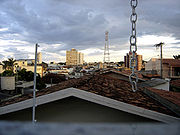
Araguari is a city and municipality in northwestern Minas Gerais
Minas Gerais
Minas Gerais is one of the 26 states of Brazil, of which it is the second most populous, the third richest, and the fourth largest in area. Minas Gerais is the Brazilian state with the largest number of Presidents of Brazil, the current one, Dilma Rousseff, being one of them. The capital is the...
state, Brazil
Brazil
Brazil , officially the Federative Republic of Brazil , is the largest country in South America. It is the world's fifth largest country, both by geographical area and by population with over 192 million people...
. It is located in the northern Triângulo Mineiro
Triângulo Mineiro
The Triangle Mineiro Portuguese pronunciation: [tɾiɐɡulu minejru] is an officer in the region west of the state of Minas Gerais, Brazil. The area is 93.500 km ² and is limited by the Serra da Canastra and Marcela, east, south of Sao Paulo, Goias in the north and west of the junction of the rivers...
region, on the Jordão River, a tributary of the Paranaíba River
Paranaíba River
The Paranaíba River is a Brazilian river whose source lies in the state of Minas Gerais in the Mata da Corda mountains, municipality of Rio Paranaíba, at an altitude of 1,148 meters; on the other face of this mountain chain are the sources of the Abaeté river, tributary of the São Francisco River...
, at an elevation between 940 and 1,087 meters.
The municipality of Araguari has an area of 2,774 km², with 54 km² in the urban zone and 2,675 km² in the rural zone. The population in 2007 was 106,403, making it the third most important city in the Triângulo Mineiro, after Uberlândia
Uberlândia
Uberlândia is the main town in the Triangle region, west of the state of Minas Gerais, Brazil. With a population of 604,013 inhabitants, according to 2010 estimates, the city is the second largest in the state second only to Belo Horizonte...
and Uberaba
Uberaba
Uberaba is a city and municipality in the west of the state of Minas Gerais in Brazil. Its population is 296.000 with an area of 4529.7 km², giving a density of 60.71 people per km². It is located on a plateau at an elevation of 785 meters and is in the Uberaba River floodplain...
.
Rivers
Rivers that water the municipality are: Rio Araguari, Ribeirão das Araras, Corrego Grande, Ribeirão Jordão, and Ribeirão Piçarrão. The Paranaíba in the north forms the boundary with the state of GoiásGoiás
Goiás is a state of Brazil, located in the central part of the country. The name Goiás comes from the name of an indigenous community...
. There are many waterfalls and rapids (128 according to one source) giving the area a great potential in tourism.
Climate
The year is divided into two periods, the rainy season from November to April and the dry season from May to October. Because of the elevation (more than 1,000 meters above sea level) temperatures are pleasant with few extremes although humidity can be high in the rainy season.- Annual average temperature: 20.7 C
- Maximum annual average: 26.3 C
- Minimum annual average: 16 C
- Annual average rainfall: 1484 mm
Distances from major cities
- Belo Horizonte 569 km.
- Rio de Janeiro 1,000 km.
- São Paulo 623 km.
- Brasília 397 km.
Main highways serving the municipality
- BR-050 - São Paulo - Brasilia: allows for south/center-west integration, and connecting with the Belém/Brasília reaches the north of the country.
- MG-223 - Allows for the integration of the region of the Triângulo Mineiro with the capital of the state, Belo Horizonte, connecting with BR-365 and with BR 050.
- MG-413 - It connects Araguari with Goiânia and all the center-west of the country.
- MG-748 - It connects Araguari to BR-365, interconnecting with the north of Minas Gerais as far as Montes Claros.
Araguari is a major railroad junction and connects with the states of Goiás
Goiás
Goiás is a state of Brazil, located in the central part of the country. The name Goiás comes from the name of an indigenous community...
, Tocantins
Tocantins (state)
Tocantins is one of the states of Brazil. . The state was formed in 1988 out of the northern part of Goiás, and construction began on the capital, Palmas, in 1989, in contrast to most of the other cities in the state which date back to the Portuguese colonial period...
, and Mato Grosso do Sul
Mato Grosso do Sul
Mato Grosso do Sul is one of the states of Brazil.Neighboring Brazilian states are Mato Grosso, Goiás, Minas Gerais, São Paulo and Paraná. It also borders the countries of Paraguay and Bolivia to the west. The economy of the state is largely based on agriculture and cattle-raising...
.
Demographics
- Total population in 2007: 110,923
- Urban population: 103,001
- Population in 1960: 52,191
- Population in 1970: 63,368
- Population in 1980: 83,523
- Population in 1991: 91,428
- Population in 2000: 101,974
The economy
Araguari's main source of income is from the large herds of cattle raised in the hinterlands, where rice, soybeans, corn (maize), citrus fruits, tomatoes, beans, and manioc are also cultivated. In recent years the region has become one of the most important coffee-growing areas in the country and there is an annual coffee fair. Araguari has 9 financial institutions. There is an industrial park with several industries specializing in metallurgy, agro-industrial products (cold meats and juices) and storage facilities for grainsOccupation of the population by sectors
- Agriculture: 7,280
- Industry: 13,032
- Commerce: 4,451
- Transport, communication, and storage: 2,392
- Other services: 14,107
Enterprises
- Total number in 2007: 3,882 units
- Wholesale commerce: 241 units
- Retail commerce: 1,762 units
- Industrial: 468 units employing 5,459 workers in 2005
- Construction: 54 units employing 2,663 workers
- Commerce, vehicle repair, personal and domestic objects: 2,048 units employing 3,773 workers
- Restaurants and hotels: 205 units employing 711 workers
- Transportation, storage, and communications: 268 units employing 1,095 workers
- Real estate, rents, and services to companies: 426 units with 1,138 workers
- Public administration, defense, and social security: 20 units with 1,881 workers
- Education: 57 units with 817 workers
- Other collective, social and personal services: 268 units with 1,246 workers
Farm data for 2006
Most of the rural properties have between 01 and 50 hectares. If we add to this group those properties between 51 and 100 hectares then we reach 72% of the total.
- Number of farms: 1,164
- Agricultural area: 154,240
- Area of permanent crops: 52,974 ha.
- Area of perennial crops: 24,936
- Area of natural pasture: 48,749
- Workers related to the producer: 2,459
- Workers not related to the producer: 1,765
Main permanent crops in planted area in 2006
- Banana: 130 ha.
- Rubber (coagulated latex): 97 ha.
- Coffee: 8,500 ha.
- Coconut: 75 ha.
- Oranges: 20 ha.
- Papaya: 20 ha.
- Passion fruit: 450 ha.
- Hearts of palm: 61 ha.
Main perennial crops in planted area in 2006
- Garlic: 238 ha.
- Rice: 100 ha.
- Beans: 310 ha.
- Manioc: 238 ha.
- Corn: 14,000 ha.
- Soybeans: 17,500 ha.
- Tomatoes: 423 ha.
- Wheat: 156 ha.
Livestock raising in 2006
- Number of cattle: 79,643 head raised by 1,232 producers
- Number of poultry: 1,593.370 head
- Number of swine: 39,033 head
Health and education
- Infant mortality rate: 22.55 (1998)
- Literacy rate in 2000: 95.6%
- Hospitals: 4 private and 1 philanthropic with 360 beds
- Public Health centers 15 with 54 doctors 34 dentists, and 9 psychologists (2002)
- Private clinics: 22 with 112 doctors and 115 dentists
- Primary schools: 46 with 16,000 students
- Middle and secondary schools: 16 with 5,397 students
- Higher education: 2 schools with 2,560 students in 2005 offering 6
- Municipal Human Development IndexHuman Development IndexThe Human Development Index is a composite statistic used to rank countries by level of "human development" and separate "very high human development", "high human development", "medium human development", and "low human development" countries...
: 815
Culture
There is a theater with capacity to seat 120 persons. The sports center seats 5,000 spectators. In the urban area there is a tropical forest, the Bosque John Kennedy, with an area of 112,000 square meters.Tourism
On the northern boundary of the municipality is an immense complex of hydroelectric power stations (Emborcação and Miranda), which form several lakes. In addition to the energy supplied these are great tourist attractions, providing opportunities for fishing and the practice of water sports. http://www.cemig.com.br/institucional/usinas/2g.asp and http://www.cemig.com.br/institucional/usinas/7g.asp And two more are being built (Capim Branco I and II)History
Settlement began in the first decades of the nineteenth century. Brejo Alegre was the name of the small village (arraial) composed of some buildings, among them a small chapel, simple houses, a few stores, and a lot of cattle ranches. In 1843 the village was raised to the status of district with the name of Sant’Ana do Rio das Velhas.In 1882 the district was declared a "vila" (town) and in 1888 it was raised to the category of "cidade" or city, with the new name of Araguari.
At this time the town consisted of the Igreja Matriz (Main church) of Senhor Bom Jesus da Cana Verde with its colonial style; the cemetery located behind the church; the houses with tiles but no ceilings, called casas de “telhas ao vento”; and in the center flowed a stream dividing the settlement, one part called Goiás, and the other, Minas. The small commerce consisted of a bakery, a shoe store, two pharmacies and some general stores, called “vendas”.
The great change in the town's situation occurred with the arrival of the railroad, the Cia. Mogiana de Estrada de Ferro, in 1896. In 1906 this railroad, called Estrada de Ferro Goiás, was extended to Goiás
Goiás
Goiás is a state of Brazil, located in the central part of the country. The name Goiás comes from the name of an indigenous community...
, further increasing the growth of the city.