
Quebec Autoroute 35
Encyclopedia
- "Autoroute 35" redirects here. For the FrenchFranceThe French Republic , The French Republic , The French Republic , (commonly known as France , is a unitary semi-presidential republic in Western Europe with several overseas territories and islands located on other continents and in the Indian, Pacific, and Atlantic oceans. Metropolitan France...
autoroute from LauterbourgLauterbourgLauterbourg is a commune and Bas-Rhin department in Alsace in north-eastern France. Situated on the German border and not far from the German city of Karlsruhe, it is the easternmost commune in Metropolitan France...
to Saint-LouisSaint-Louis, Haut-RhinSaint-Louis is a commune in the Haut-Rhin department in Alsace in north-eastern France.The inhabitants are called Ludoviciens.-Geography:...
, see A35 autorouteA35 autorouteThe A35 autoroute is a toll free highway in north eastern France. It is also known as the autoroute des cigognes and the Voie Rapide du Piémont des Vosges. It connects the German border in the Rhine valley with the Swiss frontier via Strasbourg...
.
Autoroute 35 (or A-35, also called Autoroute de la Vallée-des-Forts) is a north-south Autoroute
Autoroute (Quebec)
The Autoroute system is a network of expressways in the province of Quebec, Canada, operating under the same principle of controlled access as the Interstate Highway System in the United States or the 400-Series Highways in neighbouring Ontario. The Autoroutes are the backbone of Quebec's highway...
in southern Quebec
Quebec
Quebec or is a province in east-central Canada. It is the only Canadian province with a predominantly French-speaking population and the only one whose sole official language is French at the provincial level....
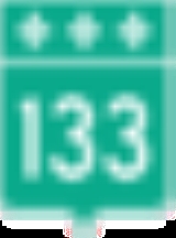
. It currently runs from Saint-Jean-sur-Richelieu (where it continues as two-lane Route 133
Quebec route 133
Route 133 is a historic and heritage road of the Montérégie region in the province of Quebec, with north/south orientation and located on the eastern shore of the Richelieu River...
into Vermont
Vermont
Vermont is a state in the New England region of the northeastern United States of America. The state ranks 43rd in land area, , and 45th in total area. Its population according to the 2010 census, 630,337, is the second smallest in the country, larger only than Wyoming. It is the only New England...
) to Autoroute 10
Quebec Autoroute 10
Autoroute 10 is an Autoroute in southern Quebec, Canada...
in Chambly
Chambly, Quebec
Chambly is a city in southwestern Quebec, Canada, about to the south east of Montreal.- Geography :It sits on the Richelieu River in the Regional County Municipality of La-Vallée-du-Richelieu, at .-History:...
.
First constructed in the late 1960s, A-35 is currently a 19.2 km (11.9 mi) long, 4-lane stub freeway linking Saint-Jean-sur-Richelieu to Autoroute 10
Quebec Autoroute 10
Autoroute 10 is an Autoroute in southern Quebec, Canada...
. However, a planned southern extension will finish the connection to Interstate 89
Interstate 89
Interstate 89 is an interstate highway in the New England region of the United States travelling between Bow, New Hampshire and Highgate Springs, Vermont. As with all odd-numbered primary interstates, I-89 is signed as a north–south highway...
and allow for a direct freeway route between Montreal
Montreal
Montreal is a city in Canada. It is the largest city in the province of Quebec, the second-largest city in Canada and the seventh largest in North America...
and New England
New England
New England is a region in the northeastern corner of the United States consisting of the six states of Maine, New Hampshire, Vermont, Massachusetts, Rhode Island, and Connecticut...
, bypassing the mostly 2-lane (and sometimes treacherous) Route 133. (The southernmost part of Route 133 is already a 4-lane at-grade expressway
Limited-access road
A limited-access road known by various terms worldwide, including limited-access highway, dual-carriageway and expressway, is a highway or arterial road for high-speed traffic which has many or most characteristics of a controlled-access highway , including limited or no access to adjacent...
and the rest of the route is on a new alignment.) Construction of the 37.9 km extension is divided into four segments. The first section (first two segments) of new highway between Saint-Jean-sur-Richelieu and Highway 133 to Saint-Sébastien is currently scheduled to open at the end of 2013. According to current planning, it is expected that the entire extension will be open to traffic in 2017. Once completed, the length of A-35 will increase to 55 km (34.2 mi).
Exit list
Interchanges are listed from south to north.| Location | km | No. Exit number An exit number is a number assigned to a road junction, usually an exit from a freeway. It is usually marked on the same sign as the destinations of the exit, as well as a sign in the gore.... |
Destinations | Notes |
|---|---|---|---|---|
| Saint-Jean-sur-Richelieu | 0.0 | Current southern terminus of  A-35. A-35.A-35 south defaults onto Route 133 Quebec route 133 Route 133 is a historic and heritage road of the Montérégie region in the province of Quebec, with north/south orientation and located on the eastern shore of the Richelieu River... south. Southern terminus of A-35/ Route 133 concurrencyConcurrency (road) A concurrency, overlap, or coincidence in a road network is an instance of one physical road bearing two or more different highway, motorway, or other route numbers... . |
||
| 1 | Route 133 north (Boulevard d'Iberville) | Southbound only. | ||
| 39 (was 3) | Route 104 Quebec route 104 Route 104 is an east/west highway on the south shore of the St. Lawrence River. Its eastern terminus is in Knowlton at the junction of Route 243 and its western terminus is in La Prairie at the junction of Route 134.-Municipalities along Route 104:... east |
|||
| Eastern terminus of A-35/ Route 104 Quebec route 104 Route 104 is an east/west highway on the south shore of the St. Lawrence River. Its eastern terminus is in Knowlton at the junction of Route 243 and its western terminus is in La Prairie at the junction of Route 134.-Municipalities along Route 104:... concurrency. |
||||
| Northern terminus of A-35/ Route 133 concurrency. A-35/Route 104 overlap continues. |
||||
| 42 (was 6) | Route 133 north (Chemin des Patriotes) | |||
| 43 (was 7) | Route 223 Quebec route 223 Route 223 is a north/south highway on the south shore of the Richelieu River. Its northern terminus is in Sorel-Tracy at the junction of Route 132 and its southern terminus is close to Lacolle, where it crosses the U.S. border and continues into New York state as U.S... (Boulevard du Séminaire) |
|||
| 45 (was 9) | Route 219 Quebec Route 219 Route 219 is a provincial highway located in the Montérégie region of Quebec south of Montreal. It starts at the border south of Hemmingford and ends in Saint-Jean-sur-Richelieu.... (Rue Pierre-Caisse) |
|||
| Western terminus of A-35/ Route 104 concurrency. |
||||
| 47 (was 11) | Route 104 west (Boulevard St-Luc) to Route 223 | |||
| 50 (was 14) | Chemin St-André | |||
| Carignan Carignan, Quebec Carignan is a town in southwestern Quebec, Canada on the Richelieu River in the Regional County Municipality of La-Vallée-du-Richelieu. The population as of the Canada 2006 Census was 7,426.... -Chambly Chambly, Quebec Chambly is a city in southwestern Quebec, Canada, about to the south east of Montreal.- Geography :It sits on the Richelieu River in the Regional County Municipality of La-Vallée-du-Richelieu, at .-History:... boundary |
19.2 | 55 (was 18) |  A-10 A-10Quebec Autoroute 10 Autoroute 10 is an Autoroute in southern Quebec, Canada... /Rue Brunelle |
|
| Northern terminus of A-35. Roadway continues north as Boulevard Fréchette. |
||||
Proposed interchanges
Exits are listed from south to north. Exit numbers are based on the distance from the future southern terminus of A-35 at the Canada-United States borderCanada-United States border
The Canada–United States border, officially known as the International Boundary, is the longest border in the world. The terrestrial boundary is 8,891 kilometers long, including 2,475 kilometres shared with Alaska...
.
| Location | km | No. Exit number An exit number is a number assigned to a road junction, usually an exit from a freeway. It is usually marked on the same sign as the destinations of the exit, as well as a sign in the gore.... |
Destinations | Notes | |
|---|---|---|---|---|---|
| Saint-Armand Saint-Armand, Quebec Saint-Armand is a municipality in the Canadian province of Quebec, located within the Brome-Missisquoi Regional County Municipality. The population as of the Canada 2006 Census was 1,166.-Population:Population trend... |
0.0 | Canada – United States border Future southern terminus of A-35.Will continue as  I-89 I-89Interstate 89 Interstate 89 is an interstate highway in the New England region of the United States travelling between Bow, New Hampshire and Highgate Springs, Vermont. As with all odd-numbered primary interstates, I-89 is signed as a north–south highway... south. |
|||
| 3 | Chemin de St-Armand | ||||
| 6 | Route 133 Quebec route 133 Route 133 is a historic and heritage road of the Montérégie region in the province of Quebec, with north/south orientation and located on the eastern shore of the Richelieu River... /Chemin Champlain |
||||
| Saint-Sébastien Saint-Sébastien, Quebec Saint-Sébastien, Quebec can refer to:*Saint-Sébastien, Estrie, Quebec, in Le Granit Regional County Municipality*Saint-Sébastien, Montérégie, Quebec, in Le Haut-Richelieu Regional County Municipality... |
15 | Route 133 | |||
| Saint-Alexandre Saint-Alexandre, Quebec Saint-Alexandre is a municipality in the province of Quebec, Canada, located in the Regional County Municipality of Le Haut-Richelieu. The population as of the Canada 2006 Census was 2,340... |
27 | Route 227 Quebec Route 227 Route 227 is a provincial highway located in the Montérégie region of Quebec. The highway runs from Venise-en-Québec at the junction of Route 202 in the northwestern shores of Lake Champlain and ends at the junction of Autoroute 20 in Sainte-Marie-Madeleine, near Mont-Saint-Hilaire... north (Montée de la Station) |
|||
| 28 | Route 227 south (Rang des Dussault) | ||||
| Saint-Jean-sur-Richelieu | 36 | Chemin de la Grande-Ligne | |||