
Pennsylvania Route 93
Encyclopedia
Pennsylvania Route 93 is a 40 miles (64.4 km) long state route located in northern Pennsylvania
. The northern terminus of the route is at Pennsylvania Route 487
in Orangeville
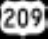
. The southern terminus is at U.S. Route 209 east of Nesquehoning
. Although the route is signed north–south, PA 93 follows an east–west alignment between Berwick
and Orangeville.
. Past the range's summit, PA 93 intersects two quadrant routes, SR 4006 and SR 4010, both leading to the community of Weatherly
, prior to entering the first populated area along the route, Beaver Meadows
. After a junction with another quadrant route in the center of the borough, PA 93 exits town on Berwick Street and crosses into Luzerne County
soon afterward.
. At a junction immediately southeast of Hazleton with Pennsylvania Route 424
, a bypass built in 2000 linking PA 93 to Interstate 81, PA 93 becomes East Broad Street, a name it retains as it enters the city.
Though not named Main Street, PA 93 acts as the main thoroughfare through Hazleton, intersecting every state route that enters the city and providing access to I-81 northwest of downtown. At Church Street, PA 93 intersects Pennsylvania Route 309
and becomes West Broad Street. Six blocks west, PA 93 meets Pennsylvania Route 924
at Diamond Avenue. The two routes run concurrent
one another for nine blocks to the north along West Hazleton
's South Broad Street, splitting at 15th Street. From here, PA 924 heads east and re-enters Hazleton while PA 93 continues northward on North Broad Street, and later Susquehanna Boulevard after North Broad branches off from the route.
At 22nd Street, the area surrounding PA 93 changes once more, this time from dense residential neighborhoods to commercial and industrial centers. PA 93 continues to the northwest through the center, passing the Valmont Industrial Park to the southwest and Laurel Mall
to the north prior to interchanging with I-81 at exit 145.
On the opposite side of I-81, the surrounding area takes on a suburban feel once again as PA 93, now the Berwick-Hazleton Highway, passes along the southern edge of Conyngham
before entering the Sugarloaf Township
community of Sybertsville
. Upon exiting Sybertsville, however, PA 93 becomes a largely rural road once again, passing through sparsely populated valleys as it interchanges with Interstate 80 1.5 miles (2.4 km) north of Sybertsville. North of I-80, PA 93 breaks from its northerly alignment and begins to progress due west to avoid the Nescopeck Mountains to its north. After clearing the range, PA 93 follows a northwesterly track through Briggsville, where PA 93 meets the southern terminus of Pennsylvania Route 239
, before turning back to the west to pass through Nescopeck
, where PA 93 intersects the northern terminus of Pennsylvania Route 339
, and enter Columbia County
yards from the Susquehanna River
.
before entering Berwick on the opposite riverbank.
Two blocks into Berwick, PA 93 meets Front Street and 2nd Street, a pair of unidirectional streets carrying U.S. Route 11 through downtown Berwick. PA 93 turns left onto 2nd Street, joining with US 11 along 2nd Street, and later Front Street following the merge of Front and 2nd Streets, to Orange Street, where PA 93 splits from US 11 and heads west out of Berwick.
West of Berwick, the routing of PA 93 is largely dictated by the surrounding terrain, resulting in a series of turns and dips between Fowlersville and Ebenezer Church in North Centre Township
. Past Ebenezer Church, however, the routing of PA 93 is fairly linear, traveling due west to Orangeville, where PA 93 terminates at PA 487.
Pennsylvania
The Commonwealth of Pennsylvania is a U.S. state that is located in the Northeastern and Mid-Atlantic regions of the United States. The state borders Delaware and Maryland to the south, West Virginia to the southwest, Ohio to the west, New York and Ontario, Canada, to the north, and New Jersey to...
. The northern terminus of the route is at Pennsylvania Route 487
Pennsylvania Route 487
Pennsylvania Route 487 is a long, north–south state highway running from PA 61 in Shamokin Township, Northumberland County to PA 87 in Dushore, Sullivan County. In Bloomsburg, PA 487 and US 11 share a brief wrong-way concurrency...
in Orangeville
Orangeville, Pennsylvania
Orangeville is a borough in Columbia County, Pennsylvania. The population was 500 at the 2000 census. It is part of the Bloomsburg–Berwick Micropolitan Statistical Area.-Geography:Orangeville is located at ....
. The southern terminus is at U.S. Route 209 east of Nesquehoning
Nesquehoning, Pennsylvania
Nesquehoning is a borough in Carbon County, Pennsylvania, United States. The population was 3,288 at the 2000 census. The name is of Native American origin, commonly believed to signify "narrow valley;" however native language scholars translate the name as "at the black lick" or "at the dirty...
. Although the route is signed north–south, PA 93 follows an east–west alignment between Berwick
Berwick, Pennsylvania
Berwick is a borough in Columbia County, Pennsylvania, 22.6 miles southwest of Wilkes Barre. Berwick is one of two principal cities of the Bloomsburg–Berwick Micropolitan Statistical Area, a micropolitan area that covers Columbia and Montour counties and had a combined population of 82,387...
and Orangeville.
Carbon County
PA 93 begins at an intersection with US 209 east of the borough of Nesquehoning. The route proceeds to the northeast from US 209, running amidst the Broad Mountain Range in the largely rural northwest corner of Carbon CountyCarbon County, Pennsylvania
As of the census of 2000, there were 58,802 people, 23,701 households, and 16,424 families residing in the county. The population density was 154 people per square mile . There were 30,492 housing units at an average density of 80 per square mile...
. Past the range's summit, PA 93 intersects two quadrant routes, SR 4006 and SR 4010, both leading to the community of Weatherly
Weatherly, Pennsylvania
Weatherly a borough in Carbon County, Pennsylvania, located northwest of Jim Thorpe and northwest of Allentown. Early in the twentieth century, there were silk mills, foundries, a candy factory, a fabricating plant, and a cigar factory. In 1900 2,471 people lived there, and in 1910, the...
, prior to entering the first populated area along the route, Beaver Meadows
Beaver Meadows, Pennsylvania
Beaver Meadows is a borough in Carbon County, Pennsylvania, United States. The population was 968 at the 2000 census.-Geography:Beaver Meadows is located at ....
. After a junction with another quadrant route in the center of the borough, PA 93 exits town on Berwick Street and crosses into Luzerne County
Luzerne County, Pennsylvania
- Demographics :As of the 2010 census, the county was 90.7% White, 3.4% Black or African American, 0.2% Native American, 1.0% Asian, 3.3% were of some other race, and 1.5% were two or more races. 6.7% of the population was of Hispanic or Latino ancestry...
soon afterward.
Luzerne County
A short distance north of the county line, the area surrounding PA 93 transforms from rural mountains to suburbs, increasing in density as the route progresses toward HazletonHazleton, Pennsylvania
Hazleton is a city in Luzerne County, Pennsylvania, United States. The population was 25,340 at the 2010 census, an increase of 8.6% from the 2000 census count .-Greater Hazleton:...
. At a junction immediately southeast of Hazleton with Pennsylvania Route 424
Pennsylvania Route 424
Pennsylvania Route 424 is a 4 mile long state highway located in north-central Pennsylvania. The western terminus is at Interstate 81 exit 141 in Hazle Township. The eastern terminus is at Pennsylvania Route 93 on the southeastern edge of Hazleton...
, a bypass built in 2000 linking PA 93 to Interstate 81, PA 93 becomes East Broad Street, a name it retains as it enters the city.
Though not named Main Street, PA 93 acts as the main thoroughfare through Hazleton, intersecting every state route that enters the city and providing access to I-81 northwest of downtown. At Church Street, PA 93 intersects Pennsylvania Route 309
Pennsylvania Route 309
Pennsylvania Route 309 is a major highway which runs for 134 miles through Pennsylvania in the United States. It connects Philadelphia and its northern suburbs to Allentown, Hazleton, and Wilkes-Barre. A limited-access highway portion of PA 309 in the Wilkes-Barre area is known as the North...
and becomes West Broad Street. Six blocks west, PA 93 meets Pennsylvania Route 924
Pennsylvania Route 924
Pennsylvania Route 924 is a long state highway in the U.S. state of Pennsylvania. The highway runs from Pennsylvania Route 61 in Frackville to Pennsylvania Route 309 in Hazleton.-Route description:...
at Diamond Avenue. The two routes run concurrent
Concurrency (road)
A concurrency, overlap, or coincidence in a road network is an instance of one physical road bearing two or more different highway, motorway, or other route numbers...
one another for nine blocks to the north along West Hazleton
West Hazleton, Pennsylvania
West Hazleton, founded by Conrad Horn, is a borough in Luzerne County, Pennsylvania, south of Wilkes Barre. In 1900, 2,516 people lived here; in 1910, 4,715 people lived here. The population was 4,594 at the 2010 census...
's South Broad Street, splitting at 15th Street. From here, PA 924 heads east and re-enters Hazleton while PA 93 continues northward on North Broad Street, and later Susquehanna Boulevard after North Broad branches off from the route.
At 22nd Street, the area surrounding PA 93 changes once more, this time from dense residential neighborhoods to commercial and industrial centers. PA 93 continues to the northwest through the center, passing the Valmont Industrial Park to the southwest and Laurel Mall
Laurel Mall (Pennsylvania)
Laurel Mall is a shopping mall which opened in 1972 just NW of Hazleton, Pennsylvania. It features three anchor stores as well as a 10-theater Regal Cinemas, Old Navy, and Aldi. In July 2005, the mall was sold by PREIT to Laurel Mall, LLC for $33.5 million, including assumed debt of $22.6 million...
to the north prior to interchanging with I-81 at exit 145.
On the opposite side of I-81, the surrounding area takes on a suburban feel once again as PA 93, now the Berwick-Hazleton Highway, passes along the southern edge of Conyngham
Conyngham, Pennsylvania
Conyngham is a borough in Luzerne County, Pennsylvania, United States. The population was 1,958 at the 2000 census.- History :The Lehigh-Susquehanna Turnpike traveled through the middle of modern-day Main Street in Conyngham and at least one of the tollgates was situated near the village...
before entering the Sugarloaf Township
Sugarloaf Township, Luzerne County, Pennsylvania
Sugarloaf Township is a township in Luzerne County, Pennsylvania, United States. The population was 3,652 at the 2000 census.-Geography:According to the United States Census Bureau, the township has a total area of 21.9 square miles , of which, 21.9 square miles of it is land and...
community of Sybertsville
Sybertsville, Pennsylvania
Sybertsville is a community in Sugarloaf Township, Luzerne County, Pennsylvania. It is one mile northwest of Conyngham and six miles west-northwest of Hazelton....
. Upon exiting Sybertsville, however, PA 93 becomes a largely rural road once again, passing through sparsely populated valleys as it interchanges with Interstate 80 1.5 miles (2.4 km) north of Sybertsville. North of I-80, PA 93 breaks from its northerly alignment and begins to progress due west to avoid the Nescopeck Mountains to its north. After clearing the range, PA 93 follows a northwesterly track through Briggsville, where PA 93 meets the southern terminus of Pennsylvania Route 239
Pennsylvania Route 239
Pennsylvania Route 239 is an long state highway located in Luzerne, Columbia and Lycoming Counties in Pennsylvania. The southern terminus is at Route 93 in Nescopeck Township...
, before turning back to the west to pass through Nescopeck
Nescopeck, Pennsylvania
Nescopeck is a borough in Luzerne County, Pennsylvania, United States. The population was 1,528 at the 2000 census.-Geography:Nescopeck is located at ....
, where PA 93 intersects the northern terminus of Pennsylvania Route 339
Pennsylvania Route 339
Pennsylvania Route 339 is a long, north–south state highway located in Schuylkill, Columbia, and Luzerne counties in Pennsylvania. The southern terminus is at PA 54 in Mahanoy City. The northern terminus is at PA 93 in Nescopeck-Route description:...
, and enter Columbia County
Columbia County, Pennsylvania
As of the census of 2000, there were 64,151 people, 24,915 households, and 16,568 families residing in the county. The population density was 132 people per square mile . There were 27,733 housing units at an average density of 57 per square mile...
yards from the Susquehanna River
Susquehanna River
The Susquehanna River is a river located in the northeastern United States. At long, it is the longest river on the American east coast that drains into the Atlantic Ocean, and with its watershed it is the 16th largest river in the United States, and the longest river in the continental United...
.
Columbia County
At the county line, PA 93 turns to the northwest to cross the Susquehanna at a 90 degree angle. While crossing the river, the route briefly enters Briar Creek TownshipBriar Creek Township, Pennsylvania
Briar Creek Township is a township in Columbia County, Pennsylvania, United States. The population was 3,061 at the 2000 census.-Geography:According to the United States Census Bureau, the township has a total area of , of which, of it is land and of it is water.-Demographics:As of the census of...
before entering Berwick on the opposite riverbank.
Two blocks into Berwick, PA 93 meets Front Street and 2nd Street, a pair of unidirectional streets carrying U.S. Route 11 through downtown Berwick. PA 93 turns left onto 2nd Street, joining with US 11 along 2nd Street, and later Front Street following the merge of Front and 2nd Streets, to Orange Street, where PA 93 splits from US 11 and heads west out of Berwick.
West of Berwick, the routing of PA 93 is largely dictated by the surrounding terrain, resulting in a series of turns and dips between Fowlersville and Ebenezer Church in North Centre Township
North Centre Township, Pennsylvania
North Centre Township is a township in Columbia County, Pennsylvania, United States. The population was 2,009 at the 2000 census.-Geography:...
. Past Ebenezer Church, however, the routing of PA 93 is fairly linear, traveling due west to Orangeville, where PA 93 terminates at PA 487.