
Pennsylvania Route 75
Encyclopedia
Pennsylvania Route 75 is a 71.3 miles (114.7 km) long north–south state highway
located in central Pennsylvania
, USA. The southern terminus is at the Mason-Dixon Line
in Montgomery Township
, where PA 75 continues into Maryland
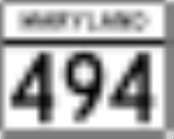
as Maryland Route 494
. The northern terminus is at an interchange with U.S. Route 22 and U.S. Route 322 in Port Royal
.
border in Montgomery Township
, Franklin County
, where the road continues south into that state as MD 494
. From the state line, the route heads north on two-lane undivided Fort Loudon Road through open agricultural areas with occasional homes. The road passes through Kasiesville before coming to Claylick and intersecting PA 995
. PA 75 runs through more farmland with some woods and residences, passing through Shimpstown. The road heads through more open agricultural areas prior to entering Mercersburg
, where it passes homes. PA 75 comes to an intersection with PA 16
/PA 416
, where it turns northwest to form a concurrency
with the two routes on Buchanan Trail West. The three routes turn north onto Main Street and passes homes and businesses in the center of Mercersburg. In the northern part of town, PA 16 heads to the northwest with PA 75 and PA 416 continuing northeast on Fort Loudon Road. The road passes a few residential and commercial areas before crossing into Peters Township
and heading into agricultural surroundings. PA 416 splits from PA 75 by continuing northeast on Mercersburg Road. At this point, the route runs through more open farmland with some residences, passing through Dickey. The road turns northwest to run a short distance east of the West Branch Conococheague Creek
before coming to an intersection with US 30
near Fort Loudon.
Here, PA 75 turns to the north and becomes Path Valley Road, passing through rural areas of homes. The route heads into forested areas with some homes between Tuscarora Mountain
to the west and Kittatinny Mountain to the east, crossing into Metal Township
. The road turns east for a short distance before heading north again, passing through Richmond Furnace. PA 75 runs through more forests before heading into a narrow agricultural valley with a few residences and curving to the northeast, heading through Metal. Farther to the northeast, the agricultural valley widens and the route runs through Fannettsburg and Springtown before coming to a ramp providing access to I-76
(Pennsylvania Turnpike
). At this point, the road runs through more rural valley areas a short distance to the east of the Pennsylvania Turnpike, passing through Willow Hill prior to passing under the Pennsylvania Turnpike. PA 75 runs through more open farmland and enters Fannett Township
, coming to an intersection with PA 641
in the community of Spring Run. The route heads through more rural areas and passes through Dry Run. The road heads into a mix of farmland and woodland with some homes and turns north at Doylesburg, coming to a junction with the western terminus of PA 274
. Past this intersection, PA 75 continues to the north and heads through Concord before heading into forested areas and crossing through a gap in Tuscarora Mountain.
in Juniata County
and becomes an unnamed road, running through Spears Grove. The road turns northeast into valley farmland with some woods and homes, passing through Waterloo. At this point, the route begins to run to the southeast of the Tuscarora Creek, heading through more rural areas. PA 75 heads into a narrow agricultural valley with some woods and homes as it passes near Pearluck. Farther northeast, the road heads into Tuscarora Township
and runs through the residential community of East Waterford
before passing through more farmland. The route heads through an area of forests before heading back into agricultural areas and crossing PA 850
in Honey Grove. The road continues between farmland to the northwest and forested Tuscarora Mountain to the southeast before turning north into open agricultural areas and heading into Spruce Hill Township
. Here, PA 75 turns northeast again and runs through more rural areas, passing through Spruce Hill. The road briefly curves north before resuming northeast, heading between wooded areas to the northwest and agricultural areas to the southeast.
The route continues into Turbett Township
and intersects the northern terminus of PA 74
, heading through more farmland and woodland with some homes. PA 75 heads north-northeast as it comes to an intersection with PA 333
in Old Port. Here, PA 75 turns north to join PA 333 on Market Street, crossing the Tuscarora Creek into Port Royal
, where PA 333 splits to the northwest. PA 75 turns to the northeast and passes several homes. The route comes to a bridge that carries it over a Norfolk Southern railroad line, a portion of the town, and the Juniata River
. After crossing the river, the road heads into Walker Township
and turns northeast as an unnamed road into agricultural areas with occasional residences. PA 75 passes near a few commercial establishments and turns to the north-northeast. After crossing Old US 22, the route becomes a four-lane divided highway
and runs through a mix of farmland and woodland, ending at an interchange with the US 22
/US 322
freeway. The road continues north past this interchange as Industrial Park Road.
from Brookville
to Brockway
.
State highway
State highway, state road or state route can refer to one of three related concepts, two of them related to a state or provincial government in a country that is divided into states or provinces :#A...
located in central Pennsylvania
Pennsylvania
The Commonwealth of Pennsylvania is a U.S. state that is located in the Northeastern and Mid-Atlantic regions of the United States. The state borders Delaware and Maryland to the south, West Virginia to the southwest, Ohio to the west, New York and Ontario, Canada, to the north, and New Jersey to...
, USA. The southern terminus is at the Mason-Dixon Line
Mason-Dixon line
The Mason–Dixon Line was surveyed between 1763 and 1767 by Charles Mason and Jeremiah Dixon in the resolution of a border dispute between British colonies in Colonial America. It forms a demarcation line among four U.S. states, forming part of the borders of Pennsylvania, Maryland, Delaware, and...
in Montgomery Township
Montgomery Township, Franklin County, Pennsylvania
Montgomery Township is a township in Franklin County, Pennsylvania, United States. The population was 4,949 at the 2000 census.-Geography:According to the United States Census Bureau, the township has a total area of 67.1 square miles , of which, 67.1 square miles of it is land and...
, where PA 75 continues into Maryland
Maryland
Maryland is a U.S. state located in the Mid Atlantic region of the United States, bordering Virginia, West Virginia, and the District of Columbia to its south and west; Pennsylvania to its north; and Delaware to its east...
as Maryland Route 494
Maryland Route 494
Maryland Route 494 is a state highway in the U.S. state of Maryland. Known as Fairview Road, the state highway runs from the Pennsylvania state line near Fairview, where the highway continues north as Pennsylvania Route 75 , east to MD 63 in Cearfoss. MD 494 was constructed in the 1930s...
. The northern terminus is at an interchange with U.S. Route 22 and U.S. Route 322 in Port Royal
Port Royal, Pennsylvania
Port Royal is a borough in Juniata County, Pennsylvania, United States. The population was 977 at the 2000 census.- History :Port Royal was originally named Perrysville, after Commodore Oliver Hazard Perry. At the time, the Port Royal post office was located in Saint Tammany town, just across the...
.
Franklin County
PA 75 begins at the MarylandMaryland
Maryland is a U.S. state located in the Mid Atlantic region of the United States, bordering Virginia, West Virginia, and the District of Columbia to its south and west; Pennsylvania to its north; and Delaware to its east...
border in Montgomery Township
Montgomery Township, Franklin County, Pennsylvania
Montgomery Township is a township in Franklin County, Pennsylvania, United States. The population was 4,949 at the 2000 census.-Geography:According to the United States Census Bureau, the township has a total area of 67.1 square miles , of which, 67.1 square miles of it is land and...
, Franklin County
Franklin County, Pennsylvania
As of the census of 2000, there were 129,313 people, 50,633 households, and 36,405 families residing in the county. The population density was 168 people per square mile . There were 53,803 housing units at an average density of 70 per square mile...
, where the road continues south into that state as MD 494
Maryland Route 494
Maryland Route 494 is a state highway in the U.S. state of Maryland. Known as Fairview Road, the state highway runs from the Pennsylvania state line near Fairview, where the highway continues north as Pennsylvania Route 75 , east to MD 63 in Cearfoss. MD 494 was constructed in the 1930s...
. From the state line, the route heads north on two-lane undivided Fort Loudon Road through open agricultural areas with occasional homes. The road passes through Kasiesville before coming to Claylick and intersecting PA 995
Pennsylvania Route 995
Pennsylvania Route 995 is a north–south state route in south central Pennsylvania. The southern terminus of the route is at Pennsylvania Route 75 four miles south of Mercersburg and three miles north of the Mason-Dixon Line with Maryland. The northern terminus is at U.S. Route 30 one mile...
. PA 75 runs through more farmland with some woods and residences, passing through Shimpstown. The road heads through more open agricultural areas prior to entering Mercersburg
Mercersburg, Pennsylvania
Mercersburg is a borough in Franklin County, Pennsylvania, southwest of Harrisburg. Originally called Black Town, it was incorporated in 1831. In 1900, 956 people lived here, and in 1910, 1,410 people lived here...
, where it passes homes. PA 75 comes to an intersection with PA 16
Pennsylvania Route 16
Pennsylvania Route 16 is a long east–west state route located in southern Pennsylvania, United States. The western terminus of the route is at U.S. Route 522 in McConnellsburg. The eastern terminus is at the Mason-Dixon Line in Liberty Township, where PA 16 continues into Maryland as...
/PA 416
Pennsylvania Route 416
Pennsylvania Route 416 is an long state highway located in Franklin county in Pennsylvania. The southern terminus is at the Maryland state line near Nova. The northern terminus is at US 30 in St. Thomas Township.-Route description:...
, where it turns northwest to form a concurrency
Concurrency (road)
A concurrency, overlap, or coincidence in a road network is an instance of one physical road bearing two or more different highway, motorway, or other route numbers...
with the two routes on Buchanan Trail West. The three routes turn north onto Main Street and passes homes and businesses in the center of Mercersburg. In the northern part of town, PA 16 heads to the northwest with PA 75 and PA 416 continuing northeast on Fort Loudon Road. The road passes a few residential and commercial areas before crossing into Peters Township
Peters Township, Franklin County, Pennsylvania
Peters Township is a township in Franklin County, Pennsylvania, United States. The population was 4,251 at the 2000 census.-Geography:According to the United States Census Bureau, the township has a total area of 56.0 square miles , of which, 55.9 square miles of it is land and...
and heading into agricultural surroundings. PA 416 splits from PA 75 by continuing northeast on Mercersburg Road. At this point, the route runs through more open farmland with some residences, passing through Dickey. The road turns northwest to run a short distance east of the West Branch Conococheague Creek
Conococheague Creek
Conococheague Creek, a tributary of the Potomac River, is a free-flowing stream that originates in Pennsylvania and empties into the Potomac River near Williamsport, Maryland. It is in length, with in Pennsylvania and in Maryland...
before coming to an intersection with US 30
U.S. Route 30 in Pennsylvania
In the U.S. state of Pennsylvania, U.S. Route 30 runs east–west across the southern part of the state, passing through Pittsburgh and Philadelphia on its way from the West Virginia state line east to the Benjamin Franklin Bridge over the Delaware River into New Jersey...
near Fort Loudon.
Here, PA 75 turns to the north and becomes Path Valley Road, passing through rural areas of homes. The route heads into forested areas with some homes between Tuscarora Mountain
Tuscarora Mountain
Tuscoarora Mountain is a mountain ridge of the Appalachian Mountains in the Ridge and Valley province in central Pennsylvania. It reaches its highest point on Big Mountain at 2,458 feet above sea level....
to the west and Kittatinny Mountain to the east, crossing into Metal Township
Metal Township, Pennsylvania
Metal Township is a township in Franklin County, Pennsylvania, United States. The population was 1,721 at the 2000 census.-Geography:According to the United States Census Bureau, the township has a total area of 44.5 square miles , of which 44.5 square miles is land and 0.1 square...
. The road turns east for a short distance before heading north again, passing through Richmond Furnace. PA 75 runs through more forests before heading into a narrow agricultural valley with a few residences and curving to the northeast, heading through Metal. Farther to the northeast, the agricultural valley widens and the route runs through Fannettsburg and Springtown before coming to a ramp providing access to I-76
Interstate 76 (east)
Interstate 76 is an Interstate Highway in the United States, running 435 miles from an interchange with Interstate 71 west of Akron, Ohio, east to Interstate 295 near Camden, New Jersey....
(Pennsylvania Turnpike
Pennsylvania Turnpike
The Pennsylvania Turnpike is a toll highway system operated by the Pennsylvania Turnpike Commission in the Commonwealth of Pennsylvania, United States. The three sections of the turnpike system total . The main section extends from Ohio to New Jersey and is long...
). At this point, the road runs through more rural valley areas a short distance to the east of the Pennsylvania Turnpike, passing through Willow Hill prior to passing under the Pennsylvania Turnpike. PA 75 runs through more open farmland and enters Fannett Township
Fannett Township, Pennsylvania
Fannett Township is a township in Franklin County, Pennsylvania, United States. The population was 2,370 at the 2000 census.-Geography:According to the United States Census Bureau, the township has a total area of , of which, of it is land and of it is water.-Demographics:As of the census of...
, coming to an intersection with PA 641
Pennsylvania Route 641
Pennsylvania Route 641 ' is a state route located in Central Pennsylvania in the United States. The route is long from U.S. Route 522 in Shade Gap to U.S. Route 11 and U.S. Route 15 in Camp Hill...
in the community of Spring Run. The route heads through more rural areas and passes through Dry Run. The road heads into a mix of farmland and woodland with some homes and turns north at Doylesburg, coming to a junction with the western terminus of PA 274
Pennsylvania Route 274
Pennsylvania Route 274 is an long state highway located in Franklin and Perry counties in Pennsylvania. The western terminus is at PA 75 in Fannett Township. The eastern terminus is at US 11/US 15 in Duncannon.-Route description:...
. Past this intersection, PA 75 continues to the north and heads through Concord before heading into forested areas and crossing through a gap in Tuscarora Mountain.
Juniata County
PA 75 enters Lack TownshipLack Township, Pennsylvania
Lack Township is a township in Juniata County, Pennsylvania, United States. The population was 750 at the 2000 census.-Geography:According to the United States Census Bureau, the township has a total area of , all of it land....
in Juniata County
Juniata County, Pennsylvania
Juniata County is a county located in the U.S. state of Pennsylvania. As of 2010, the population was 24,636. Juniata County was created on March 2, 1831, from part of Mifflin County and named for the Juniata River. Its county seat is Mifflintown....
and becomes an unnamed road, running through Spears Grove. The road turns northeast into valley farmland with some woods and homes, passing through Waterloo. At this point, the route begins to run to the southeast of the Tuscarora Creek, heading through more rural areas. PA 75 heads into a narrow agricultural valley with some woods and homes as it passes near Pearluck. Farther northeast, the road heads into Tuscarora Township
Tuscarora Township, Juniata County, Pennsylvania
Tuscarora Township is a township in Juniata County, Pennsylvania, United States. The population was 1,159 at the 2000 census.-Geography:According to the United States Census Bureau, the township has a total area of 47.4 square miles , all of it land.Tuscarora Township is bordered by Mifflin...
and runs through the residential community of East Waterford
East Waterford, Pennsylvania
East Waterford is a census-designated place that is part of Tuscarora Township in Juniata County, Pennsylvania, United States. The population was 185 at the 2000 census.-Geography:East Waterford is located at ....
before passing through more farmland. The route heads through an area of forests before heading back into agricultural areas and crossing PA 850
Pennsylvania Route 850
Pennsylvania Route 850 is a long state highway located in Juniata and Perry counties in Pennsylvania. The western terminus is at PA 35 in Tuscarora Township. The eastern terminus is at US 11/US 15 in Marysville.-Juniata County:...
in Honey Grove. The road continues between farmland to the northwest and forested Tuscarora Mountain to the southeast before turning north into open agricultural areas and heading into Spruce Hill Township
Spruce Hill Township, Pennsylvania
Spruce Hill Township is a township in Juniata County, Pennsylvania, United States. The population was 724 at the 2000 census.-Geography:According to the United States Census Bureau, the township has a total area of 21.7 square miles , all of it land.Spruce Hill Township is bordered by Beale...
. Here, PA 75 turns northeast again and runs through more rural areas, passing through Spruce Hill. The road briefly curves north before resuming northeast, heading between wooded areas to the northwest and agricultural areas to the southeast.
The route continues into Turbett Township
Turbett Township, Pennsylvania
Turbett Township is a township in Juniata County, Pennsylvania, United States. The population was 819 at the 2000 census.-Geography:According to the United States Census Bureau, the township has a total area of 16.5 square miles , of which, 16.4 square miles of it is land and...
and intersects the northern terminus of PA 74
Pennsylvania Route 74
Pennsylvania Route 74 is a long north–south state highway located in central Pennsylvania. The southern terminus of the route is at the Mason-Dixon Line southwest of Delta, where PA 74 continues into Maryland as Maryland Route 165...
, heading through more farmland and woodland with some homes. PA 75 heads north-northeast as it comes to an intersection with PA 333
Pennsylvania Route 333
Pennsylvania Route 333 is an long state highway located in Mifflin and Juniata counties in Pennsylvania. The western terminus is at PA 103 in Juniata Terrace. The eastern terminus is at PA 235 near Thompsontown.-Mifflin County:...
in Old Port. Here, PA 75 turns north to join PA 333 on Market Street, crossing the Tuscarora Creek into Port Royal
Port Royal, Pennsylvania
Port Royal is a borough in Juniata County, Pennsylvania, United States. The population was 977 at the 2000 census.- History :Port Royal was originally named Perrysville, after Commodore Oliver Hazard Perry. At the time, the Port Royal post office was located in Saint Tammany town, just across the...
, where PA 333 splits to the northwest. PA 75 turns to the northeast and passes several homes. The route comes to a bridge that carries it over a Norfolk Southern railroad line, a portion of the town, and the Juniata River
Juniata River
The Juniata River is a tributary of the Susquehanna River, approximately long, in central Pennsylvania in the United States. The river is considered scenic along much of its route, having a broad and shallow course passing through several mountain ridges and steeply-lined water gaps...
. After crossing the river, the road heads into Walker Township
Walker Township, Juniata County, Pennsylvania
Walker Township is a township in Juniata County, Pennsylvania, United States. The population was 2,598 at the 2000 census.-Geography:According to the United States Census Bureau, the township has a total area of 29.5 square miles , of which, 29.0 square miles of it is land and...
and turns northeast as an unnamed road into agricultural areas with occasional residences. PA 75 passes near a few commercial establishments and turns to the north-northeast. After crossing Old US 22, the route becomes a four-lane divided highway
Divided Highway
Divided Highway is a compilation album by American rock band The Doobie Brothers, released in 2003. . All tracks are taken from the albums Cycles and Brotherhood .-Track listing:...
and runs through a mix of farmland and woodland, ending at an interchange with the US 22
U.S. Route 22 in Pennsylvania
U.S. Route 22 is an east–west route stretching from Cincinnati, Ohio in the west to Newark, New Jersey in the east. In Pennsylvania, the route runs for between the West Virginia state line at Washington County, where it is a limited-access expressway-grade route through the western suburbs...
/US 322
U.S. Route 322 in Pennsylvania
U.S. Route 322 is a U.S. highway running from Cleveland, Ohio east to Atlantic City, New Jersey. In the U.S. state of Pennsylvania, the route runs from the Ohio border in West Shenango Township southeast to the Commodore Barry Bridge over the Delaware River in Chester, at which point the route...
freeway. The road continues north past this interchange as Industrial Park Road.
History
From 1927 to 1928, PA 75 was signed on the current alignment of Pennsylvania Route 28Pennsylvania Route 28
Pennsylvania Route 28 is a major state highway which runs for 97 miles from Interstate 279 and Interstate 579 at the Interstate 279 Interchange in Pittsburgh to U.S. Route 219 in Brockway in the U.S. state of Pennsylvania. The expressway from Kittanning to Pittsburgh is called the Alexander H...
from Brookville
Brookville, Pennsylvania
Brookville is a borough in Jefferson County in the U.S. state of Pennsylvania, 100 miles northeast of Pittsburgh. 2,472 people lived in Brookville in 1900, and 3,003 people lived there in 1910. The population was 4,230 at the 2000 census...
to Brockway
Brockway, Pennsylvania
Brockway is a borough in Jefferson County, Pennsylvania, United States. The population was 2,182 at the 2000 census.-Geography:Brockway is located at ....
.