
Pennsylvania Route 74
Encyclopedia
Pennsylvania Route 74 is a 96.4 miles (155.1 km) long north–south state highway
located in central Pennsylvania
. The southern terminus of the route is at the Mason-Dixon Line
southwest of Delta
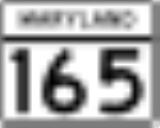
, where PA 74 continues into Maryland
as Maryland Route 165
. The northern terminus is at Pennsylvania Route 75
south of Port Royal
.
in Turnbett Township
. PA 74 begins in a mountainous region of Pennsylvania
, when PA 74 begins in Juniata County, it has more than 5 S-curves. After all of the dangerous curves, PA 74 has entered Perry County. After the county line, PA 74 heads toward the south then it shifts towards the southeast. In the village of Ickesburg
, PA 74 intersects Pennsylvania Route 17
. South of PA 17, PA 74 shifts towards the south. Then in Saville Township
, PA 74 makes a 90 degree angle turn when it meets the western terminus of Pennsylvania Route 849
. Now PA 74 is heading towards the southwest then shifts towards the south. In Spring Township
, PA 74 shifts and heads towards the southeast while meeting with Pennsylvania Route 274
. South of PA 274, PA 74 has a couple of curves. In the village of Alinda, PA 74 intersects Pennsylvania Route 850
. At and near the Perry - Cumberland
county line, PA 74 has very sharp and dangerous S-curves while crossing Blue Mountain
.
, PA 74 has entered Cumberland County
. PA 74 enters the county with one of the curves discussed above. In North Middleton Township
, PA 74 is called Waggoners Gap Road and intersects Pennsylvania Route 944
. At the Carlisle
borough line, PA 74 passes under Interstate 76
(Pennsylvania Turnpike
). PA 74 enters Carlisle heading east as B Street and makes a 90 degree angle turn towards the south and becomes College Street. Then PA 74 begins a wrong-way concurrency with U.S. Route 11
and Pennsylvania Route 641
; PA 74 makes a 90 degree turn towards the east to become High Street and join US 11 north and PA 641 east. At the center of Carlisle, US 11 leaves the PA 74/PA 641 concurrency to join Pennsylvania Route 34
and PA 74 continues its concurrency with PA 641 heading towards the east as High Street. East of downtown, PA 74 makes a 40 degree angle turn towards the southeast to split from PA 641. PA 641 has access only to Interstate 81 north and PA 74 has access only to Interstate 81 south. Southeast of PA 641 in South Middleton Township
, PA 74 becomes York Road and intersects I-81 at exit 48. Southeast of I-81, PA 74 continues as York Road as a straight road. In Monroe Township
, PA 74 intersects Pennsylvania Route 174
.
, PA 74 has a short concurrency with U.S. Route 15
. South of the US 15 concurrency, PA 74 heads south and passes through the boro of Dillsburg as Baltimore Street. South of Dillsburg, PA 74 intersects the northern terminus of Pennsylvania Route 194
and makes a turn towards the southeast becoming Carlisle Road. As Carlisle Road, PA 74 has a couple of turns in Warrington Township
. PA 74 passes through the borough of Wellsville
as Main Street; PA 74 also shifts towards the northeast as it exits the borough. Northeast of Wellsville, PA 74 makes a right turn towards the southeast when it meets the southern terminus of Pennsylvania Route 177
. PA 74 passes west of Gifford Pinchot State Park
south of PA 177. In Dover
, PA 74 is called Main Street and intersects the western terminus of Pennsylvania Route 921
. PA 74 continues into the communities of Weigelstown
and Shiloh. In Shiloh, PA 74 intersects the western terminus of Pennsylvania Route 238
. Southeast of Shiloh, PA 74 interchanges with U.S. Route 30
at a diamond interchange
.
As PA 74 enters the city of York
, PA 74 passes north of York County Agricultural Society Fairgrounds. Then, the west lanes of Pennsylvania Route 462
split from PA 74 north and PA 74 south merges with PA 462 east as PA 74/PA 462 begin a concurrency. PA 74 north/PA 462 west are called Philadelphia Street and PA 74 south/PA 462 east are called Market Street; both streets are one-way
and run parallel to each other. After crossing the Codorus Creek
, PA 74/PA 462 have entered downtown York. In downtown York, PA 74/PA 462 intersect Interstate 83 Business (George Street). East of I-83 BUS, PA 74 makes a right turn towards the south to become Queen Street and end the concurrency with PA 462. Then, PA 74 intersects the western terminus of Pennsylvania Route 124
(College Avenue). PA 74 continues towards the south passing by York's FOX 43
television station. Outside of York, PA 74 intersects Interstate 83
at exit 16.
In York Township, PA 74 intersects the eastern terminus of Pennsylvania Route 182
. Then PA 74 makes a 30 degree turn towards the southeast. In Dallastown
, PA 74 shifts towards the east and becomes East/West Main Street. In downtown Dallastown, PA 74 intersects the eastern terminus of Pennsylvania Route 214
. East of Dallastown, PA 74 enters the borough of Red Lion
as East/West Broadway. In downtown Red Lion, PA 74 shifts towards the north and intersects Pennsylvania Route 24
then shifts towards the east again. East of Red Lion, PA 24 is called Delta Road and begins to shifts towards the southeast. In Lower Chanceford Township, PA 74 has a short wrong-way concurrency with Pennsylvania Route 425
. PA 74 continues towards the southeast as Delta Road meeting with the western terminus of Pennsylvania Route 372
south of Sunnyburn. PA 74 continues towards the southeast and then shifts towards the south. In Peach Bottom Township, PA 74 intersects the eastern terminus of Pennsylvania Route 851
. PA 74 terminates (ends) at the Maryland State Line
(Mason-Dixon Line
); PA 74 continues as Maryland Route 165
.
State highway
State highway, state road or state route can refer to one of three related concepts, two of them related to a state or provincial government in a country that is divided into states or provinces :#A...
located in central Pennsylvania
Pennsylvania
The Commonwealth of Pennsylvania is a U.S. state that is located in the Northeastern and Mid-Atlantic regions of the United States. The state borders Delaware and Maryland to the south, West Virginia to the southwest, Ohio to the west, New York and Ontario, Canada, to the north, and New Jersey to...
. The southern terminus of the route is at the Mason-Dixon Line
Mason-Dixon line
The Mason–Dixon Line was surveyed between 1763 and 1767 by Charles Mason and Jeremiah Dixon in the resolution of a border dispute between British colonies in Colonial America. It forms a demarcation line among four U.S. states, forming part of the borders of Pennsylvania, Maryland, Delaware, and...
southwest of Delta
Delta, Pennsylvania
Delta is a borough in York County, Pennsylvania, United States, and one of the southernmost communities in Pennsylvania. The population was 728 at the 2010 census...
, where PA 74 continues into Maryland
Maryland
Maryland is a U.S. state located in the Mid Atlantic region of the United States, bordering Virginia, West Virginia, and the District of Columbia to its south and west; Pennsylvania to its north; and Delaware to its east...
as Maryland Route 165
Maryland Route 165
Maryland Route 165 is a state highway in the U.S. state of Maryland. The state highway runs from Baldwin north to the Pennsylvania state line in Cardiff, where the highway continues as Pennsylvania Route 74 . MD 165 passes through western and northern Harford County, where it connects the...
. The northern terminus is at Pennsylvania Route 75
Pennsylvania Route 75
Pennsylvania Route 75 is a long north–south state highway located in central Pennsylvania, USA. The southern terminus is at the Mason-Dixon Line in Montgomery Township, where PA 75 continues into Maryland as Maryland Route 494. The northern terminus is at an interchange with U.S. Route 22...
south of Port Royal
Port Royal, Pennsylvania
Port Royal is a borough in Juniata County, Pennsylvania, United States. The population was 977 at the 2000 census.- History :Port Royal was originally named Perrysville, after Commodore Oliver Hazard Perry. At the time, the Port Royal post office was located in Saint Tammany town, just across the...
.
Juniata and Perry Counties
PA 74 begins at an intersection with Pennsylvania Route 75Pennsylvania Route 75
Pennsylvania Route 75 is a long north–south state highway located in central Pennsylvania, USA. The southern terminus is at the Mason-Dixon Line in Montgomery Township, where PA 75 continues into Maryland as Maryland Route 494. The northern terminus is at an interchange with U.S. Route 22...
in Turnbett Township
Turbett Township, Pennsylvania
Turbett Township is a township in Juniata County, Pennsylvania, United States. The population was 819 at the 2000 census.-Geography:According to the United States Census Bureau, the township has a total area of 16.5 square miles , of which, 16.4 square miles of it is land and...
. PA 74 begins in a mountainous region of Pennsylvania
Pennsylvania
The Commonwealth of Pennsylvania is a U.S. state that is located in the Northeastern and Mid-Atlantic regions of the United States. The state borders Delaware and Maryland to the south, West Virginia to the southwest, Ohio to the west, New York and Ontario, Canada, to the north, and New Jersey to...
, when PA 74 begins in Juniata County, it has more than 5 S-curves. After all of the dangerous curves, PA 74 has entered Perry County. After the county line, PA 74 heads toward the south then it shifts towards the southeast. In the village of Ickesburg
Saville Township, Pennsylvania
Saville Township is a second-class township in a mountainous part of Perry County, Pennsylvania, United States. As of the 2000 census, the township had a total population of 2,204. It was founded in 1817, dividing from Tyrone Township while the area was still part of Cumberland County...
, PA 74 intersects Pennsylvania Route 17
Pennsylvania Route 17
Pennsylvania Route 17 is a long state highway located in central Pennsylvania. The western terminus of the route is at Pennsylvania Route 274 in Blain. The eastern terminus is at U.S. Route 11 and U.S...
. South of PA 17, PA 74 shifts towards the south. Then in Saville Township
Saville Township, Pennsylvania
Saville Township is a second-class township in a mountainous part of Perry County, Pennsylvania, United States. As of the 2000 census, the township had a total population of 2,204. It was founded in 1817, dividing from Tyrone Township while the area was still part of Cumberland County...
, PA 74 makes a 90 degree angle turn when it meets the western terminus of Pennsylvania Route 849
Pennsylvania Route 849
Pennsylvania Route 849 is a long state highway located in Perry and Dauphin counties in Pennsylvania. The western terminus is at PA 74 in Saville Township...
. Now PA 74 is heading towards the southwest then shifts towards the south. In Spring Township
Spring Township, Perry County, Pennsylvania
Spring Township is a township in Perry County, Pennsylvania, United States. The population was 2,021 at the 2000 census.-Geography:According to the United States Census Bureau, the township has a total area of 28.8 square miles , all of it land.-Demographics:As of the census of 2000, there...
, PA 74 shifts and heads towards the southeast while meeting with Pennsylvania Route 274
Pennsylvania Route 274
Pennsylvania Route 274 is an long state highway located in Franklin and Perry counties in Pennsylvania. The western terminus is at PA 75 in Fannett Township. The eastern terminus is at US 11/US 15 in Duncannon.-Route description:...
. South of PA 274, PA 74 has a couple of curves. In the village of Alinda, PA 74 intersects Pennsylvania Route 850
Pennsylvania Route 850
Pennsylvania Route 850 is a long state highway located in Juniata and Perry counties in Pennsylvania. The western terminus is at PA 35 in Tuscarora Township. The eastern terminus is at US 11/US 15 in Marysville.-Juniata County:...
. At and near the Perry - Cumberland
Cumberland County, Pennsylvania
Cumberland County is a county located in the U.S. state of Pennsylvania and is one of three counties comprising the Harrisburg–Carlisle Metropolitan Statistical Area. As of 2010, the population was 235,406.-History:...
county line, PA 74 has very sharp and dangerous S-curves while crossing Blue Mountain
Blue Mountain (Pennsylvania)
Blue Mountain is a ridge that forms the eastern edge of the Appalachian mountain range in the U.S. state of Pennsylvania. It cuts across the eastern half of the state from New Jersey to Maryland, providing a distinct boundary between a number of Pennsylvania's geographical and cultural regions...
.
Cumberland County
South of Blue MountainBlue Mountain (Pennsylvania)
Blue Mountain is a ridge that forms the eastern edge of the Appalachian mountain range in the U.S. state of Pennsylvania. It cuts across the eastern half of the state from New Jersey to Maryland, providing a distinct boundary between a number of Pennsylvania's geographical and cultural regions...
, PA 74 has entered Cumberland County
Cumberland County, Pennsylvania
Cumberland County is a county located in the U.S. state of Pennsylvania and is one of three counties comprising the Harrisburg–Carlisle Metropolitan Statistical Area. As of 2010, the population was 235,406.-History:...
. PA 74 enters the county with one of the curves discussed above. In North Middleton Township
North Middleton Township, Pennsylvania
North Middleton Township is a township in Cumberland County, Pennsylvania, United States. The population was 10,197 at the 2000 census.-Geography:...
, PA 74 is called Waggoners Gap Road and intersects Pennsylvania Route 944
Pennsylvania Route 944
Pennsylvania Route 944 is a long state highway located in Cumberland county in Pennsylvania. The western terminus is at PA 233 in Lower Mifflin Township. The eastern terminus is at US 11/US 15 in East Pennsboro Township.-Route description:...
. At the Carlisle
Carlisle, Pennsylvania
Carlisle is a borough in and the county seat of Cumberland County, Pennsylvania, United States. The name is traditionally pronounced with emphasis on the second syllable. Carlisle is located within the Cumberland Valley, a highly productive agricultural region. As of the 2010 census, the borough...
borough line, PA 74 passes under Interstate 76
Interstate 76 (east)
Interstate 76 is an Interstate Highway in the United States, running 435 miles from an interchange with Interstate 71 west of Akron, Ohio, east to Interstate 295 near Camden, New Jersey....
(Pennsylvania Turnpike
Pennsylvania Turnpike
The Pennsylvania Turnpike is a toll highway system operated by the Pennsylvania Turnpike Commission in the Commonwealth of Pennsylvania, United States. The three sections of the turnpike system total . The main section extends from Ohio to New Jersey and is long...
). PA 74 enters Carlisle heading east as B Street and makes a 90 degree angle turn towards the south and becomes College Street. Then PA 74 begins a wrong-way concurrency with U.S. Route 11
U.S. Route 11
U.S. Route 11 is a north–south United States highway extending 1,645 miles across the eastern United States. The southern terminus of the route is at U.S. Route 90 in the Bayou Sauvage National Wildlife Refuge in eastern New Orleans, Louisiana. The northern terminus is at the United...
and Pennsylvania Route 641
Pennsylvania Route 641
Pennsylvania Route 641 ' is a state route located in Central Pennsylvania in the United States. The route is long from U.S. Route 522 in Shade Gap to U.S. Route 11 and U.S. Route 15 in Camp Hill...
; PA 74 makes a 90 degree turn towards the east to become High Street and join US 11 north and PA 641 east. At the center of Carlisle, US 11 leaves the PA 74/PA 641 concurrency to join Pennsylvania Route 34
Pennsylvania Route 34
Pennsylvania Route 34 is a long state route located in southern Pennsylvania. The southern terminus of the route is at U.S. Route 15 Business in Gettysburg. The northern terminus is at U.S. Route 11 and U.S. Route 15 south of Liverpool....
and PA 74 continues its concurrency with PA 641 heading towards the east as High Street. East of downtown, PA 74 makes a 40 degree angle turn towards the southeast to split from PA 641. PA 641 has access only to Interstate 81 north and PA 74 has access only to Interstate 81 south. Southeast of PA 641 in South Middleton Township
South Middleton Township, Pennsylvania
South Middleton Township is a township in Cumberland County, Pennsylvania, United States. The population was 12,939 at the 2000 census.-Geography:...
, PA 74 becomes York Road and intersects I-81 at exit 48. Southeast of I-81, PA 74 continues as York Road as a straight road. In Monroe Township
Monroe Township, Cumberland County, Pennsylvania
Monroe Township is a township in Cumberland County, Pennsylvania, United States. The population was 5,530 at the 2000 census.-Geography:According to the United States Census Bureau, the township has a total area of 26.1 square miles , all of it land.-Demographics:As of the census of 2000,...
, PA 74 intersects Pennsylvania Route 174
Pennsylvania Route 174
Pennsylvania Route 174 is an long state highway located in Cumberland county in Pennsylvania. The western terminus is at US 11 and PA 533 in Shippensburg. The eastern terminus is at PA 641 in Monroe Township.-Route description:...
.
York County
In DillsburgDillsburg, Pennsylvania
Dillsburg is a borough adjacent to Carroll Township in York County, Pennsylvania, United States. The population was 2,563 as of the 2010 census.-Geography:Dillsburg is surrounded by Carroll Township in northwestern York County, Pennsylvania...
, PA 74 has a short concurrency with U.S. Route 15
U.S. Route 15
U.S. Route 15 is a -long United States highway, designated along South Carolina, North Carolina, Virginia, Maryland, Pennsylvania, and New York. The route is signed north–south, from U.S. Route 17 Alternate in Walterboro, South Carolina to Interstate 86 and NY 17 in Painted Post, New York.US...
. South of the US 15 concurrency, PA 74 heads south and passes through the boro of Dillsburg as Baltimore Street. South of Dillsburg, PA 74 intersects the northern terminus of Pennsylvania Route 194
Pennsylvania Route 194
Pennsylvania Route 194 is a long north–south state highway located in south-central Pennsylvania. The southern end is at the Maryland State Line and the northern terminus is at the intersection with PA 74 in the town of Dillsburg.-Route description:PA 194 begins at the Maryland border in...
and makes a turn towards the southeast becoming Carlisle Road. As Carlisle Road, PA 74 has a couple of turns in Warrington Township
Warrington Township, York County, Pennsylvania
Warrington Township is a township in York County, Pennsylvania, USA. The population was 4,532 at the 2010 census. The township is named after Warrington, England, like many townships having English names in York County.-Geography:...
. PA 74 passes through the borough of Wellsville
Wellsville, Pennsylvania
Wellsville is a borough in York County, Pennsylvania, United States. The population was 242 at the 2010 census.-History:Wellsville changed very little visually during the twentieth century; the borough's appearance has remained that of a nineteenth-century community, complete with brick sidewalks...
as Main Street; PA 74 also shifts towards the northeast as it exits the borough. Northeast of Wellsville, PA 74 makes a right turn towards the southeast when it meets the southern terminus of Pennsylvania Route 177
Pennsylvania Route 177
Pennsylvania Route 177 is an long state highway located in York county in Pennsylvania. The southern terminus is an intersection with PA 74 and Township Route 4026 in Rossville. From this intersection, PA 177 bisects the southwestern portion of Pinchot Lake and continues along the northwestern...
. PA 74 passes west of Gifford Pinchot State Park
Gifford Pinchot State Park
Gifford Pinchot State Park is a Pennsylvania state park in Warrington Township, York County, Pennsylvania in the United States. The park contains wooded hillsides, reverting farm fields, and Pinchot Lake. It is near York and Harrisburg in the south-central part of the state.The park is named...
south of PA 177. In Dover
Dover, Pennsylvania
Dover is a borough in York County, Pennsylvania, United States. The population was 2,007 at the 2010 census.-History:James Joner purchased in 1764 and laid out the town of Dover...
, PA 74 is called Main Street and intersects the western terminus of Pennsylvania Route 921
Pennsylvania Route 921
Pennsylvania Route 921 is a long state highway located in York county in Pennsylvania. The western terminus is at PA 74 in Dover. The eastern terminus is at PA 24 in Mount Wolf.-Route description:...
. PA 74 continues into the communities of Weigelstown
Weigelstown, Pennsylvania
Weigelstown is a census-designated place in York County, Pennsylvania, United States. The population was 12,875 at the 2010 census.-Geography:Weigelstown is located at ....
and Shiloh. In Shiloh, PA 74 intersects the western terminus of Pennsylvania Route 238
Pennsylvania Route 238
Pennsylvania Route 238 is a state highway located entirely in York County, Pennsylvania. The western terminus of the route is at Pennsylvania Route 74 in Shiloh. The eastern terminus is at Pennsylvania Route 181 in Emigsville...
. Southeast of Shiloh, PA 74 interchanges with U.S. Route 30
U.S. Route 30
U.S. Route 30 is an east–west main route of the system of United States Numbered Highways, with the highway traveling across the northern tier of the country. It is the third longest U.S. route, after U.S. Route 20 and U.S. Route 6. The western end of the highway is at Astoria, Oregon; the...
at a diamond interchange
Diamond interchange
A diamond interchange is a common type of road junction, used where a freeway crosses a minor road. The freeway itself is grade-separated from the minor road, one crossing the other over a bridge...
.
As PA 74 enters the city of York
York, Pennsylvania
York, known as the White Rose City , is a city located in York County, Pennsylvania, United States which is in the South Central region of the state. The population within the city limits was 43,718 at the 2010 census, which was a 7.0% increase from the 2000 count of 40,862...
, PA 74 passes north of York County Agricultural Society Fairgrounds. Then, the west lanes of Pennsylvania Route 462
Pennsylvania Route 462
Pennsylvania Route 462 is a long east–west running local route in central Pennsylvania. The western terminus is west of York. The eastern terminus is east of Lancaster. At both ends, PA 462 terminates at U.S. Route 30, and all of the route was signed as U.S. Route 30 before a freeway was...
split from PA 74 north and PA 74 south merges with PA 462 east as PA 74/PA 462 begin a concurrency. PA 74 north/PA 462 west are called Philadelphia Street and PA 74 south/PA 462 east are called Market Street; both streets are one-way
One-way traffic
One-way traffic is traffic that moves in a single direction. A one-way street is a street either facilitating only one-way traffic, or designed to direct vehicles to move in one direction.-General signs:...
and run parallel to each other. After crossing the Codorus Creek
Codorus Creek
Codorus Creek is a tributary of the Susquehanna River in York County, Pennsylvania in the United States.-Course:Codorus Creek rises on Beecher Hill in Manheim Township, just north of the Pennsylvania-Maryland line and the town of Lineboro, Maryland...
, PA 74/PA 462 have entered downtown York. In downtown York, PA 74/PA 462 intersect Interstate 83 Business (George Street). East of I-83 BUS, PA 74 makes a right turn towards the south to become Queen Street and end the concurrency with PA 462. Then, PA 74 intersects the western terminus of Pennsylvania Route 124
Pennsylvania Route 124
Pennsylvania Route 124 is a long state route in south central Pennsylvania. The western terminus of the route is at Pennsylvania Route 74 in York...
(College Avenue). PA 74 continues towards the south passing by York's FOX 43
WPMT
WPMT, also known as channel 43 or Fox 43, is a Fox-affiliated television station licensed to York, Pennsylvania. Owned by the Tribune Company, the station has studios in Spring Garden, Pennsylvania , and its transmitter is located in Hallam, Pennsylvania...
television station. Outside of York, PA 74 intersects Interstate 83
Interstate 83
Interstate 83 is an Interstate Highway in the eastern United States. Its southern terminus is in Baltimore, Maryland at the Fayette Street exit; its northern terminus is in Harrisburg, Pennsylvania at Interstate 81....
at exit 16.
In York Township, PA 74 intersects the eastern terminus of Pennsylvania Route 182
Pennsylvania Route 182
Pennsylvania Route 182 is an 7 mile long state highway located in York county in Pennsylvania. The western terminus is at PA 462 in West York. The eastern terminus is at PA 74 in Spry.-Route description:...
. Then PA 74 makes a 30 degree turn towards the southeast. In Dallastown
Dallastown, Pennsylvania
Dallastown is a borough in York County, Pennsylvania, United States. The population was 4,049 at the 2010 census.-History:Dallastown was named after George M. Dallas of Philadelphia during the presidential campaign of 1844...
, PA 74 shifts towards the east and becomes East/West Main Street. In downtown Dallastown, PA 74 intersects the eastern terminus of Pennsylvania Route 214
Pennsylvania Route 214
Pennsylvania Route 214 is an long state highway located in York county in Pennsylvania. The western terminus is at PA 616 in Seven Valleys. The eastern terminus is at PA 74 in Dallastown.-Route description:...
. East of Dallastown, PA 74 enters the borough of Red Lion
Red Lion, Pennsylvania
Red Lion is a borough in York County, Pennsylvania, settled in 1852 and incorporated on January 16, 1880. The population was 6,373 at the 2010 census.-History:Red Lion, settled in 1852, was named after one of the first pubs in town, the Red Lion Tavern....
as East/West Broadway. In downtown Red Lion, PA 74 shifts towards the north and intersects Pennsylvania Route 24
Pennsylvania Route 24
Pennsylvania Route 24 is an long state highway located within central Pennsylvania in the York County area. Its southern terminus is at the Mason–Dixon Line near Stewartstown, where PA 24 continues into Maryland as Maryland Route 23...
then shifts towards the east again. East of Red Lion, PA 24 is called Delta Road and begins to shifts towards the southeast. In Lower Chanceford Township, PA 74 has a short wrong-way concurrency with Pennsylvania Route 425
Pennsylvania Route 425
Pennsylvania Route 425 is an long state highway located in York county in Pennsylvania. The southern terminus is at PA 851 in Fawn Grove. The northern terminus is at PA 124/PA 624 in East Prospect.-Route description:...
. PA 74 continues towards the southeast as Delta Road meeting with the western terminus of Pennsylvania Route 372
Pennsylvania Route 372
Pennsylvania Route 372 is an east–west highway in York, Lancaster, and Chester counties. Its western terminus is at Pennsylvania Route 74 in Lower Chanceford Township north of Delta and west of Holtwood, and its eastern terminus is at Pennsylvania Route 82 in Coatesville.-York and Lancaster...
south of Sunnyburn. PA 74 continues towards the southeast and then shifts towards the south. In Peach Bottom Township, PA 74 intersects the eastern terminus of Pennsylvania Route 851
Pennsylvania Route 851
Pennsylvania Route 851 is a long state highway located in York County in Pennsylvania. The western terminus is at PA 516 in Manheim Township. The eastern terminus is at PA 74 in Peach Bottom Township.-Route description:...
. PA 74 terminates (ends) at the Maryland State Line
Mason-Dixon line
The Mason–Dixon Line was surveyed between 1763 and 1767 by Charles Mason and Jeremiah Dixon in the resolution of a border dispute between British colonies in Colonial America. It forms a demarcation line among four U.S. states, forming part of the borders of Pennsylvania, Maryland, Delaware, and...
(Mason-Dixon Line
Mason-Dixon line
The Mason–Dixon Line was surveyed between 1763 and 1767 by Charles Mason and Jeremiah Dixon in the resolution of a border dispute between British colonies in Colonial America. It forms a demarcation line among four U.S. states, forming part of the borders of Pennsylvania, Maryland, Delaware, and...
); PA 74 continues as Maryland Route 165
Maryland Route 165
Maryland Route 165 is a state highway in the U.S. state of Maryland. The state highway runs from Baldwin north to the Pennsylvania state line in Cardiff, where the highway continues as Pennsylvania Route 74 . MD 165 passes through western and northern Harford County, where it connects the...
.