
Pennsylvania Route 24
Encyclopedia
Pennsylvania Route 24 is an 29 miles (46.7 km) long state highway
located within central Pennsylvania
in the York County
area. Its southern terminus is at the Mason–Dixon Line near Stewartstown
, where PA 24 continues into Maryland
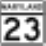
as Maryland Route 23
. The northern terminus is at Pennsylvania Route 921
in Mount Wolf
.
border in Hopewell Township
, heading to the northwest on two-lane undivided Barrens Road South. The road continues into Maryland as MD 23
. From the state line, the route passes through agricultural areas with scattered residences. PA 24 enters Stewartstown
and becomes Main Street, heading north past homes. In the center of town, the route forms a short concurrency
with PA 851
. The road passes more residences and a few businesses before leaving Stewartstown for Hopewell Township again, becoming Barrens Road North. PA 24 continues through more open farmland with occasional patches of woods and homes. Upon passing through the community of Rinely, the route crosses into North Hopewell Township
and continues northwest through more rural areas on Winterstown Road. PA 24 enters Winterstown
and becomes Main Street, passing a few homes as it intersects PA 216
. After this intersection, the road passes more farmland and heads back into North Hopewell Township, with the road name changing back to Winterstown Road. The route heads through more farm areas with some houses, curving to the northeast as it becomes the border between York Township
to the west and Windsor Township
to the east.
The road passes homes as it continues into Red Lion
, where it turns north onto Main Street. PA 24 is lined with more residences as it heads northwest through Red Lion and intersects PA 74
in the center of town. Past this intersection, the route continues past a mix of homes and businesses in the downtown area, coming to the PA 624
junction. The road passes more residences before leaving Red Lion and becoming the York Township-Windsor Township border again, with the road name becoming Cape Horn Road. PA 24 passes a mix of suburban homes and businesses, running through East Yoe. The route turns more to the north as it continues through a mix of farmland and residential development. The road makes a turn northwest into suburban neighborhoods and turns north again as it comes to an intersection with PA 124
in a commercial area. Past PA 124, PA 24 continues north on Edgewood Road and enters Springettsbury Township
, passing wooded residential neighborhoods. The route widens into a four-lane divided highway
as it reaches the PA 462
junction.
From here, the road becomes Mount Zion Road and passes homes before running near industrial establishments, coming to a bridge over a Norfolk Southern railroad line. After an interchange with US 30
, PA 24 enters commercial areas and passes to the east of the York Galleria shopping mall. Past the mall, the route narrows back into a two-lane undivided road and heads northwest through a mix of wooded residential areas and some fields, passing through Mount Zion. PA 24 makes a turn north onto an unnamed road and crosses the Codorus Creek
into Manchester Township
, passing a mix of residential neighborhoods and farmland. The route passes through Starview and turns to the northwest, heading into Mount Wolf
. Here, PA 24 becomes Center Street and passes homes before turning southwest onto Main Street and ending at the eastern terminus of PA 921
a short distance later.
State highway
State highway, state road or state route can refer to one of three related concepts, two of them related to a state or provincial government in a country that is divided into states or provinces :#A...
located within central Pennsylvania
Pennsylvania
The Commonwealth of Pennsylvania is a U.S. state that is located in the Northeastern and Mid-Atlantic regions of the United States. The state borders Delaware and Maryland to the south, West Virginia to the southwest, Ohio to the west, New York and Ontario, Canada, to the north, and New Jersey to...
in the York County
York County, Pennsylvania
York County is a county in the U.S. state of Pennsylvania. As of 2010, the population was 434,972. It is in the Susquehanna Valley, a large fertile agricultural region in South Central Pennsylvania....
area. Its southern terminus is at the Mason–Dixon Line near Stewartstown
Stewartstown, Pennsylvania
Stewartstown is a borough in York County, Pennsylvania, United States. The population was 2,089 at the 2010 census.-History:There were settlers in the Stewartstown area as early as 1750...
, where PA 24 continues into Maryland
Maryland
Maryland is a U.S. state located in the Mid Atlantic region of the United States, bordering Virginia, West Virginia, and the District of Columbia to its south and west; Pennsylvania to its north; and Delaware to its east...
as Maryland Route 23
Maryland Route 23
Maryland Route 23 is a state highway in the U.S. state of Maryland. The state highway runs from U.S. Route 1 in Hickory north and west to the Pennsylvania state line near Norrisville, where the highway continues as Pennsylvania Route 24 . MD 23 is an L-shaped highway in northwestern Harford...
. The northern terminus is at Pennsylvania Route 921
Pennsylvania Route 921
Pennsylvania Route 921 is a long state highway located in York county in Pennsylvania. The western terminus is at PA 74 in Dover. The eastern terminus is at PA 24 in Mount Wolf.-Route description:...
in Mount Wolf
Mount Wolf, Pennsylvania
Mount Wolf is a borough in York County, Pennsylvania, United States. The population was 1,393 at the 2010 census.-Geography:Mount Wolf is located at ....
.
Route description
PA 24 begins at the MarylandMaryland
Maryland is a U.S. state located in the Mid Atlantic region of the United States, bordering Virginia, West Virginia, and the District of Columbia to its south and west; Pennsylvania to its north; and Delaware to its east...
border in Hopewell Township
Hopewell Township, York County, Pennsylvania
Hopewell Township is a township in York County, Pennsylvania, United States. The population was 5,435 at the 2010 census. It is served by the South Eastern School District which provides a public education.-Geography:...
, heading to the northwest on two-lane undivided Barrens Road South. The road continues into Maryland as MD 23
Maryland Route 23
Maryland Route 23 is a state highway in the U.S. state of Maryland. The state highway runs from U.S. Route 1 in Hickory north and west to the Pennsylvania state line near Norrisville, where the highway continues as Pennsylvania Route 24 . MD 23 is an L-shaped highway in northwestern Harford...
. From the state line, the route passes through agricultural areas with scattered residences. PA 24 enters Stewartstown
Stewartstown, Pennsylvania
Stewartstown is a borough in York County, Pennsylvania, United States. The population was 2,089 at the 2010 census.-History:There were settlers in the Stewartstown area as early as 1750...
and becomes Main Street, heading north past homes. In the center of town, the route forms a short concurrency
Concurrency (road)
A concurrency, overlap, or coincidence in a road network is an instance of one physical road bearing two or more different highway, motorway, or other route numbers...
with PA 851
Pennsylvania Route 851
Pennsylvania Route 851 is a long state highway located in York County in Pennsylvania. The western terminus is at PA 516 in Manheim Township. The eastern terminus is at PA 74 in Peach Bottom Township.-Route description:...
. The road passes more residences and a few businesses before leaving Stewartstown for Hopewell Township again, becoming Barrens Road North. PA 24 continues through more open farmland with occasional patches of woods and homes. Upon passing through the community of Rinely, the route crosses into North Hopewell Township
North Hopewell Township, Pennsylvania
North Hopewell Township is a township in York County, Pennsylvania, United States. The population was 2,791 at the 2010 census.-Geography:According to the United States Census Bureau, the township has a total area of 18.6 square miles , all of it land...
and continues northwest through more rural areas on Winterstown Road. PA 24 enters Winterstown
Winterstown, Pennsylvania
Winterstown is a borough in York County, Pennsylvania, United States. The population was 632 at the 2010 census.-Geography:Winterstown is located at ....
and becomes Main Street, passing a few homes as it intersects PA 216
Pennsylvania Route 216
Pennsylvania Route 216 is an long state highway located in York county in Pennsylvania. The western terminus is at PA 116 in Hanover. The eastern terminus is at PA 24 in Winterstown.-Route description:...
. After this intersection, the road passes more farmland and heads back into North Hopewell Township, with the road name changing back to Winterstown Road. The route heads through more farm areas with some houses, curving to the northeast as it becomes the border between York Township
York Township, Pennsylvania
York Township is a township in York County, Pennsylvania, United States. The population was 27,793 at the 2010 census.-History:York Township was formed in 1753 when very few settlers lived there. Most lived in the southeast part, most of which subsequently seceded into the boroughs of Dallastown,...
to the west and Windsor Township
Windsor Township, York County, Pennsylvania
Windsor Township is a township in York County, Pennsylvania, United States. The population was 17,504 at the 2010 census.-Geography:According to the United States Census Bureau, the township has a total area of , of which 0.04% is water. The township completely encircles the borough of Windsor...
to the east.
The road passes homes as it continues into Red Lion
Red Lion, Pennsylvania
Red Lion is a borough in York County, Pennsylvania, settled in 1852 and incorporated on January 16, 1880. The population was 6,373 at the 2010 census.-History:Red Lion, settled in 1852, was named after one of the first pubs in town, the Red Lion Tavern....
, where it turns north onto Main Street. PA 24 is lined with more residences as it heads northwest through Red Lion and intersects PA 74
Pennsylvania Route 74
Pennsylvania Route 74 is a long north–south state highway located in central Pennsylvania. The southern terminus of the route is at the Mason-Dixon Line southwest of Delta, where PA 74 continues into Maryland as Maryland Route 165...
in the center of town. Past this intersection, the route continues past a mix of homes and businesses in the downtown area, coming to the PA 624
Pennsylvania Route 624
Pennsylvania Route 624 is a north–south state route located in southern central Pennsylvania. The northern terminus is at Pennsylvania Route 462 in Wrightsville near the Columbia-Wrightsville Bridge that carries PA 462 across the Susquehanna River...
junction. The road passes more residences before leaving Red Lion and becoming the York Township-Windsor Township border again, with the road name becoming Cape Horn Road. PA 24 passes a mix of suburban homes and businesses, running through East Yoe. The route turns more to the north as it continues through a mix of farmland and residential development. The road makes a turn northwest into suburban neighborhoods and turns north again as it comes to an intersection with PA 124
Pennsylvania Route 124
Pennsylvania Route 124 is a long state route in south central Pennsylvania. The western terminus of the route is at Pennsylvania Route 74 in York...
in a commercial area. Past PA 124, PA 24 continues north on Edgewood Road and enters Springettsbury Township
Springettsbury Township, Pennsylvania
Springettsbury Township is a township in York County, Pennsylvania, United States. The population was 26,668 at the 2010 census. The township takes its name from Springett Penn, grandson of Pennsylvania founder William Penn.-Geography:...
, passing wooded residential neighborhoods. The route widens into a four-lane divided highway
Divided Highway
Divided Highway is a compilation album by American rock band The Doobie Brothers, released in 2003. . All tracks are taken from the albums Cycles and Brotherhood .-Track listing:...
as it reaches the PA 462
Pennsylvania Route 462
Pennsylvania Route 462 is a long east–west running local route in central Pennsylvania. The western terminus is west of York. The eastern terminus is east of Lancaster. At both ends, PA 462 terminates at U.S. Route 30, and all of the route was signed as U.S. Route 30 before a freeway was...
junction.
From here, the road becomes Mount Zion Road and passes homes before running near industrial establishments, coming to a bridge over a Norfolk Southern railroad line. After an interchange with US 30
U.S. Route 30 in Pennsylvania
In the U.S. state of Pennsylvania, U.S. Route 30 runs east–west across the southern part of the state, passing through Pittsburgh and Philadelphia on its way from the West Virginia state line east to the Benjamin Franklin Bridge over the Delaware River into New Jersey...
, PA 24 enters commercial areas and passes to the east of the York Galleria shopping mall. Past the mall, the route narrows back into a two-lane undivided road and heads northwest through a mix of wooded residential areas and some fields, passing through Mount Zion. PA 24 makes a turn north onto an unnamed road and crosses the Codorus Creek
Codorus Creek
Codorus Creek is a tributary of the Susquehanna River in York County, Pennsylvania in the United States.-Course:Codorus Creek rises on Beecher Hill in Manheim Township, just north of the Pennsylvania-Maryland line and the town of Lineboro, Maryland...
into Manchester Township
Manchester Township, York County, Pennsylvania
Manchester Township is a township in York County, Pennsylvania, United States. The population was 18,161 at the 2010 census.-History:Manchester Township, deriving its name from the English Duke of Manchester, was laid out in 1742 by Thomas Cookson, a representative of the Lancaster County Courts,...
, passing a mix of residential neighborhoods and farmland. The route passes through Starview and turns to the northwest, heading into Mount Wolf
Mount Wolf, Pennsylvania
Mount Wolf is a borough in York County, Pennsylvania, United States. The population was 1,393 at the 2010 census.-Geography:Mount Wolf is located at ....
. Here, PA 24 becomes Center Street and passes homes before turning southwest onto Main Street and ending at the eastern terminus of PA 921
Pennsylvania Route 921
Pennsylvania Route 921 is a long state highway located in York county in Pennsylvania. The western terminus is at PA 74 in Dover. The eastern terminus is at PA 24 in Mount Wolf.-Route description:...
a short distance later.