

Pennsylvania Route 36
Encyclopedia
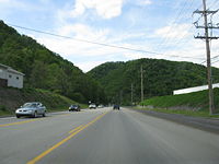
Pennsylvania Route 36 is a 151.12 mi (243.2 km) long state highway
located in the U.S. state
of Pennsylvania
. The southern terminus is at Pennsylvania Route 26
near the Hopewell Township
community of Yellow Creek. The northern terminus is at Pennsylvania Route 27
and Pennsylvania Route 227
in Pleasantville
.
One of the longest and oldest highways in the commonwealth, PA 36 serves as a major connector between South Central
and Northwestern Pennsylvania. In 1955, the highway was designated as the Colonel Drake Highway in honor of Edwin Drake
.
 PA 36 begins in the Bedford County hamlet of Yellow Creek
at PA 26
along the Tussey Mountain
range. The distance in Bedford County is brief as the highway enters Blair County and proceeds northward as the Woodbury Pike, intersecting several 800-series state highways like: PA 866
, PA 868
, and PA 869
. A short distance between Roaring Spring
and the hamlet of McKee, PA 36 overlaps the east–west running PA 164
. North of McKee, PA 36 becomes Catfish Ridge Road, closely paralleling the Frankstown Branch Juniata River
to the west, and the Interstate 99
–U.S. Route 220
overlap to the east along the Brush Mountain range.
Just south of Hollidaysburg, PA 36 has the only interchange with a non-freeway highway, Smith Road. North of Smith Road, PA 36 enters the borough as Logan Boulevard and intersects U.S. Route 22
in downtown at Blair Street. North of Hollidaysburg, PA 36 as Logan Boulevard becomes a major 4-lane divided
arterial, serving the southern suburbs of Altoona.
North of the I-99/US 220 underpass, PA 36 enters the city of Altoona. The route briefly overlaps U.S. Route 220 Business
along West Plank Road. North of the overlap, PA 36 traverses the downtown areas of the city via Union Avenue and 18th street. Running on a west direction, 18th Street leads PA 36 out of Altoona, into the Appalachian Mountains
and rural areas.
for block
in the hamlet of Ashville. West of the hamlet, PA 36 proceeds on a northwest direction into Clearfield County. Between the county line and the village of Mahaffey, PA 36 mostly runs parallel on the eastern banks of the Chest Creek
. From Mahaffey to McGees Hills, PA 36 is overlapped with U.S. Route 219
along the northern banks of the West Branch Susquehanna River
.
The highway runs through Indiana County, passing through its far northeastern portion, for less than one mile (1.6 km). Briefly after entering Jefferson County, PA 36 takes a predominantly western course. PA traverses the borough of Punxsutawney
as Main and Mahoning Streets while intersecting the Buffalo
-Pittsburgh highway (U.S. Route 119
) and PA 436
, a spur
of 36. Outside the borough, PA 36 intersects another spur, PA 536
, before taking a more northern alignment.
In Brookville, PA 36 has a three-route concurrency with U.S. Route 322
and PA 28
along Main Street. North of the overlap, PA 36 becomes Allegheny Boulevard while interchanging Interstate 80 at exit 78. North of Brookville, PA 36 runs mostly on a northern course. In the northwestern sections of the county, the road intersects PA 949
in Sigel and PA 899
near Clear Creek State Park
. PA 36 exits the county running west along the southern tips of the Clarion River
in Cook Forest State Park
.
, and exiting the county. In Forest County, PA 36 has a short overlap with U.S. Route 62
, in the borough of Tionesta along the Allegheny River
. In Venango County, PA 36 runs mostly northwest before reaching the northern terminus at PA 27 and PA 227
in Pleasantville
.
) in Altoona to PA 66 in Clarion County. From the original northern terminus to Tionesta, the highway was signed as PA 66, and from Tionesta to the current terminus, it was signed as PA 227
. From Roaring Spring to the current southern terminus, it was designated as PA 426
.
By 1940, the northern terminus was moved to its current location. Also by this time, the southern terminus was extended south to U.S. Route 30
west of Everett along what is today Lower Snake Spring Road and Church View Road. By 1950, the current southernmost segment of PA 36 between PA 26 and Loysburg was redesignated as PA 868
. On December 21, 1955, the route was designated as the "Col. Drake Highway" in honor of Edwin L. Drake, the first to drill for oil in the United States.
By 1980, the southern terminus was moved to its current location.
State highway
State highway, state road or state route can refer to one of three related concepts, two of them related to a state or provincial government in a country that is divided into states or provinces :#A...
located in the U.S. state
U.S. state
A U.S. state is any one of the 50 federated states of the United States of America that share sovereignty with the federal government. Because of this shared sovereignty, an American is a citizen both of the federal entity and of his or her state of domicile. Four states use the official title of...
of Pennsylvania
Pennsylvania
The Commonwealth of Pennsylvania is a U.S. state that is located in the Northeastern and Mid-Atlantic regions of the United States. The state borders Delaware and Maryland to the south, West Virginia to the southwest, Ohio to the west, New York and Ontario, Canada, to the north, and New Jersey to...
. The southern terminus is at Pennsylvania Route 26
Pennsylvania Route 26
Pennsylvania Route 26 is a highway in the south-central area of Pennsylvania. Its northern terminus is at Pennsylvania Route 150 northwest of Howard, Pennsylvania; its southern terminus is at the Maryland state line near Barnes Gap in Union Township...
near the Hopewell Township
Hopewell Township, Bedford County, Pennsylvania
Hopewell Township is a township in Bedford County, Pennsylvania, United States. The population was 1,894 at the 2000 census.-History:The Halls Mill Covered Bridge was listed on the National Register of Historic Places in 1980.-Geography:...
community of Yellow Creek. The northern terminus is at Pennsylvania Route 27
Pennsylvania Route 27
Pennsylvania Route 27 is a long state highway located in northwest Pennsylvania. The western terminus of the route is at Park Avenue near U.S. Route 6 and U.S. Route 19 in Meadville. The eastern terminus is at Pennsylvania Route 69 three miles south of Sugar Grove.-History:From 1927 to 1928, PA...
and Pennsylvania Route 227
Pennsylvania Route 227
Pennsylvania Route 227 is an long state highway located in Venango and Forest counties in Pennsylvania. The western terminus is at PA 8 in Rouseville. The eastern terminus is at PA 127 in Harmony Township.-Venango County:...
in Pleasantville
Pleasantville, Venango County, Pennsylvania
Pleasantville is a borough in Venango County, Pennsylvania in the United States. The population was 850 at the 2000 census, and 892 at the 2010 census. It was an early oil 'boom town', and the population jumped from 291 to 1,598 between 1860 and 1870...
.
One of the longest and oldest highways in the commonwealth, PA 36 serves as a major connector between South Central
South Central Pennsylvania
South Central Pennsylvania is a region of the U.S. state of Pennsylvania that includes the fourteen counties of Adams, Cumberland, Dauphin, Franklin, Huntingdon, Juniata, Lancaster, Lebanon, Mifflin, Northumberland, Perry, Schuylkill, Snyder, and York....
and Northwestern Pennsylvania. In 1955, the highway was designated as the Colonel Drake Highway in honor of Edwin Drake
Edwin Drake
Edwin Laurentine Drake , also known as Colonel Drake, was an American oil driller, popularly credited with being the first to drill for oil in the United States.-Early life:...
.
Bedford and Blair Counties
Hopewell Township, Bedford County, Pennsylvania
Hopewell Township is a township in Bedford County, Pennsylvania, United States. The population was 1,894 at the 2000 census.-History:The Halls Mill Covered Bridge was listed on the National Register of Historic Places in 1980.-Geography:...
at PA 26
Pennsylvania Route 26
Pennsylvania Route 26 is a highway in the south-central area of Pennsylvania. Its northern terminus is at Pennsylvania Route 150 northwest of Howard, Pennsylvania; its southern terminus is at the Maryland state line near Barnes Gap in Union Township...
along the Tussey Mountain
Tussey Mountain
]Tussey Mountain is a stratigraphic ridge in central Pennsylvania, United States, trending east of the Bald Eagle, Brush, Dunning and Evitts Mountain ridges...
range. The distance in Bedford County is brief as the highway enters Blair County and proceeds northward as the Woodbury Pike, intersecting several 800-series state highways like: PA 866
Pennsylvania Route 866
Pennsylvania Route 866 is an long state highway located in Bedford and Blair counties. The southern terminus is at PA 36 in Woodbury. The northern terminus is at US 22 in Frankstown Township...
, PA 868
Pennsylvania Route 868
Pennsylvania Route 868 is a long state highway located in Bedford county in Pennsylvania. The southern terminus is at PA 36 in South Woodbury Township...
, and PA 869
Pennsylvania Route 869
Pennsylvania Route 869 is an east–west state route located in Western Pennsylvania. Its western terminus is at Ragers Hill Road just west of US 219 in St...
. A short distance between Roaring Spring
Roaring Spring, Pennsylvania
Roaring Spring in Morrisons Cove, is a borough Blair County, Pennsylvania, United States. The population was 2,418 at the 2000 census. It is part of the Altoona, PA Metropolitan Statistical Area-History:...
and the hamlet of McKee, PA 36 overlaps the east–west running PA 164
Pennsylvania Route 164
Pennsylvania Route 164 is an long state highway located in Cambria, Blair, Bedford counties in Pennsylvania. The western terminus is at an interchange with US 22 in Munster Township...
. North of McKee, PA 36 becomes Catfish Ridge Road, closely paralleling the Frankstown Branch Juniata River
Frankstown Branch Juniata River
The Frankstown Branch Juniata River is a tributary of the Juniata River in Blair County, Pennsylvania, in the United States.The headwater tributaries of the Frankstown Branch rise on the slopes of the Allegheny Front south of Altoona...
to the west, and the Interstate 99
Interstate 99
Interstate 99 is an intrastate Interstate Highway located in central Pennsylvania in the United States. The southern terminus of the route is at exit 146 of the Pennsylvania Turnpike north of Bedford, where the road continues south as U.S. Route 220 . The northern terminus is at...
–U.S. Route 220
U.S. Route 220
U.S. Route 220 is a long U.S. Route in the eastern United States.US 220 is a spur route of U.S. Route 20 but at present, the two routes do not intersect nor do they connect via other spurs of US 20. The former U. S. Route 120, which was signed in Pennsylvania between 1926 and 1967, intersected...
overlap to the east along the Brush Mountain range.
Just south of Hollidaysburg, PA 36 has the only interchange with a non-freeway highway, Smith Road. North of Smith Road, PA 36 enters the borough as Logan Boulevard and intersects U.S. Route 22
U.S. Route 22
U.S. Route 22 is a west–east route and is one of the original United States highways of 1926, running from Cincinnati, Ohio, at US 27, US 42, US 127, and US 52 to Newark, New Jersey, at U.S. Route 1/9 near the Newark Liberty International Airport.US 22 also carries the names of the William...
in downtown at Blair Street. North of Hollidaysburg, PA 36 as Logan Boulevard becomes a major 4-lane divided
Divided Highway
Divided Highway is a compilation album by American rock band The Doobie Brothers, released in 2003. . All tracks are taken from the albums Cycles and Brotherhood .-Track listing:...
arterial, serving the southern suburbs of Altoona.
North of the I-99/US 220 underpass, PA 36 enters the city of Altoona. The route briefly overlaps U.S. Route 220 Business
U.S. Route 220
U.S. Route 220 is a long U.S. Route in the eastern United States.US 220 is a spur route of U.S. Route 20 but at present, the two routes do not intersect nor do they connect via other spurs of US 20. The former U. S. Route 120, which was signed in Pennsylvania between 1926 and 1967, intersected...
along West Plank Road. North of the overlap, PA 36 traverses the downtown areas of the city via Union Avenue and 18th street. Running on a west direction, 18th Street leads PA 36 out of Altoona, into the Appalachian Mountains
Appalachian Mountains
The Appalachian Mountains #Whether the stressed vowel is or ,#Whether the "ch" is pronounced as a fricative or an affricate , and#Whether the final vowel is the monophthong or the diphthong .), often called the Appalachians, are a system of mountains in eastern North America. The Appalachians...
and rural areas.
Cambria, Clearfield, and Jefferson Counties
Near the Cambria County line, PA 36 has the first of five wrong-way concurrencies with PA 53Pennsylvania Route 53
Pennsylvania Route 53 is an long state highway located in central Pennsylvania. The southern terminus of the route is at U.S. Route 219 in the borough of Summerhill...
for block
City block
A city block, urban block or simply block is a central element of urban planning and urban design. A city block is the smallest area that is surrounded by streets. City blocks are the space for buildings within the street pattern of a city, they form the basic unit of a city's urban fabric...
in the hamlet of Ashville. West of the hamlet, PA 36 proceeds on a northwest direction into Clearfield County. Between the county line and the village of Mahaffey, PA 36 mostly runs parallel on the eastern banks of the Chest Creek
Chest Creek
Chest Creek is a tributary of the West Branch Susquehanna River in Cambria and Clearfield counties, Pennsylvania, in the United States.Chest Creek joins the West Branch Susquehanna River at the borough of Mahaffey.-References:...
. From Mahaffey to McGees Hills, PA 36 is overlapped with U.S. Route 219
U.S. Route 219
U.S. Route 219 is a spur of U.S. Route 19. It runs for from West Seneca, New York at an interchange with Interstate 90, to Rich Creek, Virginia, intersecting at U.S. Route 460. U.S. 219 is found in New York, Pennsylvania, Maryland, West Virginia, and Virginia...
along the northern banks of the West Branch Susquehanna River
West Branch Susquehanna River
The West Branch Susquehanna River is one of the two principal branches, along with the North Branch, of the Susquehanna River in the northeastern United States. The North Branch, which rises in upstate New York, is generally regarded as the extension of the main branch, with the shorter West Branch...
.
The highway runs through Indiana County, passing through its far northeastern portion, for less than one mile (1.6 km). Briefly after entering Jefferson County, PA 36 takes a predominantly western course. PA traverses the borough of Punxsutawney
Punxsutawney, Pennsylvania
Punxsutawney is a borough in Jefferson County, Pennsylvania, United States, northeast of Pittsburgh. In 1907, Punxsutawney and Claysville boroughs were consolidated and incorporated as Greater Punxsutawney. A high-grade soft coal was mined in the surrounding region...
as Main and Mahoning Streets while intersecting the Buffalo
Buffalo, New York
Buffalo is the second most populous city in the state of New York, after New York City. Located in Western New York on the eastern shores of Lake Erie and at the head of the Niagara River across from Fort Erie, Ontario, Buffalo is the seat of Erie County and the principal city of the...
-Pittsburgh highway (U.S. Route 119
U.S. Route 119
U.S. Route 119, commonly abbreviated as US 119, is a spur of US 19. It is a north–south route that was an original United States highway of 1926. It is often referred to as Corridor G east of US 23 and KY 80 in Kentucky to Interstate 64 at Charleston, West Virginia.- Kentucky :US 119 is a two...
) and PA 436
Pennsylvania Route 436
Pennsylvania Route 436 is a long state highway located in Jefferson county in Pennsylvania. The southern terminus is at US 119 near Punxsutawney. The northern terminus is at PA 36 in Punxsutawney. Route 436 was assigned in the 1928 numbering of roads in Pennsylvania and not paved until 1932. The...
, a spur
Spur route
A spur route is a short road forming a branch from a longer, more important route . A bypass or beltway is never considered a true spur route as it typically reconnects with the major road...
of 36. Outside the borough, PA 36 intersects another spur, PA 536
Pennsylvania Route 536
Pennsylvania Route 536 is an long state highway located in Clarion, Armstrong, and Jefferson counties in Pennsylvania. The western terminus is at PA 28 in Redbank Township...
, before taking a more northern alignment.
In Brookville, PA 36 has a three-route concurrency with U.S. Route 322
U.S. Route 322
U.S. Route 322 is a long, east–west United States Highway, traversing Ohio, Pennsylvania, and New Jersey. The road is a spur of U.S. Route 22 and one of the original highways from 1926...
and PA 28
Pennsylvania Route 28
Pennsylvania Route 28 is a major state highway which runs for 97 miles from Interstate 279 and Interstate 579 at the Interstate 279 Interchange in Pittsburgh to U.S. Route 219 in Brockway in the U.S. state of Pennsylvania. The expressway from Kittanning to Pittsburgh is called the Alexander H...
along Main Street. North of the overlap, PA 36 becomes Allegheny Boulevard while interchanging Interstate 80 at exit 78. North of Brookville, PA 36 runs mostly on a northern course. In the northwestern sections of the county, the road intersects PA 949
Pennsylvania Route 949
Pennsylvania Route 949 is a long, north–south state highway located in Jefferson and Elk counties in Pennsylvania. The southern terminus is at PA 28 in Summerville. The northern terminus is at PA 948 in Ridgway.-Route description:...
in Sigel and PA 899
Pennsylvania Route 899
Pennsylvania Route 899 is a long state highway located in Jefferson and Forest counties in Pennsylvania. The southern terminus is at PA 36 in Barnett Township. The northern terminus is at PA 66 in Jenks Township.-Route description:...
near Clear Creek State Park
Clear Creek State Park
Clear Creek State Park is a Pennsylvania state park in Barnett and Heath Townships, Jefferson County, Pennsylvania in the United States. Public campsites were first opened at the park in 1922. Many of the facilities seen today at the park were constructed during the Great Depression by the...
. PA 36 exits the county running west along the southern tips of the Clarion River
Clarion River
The Clarion River is a tributary of the Allegheny River, approximately 110 mi long, in west central Pennsylvania in the United States...
in Cook Forest State Park
Cook Forest State Park
Cook Forest State Park is a Pennsylvania state park in Farmington Township, Clarion County, Barnett Township, Forest County and Barnett Township, Jefferson County, Pennsylvania in the United States. The park is a heavily wooded area of rolling hills and mountains along the Clarion River in...
.
Clarion, Forest, and Venango Counties
PA 36 entes Clarion County running westward. In the town of Leeper, the route intersects PA 66. Past Leeper, the highway runs northwest, intersecting PA 208Pennsylvania Route 208
Pennsylvania Route 208 is located in Western Pennsylvania; its western terminus just west of the village of New Bedford in Lawrence County at US 422 and the Ohio state line...
, and exiting the county. In Forest County, PA 36 has a short overlap with U.S. Route 62
U.S. Route 62
U.S. Route 62 runs from the US-Mexico border at El Paso, Texas to Niagara Falls, New York, near the United States-Canada border. It is the only east-west US Route that connects Mexico and Canada.Parts of U.S...
, in the borough of Tionesta along the Allegheny River
Allegheny River
The Allegheny River is a principal tributary of the Ohio River; it is located in the Eastern United States. The Allegheny River joins with the Monongahela River to form the Ohio River at the "Point" of Point State Park in Downtown Pittsburgh, Pennsylvania...
. In Venango County, PA 36 runs mostly northwest before reaching the northern terminus at PA 27 and PA 227
Pennsylvania Route 227
Pennsylvania Route 227 is an long state highway located in Venango and Forest counties in Pennsylvania. The western terminus is at PA 8 in Rouseville. The eastern terminus is at PA 127 in Harmony Township.-Venango County:...
in Pleasantville
Pleasantville, Venango County, Pennsylvania
Pleasantville is a borough in Venango County, Pennsylvania in the United States. The population was 850 at the 2000 census, and 892 at the 2010 census. It was an early oil 'boom town', and the population jumped from 291 to 1,598 between 1860 and 1870...
.
History
PA 36 was originally designated from Pleasant Valley Boulevard (U.S. Route 220U.S. Route 220
U.S. Route 220 is a long U.S. Route in the eastern United States.US 220 is a spur route of U.S. Route 20 but at present, the two routes do not intersect nor do they connect via other spurs of US 20. The former U. S. Route 120, which was signed in Pennsylvania between 1926 and 1967, intersected...
) in Altoona to PA 66 in Clarion County. From the original northern terminus to Tionesta, the highway was signed as PA 66, and from Tionesta to the current terminus, it was signed as PA 227
Pennsylvania Route 227
Pennsylvania Route 227 is an long state highway located in Venango and Forest counties in Pennsylvania. The western terminus is at PA 8 in Rouseville. The eastern terminus is at PA 127 in Harmony Township.-Venango County:...
. From Roaring Spring to the current southern terminus, it was designated as PA 426
Pennsylvania Route 426
Pennsylvania Route 426 is a long state highway in Warren and Erie counties of Pennsylvania. The route is split up into two segments, connected by New York State Route 426 through New York....
.
By 1940, the northern terminus was moved to its current location. Also by this time, the southern terminus was extended south to U.S. Route 30
U.S. Route 30
U.S. Route 30 is an east–west main route of the system of United States Numbered Highways, with the highway traveling across the northern tier of the country. It is the third longest U.S. route, after U.S. Route 20 and U.S. Route 6. The western end of the highway is at Astoria, Oregon; the...
west of Everett along what is today Lower Snake Spring Road and Church View Road. By 1950, the current southernmost segment of PA 36 between PA 26 and Loysburg was redesignated as PA 868
Pennsylvania Route 868
Pennsylvania Route 868 is a long state highway located in Bedford county in Pennsylvania. The southern terminus is at PA 36 in South Woodbury Township...
. On December 21, 1955, the route was designated as the "Col. Drake Highway" in honor of Edwin L. Drake, the first to drill for oil in the United States.
By 1980, the southern terminus was moved to its current location.