

Pennsylvania Route 287
Encyclopedia
Pennsylvania Route 287 is a 63.9 miles (102.8 km) long state highway in the Tioga Valley
of Pennsylvania
. Route 287 begins at an intersection with U.S. Route 220
in the community of Larrys Creek in Piatt Township
, Lycoming County
to an intersection with Pennsylvania Route 49
just south of the New York
state line in Lawrenceville
, Tioga County
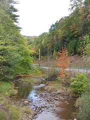
. The route follows Larrys Creek
through several isolated communities, including Salladasburg and English Center, before working its way towards Hoytville, where it meets Pennsylvania Route 414
. The route ends up in Wellsboro
, where it meets U.S. Route 6
, and reaches Tioga
.
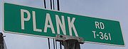
The alignment of Route 287 has been successor to a set of plank road
s from Larrys Creek to Lawrenceville. The southern plank road, known as the Larrys Creek Plank Road, dates back to 1850 as short highway from Larrys Creek to Salladasburg, and was completely gone by 1900. The second part followed the Tioga and Lawrenceville Plank Road, which although is named from Tioga to Lawrenceville, went from Wellsboro to Tioga. The portion to Lawrenceville was never constructed. The route also followed several postal routes in the area. In 1911, the Sproul Road Bill was passed, and Route 287 became segments of Legislative Route 22, Legislative Route 106, and Legislative Route 353. In 1924, the northernmost portion was designated Route 4 and the Susquehanna Trail
. This was changed to part of U.S. Route 220 in 1926.
In 1928, U.S. Route 111
was designated, and along with Pennsylvania Route 84, consisted of the alignment of Route 287. Route 111 was redesignated as part of U.S. Route 15. The highway was redesignated as Route 287 in 1961 when Route 84 was decommissioned in favor of Interstate 84
. The route was extended from Tioga to Lawrenceville in 2008, when the construction of U.S. Route 15 was finished to the New York
state line, and Route 287 was extended to Route 49.
 Much of the current-day alignment for Route 287 has been constructed through many different post, plank and turnpike roads in Lycoming and Tioga counties. The earliest known plank road in the area of the current day highway dates back to 1810, when a mail postal route was created along current day Route 287 from Wellsboro to Willardsburg (later known as Tioga). The mail was delivered once a week on horseback for several years, with the service discontinued in 1818. That year, the service was changed to a semi-weekly service for delivery two times a week on horseback. In 1824, this service was also discontinued when the mail route began to be used by coaches three times a week. This service was used and then decommissioned by 1835, when a new system, which stretched from Wellsboro and past Willardsburg to the community of Lawrenceville, was established. This route followed the alignment of Route 287, making stops in Middlebury Center, Holliday, Willardsburg and Mitchell's Creek before ending in Lawrenceville. This mail route was truncated back to Willardsburg in 1840, when the nearby Corning and Blossburg Railroad was completed. The stagecoach lines started working along the three-day process for about ten years, when the nearby Tioga and Wellsboro Plank Road was completed, which made stagecoaches run daily. Along with numerous competition, the service was discontinued in 1872, when the Lawrenceville and Wellsboro Railroad was completed. At that time, the stagecoach lines has ceased operation. By 1883, the only piece of mail routes in the area of Tioga County was a piece near Middlebury Center, but was not as large as the process once was.
Although the Corning and Blossburg Railroad had served as a good travel connection between Wellsboro and Lawrenceville (the Tioga Valley), several communities in the Crooked Creek Valley felt they were not well accommodated. At that time, in locations where railroads were not a feasible option, the construction of plank road
s became a highly popular option. In 1848, the Pennsylvania State Legislature approved and chartered construction of a brand new plank road in the valley, to be called the Tioga and Elmira Plank Road, following the alignments of current-day Route 287, Pennsylvania Route 328
and New York State Route 328
to Elmira, New York
. Construction was unable to start in 1848, so a supplement to the charter was amended on April 5, 1849, which extended the work period to continue until 1856. Yet another supplement was added in 1850, when the Tioga and Lawrenceville Plank Road was chartered on May 14. This new plank road also had the ability to extend their plank road down to Wellsboro, which repealed the acts of 1848 and 1849. The plank road was contracted and completed in a timely fashion down to Wellsboro from Tioga. In 1851, the plank road was complete from Wellsboro to Tioga, and the thoroughfare became highly used by people transporting lumber, agriculture and merchandise. This helped farmers and producers in the communities of Middlebury Center, Holliday and Delmar (now the area of Wellsboro Junction). The plank road would eventually get worn out from use, and the route was eventually changed from a plank road to a high use turnpike. The 17 miles (27.4 km) long piece of plank road, created in the original charter from Tioga to Lawrenceville, was never constructed.
 The southernmost portion of Route 287 was the location of a third plank road, this time beginning at the mouth of Larrys Creek
in the eponymous community to the current day location of English Center. The road was first considered during the early 19th century; James Williamson, a strong local entrepreneur lived in these areas and it is assumed that the road builders in this area of Lycoming County were in favor of his suggestions. On May 8, 1850, the Pennsylvania State Legislature chartered a brand new plank road along the riverbank of Larrys Creek. The stock of the plank road was 20 shares of $40.00 (1850 USD). Williamson himself was awarded the job as contractor, and in 1850, using full advantage of woodsmen who were unemployed, low wages, and wasted hemlock log trees, began construction. By 1851, the plank road had been constructed all the way to the community of Salladasburg. With the 8 feet (2.4 m)-wide plank road came several tollhouses along the entire route to pay charge for using the roadway. A movable barrier was also installed, so people could not gain access without payment. The plank road was finished and prospered for many years. The common transport on the road was bark
and hides
, along with hauling leather over to the Larrys Creek Railroad. On June 1, 1889, a major flood hit the area around the plank road, and when things were all said and done, it had experienced extensive damage. In places where damage had occurred, the road was replaced by graded dirt roads. In 1900, the remains of the plank road remained only from Salladasburg to the Larrys Creek Railroad Station. Later that year, a petition was raised to make this remaining piece of road free to access. The case was closed in support of the motion and the plank road company shut down forever.
 On May 31, 1911, the state of Pennsylvania signed the Sproul Road Bill, which started a drastic state takeover of highways around the commonwealth. Originally, only several routes were assigned around the state. The bill had approved a road from Wellsboro to the New York
state line, which was designated as Legislative Route 22. At the time, this was the only state-maintained portion of Route 287 that was in use. By 1915, more of Route 287 was taken over by the state, with the portion from the current-day intersection with Pennsylvania Route 414
in Morris Township
to the intersection with Pennsylvania Route 660
in Wellsboro becoming designated as Legislative Route 106, where it reached Legislative Route 22 and 21. In 1916, the portion from Legislative Route 23 (now the intersection with U.S. Route 220) in Larrys Creek to the community of Brookside was taken over as Legislative Route 353. The designations remained in place until 1924, when actual route designations were assigned in the commonwealth. The part that was later made as part of U.S. Route 15
, which was then changed to an alignment of Route 287, was designated as Route 4 (over the Susquehanna Trail
). The route received another designation in 1926, upon the creation of United States Highways across the country. The portion from Tioga to an intersection with the current day U.S. Route 15 was designated as part of U.S. Route 220.
 This remained in place for only two years, and when the Pennsylvania Department of Highways redesignated highways across the entire commonwealth, the alignment of the U.S. Route 220 portion was redesignated as U.S. Route 111
, while the entire alignment of Route 287 from the Larrys Creek to Tioga was redesignated as Route 84. The entire alignment of Route 84 consisted of an intersection with U.S. Route 220 in Larrys Creek to U.S. Route 111 in Tioga, where the highway terminated. In 1930, the concurrent piece of Legislative Route 4 was decommissioned, and the alignment of the highway remained as U.S. Route 111. The portion from Tioga north remained as Route 111 until 1936, when the highway was renumbered to U.S. Route 15. In that time, several intersections along Route 287 tied in with several former state highways. During the 1928 numbering, the intersection with Route 414 in Hoytville was designated as Route 893, a local intersection in Antrim was designated as Route 961, and the intersection in Somers Lane was designated as Route 826. The routes were decommissioned in 1955, 1946, and 1941 respectively. After 1946, when a mass decommissioning of state highways occurred, Route 84 remained in place for another 15 years, when the plans arose for Interstate 84
, which duplicated the state highway. Because of this duplication, Route 84 was reassigned as Route 287.
 During the 1960s, plans developed to widen U.S. Route 15 for safety precautions. Construction progressed fast, reaching the Lycoming County line in 1968. At the time, Route 287 terminated at an intersection with U.S. Route 15 at the Hammond Reservoir. Ten years later, Route 15 was completed up to Tioga, and that year, the Pennsylvania Department of Transportation
extended Route 287 to the new interchange. At that point, U.S. Route 15 followed the northernmost alignment of PA 287 to Lawrenceville. This interchange was completed in late 2000 with an opening ceremony by then-governor Tom Ridge
. With the proposal for the brand new Interstate 99
following U.S. Route 15's alignment, construction was upgraded once again, and a new alignment for U.S. Route 15 was started in 2005. The alignment was constructed for the final 5 miles (8 km) from Tioga to the state line. With the alignment's completion, Route 15 was realigned onto the newly opened freeway on October 1, 2008. The entire project cost $102 million (2008 USD), including one new interchange and the completion of the Route 287 interchange in Tioga.
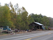
in the Piatt Township
community of Larrys Creek. The route heads north, following a former plank road through the rural areas to the west of Williamsport
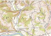
. After a while, the roadway becomes moderately developed, following residential houses for a short distance. The route enters the community of Larrysville, where the route turns to the northwest through a line of forests. Route 287 intersects with Zinck Road, where the roadway becomes highly developed, following the route past residential homes and a large factory. The route crosses through a small patch of forests and enters Mifflin Township
, where it intersects with Pennsylvania Route 973
. Route 973 becomes concurrent with Route 287 here, entering the community of Salladasburg, where the two highways fork. Route 287 continues northward on the right-of-way, while Route 973 heads to the northeast along Main Street. At an intersection with Dochter Street, a connector to Route 973, Route 287 turns to the northwest and leaves Salladasburg.
 Route 287 continues northward after leaving Salladasburg, paralleling Route 973 for a short distance until the two highways turn away. Route 287 heads northward, passing through deep patches of forests. This alignment and surroundings remain the same for several miles, passing a few local roads. The deep forests begin to clear as the highway enters the community of Brookside. In Brookside, Route 287 winds along a deep field, intersecting with the southern terminus of Pennsylvania Route 184
, which heads to the northeast. The route turns to the northwest, paralleling with Hughes Road, which merges in soon after. The highway continues northward in the fields north of Brookside until after Hughes Road, where it enters deep forests once again. Route 287 winds around curves, until the intersection with Lick Run Road, where it turns to the northwest, entering the isolated community of English Center. In English Center, the route intersects with Little Pine Creek Road, where Route 287 turns to the north. The route returns to the deep forests, intersecting with Pennsylvania Route 284
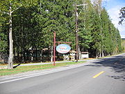
. Route 287 turns to the northwest at that intersection, continuing through the deep forests. After several miles, the route turns to the northeast, passing to the west of a large pond. The forests began to clear as Route 287 enters the community of Pine Township
, where the route continues northward, through fields and tree patches. At an intersection with Granger Lane, Route 287 crosses the county line into Tioga County
.
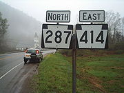 After entering Tioga County, Route 287 continues to the north, entering the community of Texas, which mainly consists of large fields. The highway continues along this right-of-way, passing a large factory before entering the community of Mount Pleasant. At an intersection with Mount Pleasant Road, Route 287 turns to the northeast, bending around deep forests. The route crosses Hurney Hill Road, which is where the highway turns to the northwest. When the highway makes a curve to the northeast, Route 287 enters the community of Hoytville. In Hoytville, Route 287 intersects with Pennsylvania Route 414
, which becomes concurrent with Route 287 for a distance. Routes 287 and 414 continue to the northeast, working its way along the residential homes in Hoytville. A short distance later, the highways enter the highly developed area in Hoytville in Morris Township. At an intersection in the center of the community, Route 287 turns to the north while Route 414 turns to the south, with the two highways splitting. Route 287 turns to the northeast, leaving the downtown area of Morris Township. After Morris Township, most of the route becomes surrounded by forests, except for a distance with residential homes following the northbound lanes. The surroundings return to the deep forests in both directions, with Route 287 continuing northward for several miles.
 Route 287 begins to parallel a waterway, entering the community of Antrim, which is surrounded mainly by forests. After Antrim, the highway continues northward through the deep forests for several miles, until entering the community of Knapp. In Knapp, Route 287 continues to the northeast, passing several fields and intersecting with a local road towards Broughton Hollow. At an intersection with Dean Hill Road, the highway turns to the northeast through the fields, entering Coolidge Hollows, a small farming community. At an intersection with Sweetbriar Road, Route 287 turns to the north, passing some homes before turning to the northeast into the farmlands once again. Approaching the intersection with Shumway Hill Road, the highway makes a gradual bend to the northwest, passing a large pond to the west, where it gains the name of Central Avenue as the route enters the community of Wellsboro
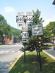
. Route 287 heads along Central Avenue through a highly developed business and residential community until the intersection with Pennsylvania Route 660
(Main Street), where the highway turns eastward on a concurrency with Route 660. Routes 287 and 660 continue to the northeast along Main Street in the center of the community, where the two highways intersect with U.S. Route 6
. At the U.S. Route 6 intersection, Route 660 turns along U.S. Route 6 East while Route 287 continues along U.S. Route 6 Westbound. Routes 6 and 287 head to the northeast through the community center, passing to the east of Wellsboro Cemetery before the two highways turn to the northwest along Tioga Street. At an intersection with Hillboldt Road, Route 287 and Route 6 leave Wellsboro. The two highways enter Stokesdale, a residential community before a fork in the highway, with Route 6 turning towards the west and Route 287 towards the north.
Route 287, after the split with Route 6, heads to the northeast, entering the community of Wellsboro Junction. Wellsboro Junction is mainly fields, with the route heading as the main highway. After passing a few factories, Route 287 turns to the northeast and out of Wellsboro Junction. The highway passes a large pond, as well as a few residential homes. Route 287 continues along the rural alignment, entering a small community of residential homes and fields. The route continues to the northeast, entering the community of Middlebury Center, where it intersects with the terminus of Pennsylvania Route 249
and Mill Plank Road. The route turns to the northeast in the barren residential community. The route crosses over a river and heads on a straight northeast alignment, passing through a residential community. A short distance later, Route 287 turns to the northeast, paralleling a railroad. The route widens to three lanes where it passes a large field. Route 287 turns to the north, reaching the northern terminus of the nearby railroad. The route heads to the north, crossing the Tioga Dam along the Hammond Reservoir and entering the community of Crooked Creek.
 The route continues northward along the eastern shore of the reservoir, until the northern end of the reservoir, where it turns to the east, entering the municipality of Tioga
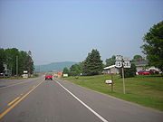
. In Tioga, Route 287 heads along Wellsboro Street in a moderately developed part of the community until turning to the north on North Main Street. Route 287 continues along North Main Street until leaving Tioga. A short distance later, Route 287 interchanges with U.S. Route 15
(the Appalachian Thruway). Route 287 continues along the former alignment of Route 15 into Mitchell Creek, a small community. The route heads northward, entering Beeman which consists of a local business center. In the center, Route 287 intersects with the western terminus of Pennsylvania Route 328
. The route intersects with Somers Lane before entering the community of Somers Lane, which is a barren area. The route heads to the northwest along the Tioga River
, crossing another railroad, and soon over the river. After the river, Route 287 enters the municipality of Lawrenceville
, where the highway intersects with Pennsylvania Route 49
's eastern terminus. At that intersection, Route 287 terminates, with the right-of-way continuing the short distance as State Route 1015 to the New York
state line.
Tioga River (Chemung River)
The Tioga River is a tributary of the Chemung River, approximately long, in northern Pennsylvania and western New York in the United States...
of Pennsylvania
Pennsylvania
The Commonwealth of Pennsylvania is a U.S. state that is located in the Northeastern and Mid-Atlantic regions of the United States. The state borders Delaware and Maryland to the south, West Virginia to the southwest, Ohio to the west, New York and Ontario, Canada, to the north, and New Jersey to...
. Route 287 begins at an intersection with U.S. Route 220
U.S. Route 220
U.S. Route 220 is a long U.S. Route in the eastern United States.US 220 is a spur route of U.S. Route 20 but at present, the two routes do not intersect nor do they connect via other spurs of US 20. The former U. S. Route 120, which was signed in Pennsylvania between 1926 and 1967, intersected...
in the community of Larrys Creek in Piatt Township
Piatt Township, Pennsylvania
Piatt Township is a township in Lycoming County, Pennsylvania, in the United States. The population was 1,259 at the 2000 census. It is part of the Williamsport, Pennsylvania Metropolitan Statistical Area.-History:...
, Lycoming County
Lycoming County, Pennsylvania
-Appalachian Mountains and Allegheny Plateau:Lycoming County is divided between the Appalachian Mountains in the south, the dissected Allegheny Plateau in the north and east, and the valley of the West Branch Susquehanna River between these.-West Branch Susquehanna River:The West Branch of the...
to an intersection with Pennsylvania Route 49
Pennsylvania Route 49
Pennsylvania Route 49 is a long state highway located in northern Pennsylvania. The western terminus of the route is at Pennsylvania Route 44 three miles north of Coudersport. The eastern terminus is at PA 287 in Lawrenceville less than south of the New York-Pennsylvania border...
just south of the New York
New York
New York is a state in the Northeastern region of the United States. It is the nation's third most populous state. New York is bordered by New Jersey and Pennsylvania to the south, and by Connecticut, Massachusetts and Vermont to the east...
state line in Lawrenceville
Lawrenceville, Pennsylvania
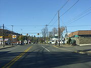
Lawrenceville is a borough in Tioga County, Pennsylvania, in the United States. The population was 627 at the 2000 census.-Geography:Lawrenceville is located at . It is at the intersection of Pennsylvania Route 287 and Pennsylvania Route 49. The only traffic light in town can be found at this...
, Tioga County
Tioga County, Pennsylvania
Tioga County is a county located in the U.S. state of Pennsylvania. As of the 2010 census, the population was 41,981. Tioga County was created on March 26, 1804, from part of Lycoming County and named for the Tioga River. Its county seat is Wellsboro....
. The route follows Larrys Creek
Larrys Creek
Larrys Creek is a tributary of the West Branch Susquehanna River in Lycoming County in the U.S. state of Pennsylvania. A part of the Chesapeake Bay drainage basin, its watershed drains in six townships and a borough...
through several isolated communities, including Salladasburg and English Center, before working its way towards Hoytville, where it meets Pennsylvania Route 414
Pennsylvania Route 414
Pennsylvania Route 414 is an long state highway located in Lycoming, Tioga, and Bradford counties in Pennsylvania. The western terminus is at PA 44 in Waterville...
. The route ends up in Wellsboro
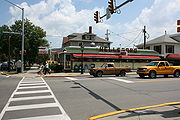
Wellsboro, Pennsylvania
Wellsboro is a borough in Tioga County, Pennsylvania, 52 miles northwest of Williamsport. Early in the twentieth century, Wellsboro was the shipping point and trade center for a large area...
, where it meets U.S. Route 6
U.S. Route 6
U.S. Route 6 , also called the Grand Army of the Republic Highway, a name that honors an American Civil War veterans association, is a main route of the U.S. Highway system, running east-northeast from Bishop, California to Provincetown, Massachusetts. Until 1964, it continued south from Bishop to...
, and reaches Tioga
Tioga, Pennsylvania
Tioga is a borough in Tioga County, Pennsylvania, in the United States. The population was 622 at the 2000 census. It is located north of Tioga and Hammond Lakes.-Geography:Tioga is located at ....
.
The alignment of Route 287 has been successor to a set of plank road
Plank road
A plank road or puncheon is a dirt path or road covered with a series of planks, similar to the wooden sidewalks one would see in a Western movie. Plank roads were very popular in Ontario, the U.S. Northeast and U.S. Midwest in the first half of the 19th century...
s from Larrys Creek to Lawrenceville. The southern plank road, known as the Larrys Creek Plank Road, dates back to 1850 as short highway from Larrys Creek to Salladasburg, and was completely gone by 1900. The second part followed the Tioga and Lawrenceville Plank Road, which although is named from Tioga to Lawrenceville, went from Wellsboro to Tioga. The portion to Lawrenceville was never constructed. The route also followed several postal routes in the area. In 1911, the Sproul Road Bill was passed, and Route 287 became segments of Legislative Route 22, Legislative Route 106, and Legislative Route 353. In 1924, the northernmost portion was designated Route 4 and the Susquehanna Trail
Susquehanna Trail
The Susquehanna Trail was an auto trail in the United States linking Washington, D.C. with Niagara Falls, New York. It passed through Baltimore, Maryland; Harrisburg, Pennsylvania; Williamsport, Pennsylvania; and Buffalo, New York....
. This was changed to part of U.S. Route 220 in 1926.
In 1928, U.S. Route 111
U.S. Route 111
U.S. Route 111 was a U.S. Route that ran from Baltimore, Maryland north to the Harrisburg, Pennsylvania area. It replaced part of the Susquehanna Trail and was in turn replaced by Interstate 83. Portions of its pre-freeway alignment are now Maryland Route 45 and Interstate 83 Business...
was designated, and along with Pennsylvania Route 84, consisted of the alignment of Route 287. Route 111 was redesignated as part of U.S. Route 15. The highway was redesignated as Route 287 in 1961 when Route 84 was decommissioned in favor of Interstate 84
Interstate 84 (east)
Interstate 84 is an Interstate Highway extending from Dunmore, Pennsylvania at an interchange with Interstate 81 to Sturbridge, Massachusetts, at an interchange with the Massachusetts Turnpike . I-84 has mile-log junction numbering in Pennsylvania; otherwise, exit numbers are roughly sequential...
. The route was extended from Tioga to Lawrenceville in 2008, when the construction of U.S. Route 15 was finished to the New York
New York
New York is a state in the Northeastern region of the United States. It is the nation's third most populous state. New York is bordered by New Jersey and Pennsylvania to the south, and by Connecticut, Massachusetts and Vermont to the east...
state line, and Route 287 was extended to Route 49.
Old roads
Although the Corning and Blossburg Railroad had served as a good travel connection between Wellsboro and Lawrenceville (the Tioga Valley), several communities in the Crooked Creek Valley felt they were not well accommodated. At that time, in locations where railroads were not a feasible option, the construction of plank road
Plank road
A plank road or puncheon is a dirt path or road covered with a series of planks, similar to the wooden sidewalks one would see in a Western movie. Plank roads were very popular in Ontario, the U.S. Northeast and U.S. Midwest in the first half of the 19th century...
s became a highly popular option. In 1848, the Pennsylvania State Legislature approved and chartered construction of a brand new plank road in the valley, to be called the Tioga and Elmira Plank Road, following the alignments of current-day Route 287, Pennsylvania Route 328
Pennsylvania Route 328
Pennsylvania Route 328 is a long state highway located in Tioga and Bradford counties in Pennsylvania. The western terminus is at Pennsylvania Route 287 in Tioga Junction...
and New York State Route 328
New York State Route 328
New York State Route 328 is a northeast–southwest state highway located entirely within the town of Southport in Chemung County, New York, in the United States...
to Elmira, New York
Elmira, New York
Elmira is a city in Chemung County, New York, USA. It is the principal city of the 'Elmira, New York Metropolitan Statistical Area' which encompasses Chemung County, New York. The population was 29,200 at the 2010 census. It is the county seat of Chemung County.The City of Elmira is located in...
. Construction was unable to start in 1848, so a supplement to the charter was amended on April 5, 1849, which extended the work period to continue until 1856. Yet another supplement was added in 1850, when the Tioga and Lawrenceville Plank Road was chartered on May 14. This new plank road also had the ability to extend their plank road down to Wellsboro, which repealed the acts of 1848 and 1849. The plank road was contracted and completed in a timely fashion down to Wellsboro from Tioga. In 1851, the plank road was complete from Wellsboro to Tioga, and the thoroughfare became highly used by people transporting lumber, agriculture and merchandise. This helped farmers and producers in the communities of Middlebury Center, Holliday and Delmar (now the area of Wellsboro Junction). The plank road would eventually get worn out from use, and the route was eventually changed from a plank road to a high use turnpike. The 17 miles (27.4 km) long piece of plank road, created in the original charter from Tioga to Lawrenceville, was never constructed.
Larrys Creek
Larrys Creek is a tributary of the West Branch Susquehanna River in Lycoming County in the U.S. state of Pennsylvania. A part of the Chesapeake Bay drainage basin, its watershed drains in six townships and a borough...
in the eponymous community to the current day location of English Center. The road was first considered during the early 19th century; James Williamson, a strong local entrepreneur lived in these areas and it is assumed that the road builders in this area of Lycoming County were in favor of his suggestions. On May 8, 1850, the Pennsylvania State Legislature chartered a brand new plank road along the riverbank of Larrys Creek. The stock of the plank road was 20 shares of $40.00 (1850 USD). Williamson himself was awarded the job as contractor, and in 1850, using full advantage of woodsmen who were unemployed, low wages, and wasted hemlock log trees, began construction. By 1851, the plank road had been constructed all the way to the community of Salladasburg. With the 8 feet (2.4 m)-wide plank road came several tollhouses along the entire route to pay charge for using the roadway. A movable barrier was also installed, so people could not gain access without payment. The plank road was finished and prospered for many years. The common transport on the road was bark
Bark
Bark is the outermost layers of stems and roots of woody plants. Plants with bark include trees, woody vines and shrubs. Bark refers to all the tissues outside of the vascular cambium and is a nontechnical term. It overlays the wood and consists of the inner bark and the outer bark. The inner...
and hides
Hides
A hide is an animal skin treated for human use. Hides include leather from cattle and other livestock animals, alligator skins, snake skins for shoes and fashion accessories and furs from wild cats, mink and bears. In some areas, leather is produced on a domestic or small industrial scale, but most...
, along with hauling leather over to the Larrys Creek Railroad. On June 1, 1889, a major flood hit the area around the plank road, and when things were all said and done, it had experienced extensive damage. In places where damage had occurred, the road was replaced by graded dirt roads. In 1900, the remains of the plank road remained only from Salladasburg to the Larrys Creek Railroad Station. Later that year, a petition was raised to make this remaining piece of road free to access. The case was closed in support of the motion and the plank road company shut down forever.
Designation of Route 84
New York
New York is a state in the Northeastern region of the United States. It is the nation's third most populous state. New York is bordered by New Jersey and Pennsylvania to the south, and by Connecticut, Massachusetts and Vermont to the east...
state line, which was designated as Legislative Route 22. At the time, this was the only state-maintained portion of Route 287 that was in use. By 1915, more of Route 287 was taken over by the state, with the portion from the current-day intersection with Pennsylvania Route 414
Pennsylvania Route 414
Pennsylvania Route 414 is an long state highway located in Lycoming, Tioga, and Bradford counties in Pennsylvania. The western terminus is at PA 44 in Waterville...
in Morris Township
Morris Township, Tioga County, Pennsylvania
Morris Township is a township in Tioga County, Pennsylvania, in the United States. The population was 646 at the 2000 census.-Geography:According to the United States Census Bureau, the township has a total area of 73.5 square miles , of which, 73.5 square miles of it is land and...
to the intersection with Pennsylvania Route 660
Pennsylvania Route 660
Pennsylvania Route 660 is a long state highway located in Tioga county in Pennsylvania. The western terminus is at the entrance of Leonard Harrison State Park. The eastern terminus is at US 15 and US 15 BUS in Richmond Township.-Major intersections:...
in Wellsboro becoming designated as Legislative Route 106, where it reached Legislative Route 22 and 21. In 1916, the portion from Legislative Route 23 (now the intersection with U.S. Route 220) in Larrys Creek to the community of Brookside was taken over as Legislative Route 353. The designations remained in place until 1924, when actual route designations were assigned in the commonwealth. The part that was later made as part of U.S. Route 15
U.S. Route 15
U.S. Route 15 is a -long United States highway, designated along South Carolina, North Carolina, Virginia, Maryland, Pennsylvania, and New York. The route is signed north–south, from U.S. Route 17 Alternate in Walterboro, South Carolina to Interstate 86 and NY 17 in Painted Post, New York.US...
, which was then changed to an alignment of Route 287, was designated as Route 4 (over the Susquehanna Trail
Susquehanna Trail
The Susquehanna Trail was an auto trail in the United States linking Washington, D.C. with Niagara Falls, New York. It passed through Baltimore, Maryland; Harrisburg, Pennsylvania; Williamsport, Pennsylvania; and Buffalo, New York....
). The route received another designation in 1926, upon the creation of United States Highways across the country. The portion from Tioga to an intersection with the current day U.S. Route 15 was designated as part of U.S. Route 220.
U.S. Route 111
U.S. Route 111 was a U.S. Route that ran from Baltimore, Maryland north to the Harrisburg, Pennsylvania area. It replaced part of the Susquehanna Trail and was in turn replaced by Interstate 83. Portions of its pre-freeway alignment are now Maryland Route 45 and Interstate 83 Business...
, while the entire alignment of Route 287 from the Larrys Creek to Tioga was redesignated as Route 84. The entire alignment of Route 84 consisted of an intersection with U.S. Route 220 in Larrys Creek to U.S. Route 111 in Tioga, where the highway terminated. In 1930, the concurrent piece of Legislative Route 4 was decommissioned, and the alignment of the highway remained as U.S. Route 111. The portion from Tioga north remained as Route 111 until 1936, when the highway was renumbered to U.S. Route 15. In that time, several intersections along Route 287 tied in with several former state highways. During the 1928 numbering, the intersection with Route 414 in Hoytville was designated as Route 893, a local intersection in Antrim was designated as Route 961, and the intersection in Somers Lane was designated as Route 826. The routes were decommissioned in 1955, 1946, and 1941 respectively. After 1946, when a mass decommissioning of state highways occurred, Route 84 remained in place for another 15 years, when the plans arose for Interstate 84
Interstate 84 (east)
Interstate 84 is an Interstate Highway extending from Dunmore, Pennsylvania at an interchange with Interstate 81 to Sturbridge, Massachusetts, at an interchange with the Massachusetts Turnpike . I-84 has mile-log junction numbering in Pennsylvania; otherwise, exit numbers are roughly sequential...
, which duplicated the state highway. Because of this duplication, Route 84 was reassigned as Route 287.
U.S. Route 15 conversion
Pennsylvania Department of Transportation
The Pennsylvania Department of Transportation oversees transportation issues in the Commonwealth of Pennsylvania. The administrator of PennDOT is the Pennsylvania Secretary of Transportation, currently Barry Schoch Presently, PennDOT supports over of state roads and highways, about 25,000...
extended Route 287 to the new interchange. At that point, U.S. Route 15 followed the northernmost alignment of PA 287 to Lawrenceville. This interchange was completed in late 2000 with an opening ceremony by then-governor Tom Ridge
Tom Ridge
Thomas Joseph "Tom" Ridge is an American politician who served as a member of the United States House of Representatives , the 43rd Governor of Pennsylvania , Assistant to the President for Homeland Security , and the first United States Secretary of Homeland Security...
. With the proposal for the brand new Interstate 99
Interstate 99
Interstate 99 is an intrastate Interstate Highway located in central Pennsylvania in the United States. The southern terminus of the route is at exit 146 of the Pennsylvania Turnpike north of Bedford, where the road continues south as U.S. Route 220 . The northern terminus is at...
following U.S. Route 15's alignment, construction was upgraded once again, and a new alignment for U.S. Route 15 was started in 2005. The alignment was constructed for the final 5 miles (8 km) from Tioga to the state line. With the alignment's completion, Route 15 was realigned onto the newly opened freeway on October 1, 2008. The entire project cost $102 million (2008 USD), including one new interchange and the completion of the Route 287 interchange in Tioga.
Route description
Lycoming County
Route 287 begins at an interchange with westbound U.S. Route 220U.S. Route 220
U.S. Route 220 is a long U.S. Route in the eastern United States.US 220 is a spur route of U.S. Route 20 but at present, the two routes do not intersect nor do they connect via other spurs of US 20. The former U. S. Route 120, which was signed in Pennsylvania between 1926 and 1967, intersected...
in the Piatt Township
Piatt Township, Pennsylvania
Piatt Township is a township in Lycoming County, Pennsylvania, in the United States. The population was 1,259 at the 2000 census. It is part of the Williamsport, Pennsylvania Metropolitan Statistical Area.-History:...
community of Larrys Creek. The route heads north, following a former plank road through the rural areas to the west of Williamsport
Williamsport, Pennsylvania
Williamsport is a city in and the county seat of Lycoming County, Pennsylvania in the United States. In 2009, the population was estimated at 29,304...
. After a while, the roadway becomes moderately developed, following residential houses for a short distance. The route enters the community of Larrysville, where the route turns to the northwest through a line of forests. Route 287 intersects with Zinck Road, where the roadway becomes highly developed, following the route past residential homes and a large factory. The route crosses through a small patch of forests and enters Mifflin Township
Mifflin Township, Lycoming County, Pennsylvania
Mifflin Township is a township in Lycoming County, Pennsylvania, in the United States. The population was 1,145 at the 2000 census. It is part of the Williamsport, Pennsylvania Metropolitan Statistical Area.- History :...
, where it intersects with Pennsylvania Route 973
Pennsylvania Route 973
Pennsylvania Route 973 is a highway which runs for 26 miles generally east–west in Lycoming County in north central Pennsylvania in the United States...
. Route 973 becomes concurrent with Route 287 here, entering the community of Salladasburg, where the two highways fork. Route 287 continues northward on the right-of-way, while Route 973 heads to the northeast along Main Street. At an intersection with Dochter Street, a connector to Route 973, Route 287 turns to the northwest and leaves Salladasburg.
Pennsylvania Route 184
Pennsylvania Route 184 is an long state highway located in Lycoming county in Pennsylvania. The western terminus is at Route 287 in Brookside. The eastern terminus is at Steam Mill Road, just after an interchange with U.S. Route 15 in Steam Valley, a hamlet of Cogan House Township...
, which heads to the northeast. The route turns to the northwest, paralleling with Hughes Road, which merges in soon after. The highway continues northward in the fields north of Brookside until after Hughes Road, where it enters deep forests once again. Route 287 winds around curves, until the intersection with Lick Run Road, where it turns to the northwest, entering the isolated community of English Center. In English Center, the route intersects with Little Pine Creek Road, where Route 287 turns to the north. The route returns to the deep forests, intersecting with Pennsylvania Route 284
Pennsylvania Route 284
Pennsylvania Route 284 is an long state highway located in Lycoming County in Pennsylvania. The western terminus is at PA 287 in English Center. The eastern terminus is at US 15 in Buttonwood. The route is rather isolated, passing through forestry most of its length...
. Route 287 turns to the northwest at that intersection, continuing through the deep forests. After several miles, the route turns to the northeast, passing to the west of a large pond. The forests began to clear as Route 287 enters the community of Pine Township
Pine Township, Lycoming County, Pennsylvania
Pine Township is a township in Lycoming County, Pennsylvania, in the United States. The population was 329 at the 2000 census. It is part of the Williamsport, Pennsylvania Metropolitan Statistical Area.-History:...
, where the route continues northward, through fields and tree patches. At an intersection with Granger Lane, Route 287 crosses the county line into Tioga County
Tioga County, Pennsylvania
Tioga County is a county located in the U.S. state of Pennsylvania. As of the 2010 census, the population was 41,981. Tioga County was created on March 26, 1804, from part of Lycoming County and named for the Tioga River. Its county seat is Wellsboro....
.
Tioga County
Pennsylvania Route 414
Pennsylvania Route 414 is an long state highway located in Lycoming, Tioga, and Bradford counties in Pennsylvania. The western terminus is at PA 44 in Waterville...
, which becomes concurrent with Route 287 for a distance. Routes 287 and 414 continue to the northeast, working its way along the residential homes in Hoytville. A short distance later, the highways enter the highly developed area in Hoytville in Morris Township. At an intersection in the center of the community, Route 287 turns to the north while Route 414 turns to the south, with the two highways splitting. Route 287 turns to the northeast, leaving the downtown area of Morris Township. After Morris Township, most of the route becomes surrounded by forests, except for a distance with residential homes following the northbound lanes. The surroundings return to the deep forests in both directions, with Route 287 continuing northward for several miles.
Wellsboro, Pennsylvania
Wellsboro is a borough in Tioga County, Pennsylvania, 52 miles northwest of Williamsport. Early in the twentieth century, Wellsboro was the shipping point and trade center for a large area...
. Route 287 heads along Central Avenue through a highly developed business and residential community until the intersection with Pennsylvania Route 660
Pennsylvania Route 660
Pennsylvania Route 660 is a long state highway located in Tioga county in Pennsylvania. The western terminus is at the entrance of Leonard Harrison State Park. The eastern terminus is at US 15 and US 15 BUS in Richmond Township.-Major intersections:...
(Main Street), where the highway turns eastward on a concurrency with Route 660. Routes 287 and 660 continue to the northeast along Main Street in the center of the community, where the two highways intersect with U.S. Route 6
U.S. Route 6 in Pennsylvania
U.S. Route 6 travels east–west near the north edge of the U.S. state of Pennsylvania from the Ohio state line near Pymatuning Reservoir east to the Mid-Delaware Bridge over the Delaware River into Port Jervis, New York. It is the longest highway segment in the Commonwealth. Most of it is a...
. At the U.S. Route 6 intersection, Route 660 turns along U.S. Route 6 East while Route 287 continues along U.S. Route 6 Westbound. Routes 6 and 287 head to the northeast through the community center, passing to the east of Wellsboro Cemetery before the two highways turn to the northwest along Tioga Street. At an intersection with Hillboldt Road, Route 287 and Route 6 leave Wellsboro. The two highways enter Stokesdale, a residential community before a fork in the highway, with Route 6 turning towards the west and Route 287 towards the north.
Route 287, after the split with Route 6, heads to the northeast, entering the community of Wellsboro Junction. Wellsboro Junction is mainly fields, with the route heading as the main highway. After passing a few factories, Route 287 turns to the northeast and out of Wellsboro Junction. The highway passes a large pond, as well as a few residential homes. Route 287 continues along the rural alignment, entering a small community of residential homes and fields. The route continues to the northeast, entering the community of Middlebury Center, where it intersects with the terminus of Pennsylvania Route 249
Pennsylvania Route 249
Pennsylvania Route 249 is an long state highway located in Tioga county in Pennsylvania. The southern terminus is at PA 287 in Middlebury Township...
and Mill Plank Road. The route turns to the northeast in the barren residential community. The route crosses over a river and heads on a straight northeast alignment, passing through a residential community. A short distance later, Route 287 turns to the northeast, paralleling a railroad. The route widens to three lanes where it passes a large field. Route 287 turns to the north, reaching the northern terminus of the nearby railroad. The route heads to the north, crossing the Tioga Dam along the Hammond Reservoir and entering the community of Crooked Creek.
Tioga, Pennsylvania
Tioga is a borough in Tioga County, Pennsylvania, in the United States. The population was 622 at the 2000 census. It is located north of Tioga and Hammond Lakes.-Geography:Tioga is located at ....
. In Tioga, Route 287 heads along Wellsboro Street in a moderately developed part of the community until turning to the north on North Main Street. Route 287 continues along North Main Street until leaving Tioga. A short distance later, Route 287 interchanges with U.S. Route 15
U.S. Route 15 in Pennsylvania
U.S. Route 15 is a north-south U.S. Highway in Pennsylvania.-Route description:US 15 enters Pennsylvania south of Gettysburg, Adams County. The route heads to the north toward Harrisburg. It joins with U.S. 11 going along the west shore of the Susquehanna River until they split across the river...
(the Appalachian Thruway). Route 287 continues along the former alignment of Route 15 into Mitchell Creek, a small community. The route heads northward, entering Beeman which consists of a local business center. In the center, Route 287 intersects with the western terminus of Pennsylvania Route 328
Pennsylvania Route 328
Pennsylvania Route 328 is a long state highway located in Tioga and Bradford counties in Pennsylvania. The western terminus is at Pennsylvania Route 287 in Tioga Junction...
. The route intersects with Somers Lane before entering the community of Somers Lane, which is a barren area. The route heads to the northwest along the Tioga River
Tioga River (Chemung River)
The Tioga River is a tributary of the Chemung River, approximately long, in northern Pennsylvania and western New York in the United States...
, crossing another railroad, and soon over the river. After the river, Route 287 enters the municipality of Lawrenceville
Lawrenceville, Pennsylvania
Lawrenceville is a borough in Tioga County, Pennsylvania, in the United States. The population was 627 at the 2000 census.-Geography:Lawrenceville is located at . It is at the intersection of Pennsylvania Route 287 and Pennsylvania Route 49. The only traffic light in town can be found at this...
, where the highway intersects with Pennsylvania Route 49
Pennsylvania Route 49
Pennsylvania Route 49 is a long state highway located in northern Pennsylvania. The western terminus of the route is at Pennsylvania Route 44 three miles north of Coudersport. The eastern terminus is at PA 287 in Lawrenceville less than south of the New York-Pennsylvania border...
's eastern terminus. At that intersection, Route 287 terminates, with the right-of-way continuing the short distance as State Route 1015 to the New York
New York
New York is a state in the Northeastern region of the United States. It is the nation's third most populous state. New York is bordered by New Jersey and Pennsylvania to the south, and by Connecticut, Massachusetts and Vermont to the east...
state line.
Major intersections
External links
- [ftp://ftp.dot.state.pa.us/public/pdf/BPR_pdf_files/Maps/GHS/Roadnames/lycoming_GHSN.PDF Official Pennsylvania Department of Transportation Map of Lycoming County, showing PA 287]
- Junction List for PA 287
- Photos of the ends of PA 287