

Grupiara
Encyclopedia
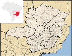
Minas Gerais
Minas Gerais is one of the 26 states of Brazil, of which it is the second most populous, the third richest, and the fourth largest in area. Minas Gerais is the Brazilian state with the largest number of Presidents of Brazil, the current one, Dilma Rousseff, being one of them. The capital is the...
. Its population as of 2007 was 1,412 people living in a total area of 192 km². The city belongs to the mesoregion
Mesoregion (Brazil)
Mesoregions are subdivisions of Brazilian states, grouping together various municipalities in proximity and with common characteristics. They were created by the Brazilian Institute of Geography and Statistics for statistical purposes and do not, therefore, constitute an administrative area....
of Triângulo Mineiro
Triângulo Mineiro
The Triangle Mineiro Portuguese pronunciation: [tɾiɐɡulu minejru] is an officer in the region west of the state of Minas Gerais, Brazil. The area is 93.500 km ² and is limited by the Serra da Canastra and Marcela, east, south of Sao Paulo, Goias in the north and west of the junction of the rivers...
e Alto Paranaíba and to the microregion
Microregion (Brazil)
Microregions are legally defined administrative areas in Brazil consisting of groups of municipalities bordering urban areas. Microregions are grouped together into mesoregions....
of Patrocínio
Patrocínio
Patrocínio is a municipality in the state of Minas Gerais in Brazil. The population of the municipality in 2007 was 81,589. The area is 2,867 km² and the elevation is 965 mts.-Highway connections:...
. It became a municipality in 1962.
Location
The municipality is located in the region of the Alto Paranaíba, on the edge of the Emborcação ReservoirEmborcação Dam
The Emborcação Dam, also known as Theodomiro Sampaio, is an embankment dam on the Paranaíba River near Araguari in Minas Gerais, Brazil. It was constructed for hydroelectric power production and flood control.-Background:...
, which dams up the Paranaíba River
Paranaíba River
The Paranaíba River is a Brazilian river whose source lies in the state of Minas Gerais in the Mata da Corda mountains, municipality of Rio Paranaíba, at an altitude of 1,148 meters; on the other face of this mountain chain are the sources of the Abaeté river, tributary of the São Francisco River...
. More than half of the municipal territory is covered by water seriously limiting agricultural production. The elevation of the town center is 713 meters. Highway connections are made by local road to MG-223, which connects to BR-050 north of Araguari
Araguari
Araguari is a city and municipality in northwestern Minas Gerais state, Brazil. It is located in the northern Triângulo Mineiro region, on the Jordão River, a tributary of the Paranaíba River, at an elevation between 940 and 1,087 meters....
. Neighboring municipalities are: Catalão
Catalão
Catalão is a small city and municipality located in the south of the state of Goiás, in Brazil. It is a large producer of grains, cattle, and phosphates and has a John Deere and Mitsubishi factory.-Demographics:*Population density: 17.85 inhab/km²...
(N), Douradoquara
Douradoquara
Doradoquara is a Brazilian municipality located in the northwest of the state of Minas Gerais. Its population as of 2007 was 1,846 people living in a total area of 313 km². The city belongs to the mesoregion of Triângulo Mineiro e Alto Paranaíba and to the microregion of Patrocínio...
(E) Monte Carmelo
Monte Carmelo
Monte Carmelo is a Brazilian municipality located in the northwest of the state of Minas Gerais. Its population as of 2007 was 44,367 people living in a total area of 1,354 km². The city belongs to the mesoregion of Triângulo Mineiro e Alto Paranaíba and to the microregion of Patrocínio...
and Estrela do Sul
Estrela do Sul
Estrela do Sul is a Brazilian municipality located in the northwest of the state of Minas Gerais. Its population as of 2007 was 7,136 people living in a total area of 820 km². The city belongs to the mesoregion of Triângulo Mineiro e Alto Paranaíba and to the microregion of Patrocínio...
(S), and Catalão
Catalão
Catalão is a small city and municipality located in the south of the state of Goiás, in Brazil. It is a large producer of grains, cattle, and phosphates and has a John Deere and Mitsubishi factory.-Demographics:*Population density: 17.85 inhab/km²...
(W).
Distances
- Monte CarmeloMonte CarmeloMonte Carmelo is a Brazilian municipality located in the northwest of the state of Minas Gerais. Its population as of 2007 was 44,367 people living in a total area of 1,354 km². The city belongs to the mesoregion of Triângulo Mineiro e Alto Paranaíba and to the microregion of Patrocínio...
: 65 km - AraguariAraguariAraguari is a city and municipality in northwestern Minas Gerais state, Brazil. It is located in the northern Triângulo Mineiro region, on the Jordão River, a tributary of the Paranaíba River, at an elevation between 940 and 1,087 meters....
: 100 km - UberlândiaUberlândiaUberlândia is the main town in the Triangle region, west of the state of Minas Gerais, Brazil. With a population of 604,013 inhabitants, according to 2010 estimates, the city is the second largest in the state second only to Belo Horizonte...
: 130 km - Belo HorizonteBelo HorizonteBelo Horizonte is the capital of and largest city in the state of Minas Gerais, located in the southeastern region of Brazil. It is the third largest metropolitan area in the country...
: 553 km
Until the 1990s Grupiara was on the railroad line of the RFFSA and had its own station. With the flooding to make the Emborcação Reservoir in the 1990s the line was discontinued and moved further east to Araguari
Araguari
Araguari is a city and municipality in northwestern Minas Gerais state, Brazil. It is located in the northern Triângulo Mineiro region, on the Jordão River, a tributary of the Paranaíba River, at an elevation between 940 and 1,087 meters....
. The railroad station is now under water.
Economic activities
The most important economic activities are cattle raising for meat and dairy, commerce, and agriculture, with the main crops being coffee, corn, rice, and citrus fruits. The GDP in 2005 was R$11 million 800 thousand, with 06 million generated by services, five hundred thousand generated by industry, and 04 million, 500 thousand generated by agriculture. Grupiara is in the middle tier of municipalities in the state with regard to economic and social development. As of 2007 there were no banking agencies in the town. There was a modest retail infrastructure serving the surrounding area of cattle and agricultural lands. There were 158 automobiles in all of the municipality (2007), about one for every 09 inhabitants.Grupiara has a small municipal area and therefore little available land for agriculture. In the rural area there were 104 establishments (2006) occupying 11,000 hectares (planted area: 900 ha,; natural pasture: 8,200 ha.; and woodland: 1,600 ha.). About 250 persons were dependent on agriculture. 19 of the farms had tractors, a ratio of one in 05 farms. There were 9,000 head of cattle in 2006. The main crops were coffee, corn, rice, and soybeans .
Health and education
In the health sector there was 01 health clinic. In the educational sector there was 01 pre-primary schools, 01 primary school, and 01 middle school.Grupiara is in the top tier of municipalities in the state with regard to economic and social development.
- Municipal Human Development IndexHuman Development IndexThe Human Development Index is a composite statistic used to rank countries by level of "human development" and separate "very high human development", "high human development", "medium human development", and "low human development" countries...
: 0.779 (2000) - State ranking: 123 out of 853 municipalities as of 2000
- National ranking: 1,098 out of 5,138 municipalities as of 2000
- Literacy rate: 89%
- Life expectancy: 73 (average of males and females)
The highest ranking municipality in Minas Gerais in 2000 was Poços de Caldas
Poços de Caldas
Poços de Caldas is a city and municipality in south-western Minas Gerais state, Brazil, in the microregion of the same name. Its estimated population in 2009 was 151,449 inhabitants...
with 0.841, while the lowest was Setubinha
Setubinha
Setubinha is a municipality in the northeast of the Brazilian state of Minas Gerais. As of 2007 the population was 10,834 in a total area of 536 km². The elevation is 729 metres. It is part of the IBGE statistical microregion of Teófilo Otoni...
with 0.568. Nationally the highest was São Caetano do Sul
São Caetano do Sul
São Caetano do Sul is a city in São Paulo state in Brazil, located in the Greater São Paulo Metropolitan Area. It is the city with the highest per capita income in Brazil and it also has the highest Human Development Index .-Geography:São Caetano do Sul is located on a plateau that is part of the...
in São Paulo with 0.919, while the lowest was Setubinha. In more recent statistics (considering 5,507 municipalities) Manari in the state of Pernambuco
Pernambuco
Pernambuco is a state of Brazil, located in the Northeast region of the country. To the north are the states of Paraíba and Ceará, to the west is Piauí, to the south are Alagoas and Bahia, and to the east is the Atlantic Ocean. There are about of beaches, some of the most beautiful in the...
has the lowest rating in the country—0,467—putting it in last place.
See also
- List of municipalities in Minas Gerais