
.gif)
N80 road (Ireland)
Encyclopedia
The N80 road is a national secondary road
in Ireland
that runs southeastwards from its junction with the N52
and R443
in the town of Tullamore
in County Offaly
, to the N11 at Ballynahallin, just north of Enniscorthy
in County Wexford
, a distance of 116 km. Total length is 116 km (72.1 mi).
 In common with most National secondary routes, the N80 is a simple two lane road without hard shoulders for much of its route. Some of the worst bends may have been removed through the years and some junctions improved, but general pavement quality is rather poor. No improvements are scheduled.
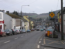
Works of note on the N80 include:
 The Tullamore
bypass
is a new 14 km (8.7 mi) single carriageway upgrade to the N52. The route leaves the existing N52 approximately 6 km (3.7 mi) southwest of Tullamore town, intersecting with the N80 road SE of the town , crossing over the Grand Canal, before rejoining the N52 again 3 km (1.9 mi) north of the town. A spur designated part of the R443
was constructed from the northern section of the route to the Tullamore Western Relief Road forming a near complete orbital route around Tullamore. The N80 now terminates at the N52 junction on the bypass; traffic heading for Athlone now takes the N52 north to the M6 motorway
at Kilbeggan
.
National secondary road
A national secondary road is a category of road in Ireland. These roads form an important part of the national route network, but are secondary to the main arterial routes which are classified as national primary roads. National secondary roads are designated with route numbers higher than those...
in Ireland
Republic of Ireland
Ireland , described as the Republic of Ireland , is a sovereign state in Europe occupying approximately five-sixths of the island of the same name. Its capital is Dublin. Ireland, which had a population of 4.58 million in 2011, is a constitutional republic governed as a parliamentary democracy,...
that runs southeastwards from its junction with the N52
N52 road (Ireland)
The N52 road is a national secondary road in Ireland. It links the M7 motorway from just south of Nenagh, County Tipperary to the M1 motorway north of Dundalk in County Louth.The road is long.-Quality of Road:...
and R443
R443 road
The R443 road is a regional road in Ireland, which forms the northern and western part of an Orbital route around the town of Tullamore. The southern and eastern part is formed by the N52 Tullamore bypass. The R443 commences at a roundabout junction with the N52/N80...
in the town of Tullamore
Tullamore
Tullamore is a town in County Offaly, in the midlands of Ireland. It is Offaly's county town and the centre of the district.Tullamore is an important commercial and industrial centre in the region. Major international employers in the town include 'Tyco Healthcare' and 'Boston Scientific'. In...
in County Offaly
County Offaly
County Offaly is a county in Ireland. It is part of the Midlands Region and is also located in the province of Leinster. It is named after the ancient Kingdom of Uí Failghe and was formerly known as King's County until the establishment of the Irish Free State in 1922. Offaly County Council is...
, to the N11 at Ballynahallin, just north of Enniscorthy
Enniscorthy
Enniscorthy is the second largest town in County Wexford, Ireland. The population of the town and environs is 9538. The Placenames Database of Ireland sheds no light on the origins of the town's name. It may refer either to the "Island of Corthaidh" or the "Island of Rocks". With a history going...
in County Wexford
County Wexford
County Wexford is a county in Ireland. It is part of the South-East Region and is also located in the province of Leinster. It is named after the town of Wexford. In pre-Norman times it was part of the Kingdom of Uí Cheinnselaig, whose capital was at Ferns. Wexford County Council is the local...
, a distance of 116 km. Total length is 116 km (72.1 mi).
Upgrading
Works of note on the N80 include:
- a bypass of Tullamore (N52) and Moate (M6) involved the designation of some 26 km of N80 to R road resulting in a reduction in its total length.
- MountmellickMountmellickOther than that its a 15th-century settlement on the narrow Owenass river with an encampment on its banks at Irishtown. Overlooking this valley with its trees and wildlife was a small church called Kilmongan which was closed by the Penal Laws in 1640...
inner relief road - project appears to have been abandoned. - Realigned section where it crosses over the M7 (Completed late 1990s).
- KildavinKildavinKildavin is a small village in County Carlow, Ireland. Situated on at the junction of the N80 National secondary road and the R724 regional road, it lies 5 km north of Bunclody, County Wexford at the northern end of the Blackstairs Mountains.-See also:...
bypass (completed in the 1990s it involved passing over the village and bridging over the R724R724 roadThe R724 road is a regional road in County Carlow, Ireland. From its junction with the N9 at Royal Oak on the western edge of Muine Bheag Town it takes an easterly route crossing the River Barrow, the R705 regional road and the Dublin – Kilkenny railway line in the town.It continues east to...
) - Southern terminus of the N80 at the N11 converted from a simple T-junction to a roundabout (2008).
Tullamore bypass
Tullamore
Tullamore is a town in County Offaly, in the midlands of Ireland. It is Offaly's county town and the centre of the district.Tullamore is an important commercial and industrial centre in the region. Major international employers in the town include 'Tyco Healthcare' and 'Boston Scientific'. In...
bypass
Bypass (road)
A bypass is a road or highway that avoids or "bypasses" a built-up area, town, or village, to let through traffic flow without interference from local traffic, to reduce congestion in the built-up area, and to improve road safety....
is a new 14 km (8.7 mi) single carriageway upgrade to the N52. The route leaves the existing N52 approximately 6 km (3.7 mi) southwest of Tullamore town, intersecting with the N80 road SE of the town , crossing over the Grand Canal, before rejoining the N52 again 3 km (1.9 mi) north of the town. A spur designated part of the R443
R443 road
The R443 road is a regional road in Ireland, which forms the northern and western part of an Orbital route around the town of Tullamore. The southern and eastern part is formed by the N52 Tullamore bypass. The R443 commences at a roundabout junction with the N52/N80...
was constructed from the northern section of the route to the Tullamore Western Relief Road forming a near complete orbital route around Tullamore. The N80 now terminates at the N52 junction on the bypass; traffic heading for Athlone now takes the N52 north to the M6 motorway
M6 motorway (Ireland)
The M6 motorway is a motorway in Ireland, which runs from Dublin to Galway. The M6 extends from its junction with the M4 at Kinnegad all the way west to the outskirts of Galway City, but the Athlone bypass and the approach to Galway city - while of dual carriageway standard - have not been...
at Kilbeggan
Kilbeggan
-Geography:Kilbeggan is situated on the River Brosna, in the south of County Westmeath. It lies southeast of Lough Ennell, north of the boundary with County Offaly, about 9 kilometres north of Tullamore. Kilbeggan is surrounded by the gently rolling Esker Riada, the linear sand hills that stretch...
.
See also
- Roads in IrelandRoads in IrelandThe island of Ireland, comprising Northern Ireland and the Republic of Ireland, has an extensive network of tens of thousands of kilometres of public roads, usually surfaced. These roads have been developed and modernised over centuries, from trackways suitable only for walkers and horses, to...
- Motorways in Ireland
- National primary roadNational primary roadA national primary road is a road classification in the Republic of Ireland. National primary roads form the major routes between the major urban centres. There are over 2,700km of national primary roads. This category of road has the prefix "N" followed by one or two digits...
- Regional roadRegional roadA regional road in Ireland is a class of road not forming a major route , but nevertheless forming a link in the national route network. There are over 11,600 kilometres of regional roads. Regional roads are numbered with three digit route numbers, prefixed by "R" A regional road in Ireland is a...