

Mountain Communities of the Tejon Pass
Encyclopedia
The Mountain Communities of the Tejon Pass, or the Frazier Mountain Communities, in the San Emigdio Mountains
is a region of California that includes Lebec
, Frazier Park
, Lake of the Woods
, Lockwood Valley
, Pinon Pines
, and Pine Mountain Club
, in Kern County, California
, and Gorman
in Los Angeles County. They are all within or near the Tejon Pass
, which links Southern California
with the San Joaquin Valley
. Also sometimes included within the communities are Cuddy Valley
, Grapevine
, Neenach
and New Cuyama
.
Although the communities are divided among three counties (four, if New Cuyama, which is in Santa Barbara County, is included), they are tied together by the local newspaper, the Mountain Enterprise, the Mountain Communities Chamber of Commerce
, and the Ridge Route
Communities Museum and Historical Society. All the communities are unincorporated area
s, and all are served by their respective county agencies, such as sheriff's departments and county fire departments.
A total of 6,066 people lived within the four areas of the Mountain Communities that were distinguished in the March 2000 U.S. census
— 2,348 in Frazier Park, 1,600 in Pine Mountain Club, 1,285 in Lebec, and 833 in Lake of the Woods. There were 3,931 housing units — houses, apartments, trailers, etc. — of which only 2,392 were occupied.
The area's residents were older than the U.S. median — which was 35.3 years of age at the time. Pine Mountain Club was the “oldest” community — the median age being 45 and 15 percent of the residents being older than 65. Lake of the Woods’s median age was 39, with 14 percent of its population over 65, Frazier Park’s median age was 38, with 10 percent of its residents over 65, and Lebec had a median age of 36, with 13 percent over 65.
By another measurement, Lebec was the “youngest" town. Eight percent of its residents were under age 5, compared to six percent in Frazier Park and five percent in Pine Mountain Club and Lake of the Woods.
The Mountain Communities were overwhelmingly white — 91 percent in Pine Mountain Club, 88 percent in Frazier Park, 87 percent in Lake of the Woods, and 79 percent in Lebec. Latinos or Hispanics of any race amounted to 20 percent in Lebec, 12 percent in Frazier Park, 11 percent in Lake of the Woods, and nine percent in Pine Mountain Club.
Reported yearly incomes for each person in the labor force were $25,465 (in 1999 dollars) in Pine Mountain Club, $19,302 in Frazier Park, $17,983 in Lake of the Woods, and $14,895 in Lebec.
Pine Mountain Club also had the highest household and family incomes (at a median of $45,250 and $62,750, respectively), Frazier Park was next with $40,721 and $46,857, Lake of the Woods showed $42,742 and $43,468, and Lebec trailed with $39,063 and $40,972. To measure the income of a household, the pre-tax money receipts of all residents over the age of 15 over a single year were combined. Family income measured households with two or more people related through blood, marriage, or adoption.
Educational levels correlated to a large degree with income: Thirty-one percent of Pine Mountain Club residents had bachelor’s degrees or higher, compared to 22 percent in Lake of the Woods, 15 percent in Frazier Park and 12 percent in Lebec.
But Pine Mountain Club had the highest percentage of people whose incomes were below the poverty level
— 17 percent (193 people), with Lake of the Woods following at 14 percent (119 people), Frazier Park at 12 percent (291 people) and Lebec last at eight percent (100 people). (see Poverty in the United States#Measures of poverty for a discussion on problems with the official measurements of poverty in the United States.)
The utilization by Mountain Community property owners of residences as second homes, vacation homes or seasonal rental properties
can be shown by the fact that 62 percent of the 1,737 Pine Mountain Club houses (1,069) were vacant in March 2000 when the census was taken. In Lake of the Woods, the vacancies were 27 percent (or 129 of 475 housing units); Frazier Park, with 23 percent (or 281 of 1,203 units) and in Lebec, there were only 60 vacancies of 516 units, or 12 percent. All those figures in these mountainous communities were higher than that for the country as a whole — nine percent.
 The vacancies correlated with the elevation of the communities — 5,554 feet for Pine Mountain Club, 5,121 feet for Lake of the Woods, 4,767 feet for Frazier Park, and 3,481 feet for Lebec. Elevation generally corresponds to snow levels in the winter.
Lebec had the highest valuation of single-family owner-occupied homes. The median, as identified by the census respondents, was $163,600 for 104 houses in Lebec, $144,500 for 453 houses in Pine Mountain Club, $96,800 for 636 such houses in Frazier Park, and $89,700 for 187 in Lake of the Woods. The median is the point at which half the homes were valued for more and half for less. These figures are not the same as actual real-estate
sales. Neither do they reflect the value of second or vacation homes, or houses rented out.
Of the occupied residences, Pine Mountain Club, which is a private community
, had the highest ratio of owner-occupied units — 84 percent, followed by Frazier Park and Lebec, each with 70 percent, and Lake of the Woods, 69 percent. The rest were occupied by renters.
Notes: "Native Americans" includes Alaska natives. "Family income" is median family income in 1999 dollars. "Med. home value" is the median value of single-family houses. The "vacancy rate" is based on vacant housing units of any type in March 2000. Some figures have been rounded.
Electioneering was frustrating for council members because Kern County officials denied their request to allow a vote at the same time residents balloted in county elections. The council also tried putting a mail-in ballot in the local newspaper.
As a result, a proposal was made in 2006 to the local county supervisor, Raymond A. Watson
, to strengthen the council, but, according to the local newspaper, it "received a chilly response." Rose said that Watson rejected a proposal to establish an elected municipal advisory council as allowed by state law.
During the 2004-2009 period, the council held a number of forums, which attracted more than a thousand people considering subjects ranging from wildfire evacuations to land-development proposals. In 2007, the California Air Resources Board
lent it equipment to test air quality in Lebec.
The Town Council lapsed, with its last meeting held on October 16, 2008. At that time, the council decided to bring the matter of a municipal advisory council — or MAC — before Watson again.
, or MAC, with a budget of $10,000, along with a part-time clerk and space at the supervisor's office in Frazier Park. It would cover only the Kern County part of the Mountain Communities.
Watson responded to a query from the Mountain Enterprise that
On February 23, 2009, an open meeting of about 75 people was held in Frazier Park under the control of Supervisor Watson. A poll by show of hands revealed about 40 in favor of a MAC, 7 opposed, and 20 undecided, with others not voting.
On August 14, 2009, Watson announced he would recommend the formation of a Municipal Advisory Council to the Kern County Board of Supervisors, with the first members to be
Watson told a community meeting in Frazier Park on October 29 that he did not want to have elections.
serves the entire mountain community: Lockwood Valley is part of the district even though it is within Ventura County, and Gorman students are accepted into the high school by special permit.
Frazier Park Elementary School
educates children in kindergarten through third grade. El Tejon Middle School
in Lebec takes district students from the fourth through the eighth grade. Frazier Mountain High School, also in Lebec, was founded in 1995 for ninth- through 12th-graders.
Pine Mountain Learning Center is a district-sponsored charter school 3.5 miles west of Pine Mountain
.
is important in the Mountain Communities, according to a March 2008 report in the Mountain Enterprise, which added:
Frazier Park hosts a branch of the Charter Oaks Community Charter School
, headquartered in Bakersfield. The charter school is designed to "provide opportunities, support, and accountability for parents in their homeschooling endeavors."
Historic events
Nature
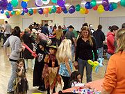
Recreation
Transportation
San Emigdio Mountains
The San Emigdio Mountains are a part of the Transverse Ranges in Southern California, extending from Interstate 5 at Lebec and Gorman on the east to Highway 33–166 on the west. They link the Tehachapis and Temblor Range and form the southern wall of the San Joaquin Valley.The range is within Los...
is a region of California that includes Lebec
Lebec, California
Lebec is an unincorporated area and census-designated place in Kern County, California. It is one of the Mountain Communities of the Tejon Pass, and the home of the Tejon Ranch Company. Lebec is south of Bakersfield. The population was 1,468 in the 2010 census, up from 1,224 in...
, Frazier Park
Frazier Park, California
Frazier Park is an unincorporated community and census-designated place in Kern County, California. Frazier Park is west of Lebec, at an elevation of 4,639 feet . It is one of the Mountain Communities of the Tejon Pass...
, Lake of the Woods
Lake of the Woods, California
Lake of the Woods is an unincorporated area and census-designated place in Kern County, California. The population was 917 at the 2010 census, up from 833 at the 2000 census. The community is contained in Cuddy Canyon along the Ventura and Kern County line inside the Los Padres National Forest. It...
, Lockwood Valley
Lockwood Valley, California
Lockwood Valley is an unincorporated community in Ventura County, California, and part of the Mountain Communities. It lies at an elevation of 4,839 feet .....
, Pinon Pines
Pinon Pines Estates, California
Pinon Pines Estates is an unincorporated community in Kern County, California, and part of the Mountain Communities of the Tejon Pass. It lies at an elevation of 5,561 feet .....
, and Pine Mountain Club
Pine Mountain Club, California
Pine Mountain Club is an unincorporated private community and census-designated place in Kern County, California, northwest of the San Fernando Valley and west of Gorman. It is one of the mountain Communities of the Tejon Pass, and sits in a deep valley on the San Andreas fault, in the same area...
, in Kern County, California
Kern County, California
Spreading across the southern end of the California Central Valley, Kern County is the fifth-largest county by population in California. Its economy is heavily linked to agriculture and to petroleum extraction, and there is a strong aviation and space presence. Politically, it has generally...
, and Gorman
Gorman, California
Gorman, California, is an unincorporated community in northwestern Los Angeles County. As of 2005 it had just 15 homes and a few registered voters, but tens of thousands of motorists traveled through it daily on the Interstate 5 freeway....
in Los Angeles County. They are all within or near the Tejon Pass
Tejon Pass
The Tejon Pass is a mountain pass at the southwest end of the Tehachapi Mountains linking Southern to Central California.-Geography:The apex of the pass is near the northwesternmost corner of Los Angeles County, north of Gorman...
, which links Southern California
Southern California
Southern California is a megaregion, or megapolitan area, in the southern area of the U.S. state of California. Large urban areas include Greater Los Angeles and Greater San Diego. The urban area stretches along the coast from Ventura through the Southland and Inland Empire to San Diego...
with the San Joaquin Valley
San Joaquin Valley
The San Joaquin Valley is the area of the Central Valley of California that lies south of the Sacramento – San Joaquin River Delta in Stockton...
. Also sometimes included within the communities are Cuddy Valley
Cuddy Valley, California
Cuddy Valley is a valley in the San Andreas Rift Zone south of the San Emigdio Mountains west of Tejon Pass, and unincorporated community in Kern County, California, and part of the Mountain Communities. It lies at an elevation of 5,282 feet 1610 m).....
, Grapevine
Grapevine, California
Grapevine is an unincorporated community in Kern County, California. At an elevation of 1499 feet , the community is located at the foot of a road grade known as The Grapevine through the Grapevine Canyon to Tejon Pass in the Tehachapi Mountains at the southern end of the San Joaquin Valley along...
, Neenach
Neenach, California
Neenach is an agricultural settlement in northwestern Los Angeles County, California, with a population of about 800. It is facing a massive change with the proposed construction of a 23,000-home planned community to its north called Centennial....
and New Cuyama
New Cuyama, California
New Cuyama is a census-designated place in the Cuyama Valley, in Santa Barbara County, California, in the United States. It was named after the Chumash Indian word for "clams", most likely due to the millions of petrified prehistoric clamshell fossils that are found in the surrounding areas...
.
Although the communities are divided among three counties (four, if New Cuyama, which is in Santa Barbara County, is included), they are tied together by the local newspaper, the Mountain Enterprise, the Mountain Communities Chamber of Commerce
Chamber of commerce
A chamber of commerce is a form of business network, e.g., a local organization of businesses whose goal is to further the interests of businesses. Business owners in towns and cities form these local societies to advocate on behalf of the business community...
, and the Ridge Route
Ridge Route
The Ridge Route, officially the Castaic-Tejon Route, was a two-lane highway running between Los Angeles and Kern counties, California. Opened in 1915 and paved with concrete between 1917 and 1921, the road was the first paved highway directly linking the Los Angeles Basin with the San Joaquin...
Communities Museum and Historical Society. All the communities are unincorporated area
Unincorporated area
In law, an unincorporated area is a region of land that is not a part of any municipality.To "incorporate" in this context means to form a municipal corporation, a city, town, or village with its own government. An unincorporated community is usually not subject to or taxed by a municipal government...
s, and all are served by their respective county agencies, such as sheriff's departments and county fire departments.
Population
The source for this section is the U.S. Census Bureau, American FactFinder.
A total of 6,066 people lived within the four areas of the Mountain Communities that were distinguished in the March 2000 U.S. census
United States Census
The United States Census is a decennial census mandated by the United States Constitution. The population is enumerated every 10 years and the results are used to allocate Congressional seats , electoral votes, and government program funding. The United States Census Bureau The United States Census...
— 2,348 in Frazier Park, 1,600 in Pine Mountain Club, 1,285 in Lebec, and 833 in Lake of the Woods. There were 3,931 housing units — houses, apartments, trailers, etc. — of which only 2,392 were occupied.
The area's residents were older than the U.S. median — which was 35.3 years of age at the time. Pine Mountain Club was the “oldest” community — the median age being 45 and 15 percent of the residents being older than 65. Lake of the Woods’s median age was 39, with 14 percent of its population over 65, Frazier Park’s median age was 38, with 10 percent of its residents over 65, and Lebec had a median age of 36, with 13 percent over 65.
By another measurement, Lebec was the “youngest" town. Eight percent of its residents were under age 5, compared to six percent in Frazier Park and five percent in Pine Mountain Club and Lake of the Woods.
The Mountain Communities were overwhelmingly white — 91 percent in Pine Mountain Club, 88 percent in Frazier Park, 87 percent in Lake of the Woods, and 79 percent in Lebec. Latinos or Hispanics of any race amounted to 20 percent in Lebec, 12 percent in Frazier Park, 11 percent in Lake of the Woods, and nine percent in Pine Mountain Club.
Reported yearly incomes for each person in the labor force were $25,465 (in 1999 dollars) in Pine Mountain Club, $19,302 in Frazier Park, $17,983 in Lake of the Woods, and $14,895 in Lebec.
Pine Mountain Club also had the highest household and family incomes (at a median of $45,250 and $62,750, respectively), Frazier Park was next with $40,721 and $46,857, Lake of the Woods showed $42,742 and $43,468, and Lebec trailed with $39,063 and $40,972. To measure the income of a household, the pre-tax money receipts of all residents over the age of 15 over a single year were combined. Family income measured households with two or more people related through blood, marriage, or adoption.
Educational levels correlated to a large degree with income: Thirty-one percent of Pine Mountain Club residents had bachelor’s degrees or higher, compared to 22 percent in Lake of the Woods, 15 percent in Frazier Park and 12 percent in Lebec.
But Pine Mountain Club had the highest percentage of people whose incomes were below the poverty level
Poverty threshold
The poverty threshold, or poverty line, is the minimum level of income deemed necessary to achieve an adequate standard of living in a given country...
— 17 percent (193 people), with Lake of the Woods following at 14 percent (119 people), Frazier Park at 12 percent (291 people) and Lebec last at eight percent (100 people). (see Poverty in the United States#Measures of poverty for a discussion on problems with the official measurements of poverty in the United States.)
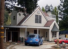
Housing
The source for this section is the U.S. Census Bureau, American FactFinder.
The utilization by Mountain Community property owners of residences as second homes, vacation homes or seasonal rental properties
Vacation property
Vacation property is a niche in the real estate market dealing with residences used for holiday vacations . In the United Kingdom this type of property is usually termed a holiday home, in Australia, a holiday house/home, or weekender, in New Zealand, a bach or crib...
can be shown by the fact that 62 percent of the 1,737 Pine Mountain Club houses (1,069) were vacant in March 2000 when the census was taken. In Lake of the Woods, the vacancies were 27 percent (or 129 of 475 housing units); Frazier Park, with 23 percent (or 281 of 1,203 units) and in Lebec, there were only 60 vacancies of 516 units, or 12 percent. All those figures in these mountainous communities were higher than that for the country as a whole — nine percent.
Lebec had the highest valuation of single-family owner-occupied homes. The median, as identified by the census respondents, was $163,600 for 104 houses in Lebec, $144,500 for 453 houses in Pine Mountain Club, $96,800 for 636 such houses in Frazier Park, and $89,700 for 187 in Lake of the Woods. The median is the point at which half the homes were valued for more and half for less. These figures are not the same as actual real-estate
Real estate
In general use, esp. North American, 'real estate' is taken to mean "Property consisting of land and the buildings on it, along with its natural resources such as crops, minerals, or water; immovable property of this nature; an interest vested in this; an item of real property; buildings or...
sales. Neither do they reflect the value of second or vacation homes, or houses rented out.
Of the occupied residences, Pine Mountain Club, which is a private community
Private community
A private community is a residential community that can be an association or a proprietary organization. Associations can include condominiums, homeowner associations or cooperatives....
, had the highest ratio of owner-occupied units — 84 percent, followed by Frazier Park and Lebec, each with 70 percent, and Lake of the Woods, 69 percent. The rest were occupied by renters.
| 2000 figures | Pine Mountain Club | Lake of the Woods | Frazier Park | Lebec |
|---|---|---|---|---|
| Elevation | 5,554 feet | 5,121 feet | 4,767 feet | 3,481 feet |
| Population | 1,600 | 833 | 2,348 | 1,285 |
| Median age | 45 | 40 | 38 | 36 |
| Whites | 91 % | 87% | 88% | 79% |
| Blacks | 0.6% | 0.0% | 0.6% | 0.2% |
| Hispanic/Latino | 9% | 11% | 12% | 20% |
| Native Americans | 1% | 2% | 1% | 1% |
| Asian | 0.8% | 1.9% | 0.8% | 0.3% |
| Family income | $62,750 | $43,468 | $46,857 | $40,972 |
| Med. home value | $144,500 | $69,700 | $96,800 | $163,600 |
| Vacancy rate | 62% | 27% | 23% | 12% |
Notes: "Native Americans" includes Alaska natives. "Family income" is median family income in 1999 dollars. "Med. home value" is the median value of single-family houses. The "vacancy rate" is based on vacant housing units of any type in March 2000. Some figures have been rounded.
Town Council
As unincorporated areas, the Mountain Communities have no local government, but they have been served by the volunteer Mountain Communities Town Council, formed in 1995 "to provide a stronger local voice in community development" and to be "a liaison between various government agencies and the community at large." The first officers were Bob Anderson, president; Fred Rose, vice president; Richard Haugh, treasurer, and Ana Soares, secretary. The highest number of votes cast was 184 for Sanchez.Electioneering was frustrating for council members because Kern County officials denied their request to allow a vote at the same time residents balloted in county elections. The council also tried putting a mail-in ballot in the local newspaper.
As a result, a proposal was made in 2006 to the local county supervisor, Raymond A. Watson
Ray Watson (broadcaster)
Raymond A. Watson is a former television executive who has been a member of the Board of Supervisors in Kern County, California, representing the western part of the county, since November 2002. He was chairman of the board in 2010. Watson was named Broadcaster of the Year by the California...
, to strengthen the council, but, according to the local newspaper, it "received a chilly response." Rose said that Watson rejected a proposal to establish an elected municipal advisory council as allowed by state law.
During the 2004-2009 period, the council held a number of forums, which attracted more than a thousand people considering subjects ranging from wildfire evacuations to land-development proposals. In 2007, the California Air Resources Board
California Air Resources Board
The California Air Resources Board, also known as CARB or ARB, is the "clean air agency" in the government of California. Established in 1967 in the Mulford-Carrell Act, combining the Bureau of Air Sanitation and the Motor Vehicle Pollution Control Board, CARB is a department within the...
lent it equipment to test air quality in Lebec.
The Town Council lapsed, with its last meeting held on October 16, 2008. At that time, the council decided to bring the matter of a municipal advisory council — or MAC — before Watson again.
Municipal Advisory Council
Rose thereupon sent a letter to Watson on behalf of a "Mountain Communities MAC/CSD Working Group" for establishment of an elected municipal advisory councilMunicipal Advisory Council
A municipal advisory council in the United States is an organization composed of elected or appointed members whose purpose is to advise a city or county government about the activities and problems of the area represented....
, or MAC, with a budget of $10,000, along with a part-time clerk and space at the supervisor's office in Frazier Park. It would cover only the Kern County part of the Mountain Communities.
Watson responded to a query from the Mountain Enterprise that
I am opposed to any new layer of government that adds significant costs and bureaucracy. … The idea of a municipal advisory committee or perhaps some other local representative would be strictly advisory. Ultimately, decisions for the Mountain Communities will lie with the elected Supervisor, whoever that is."
On February 23, 2009, an open meeting of about 75 people was held in Frazier Park under the control of Supervisor Watson. A poll by show of hands revealed about 40 in favor of a MAC, 7 opposed, and 20 undecided, with others not voting.
On August 14, 2009, Watson announced he would recommend the formation of a Municipal Advisory Council to the Kern County Board of Supervisors, with the first members to be
- Real estate brokerReal estate brokerA real estate broker, real estate agent or realtor is a party who acts as an intermediary between sellers and buyers of real estate/real property and attempts to find sellers who wish to sell and buyers who wish to buy...
Stacy Havener of Pine Mountain. - Linda MacKay of Lebec, who works for the Family Resource Center. She served two terms on the Town Council, one term as president.
- Steve Newman of Cuddy Valley, retired sheriff's sergeant and past nine-year member of the El Tejon Unified School DistrictUnified school districtA unified school district or unit school district is a school district which includes both primary school and high school under the same district control....
board. - Robert Peterson of Lebec, employed by Tejon RanchTejon RanchThe Tejon Ranch Company , based in Lebec, California, is one of the largest private landowners in California. [The federally-gifted lands still held by the Catellus Corporation, a successor to the Southern Pacific Land Company, are much more extensive.] It was incorporated in 1936 to organise the...
. - Anne Weber of Frazier Park, who established the Family Resource Center.
Watson told a community meeting in Frazier Park on October 29 that he did not want to have elections.
El Tejon Unified School District
The El Tejon Unified School DistrictEl Tejon Unified School District
The El Tejon Unified School District serves kindergarten-through-12th-grade students in the Mountain Communities of the Tejon Pass, which include Frazier Park, Lebec, and Pine Mountain Club in the southern mountains of Kern County, California...
serves the entire mountain community: Lockwood Valley is part of the district even though it is within Ventura County, and Gorman students are accepted into the high school by special permit.
Frazier Park Elementary School
Primary education
A primary school is an institution in which children receive the first stage of compulsory education known as primary or elementary education. Primary school is the preferred term in the United Kingdom and many Commonwealth Nations, and in most publications of the United Nations Educational,...
educates children in kindergarten through third grade. El Tejon Middle School
Middle school
Middle School and Junior High School are levels of schooling between elementary and high schools. Most school systems use one term or the other, not both. The terms are not interchangeable...
in Lebec takes district students from the fourth through the eighth grade. Frazier Mountain High School, also in Lebec, was founded in 1995 for ninth- through 12th-graders.
Pine Mountain Learning Center is a district-sponsored charter school 3.5 miles west of Pine Mountain
Pine Mountain Club, California
Pine Mountain Club is an unincorporated private community and census-designated place in Kern County, California, northwest of the San Fernando Valley and west of Gorman. It is one of the mountain Communities of the Tejon Pass, and sits in a deep valley on the San Andreas fault, in the same area...
.
Gorman Joint School District
Gorman children and others from outside the district are educated in the small Gorman Elementary School from kindergarten through eighth grade.Other education
Home-schoolingHomeschooling
Homeschooling or homeschool is the education of children at home, typically by parents but sometimes by tutors, rather than in other formal settings of public or private school...
is important in the Mountain Communities, according to a March 2008 report in the Mountain Enterprise, which added:
Per capita, the Mountain Communities may have one of the highest rates of homeschooling in the state, far above the national average of 2 to 4 percent, Holly Van Houten [a home-school parent of the area] . . . said. Estimates range between 8 and 30 percent—somewhere between 100 and 400 children, she reports.
Frazier Park hosts a branch of the Charter Oaks Community Charter School
Charter school
Charter schools are primary or secondary schools that receive public money but are not subject to some of the rules, regulations, and statutes that apply to other public schools in exchange for some type of accountability for producing certain results, which are set forth in each school's charter...
, headquartered in Bakersfield. The charter school is designed to "provide opportunities, support, and accountability for parents in their homeschooling endeavors."
See also
Geographical features- Frazier MountainFrazier MountainFrazier Mountain is a broad, pine-forested peak in the Transverse Ranges within the Los Padres National Forest, in Ventura County, California. At , Frazier is the fifth-highest mountain in the Transverse Ranges of Southern California....
- Mount PinosMount PinosMount Pinos is a mountain located in the Los Padres National Forest on the boundary between Ventura and Kern counties in California. The summit is the highest point in Ventura County.- Geography :...
- San Emigdio MountainsSan Emigdio MountainsThe San Emigdio Mountains are a part of the Transverse Ranges in Southern California, extending from Interstate 5 at Lebec and Gorman on the east to Highway 33–166 on the west. They link the Tehachapis and Temblor Range and form the southern wall of the San Joaquin Valley.The range is within Los...
- San Andreas FaultSan Andreas FaultThe San Andreas Fault is a continental strike-slip fault that runs a length of roughly through California in the United States. The fault's motion is right-lateral strike-slip...
- San Joaquin ValleySan Joaquin ValleyThe San Joaquin Valley is the area of the Central Valley of California that lies south of the Sacramento – San Joaquin River Delta in Stockton...
- Tehachapi MountainsTehachapi MountainsThe Tehachapi Mountains , regionally also called The Tehachapis, are a mountain range in the Transverse Ranges system of California in the Western United States...
- Transverse RangesTransverse RangesThe Transverse Ranges are a group of mountain ranges of southern California, in the Pacific Coast Ranges physiographic region that runs along the Pacific coast from Alaska to Mexico in North America. The Transverse Ranges begin at the southern end of the California Coast Ranges and lie between...
Historic events
- 1857 Fort Tejon earthquake
- Ridge RouteRidge RouteThe Ridge Route, officially the Castaic-Tejon Route, was a two-lane highway running between Los Angeles and Kern counties, California. Opened in 1915 and paved with concrete between 1917 and 1921, the road was the first paved highway directly linking the Los Angeles Basin with the San Joaquin...
Nature
- California Floristic ProvinceCalifornia Floristic ProvinceThe California Floristic Province is a floristic province with a Mediterranean climate located on the Pacific Coast of North America with a distinctive flora that bears similarities to floras found in other regions experiencing a winter rainfall, summer drought climate like the Mediterranean...
- California CondorCalifornia CondorThe California Condor is a New World vulture, the largest North American land bird. Currently, this condor inhabits only the Grand Canyon area, Zion National Park, and coastal mountains of central and southern California and northern Baja California...
- California PoppyCalifornia poppyThe California poppy is a perennial and annual plant, native to the United States, and the official state flower of California.- Description :...
- California native plantsCalifornia native plantsCalifornia native plants are plants that existed in California prior to the arrival of European explorers and colonists in the late 18th century...
Recreation
- Fort TejonFort TejonFort Tejon in California is a former United States Army outpost which was intermittently active from June 24, 1854, until September 11, 1864. It is located in the Grapevine Canyon area of Tejon Pass along Interstate 5, the main route through the mountains separating the Central Valley from Los...
- Los Padres National ForestLos Padres National ForestLos Padres National Forest is a forest located in southern and central California, which includes most of the mountainous land along the California coast from Ventura to Monterey, extending inland...
Transportation
- Interstate 5 in CaliforniaInterstate 5 in CaliforniaInterstate 5 is a major north–south route of the Interstate Highway System in the U.S. state of California. It begins at the Mexico – United States border at the San Ysidro crossing, goes north across the length of California and crosses into Oregon south of the Medford-Ashland metropolitan...
External links
- Antelope Valley Press (Neenach)
- Bakersfield Californian The Californian discontinued circulation in the Mountain Communities effective May 1, 2009. Source: Mountain Enterprise, April 3, 2009
- The Mountain Enterprise (all areas but Mettler)
- Ventura County Star (Lockwood Valley)
- Center of the World Festival
- Rotary Club of Frazier Park and Mountain Communities
- Frazier Park online: community resources and information
- Rosamond Municipal Advisory Council