
Lebec, California
Encyclopedia
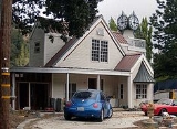
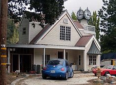
Lebec is an unincorporated area
and census-designated place
in Kern County
, California
. It is one of the Mountain Communities of the Tejon Pass
, and the home of the Tejon Ranch
Company. Lebec is 40 miles (64 km) south of Bakersfield
http://maps.google.com/maps?client=safari&rls=en-us&q=Lebec,+California&oe=UTF-8&um=1&ie=UTF-8&split=0&gl=us&ei=UfYpSuuBOqPmsgOiqbjoCg&sa=X&oi=geocode_result&ct=title&resnum=1. The population was 1,468 in the 2010 census, up from 1,224 in 2000.
.
, Lebec has an area of 15.3 square miles (39.6 km²). The community, which is in the Tejon Pass
, lies at an elevation of 3,481 feet (1,061 m). Interstate 5
is the only highway. Local traffic drives on Lebec Road, Peace Valley Road, Frazier Mountain Park Road and adjoining streets.
. Lebec is named in honor of Peter Lebeck or Lebecque, who was killed by a bear nearby in 1837, and is memorialized in an epitaph at Old Fort Tejon, found carved on an old oak tree. The carving has since been covered by bark.
was 95.8 people per square mile (37.0/km²). There were 594 housing units at an average density of 38.8 per square mile (15.0/km²). The racial makeup of the CDP was 78.5% White, 1.0% African American, 3.1% Native American, 1.2% Asian, 10.1% from other races
, and 6.2% from two or more races. 26.9% of the population was Hispanic or Latino of any race.
The Census reported that 100% of the population lived in households.
There were 533 households out of which 33.6% had children under the age of 18 living in them, 54.0% were opposite-sex married couples
living together, 9.9% had a female householder with no husband present, and 5.8% had a male householder with no wife present. 5.3% of households were unmarried opposite-sex partnerships
and 0.6% were same-sex married couples or partnerships. 25.1% of households were made up of individuals and 8.3% had someone living alone who was 65 years of age or older. The average household size was 2.75.
The population was spread out with 26.1% under the age of 18, 8.0% aged 18 to 24, 20.6% aged 25 to 44, 31.8% aged 45 to 64, and 13.5% who were 65 years of age or older. The median age was 40.6 years. For every 100 females there were 108.2 males. For every 100 females age 18 and over, there were 109.1 males.
There were 594 housing units of which 71.1% were owner-occupied and 28.9% were occupied by renters. The homeowner vacancy rate was 2.8%; the rental vacancy rate was 7.1%. 70.4% of the population lived in owner-occupied housing units and 29.6% lived in rental housing units.
(1,019 people). There were only three African Americans
. There were 256 Hispanics
or Latinos
of any race (20 percent of all residents). Other residents included 16 American Indians
or Alaska natives
and four Asians
.
The median age for Lebec residents was 36 years — almost the same as the 35 years for the nation as a whole.
 Lebec also had slightly more veterans than its share — 169, or 19 percent, compared to 13 percent around the country.
Fifty-nine percent of Lebec adults were employed. On average, they traveled 27 minutes to get to their jobs, about the same as most Americans.
Lebec households had a lower median income than the nation as a whole — $46,857, compared to $50,046. Family income was $40,972.
There were just 100 people (or 8 percent) below the poverty level in Lebec in 2000 — significantly less than the nation as a whole, which was 12 percent in 2000. When calculated by families, though, the poverty rate in Lebec was only 1.4 percent.
Of the 516 housing units, 319 were occupied by owners and 127 by renters — about the same 7-3 ratio as the rest of the country. Sixty housing units (12 percent) were vacant.
provides bus service Thursdays and Saturdays during the summer months to Frazier Park
, Gorman
, Lake of the Woods
, Pinon Pines
, and Pine Mountain Club
. It offers a dial-a-ride service
all year. There is also a scheduled service to Bakersfield
and connection there to Greyhound
and Amtrak
.
Unincorporated area
In law, an unincorporated area is a region of land that is not a part of any municipality.To "incorporate" in this context means to form a municipal corporation, a city, town, or village with its own government. An unincorporated community is usually not subject to or taxed by a municipal government...
and census-designated place
Census-designated place
A census-designated place is a concentration of population identified by the United States Census Bureau for statistical purposes. CDPs are delineated for each decennial census as the statistical counterparts of incorporated places such as cities, towns and villages...
in Kern County
Kern County, California
Spreading across the southern end of the California Central Valley, Kern County is the fifth-largest county by population in California. Its economy is heavily linked to agriculture and to petroleum extraction, and there is a strong aviation and space presence. Politically, it has generally...
, California
California
California is a state located on the West Coast of the United States. It is by far the most populous U.S. state, and the third-largest by land area...
. It is one of the Mountain Communities of the Tejon Pass
Mountain Communities of the Tejon Pass
The Mountain Communities of the Tejon Pass, or the Frazier Mountain Communities, in the San Emigdio Mountains is a region of California that includes Lebec, Frazier Park, Lake of the Woods, Lockwood Valley, Pinon Pines, and Pine Mountain Club, in Kern County, California, and Gorman in Los Angeles...
, and the home of the Tejon Ranch
Tejon Ranch
The Tejon Ranch Company , based in Lebec, California, is one of the largest private landowners in California. [The federally-gifted lands still held by the Catellus Corporation, a successor to the Southern Pacific Land Company, are much more extensive.] It was incorporated in 1936 to organise the...
Company. Lebec is 40 miles (64 km) south of Bakersfield
Bakersfield, California
Bakersfield is a city near the southern end of the San Joaquin Valley in Kern County, California. It is roughly equidistant between Fresno and Los Angeles, to the north and south respectively....
http://maps.google.com/maps?client=safari&rls=en-us&q=Lebec,+California&oe=UTF-8&um=1&ie=UTF-8&split=0&gl=us&ei=UfYpSuuBOqPmsgOiqbjoCg&sa=X&oi=geocode_result&ct=title&resnum=1. The population was 1,468 in the 2010 census, up from 1,224 in 2000.
.
Geography
According to the United States Census BureauUnited States Census Bureau
The United States Census Bureau is the government agency that is responsible for the United States Census. It also gathers other national demographic and economic data...
, Lebec has an area of 15.3 square miles (39.6 km²). The community, which is in the Tejon Pass
Tejon Pass
The Tejon Pass is a mountain pass at the southwest end of the Tehachapi Mountains linking Southern to Central California.-Geography:The apex of the pass is near the northwesternmost corner of Los Angeles County, north of Gorman...
, lies at an elevation of 3,481 feet (1,061 m). Interstate 5
Interstate 5
Interstate 5 is the main Interstate Highway on the West Coast of the United States, running largely parallel to the Pacific Ocean coastline from Canada to Mexico . It serves some of the largest cities on the U.S...
is the only highway. Local traffic drives on Lebec Road, Peace Valley Road, Frazier Mountain Park Road and adjoining streets.
History
The first post office opened in 1895, having been transferred from TejonTejon, California
Tejon is a former settlement in Kern County, California. It was located north of Lebec.A post office operated at Tejon during part of 1895, before the service was transferred to Lebec....
. Lebec is named in honor of Peter Lebeck or Lebecque, who was killed by a bear nearby in 1837, and is memorialized in an epitaph at Old Fort Tejon, found carved on an old oak tree. The carving has since been covered by bark.
2010
The 2010 United States Census reported that 1,468 people, 533 households, and 372 families resided in the CDP. The population densityPopulation density
Population density is a measurement of population per unit area or unit volume. It is frequently applied to living organisms, and particularly to humans...
was 95.8 people per square mile (37.0/km²). There were 594 housing units at an average density of 38.8 per square mile (15.0/km²). The racial makeup of the CDP was 78.5% White, 1.0% African American, 3.1% Native American, 1.2% Asian, 10.1% from other races
Race (United States Census)
Race and ethnicity in the United States Census, as defined by the Federal Office of Management and Budget and the United States Census Bureau, are self-identification data items in which residents choose the race or races with which they most closely identify, and indicate whether or not they are...
, and 6.2% from two or more races. 26.9% of the population was Hispanic or Latino of any race.
The Census reported that 100% of the population lived in households.
There were 533 households out of which 33.6% had children under the age of 18 living in them, 54.0% were opposite-sex married couples
Marriage
Marriage is a social union or legal contract between people that creates kinship. It is an institution in which interpersonal relationships, usually intimate and sexual, are acknowledged in a variety of ways, depending on the culture or subculture in which it is found...
living together, 9.9% had a female householder with no husband present, and 5.8% had a male householder with no wife present. 5.3% of households were unmarried opposite-sex partnerships
POSSLQ
POSSLQ is an abbreviation for "Persons of Opposite Sex Sharing Living Quarters," a term coined in the late 1970s by the United States Census Bureau as part of an effort to more accurately gauge the prevalence of cohabitation in American households....
and 0.6% were same-sex married couples or partnerships. 25.1% of households were made up of individuals and 8.3% had someone living alone who was 65 years of age or older. The average household size was 2.75.
The population was spread out with 26.1% under the age of 18, 8.0% aged 18 to 24, 20.6% aged 25 to 44, 31.8% aged 45 to 64, and 13.5% who were 65 years of age or older. The median age was 40.6 years. For every 100 females there were 108.2 males. For every 100 females age 18 and over, there were 109.1 males.
There were 594 housing units of which 71.1% were owner-occupied and 28.9% were occupied by renters. The homeowner vacancy rate was 2.8%; the rental vacancy rate was 7.1%. 70.4% of the population lived in owner-occupied housing units and 29.6% lived in rental housing units.
2000
In the 2000 census, 79 percent of the 1,224 residents were CaucasianRace (United States Census)
Race and ethnicity in the United States Census, as defined by the Federal Office of Management and Budget and the United States Census Bureau, are self-identification data items in which residents choose the race or races with which they most closely identify, and indicate whether or not they are...
(1,019 people). There were only three African Americans
Race (United States Census)
Race and ethnicity in the United States Census, as defined by the Federal Office of Management and Budget and the United States Census Bureau, are self-identification data items in which residents choose the race or races with which they most closely identify, and indicate whether or not they are...
. There were 256 Hispanics
Race (United States Census)
Race and ethnicity in the United States Census, as defined by the Federal Office of Management and Budget and the United States Census Bureau, are self-identification data items in which residents choose the race or races with which they most closely identify, and indicate whether or not they are...
or Latinos
Race (United States Census)
Race and ethnicity in the United States Census, as defined by the Federal Office of Management and Budget and the United States Census Bureau, are self-identification data items in which residents choose the race or races with which they most closely identify, and indicate whether or not they are...
of any race (20 percent of all residents). Other residents included 16 American Indians
Race (United States Census)
Race and ethnicity in the United States Census, as defined by the Federal Office of Management and Budget and the United States Census Bureau, are self-identification data items in which residents choose the race or races with which they most closely identify, and indicate whether or not they are...
or Alaska natives
Alaska Natives
Alaska Natives are the indigenous peoples of Alaska. They include: Aleut, Inuit, Tlingit, Haida, Tsimshian, Eyak, and a number of Northern Athabaskan cultures.-History:In 1912 the Alaska Native Brotherhood was founded...
and four Asians
Race (United States Census)
Race and ethnicity in the United States Census, as defined by the Federal Office of Management and Budget and the United States Census Bureau, are self-identification data items in which residents choose the race or races with which they most closely identify, and indicate whether or not they are...
.
The median age for Lebec residents was 36 years — almost the same as the 35 years for the nation as a whole.
Fifty-nine percent of Lebec adults were employed. On average, they traveled 27 minutes to get to their jobs, about the same as most Americans.
Lebec households had a lower median income than the nation as a whole — $46,857, compared to $50,046. Family income was $40,972.
There were just 100 people (or 8 percent) below the poverty level in Lebec in 2000 — significantly less than the nation as a whole, which was 12 percent in 2000. When calculated by families, though, the poverty rate in Lebec was only 1.4 percent.
Of the 516 housing units, 319 were occupied by owners and 127 by renters — about the same 7-3 ratio as the rest of the country. Sixty housing units (12 percent) were vacant.
| 2000 figures | Lebec | California | United States |
|---|---|---|---|
| Median age | 36.1 | 33.3 | 35.3 |
| White | 79.3% | 59.5% | 75.1% |
| African-American | 0.2% | 6.7% | 12.3% |
| Hispanic/Latino | 19.9% | 32.4% | 12.5% |
| Family income | $40,972 | $53,025 | $50,046 |
| Poverty families | 1.4% | 10.6% | 9.2% |
| Med. home value | $163,600 | $211,500 | $119,600 |
| High school diploma | 72.1% | 76.8% | 80.4% |
| College degree | 11.8% | 28.6% | 24.4% |
Transportation
Kern Regional TransitKern Regional Transit
Kern Regional Transit is the operator of mass transportation in Kern County, California. Primarily, it provides inter-regional transportation, connecting outlying regions with the City of Bakersfield...
provides bus service Thursdays and Saturdays during the summer months to Frazier Park
Frazier Park, California
Frazier Park is an unincorporated community and census-designated place in Kern County, California. Frazier Park is west of Lebec, at an elevation of 4,639 feet . It is one of the Mountain Communities of the Tejon Pass...
, Gorman
Gorman, California
Gorman, California, is an unincorporated community in northwestern Los Angeles County. As of 2005 it had just 15 homes and a few registered voters, but tens of thousands of motorists traveled through it daily on the Interstate 5 freeway....
, Lake of the Woods
Lake of the Woods, California
Lake of the Woods is an unincorporated area and census-designated place in Kern County, California. The population was 917 at the 2010 census, up from 833 at the 2000 census. The community is contained in Cuddy Canyon along the Ventura and Kern County line inside the Los Padres National Forest. It...
, Pinon Pines
Pinon Pines Estates, California
Pinon Pines Estates is an unincorporated community in Kern County, California, and part of the Mountain Communities of the Tejon Pass. It lies at an elevation of 5,561 feet .....
, and Pine Mountain Club
Pine Mountain Club, California
Pine Mountain Club is an unincorporated private community and census-designated place in Kern County, California, northwest of the San Fernando Valley and west of Gorman. It is one of the mountain Communities of the Tejon Pass, and sits in a deep valley on the San Andreas fault, in the same area...
. It offers a dial-a-ride service
Paratransit
Paratransit is an alternative mode of flexible passenger transportation that does not follow fixed routes or schedules. Typically mini-buses are used to provide paratransit service, but also share taxis and jitneys are important providers....
all year. There is also a scheduled service to Bakersfield
Bakersfield, California
Bakersfield is a city near the southern end of the San Joaquin Valley in Kern County, California. It is roughly equidistant between Fresno and Los Angeles, to the north and south respectively....
and connection there to Greyhound
Greyhound
The Greyhound is a breed of sighthound that has been primarily bred for coursing game and racing, and the breed has also recently seen a resurgence in its popularity as a pedigree show dog and family pet. It is a gentle and intelligent breed...
and Amtrak
Amtrak
The National Railroad Passenger Corporation, doing business as Amtrak , is a government-owned corporation that was organized on May 1, 1971, to provide intercity passenger train service in the United States. "Amtrak" is a portmanteau of the words "America" and "track". It is headquartered at Union...
.
See also
- Mountain Enterprise newspaperMountain EnterpriseThe is a weekly newspaper circulating in the Mountain Communities of the Tejon Pass in the Tehachapi Mountains region of California, midway between Los Angeles and Bakersfield. Its sister publication is The New Mountain Pioneer, published monthly....
, which circulates in Lebec and the surrounding areaMountain Communities of the Tejon PassThe Mountain Communities of the Tejon Pass, or the Frazier Mountain Communities, in the San Emigdio Mountains is a region of California that includes Lebec, Frazier Park, Lake of the Woods, Lockwood Valley, Pinon Pines, and Pine Mountain Club, in Kern County, California, and Gorman in Los Angeles...
. - 1857 Fort Tejon earthquake
Newspapers
- Mountain Enterprise website
- Bakersfield Californian The Californian discontinued circulation in the Mountain Communities effective May 1, 2009. Source: Mountain Enterprise, April 3, 2009