
Millbrae, California
Encyclopedia
Millbrae is a city in San Mateo County
, California
, United States
, just west of San Francisco Bay
, with San Bruno on the north and Burlingame
on the south. The population was 21,532 at the 2010 census.
purchased land in the 1860s from the Sanchez family
to build a country estate. The former Mills estate was bordered by what is now Skyline Boulevard, Bayshore Highway U.S. Route 101, Millbrae Avenue and Trousdale Drive. The estate became known as "Millbrae" from "Mills" and the Scottish word "brae," which means "rolling hills." Children swam in three lakes situated on the estate and sold acacias to tourists before the Mills family began to sell the land for development. The estate's spectacular mansion burned down during a realistic "fire drill" in 1954.
Millbrae used a private patrol financed by fees from merchants and residents until 1941, when the San Mateo County Board of Supervisors created the Millbrae Police District. Records of the Internal Revenue Service
document the licensing of several Millbrae bars for gambling; only after incorporation were gambling laws enforced in Millbrae and not until the 1950s was gambling defeated. In 1931, citizens organized a volunteer fire department, which remained entirely volunteer until 1938. The police and fire departments were housed together for several years at Hillcrest Boulevard and El Camino Real before the vital services moved to their permanent location in Millbrae's civic center, a few blocks west of El Camino.
For many Millbrae residents, the original Sixteen Mile House was a direct link to Millbrae's early days. The rest stop was built in 1872 by members of the Sanchez family, the original landholders of the Rancho Buri Buri
, which at one time comprised parts of present-day Millbrae and Burlingame. The building faced demolition but was moved to its current location on Broadway and serves today as a tavern and restaurant.
Spurred largely by the desire to secure the Mills' estate for residential use and by the efforts of Millbrae's weekly newspaper, the Millbrae Sun, residents heatedly discussed incorporation for over a decade before voting to incorporate. Finally, on January 14, 1948, residents of Millbrae traveled to Sacramento to present their new city's charter. W.F. Leutenegger was elected mayor to represent Millbrae's nearly 8,000 residents. That year, Green Hills Elementary School opened as Millbrae's first new school in over 25 years, in anticipation of the educational needs of the post-war "baby boom" children. The new city's chief industries were agriculture, floriculture, dairy, and porcelain manufacturing. Many families that built the new city have never left.
In the 1950s, Millbrae residents united to resist efforts to divide the city by the planned Junipero Serra Freeway (I-280), which was later routed parallel to Junipero Serra Boulevard, then through a canyon in San Bruno up to Skyline Boulevard. An unsuccessful effort to save the original Sixteen Mile House in the 1970s led to the birth of the Millbrae Historical Society and eventual successful crusades to save the Millbrae train station and the historic building that has become the Millbrae Historical Museum. Such challenges, though inevitable, have only strengthened Millbrae's resolve to preserve the city's unique character and rich
history.
Millbrae is also the home of Green Hills Country Club
which was designed by famed golf course architect Dr. Alister MacKenzie
(who designed other noteworthy courses such as Cypress Point
, Augusta National, Royal Melbourne
, Pasatiempo
, and many more). The course was originally known as the Union League Golf Club of San Francisco (1930 to 1933) and Millbrae Country Club (1933 to 1945). The course provides a green belt in the center of the city that is the home of many animals, such as the red-tail fox, that otherwise would not be able to survive in the urban setting. It also may be the only area of the city where natural creeks still flow overground.
Transportation has shaped Millbrae's growth. From the turn of the century, the #40 "interurban" streetcar traveled through Millbrae, linking the city with San Francisco and San Mateo. Millbrae's high school children rode the streetcar to attend Burlingame High School
until Capuchino High School
opened on September 11, 1950. The streetcar line was dismantled just after Millbrae's incorporation, leaving the Southern Pacific Railroad
as the only railway linking Millbrae with surrounding areas. The Sixteen Mile House marked Millbrae along the railroad route, located where Millbrae's first Corner Frame Shop stands today. In the 1940s, as long-time residents vividly recall, a hilltop literally was shaved away to produce landfill for expanding San Francisco Airport, which received an "international" designation in 1954 with the completion of the Central Terminal.
Today, Millbrae boasts over 21,000 residents. Residents are employed in various industries throughout the Bay Area and children attend one of five public elementary schools, or private schools. The city's senior citizen community recently dedicated a new senior wing within the Millbrae community center. Millbrae has Sister City relationships with La Serena, Chile, and Mosta, Malta.
, Millbrae enjoys a typical Mediterranean climate featuring cool, wet winters and dry, mild summers. Night and morning fog are common during the summer months. Frequent, westerly sea breezes keep temperatures relatively mild throughout the year with highs in the middle fifties (~15°C) and lows in the lower forties (~8°C) during the winter and highs in the lower seventies (~22°C) and lows in the lower fifties (~13°C) during the summer. Annual precipitation ranges from 20 inches (51 cm) in the lowlands to 32 inches (81 cm) in the hills near Skyline Boulevard and I-280; most of the rain falls from November through April. Snow is very rare; the last measurable occurrence was on February 5, 1976. The nearest National Weather Service station is at the nearby San Francisco International Airport
, where records go back to early 1927. For more details, see San Bruno, California
.
San Francisco garter snake
, a species endemic to San Mateo County. At the western edge of the city the San Andreas Lake
and the San Andreas Fault
may be found.
was 6,608.5 people per square mile (2,551.6/km²). The racial makeup of Millbrae was 10,177 (47.3%) White, 179 (0.8%) African American, 33 (0.2%) Native American, 9,205 (42.8%) Asian, 214 (1.0%) Pacific Islander, 776 (3.6%) from other races
, and 948 (4.4%) from two or more races. Hispanic or Latino of any race were 2,555 persons (11.9%).
The Census reported that 21,217 people (98.5% of the population) lived in households, 58 (0.3%) lived in non-institutionalized group quarters, and 257 (1.2%) were institutionalized.
There were 7,994 households, out of which 2,593 (32.4%) had children under the age of 18 living in them, 4,543 (56.8%) were opposite-sex married couples
living together, 868 (10.9%) had a female householder with no husband present, 315 (3.9%) had a male householder with no wife present. There were 268 (3.4%) unmarried opposite-sex partnerships
, and 40 (0.5%) same-sex married couples or partnerships. 1,883 households (23.6%) were made up of individuals and 1,059 (13.2%) had someone living alone who was 65 years of age or older. The average household size was 2.65. There were 5,726 families
(71.6% of all households); the average family size was 3.15.
The population was spread out with 4,337 people (20.1%) under the age of 18, 1,523 people (7.1%) aged 18 to 24, 4,960 people (23.0%) aged 25 to 44, 6,476 people (30.1%) aged 45 to 64, and 4,236 people (19.7%) who were 65 years of age or older. The median age was 44.8 years. For every 100 females there were 90.0 males. For every 100 females age 18 and over, there were 86.7 males.
There were 8,372 housing units at an average density of 2,569.5 per square mile (992.1/km²), of which 5,076 (63.5%) were owner-occupied, and 2,918 (36.5%) were occupied by renters. The homeowner vacancy rate was 0.7%; the rental vacancy rate was 4.8%. 13,968 people (64.9% of the population) lived in owner-occupied housing units and 7,249 people (33.7%) lived in rental housing units.
of 2000, there were 20,718 people, 7,956 households, and 5,513 families residing in the city. The population density
was 6,446.4 people per square mile (2,492.0/km²). There were 8,113 housing units at an average density of 2,524.4 per square mile (975.8/km²).
There were 7,956 households out of which 28.3% had children under the age of 18 living with them, 55.7% were married couples
living together, 9.9% had a female householder with no husband present, and 30.7% were non-families. 25.1% of all households were made up of individuals and 13.7% had someone living alone who was 65 years of age or older. The average household size was 2.56 and the average family size was 3.08.
In the city the population was spread out with 20.6% under the age of 18, 6.4% from 18 to 24, 27.5% from 25 to 44, 24.7% from 45 to 64, and 20.8% who were 65 years of age or older. The median age was 42 years. For every 100 females there were 89.8 males. For every 100 females age 18 and over, there were 87.0 males.
According to a 2008 estimate, the median income
for a household in the city was $77,128, and the median income for a family was $97,351. Males had a median income of $51,867 versus $40,249 for females. About 2.2% of families and 3.4% of the population were below the poverty line, including 2.2% of those under age 18 and 4.6% of those age 65 or over.
Millbrae is located in the 8th Senate
District, represented by Democrat
Leland Yee
, and in the 19th Assembly
District, represented by Democrat Jerry Hill
. Federally, Millbrae is located in California's 12th congressional district
, which has a Cook PVI
of D +22 and is currently held by Jackie Speier
, who won in a special election to fill the vacancy left by Tom Lantos
upon his death.
. Parents are actively involved in their children's scores and school functions.
Millbrae School District
oversees four public elementary schools (Meadows, Green Hills, Spring Valley, and Lomita Park) and one middle school (Taylor Middle School, named after the family that owned land along Taylor Boulevard prior to the city being laid out).
Millbrae has one private school at Saint Dunstan's, a Catholic church. The school provides education for grades K-8.
Millbrae has one public high school, Mills High School
, which is part of the San Mateo Union High School District. Mills High School
is the highest scoring high school, test-wise, in San Mateo County. Although surrounded by land that is part of Millbrae, nearby Capuchino High School
is located in San Bruno
. Mills High School is situated about a block away from the southern border of Millbrae with Burlingame
.
The city is served by the Peninsula Library System
.
to consolidate police services due to both budgeting issues and the relatively low rate of crime.
and San Jose
. U.S. Route 101 and Interstate 280
run along the eastern and western boundaries of the city, respectively. San Francisco International Airport
is adjacent to the city.
The Millbrae Intermodal Station
serves as a major transit hub for the Peninsula
, connecting the BART
, Caltrain
, and SamTrans
networks. It is the largest intermodal station west of the Mississippi river, in terms of construction size and land usage. The BART Pittsburg/Bay Point – SFO/Millbrae line and Richmond–Millbrae line serve the Millbrae Intermodal Station
. A SamTrans
local line 43 serves Millbrae.
and to the city of San Francisco
, and its advanced transit center that can connect people to all major cities/events in the Bay Area, many tourists opt to stay in Millbrae. Its downtown is mainly along El Camino Real
and Broadway Avenue. There are many small shops, restaurants, a Safeway, Walgreens
, Trader Joe's
, The Children's Place
, Dress Barn, Orchard Supply Hardware
, and Kohl's
.
Mosta
, Malta
San Mateo County, California
San Mateo County is a county located in the San Francisco Bay Area of the U.S. state of California. It covers most of the San Francisco Peninsula just south of San Francisco, and north of Santa Clara County. San Francisco International Airport is located at the northern end of the county, and...
, California
California
California is a state located on the West Coast of the United States. It is by far the most populous U.S. state, and the third-largest by land area...
, United States
United States
The United States of America is a federal constitutional republic comprising fifty states and a federal district...
, just west of San Francisco Bay
San Francisco Bay
San Francisco Bay is a shallow, productive estuary through which water draining from approximately forty percent of California, flowing in the Sacramento and San Joaquin rivers from the Sierra Nevada mountains, enters the Pacific Ocean...
, with San Bruno on the north and Burlingame
Burlingame, California
Burlingame is a city in San Mateo County, California. It is located on the San Francisco Peninsula and has a significant shoreline on San Francisco Bay. The city is named after diplomat Anson Burlingame. It is renowned for its many surviving examples of Victorian architecture, its affluence, and...
on the south. The population was 21,532 at the 2010 census.
History
Darius Ogden MillsDarius Ogden Mills
Darius Ogden Mills was a prominent American banker, philanthropist and, for a time, California's wealthiest citizen.-Biography:...
purchased land in the 1860s from the Sanchez family
Rancho Buri Buri
Rancho Buri Buri was a Mexican land grant in present day San Mateo County, California given in 1835 by Governor José Castro to José Antonio Sánchez. The name derives from the Urebure village of the Ramaytush speaking Yelamu tribe of Ohlone people who were settled by the banks of San Bruno Creek...
to build a country estate. The former Mills estate was bordered by what is now Skyline Boulevard, Bayshore Highway U.S. Route 101, Millbrae Avenue and Trousdale Drive. The estate became known as "Millbrae" from "Mills" and the Scottish word "brae," which means "rolling hills." Children swam in three lakes situated on the estate and sold acacias to tourists before the Mills family began to sell the land for development. The estate's spectacular mansion burned down during a realistic "fire drill" in 1954.
Millbrae used a private patrol financed by fees from merchants and residents until 1941, when the San Mateo County Board of Supervisors created the Millbrae Police District. Records of the Internal Revenue Service
Internal Revenue Service
The Internal Revenue Service is the revenue service of the United States federal government. The agency is a bureau of the Department of the Treasury, and is under the immediate direction of the Commissioner of Internal Revenue...
document the licensing of several Millbrae bars for gambling; only after incorporation were gambling laws enforced in Millbrae and not until the 1950s was gambling defeated. In 1931, citizens organized a volunteer fire department, which remained entirely volunteer until 1938. The police and fire departments were housed together for several years at Hillcrest Boulevard and El Camino Real before the vital services moved to their permanent location in Millbrae's civic center, a few blocks west of El Camino.
For many Millbrae residents, the original Sixteen Mile House was a direct link to Millbrae's early days. The rest stop was built in 1872 by members of the Sanchez family, the original landholders of the Rancho Buri Buri
Rancho Buri Buri
Rancho Buri Buri was a Mexican land grant in present day San Mateo County, California given in 1835 by Governor José Castro to José Antonio Sánchez. The name derives from the Urebure village of the Ramaytush speaking Yelamu tribe of Ohlone people who were settled by the banks of San Bruno Creek...
, which at one time comprised parts of present-day Millbrae and Burlingame. The building faced demolition but was moved to its current location on Broadway and serves today as a tavern and restaurant.
Spurred largely by the desire to secure the Mills' estate for residential use and by the efforts of Millbrae's weekly newspaper, the Millbrae Sun, residents heatedly discussed incorporation for over a decade before voting to incorporate. Finally, on January 14, 1948, residents of Millbrae traveled to Sacramento to present their new city's charter. W.F. Leutenegger was elected mayor to represent Millbrae's nearly 8,000 residents. That year, Green Hills Elementary School opened as Millbrae's first new school in over 25 years, in anticipation of the educational needs of the post-war "baby boom" children. The new city's chief industries were agriculture, floriculture, dairy, and porcelain manufacturing. Many families that built the new city have never left.
In the 1950s, Millbrae residents united to resist efforts to divide the city by the planned Junipero Serra Freeway (I-280), which was later routed parallel to Junipero Serra Boulevard, then through a canyon in San Bruno up to Skyline Boulevard. An unsuccessful effort to save the original Sixteen Mile House in the 1970s led to the birth of the Millbrae Historical Society and eventual successful crusades to save the Millbrae train station and the historic building that has become the Millbrae Historical Museum. Such challenges, though inevitable, have only strengthened Millbrae's resolve to preserve the city's unique character and rich
history.
Millbrae is also the home of Green Hills Country Club
Green Hills Country Club
Green Hills Country Club, located in Millbrae, California, is often referred to as the San Francisco Peninsula’s “hidden gem”. Green Hills is a private members-only country club located on the San Francisco peninsula approximately 20 minutes south of the city.Green Hills was originally known...
which was designed by famed golf course architect Dr. Alister MacKenzie
Alister MacKenzie
Dr. Alister MacKenzie was an internationally renowned, British golf course architect whose course designs, on three different continents, are consistently ranked among the finest golf courses in the world...
(who designed other noteworthy courses such as Cypress Point
Cypress Point Club
Cypress Point Club is a private golf club in California. The club has a single eighteen hole course, one of eight on the Monterey peninsula near Monterey, California. The course is well known around the world for its series of three holes that play along the Pacific Ocean: the 15th, 16th and 17th,...
, Augusta National, Royal Melbourne
Royal Melbourne Golf Club
Royal Melbourne Golf Club is a golf club located in Black Rock, a suburb of Melbourne, Australia with two courses. Royal Melbourne has hosted numerous national and international events, including the 1959 Canada Cup , and the 1970 World Cup...
, Pasatiempo
Pasatiempo Golf Club
Pasatiempo Golf Club is a golf club located in Pasatiempo, Santa Cruz County, California. Designed by the famous Scottish architect Alister MacKenzie, the course is famed for its breathtaking scenery and rich golfing history. MacKenzie claimed that it was his best ever layout, ahead of even Cypress...
, and many more). The course was originally known as the Union League Golf Club of San Francisco (1930 to 1933) and Millbrae Country Club (1933 to 1945). The course provides a green belt in the center of the city that is the home of many animals, such as the red-tail fox, that otherwise would not be able to survive in the urban setting. It also may be the only area of the city where natural creeks still flow overground.
Transportation has shaped Millbrae's growth. From the turn of the century, the #40 "interurban" streetcar traveled through Millbrae, linking the city with San Francisco and San Mateo. Millbrae's high school children rode the streetcar to attend Burlingame High School
Burlingame High School
Burlingame High School is a public high school in Burlingame, California. It is part of the San Mateo Union High School District .-History:...
until Capuchino High School
Capuchino High School
Capuchino High School is a public high school in San Bruno, California, although the school is surrounded by the city of Millbrae on all but one corner...
opened on September 11, 1950. The streetcar line was dismantled just after Millbrae's incorporation, leaving the Southern Pacific Railroad
Southern Pacific Railroad
The Southern Pacific Transportation Company , earlier Southern Pacific Railroad and Southern Pacific Company, and usually simply called the Southern Pacific or Espee, was an American railroad....
as the only railway linking Millbrae with surrounding areas. The Sixteen Mile House marked Millbrae along the railroad route, located where Millbrae's first Corner Frame Shop stands today. In the 1940s, as long-time residents vividly recall, a hilltop literally was shaved away to produce landfill for expanding San Francisco Airport, which received an "international" designation in 1954 with the completion of the Central Terminal.
Today, Millbrae boasts over 21,000 residents. Residents are employed in various industries throughout the Bay Area and children attend one of five public elementary schools, or private schools. The city's senior citizen community recently dedicated a new senior wing within the Millbrae community center. Millbrae has Sister City relationships with La Serena, Chile, and Mosta, Malta.
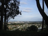
Geography
Millbrae has a total area of 3.26 sq mi (8.4 km²), of which, 3.25 sq mi (8.4 km²) is land and 0.01 sq mi (0.0258998811 km²) (0.36%) is water.Climate
According to the National Weather ServiceNational Weather Service
The National Weather Service , once known as the Weather Bureau, is one of the six scientific agencies that make up the National Oceanic and Atmospheric Administration of the United States government...
, Millbrae enjoys a typical Mediterranean climate featuring cool, wet winters and dry, mild summers. Night and morning fog are common during the summer months. Frequent, westerly sea breezes keep temperatures relatively mild throughout the year with highs in the middle fifties (~15°C) and lows in the lower forties (~8°C) during the winter and highs in the lower seventies (~22°C) and lows in the lower fifties (~13°C) during the summer. Annual precipitation ranges from 20 inches (51 cm) in the lowlands to 32 inches (81 cm) in the hills near Skyline Boulevard and I-280; most of the rain falls from November through April. Snow is very rare; the last measurable occurrence was on February 5, 1976. The nearest National Weather Service station is at the nearby San Francisco International Airport
San Francisco International Airport
San Francisco International Airport is a major international airport located south of downtown San Francisco, California, United States, near the cities of Millbrae and San Bruno in unincorporated San Mateo County. It is often referred to as SFO...
, where records go back to early 1927. For more details, see San Bruno, California
San Bruno, California
San Bruno is a city in San Mateo County, California, United States. The population was 41,114 at the 2010 census.The city is adjacent to San Francisco International Airport and Golden Gate National Cemetery.-Geography:San Bruno is located at...
.
Environmental features
A wetland area in the eastern part of the city adjacent to U.S. highway 101 is habitat to the endangered speciesEndangered species
An endangered species is a population of organisms which is at risk of becoming extinct because it is either few in numbers, or threatened by changing environmental or predation parameters...
San Francisco garter snake
San Francisco garter snake
The San Francisco Garter Snake is a slender multi-colored colubrid snake. Designated as an endangered species since the year 1967, it is endemic to California and resides only in San Mateo County, California, and the extreme northern part of coastal Santa Cruz County, California...
, a species endemic to San Mateo County. At the western edge of the city the San Andreas Lake
San Andreas Lake
San Andreas Lake is a reservoir adjacent to the San Francisco Peninsula cities of Millbrae and San Bruno in San Mateo County, California. It is situated directly on the San Andreas Fault, which is named after the lake.- History :...
and the San Andreas Fault
San Andreas Fault
The San Andreas Fault is a continental strike-slip fault that runs a length of roughly through California in the United States. The fault's motion is right-lateral strike-slip...
may be found.
2010
The 2010 United States Census reported that Millbrae had a population of 21,532. The population densityPopulation density
Population density is a measurement of population per unit area or unit volume. It is frequently applied to living organisms, and particularly to humans...
was 6,608.5 people per square mile (2,551.6/km²). The racial makeup of Millbrae was 10,177 (47.3%) White, 179 (0.8%) African American, 33 (0.2%) Native American, 9,205 (42.8%) Asian, 214 (1.0%) Pacific Islander, 776 (3.6%) from other races
Race (United States Census)
Race and ethnicity in the United States Census, as defined by the Federal Office of Management and Budget and the United States Census Bureau, are self-identification data items in which residents choose the race or races with which they most closely identify, and indicate whether or not they are...
, and 948 (4.4%) from two or more races. Hispanic or Latino of any race were 2,555 persons (11.9%).
The Census reported that 21,217 people (98.5% of the population) lived in households, 58 (0.3%) lived in non-institutionalized group quarters, and 257 (1.2%) were institutionalized.
There were 7,994 households, out of which 2,593 (32.4%) had children under the age of 18 living in them, 4,543 (56.8%) were opposite-sex married couples
Marriage
Marriage is a social union or legal contract between people that creates kinship. It is an institution in which interpersonal relationships, usually intimate and sexual, are acknowledged in a variety of ways, depending on the culture or subculture in which it is found...
living together, 868 (10.9%) had a female householder with no husband present, 315 (3.9%) had a male householder with no wife present. There were 268 (3.4%) unmarried opposite-sex partnerships
POSSLQ
POSSLQ is an abbreviation for "Persons of Opposite Sex Sharing Living Quarters," a term coined in the late 1970s by the United States Census Bureau as part of an effort to more accurately gauge the prevalence of cohabitation in American households....
, and 40 (0.5%) same-sex married couples or partnerships. 1,883 households (23.6%) were made up of individuals and 1,059 (13.2%) had someone living alone who was 65 years of age or older. The average household size was 2.65. There were 5,726 families
Family (U.S. Census)
A family or family household is defined by the United States Census Bureau for statistical purposes as "a householder and one or more other people related to the householder by birth, marriage, or adoption. They do not include same-sex married couples even if the marriage was performed in a state...
(71.6% of all households); the average family size was 3.15.
The population was spread out with 4,337 people (20.1%) under the age of 18, 1,523 people (7.1%) aged 18 to 24, 4,960 people (23.0%) aged 25 to 44, 6,476 people (30.1%) aged 45 to 64, and 4,236 people (19.7%) who were 65 years of age or older. The median age was 44.8 years. For every 100 females there were 90.0 males. For every 100 females age 18 and over, there were 86.7 males.
There were 8,372 housing units at an average density of 2,569.5 per square mile (992.1/km²), of which 5,076 (63.5%) were owner-occupied, and 2,918 (36.5%) were occupied by renters. The homeowner vacancy rate was 0.7%; the rental vacancy rate was 4.8%. 13,968 people (64.9% of the population) lived in owner-occupied housing units and 7,249 people (33.7%) lived in rental housing units.
2000
As of the censusCensus
A census is the procedure of systematically acquiring and recording information about the members of a given population. It is a regularly occurring and official count of a particular population. The term is used mostly in connection with national population and housing censuses; other common...
of 2000, there were 20,718 people, 7,956 households, and 5,513 families residing in the city. The population density
Population density
Population density is a measurement of population per unit area or unit volume. It is frequently applied to living organisms, and particularly to humans...
was 6,446.4 people per square mile (2,492.0/km²). There were 8,113 housing units at an average density of 2,524.4 per square mile (975.8/km²).
There were 7,956 households out of which 28.3% had children under the age of 18 living with them, 55.7% were married couples
Marriage
Marriage is a social union or legal contract between people that creates kinship. It is an institution in which interpersonal relationships, usually intimate and sexual, are acknowledged in a variety of ways, depending on the culture or subculture in which it is found...
living together, 9.9% had a female householder with no husband present, and 30.7% were non-families. 25.1% of all households were made up of individuals and 13.7% had someone living alone who was 65 years of age or older. The average household size was 2.56 and the average family size was 3.08.
In the city the population was spread out with 20.6% under the age of 18, 6.4% from 18 to 24, 27.5% from 25 to 44, 24.7% from 45 to 64, and 20.8% who were 65 years of age or older. The median age was 42 years. For every 100 females there were 89.8 males. For every 100 females age 18 and over, there were 87.0 males.
According to a 2008 estimate, the median income
Income
Income is the consumption and savings opportunity gained by an entity within a specified time frame, which is generally expressed in monetary terms. However, for households and individuals, "income is the sum of all the wages, salaries, profits, interests payments, rents and other forms of earnings...
for a household in the city was $77,128, and the median income for a family was $97,351. Males had a median income of $51,867 versus $40,249 for females. About 2.2% of families and 3.4% of the population were below the poverty line, including 2.2% of those under age 18 and 4.6% of those age 65 or over.
Politics
In the state legislatureCalifornia State Legislature
The California State Legislature is the state legislature of the U.S. state of California. It is a bicameral body consisting of the lower house, the California State Assembly, with 80 members, and the upper house, the California State Senate, with 40 members...
Millbrae is located in the 8th Senate
California State Senate
The California State Senate is the upper house of the California State Legislature. There are 40 state senators. The state legislature meets in the California State Capitol in Sacramento. The Lieutenant Governor is the ex officio President of the Senate and may break a tied vote...
District, represented by Democrat
Democratic Party (United States)
The Democratic Party is one of two major contemporary political parties in the United States, along with the Republican Party. The party's socially liberal and progressive platform is largely considered center-left in the U.S. political spectrum. The party has the lengthiest record of continuous...
Leland Yee
Leland Yee
Leland Yee is a California State Senator in District 8 which represents the western half of San Francisco and most of San Mateo County. Prior to becoming state senator, Yee was a California State Assemblyman, Supervisor of San Francisco's Sunset District, and was a member and President of the San...
, and in the 19th Assembly
California State Assembly
The California State Assembly is the lower house of the California State Legislature. There are 80 members in the Assembly, representing an approximately equal number of constituents, with each district having a population of at least 420,000...
District, represented by Democrat Jerry Hill
Jerry Hill (Politician)
Jerry Hill is a Democratic state assemblyman representing California's 19th assembly district since December 2008. The district includes the cities of San Mateo, Burlingame, Brisbane, Daly City, Foster City, Millbrae, San Bruno, South San Francisco, Half Moon Bay, Pacifica, and Belmont.- Personal...
. Federally, Millbrae is located in California's 12th congressional district
California's 12th congressional district
California's 12th congressional district is a congressional district in the U.S. state of California that spans from the southwestern portions of San Francisco in the north down to San Mateo in the south, and from Moss Beach in the west to the edge of San Mateo in the east, where it borders...
, which has a Cook PVI
Cook Partisan Voting Index
The Cook Partisan Voting Index , sometimes referred to as simply the Partisan Voting Index , is a measurement of how strongly an American congressional district or state leans toward one political party compared to the nation as a whole...
of D +22 and is currently held by Jackie Speier
Jackie Speier
Karen Lorraine Jacqueline "Jackie" Speier is the U.S. Representative for , serving since 2008. She is a member of the Democratic Party. The district includes the northern two-thirds of San Mateo County and the southwest quarter of San Francisco.She is also a former member of the California State...
, who won in a special election to fill the vacancy left by Tom Lantos
Tom Lantos
Thomas Peter "Tom" Lantos was a Democratic member of the United States House of Representatives from 1981 until his death, representing the northern two-thirds of San Mateo County and a portion of southwest San Francisco...
upon his death.
Education
Millbrae has a reputation for having some of the best schools in the San Francisco Bay AreaSan Francisco Bay Area
The San Francisco Bay Area, commonly known as the Bay Area, is a populated region that surrounds the San Francisco and San Pablo estuaries in Northern California. The region encompasses metropolitan areas of San Francisco, Oakland, and San Jose, along with smaller urban and rural areas...
. Parents are actively involved in their children's scores and school functions.
Millbrae School District
Millbrae School District
Millbrae School District is a school district in California. It consists of one middle school and four elementary schools.Middle School* Taylor Middle SchoolElementary Schools* * * * .-External links:*...
oversees four public elementary schools (Meadows, Green Hills, Spring Valley, and Lomita Park) and one middle school (Taylor Middle School, named after the family that owned land along Taylor Boulevard prior to the city being laid out).
Millbrae has one private school at Saint Dunstan's, a Catholic church. The school provides education for grades K-8.
Millbrae has one public high school, Mills High School
Mills High School
Mills High School is a public high school in Millbrae, California. It is one of seven high schools in the San Mateo Union High School District....
, which is part of the San Mateo Union High School District. Mills High School
Mills High School
Mills High School is a public high school in Millbrae, California. It is one of seven high schools in the San Mateo Union High School District....
is the highest scoring high school, test-wise, in San Mateo County. Although surrounded by land that is part of Millbrae, nearby Capuchino High School
Capuchino High School
Capuchino High School is a public high school in San Bruno, California, although the school is surrounded by the city of Millbrae on all but one corner...
is located in San Bruno
San Bruno, California
San Bruno is a city in San Mateo County, California, United States. The population was 41,114 at the 2010 census.The city is adjacent to San Francisco International Airport and Golden Gate National Cemetery.-Geography:San Bruno is located at...
. Mills High School is situated about a block away from the southern border of Millbrae with Burlingame
Burlingame, California
Burlingame is a city in San Mateo County, California. It is located on the San Francisco Peninsula and has a significant shoreline on San Francisco Bay. The city is named after diplomat Anson Burlingame. It is renowned for its many surviving examples of Victorian architecture, its affluence, and...
.
The city is served by the Peninsula Library System
Peninsula Library System
The Peninsula Library System is the public library organization serving San Mateo County, California, United States, which forms the bulk of the region within the San Francisco Bay Area known as "The Peninsula"...
.
Police services
The Millbrae Police Department is the provider for police services in the city of Millbrae. As of 2009 there are talks between the neighboring city of San Bruno, CaliforniaSan Bruno, California
San Bruno is a city in San Mateo County, California, United States. The population was 41,114 at the 2010 census.The city is adjacent to San Francisco International Airport and Golden Gate National Cemetery.-Geography:San Bruno is located at...
to consolidate police services due to both budgeting issues and the relatively low rate of crime.
Fire services
The Millbrae Fire Department has administratively merged with the San Bruno Fire Department as of 2008. Both departments share the same chief and training staff.Transportation
Millbrae is located between San FranciscoSan Francisco, California
San Francisco , officially the City and County of San Francisco, is the financial, cultural, and transportation center of the San Francisco Bay Area, a region of 7.15 million people which includes San Jose and Oakland...
and San Jose
San Jose, California
San Jose is the third-largest city in California, the tenth-largest in the U.S., and the county seat of Santa Clara County which is located at the southern end of San Francisco Bay...
. U.S. Route 101 and Interstate 280
Interstate 280 (California)
Interstate 280 is a 57-mile long north–south Interstate Highway in the San Francisco Bay Area of Northern California. It connects San Jose and San Francisco, running along just to the west of the cities of San Francisco Peninsula for most of its route.I-280 from its northern end at King...
run along the eastern and western boundaries of the city, respectively. San Francisco International Airport
San Francisco International Airport
San Francisco International Airport is a major international airport located south of downtown San Francisco, California, United States, near the cities of Millbrae and San Bruno in unincorporated San Mateo County. It is often referred to as SFO...
is adjacent to the city.
The Millbrae Intermodal Station
Millbrae Station
Millbrae Station is an at-grade Bay Area Rapid Transit and Caltrain station located in suburban Millbrae, California, in northern San Mateo County.-Description:...
serves as a major transit hub for the Peninsula
San Francisco Peninsula
The San Francisco Peninsula is a peninsula in the San Francisco Bay Area that separates the San Francisco Bay from the Pacific Ocean. On its northern tip is the City and County of San Francisco. Its southern base is in Santa Clara County, including the cities of Palo Alto, Los Altos, and Mountain...
, connecting the BART
Bay Area Rapid Transit
Bay Area Rapid Transit is a rapid transit system serving the San Francisco Bay Area. The heavy-rail public transit and subway system connects San Francisco with cities in the East Bay and suburbs in northern San Mateo County. BART operates five lines on of track with 44 stations in four counties...
, Caltrain
Caltrain
Caltrain is a California commuter rail line on the San Francisco Peninsula and in the Santa Clara Valley in the United States. The northern terminus of the rail line is in San Francisco, at 4th and King streets; its southern terminus is in Gilroy...
, and SamTrans
SamTrans
SamTrans is a public transport agency in and around San Mateo, California, in the San Francisco Bay Area. It provides bus service throughout San Mateo County and into portions of San Francisco and Palo Alto...
networks. It is the largest intermodal station west of the Mississippi river, in terms of construction size and land usage. The BART Pittsburg/Bay Point – SFO/Millbrae line and Richmond–Millbrae line serve the Millbrae Intermodal Station
Millbrae Station
Millbrae Station is an at-grade Bay Area Rapid Transit and Caltrain station located in suburban Millbrae, California, in northern San Mateo County.-Description:...
. A SamTrans
SamTrans
SamTrans is a public transport agency in and around San Mateo, California, in the San Francisco Bay Area. It provides bus service throughout San Mateo County and into portions of San Francisco and Palo Alto...
local line 43 serves Millbrae.
Economy
Millbrae's economy is driven mainly by its long strips of hotels. Because of its close proximity to San Francisco International AirportSan Francisco International Airport
San Francisco International Airport is a major international airport located south of downtown San Francisco, California, United States, near the cities of Millbrae and San Bruno in unincorporated San Mateo County. It is often referred to as SFO...
and to the city of San Francisco
San Francisco, California
San Francisco , officially the City and County of San Francisco, is the financial, cultural, and transportation center of the San Francisco Bay Area, a region of 7.15 million people which includes San Jose and Oakland...
, and its advanced transit center that can connect people to all major cities/events in the Bay Area, many tourists opt to stay in Millbrae. Its downtown is mainly along El Camino Real
California State Route 82
State Route 82 is a state highway in the U.S. state of California that runs from U.S. Route 101 at Blossom Hill Road in San Jose to Interstate 280 in San Francisco following the San Francisco Peninsula...
and Broadway Avenue. There are many small shops, restaurants, a Safeway, Walgreens
Walgreens
Walgreen Co. , doing business as Walgreens , is the largest drugstore chain in the United States of America. As of August 31st, the company operates 8,210 locations across all 50 states, the District of Columbia and Puerto Rico. Founded in Chicago, Illinois in 1901, and has since expanded...
, Trader Joe's
Trader Joe's
Trader Joe's is a privately held chain of specialty grocery stores headquartered in Monrovia, California. , Trader Joe's had a total of 365 stores. Approximately half of its stores are in California, with the heaviest concentration in Southern California, but the company also has locations in 30...
, The Children's Place
The Children's Place
The Children’s Place is an American specialty retailer of children’s apparel and accessories founded in 1969. They became publicly traded on the NASDAQ exchange in 1997 under the ticker symbol PLCE...
, Dress Barn, Orchard Supply Hardware
Orchard Supply Hardware
Orchard Supply Hardware LLC is a California-based "Do-It-Yourself" home and garden retailer. Headquartered in San Jose, California, OSH is a leading chain of home improvement and garden retail stores with nearly 100 locations throughout the state of California.OSH primarily serves retail DIY and...
, and Kohl's
Kohl's
Kohl's Corporation is an American department store chain headquartered in the Milwaukee suburb of Menomonee Falls, Wisconsin, operating , 1,089 stores in 49 states. In 1998, it entered the S&P 500 list, and is also listed in the Fortune 500...
.
Top employers
According to the City's 2009 Comprehensive Annual Financial Report, the top employers in the city are:| # | Employer | # of Employees |
|---|---|---|
| 1 | City and County of San Francisco | 300 |
| 2 | Millbrae School District Millbrae School District Millbrae School District is a school district in California. It consists of one middle school and four elementary schools.Middle School* Taylor Middle SchoolElementary Schools* * * * .-External links:*... |
225 |
| 3 | Starwood Hotels & Resorts Worldwide Starwood Hotels & Resorts Worldwide Starwood Hotels and Resorts Worldwide, Inc. is a hospitality ownership and management organization, headquartered in White Plains, New York. One of the world's largest hotel companies, it owns, operates, franchises and manages hotels, resorts, spas, residences, and vacation ownership properties... |
200 |
| 4 | Best Western Best Western Best Western International, Inc. is the third largest hotel chain, with over 4,195 hotels in nearly 80 countries. The chain, with its corporate headquarters in Phoenix, Arizona, operates more than 2,000 hotels in North America alone. Best Western has a marketing program involving placement of free... El Rancho Inn & Suites |
168 |
| 5 | City of Millbrae | 144 |
| 6 | A & C Convalescent Hospital of Millbrae | 135 |
| 7 | San Mateo Union High School District San Mateo Union High School District The San Mateo Union High School District is a high school district headquartered in San Mateo, California.-Schools:The district consists of seven public high schools, one alternative high school , and one adult School in San Bruno, Millbrae, Burlingame, and San Mateo. The oldest school in the... |
130 |
| 7 | Pleasant Care Convalescent Hospital | 130 |
| 8 | Millbrae Serra Convalescent Hospital | 125 |
| 9 | Orchard Supply Hardware Orchard Supply Hardware Orchard Supply Hardware LLC is a California-based "Do-It-Yourself" home and garden retailer. Headquartered in San Jose, California, OSH is a leading chain of home improvement and garden retail stores with nearly 100 locations throughout the state of California.OSH primarily serves retail DIY and... |
100 |
| 9 | Save Mart Supermarkets Save Mart Supermarkets Save Mart Supermarkets owns and operates supermarkets operating under the names of Save Mart, S-Mart Foods, Lucky, and FoodMaxx located in Northern California and Northern Nevada.-Background:... |
100 |
| 9 | Sprint Sprint Nextel Sprint Nextel Corporation is an American telecommunications company based in Overland Park, Kansas. The company owns and operates Sprint, the third largest wireless telecommunications network in the United States, with 53.4 million customers, behind Verizon Wireless and AT&T Mobility... |
100 |
| 10 | World Journal World Journal World Journal is a daily Chinese language newspaper serving overseas Chinese in North America. The newspaper has its headquarters in Whitestone, Queens, New York City.... |
98 |
Notable residents
Notable current and former residents of Millbrae include:- Craig VenterCraig VenterJohn Craig Venter is an American biologist and entrepreneur, most famous for his role in being one of the first to sequence the human genome and for his role in creating the first cell with a synthetic genome in 2010. Venter founded Celera Genomics, The Institute for Genomic Research and the J...
— Synthetic Biologist and businessman
Sister cities
La Serena, ChileChile
Chile ,officially the Republic of Chile , is a country in South America occupying a long, narrow coastal strip between the Andes mountains to the east and the Pacific Ocean to the west. It borders Peru to the north, Bolivia to the northeast, Argentina to the east, and the Drake Passage in the far...
Mosta
Mosta
Mosta is a town situated in the middle of the island of Malta, to the north-west of Valletta. It had a population of 19,018 people in 2010. Mosta celebrates the feast of Saint Mary the Assumption on the 15th August. This is a very popular feast among the Mostin and tourists alike...
, Malta
Malta
Malta , officially known as the Republic of Malta , is a Southern European country consisting of an archipelago situated in the centre of the Mediterranean, south of Sicily, east of Tunisia and north of Libya, with Gibraltar to the west and Alexandria to the east.Malta covers just over in...