

Mersey & Irwell Navigation
Encyclopedia
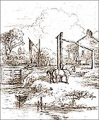
The Mersey and Irwell Navigation was a river navigation in North West England
North West England
North West England, informally known as The North West, is one of the nine official regions of England.North West England had a 2006 estimated population of 6,853,201 the third most populated region after London and the South East...
, which provided a navigable route from the Mersey estuary to Salford and Manchester
Manchester
Manchester is a city and metropolitan borough in Greater Manchester, England. According to the Office for National Statistics, the 2010 mid-year population estimate for Manchester was 498,800. Manchester lies within one of the UK's largest metropolitan areas, the metropolitan county of Greater...
, by improving the course of the River Irwell
River Irwell
The River Irwell is a long river which flows through the Irwell Valley in the counties of Lancashire and Greater Manchester in North West England. The river's source is at Irwell Springs on Deerplay Moor, approximately north of Bacup, in the parish of Cliviger, Lancashire...
and the River Mersey
River Mersey
The River Mersey is a river in North West England. It is around long, stretching from Stockport, Greater Manchester, and ending at Liverpool Bay, Merseyside. For centuries, it formed part of the ancient county divide between Lancashire and Cheshire....
. Eight locks were constructed between 1724 and 1734, and the rivers were improved by the construction of new cuts several times subsequently. Use of the navigation declined from the 1870s, and it was ultimately superseded by the Manchester Ship Canal
Manchester Ship Canal
The Manchester Ship Canal is a river navigation 36 miles long in the North West of England. Starting at the Mersey Estuary near Liverpool, it generally follows the original routes of the rivers Mersey and Irwell through the historic counties of Cheshire and Lancashire. Several sets of locks lift...
, the construction of which destroyed most of the Irwell section of the navigation and the long cut between Latchford and Runcorn.
History
The idea that the Rivers MerseyRiver Mersey
The River Mersey is a river in North West England. It is around long, stretching from Stockport, Greater Manchester, and ending at Liverpool Bay, Merseyside. For centuries, it formed part of the ancient county divide between Lancashire and Cheshire....
and Irwell
River Irwell
The River Irwell is a long river which flows through the Irwell Valley in the counties of Lancashire and Greater Manchester in North West England. The river's source is at Irwell Springs on Deerplay Moor, approximately north of Bacup, in the parish of Cliviger, Lancashire...
should be made navigable from the Mersey Estuary in the west to Manchester
Manchester
Manchester is a city and metropolitan borough in Greater Manchester, England. According to the Office for National Statistics, the 2010 mid-year population estimate for Manchester was 498,800. Manchester lies within one of the UK's largest metropolitan areas, the metropolitan county of Greater...
in the east was first proposed in 1660, and revived in 1712 by Thomas Steers. In 1720 the necessary bills
Acts of Parliament in the United Kingdom
An Act of Parliament in the United Kingdom is a type of legislation called primary legislation. These Acts are passed by the Parliament of the United Kingdom at Westminster, or by the Scottish Parliament at Edinburgh....
were tabled. The Act of Parliament for the navigation was received in 1721 The construction work was undertaken by the Mersey & Irwell Navigation Company. Work began in 1724, and by 1734 boats "of moderate size" could make the journey from quays in Water Street, Manchester, to the Irish Sea
Irish Sea
The Irish Sea separates the islands of Ireland and Great Britain. It is connected to the Celtic Sea in the south by St George's Channel, and to the Atlantic Ocean in the north by the North Channel. Anglesey is the largest island within the Irish Sea, followed by the Isle of Man...
. The navigation was suitable only for small ships, and during periods of drought, or when strong easterly winds held back the tide in the estuary, there was not always sufficient draft for a fully laden boat.
Eight weir
Weir
A weir is a small overflow dam used to alter the flow characteristics of a river or stream. In most cases weirs take the form of a barrier across the river that causes water to pool behind the structure , but allows water to flow over the top...
s were constructed along the length of the route, and some short cuts were made around shallower parts of the river, with locks, to enable the passage of boats. Some difficult turns along the river were also removed.
The navigation was modified and improved on a number of occasions. A canal section known as the Runcorn and Latchford Canal was added in 1804, to bypass part of the lower reaches. In 1740 the company built quays and warehouses along Water Street in Manchester.
In 1779 a group of businessmen from Manchester and Liverpool purchased the navigation, and began making improvements. A difficult section below Howley lock was cut out by the building of the Runcorn to Latchford Canal
Runcorn to Latchford Canal
The Runcorn to Latchford Canal ran from Runcorn, Cheshire to the Latchford area of Warrington, then in the historic county of Lancashire...
, and at Runcorn
Runcorn
Runcorn is an industrial town and cargo port within the borough of Halton in the ceremonial county of Cheshire, England. In 2009, its population was estimated to be 61,500. The town is on the southern bank of the River Mersey where the estuary narrows to form Runcorn Gap. Directly to the north...
a basin was built for boats to wait for the tide.
An aqueduct was built from Woolston Cut, to replace water lost from the locks that were used to raise boats into the new canal section.
The completion of the Bridgewater Canal
Bridgewater Canal
The Bridgewater Canal connects Runcorn, Manchester and Leigh, in North West England. It was commissioned by Francis Egerton, 3rd Duke of Bridgewater, to transport coal from his mines in Worsley to Manchester...
in 1776, followed in 1830 by the opening of the Liverpool & Manchester Railway, meant increasing competition for the carriage of goods, and in 1844 the navigation was purchased on behalf of the Bridgewater Canal Company, for £
Pound sterling
The pound sterling , commonly called the pound, is the official currency of the United Kingdom, its Crown Dependencies and the British Overseas Territories of South Georgia and the South Sandwich Islands, British Antarctic Territory and Tristan da Cunha. It is subdivided into 100 pence...
550,800. In 1846 ownership was transferred to the Canal Company.
The company in charge of the navigation was known by several names. These include "The Old Navigation", "Old Quay Company", and "Old Quay Canal".
Decline
In 1872, the navigation was sold to the newly formed Bridgewater Navigation Company for £Pound sterling
The pound sterling , commonly called the pound, is the official currency of the United Kingdom, its Crown Dependencies and the British Overseas Territories of South Georgia and the South Sandwich Islands, British Antarctic Territory and Tristan da Cunha. It is subdivided into 100 pence...
1,112,000, but it had by then fallen into disrepair. In 1882 it was described as being "hopelessly choked with silt and filth", and was open to 50-ton boats for only 47 out of 311 working days.
Economic conditions deteriorated during the mid-1870s, in what has been called the Long Depression
Long Depression
The Long Depression was a worldwide economic crisis, felt most heavily in Europe and the United States, which had been experiencing strong economic growth fueled by the Second Industrial Revolution in the decade following the American Civil War. At the time, the episode was labeled the Great...
. The dues charged by the Port of Liverpool
Port of Liverpool
The Port of Liverpool is the name for the enclosed 7.5 mile dock system that runs from Brunswick Dock in Liverpool to Seaforth Dock, Seaforth, on the east side of the River Mersey and the Birkenhead Docks between Birkenhead and Wallasey on the west side of the river...
, and the railway charges from there to Manchester, were perceived to be excessive; it was often cheaper to import goods via Hull
Kingston upon Hull
Kingston upon Hull , usually referred to as Hull, is a city and unitary authority area in the ceremonial county of the East Riding of Yorkshire, England. It stands on the River Hull at its junction with the Humber estuary, 25 miles inland from the North Sea. Hull has a resident population of...
, on the other side of England, than it was to use Liverpool, about 35 miles (56.3 km) away. A ship canal
Ship canal
A ship canal is a canal especially constructed to carry ocean-going ships, as opposed to barges. Ship canals can be enlarged barge canals, canalized or channelized rivers, or canals especially constructed from the start to accommodate ships....
was proposed as a way to reverse Manchester's economic decline by giving the city direct access to the sea for its imports and its exports of manufactured goods.
Closure
The construction of the Manchester Ship CanalManchester Ship Canal
The Manchester Ship Canal is a river navigation 36 miles long in the North West of England. Starting at the Mersey Estuary near Liverpool, it generally follows the original routes of the rivers Mersey and Irwell through the historic counties of Cheshire and Lancashire. Several sets of locks lift...
obliterated large parts of the earlier navigation, including almost the whole of the Irwell part of the course (except for a short length upstream of Pomona Docks, which is the only surviving part of the navigation today).
A short way downstream of the confluence with the Mersey, the Ship Canal followed a more southerly course than the old navigation, which remained in use as late as 1950 from Rixton Junction downstream.
The lower reaches of the Ship Canal from Eastham to Latchford obliterated a large section of the Runcorn to Latchford Canal
Runcorn to Latchford Canal
The Runcorn to Latchford Canal ran from Runcorn, Cheshire to the Latchford area of Warrington, then in the historic county of Lancashire...
, leaving just a short stub joining the navigation to the Canal near Stockton Heath. The Woolston New Cut, excavated in 1821, is still visible although completely dry. Woolston Old Cut, built in 1755, still exists although the lock is gone.
Locks
There were originally eight locks along the navigation. Each lock chamber was 13 feet wide by 65 feet long.Throstles Nest Lock was the highest on the navigation. It was followed by Mode Wheel lock. Lock 3 was at Barton-upon-Irwell
Barton-upon-Irwell
Barton-upon-Irwell is a suburban area of Eccles, Greater Manchester, England.-History:...
, next to James Brindley's
James Brindley
James Brindley was an English engineer. He was born in Tunstead, Derbyshire, and lived much of his life in Leek, Staffordshire, becoming one of the most notable engineers of the 18th century.-Early life:...
original Barton Aqueduct
Barton Swing Aqueduct
The Barton Swing Aqueduct is a moveable navigable aqueduct in Barton upon Irwell in Greater Manchester, England. It carries the Bridgewater Canal across the Manchester Ship Canal. The swinging action allows large vessels using the Manchester Ship Canal to pass underneath and smaller narrowboats to...
. The remains of the lock island appear to be situated in the same location as the island presently used for the swing aqueduct. Stickins Lock followed, located in a 600 yards (548.6 m) cut. There were further locks named Holmes Bridge, Calamanco, Holmes Bridge and finally Howley Tidal.
Further locks were added throughout the route's history. These include a new Stickins Lock, Sandywarps Lock in a cut located close to the confluence of the Irwell and Mersey, Butchersfield Locks (located on a short cut known as the Butchersfield Canal]], Woolston New (located at the upper end of Woolston New Cut), Paddington Lock (lower end of Woolston New Cut), Woolston Old Lock, Latchford, and Old Quay Sea Locks.
See also
- Canals of the United KingdomCanals of the United KingdomThe canals of the United Kingdom are a major part of the network of inland waterways in the United Kingdom. They have a colourful history, from use for irrigation and transport, through becoming the focus of the Industrial Revolution, to today's role for recreational boating...
- History of the British canal systemHistory of the British canal systemThe British canal system of water transport played a vital role in the United Kingdom's Industrial Revolution at a time when roads were only just emerging from the medieval mud and long trains of pack horses were the only means of "mass" transit by road of raw materials and finished products The...
- Emma (ship)Emma (ship)The Emma was a River Flat launched on 28 February 1828 along the Mersey and Irwell Navigation, in Manchester. Built by the New Quay Company, it was one of the largest cargo vessels to be built alongside the Irwell. The vessel capsized shortly after its launch, causing the deaths of as many as 47...