
Maryland Route 43
Encyclopedia
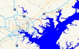
Maryland Route 43 is a state highway
in the U.S. state of Maryland
. Known as White Marsh Boulevard, the state highway runs 8.65 miles (13.9 km) from Interstate 695
(I-695) near Parkville
east to MD 150
in Middle River
. MD 43 is a four-lane divided highway in eastern Baltimore County
that connects the northern and eastern suburbs of Baltimore with the commercial center of White Marsh
, where the highway has junctions with I-95
and U.S. Route 40
(US 40). The state highway was built from west of I-95 to US 40 concurrent with the construction of I-95 in the early 1960s. MD 43 was extended west to Parkville in the early 1990s and east to Middle River in 2006.
, the highway has intersections with county-maintained Walther Boulevard and a pair of two-way ramps that connect the boulevard with either direction of US 1
(Belair Road), under which MD 43 passes between the pair of ramps. The state highway continues east into the planned community of White Marsh where the highway has intersections with Perry Hall Boulevard and Honeygo Boulevard, which serve White Marsh Town Center
and its centerpiece, White Marsh Mall
.
East of the town center, MD 43 veers away from Whitemarsh Run and meets I-95 (John F. Kennedy Memorial Highway) at a cloverleaf interchange
and has a partial interchange with MD 7
(Philadelphia Road). The state highway continues east across CSX
's Philadelphia Subdivision and US 40 (Pulaski Highway). The US 40 interchange includes a two-way ramp between the two highways and a direct ramp from southbound US 40 to westbound MD 43. East of US 40, the state highway crosses over Whitemarsh Run, which heads north to its mouth at the tidal Bird River, itself a tributary of the Gunpowder River
. MD 43 curves southeast through a forested area with scattered industrial parks, where the highway crosses over Bird River Road and Windlass Run and intersects Crossroads Circle. The state highway continues southwest into Middle River, crossing over the Amtrak Northeast Corridor before reaching its eastern terminus at MD 150 (Eastern Boulevard) just east of the Martin State Airport
station on MARC
's Penn Line
and Martin State Airport
.
Construction on the western extension of MD 43 from White Marsh Town Center west to I-695 began in 1989 with construction of bridges. The roadways, including the interchange ramps at US 1, were under construction by 1991. MD 43 was rebuilt at Honeygo Boulevard and completed west to I-695 in January 1993. Around 1997, the pair of ramps at MD 7 were added. Work on the eastern extension of MD 43 from US 40 east to Middle River began with bridge work in 2004. The state highway was completed east to MD 150 on October 23, 2006, opening up a large area of eastern Baltimore County to commercial and industrial development.
.
{| class=wikitable
!Location
!Mile
!Destinations
!Notes
|-
|Parkville
|0.00
|
|Western terminus; I-695 Exit 31C; eastbound exit from and westbound entrance to I-695
|-
|rowspan=2|Fullerton
|1.02
|
|Two-way ramp between MD 43 and southbound US 1
|-
|1.69
|
|Two-way ramp between MD 43 and northbound US 1
|-
|rowspan=3|White Marsh
|4.19
|
|I-95 Exit 67
|-
|4.76
|
|Eastbound exit and westbound entrance
|-
|5.15
|
|Two-way ramp between MD 43 and US 40
|-
|Middle River
|8.65
|
|Eastern terminus
State highway
State highway, state road or state route can refer to one of three related concepts, two of them related to a state or provincial government in a country that is divided into states or provinces :#A...
in the U.S. state of Maryland
Maryland
Maryland is a U.S. state located in the Mid Atlantic region of the United States, bordering Virginia, West Virginia, and the District of Columbia to its south and west; Pennsylvania to its north; and Delaware to its east...
. Known as White Marsh Boulevard, the state highway runs 8.65 miles (13.9 km) from Interstate 695
Interstate 695 (Maryland)
Interstate 695 is a -long full beltway Interstate Highway extending around Baltimore, Maryland, USA. I-695 is officially designated the McKeldin Beltway, but is colloquially referred to as either the Baltimore Beltway or 695...
(I-695) near Parkville
Parkville, Maryland
-Demographics:As of the census of 2000, there were 31,118 people, 13,044 households, and 8,243 families residing in the CDP. The population density was 7,352.1 people per square mile . There were 13,550 housing units at an average density of 3,201.4 per square mile...
east to MD 150
Maryland Route 150
Maryland Route 150 is a state highway in the U.S. state of Maryland. Known for most of its length as either Eastern Avenue or Eastern Boulevard, the state highway runs from U.S. Route 40 in Baltimore east to Graces Quarters Road in Chase in eastern Baltimore County. MD 150 connects Baltimore...
in Middle River
Middle River, Maryland
Middle River is an unincorporated community and a census-designated place in Baltimore County, Maryland, United States. The population was 23,958 at the 2000 census...
. MD 43 is a four-lane divided highway in eastern Baltimore County
Baltimore County, Maryland
Baltimore County is a county located in the northern part of the US state of Maryland. In 2010, its population was 805,029. It is part of the Baltimore-Washington Metropolitan Area. Its county seat is Towson. The name of the county was derived from the barony of the Proprietor of the Maryland...
that connects the northern and eastern suburbs of Baltimore with the commercial center of White Marsh
White Marsh, Maryland
White Marsh is an unincorporated community and a census-designated place in Baltimore County, Maryland, United States. The population was 8,485 at the 2000 census.- History :...
, where the highway has junctions with I-95
Interstate 95 in Maryland
Interstate 95 in Maryland is a major highway that runs diagonally from northeast to southwest, from Maryland's border with Delaware, to the Woodrow Wilson Bridge, briefly entering the District of Columbia before reaching Virginia...
and U.S. Route 40
U.S. Route 40 in Maryland
U.S. Route 40 in the U.S. state of Maryland runs from western Maryland to Cecil County in the state's northeastern corner. With a total length of over , it is the longest numbered highway in Maryland. Almost half of the road overlaps with Interstate 68 or Interstate 70, while the old alignment...
(US 40). The state highway was built from west of I-95 to US 40 concurrent with the construction of I-95 in the early 1960s. MD 43 was extended west to Parkville in the early 1990s and east to Middle River in 2006.
Route description
MD 43 begins at a partial interchange with I-695 (Baltimore Beltway) near Parkville that includes ramps from eastbound I-695 to eastbound MD 43 and from westbound MD 43 to westbound I-695. The state highway heads east as a four-lane divided controlled-access highway through the forested valley of Whitemarsh Run. As MD 43 passes through the community of FullertonFullerton, Maryland
Fullerton is an unincorporated community in Baltimore County, Maryland, United States.There was a major fire at an empty building owned by the Schmidt Baking Company on Fitch Lane in Fullerton in April 2008.-References:...
, the highway has intersections with county-maintained Walther Boulevard and a pair of two-way ramps that connect the boulevard with either direction of US 1
U.S. Route 1 in Maryland
U.S. Route 1 is the easternmost and longest of the major north–south routes of the United States Numbered Highway System, running from Key West, Florida to Fort Kent, Maine. In the U.S...
(Belair Road), under which MD 43 passes between the pair of ramps. The state highway continues east into the planned community of White Marsh where the highway has intersections with Perry Hall Boulevard and Honeygo Boulevard, which serve White Marsh Town Center
White Marsh Town Center
White Marsh Town Center a planned community of residential, office, industrial, and retail properties developed by Nottingham Properties, now owned by Corporate Office Properties Trust. It is located in White Marsh, northeast Baltimore County, Maryland....
and its centerpiece, White Marsh Mall
White Marsh Mall
White Marsh Mall is a shopping mall in the unincorporated and planned community of White Marsh in Baltimore County, Maryland, USA. The White Marsh Mall is one of the largest regional malls in the Baltimore area, with 5 anchor stores and 142 specialty shops in ....
.
East of the town center, MD 43 veers away from Whitemarsh Run and meets I-95 (John F. Kennedy Memorial Highway) at a cloverleaf interchange
Cloverleaf interchange
A cloverleaf interchange is a two-level interchange in which left turns, reverse direction in left-driving regions, are handled by ramp roads...
and has a partial interchange with MD 7
Maryland Route 7
Maryland Route 7 is a collection of state highways in the U.S. state of Maryland. These highways are sections of old alignment of U.S. Route 40 between Baltimore and Elkton that were bypassed when US 40 was moved to Pulaski Highway, a four-lane divided highway, in the late 1930s and early 1940s...
(Philadelphia Road). The state highway continues east across CSX
CSX Transportation
CSX Transportation operates a Class I railroad in the United States known as the CSX Railroad. It is the main subsidiary of the CSX Corporation. The company is headquartered in Jacksonville, Florida, and owns approximately 21,000 route miles...
's Philadelphia Subdivision and US 40 (Pulaski Highway). The US 40 interchange includes a two-way ramp between the two highways and a direct ramp from southbound US 40 to westbound MD 43. East of US 40, the state highway crosses over Whitemarsh Run, which heads north to its mouth at the tidal Bird River, itself a tributary of the Gunpowder River
Gunpowder River
The Gunpowder River is a tidal inlet on the western side of Chesapeake Bay in Maryland, United States. It is formed by the joining of two freshwater rivers, Gunpowder Falls and Little Gunpowder Falls.-Gunpowder Falls:The Big Gunpowder, long, begins in the extreme southern part of Pennsylvania's...
. MD 43 curves southeast through a forested area with scattered industrial parks, where the highway crosses over Bird River Road and Windlass Run and intersects Crossroads Circle. The state highway continues southwest into Middle River, crossing over the Amtrak Northeast Corridor before reaching its eastern terminus at MD 150 (Eastern Boulevard) just east of the Martin State Airport
Martin State Airport (MARC station)
Martin State Airport is a passenger rail station on the MARC Penn Line between Washington, D.C., Baltimore, MD and Perryville, MD which serves Martin State Airport and surrounding communities. The station is also on the southern section of the Northeast Corridor however, Amtrak does not stop at...
station on MARC
MARC Train
MARC , known prior to 1984 as Maryland Rail Commuter Service, is a regional rail system comprising three lines in the Baltimore-Washington Metropolitan Area. MARC is administered by the Maryland Transit Administration , a Maryland Department of Transportation agency, and is operated under contract...
's Penn Line
Penn Line (MARC)
The Penn Line is a MARC commuter rail line running from Union Station, Washington D.C. to Perryville, Maryland via Penn Station, Baltimore, Maryland on Amtrak's Northeast Corridor. It is MARC's busiest and only electric line. Currently the line is the fastest commuter rail line in the country, with...
and Martin State Airport
Martin State Airport
Martin State Airport is a public use airport located nine nautical miles east of the central business district of Baltimore, in Baltimore County, Maryland, United States...
.
History
White Marsh Boulevard was constructed concurrent with the portion of I-95 between the boulevard and I-695 in 1962 and 1963. The state highway, which was marked as MD 43 by 1965, originally consisted of a four-lane divided section from the Honeygo Boulevard intersection east to US 40, under which the highway passed then followed the present two-way ramp to an intersection with the U.S. Highway. The original highway also had its modern cloverleaf interchange with I-95 and an underpass of MD 7 with no access. At its western end, MD 43 turned north as a two-lane road along what is now Honeygo Boulevard to its western terminus at Silver Spring Road. Around 1983, in conjunction with the construction of White Marsh Town Center, the state highway's western terminus was moved to just east of the Honeygo Boulevard intersection, which became a three-way directional intersection with an overpass for traffic from westbound MD 43 south onto Honeygo Boulevard toward White Marsh Mall.Construction on the western extension of MD 43 from White Marsh Town Center west to I-695 began in 1989 with construction of bridges. The roadways, including the interchange ramps at US 1, were under construction by 1991. MD 43 was rebuilt at Honeygo Boulevard and completed west to I-695 in January 1993. Around 1997, the pair of ramps at MD 7 were added. Work on the eastern extension of MD 43 from US 40 east to Middle River began with bridge work in 2004. The state highway was completed east to MD 150 on October 23, 2006, opening up a large area of eastern Baltimore County to commercial and industrial development.
Junction list
The entire route is in Baltimore CountyBaltimore County, Maryland
Baltimore County is a county located in the northern part of the US state of Maryland. In 2010, its population was 805,029. It is part of the Baltimore-Washington Metropolitan Area. Its county seat is Towson. The name of the county was derived from the barony of the Proprietor of the Maryland...
.
{| class=wikitable
!Location
!Mile
!Destinations
!Notes
|-
|Parkville
Parkville, Maryland
-Demographics:As of the census of 2000, there were 31,118 people, 13,044 households, and 8,243 families residing in the CDP. The population density was 7,352.1 people per square mile . There were 13,550 housing units at an average density of 3,201.4 per square mile...
|0.00
|
|Western terminus; I-695 Exit 31C; eastbound exit from and westbound entrance to I-695
|-
|rowspan=2|Fullerton
Fullerton, Maryland
Fullerton is an unincorporated community in Baltimore County, Maryland, United States.There was a major fire at an empty building owned by the Schmidt Baking Company on Fitch Lane in Fullerton in April 2008.-References:...
|1.02
|
|Two-way ramp between MD 43 and southbound US 1
|-
|1.69
|
|Two-way ramp between MD 43 and northbound US 1
|-
|rowspan=3|White Marsh
White Marsh, Maryland
White Marsh is an unincorporated community and a census-designated place in Baltimore County, Maryland, United States. The population was 8,485 at the 2000 census.- History :...
|4.19
|
|I-95 Exit 67
|-
|4.76
|
|Eastbound exit and westbound entrance
|-
|5.15
|
|Two-way ramp between MD 43 and US 40
|-
|Middle River
Middle River, Maryland
Middle River is an unincorporated community and a census-designated place in Baltimore County, Maryland, United States. The population was 23,958 at the 2000 census...
|8.65
|
|Eastern terminus