
Maryland Route 648
Encyclopedia
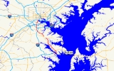
Maryland Route 648 is a collection of state highway
s in the U.S. state of Maryland
. These highways are sections of Baltimore–Annapolis Boulevard, the old alignment of MD 2
between Annapolis
and Glen Burnie
. These segments were bypassed when MD 2 was moved to Governor Ritchie Highway, a four-lane divided highway, in the late 1930s. MD 648 has five distinct sections of mainline highway that pass through Anne Arundel County
. The northernmost segment of MD 648 also follows the old alignment of MD 3
from Glen Burnie to Baltimore.
in Annapolis north to a dead end located just south of U.S. Route 50
and US 301
near Winchester-on-the-Severn
. The highway's alignment continues north of the U.S. Highways as MD 648F, which runs 0.61 mile (0.9816974 km) from the westbound lanes of US 50 and US 301 north to MD 2 within Winchester-on-the-Severn.
that crosses the Severn River into the city of Annapolis. The state highway heads east and immediately intersects the access road for Jonas Green State Park
, which is unsigned MD 648AB. At the junction with MD 672 (Greenbury Point Road), which serves several facilities of the U.S. Navy and U.S. Naval Academy, MD 648A turns north and meets the west end of MD 179
(Saint Margarets Road). The state highway continues north through a forested residential area to its terminus at a dead end just south of US 50 and US 301, which run concurrently
as Blue Star Memorial Highway. The westbound direction of the freeway has a right-in/right-out
intersection with MD 648F directly opposite from the dead end of MD 648A. MD 648F heads west parallel to the freeway then turns north to a partial intersection with MD 2 (Governor Ritchie Highway). There is no access from northbound MD 648F to southbound MD 2.
{| class=wikitable
!Location
!Mile
!Destinations
!Notes
|-
|rowspan=4|Annapolis
|0.00
|
|Southern terminus of MD 648A
|-
|0.06
|Entrance to Jonas Green State Park
|Unsigned MD 648AB
|-
|0.46
|
|MD 648 turns north to remain on Baltimore–Annapolis Boulevard
|-
|0.88
|
|
|-
|rowspan=3|Winchester-on-the-Severn
|2.09
|Dead end on south side of
|Northern terminus of MD 648A
|-
|0.00
|
|Southern terminus of MD 648F; right-in/right-out
intersection
|-
|0.61
|
|Northern terminus of MD 648F; no access from northbound MD 648F to southbound MD 2
, a rail trail
that follows the abandoned right-of-way of the Baltimore & Annapolis Railroad from Annapolis to Glen Burnie.
and Severna Park
.
.
{| class=wikitable
!Location
!Mile
!Destinations
!Notes
|-
|rowspan=2|Arnold
|0.0
|
|Southern terminus of MD 648D
|-
|1.85
|
|Spur from MD 648D to southbound MD 2; no access to northbound MD 2
|-
|Severna Park
|4.18
|
|Northern terminus of MD 648D
in Pasadena
.
just downstream from its impoundment, Lake Waterford. Just north of the lake, Baltimore–Annapolis Boulevard veers to the northwest as unsigned MD 915; MD 915 is a section of the old alignment prior to the highway being cut by the construction of MD 100
. MD 648 continues north as Waterford Road. The state highway crosses over MD 100 (Paul T. Pitcher Memorial Highway) with no access before reaching its northern terminus at MD 177 (Mountain Road).
.
{| class=wikitable
!Location
!Mile
!Destinations
!Notes
|-
|
|0.00
|
|Southern terminus of MD 648H
|-
|
|0.22
|Asbury Drive south
|Unsigned MD 648AA
|-
|
|2.39
|Baltimore–Annapolis Boulevard north
|Unsigned MD 915
|-
|
|3.49
|
|Northern terminus of MD 648H
before heading into Baltimore, where the highway is maintained by the Baltimore City Department of Transportation. MD 648E has freeway connections with 10
and I-97
in Glen Burnie
, I-695
in Ferndale
, and the Baltimore–Washington Parkway in Baltimore. The state highway is a part of the National Highway System
between I-97 and the entrance to the Cromwell Station / Glen Burnie station of the Baltimore Light Rail
.
(Furnace Branch Road); the south leg of that intersection is unsigned MD 648G, which is also named Baltimore–Annapolis Boulevard. MD 648 temporarily becomes a four-lane divided highway through its partial cloverleaf interchange with MD 10 (Arundel Expressway).
 MD 648 reduces to two lanes as it passes through a residential neighborhood in Glen Burnie. The state highway curves to the northwest through a commercial area in the center of the suburb where the highway intersects MD 2 (Governor Ritchie Highway) and MD 3 Business (Robert Crain Highway). MD 648 expands to a four-lane undivided highway at its intersection with Eighth Avenue and MD 176
(Dorsey Road), which heads west toward Baltimore/Washington International Thurgood Marshall Airport. The state highway begins to parallel the Baltimore Light Rail and its southern terminal station, Cromwell Station / Glen Burnie. North of the station, MD 648 becomes divided and has a folded diamond interchange
with I-97.
MD 648 continues to parallel the transit line as a two-lane road north through Ferndale. The state highway passes the Ferndale
station in the center of the community. MD 648 veers north away from the transit line at Hollins Ferry Road, then passes North County High School
and crosses Cabin Branch. The state highway intersects Furnace Branch Road and the eastern end of MD 169
(Maple Road) prior to meeting I-695 (Baltimore Beltway) at a partial cloverleaf interchange. In the center of Pumphrey
, MD 648 intersects MD 170
, which heads northeast as Belle Grove Road and southwest as Camp Meade Road past the North Linthicum
light rail station. The state highway passes under the Baltimore Light Rail tracks and begins to parallel them. MD 648 intersects MD 168
(Nursery Road) just west of the Nursery Road
station shortly before the highway veers away from the transit line and crosses the Patapsco River
.
MD 648 continues north as Old Annapolis Road, crossing under Interstate 895
(Harbor Tunnel Thruway) with no access before passing through the suburb of Baltimore Highlands in the southeastern corner of Baltimore County. The state highway enters the city of Baltimore and its name changes to Annapolis Road shortly before intersecting Patapsco Avenue. MD 648 crosses over the Baltimore–Washington Parkway (signed as MD 295) and under the Curtis Bay Branch of CSX
's Baltimore Terminal Subdivision. The state highway intersects ramps to and from the southbound parkway as it passes to the east of Mount Auburn Cemetery
. MD 648 has a pair of intersections with Waterview Avenue on both sides of an east–west segment to cross to the east side of the Baltimore–Washington Parkway. The state highway passes through the Westport
neighborhood, where Wenburn Street and Manokin Street lead west to ramps with the northbound and southbound directions of the parkway, respectively. MD 648 meets a pair of rail lines at grade, intersects Monroe Street, and passes under I-95
before crossing over Gwynns Falls
. The state highway reaches its northern terminus at a right-in/right-out
interchange with the ramp from northbound I-95 to northbound MD 295, which continues north as Russell Street toward Downtown Baltimore
.
!County
!Location
!Mile
!Destinations
!Notes
|-
|rowspan=11|Anne Arundel
|Pasadena
|0.00
|
|Southern terminus of MD 648E
|-
|rowspan=5|Glen Burnie
|1.77
|
|Baltimore–Annapolis Boulevard is unsigned MD 648G
|-
|1.99
|
|Partial cloverleaf interchange
|-
|3.07
|
|
|-
|3.29
|
|
|-
|3.81
|
|
|-
|rowspan=3|Ferndale
|4.29
|
|I-97 Exit 16
|-
|6.26
|
|
|-
|6.43
|
|I-695 Exit 5
|-
|rowspan=2|Pumphrey
|7.05
|
|
|-
|7.53
|
|
|-
|Baltimore
|Baltimore Highlands
|colspan=3|No major intersections
|-
|rowspan=5 colspan=2|Baltimore
|9.47
|Patapsco Avenue
|
|-
|10.15
|
|
|-
|10.31
|Waterview Avenue east
|MD 648 turns east at this intersection
|-
|10.35
|Waterview Avenue east
|MD 648 turns north at this intersection
|-
|11.15
|
|Northern terminus of MD 648E; right-in/right-out
interchange with ramp from northbound I-95 to northbound MD 295
State highway
State highway, state road or state route can refer to one of three related concepts, two of them related to a state or provincial government in a country that is divided into states or provinces :#A...
s in the U.S. state of Maryland
Maryland
Maryland is a U.S. state located in the Mid Atlantic region of the United States, bordering Virginia, West Virginia, and the District of Columbia to its south and west; Pennsylvania to its north; and Delaware to its east...
. These highways are sections of Baltimore–Annapolis Boulevard, the old alignment of MD 2
Maryland Route 2
Maryland Route 2 is the longest state highway in the U.S. state of Maryland. The route runs from Solomons Island in Calvert County north to an intersection with U.S. Route 1 and U.S. Route 40 Truck in Baltimore...
between Annapolis
Annapolis, Maryland
Annapolis is the capital of the U.S. state of Maryland, as well as the county seat of Anne Arundel County. It had a population of 38,394 at the 2010 census and is situated on the Chesapeake Bay at the mouth of the Severn River, south of Baltimore and about east of Washington, D.C. Annapolis is...
and Glen Burnie
Glen Burnie, Maryland
Glen Burnie is a census-designated place in Anne Arundel County, Maryland, United States, and is a suburb of Baltimore. The population was 67,639 at the 2010 census...
. These segments were bypassed when MD 2 was moved to Governor Ritchie Highway, a four-lane divided highway, in the late 1930s. MD 648 has five distinct sections of mainline highway that pass through Anne Arundel County
Anne Arundel County, Maryland
Anne Arundel County is a county located in the U.S. state of Maryland. It is named for Anne Arundell , a member of the ancient family of Arundells in Cornwall, England and the wife of Cæcilius Calvert, 2nd Baron Baltimore. Its county seat is Annapolis, which is also the capital of the state...
. The northernmost segment of MD 648 also follows the old alignment of MD 3
Maryland Route 3
Maryland Route 3, also part of Robert Crain Highway, is the designation given to the former alignment of U.S. Route 301 from Bowie, Maryland, USA, to Baltimore. It is named for Robert Crain of Baltimore.-Route description:...
from Glen Burnie to Baltimore.
Annapolis – Winchester-on-the-Severn
MD 648A runs 2.09 miles (3.4 km) from MD 450Maryland Route 450
Maryland Route 450 is a state highway in the U.S. state of Maryland. The state highway runs from U.S. Route 1 Alternate in Bladensburg east to US 50, US 301, and MD 2 near Annapolis. MD 450 is the original alignment of US 50 in Prince George's and Anne Arundel Counties...
in Annapolis north to a dead end located just south of U.S. Route 50
U.S. Route 50 in Maryland
U.S. Route 50 is a major east–west route of the U.S. Highway system, stretching just over from Ocean City, Maryland on the Atlantic Ocean to West Sacramento, California. In the U.S. state of Maryland, US 50 exists in two sections. The longer of these serves as a major route connecting...
and US 301
U.S. Route 301 in Maryland
U.S. Route 301 in Maryland is a major highway that runs from Delaware to the Governor Harry W. Nice Memorial Bridge into Virginia. It passes through three of Maryland's four main regions: the Eastern Shore, the Baltimore-Washington Metropolitan Area, and Southern Maryland...
near Winchester-on-the-Severn
Winchester-on-the-Severn, Maryland
Winchester-on-the-Severn is a populated place located in Anne Arundel County, Maryland.It is the longest hyphenated placename in the United States appearing in the USGS's Geographic Names Information System, consisting of 21 letters....
. The highway's alignment continues north of the U.S. Highways as MD 648F, which runs 0.61 mile (0.9816974 km) from the westbound lanes of US 50 and US 301 north to MD 2 within Winchester-on-the-Severn.
Route description
MD 648A begins at an intersection with MD 450 (Governor Ritchie Highway) just east of the Naval Academy BridgeNaval Academy Bridge
The U.S. Naval Academy Bridge is a bridge that crosses the Severn River in Annapolis, Maryland. It is located downriver from the Severn River Bridge and adjacent to the United States Naval Academy...
that crosses the Severn River into the city of Annapolis. The state highway heads east and immediately intersects the access road for Jonas Green State Park
Jonas Green State Park
Jonas Green State Park is a state park in Anne Arundel County, Maryland, located in Annapolis at 1990 Governor Ritchie Highway, at the end of the Baltimore & Annapolis Trail. It was established on June 6, 2009, the park offers a visitors center, a cartop boat launch site, environmental plantings,...
, which is unsigned MD 648AB. At the junction with MD 672 (Greenbury Point Road), which serves several facilities of the U.S. Navy and U.S. Naval Academy, MD 648A turns north and meets the west end of MD 179
Maryland Route 179
Maryland Route 179 is a two-lane road running east–west along the Broadneck Peninsula of Anne Arundel County, Maryland. It is better known locally as St. Margaret's Road. MD 179 runs from outside of Annapolis to the end of state maintenance in Cape St...
(Saint Margarets Road). The state highway continues north through a forested residential area to its terminus at a dead end just south of US 50 and US 301, which run concurrently
Concurrency (road)
A concurrency, overlap, or coincidence in a road network is an instance of one physical road bearing two or more different highway, motorway, or other route numbers...
as Blue Star Memorial Highway. The westbound direction of the freeway has a right-in/right-out
Right-in/right-out
Right-in/right-out and left-in/left-out refer to a type of road intersection where turning movements of vehicles are restricted. A RIRO permits only right turns and a LILO permits only left turns. RIRO is usual where vehicles drive on the right, and LILO is usual where vehicles drive on the left...
intersection with MD 648F directly opposite from the dead end of MD 648A. MD 648F heads west parallel to the freeway then turns north to a partial intersection with MD 2 (Governor Ritchie Highway). There is no access from northbound MD 648F to southbound MD 2.
Junction list
The entire route is in Anne Arundel CountyAnne Arundel County, Maryland
Anne Arundel County is a county located in the U.S. state of Maryland. It is named for Anne Arundell , a member of the ancient family of Arundells in Cornwall, England and the wife of Cæcilius Calvert, 2nd Baron Baltimore. Its county seat is Annapolis, which is also the capital of the state...
{| class=wikitable
!Location
!Mile
!Destinations
!Notes
|-
|rowspan=4|Annapolis
Annapolis, Maryland
Annapolis is the capital of the U.S. state of Maryland, as well as the county seat of Anne Arundel County. It had a population of 38,394 at the 2010 census and is situated on the Chesapeake Bay at the mouth of the Severn River, south of Baltimore and about east of Washington, D.C. Annapolis is...
|0.00
|
|Southern terminus of MD 648A
|-
|0.06
|Entrance to Jonas Green State Park
Jonas Green State Park
Jonas Green State Park is a state park in Anne Arundel County, Maryland, located in Annapolis at 1990 Governor Ritchie Highway, at the end of the Baltimore & Annapolis Trail. It was established on June 6, 2009, the park offers a visitors center, a cartop boat launch site, environmental plantings,...
|Unsigned MD 648AB
|-
|0.46
|
|MD 648 turns north to remain on Baltimore–Annapolis Boulevard
|-
|0.88
|
|
|-
|rowspan=3|Winchester-on-the-Severn
Winchester-on-the-Severn, Maryland
Winchester-on-the-Severn is a populated place located in Anne Arundel County, Maryland.It is the longest hyphenated placename in the United States appearing in the USGS's Geographic Names Information System, consisting of 21 letters....
|2.09
|Dead end on south side of
|Northern terminus of MD 648A
|-
|0.00
|
|Southern terminus of MD 648F; right-in/right-out
Right-in/right-out
Right-in/right-out and left-in/left-out refer to a type of road intersection where turning movements of vehicles are restricted. A RIRO permits only right turns and a LILO permits only left turns. RIRO is usual where vehicles drive on the right, and LILO is usual where vehicles drive on the left...
intersection
|-
|0.61
|
|Northern terminus of MD 648F; no access from northbound MD 648F to southbound MD 2
Auxiliary route
MD 648AB is the designation for the unnamed 0.1 mile (0.160934 km) access road to Jonas Green State Park. The state park features the southern end of the Baltimore & Annapolis TrailBaltimore & Annapolis Trail
The Baltimore & Annapolis Trail is a rail trail in Anne Arundel County, Maryland. The trail starts at Boulter's Way in Arnold and ends near Baltimore Light Rail's Cromwell Station in Glen Burnie. Starting near Annapolis at Jonas Green State Park, the trail passes through Arnold, Severna Park,...
, a rail trail
Rail trail
A rail trail is the conversion of a disused railway easement into a multi-use path, typically for walking, cycling and sometimes horse riding. The characteristics of former tracks—flat, long, frequently running through historical areas—are appealing for various development. The term sometimes also...
that follows the abandoned right-of-way of the Baltimore & Annapolis Railroad from Annapolis to Glen Burnie.
Arnold – Severna Park
MD 648D runs 4.18 miles (6.7 km) between intersections with MD 2 in ArnoldArnold, Maryland
Arnold is a census-designated place in Anne Arundel County, Maryland, United States. The population was 23,422 at the 2000 census. Neighborhoods straddle College Parkway and Ritchie Highway. Arnold is located on the scenic Broadneck peninsula...
and Severna Park
Severna Park, Maryland
Severna Park is a census-designated place in Anne Arundel County, Maryland, United States. The population was 28,507 at the 2000 census.-History:Robinson House was listed on the National Register of Historic Places in 2009.-Geography:...
.
Route description
There are two county-maintained segments of Baltimore–Annapolis Boulevard on the southbound and northbound sides, respectively, of MD 2 (Governor Ritchie Highway) between Winchester-on-the-Severn and Arnold. MD 648 begins at an intersection with MD 2 in Arnold a short distance north of the second county highway loop. The state highway parallels the southbound direction of MD 2 and the Baltimore & Annapolis Trail, which the highway follows closely except close to its termini. On the northern end of Arnold, MD 648 and MD 2 approach closely; within this stretch there is a spur from MD 648 to southbound MD 2 and a spur from both directions of MD 2 to MD 648. The state highway leaves the vicinity of MD 2 then splits from the rail trail to its northern terminus at an oblique intersection with MD 2 within a commercial area in Severna Park.Junction list
The entire route is in Anne Arundel CountyAnne Arundel County, Maryland
Anne Arundel County is a county located in the U.S. state of Maryland. It is named for Anne Arundell , a member of the ancient family of Arundells in Cornwall, England and the wife of Cæcilius Calvert, 2nd Baron Baltimore. Its county seat is Annapolis, which is also the capital of the state...
.
{| class=wikitable
!Location
!Mile
!Destinations
!Notes
|-
|rowspan=2|Arnold
Arnold, Maryland
Arnold is a census-designated place in Anne Arundel County, Maryland, United States. The population was 23,422 at the 2000 census. Neighborhoods straddle College Parkway and Ritchie Highway. Arnold is located on the scenic Broadneck peninsula...
|0.0
|
|Southern terminus of MD 648D
|-
|1.85
|
|Spur from MD 648D to southbound MD 2; no access to northbound MD 2
|-
|Severna Park
Severna Park, Maryland
Severna Park is a census-designated place in Anne Arundel County, Maryland, United States. The population was 28,507 at the 2000 census.-History:Robinson House was listed on the National Register of Historic Places in 2009.-Geography:...
|4.18
|
|Northern terminus of MD 648D
Severna Park – Pasadena
MD 648D runs 3.49 miles (5.6 km) from MD 2 in Severna Park north to MD 177Maryland Route 177
Maryland Route 177 is a state route in Anne Arundel County, beginning at MD 2 in Pasadena and ending at Gibson Island. It is named 'Mountain Road' for its entire length.-Route description:...
in Pasadena
Pasadena, Maryland
Pasadena is a census-designated place in Anne Arundel County, Maryland, United States. The population was 12,093 at the 2000 census.-Geography:Pasadena is located at ....
.
Route description
MD 648 begins at an intersection with MD 2 (Governor Ritchie Highway) in Severna Park. The state highway heads east, crossing Cattail Creek before intersecting Asbury Drive, which is unsigned MD 648AA. MD 648 veers north through residential subdivisions in Pasadena. The state highway passes along the eastern edge of Waterford Park, where the highway crosses the Magothy RiverMagothy River
The Magothy River runs through Anne Arundel County in the U.S. state of Maryland. It is located south of the Patapsco River and north of the Severn River...
just downstream from its impoundment, Lake Waterford. Just north of the lake, Baltimore–Annapolis Boulevard veers to the northwest as unsigned MD 915; MD 915 is a section of the old alignment prior to the highway being cut by the construction of MD 100
Maryland Route 100
Maryland Route 100 is a major east–west highway connecting U.S. Route 29 in Ellicott City and MD 177 in Pasadena. MD 100 also connects to Interstate 95 , US 1, the Baltimore-Washington Parkway , and I-97...
. MD 648 continues north as Waterford Road. The state highway crosses over MD 100 (Paul T. Pitcher Memorial Highway) with no access before reaching its northern terminus at MD 177 (Mountain Road).
Junction list
The entire route is in Anne Arundel CountyAnne Arundel County, Maryland
Anne Arundel County is a county located in the U.S. state of Maryland. It is named for Anne Arundell , a member of the ancient family of Arundells in Cornwall, England and the wife of Cæcilius Calvert, 2nd Baron Baltimore. Its county seat is Annapolis, which is also the capital of the state...
.
{| class=wikitable
!Location
!Mile
!Destinations
!Notes
|-
|
|0.00
|
|Southern terminus of MD 648H
|-
|
|0.22
|Asbury Drive south
|Unsigned MD 648AA
|-
|
|2.39
|Baltimore–Annapolis Boulevard north
|Unsigned MD 915
|-
|
|3.49
|
|Northern terminus of MD 648H
Auxiliary route
MD 648AA is the designation for Asbury Drive, a section of old alignment of MD 648 in Severna Park. The state highway runs 0.48 mile (0.7724832 km) from Leelyn Drive near MD 2's intersection with MD 648D north to MD 648H.Pasadena–Baltimore
MD 648E runs 11.15 miles (17.9 km) from MD 177 in Pasadena north to MD 295 in the city of Baltimore. The state highway, which is the longest section of MD 648, is mostly located in Anne Arundel County; a small portion of the highway passes through the southeastern corner of Baltimore CountyBaltimore County, Maryland
Baltimore County is a county located in the northern part of the US state of Maryland. In 2010, its population was 805,029. It is part of the Baltimore-Washington Metropolitan Area. Its county seat is Towson. The name of the county was derived from the barony of the Proprietor of the Maryland...
before heading into Baltimore, where the highway is maintained by the Baltimore City Department of Transportation. MD 648E has freeway connections with 10
Maryland Route 10
Maryland Route 10, also known as the Arundel Expressway, is a state highway and freeway in Anne Arundel County, Maryland, United States.-Route description:...
and I-97
Interstate 97
Interstate 97 is an intrastate Interstate Highway located entirely within Anne Arundel County, Maryland, United States. It runs from Annapolis at the overlapped section of US 50, US 301, and the unsigned I-595 to Baltimore at the city's beltway...
in Glen Burnie
Glen Burnie, Maryland
Glen Burnie is a census-designated place in Anne Arundel County, Maryland, United States, and is a suburb of Baltimore. The population was 67,639 at the 2010 census...
, I-695
Interstate 695 (Maryland)
Interstate 695 is a -long full beltway Interstate Highway extending around Baltimore, Maryland, USA. I-695 is officially designated the McKeldin Beltway, but is colloquially referred to as either the Baltimore Beltway or 695...
in Ferndale
Ferndale, Maryland
Ferndale is a census-designated place in Anne Arundel County, Maryland, in the United States. As of the 2000 census, the CDP population was 16,056.-Geography:Ferndale is located at ....
, and the Baltimore–Washington Parkway in Baltimore. The state highway is a part of the National Highway System
National Highway System (United States)
The National Highway System is a network of strategic highways within the United States, including the Interstate Highway System and other roads serving major airports, ports, rail or truck terminals, railway stations, pipeline terminals and other strategic transport facilities.Individual states...
between I-97 and the entrance to the Cromwell Station / Glen Burnie station of the Baltimore Light Rail
Baltimore Light Rail
The Maryland Transit Administration Light Rail is a light rail system serving Baltimore, Maryland, United States, and the surrounding suburbs.In downtown Baltimore it uses city streets...
.
Route description
MD 648E begins at an intersection with MD 177 (Mountain Road) and Jumpers Hole Road in Pasadena about 1 miles (1.6 km) west of the intersection of MD 177 and MD 648H. This intersection is a short distance to the east of MD 177's partial interchanges with MD 10 and MD 100 (Paul T. Pitcher Highway) and the highway's western terminus at MD 2. MD 648 heads north as a three-lane road with center turn lane through residential subdivisions. The state highway expands to a five-lane road with center turn lane as it curves to the west, crosses Marley Creek, and intersects MD 270Maryland Route 270
Maryland Route 270 is a state highway in the U.S. state of Maryland. Known as Furnace Branch Road, the route runs from Maryland Route 648 north to Maryland Route 3 Business within Glen Burnie.-Route description:...
(Furnace Branch Road); the south leg of that intersection is unsigned MD 648G, which is also named Baltimore–Annapolis Boulevard. MD 648 temporarily becomes a four-lane divided highway through its partial cloverleaf interchange with MD 10 (Arundel Expressway).
Maryland Route 176
Maryland Route 176 is an east–west route in Anne Arundel County.-Route description:MD 176 begins at a cul-de-sac near Wright Rd., a local neighborhood street, within sight of its old interchange with MD 295, now used by MD 100. Continuing east it intersects the northern end of MD 713 north of...
(Dorsey Road), which heads west toward Baltimore/Washington International Thurgood Marshall Airport. The state highway begins to parallel the Baltimore Light Rail and its southern terminal station, Cromwell Station / Glen Burnie. North of the station, MD 648 becomes divided and has a folded diamond interchange
Diamond interchange
A diamond interchange is a common type of road junction, used where a freeway crosses a minor road. The freeway itself is grade-separated from the minor road, one crossing the other over a bridge...
with I-97.
MD 648 continues to parallel the transit line as a two-lane road north through Ferndale. The state highway passes the Ferndale
Ferndale (Baltimore Light Rail station)
Ferndale is a stop on the Baltimore Light Rail system. Northbound trains depart for Timonium, continuing on at off-peak hours to Hunt Valley; southbound trains depart for Cromwell Station/Glen Burnie. There is currently no free public parking or bus connections at this station.Ferndale Station is...
station in the center of the community. MD 648 veers north away from the transit line at Hollins Ferry Road, then passes North County High School
North County High School
North County High School is a public high school located in Glen Burnie, Maryland and it is part of the Anne Arundel County Public Schools system. The school was established in 1990 when Andover High School and Brooklyn Park High School were merged to form North County High School. Later moved...
and crosses Cabin Branch. The state highway intersects Furnace Branch Road and the eastern end of MD 169
Maryland Route 169
Maryland Route 169, known locally as Maple Road, is an east–west highway in Anne Arundel County, Maryland. The route heads east, traveling from Hammonds Ferry Rd to its intersection with Maryland Route 648, where the route ends....
(Maple Road) prior to meeting I-695 (Baltimore Beltway) at a partial cloverleaf interchange. In the center of Pumphrey
Pumphrey, Maryland
Pumphrey is a census-designated place in Anne Arundel County, Maryland, United States. The population was 5,317 at the 2000 census.-History:According to the 1878 survey of Anne Arundel County prepared by G. M...
, MD 648 intersects MD 170
Maryland Route 170
Maryland Route 170 is a roughly 13-mile-long road in Anne Arundel County.-Route description:MD 170 begins at the intersection of MD 175 Annapolis Road and Piney Orchard Parkway, in Odenton. It runs north towards Severn, interchanging with MD 32 northwest of the town...
, which heads northeast as Belle Grove Road and southwest as Camp Meade Road past the North Linthicum
North Linthicum (Baltimore Light Rail station)
North Linthicum is a stop on the Baltimore Light Rail system. There are currently 347 free parking spaces at this station. No bus connections can be made from here.-External links:**...
light rail station. The state highway passes under the Baltimore Light Rail tracks and begins to parallel them. MD 648 intersects MD 168
Maryland Route 168
Maryland Route 168, better known as Nursery Road, is a road in Anne Arundel County, Maryland in the area of BWI Airport.-Route description:Nursery Road, without the MD 168 designation, starts off at BWI Airport at Elkridge Landing Road The road starts as a two-lane road, but this grows to four...
(Nursery Road) just west of the Nursery Road
Nursery Road (Baltimore Light Rail station)
Nursery Road is a stop on the Baltimore Light Rail system, located in Pumphrey, Maryland. There are 37 free parking spaces and connections can be made to MTA Maryland's Route 17 bus from here....
station shortly before the highway veers away from the transit line and crosses the Patapsco River
Patapsco River
The Patapsco River is a river in central Maryland which flows into Chesapeake Bay. The river's tidal portion forms the harbor for the city of Baltimore...
.
MD 648 continues north as Old Annapolis Road, crossing under Interstate 895
Interstate 895 (Maryland)
Interstate 895 is an Interstate Highway in the U.S. state of Maryland. Known as the Harbor Tunnel Thruway, the highway runs between one junction with I-95 in Elkridge and another interchange with I-95 on the east side of Baltimore. I-895 is a toll road that crosses the Patapsco River estuary...
(Harbor Tunnel Thruway) with no access before passing through the suburb of Baltimore Highlands in the southeastern corner of Baltimore County. The state highway enters the city of Baltimore and its name changes to Annapolis Road shortly before intersecting Patapsco Avenue. MD 648 crosses over the Baltimore–Washington Parkway (signed as MD 295) and under the Curtis Bay Branch of CSX
CSX Transportation
CSX Transportation operates a Class I railroad in the United States known as the CSX Railroad. It is the main subsidiary of the CSX Corporation. The company is headquartered in Jacksonville, Florida, and owns approximately 21,000 route miles...
's Baltimore Terminal Subdivision. The state highway intersects ramps to and from the southbound parkway as it passes to the east of Mount Auburn Cemetery
Mount Auburn Cemetery (Baltimore, Maryland)
Mount Auburn Cemetery is a historic African American cemetery and national historic district in Baltimore, Maryland, United States. Overlooking the Middle Branch of the Patapsco River to the east, Baltimore's Downtown to the north and railroad tracks to the south, Mt. Auburn Cemetery is surrounded...
. MD 648 has a pair of intersections with Waterview Avenue on both sides of an east–west segment to cross to the east side of the Baltimore–Washington Parkway. The state highway passes through the Westport
Westport, Baltimore
Westport is a neighborhood in south Baltimore, Maryland. It borders the Middle Branch River on the east, Cherry Hill and Lansdowne to the south, Hollins Ferry Road to the west, and Interstate 95 to the north...
neighborhood, where Wenburn Street and Manokin Street lead west to ramps with the northbound and southbound directions of the parkway, respectively. MD 648 meets a pair of rail lines at grade, intersects Monroe Street, and passes under I-95
Interstate 95 in Maryland
Interstate 95 in Maryland is a major highway that runs diagonally from northeast to southwest, from Maryland's border with Delaware, to the Woodrow Wilson Bridge, briefly entering the District of Columbia before reaching Virginia...
before crossing over Gwynns Falls
Gwynns Falls
Gwynns Falls is a stream located in Baltimore County and Baltimore City, Maryland. The headwaters are located in Reisterstown in Baltimore County, and the stream flows southeast, entering the city of Baltimore and emptying into the Middle Branch of the Patapsco River. The Patapsco drains into the...
. The state highway reaches its northern terminus at a right-in/right-out
Right-in/right-out
Right-in/right-out and left-in/left-out refer to a type of road intersection where turning movements of vehicles are restricted. A RIRO permits only right turns and a LILO permits only left turns. RIRO is usual where vehicles drive on the right, and LILO is usual where vehicles drive on the left...
interchange with the ramp from northbound I-95 to northbound MD 295, which continues north as Russell Street toward Downtown Baltimore
Downtown Baltimore
Downtown Baltimore is the section of Baltimore traditionally bounded by Martin Luther King, Jr. Boulevard to the west, Mt. Royal Avenue to the north, President Street to the east and the Inner Harbor area to the south. It consists of four neighborhoods: Westside, City Centre, Inner Harbor, and...
.
Junction list
{| class=wikitable!County
!Location
!Mile
!Destinations
!Notes
|-
|rowspan=11|Anne Arundel
Anne Arundel County, Maryland
Anne Arundel County is a county located in the U.S. state of Maryland. It is named for Anne Arundell , a member of the ancient family of Arundells in Cornwall, England and the wife of Cæcilius Calvert, 2nd Baron Baltimore. Its county seat is Annapolis, which is also the capital of the state...
|Pasadena
Pasadena, Maryland
Pasadena is a census-designated place in Anne Arundel County, Maryland, United States. The population was 12,093 at the 2000 census.-Geography:Pasadena is located at ....
|0.00
|
|Southern terminus of MD 648E
|-
|rowspan=5|Glen Burnie
Glen Burnie, Maryland
Glen Burnie is a census-designated place in Anne Arundel County, Maryland, United States, and is a suburb of Baltimore. The population was 67,639 at the 2010 census...
|1.77
|
|Baltimore–Annapolis Boulevard is unsigned MD 648G
|-
|1.99
|
|Partial cloverleaf interchange
|-
|3.07
|
|
|-
|3.29
|
|
|-
|3.81
|
|
|-
|rowspan=3|Ferndale
Ferndale, Maryland
Ferndale is a census-designated place in Anne Arundel County, Maryland, in the United States. As of the 2000 census, the CDP population was 16,056.-Geography:Ferndale is located at ....
|4.29
|
|I-97 Exit 16
|-
|6.26
|
|
|-
|6.43
|
|I-695 Exit 5
|-
|rowspan=2|Pumphrey
Pumphrey, Maryland
Pumphrey is a census-designated place in Anne Arundel County, Maryland, United States. The population was 5,317 at the 2000 census.-History:According to the 1878 survey of Anne Arundel County prepared by G. M...
|7.05
|
|
|-
|7.53
|
|
|-
|Baltimore
Baltimore County, Maryland
Baltimore County is a county located in the northern part of the US state of Maryland. In 2010, its population was 805,029. It is part of the Baltimore-Washington Metropolitan Area. Its county seat is Towson. The name of the county was derived from the barony of the Proprietor of the Maryland...
|Baltimore Highlands
|colspan=3|No major intersections
|-
|rowspan=5 colspan=2|Baltimore
|9.47
|Patapsco Avenue
|
|-
|10.15
|
|
|-
|10.31
|Waterview Avenue east
|MD 648 turns east at this intersection
|-
|10.35
|Waterview Avenue east
|MD 648 turns north at this intersection
|-
|11.15
|
|Northern terminus of MD 648E; right-in/right-out
Right-in/right-out
Right-in/right-out and left-in/left-out refer to a type of road intersection where turning movements of vehicles are restricted. A RIRO permits only right turns and a LILO permits only left turns. RIRO is usual where vehicles drive on the right, and LILO is usual where vehicles drive on the left...
interchange with ramp from northbound I-95 to northbound MD 295
Auxiliary routes
MD 648E has two auxiliary routes.- MD 648G is the designation for Baltimore–Annapolis Boulevard, a 0.13 mile (0.2092142 km) L-shaped service road in Glen Burnie. The highway heads south from the intersection of MD 648E and MD 270, then turns west along a section of old alignment of MD 648 to a dead end.
- MD 648I is the designation for McGivney Way, a 0.13 mile (0.2092142 km) section of old alignment that serves a Knights of ColumbusKnights of ColumbusThe Knights of Columbus is the world's largest Catholic fraternal service organization. Founded in the United States in 1882, it is named in honor of Christopher Columbus....
hall at its eastern terminus, a dead end at Marley Creek. McGivney Way is named for Michael J. McGivney, the founder of the fraternal organization.