
Maryland Route 224
Encyclopedia
Maryland Route 224 is a state highway
in the U.S. state
of Maryland
. The state highway runs 26.7 mi (43 km) from MD 6
in Riverside
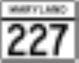
north to MD 227
in Pomonkey. MD 224 is one of the main highways of southwestern Charles County
, connecting several villages, state parks, and preserves along the Potomac River
and Mattawoman Creek
. Much of the route is undeveloped, heavily forested and makes a nice drive, but there few places to stop.
. After crossing Liverpool Point Road to the west of Nanjemoy
, the state highway continues north then northeast to its intersection with MD 344
(Chicamuxen Road) near the hamlet of Chicamuxen.
MD 224 continues northeast as Chicamuxen Road, crossing Reeder Run and passing along the southern edge of Chicamuxen Wildlife Management Area
and an intersection with Stump Neck Road, which leads to the Naval Explosive Ordnance Disposal Technology Division
. The state highway passes through the villages of Rison
, where it passes the entrance to Smallwood State Park
, and Marbury
, where MD 224 intersects Bicknell Road and crosses Marbury Run. The state highway passes through Mattawoman Natural Environmental Area
and intersects the northern end of MD 425
(Mason Springs Road) at Mason Springs before joining MD 225
(Hawthorne Road) in a concurrency to cross Mattawoman Creek. MD 224 continues east on Livingston Road, crossing the Indian Head Rail Trail and passing Maryland Airport
before reaching its northern terminus at MD 227
(Pomfret Road) in Pomonkey. MD 227 continues north on Livingston Road toward Bryans Road
.
. MD 224's function in Prince George's County
was replaced by MD 210
in the 1950s; MD 224's northern terminus was rolled back to its present location at that time. MD 224 was extended south to Riverside along what was originally MD 563. MD 344 was then assigned to the portion of Chicamuxen Road south of Riverside Road.
.
State highway
State highway, state road or state route can refer to one of three related concepts, two of them related to a state or provincial government in a country that is divided into states or provinces :#A...
in the U.S. state
U.S. state
A U.S. state is any one of the 50 federated states of the United States of America that share sovereignty with the federal government. Because of this shared sovereignty, an American is a citizen both of the federal entity and of his or her state of domicile. Four states use the official title of...
of Maryland
Maryland
Maryland is a U.S. state located in the Mid Atlantic region of the United States, bordering Virginia, West Virginia, and the District of Columbia to its south and west; Pennsylvania to its north; and Delaware to its east...
. The state highway runs 26.7 mi (43 km) from MD 6
Maryland Route 6
Maryland Route 6 is a state highway in the U.S. state of Maryland. The state highway runs from a dead end at the Potomac River in Riverside east to MD 235 in Oraville. MD 6 connects several small communities in southern Charles County and northern St. Mary's County with U.S. Route 301 in La...
in Riverside
Riverside, Charles County, Maryland
Riverside is an unincorporated community in Charles County, Maryland around the intersection of Maryland Route 6 and MD 224 beside the Potomac River. It is considered part of the greater Nanjemoy community. Although quite isolated today, for many generations Riverside was the site of a general...
north to MD 227
Maryland Route 227
Maryland Route 227 is a state highway in the U.S. state of Maryland. The state highway runs from Marshall Hall east to U.S. Route 301 in White Plains. MD 227 connects the communities of Bryans Road, Pomonkey, and Pomfret in northwestern Charles County...
in Pomonkey. MD 224 is one of the main highways of southwestern Charles County
Charles County, Maryland
Charles County is a county in the south central portion of the U.S. state of Maryland.As of 2010, the population was 146,551. Its county seat is La Plata. This county was named for Charles Calvert , third Baron Baltimore....
, connecting several villages, state parks, and preserves along the Potomac River
Potomac River
The Potomac River flows into the Chesapeake Bay, located along the mid-Atlantic coast of the United States. The river is approximately long, with a drainage area of about 14,700 square miles...
and Mattawoman Creek
Mattawoman Creek
Mattawoman Creek is a coastal-plain tributary to the tidal Potomac River with a mouth at Indian Head, Maryland, downstream of Washington, D.C. It comprises a river flowing through Prince George's and Charles counties and a tidal-freshwater estuary in Charles County...
. Much of the route is undeveloped, heavily forested and makes a nice drive, but there few places to stop.
Route description
MD 224 begins at an intersection with MD 6 (Port Tobacco Road) just north of the latter highway's western terminus in Riverside. MD 224 heads west as two-lane Riverside Road through densely-forested southwestern Charles County, paralleling the left bank of the Potomac River about a mile (1.6 km) inland. The state highway passes the entrance to Camp Merrick and the former Maryland Point Observatory in Maryland Point. MD 224 crosses Thorne Gut and curves northwest and then north through Purse State ParkPurse State Park
Purse State Park is a state park in Charles County, Maryland, United States. It is located on the freshwater-tidal Potomac River along Wades Bay. The undeveloped park features hunting, fishing, hiking, bird watching, and fossil hunting....
. After crossing Liverpool Point Road to the west of Nanjemoy
Nanjemoy, Maryland
Nanjemoy is a settlement along Maryland Route 6 in southwestern Charles County, Maryland, United States, and the surrounding large rural area more or less bounded by Nanjemoy Creek to the east and north, and the Potomac River to the south and west. It and the creek draw their names from a Native...
, the state highway continues north then northeast to its intersection with MD 344
Maryland Route 344
Maryland Route 344 is a state highway in the U.S. state of Maryland. Known as Chicamuxen Road, the state highway runs from MD 6 in Doncaster north to MD 224 near Chicamuxen. A connector between MD 6 and MD 224 in western Charles County, MD 344 was originally the southernmost part of MD 224...
(Chicamuxen Road) near the hamlet of Chicamuxen.
MD 224 continues northeast as Chicamuxen Road, crossing Reeder Run and passing along the southern edge of Chicamuxen Wildlife Management Area
Chicamuxen Wildlife Management Area
Chicamuxen Wildlife Management Area is a state Wildlife Management Area along Chickamuxen Creek near the Potomac River in Charles County, Maryland.-External links:*...
and an intersection with Stump Neck Road, which leads to the Naval Explosive Ordnance Disposal Technology Division
Naval EOD Technology Division
Naval Explosive Ordnance Disposal Technology Division is a field activity of the United States Naval Sea Systems Command . It is located 30 miles South of Washington, D.C. in Charles County, Maryland. NAVEODTECHDIV is a unique support activity administered by the U.S...
. The state highway passes through the villages of Rison
Rison, Maryland
Rison is an unincorporated community in Charles County, Maryland, United States. The Rison post office was established in 1905, but the area's residents are now part of the 20640 zip code area for nearby Indian Head, Maryland. Its elevation is 50 feet and it had a population of 50 in 1941...
, where it passes the entrance to Smallwood State Park
Smallwood State Park
Smallwood State Park is a state park near Marbury, Maryland. It is located at Sweden Point on the Mattawoman Creek. It includes a restored plantation home, Smallwood's Retreat, home of General William Smallwood. The park features a marina, boat launching ramps, a picnic area, camping area,...
, and Marbury
Marbury, Maryland
Marbury is an unincorporated community in Charles County, Maryland. It has been designated the zip code of 20658.It is 6.3 miles from Indian Head on Maryland Route 224....
, where MD 224 intersects Bicknell Road and crosses Marbury Run. The state highway passes through Mattawoman Natural Environmental Area
Natural Environment Area (Maryland)
A Natural Environment Area is a unit of the Maryland State Park Service of the Maryland Department of Natural Resources. These public lands are generally or more in extent and are judged to constitute a “significant natural attraction or unique geological feature”...
and intersects the northern end of MD 425
Maryland Route 425
Maryland Route 425 is a state highway in the U.S. state of Maryland. The state highway runs from MD 6 near Nanjemoy north to MD 224 in Mason Springs. MD 425 connects Nanjemoy and Ironsides with Pisgah and Mason Springs in western Charles County...
(Mason Springs Road) at Mason Springs before joining MD 225
Maryland Route 225
Maryland Route 225 is a state highway in the U.S. state of Maryland. Known as Hawthorne Road, the state highway runs from MD 210 in Potomac Heights east to U.S. Route 301 in La Plata. MD 225 connects La Plata, the county seat of Charles County, with Indian Head in the northwestern part of the...
(Hawthorne Road) in a concurrency to cross Mattawoman Creek. MD 224 continues east on Livingston Road, crossing the Indian Head Rail Trail and passing Maryland Airport
Maryland Airport
Maryland Airport is a privately-owned, public-use airport located four miles east of the central business district of Indian Head, in Charles County, Maryland, United States.- Facilities and aircraft :...
before reaching its northern terminus at MD 227
Maryland Route 227
Maryland Route 227 is a state highway in the U.S. state of Maryland. The state highway runs from Marshall Hall east to U.S. Route 301 in White Plains. MD 227 connects the communities of Bryans Road, Pomonkey, and Pomfret in northwestern Charles County...
(Pomfret Road) in Pomonkey. MD 227 continues north on Livingston Road toward Bryans Road
Bryans Road, Maryland
Bryans Road is a census-designated place in Charles County, Maryland, United States. Bryans Road was named after Oliver Norris Bryan, a 19th century farmer and scientist who owned and operated Locust Grove Farm near Marshall Hall, Maryland. The area consisted mostly of tobacco farms until the...
.
History
MD 224 was originally the designation assigned to Chicamuxen Road from Doncaster to Mason Springs and Livingston Road from Mason Springs all the way to the District of Columbia boundary in Forest HeightsForest Heights, Maryland
Forest Heights, officially the Town of Forest Heights is a town in Prince George's County, Maryland, United States, with an African-American majority population, and part of the larger postal designation Oxon Hill, MD. Students attend Oxon Hill High School. The town straddles both sides of...
. MD 224's function in Prince George's County
Prince George's County, Maryland
Prince George's County is a county located in the U.S. state of Maryland, immediately north, east, and south of Washington, DC. As of 2010, it has a population of 863,420 and is the wealthiest African-American majority county in the nation....
was replaced by MD 210
Maryland Route 210
Maryland Route 210 , or Indian Head Highway, is a state highway in Prince George's and Charles counties in Maryland. At its northern end, MD 210 starts from the end of South Capitol Street in Washington, D.C., connecting the U.S. Capitol with Indian Head, Maryland...
in the 1950s; MD 224's northern terminus was rolled back to its present location at that time. MD 224 was extended south to Riverside along what was originally MD 563. MD 344 was then assigned to the portion of Chicamuxen Road south of Riverside Road.
Junction list
The entire route is in Charles CountyCharles County, Maryland
Charles County is a county in the south central portion of the U.S. state of Maryland.As of 2010, the population was 146,551. Its county seat is La Plata. This county was named for Charles Calvert , third Baron Baltimore....
.
| Location | Mile |
Destinations | Notes |
|---|---|---|---|
| Riverside Riverside, Charles County, Maryland Riverside is an unincorporated community in Charles County, Maryland around the intersection of Maryland Route 6 and MD 224 beside the Potomac River. It is considered part of the greater Nanjemoy community. Although quite isolated today, for many generations Riverside was the site of a general... |
0.00 | Southern terminus | |
| Nanjemoy Nanjemoy, Maryland Nanjemoy is a settlement along Maryland Route 6 in southwestern Charles County, Maryland, United States, and the surrounding large rural area more or less bounded by Nanjemoy Creek to the east and north, and the Potomac River to the south and west. It and the creek draw their names from a Native... |
10.10 | Liverpool Point Road | Former MD 426 |
| Chicamuxen | 14.82 | MD 224 turns north onto Chicamuxen Road; MD 344 is old alignment of MD 224 | |
| Marbury Marbury, Maryland Marbury is an unincorporated community in Charles County, Maryland. It has been designated the zip code of 20658.It is 6.3 miles from Indian Head on Maryland Route 224.... |
21.14 | Bicknell Road – Pisgah Pisgah, Maryland Pisgah is an unincorporated community in Charles County, Maryland, United States.... |
Bicknell Road south is former MD 484 |
| Mason Springs | 23.22 | ||
| 23.36 | South end of concurrency with MD 225 | ||
| 23.76 | North end of concurrency with MD 225 | ||
| Pomonkey | 26.70 | Northern terminus |