
Machiasport, Maine
Encyclopedia
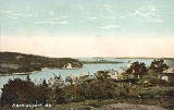
Machiasport is a town in Washington County
, Maine
, United States
. The population was 1,160 at the 2000 census. Machiasport is a historic seaport and tourist destination.
established a trading post
here to conduct business with the Native American
s. But this was part of Acadia
, territory which New France
considered its own. So in 1634, the trading post was sacked by French
forces from Port Royal
under the command of Charles de Saint-Étienne de la Tour
.
In 1770, the area was granted by the Massachusetts General Court
to 80 petitioners, 54 from Scarborough. It was first part of Machias, incorporated in 1784, then set off and incorporated as Machiasport in 1826.
In 1775, following the capture
of the British
ship
HMS Margaretta by locals under leadership of Jeremiah O'Brien
, the residents built a small breastworks here to guard the mouth of the Machias River
and the area settlements. Later that year, the British sent four ships under the command of Sir George Collier
that defeated the local militia
, destroyed the breastworks, and burned several buildings. In 1777, the fort was rebuilt as a crescent shaped four-gun battery
. In 1781 it was made part of the national defense and named Fort O'Brien. In 1808-1809, Lemuel Trescott of Eastport
oversaw the construction of a blockhouse
, barracks
and battery. During the War of 1812
, in September 1814 the British captured the fort and burnt the barracks.
In 1863, during the American Civil War
, Fort Machias was built adjacent to the ruins of Fort O'Brien. It was a five-gun earthworks fort with Napoleon 12-pound cannon
. It was actively manned from 1863 to 1865. In 1923, the U.S. government transferred the sites of both forts to the state of Maine. As of 2006, they are managed as a historic site by the Maine Bureau of Parks and Lands. In 1969, they were added to the National Register of Historic Places
, as structure #69000024.
, the town has a total area of 62.3 square miles (161.4 km²), of which, 21.3 square miles (55.2 km²) of it is land and 40.9 square miles (105.9 km²) of it (65.71%) is water. Drained by the Machias River
, the town is located at the head of Machias Bay
on the Gulf of Maine
, part of the Atlantic Ocean
.
The town is crossed by state routes 92 and 191. It borders the towns of East Machias
to the north, Whiting
to the northeast, Machias to the west, and (separated by water) is near Cutler
to the east, and Roque Bluffs
to the southwest.
of 2000, there were 1,160 people, 413 households, and 289 families residing in the town. The population density
was 54.3 people per square mile (21.0/km²). There were 576 housing units at an average density of 27.0 per square mile (10.4/km²). The racial makeup of the town was 97.50% White, 0.09% African American, 0.78% Native American, 0.26% Asian, and 1.38% from two or more races. Hispanic or Latino of any race were 0.26% of the population.
There were 413 households out of which 29.1% had children under the age of 18 living with them, 58.4% were married couples
living together, 7.3% had a female householder with no husband present, and 30.0% were non-families. 22.5% of all households were made up of individuals and 8.7% had someone living alone who was 65 years of age or older. The average household size was 2.46 and the average family size was 2.88.
In the town the population was spread out with 20.9% under the age of 18, 8.3% from 18 to 24, 32.1% from 25 to 44, 24.8% from 45 to 64, and 14.0% who were 65 years of age or older. The median age was 38 years. For every 100 females there were 125.7 males. For every 100 females age 18 and over, there were 134.2 males.
The median income for a household in the town was $29,531, and the median income for a family was $32,279. Males had a median income of $29,643 versus $20,500 for females. The per capita income
for the town was $13,727. About 11.8% of families and 12.2% of the population were below the poverty line, including 12.9% of those under age 18 and 15.3% of those age 65 or over.
Washington County, Maine
Washington County is a county located in the U.S. state of Maine. In 2010, its population was 32,856. Its county seat is Machias.Sometimes referred to as "Sunrise County" because it is the easternmost county in the United States, and it is often where the rising sun first shines on the 48...
, Maine
Maine
Maine is a state in the New England region of the northeastern United States, bordered by the Atlantic Ocean to the east and south, New Hampshire to the west, and the Canadian provinces of Quebec to the northwest and New Brunswick to the northeast. Maine is both the northernmost and easternmost...
, United States
United States
The United States of America is a federal constitutional republic comprising fifty states and a federal district...
. The population was 1,160 at the 2000 census. Machiasport is a historic seaport and tourist destination.
History
In 1633, the Plymouth CompanyPlymouth Company
The Plymouth Company was an English joint stock company founded in 1606 by James I of England with the purpose of establishing settlements on the coast of North America.The Plymouth Company was one of two companies, along with the London Company, chartered with such...
established a trading post
Trading post
A trading post was a place or establishment in historic Northern America where the trading of goods took place. The preferred travel route to a trading post or between trading posts, was known as a trade route....
here to conduct business with the Native American
Indigenous peoples of the Americas
The indigenous peoples of the Americas are the pre-Columbian inhabitants of North and South America, their descendants and other ethnic groups who are identified with those peoples. Indigenous peoples are known in Canada as Aboriginal peoples, and in the United States as Native Americans...
s. But this was part of Acadia
Acadia
Acadia was the name given to lands in a portion of the French colonial empire of New France, in northeastern North America that included parts of eastern Quebec, the Maritime provinces, and modern-day Maine. At the end of the 16th century, France claimed territory stretching as far south as...
, territory which New France
New France
New France was the area colonized by France in North America during a period beginning with the exploration of the Saint Lawrence River by Jacques Cartier in 1534 and ending with the cession of New France to Spain and Great Britain in 1763...
considered its own. So in 1634, the trading post was sacked by French
French people
The French are a nation that share a common French culture and speak the French language as a mother tongue. Historically, the French population are descended from peoples of Celtic, Latin and Germanic origin, and are today a mixture of several ethnic groups...
forces from Port Royal
Port Royal, Nova Scotia
Port Royal was the capital of Acadia from 1605 to 1710 and is now a town called Annapolis Royal in the western part of the Canadian province of Nova Scotia. Initially Port Royal was located on the north shore of the Annapolis Basin, Nova Scotia, at the site of the present reconstruction of the...
under the command of Charles de Saint-Étienne de la Tour
Charles de Saint-Étienne de la Tour
Charles de Saint-Étienne de la Tour, the French King's appointed Governor of Acadia from 1631–1642 and again from 1653–1657, was born in France in 1593 and died at Cap de Sable in 1666...
.
In 1770, the area was granted by the Massachusetts General Court
Massachusetts General Court
The Massachusetts General Court is the state legislature of the Commonwealth of Massachusetts. The name "General Court" is a hold-over from the Colonial Era, when this body also sat in judgment of judicial appeals cases...
to 80 petitioners, 54 from Scarborough. It was first part of Machias, incorporated in 1784, then set off and incorporated as Machiasport in 1826.
In 1775, following the capture
Battle of Machias
The Battle of Machias was the first naval engagement of the American Revolutionary War...
of the British
British people
The British are citizens of the United Kingdom, of the Isle of Man, any of the Channel Islands, or of any of the British overseas territories, and their descendants...
ship
Ship
Since the end of the age of sail a ship has been any large buoyant marine vessel. Ships are generally distinguished from boats based on size and cargo or passenger capacity. Ships are used on lakes, seas, and rivers for a variety of activities, such as the transport of people or goods, fishing,...
HMS Margaretta by locals under leadership of Jeremiah O'Brien
Jeremiah O'Brien
Captain Jeremiah O’Brien was a captain in the Massachusetts State Navy. Prior to its existence Captain Jeremiah O’Brien (1744–1818) was a captain in the Massachusetts State Navy. Prior to its existence Captain Jeremiah O’Brien (1744–1818) was a captain in the Massachusetts State...
, the residents built a small breastworks here to guard the mouth of the Machias River
Machias River
The Machias River is a river in Maine, USA. It flows through Washington County in the eastern part of the state, from Third Machias Lake , passing the town of Machias and emptying into Machias Bay.-History:...
and the area settlements. Later that year, the British sent four ships under the command of Sir George Collier
George Collier
Sir George Collier was an officer of the Royal Navy who saw service during the Seven Years War, the American War of Independence and the French Revolutionary Wars. As commander of the frigate HMS Rainbow, he was one of the most successful British naval commanders during the opening stages of war...
that defeated the local militia
Militia
The term militia is commonly used today to refer to a military force composed of ordinary citizens to provide defense, emergency law enforcement, or paramilitary service, in times of emergency without being paid a regular salary or committed to a fixed term of service. It is a polyseme with...
, destroyed the breastworks, and burned several buildings. In 1777, the fort was rebuilt as a crescent shaped four-gun battery
Artillery battery
In military organizations, an artillery battery is a unit of guns, mortars, rockets or missiles so grouped in order to facilitate better battlefield communication and command and control, as well as to provide dispersion for its constituent gunnery crews and their systems...
. In 1781 it was made part of the national defense and named Fort O'Brien. In 1808-1809, Lemuel Trescott of Eastport
Eastport, Maine
Eastport is a small city in Washington County, Maine, United States. The population was 1,640 at the 2000 census. The principal island is Moose Island, which is connected to the mainland by causeway...
oversaw the construction of a blockhouse
Blockhouse
In military science, a blockhouse is a small, isolated fort in the form of a single building. It serves as a defensive strong point against any enemy that does not possess siege equipment or, in modern times, artillery...
, barracks
Barracks
Barracks are specialised buildings for permanent military accommodation; the word may apply to separate housing blocks or to complete complexes. Their main object is to separate soldiers from the civilian population and reinforce discipline, training and esprit de corps. They were sometimes called...
and battery. During the War of 1812
War of 1812
The War of 1812 was a military conflict fought between the forces of the United States of America and those of the British Empire. The Americans declared war in 1812 for several reasons, including trade restrictions because of Britain's ongoing war with France, impressment of American merchant...
, in September 1814 the British captured the fort and burnt the barracks.
In 1863, during the American Civil War
American Civil War
The American Civil War was a civil war fought in the United States of America. In response to the election of Abraham Lincoln as President of the United States, 11 southern slave states declared their secession from the United States and formed the Confederate States of America ; the other 25...
, Fort Machias was built adjacent to the ruins of Fort O'Brien. It was a five-gun earthworks fort with Napoleon 12-pound cannon
Cannon
A cannon is any piece of artillery that uses gunpowder or other usually explosive-based propellents to launch a projectile. Cannon vary in caliber, range, mobility, rate of fire, angle of fire, and firepower; different forms of cannon combine and balance these attributes in varying degrees,...
. It was actively manned from 1863 to 1865. In 1923, the U.S. government transferred the sites of both forts to the state of Maine. As of 2006, they are managed as a historic site by the Maine Bureau of Parks and Lands. In 1969, they were added to the National Register of Historic Places
National Register of Historic Places
The National Register of Historic Places is the United States government's official list of districts, sites, buildings, structures, and objects deemed worthy of preservation...
, as structure #69000024.
Geography
According to the United States Census BureauUnited States Census Bureau
The United States Census Bureau is the government agency that is responsible for the United States Census. It also gathers other national demographic and economic data...
, the town has a total area of 62.3 square miles (161.4 km²), of which, 21.3 square miles (55.2 km²) of it is land and 40.9 square miles (105.9 km²) of it (65.71%) is water. Drained by the Machias River
Machias River
The Machias River is a river in Maine, USA. It flows through Washington County in the eastern part of the state, from Third Machias Lake , passing the town of Machias and emptying into Machias Bay.-History:...
, the town is located at the head of Machias Bay
Machias Bay
Machias Bay is a bay in Washington County, Maine that opens into the Gulf of Maine.The bay was the scene of the Battle of Machias — the first naval battle of the American Revolution, occasioned by the British need for lumber for Boston....
on the Gulf of Maine
Gulf of Maine
The Gulf of Maine is a large gulf of the Atlantic Ocean on the east coast of North America.It is delineated by Cape Cod at the eastern tip of Massachusetts in the southwest and Cape Sable at the southern tip of Nova Scotia in the northeast. It includes the entire coastlines of the U.S...
, part of the Atlantic Ocean
Atlantic Ocean
The Atlantic Ocean is the second-largest of the world's oceanic divisions. With a total area of about , it covers approximately 20% of the Earth's surface and about 26% of its water surface area...
.
The town is crossed by state routes 92 and 191. It borders the towns of East Machias
East Machias, Maine
East Machias is a town in Washington County, Maine, United States on the East Machias River. As of the 2000 census, the town population was 1,298.-Geography:...
to the north, Whiting
Whiting, Maine
Whiting is a town in Washington County, Maine, United States. The town was named after Timothy Whiting, an early settler. The population was 430 at the 2000 census...
to the northeast, Machias to the west, and (separated by water) is near Cutler
Cutler, Maine
Cutler is a town in Washington County, Maine, United States. The town was named after Joseph Cutler, an early settler. The population was 623 at the 2000 census.-Geography:...
to the east, and Roque Bluffs
Roque Bluffs, Maine
Roque Bluffs is a town in Washington County, Maine, United States. The population was 264 at the 2000 census.-Geography:According to the United States Census Bureau, the town has a total area of 19.5 square miles , of which, 10.6 square miles of it is land and 8.9 square miles of...
to the southwest.
Demographics
As of the censusCensus
A census is the procedure of systematically acquiring and recording information about the members of a given population. It is a regularly occurring and official count of a particular population. The term is used mostly in connection with national population and housing censuses; other common...
of 2000, there were 1,160 people, 413 households, and 289 families residing in the town. The population density
Population density
Population density is a measurement of population per unit area or unit volume. It is frequently applied to living organisms, and particularly to humans...
was 54.3 people per square mile (21.0/km²). There were 576 housing units at an average density of 27.0 per square mile (10.4/km²). The racial makeup of the town was 97.50% White, 0.09% African American, 0.78% Native American, 0.26% Asian, and 1.38% from two or more races. Hispanic or Latino of any race were 0.26% of the population.
There were 413 households out of which 29.1% had children under the age of 18 living with them, 58.4% were married couples
Marriage
Marriage is a social union or legal contract between people that creates kinship. It is an institution in which interpersonal relationships, usually intimate and sexual, are acknowledged in a variety of ways, depending on the culture or subculture in which it is found...
living together, 7.3% had a female householder with no husband present, and 30.0% were non-families. 22.5% of all households were made up of individuals and 8.7% had someone living alone who was 65 years of age or older. The average household size was 2.46 and the average family size was 2.88.
In the town the population was spread out with 20.9% under the age of 18, 8.3% from 18 to 24, 32.1% from 25 to 44, 24.8% from 45 to 64, and 14.0% who were 65 years of age or older. The median age was 38 years. For every 100 females there were 125.7 males. For every 100 females age 18 and over, there were 134.2 males.
The median income for a household in the town was $29,531, and the median income for a family was $32,279. Males had a median income of $29,643 versus $20,500 for females. The per capita income
Per capita income
Per capita income or income per person is a measure of mean income within an economic aggregate, such as a country or city. It is calculated by taking a measure of all sources of income in the aggregate and dividing it by the total population...
for the town was $13,727. About 11.8% of families and 12.2% of the population were below the poverty line, including 12.9% of those under age 18 and 15.3% of those age 65 or over.
Sites of interest
- Fort O'Brien State Historic Site
- Larrabee Heath
- Libby Island Light -- designed by Alexander ParrisAlexander ParrisAlexander Parris was a prominent American architect-engineer. Beginning as a housewright, he evolved into an architect whose work transitioned from Federal style architecture to the later Greek Revival. Parris taught Ammi B. Young, and was among the group of architects influential in founding what...
- Liberty HallLiberty Hall (Machiasport, Maine)Liberty Hall is a historic town hall in Machiasport, Maine.It was built in 1873 and added to the National Register of Historic Places in 1977....
(1873) - Machiasport Historical Society & Museum