
London Buses route 137
Encyclopedia
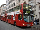
London Buses route 137 is a Transport for London
contracted bus route in London
, United Kingdom
. The service is contracted to Arriva London
.
. The 536 group of routes ran as follows: 536 Highgate (Underground Station)
- West Wickham
; 536A Highgate - Southend Village; 536C Highgate - Elmers End
. These services were later taken over by London Transport.
As from 3 October 1934, the newly constituted London Passenger Transport Board
instituted its own numbering system. Route 536, which by then had developed into a self-contained route was renumbered 137, running as a daily service between Highgate (Archway Station) and Elmers End via Kentish Town
, Camden Town
, Euston
, Oxford Circus
, Marble Arch
, Hyde Park Corner
, Victoria
, Vauxhall
, Camberwell
, Peckham
, New Cross
, Brockley Rise
, Catford
and Beckenham
. The route was further extended on Sundays to West Wickham. This was the fifth time that the route number 137 had been used on a London bus route.
London Transport soon set about reducing duplication of services. The 137 duplicated tram route 19 between Camden Town and Highgate (Archway Station). Therefore it was withdrawn on Monday to Friday evenings as from 30 October 1935. The Sunday extension to West Wickham was also withdrawn as from 12 April 1935. Six months later on 7 October 1936, the 137 was withdrawn between Catford Garage and Elmers End and re-routed to Bromley
(Chatterton Arms). One journey was also extended via Bromley Common, Keston
, Biggin Hill
to Westerham Hill
. At the same time the Monday to Friday evening service to Highgate (Archway Station) was re-instated.
As from 8 September 1937, the 137 became much more of the route that it is today. It was withdrawn between Hyde Park Corner and Bromley /Westerham. This withdrawal of an established service was very unpopular with the travelling public and was only re-instated fouteen years later when a route 36A was introduced on 7 October 1951. Sections of the withdrawn part of the route were covered by a re-routed 21A and a newly introduced 89
. The 137 was re-routed to Clapham Common via Knightsbridge
, Sloane Square
, Chelsea Bridge
, Queens Road now Queenstown Road to Clapham Common
replacing tram route 32 (Chelsea Bridge - Clapham Common) which was withdrawn at the same time. On 4 May 1938, the 137 became a daily Highgate (Archway Station) - Crystal Palace route, when it was further extended to Crystal Palace via Streatham and Upper Norwood.
Following the outbreak of the Second World War on 3 September 1939, most bus services in London were subject to restrictions, many of which were still in operation after hostilities ceased in 1945. The evening service on the 137 was withdrawn between Clapham Common and Crystal Palace from 29 November 1939 until 23 January 1940. As from 28 October 1942, evening service was withdrawn between Knightsbridge and Highgate (Archway Station). 1942 also saw the first use of RT type
vehicles on the route. RTs continued to appear on the route until the late 1970s. Service was totally withdrawn on Saturdays PM and all day Sundays between Oxford Circus & Archway as from 27 October 1943.
By the end of 1946, the wartime restrictions had been relaxed and the route settled down to run daily between Crystal Palace and Oxford Circus, extended Monday to Friday except evenings and Saturdays until 14:00 via Camden Town to Archway Station. This operation became very stable and remained so until 1987. Although small change did occur on 24 January 1970, when the Saturday service was brought into line with the Monday Friday service, operating to Archway Station until 19:00.
In 1951 the Festival of Britain
was celebrated. One of the special services introduced was a service "B" which ran between Sloane Square and the Festival Gardens at Battersea Park. This service ran every summer until the late 1970s, It was re-numbered 137A as from 16 April 1954, being converted to one person operation as from 1973.
In 1987 a period of frequent route changes was ushered in. On 7 February, a small re-routing at Clapham Park
was introduced, the 137 swapped a short section of route with the 118
to serve Brixton Garage, enabling easier crew change-overs. At the same time, the Sunday service was converted to one-person operation. Later that year, on 21 November, the 137 was withdrawn north of Oxford Circus, with this section being given over to a new route 135
.
As from 2 February 1991, as part of a scheme to increase one-person operation, the 137 was withdrawn completely between Crystal Palace and Streatham Hill (Brixton Garage). This section was covered by a new 137A, which was also extended from Streatham Hill to Oxford Circus in the evenings and on Sundays, replacing the 137 at those times. This change was partially reversed on 25 April 1998 when the 137 was re-introduced on Sundays and evenings, becoming a daily service between Streatham Hill and Oxford Circus again. At the same time, the 137A was revised to run daily between Crystal Palace and Clapham Common. As suffixed route numbers had "gone out of fashion", this service was re-numbered 417 as from 18 September 1999.
The Routemaster
buses which had been working on the 137 since 1 November 1964, were eventually replaced by one-person operated vehicles as from 10 July 2004 ending a remarkable forty years of service on the 137.
There were also in London:
Transport for London
Transport for London is the local government body responsible for most aspects of the transport system in Greater London in England. Its role is to implement the transport strategy and to manage transport services across London...
contracted bus route in London
London
London is the capital city of :England and the :United Kingdom, the largest metropolitan area in the United Kingdom, and the largest urban zone in the European Union by most measures. Located on the River Thames, London has been a major settlement for two millennia, its history going back to its...
, United Kingdom
United Kingdom
The United Kingdom of Great Britain and Northern IrelandIn the United Kingdom and Dependencies, other languages have been officially recognised as legitimate autochthonous languages under the European Charter for Regional or Minority Languages...
. The service is contracted to Arriva London
Arriva London
Arriva London is a division of Arriva which operates bus services in London, UK. It is made up of many previous bus operators including previously independent Grey Green...
.
History
Route 137 traces its roots back to a service numbered 536, which was introduced in 1925 by the "Independent operator" "City". It supplemented the long established route 36London Buses route 36
London Buses route 36 is a Transport for London contracted bus route in London, United Kingdom. The service is currently contracted to Go-Ahead London.-The Beginning:...
. The 536 group of routes ran as follows: 536 Highgate (Underground Station)
Archway tube station
Archway tube station is a London Underground station in north London, underneath the Archway Tower, at the intersection of Holloway Road, Highgate Hill and Junction Road in the area known as Archway....
- West Wickham
West Wickham
West Wickham is a place in the London Borough of Bromley, England. It is 10.3 miles south east of Charing Cross. West Wickham history dates back to early settlements existing since 1068, although the name `Wickham` is an indication of an earlier Anglo-Saxon settlement...
; 536A Highgate - Southend Village; 536C Highgate - Elmers End
Elmers End
Elmers End is a place in London Borough of Bromley, England. It has a large green space which is the centre of a gyratory. Very close to the combined railway station and Tramlink terminus bearing its name is the old sewage farm. The remains of this industrial site can still be seen...
. These services were later taken over by London Transport.
As from 3 October 1934, the newly constituted London Passenger Transport Board
London Passenger Transport Board
The London Passenger Transport Board was the organisation responsible for public transport in London, UK, and its environs from 1933 to 1948...
instituted its own numbering system. Route 536, which by then had developed into a self-contained route was renumbered 137, running as a daily service between Highgate (Archway Station) and Elmers End via Kentish Town
Kentish Town
Kentish Town is an area of north west London, England in the London Borough of Camden.-History:The most widely accepted explanation of the name of Kentish Town is that it derived from 'Ken-ditch' meaning the 'bed of a waterway'...
, Camden Town
Camden Town
-Economy:In recent years, entertainment-related businesses and a Holiday Inn have moved into the area. A number of retail and food chain outlets have replaced independent shops driven out by high rents and redevelopment. Restaurants have thrived, with the variety of culinary traditions found in...
, Euston
Euston railway station
Euston railway station, also known as London Euston, is a central London railway terminus in the London Borough of Camden. It is the sixth busiest rail terminal in London . It is one of 18 railway stations managed by Network Rail, and is the southern terminus of the West Coast Main Line...
, Oxford Circus
Oxford Circus
Oxford Circus is the area of London at the busy intersection of Regent Street and Oxford Street, in the West End. It is served by Oxford Circus tube station, which is directly beneath the junction itself.- History :...
, Marble Arch
Marble Arch
Marble Arch is a white Carrara marble monument that now stands on a large traffic island at the junction of Oxford Street, Park Lane, and Edgware Road, almost directly opposite Speakers' Corner in Hyde Park in London, England...
, Hyde Park Corner
Hyde Park Corner
Hyde Park Corner is a place in London, at the south-east corner of Hyde Park. It is a major intersection where Park Lane, Knightsbridge, Piccadilly, Grosvenor Place and Constitution Hill converge...
, Victoria
Victoria, London
Victoria is a commercial and residential area of inner city London, lying wholly within the City of Westminster, and named after Queen Victoria....
, Vauxhall
Vauxhall
-Demography:Many Vauxhall residents live in social housing. There are several gentrified areas, and areas of terraced townhouses on streets such as Fentiman Road and Heyford Avenue have higher property values in the private market, however by far the most common type of housing stock within...
, Camberwell
Camberwell
Camberwell is a district of south London, England, and forms part of the London Borough of Southwark. It is a built-up inner city district located southeast of Charing Cross. To the west it has a boundary with the London Borough of Lambeth.-Toponymy:...
, Peckham
Peckham
Peckham is a district in south London, England, located in the London Borough of Southwark. It is situated south-east of Charing Cross. The area is identified in the London Plan as one of 35 major centres in Greater London...
, New Cross
New Cross
New Cross is a district and ward of the London Borough of Lewisham, England. It is situated 4 miles south-east of Charing Cross. The ward covered by London post town and the SE 14 postcode district. New Cross is near St Johns, Telegraph Hill, Nunhead, Peckham, Brockley, Deptford and Greenwich...
, Brockley Rise
Brockley
Brockley is a district of south London, England, located in the London Borough of Lewisham. It is situated south-east of Charing Cross.It is covered by the London postcode districts SE4 and SE14.-History:...
, Catford
Catford
Catford is a district in south London, England, located in the London Borough of Lewisham. It is situated south-east of Charing Cross. The area is identified in the London Plan as one of 35 major centres in Greater London.-Architecture:...
and Beckenham
Beckenham
Beckenham is a town in the London Borough of Bromley, England. It is located 8.4 miles south east of Charing Cross and 1.75 miles west of Bromley town...
. The route was further extended on Sundays to West Wickham. This was the fifth time that the route number 137 had been used on a London bus route.
London Transport soon set about reducing duplication of services. The 137 duplicated tram route 19 between Camden Town and Highgate (Archway Station). Therefore it was withdrawn on Monday to Friday evenings as from 30 October 1935. The Sunday extension to West Wickham was also withdrawn as from 12 April 1935. Six months later on 7 October 1936, the 137 was withdrawn between Catford Garage and Elmers End and re-routed to Bromley
Bromley
Bromley is a large suburban town in south east London, England and the administrative headquarters of the London Borough of Bromley. It was historically a market town, and prior to 1963 was in the county of Kent and formed the administrative centre of the Municipal Borough of Bromley...
(Chatterton Arms). One journey was also extended via Bromley Common, Keston
Keston
Keston is a part suburban, part rural area of the London Borough of Bromley, England. It lies on the edge of Hayes Common, to the northwest of Greater London's border with Kent.-History:...
, Biggin Hill
Biggin Hill
Biggin Hill is an area and electoral ward in the outskirts of the London Borough of Bromley in southeast London, United Kingdom.-History:Historically the settlement was known as Aperfield and formed part of the parish of Cudham...
to Westerham Hill
Westerham
Westerham is a town and civil parish in the Sevenoaks District of Kent, in South East England with 5,000 people. The parish is south of the North Downs, ten miles west of Sevenoaks. It covers 5800 acres . It is recorded as early as the 9th century, and was mentioned in the Domesday Book in a...
. At the same time the Monday to Friday evening service to Highgate (Archway Station) was re-instated.
As from 8 September 1937, the 137 became much more of the route that it is today. It was withdrawn between Hyde Park Corner and Bromley /Westerham. This withdrawal of an established service was very unpopular with the travelling public and was only re-instated fouteen years later when a route 36A was introduced on 7 October 1951. Sections of the withdrawn part of the route were covered by a re-routed 21A and a newly introduced 89
London Buses route 89
London Buses route 89 is a Transport for London contracted bus route in London, United Kingdom. The service is currently contracted to Go-Ahead London.-History:...
. The 137 was re-routed to Clapham Common via Knightsbridge
Knightsbridge
Knightsbridge is a road which gives its name to an exclusive district lying to the west of central London. The road runs along the south side of Hyde Park, west from Hyde Park Corner, spanning the City of Westminster and the Royal Borough of Kensington and Chelsea...
, Sloane Square
Sloane Square
Sloane Square is a small hard-landscaped square on the boundaries of the fashionable London districts of Knightsbridge, Belgravia and Chelsea, located southwest of Charing Cross, in the Royal Borough of Kensington and Chelsea. The square is part of the Hans Town area designed in 1771 by Henry...
, Chelsea Bridge
Chelsea Bridge
Chelsea Bridge is a bridge over the River Thames in west London, connecting Chelsea on the north bank to Battersea on the south bank. There have been two Chelsea Bridges, on the site of what was an ancient ford....
, Queens Road now Queenstown Road to Clapham Common
Clapham Common
Clapham Common is an 89 hectare triangular area of grassland situated in south London, England. It was historically common land for the parishes of Battersea and Clapham, but was converted to parkland under the terms of the Metropolitan Commons Act 1878.43 hectares of the common are within the...
replacing tram route 32 (Chelsea Bridge - Clapham Common) which was withdrawn at the same time. On 4 May 1938, the 137 became a daily Highgate (Archway Station) - Crystal Palace route, when it was further extended to Crystal Palace via Streatham and Upper Norwood.
Following the outbreak of the Second World War on 3 September 1939, most bus services in London were subject to restrictions, many of which were still in operation after hostilities ceased in 1945. The evening service on the 137 was withdrawn between Clapham Common and Crystal Palace from 29 November 1939 until 23 January 1940. As from 28 October 1942, evening service was withdrawn between Knightsbridge and Highgate (Archway Station). 1942 also saw the first use of RT type
AEC Regent III RT
The AEC Regent III RT was a variant of the AEC Regent III. It was a double-decker bus produced jointly between AEC and London Transport. It was the standard red London bus during the 1950s.-Prototype:...
vehicles on the route. RTs continued to appear on the route until the late 1970s. Service was totally withdrawn on Saturdays PM and all day Sundays between Oxford Circus & Archway as from 27 October 1943.
By the end of 1946, the wartime restrictions had been relaxed and the route settled down to run daily between Crystal Palace and Oxford Circus, extended Monday to Friday except evenings and Saturdays until 14:00 via Camden Town to Archway Station. This operation became very stable and remained so until 1987. Although small change did occur on 24 January 1970, when the Saturday service was brought into line with the Monday Friday service, operating to Archway Station until 19:00.
In 1951 the Festival of Britain
Festival of Britain
The Festival of Britain was a national exhibition in Britain in the summer of 1951. It was organised by the government to give Britons a feeling of recovery in the aftermath of war and to promote good quality design in the rebuilding of British towns and cities. The Festival's centrepiece was in...
was celebrated. One of the special services introduced was a service "B" which ran between Sloane Square and the Festival Gardens at Battersea Park. This service ran every summer until the late 1970s, It was re-numbered 137A as from 16 April 1954, being converted to one person operation as from 1973.
In 1987 a period of frequent route changes was ushered in. On 7 February, a small re-routing at Clapham Park
Clapham Park
Clapham Park is an area in the Borough of Lambeth in London, to the south of central Clapham and west of Brixton.The original Clapham Park estate was a speculative development by Thomas Cubitt, who bought of Bleak Hall Farm in 1825, and marked out plots for building around the new broad,...
was introduced, the 137 swapped a short section of route with the 118
London Buses route 118
London Buses route 118 is a Transport for London contracted bus route in London, England. The service is currently contracted to Go-Ahead London.-History:...
to serve Brixton Garage, enabling easier crew change-overs. At the same time, the Sunday service was converted to one-person operation. Later that year, on 21 November, the 137 was withdrawn north of Oxford Circus, with this section being given over to a new route 135
London Buses route 135
London Buses route 135 is a Transport for London contracted bus route in London, United Kingdom. The service is currently contracted to Arriva London for London Buses.-History:Route 135 began operation on 24 May 2008...
.
As from 2 February 1991, as part of a scheme to increase one-person operation, the 137 was withdrawn completely between Crystal Palace and Streatham Hill (Brixton Garage). This section was covered by a new 137A, which was also extended from Streatham Hill to Oxford Circus in the evenings and on Sundays, replacing the 137 at those times. This change was partially reversed on 25 April 1998 when the 137 was re-introduced on Sundays and evenings, becoming a daily service between Streatham Hill and Oxford Circus again. At the same time, the 137A was revised to run daily between Crystal Palace and Clapham Common. As suffixed route numbers had "gone out of fashion", this service was re-numbered 417 as from 18 September 1999.
The Routemaster
Routemaster
The AEC Routemaster is a model of double-decker bus that was built by Associated Equipment Company in 1954 and produced until 1968. Primarily front-engined, rear open-platform buses, a small number of variants were produced with doors and/or front entrances...
buses which had been working on the 137 since 1 November 1964, were eventually replaced by one-person operated vehicles as from 10 July 2004 ending a remarkable forty years of service on the 137.
Current route
- Marble Arch StationMarble Arch tube stationMarble Arch is a London Underground station in the City of Westminster. The station is between Lancaster Gate and Bond Street stations on the Central line, and is in Travelcard Zone 1.-History:...
- Park LanePark Lane (road)Park Lane is a major road in the City of Westminster, in Central London.-History:Originally a country lane running north-south along what is now the eastern boundary of Hyde Park, it became a fashionable residential address from the eighteenth century onwards, offering both views across Hyde Park...
- Duke of Wellington
- Hyde Park Corner StationHyde Park Corner tube stationHyde Park Corner is a London Underground station near Hyde Park Corner in Hyde Park. It is in Travelcard Zone 1, between Knightsbridge and Green Park on the Piccadilly Line.-History:...
- KnightsbridgeKnightsbridgeKnightsbridge is a road which gives its name to an exclusive district lying to the west of central London. The road runs along the south side of Hyde Park, west from Hyde Park Corner, spanning the City of Westminster and the Royal Borough of Kensington and Chelsea...
- Knightsbridge StationKnightsbridge tube stationKnightsbridge tube station is a London Underground station in Knightsbridge , The Royal Borough of Kensington and Chelsea. It is on the Piccadilly Line between South Kensington and Hyde Park Corner, and is in Travelcard Zone 1.-History:...
- Sloane Street
- Sloane SquareSloane SquareSloane Square is a small hard-landscaped square on the boundaries of the fashionable London districts of Knightsbridge, Belgravia and Chelsea, located southwest of Charing Cross, in the Royal Borough of Kensington and Chelsea. The square is part of the Hans Town area designed in 1771 by Henry...
for Sloane Square StationSloane Square tube stationSloane Square is a London Underground station in Sloane Square, in the Chelsea district of The Royal Borough of Kensington and Chelsea. It is served by the District and Circle Lines and is between South Kensington and Victoria. It is in Travelcard Zone 1.... - Lower Sloane Street
- Chelsea Bridge Road
- Chelsea BridgeChelsea BridgeChelsea Bridge is a bridge over the River Thames in west London, connecting Chelsea on the north bank to Battersea on the south bank. There have been two Chelsea Bridges, on the site of what was an ancient ford....
- Queenstown Road
- Queen's Circus
- Battersea Park StationBattersea Park railway stationBattersea Park is a suburban railway station in the London Borough of Wandsworth, formerly known as York Road. It is situated at the junction of the South London Line and the Brighton Main Line between Victoria and...
- Queenstown Road Station
- Cedars Road
- Clapham CommonClapham CommonClapham Common is an 89 hectare triangular area of grassland situated in south London, England. It was historically common land for the parishes of Battersea and Clapham, but was converted to parkland under the terms of the Metropolitan Commons Act 1878.43 hectares of the common are within the...
North Side - The Pavement
- Clapham Common StationClapham Common tube stationClapham Common tube station is a station on London Underground's Northern Line. It lies between Clapham North and Clapham South stations and is in Travelcard Zone 2.-History:...
- Clapham Park Road
- King's Avenue
- Atkins Road
- Streatham Place
- Streatham Hill
- Streatham Hill Telford Avenue
Previous route 137s in London
The route number 137 had been used four times prior to its current use.- Between April 1925 - November 1925 for a Camberwell GreenCamberwellCamberwell is a district of south London, England, and forms part of the London Borough of Southwark. It is a built-up inner city district located southeast of Charing Cross. To the west it has a boundary with the London Borough of Lambeth.-Toponymy:...
,Epping Town (Cock) EppingEpping is a small market town and civil parish in the Epping Forest district of the County of Essex, England. It is located north-east of Loughton, south of Harlow and north-west of Brentwood....
, via Elephant & Castle, London BridgeLondon BridgeLondon Bridge is a bridge over the River Thames, connecting the City of London and Southwark, in central London. Situated between Cannon Street Railway Bridge and Tower Bridge, it forms the western end of the Pool of London...
, BishopsgateBishopsgateBishopsgate is a road and ward in the northeast part of the City of London, extending north from Gracechurch Street to Norton Folgate. It is named after one of the original seven gates in London Wall...
, ShoreditchShoreditchShoreditch is an area of London within the London Borough of Hackney in England. It is a built-up part of the inner city immediately to the north of the City of London, located east-northeast of Charing Cross.-Etymology:...
, DalstonDalstonDalston is a district of north-east London, England, located in the London Borough of Hackney. It is situated northeast of Charing Cross. The area is identified in the London Plan as one of 35 major centres in Greater London...
, ClaptonLower ClaptonLower Clapton is a district within the London Borough of Hackney.It is immediately adjacent to central Hackney - bounded, roughly, by the western side of Hackney Downs , the Lea Valley , Clifden Road and the Lea Bridge Road...
, Lea Bridge RoadLea Bridge RoadLea Bridge Road is a major through route in North East London, across the Lea Valley from Clapton to Whipps Cross in Leyton. Lea Bridge was once the name of a football stadium for Leyton Orient located along Lea Bridge Road. Lea Bridge Road is an excellent area for residence. The area is welcoming...
, Woodford New Road, Woodford GreenWoodford GreenWoodford Green, formerly in the county of Essex, is part of the North East London suburb of Woodford, on the edge of Epping Forest, mostly within the London Borough of Redbridge with a small part on the western side of the green within the London Borough of Waltham Forest .-History:Woodford Green...
and Epping New Road; Sunday Route 137 - Between July 1926 - 1927 for a Burnham Beeches (Wingrove's Tea Rooms)Burnham BeechesBurnham Beeches is an area of 220 hectares of ancient woodland, located close to Farnham Common, Burnham and Beaconsfield, in Buckinghamshire. It is approximately 25 miles to the west of London, England.-Preservation:...
,Ealing Broadway Station, via Farnham Common Farnham CommonFarnham Common is a village in the parish of Farnham Royal, in Buckinghamshire, England, about 3 miles north of the town of Slough, on the A355 road between Slough and Beaconsfield. It is to the north of the village of Farnham Royal, and adjoins the woodland of Burnham Beeches.Lois Allan invented...
, SloughSloughSlough is a borough and unitary authority within the ceremonial county of Royal Berkshire, England. The town straddles the A4 Bath Road and the Great Western Main Line, west of central London...
, ColnbrookColnbrookColnbrook is a large village in the unitary authority of Slough, in Berkshire, England. It is situated southeast of central Slough, east of Windsor and west of central London....
, Bath Road, Great West Road, South Ealing Road, High Street Ealing and Ealing Broadway; Saturday P.M. & Sunday Route 137 - Between 1929 - 1930 for a Golders GreenGolders Green tube stationGolders Green tube station is a London Underground station in Golders Green, north London. The station is on the Edgware branch of the Northern Line between Hampstead and Brent Cross...
,Welwyn WelwynWelwyn is a village and civil parish in Hertfordshire, England. The parish also includes the villages of Digswell and Oaklands. It is sometimes called Old Welwyn to distinguish it from the newer settlement of Welwyn Garden City, about a mile to the south.-History:Situated in the valley of the...
, via HendonHendonHendon is a London suburb situated northwest of Charing Cross.-History:Hendon was historically a civil parish in the county of Middlesex. The manor is described in Domesday , but the name, 'Hendun' meaning 'at the highest hill', is earlier...
; Mill HillMill HillMill Hill is a place in the London Borough of Barnet. It is a suburb situated 9 miles north west of Charing Cross. Mill Hill was in the historic county of Middlesex until it was absorbed by London...
, StanboroughStanboroughStanborough is the site of an Iron Age hill fort near the village of Halwell, south of Totnes, Devon, England. The fort is situated on a promontory on the western edge of a hill at about above sea level....
and LemsfordLemsfordLemsford is a village and parish in Hertfordshire. It is near Welwyn Garden City and was created out of Hatfield parish in 1858.It is nearly 3 miles N. from Hatfield, on the S.E. side of Brocket Hall Park. It is widely known for its large mill on the River Lea, which is now the headquarters of...
Summer Only Route 137 - Between 1932 - 2 October 1934 for a ChertseyChertseyChertsey is a town in Surrey, England, on the River Thames and its tributary rivers such as the River Bourne. It can be accessed by road from junction 11 of the M25 London orbital motorway. It shares borders with Staines, Laleham, Shepperton, Addlestone, Woking, Thorpe and Egham...
,Hounslow Garage HounslowHounslow is the principal town in the London Borough of Hounslow. It is a suburban development situated 10.6 miles west south-west of Charing Cross. It forms a post town in the TW postcode area.-Etymology:...
, via SheppertonSheppertonShepperton is a town in the borough of Spelthorne, Surrey, England. To the south it is bounded by the river Thames at Desborough Island and is bisected by the M3 motorway...
; SunburySunburyPlaces called Sunbury include:Australia*Sunbury, Victoria**Sunbury Downs College**Sunbury Pop Festival Canada*Sunbury County, New Brunswick...
, FelthamFelthamFeltham is a town in the London Borough of Hounslow, west London. It is located about west south west of central London at Charing Cross and from Heathrow Airport Central...
and Hounslow HeathHounslow HeathHounslow Heath is a public open space and local nature reserve to the west of Hounslow, a London borough. It now covers about , the residue of the historic Hounslow Heath that covered over .-History:...
; Route 137London Buses route 237London Buses route 237 is a Transport for London contracted bus route in London, United Kingdom. This route is currently contracted to Metroline.-History:...
There were also in London:
- Between April 1925 - November 1925 for a Camberwell GreenCamberwellCamberwell is a district of south London, England, and forms part of the London Borough of Southwark. It is a built-up inner city district located southeast of Charing Cross. To the west it has a boundary with the London Borough of Lambeth.-Toponymy:...
,Epping Forest (Warren Wood House) Epping ForestEpping Forest is an area of ancient woodland in south-east England, straddling the border between north-east Greater London and Essex. It is a former royal forest, and is managed by the City of London Corporation....
, via Elephant & Castle, London BridgeLondon BridgeLondon Bridge is a bridge over the River Thames, connecting the City of London and Southwark, in central London. Situated between Cannon Street Railway Bridge and Tower Bridge, it forms the western end of the Pool of London...
, BishopsgateBishopsgateBishopsgate is a road and ward in the northeast part of the City of London, extending north from Gracechurch Street to Norton Folgate. It is named after one of the original seven gates in London Wall...
, ShoreditchShoreditchShoreditch is an area of London within the London Borough of Hackney in England. It is a built-up part of the inner city immediately to the north of the City of London, located east-northeast of Charing Cross.-Etymology:...
, DalstonDalstonDalston is a district of north-east London, England, located in the London Borough of Hackney. It is situated northeast of Charing Cross. The area is identified in the London Plan as one of 35 major centres in Greater London...
, ClaptonLower ClaptonLower Clapton is a district within the London Borough of Hackney.It is immediately adjacent to central Hackney - bounded, roughly, by the western side of Hackney Downs , the Lea Valley , Clifden Road and the Lea Bridge Road...
, Lea Bridge RoadLea Bridge RoadLea Bridge Road is a major through route in North East London, across the Lea Valley from Clapton to Whipps Cross in Leyton. Lea Bridge was once the name of a football stadium for Leyton Orient located along Lea Bridge Road. Lea Bridge Road is an excellent area for residence. The area is welcoming...
, Woodford New Road, Woodford GreenWoodford GreenWoodford Green, formerly in the county of Essex, is part of the North East London suburb of Woodford, on the edge of Epping Forest, mostly within the London Borough of Redbridge with a small part on the western side of the green within the London Borough of Waltham Forest .-History:Woodford Green...
and Epping New Road; Sunday Route 137A