
Biggin Hill
Encyclopedia
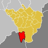
Biggin Hill is an area and electoral ward
in the outskirts of the London Borough of Bromley
in southeast London
, United Kingdom.
and formed part of the parish of Cudham
. It took the name Biggin Hill after the Second World War in recognition of the historic role played by the adjoining Biggin Hill Aerodrome.
Biggin Hill was an ancient parish county of Kent
, in the Diocese of Rochester
, and under the Local Government Act 1894
formed part of Bromley Urban District.
The urban district gained further status in 1935 as a municipal borough
. Kent County Council formed the second tier of local government during that time. In 1965, London County Council was abolished and replaced by Greater London Council
, with an expanded administrative area that took in the metropolitan parts of the Home Counties
.
Now part of the London Borough of Bromley
.
The most architecturally noteworthy building within Biggin Hill is St Mark's Church, Church Road - 'the moving church'. - designed by Richard Gilbert Scott
. It was erected in the 1950s using the dismantled materials from All Saints Church, North Peckham. Much of the work was undertaken by volunteers led by Rev Vivian Symons who undertook much of the decorative work himself.
, which uses much of the land formerly used by RAF
Biggin Hill Aerodrome. The latter hosted the "Operations Room" for the Operation Crossbow
V-1 flying bomb
defence during World War II
.
The old "west camp" of the airport is now owned by Bernie Ecclestone
. Most of the buildings in the West Camp are Grade II listed. A small section remains in the care of the RAF, and the Grade II listed chapel (guarded by replicas of the base gate guardians, a Hawker Hurricane
and a Supermarine Spitfire
) is open to the public.
The old "south camp" is now occupied by the Biggin Hill Business Park, Airport Industrial Estate and various private flying clubs. There are further commercial premises, hangars, private flying clubs and a helicopter joy-ride and pilot training centre to the east of the main runway.
The term "airport", rather than airfield, is used to describe the present-day facility because it has a terminal building and customs facilities. It is host to a wide range of private/business jet and turbo-prop aircraft up to the size of a Boeing 737
. The main airport apron has recently been enlarged; the one remaining hangar on the old south camp has been totally re-clad and a planning application has been posted for further hangars on the eastern side.
A model aircraft site operates within its Air Traffic Zone, operating large model aircraft. In 2009 there were sightings of model aircraft traffic and one air proximity report was filed, according to the Airport Consultative Committee in May 2010.
Biggin Hill is the location of a VOR
navigational beacon, codenamed "BIG", which anchors the South East Arrival Stack for London Heathrow Airport
.
The airport was the venue of the Biggin Hill International Air Fair
, an annual airshow that usually took place towards the end of June. The event was first held in 1963 and the airshow was permanently cancelled in 2010, shortly after the 48th event.
 Charles Darwin School
is the only secondary school in the immediate area.
There are two main primary schools; Oaklands Primary School and Biggin Hill Primary School. On the outskirts of Biggin Hill, there is also Cudham CoE Primary School which is situated near Foal Farm, Tatsfield Primary and Downe Primary in the Downe
village.
and its post town is WESTERHAM. Although Westerham
itself is located outside Greater London
.
, along with another bus not operated by Transport for London
:
terminus of Tramlink Route 3, is 3.5 miles (5.6 km) away, and linked by bus 464. Recently, Croydon Tramlink has been talking about an extension of Route 3 to Biggin Hill but there are no definite plans.
Wards of the United Kingdom
A ward in the United Kingdom is an electoral district at sub-national level represented by one or more councillors. It is the primary unit of British administrative and electoral geography .-England:...
in the outskirts of the London Borough of Bromley
London Borough of Bromley
The London Borough of Bromley is a London borough of south east London, England and forms part of Outer London. The principal town in the borough is Bromley.-Geography:...
in southeast London
London
London is the capital city of :England and the :United Kingdom, the largest metropolitan area in the United Kingdom, and the largest urban zone in the European Union by most measures. Located on the River Thames, London has been a major settlement for two millennia, its history going back to its...
, United Kingdom.
History
Historically the settlement was known as AperfieldAperfield
Aperfield is a locality in the London Borough of Bromley in London, UK.It is located near Biggin Hill and Berry's Green and forms part of the Westerham post town and the TN16 postcode area. The name has its first recorded use in 1242 as Apeldrefeld and means field where apple trees grow....
and formed part of the parish of Cudham
Cudham
Cudham is a village in the London Borough of Bromley in London, UK. It is located south-southeast of Charing Cross and about northwest of Sevenoaks....
. It took the name Biggin Hill after the Second World War in recognition of the historic role played by the adjoining Biggin Hill Aerodrome.
Biggin Hill was an ancient parish county of Kent
Kent
Kent is a county in southeast England, and is one of the home counties. It borders East Sussex, Surrey and Greater London and has a defined boundary with Essex in the middle of the Thames Estuary. The ceremonial county boundaries of Kent include the shire county of Kent and the unitary borough of...
, in the Diocese of Rochester
Diocese of Rochester
The Diocese of Rochester is a Church of England diocese in South-East England and forms part of the Province of Canterbury. It is an ancient diocese, having been established in 604; only the neighbouring Diocese of Canterbury is older in the Church of England....
, and under the Local Government Act 1894
Local Government Act 1894
The Local Government Act 1894 was an Act of the Parliament of the United Kingdom that reformed local government in England and Wales outside the County of London. The Act followed the reforms carried out at county level under the Local Government Act 1888...
formed part of Bromley Urban District.
The urban district gained further status in 1935 as a municipal borough
Municipal borough
Municipal boroughs were a type of local government district which existed in England and Wales between 1835 and 1974, in Northern Ireland from 1840 to 1973 and in the Republic of Ireland from 1840 to 2002...
. Kent County Council formed the second tier of local government during that time. In 1965, London County Council was abolished and replaced by Greater London Council
Greater London Council
The Greater London Council was the top-tier local government administrative body for Greater London from 1965 to 1986. It replaced the earlier London County Council which had covered a much smaller area...
, with an expanded administrative area that took in the metropolitan parts of the Home Counties
Home Counties
The home counties is a term which refers to the counties of South East England and the East of England which border London, but do not include the capital city itself...
.
Now part of the London Borough of Bromley
Bromley
Bromley is a large suburban town in south east London, England and the administrative headquarters of the London Borough of Bromley. It was historically a market town, and prior to 1963 was in the county of Kent and formed the administrative centre of the Municipal Borough of Bromley...
.
The most architecturally noteworthy building within Biggin Hill is St Mark's Church, Church Road - 'the moving church'. - designed by Richard Gilbert Scott
Richard Gilbert Scott
Richard Gilbert Scott is a British architect, the son of Giles Gilbert Scott and great-grandson of the great Gothic Revival architect George Gilbert Scott...
. It was erected in the 1950s using the dismantled materials from All Saints Church, North Peckham. Much of the work was undertaken by volunteers led by Rev Vivian Symons who undertook much of the decorative work himself.
Airport
Biggin Hill also has an airport, London Biggin Hill AirportLondon Biggin Hill Airport
London Biggin Hill Airport is an airport at Biggin Hill in the London Borough of Bromley, located south southeast of Central London, United Kingdom...
, which uses much of the land formerly used by RAF
Royal Air Force
The Royal Air Force is the aerial warfare service branch of the British Armed Forces. Formed on 1 April 1918, it is the oldest independent air force in the world...
Biggin Hill Aerodrome. The latter hosted the "Operations Room" for the Operation Crossbow
Operation Crossbow
Crossbow was the code name of the World War II campaign of Anglo-American "operations against all phases of the German long-range weapons programme—operations against research and development of the weapons, their manufacture, transportation and their launching sites, and against missiles in flight"...
V-1 flying bomb
V-1 flying bomb
The V-1 flying bomb, also known as the Buzz Bomb or Doodlebug, was an early pulse-jet-powered predecessor of the cruise missile....
defence during World War II
World War II
World War II, or the Second World War , was a global conflict lasting from 1939 to 1945, involving most of the world's nations—including all of the great powers—eventually forming two opposing military alliances: the Allies and the Axis...
.
The old "west camp" of the airport is now owned by Bernie Ecclestone
Bernie Ecclestone
Bernard Charles "Bernie" Ecclestone is an English business magnate, as president and CEO of Formula One Management and Formula One Administration and through his part-ownership of Alpha Prema, the parent company of the Formula One Group of companies. As such, he is generally considered the primary...
. Most of the buildings in the West Camp are Grade II listed. A small section remains in the care of the RAF, and the Grade II listed chapel (guarded by replicas of the base gate guardians, a Hawker Hurricane
Hawker Hurricane
The Hawker Hurricane is a British single-seat fighter aircraft that was designed and predominantly built by Hawker Aircraft Ltd for the Royal Air Force...
and a Supermarine Spitfire
Supermarine Spitfire
The Supermarine Spitfire is a British single-seat fighter aircraft that was used by the Royal Air Force and many other Allied countries throughout the Second World War. The Spitfire continued to be used as a front line fighter and in secondary roles into the 1950s...
) is open to the public.
The old "south camp" is now occupied by the Biggin Hill Business Park, Airport Industrial Estate and various private flying clubs. There are further commercial premises, hangars, private flying clubs and a helicopter joy-ride and pilot training centre to the east of the main runway.
The term "airport", rather than airfield, is used to describe the present-day facility because it has a terminal building and customs facilities. It is host to a wide range of private/business jet and turbo-prop aircraft up to the size of a Boeing 737
Boeing 737
The Boeing 737 is a short- to medium-range, twin-engine narrow-body jet airliner. Originally developed as a shorter, lower-cost twin-engine airliner derived from Boeing's 707 and 727, the 737 has developed into a family of nine passenger models with a capacity of 85 to 215 passengers...
. The main airport apron has recently been enlarged; the one remaining hangar on the old south camp has been totally re-clad and a planning application has been posted for further hangars on the eastern side.
A model aircraft site operates within its Air Traffic Zone, operating large model aircraft. In 2009 there were sightings of model aircraft traffic and one air proximity report was filed, according to the Airport Consultative Committee in May 2010.
Biggin Hill is the location of a VOR
VHF omnidirectional range
VOR, short for VHF omnidirectional radio range, is a type of radio navigation system for aircraft. A VOR ground station broadcasts a VHF radio composite signal including the station's identifier, voice , and navigation signal. The identifier is typically a two- or three-letter string in Morse code...
navigational beacon, codenamed "BIG", which anchors the South East Arrival Stack for London Heathrow Airport
London Heathrow Airport
London Heathrow Airport or Heathrow , in the London Borough of Hillingdon, is the busiest airport in the United Kingdom and the third busiest airport in the world in terms of total passenger traffic, handling more international passengers than any other airport around the globe...
.
The airport was the venue of the Biggin Hill International Air Fair
Biggin Hill International Air Fair
The Biggin Hill International Air Show, or Biggin Hill Air Fair, was one of the largest civilian airshows in the world and the largest privately organised air show in Europe...
, an annual airshow that usually took place towards the end of June. The event was first held in 1963 and the airshow was permanently cancelled in 2010, shortly after the 48th event.
Education
Charles Darwin School
Charles Darwin School is the only secondary school in the Biggin Hill area. The school consists of 1,250 secondary and sixth form students. Currently the head teacher is Mr Choti. The school has recently received good with outstanding features in the OFSTED 2008 report. Charles Darwin Science...
is the only secondary school in the immediate area.
There are two main primary schools; Oaklands Primary School and Biggin Hill Primary School. On the outskirts of Biggin Hill, there is also Cudham CoE Primary School which is situated near Foal Farm, Tatsfield Primary and Downe Primary in the Downe
Downe
Downe is a village in the London Borough of Bromley in London, UK.Downe is south west of Orpington and south east of Charing Cross. Downe lies in a wooded valley, and much of the centre of the village is unchanged; the former village school now acts as the village hall.-Darwin:Charles Darwin...
village.
Location
Biggin Hill is on the outskirts of the London Borough of Bromley. The A233 road is the only main road that runs through the area, from North to South. Most places surrounded by Biggin Hill are small towns and villages. Biggin Hill's postcode is TN16TN postcode area
The TN postcode area, also known as the Tonbridge postcode area, is a group of postcode districts in England. The majority of the TN postcode districts cover places in Kent, with some covering places in East Sussex...
and its post town is WESTERHAM. Although Westerham
Westerham
Westerham is a town and civil parish in the Sevenoaks District of Kent, in South East England with 5,000 people. The parish is south of the North Downs, ten miles west of Sevenoaks. It covers 5800 acres . It is recorded as early as the 9th century, and was mentioned in the Domesday Book in a...
itself is located outside Greater London
Greater London
Greater London is the top-level administrative division of England covering London. It was created in 1965 and spans the City of London, including Middle Temple and Inner Temple, and the 32 London boroughs. This territory is coterminate with the London Government Office Region and the London...
.
Transport
Biggin Hill is served by regular transport links to Bromley, Catford, Orpington, Westerham and Tatsfield.Rail
The area does not have any railway station in its own location. The following stations are the closest:- Hayes stationHayes railway stationHayes railway station is a railway station located in Hayes in the London Borough of Bromley, south east London, England.The station is served by Southeastern services from Charing Cross and Cannon Street. It forms the suburban terminus for trains on the Hayes line...
(6.5 mi (10.5 km)) - Orpington stationOrpington railway stationOrpington railway station serves the town of Orpington in the London Borough of Bromley, and is in Travelcard Zone 6. Located in Crofton Road, the station is a 500m west of the southern end of Orpington High Street....
(7 mi (11.3 km)) - Bromley South stationBromley South railway stationBromley South railway station is a major interchange and station in Bromley town centre within the London Borough of Bromley in southeast London. It is in Travelcard Zone 5, and the station and all trains are operated by Southeastern...
(7.5 mi (12.1 km))
Buses
The area is served by five London BusesLondon Buses
London Buses is the subsidiary of Transport for London that manages bus services within Greater London, UK. Buses are required to carry similar red colour schemes and conform to the same fare scheme...
, along with another bus not operated by Transport for London
Transport for London
Transport for London is the local government body responsible for most aspects of the transport system in Greater London in England. Its role is to implement the transport strategy and to manage transport services across London...
:
- 246 BromleyBromleyBromley is a large suburban town in south east London, England and the administrative headquarters of the London Borough of Bromley. It was historically a market town, and prior to 1963 was in the county of Kent and formed the administrative centre of the Municipal Borough of Bromley...
– WesterhamWesterhamWesterham is a town and civil parish in the Sevenoaks District of Kent, in South East England with 5,000 people. The parish is south of the North Downs, ten miles west of Sevenoaks. It covers 5800 acres . It is recorded as early as the 9th century, and was mentioned in the Domesday Book in a...
(extended to ChartwellChartwellChartwell was the principal adult home of Sir Winston Churchill. Churchill and his wife Clementine bought the property, located two miles south of Westerham, Kent, England, in 1922...
during the summer); - 320 Catford – Biggin Hill Valley (Rosehill Road);
- 464 TatsfieldTatsfieldTatsfield is a village of some 1800 inhabitants located in the Tandridge district of Surrey, England, and 16 miles south south-east of Charing Cross in London...
– New AddingtonNew AddingtonNew Addington is an area on the edge of South London in the London Borough of Croydon. It is a large local authority estate surrounded by open countryside, woodland and golf courses. The Prime Meridian crosses the eastern edge of New Addington...
; - R2 Biggin Hill Valley (Melody Road) – Petts WoodPetts Wood-History:The name appeared first in 1577 as "the wood of the Pett family", who were shipbuilders and leased the wood as a source of timbers. William Willett, a campaigner for daylight saving time, lived in nearby Chislehurst for most of his life, and is commemorated by a memorial sundial in the...
; - R8 AperfieldAperfieldAperfield is a locality in the London Borough of Bromley in London, UK.It is located near Biggin Hill and Berry's Green and forms part of the Westerham post town and the TN16 postcode area. The name has its first recorded use in 1242 as Apeldrefeld and means field where apple trees grow....
– OrpingtonOrpingtonOrpington is a suburban town and electoral ward in the London Borough of Bromley. It forms the southeastern edge of London's urban sprawl and is identified in the London Plan as one of 35 major centres in Greater London.-History:... - Surrey Route 594 OxtedOxtedOxted is a commuter town in Surrey, England at the foot of the North Downs, north of East Grinstead and south-east of Croydon.- History :The town lay within the Anglo-Saxon administrative division of Tandridge hundred....
(Chalkpit Wood) - Biggin Hill (schooldays only and no Sunday/public holiday service)
Trams
The area is not served by Croydon Tramlink services but the New AddingtonNew Addington tram stop
New Addington is a terminal tram stop serving New Addington, in the London Borough of Croydon, in the southern suburbs of London. The tram stop is served by Tramlink route 3, which connects New Addington with Wimbledon via central Croydon.-Connections:...
terminus of Tramlink Route 3, is 3.5 miles (5.6 km) away, and linked by bus 464. Recently, Croydon Tramlink has been talking about an extension of Route 3 to Biggin Hill but there are no definite plans.
Nearby areas
- Berry's GreenBerry's GreenBerry's Green is a small area in the London Borough of Bromley in London, UK. It is a fairly wooded rural area with a scattering of farmland. Housing consists mainly of detached properties, mostly bungalows, with a row of local authority cottages and a static mobile home site...
- CudhamCudhamCudham is a village in the London Borough of Bromley in London, UK. It is located south-southeast of Charing Cross and about northwest of Sevenoaks....
- DowneDowneDowne is a village in the London Borough of Bromley in London, UK.Downe is south west of Orpington and south east of Charing Cross. Downe lies in a wooded valley, and much of the centre of the village is unchanged; the former village school now acts as the village hall.-Darwin:Charles Darwin...
- Leaves GreenLeaves GreenLeaves Green is a village in the London Borough of Bromley in London, UK.The village lies on the Bromley to Westerham road , adjacent to the north-western perimeter of Biggin Hill Airport. It is some south of Bromley and north of Biggin Hill....
- TatsfieldTatsfieldTatsfield is a village of some 1800 inhabitants located in the Tandridge district of Surrey, England, and 16 miles south south-east of Charing Cross in London...
- New AddingtonNew AddingtonNew Addington is an area on the edge of South London in the London Borough of Croydon. It is a large local authority estate surrounded by open countryside, woodland and golf courses. The Prime Meridian crosses the eastern edge of New Addington...
- Westerham HeightsWesterhamWesterham is a town and civil parish in the Sevenoaks District of Kent, in South East England with 5,000 people. The parish is south of the North Downs, ten miles west of Sevenoaks. It covers 5800 acres . It is recorded as early as the 9th century, and was mentioned in the Domesday Book in a...
Ghosts
Biggin Hill is a place that is believed to be the home of many ghosts. This is commonly attributed to the fact that it is the home of a World War II airbase.External links
- Biggin Hill Air Fair
- Biggin Hill Local News, Information and Forum
- Illustrated Review of Biggin Hill International Air Fair 2008
- Illustrated Review of Biggin Hill International Air Fair 2007
- Illustrated Review of Biggin Hill International Air Fair 2006
- Illustrated Review of Biggin Hill International Air Fair 2005
- Illustrated Review of Biggin Hill International Air Fair 2004
- A brief commentary
- A comprehensive history
- Photographs
- Biggin Hill air shows
- The RAF Biggin Hill Mutiny of 1919 on peopleshistory.co.uk
- Charles Darwin School homepage
- Biggin Hill weather, notams & pilot reviews on ukga.com