
List of bridges on the National Register of Historic Places in Washington
Encyclopedia
This is a list of bridge
s and tunnel
s on the National Register of Historic Places
in the U.S. state
of Washington.
Bridge
A bridge is a structure built to span physical obstacles such as a body of water, valley, or road, for the purpose of providing passage over the obstacle...
s and tunnel
Tunnel
A tunnel is an underground passageway, completely enclosed except for openings for egress, commonly at each end.A tunnel may be for foot or vehicular road traffic, for rail traffic, or for a canal. Some tunnels are aqueducts to supply water for consumption or for hydroelectric stations or are sewers...
s on the National Register of Historic Places
National Register of Historic Places
The National Register of Historic Places is the United States government's official list of districts, sites, buildings, structures, and objects deemed worthy of preservation...
in the U.S. state
U.S. state
A U.S. state is any one of the 50 federated states of the United States of America that share sovereignty with the federal government. Because of this shared sovereignty, an American is a citizen both of the federal entity and of his or her state of domicile. Four states use the official title of...
of Washington.
| Name | Image | Built | Listed | Location | County | Type |
|---|---|---|---|---|---|---|
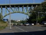
| 12th Avenue South Bridge 12th Avenue South Bridge The Jose Rizal Bridge carries 12th Avenue South across South Dearborn Street and Interstate 90 in Seattle, connecting the International District to Beacon Hill. Built in 1911, and originally called the 12th Avenue South Bridge or the Dearborn Street Bridge, it was one of the first permanent steel... |
 |
1911, 1912 | 1982-07-16 | Seattle Seattle, Washington Seattle is the county seat of King County, Washington. With 608,660 residents as of the 2010 Census, Seattle is the largest city in the Northwestern United States. The Seattle metropolitan area of about 3.4 million inhabitants is the 15th largest metropolitan area in the country... 47°35′46"N 122°18′58"W |
King King County, Washington King County is a county located in the U.S. state of Washington. The population in the 2010 census was 1,931,249. King is the most populous county in Washington, and the 14th most populous in the United States.... |
|
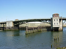
| South Park Bridge (Seattle) South Park Bridge (Seattle) The South Park Bridge was a Scherzer Rolling Lift double-leaf bascule bridge, constructed in 1929-31 and closed to traffic on June 30, 2010, due to safety concerns. The South Park Bridge carried automobile traffic over the Duwamish River near Boeing Field, just outside the city limits of Seattle,... (14th/16th Avenue South Bridge) |
 |
1931 | 1982-07-16 | Seattle Seattle, Washington Seattle is the county seat of King County, Washington. With 608,660 residents as of the 2010 Census, Seattle is the largest city in the Northwestern United States. The Seattle metropolitan area of about 3.4 million inhabitants is the 15th largest metropolitan area in the country... 47°34′13"N 122°21′2"W |
King King County, Washington King County is a county located in the U.S. state of Washington. The population in the 2010 census was 1,931,249. King is the most populous county in Washington, and the 14th most populous in the United States.... |
Scherzer Rlng Lft Bascule Br |
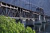
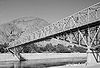
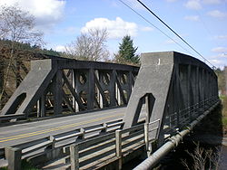
| Agate Pass Bridge Agate Pass Bridge The Agate Pass Bridge is a structural steel truss cantilever bridge spanning Agate Pass, connecting Bainbridge Island to the Kitsap Peninsula. It was built in 1950, and it replaced a car ferry service which dated from the 1920s... |
 |
1950 | 1995-05-24 | Suquamish Suquamish, Washington Suquamish is a census-designated place in Kitsap County, Washington, United States. The population was 4,140 at the 2010 census. Located within the Port Madison Indian Reservation, it is the burial site of Chief Seattle.-Geography:... 47°42′45"N 122°33′54"W |
Kitsap Kitsap County, Washington Kitsap County is a county located in the U.S. state of Washington, named after Chief Kitsap of the Suquamish tribe. As of 2011 state estimate, its population was 253,900. Its county seat is at Port Orchard, and its largest city is Bremerton.... |
cantilever truss |
| Arboretum Sewer Trestle Arboretum Sewer Trestle The Arboretum Sewer Trestle is a historic trestle in Seattle, Washington, that was listed on the National Register of Historic Places in 1982... |
 |
1910 | 1982-07-16 | Seattle Seattle, Washington Seattle is the county seat of King County, Washington. With 608,660 residents as of the 2010 Census, Seattle is the largest city in the Northwestern United States. The Seattle metropolitan area of about 3.4 million inhabitants is the 15th largest metropolitan area in the country... 47°38′33"N 122°17′52"W |
King King County, Washington King County is a county located in the U.S. state of Washington. The population in the 2010 census was 1,931,249. King is the most populous county in Washington, and the 14th most populous in the United States.... |
|
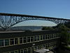
| George Washington Memorial Bridge George Washington Memorial Bridge For other bridges of the same name, see Washington Bridge .The George Washington Memorial Bridge is a cantilever and truss bridge that carries Aurora Avenue N. over the west end of Seattle's Lake Union between Queen Anne and Fremont, just east of the Fremont Cut... (Aurora Avenue Bridge) |
 |
1931 | 1982-07-16 | Seattle Seattle, Washington Seattle is the county seat of King County, Washington. With 608,660 residents as of the 2010 Census, Seattle is the largest city in the Northwestern United States. The Seattle metropolitan area of about 3.4 million inhabitants is the 15th largest metropolitan area in the country... 47°38′37"N 122°20′46"W |
King King County, Washington King County is a county located in the U.S. state of Washington. The population in the 2010 census was 1,931,249. King is the most populous county in Washington, and the 14th most populous in the United States.... |
|
| Baker River Bridge | 1916, 1917 | 1976-05-04 | Concrete Concrete, Washington Concrete is a town in north-central Skagit County, Washington, United States. The population was 705 at the 2010 census. The town of Concrete is included in the Mount Vernon-Anacortes, Washington Metropolitan Statistical Area.-Early history:... 48°32′28"N 121°44′34"W |
Skagit Skagit County, Washington Skagit County is a county in the U.S. state of Washington. It is named after the Skagit Indian tribe. As of 2010, the population was 116,901. It is included in the Mount Vernon-Anacortes, Washington, Metropolitan Statistical Area... |
||
| Ballard Bridge Ballard Bridge The Ballard Bridge, also known as the 15th Avenue Bridge, is a double-leaf bascule bridge in Seattle, Washington, United States. It carries 15th Avenue NW over Seattle's Salmon Bay between Ballard and Interbay. Built in 1917, it has an opening span of and a total length of . It was added to the... |
 |
1917 | 1982-07-16 | Seattle Seattle, Washington Seattle is the county seat of King County, Washington. With 608,660 residents as of the 2010 Census, Seattle is the largest city in the Northwestern United States. The Seattle metropolitan area of about 3.4 million inhabitants is the 15th largest metropolitan area in the country... 47°39′47"N 122°22′30"W |
King King County, Washington King County is a county located in the U.S. state of Washington. The population in the 2010 census was 1,931,249. King is the most populous county in Washington, and the 14th most populous in the United States.... |
dbl-leaf trunnion bascule br |
| Barstow Bridge | 1947 | 1995-03-30 | Kettle Falls Kettle Falls, Washington Kettle Falls is a city in Stevens County, Washington, United States, named for the nearby Kettle Falls on the Columbia River, an ancient and important fishing site for Native Americans... 48°47′4"N 118°7′28"W |
Ferry | Pratt Pony Truss | |
| Beverly Railroad Bridge Beverly Railroad Bridge The Beverly Railroad Bridge was constructed by the Chicago, Milwaukee, St. Paul and Pacific Railroad in 1909 during its Pacific Extension... |
 |
1909 | 1982-07-16 | Beverly Beverly, Washington Beverly, Washington is a small community along the banks of the Columbia River in central Washington state. The community, which consists of a few hundred residents, is just a few miles downriver from Wanapum Dam and is nestled at the base of what locals call Sentinel Gap, a huge basalt formation... 46°49′52"N 119°56′54"W |
Grant, Kittitas | Warren deck truss, Parker through truss, deck plate girder |
| Blue Bridge (Pioneer Memorial Bridge) Blue Bridge (Washington) The Blue Bridge is a four-lane arch-truss bridge connecting Pasco, Washington to Kennewick, Washington. U.S. Route 395 crosses the Columbia River via this bridge. The name comes from the blue paint used on the truss superstructure, with white paint on the suspension beams... |
1954 | 2002 | Kennewick Kennewick, Washington Kennewick is a city in Benton County in the southeastern part of the U.S. state of Washington, near the Hanford nuclear site. It is the most populous of the three cities collectively referred to as the Tri-Cities... -Pasco Pasco, Washington Pasco is a city in and the county seat of Franklin County, Washington, United States.Pasco is one of three cities that make up the Tri-Cities region of the state of Washington... 46°13′10.38"N 119°6′14.54"W |
Benton Benton County, Washington Benton County is a county located in the south-central portion of the U.S. state of Washington. The Columbia River makes up the north, south, and east boundaries of the county. In 2010, its population was 175,177. The county seat is Prosser, and its largest city is Kennewick... , Franklin |
4-lane Arch Truss bridge | |
| Capital Boulevard Crossing | 1936, 1937 | 1982-07-16 | Tumwater Tumwater, Washington Tumwater is a city in Thurston County, Washington, United States. It lies near where the Deschutes River enters Budd Inlet, the southernmost point of Puget Sound. The population was 17,371 at the 2010 census... 47°0′50"N 122°54′7"W |
Thurston | ||
| Chinook Pass Entrance Arch Chinook Pass Entrance Arch The Chinook Pass Entrance Arch marks the east entrance to Mount Rainier National Park. The rectangular log entry arch is one of several placed at the entrances to the park. It was designed in 1933 by the National Park Service Branch of Plans and Designs, and was built in 1936 by the Civilian... |
 |
1936 | 1991-03-13 | Chinook Pass Chinook Pass Chinook Pass is a pass through the Cascade Range in the state of Washington.The pass provides the east entrance to Mount Rainier National Park, and carries State Route 410 between the towns of Enumclaw and Naches. Because of the high elevation, Chinook Pass is usually closed in November due to... 46°52′20"N 121°30′52"W |
Pierce Pierce County, Washington right|thumb|[[Tacoma, Washington|Tacoma]] - Seat of Pierce CountyPierce County is the second most populous county in the U.S. state of Washington. Formed out of Thurston County on December 22, 1852, by the legislature of Oregon Territory... |
Rustic style |
| Christine Falls Bridge Christine Falls Bridge The Christine Falls Bridge is a reinforced concrete arch bridge in Mount Rainier National Park, spanning Van Trump Creek. The bridge was built in 1927-1928 by contractor J.D. Tobin of Portland, Oregon, who built the Narada Falls Bridge at the same time. The arch has a three-centered profile and... |
 |
1928 | 1991-03-13 | Paradise Paradise, Washington Paradise is the name of an area at approximately on the south slope of Mount Rainier in Mount Rainier National Park in Washington, United States. The area lies on the border of Pierce and Lewis counties and includes the Paradise Valley and the Paradise Glacier which is the source of the Paradise... 46°46′51"N 121°46′42"W |
Pierce Pierce County, Washington right|thumb|[[Tacoma, Washington|Tacoma]] - Seat of Pierce CountyPierce County is the second most populous county in the U.S. state of Washington. Formed out of Thurston County on December 22, 1852, by the legislature of Oregon Territory... |
Rustic style |
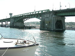
| Murray Morgan Bridge Murray Morgan Bridge The Murray Morgan Bridge, also known as the 11th Street bridge or City Waterway bridge, is a lift bridge in Tacoma, Washington. It was built in 1913 to replace an 1894 swing-span bridge. The bridge connects downtown with the tideflats, it spans the Thea Foss Waterway, originally known as the City... (City Waterway Bridge) |
 |
1911 | 1982-07-16 | Tacoma Tacoma, Washington Tacoma is a mid-sized urban port city and the county seat of Pierce County, Washington, United States. The city is on Washington's Puget Sound, southwest of Seattle, northeast of the state capital, Olympia, and northwest of Mount Rainier National Park. The population was 198,397, according to... 47°15′17"N 122°25′35"W |
Pierce Pierce County, Washington right|thumb|[[Tacoma, Washington|Tacoma]] - Seat of Pierce CountyPierce County is the second most populous county in the U.S. state of Washington. Formed out of Thurston County on December 22, 1852, by the legislature of Oregon Territory... |
vertical-lift bridge |
| Columbia River Bridge | 1906–1908 | 1982-07-16 | Wenatchee Wenatchee, Washington Wenatchee is located in North Central Washington and is the largest city and county seat of Chelan County, Washington, United States. The population within the city limits in 2010 was 31,925... 47°24′51"N 120°17′54"W |
Chelan | pin-connected cantilever br. | |
| Columbia River Bridge at Bridgeport | 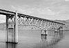 |
1995-05-31 | Bridgeport Bridgeport, Washington Bridgeport is a city in Douglas County, Washington, United States. It is part of the Wenatchee–East Wenatchee Metropolitan Statistical Area. Bridgeport's population was 2,059 at the 2000 census.Bridgeport is located near the Chief Joseph Dam.-History:... 48°0′4"N 119°39′13"W |
Douglas, Okanogan | ||
| Columbia River Bridge at Kettle Falls | 1941 | 1995-03-28 | Kettle Falls Kettle Falls, Washington Kettle Falls is a city in Stevens County, Washington, United States, named for the nearby Kettle Falls on the Columbia River, an ancient and important fishing site for Native Americans... 48°37′34"N 118°7′1"W |
Ferry | Steel Through Truss | |
| Columbia River Bridge at Northport | 1949 | 1995-05-24 | Northport Northport, Washington Northport is a town in Stevens County, Washington, United States. The population was 295 at the 2010 census.-History:Northport was given its name since it was once the northernmost town on the Spokane Falls and Northern Railway... 48°55′21"N 117°46′32"W |
Stevens | Steel Through truss | |
| Columbia River Bridge at Wenatchee | 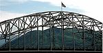 |
1950 | 1995-05-24 | Wenatchee Wenatchee, Washington Wenatchee is located in North Central Washington and is the largest city and county seat of Chelan County, Washington, United States. The population within the city limits in 2010 was 31,925... 47°24′36"N 120°17′41"W |
Chelan, Douglas | Steel Though Arch |
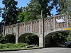
| Cowen Park Bridge Cowen Park Bridge The Cowen Park Bridge is a reinforced concrete arch bridge that spans a ravine in Seattle's Cowen Park. The structure is listed in the National Register of Historic Places, and it is a designated city landmark. The bridge has been praised for the Art Deco light standards along its sides.It was... |
 |
1936 | 1982-07-16 | Seattle Seattle, Washington Seattle is the county seat of King County, Washington. With 608,660 residents as of the 2010 Census, Seattle is the largest city in the Northwestern United States. The Seattle metropolitan area of about 3.4 million inhabitants is the 15th largest metropolitan area in the country... 47°40′16"N 122°18′45"W |
King King County, Washington King County is a county located in the U.S. state of Washington. The population in the 2010 census was 1,931,249. King is the most populous county in Washington, and the 14th most populous in the United States.... |
|
| Curlew Bridge Curlew Bridge The Curlew Bridge is a one lane pin-connected Parker Truss bridge located in Curlew, Washington which spans the Kettle River just downstream from the point where the river turns north.- Original Construction :... |
 |
1908 | 1982-07-16 | Curlew Curlew, Washington Curlew is an unincorporated community located in northwestern Ferry County, Washington, United States, between Malo and Danville on State Route 21. The BNSF Railway ran through the town. The historic Ansorge Hotel is located in Curlew.-Geography:... 48°53′8"N 118°36′1"W |
Ferry | pin-cncted. Parker truss br. |
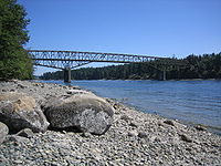
| Deception Pass Bridge Deception Pass Bridge The Deception Pass Bridge is a two-lane bridge connecting Whidbey Island to Fidalgo Island in the U.S. state of Washington. It was a Washington State Highways project, and included project elements built by young workers from the Civilian Conservation Corps... |
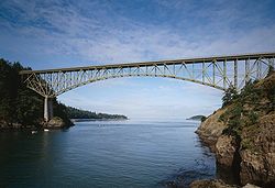 |
1934–1935 | 1982-07-16 | Anacortes Anacortes, Washington Anacortes is a city in Skagit County, Washington, United States. The name "Anacortes" is a consolidation of the name Anna Curtis, who was the wife of early Fidalgo Island settler Amos Bowman. Anacortes' population was 15,778 at the time of the 2010 census... 48°24′22"N 122°38′35"W |
Skagit Skagit County, Washington Skagit County is a county in the U.S. state of Washington. It is named after the Skagit Indian tribe. As of 2010, the population was 116,901. It is included in the Mount Vernon-Anacortes, Washington, Metropolitan Statistical Area... |
deck-type bridge |
| Devil's Corner Cliff Walk Devil's Corner Cliff Walk The Devil's Corner Cliff Walk is a National Recreation Area in the Ross Lake area.Built in 1875, it functioned as pedestrian transportation until the turn of the century, and now functions as a park. It was added to the National Register of Historic Places in 1974.-External links:**... |
 |
1974-06-07 | Newhalem Newhalem, Washington Newhalem is a small, unincorporated community in northwestern Washington, USA, located in the western foothills of the North Cascades along the Skagit River. It is located within Whatcom County.... 48°41′28"N 121°13′23"W |
Whatcom Whatcom County, Washington Whatcom County is a county located in the U.S. state of Washington. Its name ultimately derives from the Lummi word Xwotʼqom, meaning "noisy water." As of 2010, the population was 201,140. The county seat is at Bellingham, which is also the county's largest city... |
||
| Donald-Wapato Bridge | 1949 | 1995-05-24 | Wapato Wapato, Washington Wapato is a city in Yakima County, Washington, United States. The population was 4,997 at the 2010 census.-History:The town was originally founded in 1885 by Indian Postmaster Alexander McCredy as a railroad stop on the Northern Pacific Railroad as Simcoe, Washington... 46°27′58"N 120°23′51"W |
Yakima Yakima County, Washington Yakima County is the second largest county by area in the U.S. state of Washington. It is named after the Yakama tribe of Native Americans. In the 2010 census, its population was 243,231... |
Box Girder | |
| Duckabush River Bridge | 1934 | 1982-07-16 | Duckabush 47°41′25"N 122°53′52"W |
Jefferson Jefferson County, Washington Jefferson County is a county located in the U.S. state of Washington, named after Thomas Jefferson. As of 2010, the population was 29,872. The county seat is at Port Townsend, which is also the county's only incorporated city.... |
through-tied ribbed arch br. | |
| Dungeness River Bridge Dungeness River Bridge The Dungeness River Bridge is the centerpiece of Railroad Bridge Park near the town of Sequim, Washington. It crosses the Dungeness River. The bridge was first constructed by the Seattle, Port Angeles, and Western Railway, a subsidiary of the Chicago, Milwaukee, St. Paul and Pacific Railroad in 1916... |
1930 | 1982-07-16 | Sequim Sequim, Washington Sequim is a city in Clallam County, Washington, United States. The 2010 US Census counted a population of 6,606. Sequim is located along the Dungeness River near the base of the Olympic Mountains... 48°5′8"N 123°8′46"W |
Clallam | timber Howe truss bridge | |
| East 34th Street Bridge East 34th Street Bridge The East 34th Street Bridge is a concrete open-spandrel bridge in Tacoma, Washington. The bridge was built in 1937 to replace a wood bridge that had previously spanned the gulch. The bridge is constructed of two rib arches, that are supported by support legs, with spandrel columns between the... |
 |
1937 | 1982-07-16 | Tacoma Tacoma, Washington Tacoma is a mid-sized urban port city and the county seat of Pierce County, Washington, United States. The city is on Washington's Puget Sound, southwest of Seattle, northeast of the state capital, Olympia, and northwest of Mount Rainier National Park. The population was 198,397, according to... 47°14′18"N 122°25′55"W |
Pierce Pierce County, Washington right|thumb|[[Tacoma, Washington|Tacoma]] - Seat of Pierce CountyPierce County is the second most populous county in the U.S. state of Washington. Formed out of Thurston County on December 22, 1852, by the legislature of Oregon Territory... |
open-spandrel arch bridge |
| Elwha River Bridge Elwha River Bridge The Elwha River Bridge was built around 1913 to span the Elwha River, Washington. The bridge was closed and then demolished in late 2007 due to concerns regarding its structure after the I-35W Mississippi River bridge collapse. A new two lane bridge has been constructed with a pedestrian and... |
1913 | 1982-07-16 | Elwha Elwha, Washington Elwha is an unincorporated community in Clallam County, Washington, United States. The community is located along U.S. Route 101 near Port Angeles, on the edge of the Olympic National Park.... 48°6′4"N 123°33′23"W |
Clallam | Warren deck truss bridge | |
| F Street Bridge (Palouse, Washington) |  |
1905 | 1982-07-16 | Palouse Palouse, Washington Palouse is a city in Whitman County, Washington, United States. The population was 998 at the 2010 census. Palouse is named for the region of farmland in which it is situated, and was incorporated in 1888.-History:... 46°54′36"N 117°4′7"W |
Whitman Whitman County, Washington Whitman County is a county located in the U.S. state of Washington. As of the 2010 census, the population was 44,776, with the majority living in its largest city, Pullman, home to Washington State University, the state's land-grant university. The county seat is at Colfax.Whitman County was... |
pin-connected Pratt truss |
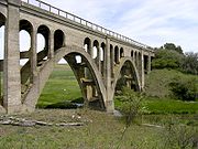
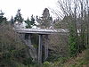
| Fairfax Bridge Fairfax Bridge (Washington) The Fairfax Bridge is a steel-lattice three-hinged arch bridge spanning the Carbon River on State Route 165 in Pierce County, Washington. Previous to the construction of the bridge in 1921, the only route south to the area around Fairfax was by train... |
 |
1921 | 1982-07-16 | Melmont Melmont, Washington Melmont is a ghost town in Pierce County, Washington, USA. The town was founded in 1900 when the Northwest Improvement Company, a subsidiary of Northern Pacific Railway, started the Melmont coal mine... 47°2′29"N 122°2′25"W |
Pierce Pierce County, Washington right|thumb|[[Tacoma, Washington|Tacoma]] - Seat of Pierce CountyPierce County is the second most populous county in the U.S. state of Washington. Formed out of Thurston County on December 22, 1852, by the legislature of Oregon Territory... |
three-hinged lattice arch |
| Fremont Bridge | 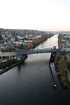 |
1917 | 1982-07-16 | Seattle Seattle, Washington Seattle is the county seat of King County, Washington. With 608,660 residents as of the 2010 Census, Seattle is the largest city in the Northwestern United States. The Seattle metropolitan area of about 3.4 million inhabitants is the 15th largest metropolitan area in the country... 47°38′52"N 122°20′55"W |
King King County, Washington King County is a county located in the U.S. state of Washington. The population in the 2010 census was 1,931,249. King is the most populous county in Washington, and the 14th most populous in the United States.... |
dbl-leaf trunnion bascule br |
| Goldsborough Creek Bridge | 1923 | 1982-07-16 | Shelton Shelton, Washington Shelton is the county seat, of Mason County, Washington, United States. Shelton is the westernmost city on Puget Sound. The population was 9,834 at the 2010 census. In terms of population, the city is ranked 161 out of approximately 500 municipalities in Washington... 47°12′34"N 123°5′57"W |
Mason | ||
| Grand Coulee Bridge Grand Coulee Bridge The Grand Coulee Bridge, or Columbia River Bridge at Grand Coulee Dam, is a thru-cantilever steel truss bridge built in 1935. It carries Washington State Route 155. It is near the city of Grand Coulee, Washington and the Grand Coulee Dam. In 1982, it was added to the National Register of Historic... |
 |
1934, 1935 | 1982-07-16 | Grand Coulee Grand Coulee, Washington Grand Coulee is a city in Grant County, Washington, United States. The population was 897 at the 2000 census.-History:Grand Coulee was officially incorporated on November 6, 1935... 47°57′56"N 118°58′53"W |
Okanogan | thru-cantilever steel truss |
| Grande Ronde River Bridge | 1941 | 1995-03-28 | Asotin Asotin, Washington Asotin is the county seat of Asotin County, Washington, United States. The population of the city was 1,251 at the 2010 census. It is part of the Lewiston, ID–WA Metropolitan Statistical Area.-History:... 46°2′30"N 117°15′4"W |
Asotin | Riveted Steel Girder | |
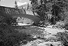
| Grays River Covered Bridge Grays River Covered Bridge The Grays River Covered Bridge is a one-lane wooden covered bridge over the Grays River in western Wahkiakum County, Washington. The bridge is listed on the National Register of Historic Places and is the only covered bridge still in use by the public in Washington State. The bridge rests as the... |
 |
1905, 1908 | 1971-11-23 | Grays River Grays River, Washington Grays River is an unincorporated rural village in Wahkiakum County, Washington, United States.Grays River stands on the north bank of the lower Grays River, which flows into the Columbia River estuary. The National Register of Historic Places-listed Grays River Covered Bridge crosses the Grays... 46°21′17"N 123°34′47"W |
Wahkiakum | |
| High Steel Bridge High Steel Bridge High Steel Bridge is a truss arch bridge that spans the south fork of the Skokomish River in Mason County, Washington. It was built in 1929 by Simpson Logging Company as part of a logging railroad.... |
1929 | 1982-07-16 | Shelton Shelton, Washington Shelton is the county seat, of Mason County, Washington, United States. Shelton is the westernmost city on Puget Sound. The population was 9,834 at the 2010 census. In terms of population, the city is ranked 161 out of approximately 500 municipalities in Washington... 47°22′5"N 123°16′44"W |
Mason | ||
| Hoquiam River Bridge |  |
1928 | 1982-07-16 | Hoquiam Hoquiam, Washington Hoquiam is a city in Grays Harbor County, Washington state, United States. The town borders the city of Aberdeen at Myrtle Street with Hoquiam to the west. The two cities share a common economic history in lumbering and exporting but Hoquiam has maintained its independent identity... 46°58′32"N 123°52′32"W |
Grays Harbor Grays Harbor County, Washington Grays Harbor County is a county in the state of Washington, in the United States of America. As of 2010, the population was 72,797. The county seat is at Montesano, and its largest city is Aberdeen. The county is named after a large estuarine bay near its southwestern corner... |
Strauss trunnion bascule br. |
| Idaho and Wash. Northern RR Bridge | 1911 | 1982-07-16 | Metaline Falls Metaline Falls, Washington Metaline Falls is a town in Pend Oreille County, Washington, United States. The population was 238 at the 2010 census.-History:Metaline Falls was discovered by natives 12,000 years ago. Eventually by fur traders came in 1810. The town was founded in 1900, with most of its residents then employed... 48°46′50"N 117°24′33"W |
Pend Oreille | cantilever bridge | |
| Indian Timothy Memorial Bridge |  |
1923 | 1982-07-16 | Pomeroy Pomeroy, Washington Pomeroy is a city in Garfield County, Washington, United States. The population was 1,425 at the 2010 census. It is the county seat of Garfield County.-Geography: Pomeroy is located at .... 46°24′43"N 117°12′46"W |
Asotin | tied-arch bridge |
| Jim Creek Bridge | 1943 | 1995-03-28 | Woodland Woodland, Washington Woodland is a city in Clark and Cowlitz counties in the U.S. state of Washington. Most residents live within Cowlitz County, in which the majority of the city lies. It is part of the 'Longview, Washington Metropolitan Statistical Area'... 45°59′45"N 122°30′55"W |
Cowlitz Cowlitz County, Washington Cowlitz County is a county located in the U.S. state of Washington. As of the 2010 census its population was 102,410. It forms the Longview, Washington, Metropolitan Statistical Area which encompasses all of Cowlitz County. The county seat is at Kelso, and its largest city is Longview... |
Concrete Arch | |
| Johnson Bridge | 1929 | 1982-07-16 | Lowden Lowden, Washington Lowden is an unincorporated community in Walla Walla County, Washington, United States. It lies along U.S. Route 12 between Tri-Cities and Walla Walla. The Woodward Canyon Winery is located there. Also located there is the l'ecole 41 Winery which is located in the what used to be the old Lowden... 46°7′22"N 118°38′57"W |
Walla Walla | ||
| Lake Keechelus Snowshed Bridge | 1950 | 1995-05-24 | Hyak Hyak, Washington Hyak is an unincorporated community located on Snoqualmie Pass in Kittitas County, Washington.Hyak was established around 1915 at the eastern portal of the Snoqualmie Pass Milwaukee Road Railroad tunnel. Originally a train station, the community began to grow in the 1930s when the railroad built a... 47°21′20"N 121°21′53"W |
Kittitas | rigid frame | |
| Lewis and Clark Bridge (Columbia River) (Longview Bridge) |  |
1929, 1930 | 1982-07-16 | Longview Longview, Washington Longview is a city in Cowlitz County, Washington, United States. It is the principal city of the "Longview, Washington Metropolitan Statistical Area", which encompasses all of Cowlitz County. Longview's population was 36,648 at the time of the 2010 census and is the largest city in Cowlitz County... 46°6′48"N 122°57′10"W |
Cowlitz Cowlitz County, Washington Cowlitz County is a county located in the U.S. state of Washington. As of the 2010 census its population was 102,410. It forms the Longview, Washington, Metropolitan Statistical Area which encompasses all of Cowlitz County. The county seat is at Kelso, and its largest city is Longview... |
cantilever bridge |
| Manning-Rye Covered Bridge | 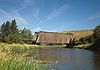 |
1982-07-16 | Colfax Colfax, Washington Colfax is the county seat of Whitman County, Washington, United States.The population was 2,805 at the 2010 census.It is situated amidst wheat-covered hills in a valley at the confluence of the north and south forks of the Palouse River. U.S... 46°55′42"N 117°24′52"W |
Whitman Whitman County, Washington Whitman County is a county located in the U.S. state of Washington. As of the 2010 census, the population was 44,776, with the majority living in its largest city, Pullman, home to Washington State University, the state's land-grant university. The county seat is at Colfax.Whitman County was... |
||
| Marshall Bridge | 1949 | 1995-05-24 | Marshall Marshall, Washington Marshall is an unincorporated community in Spokane County, Washington, United States. Named in 1880 for early settler William H. Marshall, Marshall is south-southwest of downtown Spokane. Marshall has a post office with ZIP code 99020.... 47°34′0"N 117°29′32"W |
Spokane Spokane County, Washington Spokane County is a county located in the U.S. state of Washington, named after the Spokane tribe. As of the 2010 census the population was 471,221, making it the fourth most populous county in Washington state. The largest city and county seat is Spokane, the second largest city in the state,... |
T-beam | |
| McMillin Bridge McMillin Bridge The McMillin Bridge is a concrete half-through truss bridge crossing the Puyallup River, in Pierce County, Washington, built in 1934. The bridge is signed as part of State Route 162. The main span of the bridge is long, which was the longest beam span or concrete truss in the US when it was built... |
 |
1934 | 1982-07-16 | Puyallup Puyallup, Washington Puyallup, Washington is a city in Pierce County, Washington about five miles east of Tacoma. The population was 37,022 at the 2010 Census. Named after the Puyallup Tribe of Native Americans, Puyallup means "the generous people."-History:... 47°7′49"N 122°14′7"W |
Pierce Pierce County, Washington right|thumb|[[Tacoma, Washington|Tacoma]] - Seat of Pierce CountyPierce County is the second most populous county in the U.S. state of Washington. Formed out of Thurston County on December 22, 1852, by the legislature of Oregon Territory... |
beam-span bridge |
| Middle Fork Nooksack River Bridge | 1915, 1951 | 1982-07-16 | Acme Acme, Washington Acme is a census-designated place in Whatcom County, Washington, United States. The population was 246 at the 2010 census.Acme is located in the South Fork Valley between the northern Cascade Mountains and Lake Whatcom... 48°47′5"N 122°6′40"W |
Whatcom Whatcom County, Washington Whatcom County is a county located in the U.S. state of Washington. Its name ultimately derives from the Lummi word Xwotʼqom, meaning "noisy water." As of 2010, the population was 201,140. The county seat is at Bellingham, which is also the county's largest city... |
pinconnected Petit Truss | |
| Monroe Street Bridge Monroe Street Bridge Monroe Street Bridge is a deck arch bridge that spans the Spokane River in Spokane, Washington. It was built in 1911 by the city of Spokane and was designed by John Chester Ralston and Kirtland Kelsey Cutter... |
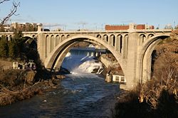 |
1911 | 1976-05-13 | Spokane Spokane, Washington Spokane is a city located in the Northwestern United States in the state of Washington. It is the largest city of Spokane County of which it is also the county seat, and the metropolitan center of the Inland Northwest region... 47°39′40"N 117°25′32"W |
Spokane Spokane County, Washington Spokane County is a county located in the U.S. state of Washington, named after the Spokane tribe. As of the 2010 census the population was 471,221, making it the fourth most populous county in Washington state. The largest city and county seat is Spokane, the second largest city in the state,... |
|
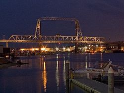
| Montlake Bridge Montlake Bridge The Montlake Bridge is a double-leaf bascule bridge that carries Montlake Boulevard over Seattle's Montlake Cut--part of the Lake Washington Ship Canal--connecting Montlake and the University District.... |
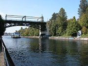 |
1913, 1924 | 1982-07-16 | Seattle Seattle, Washington Seattle is the county seat of King County, Washington. With 608,660 residents as of the 2010 Census, Seattle is the largest city in the Northwestern United States. The Seattle metropolitan area of about 3.4 million inhabitants is the 15th largest metropolitan area in the country... 47°38′51"N 122°18′13"W |
King King County, Washington King County is a county located in the U.S. state of Washington. The population in the 2010 census was 1,931,249. King is the most populous county in Washington, and the 14th most populous in the United States.... |
dbl-leaf trunnion bascule br |
| Mount Baker Ridge Tunnel | 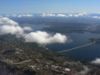 |
1940 | 1982-07-16 | Seattle Seattle, Washington Seattle is the county seat of King County, Washington. With 608,660 residents as of the 2010 Census, Seattle is the largest city in the Northwestern United States. The Seattle metropolitan area of about 3.4 million inhabitants is the 15th largest metropolitan area in the country... 47°35′25"N 122°17′14"W |
King King County, Washington King County is a county located in the U.S. state of Washington. The population in the 2010 census was 1,931,249. King is the most populous county in Washington, and the 14th most populous in the United States.... |
|
| Narada Falls Bridge Narada Falls Bridge The Narada Falls Bridge is a reinforced concrete arch bridge in Mount Rainier National Park, spanning the Paradise River above Narada Falls. The bridge was built in 1927-1928 by contractor J.D. Tobin of Portland, Oregon, who built the Christine Falls Bridge at the same time. The arch spans . The... |
 |
1927 | 1991-03-13 | Paradise Paradise, Washington Paradise is the name of an area at approximately on the south slope of Mount Rainier in Mount Rainier National Park in Washington, United States. The area lies on the border of Pierce and Lewis counties and includes the Paradise Valley and the Paradise Glacier which is the source of the Paradise... 46°46′31"N 121°44′43"W |
Pierce Pierce County, Washington right|thumb|[[Tacoma, Washington|Tacoma]] - Seat of Pierce CountyPierce County is the second most populous county in the U.S. state of Washington. Formed out of Thurston County on December 22, 1852, by the legislature of Oregon Territory... |
Rustic style |
| Norman Bridge | 1950 | 1994-07-19 | North Bend North Bend, Washington North Bend is a city in King County, Washington, United States. The town was made famous by David Lynch's television series Twin Peaks Since the Weyerhaeuser sawmill closed, North Bend has become an upscale bedroom community for the Eastside of Seattle, Washington, with property values more than... 47°30′58"N 121°46′5"W |
King King County, Washington King County is a county located in the U.S. state of Washington. The population in the 2010 census was 1,931,249. King is the most populous county in Washington, and the 14th most populous in the United States.... |
||
| North 21st Street Bridge |  |
1910, 1911 | 1982-07-16 | Tacoma Tacoma, Washington Tacoma is a mid-sized urban port city and the county seat of Pierce County, Washington, United States. The city is on Washington's Puget Sound, southwest of Seattle, northeast of the state capital, Olympia, and northwest of Mount Rainier National Park. The population was 198,397, according to... 47°16′3"N 122°28′11"W |
Pierce Pierce County, Washington right|thumb|[[Tacoma, Washington|Tacoma]] - Seat of Pierce CountyPierce County is the second most populous county in the U.S. state of Washington. Formed out of Thurston County on December 22, 1852, by the legislature of Oregon Territory... |
rigid-frame girder bridge |
| North 23rd Street Bridge |  |
1909, 1910 | 1982-07-16 | Tacoma Tacoma, Washington Tacoma is a mid-sized urban port city and the county seat of Pierce County, Washington, United States. The city is on Washington's Puget Sound, southwest of Seattle, northeast of the state capital, Olympia, and northwest of Mount Rainier National Park. The population was 198,397, according to... 47°16′40"N 122°28′14"W |
Pierce Pierce County, Washington right|thumb|[[Tacoma, Washington|Tacoma]] - Seat of Pierce CountyPierce County is the second most populous county in the U.S. state of Washington. Formed out of Thurston County on December 22, 1852, by the legislature of Oregon Territory... |
rigid-frame bridge |
| North Hamma Hamma River Bridge |  |
1924 | 1982-07-16 | Eldon Eldon, Washington Eldon is an unincorporated community in Mason County, Washington, United States. Eldon is located along U.S. Route 101 on the scenic Hood Canal... 47°32′23"N 123°2′33"W |
Mason | tied-arch bridge |
| Orient Bridge | 1909 | 1982-07-16 | Orient Orient, Washington Orient is a small unincorporated community in northeastern Ferry County, Washington, United States. The Kettle River flows to the east of the town and marks the border with Stevens County. A BNSF rail line runs through the town alongside U.S. Route 395... 48°51′59"N 118°11′52"W |
Stevens | pincncted Parker steel truss | |
| Patton Bridge | 1950 | 1995-05-24 | Auburn Auburn, Washington -Parks:Auburn has an extensive system of parks, open space and urban trails comprising 29 developed parks, 5 undeveloped sites under planning, 2 skate parks, 2 water roatary parks, and over of trails , and almost of open space for passive and active recreation.-Environmental Park:The Auburn... 47°17′18"N 122°9′34"W |
King King County, Washington King County is a county located in the U.S. state of Washington. The population in the 2010 census was 1,931,249. King is the most populous county in Washington, and the 14th most populous in the United States.... |
box girder | |
| Penstock Bridge | 1982-07-16 | Leavenworth Leavenworth, Washington Leavenworth is a city in Chelan County, Washington, United States. It is part of the Wenatchee–East Wenatchee Metropolitan Statistical Area. The population was 1,965 at the 2010 census. The entire town center is modelled on a Bavarian village.-History:... 47°35′17"N 120°42′28"W |
Chelan | Baltimore Petit truss bridge | ||
| Purdy Bridge Purdy Bridge The Purdy Bridge is a continuous hollow-box girder bridge that spans over Henderson Bay, connecting Purdy, Washington, USA with the Purdy Sand Spit Park. It was built on September 29, 1937, and at the time was the longest continuous box girder bridge in the US, at a cost of $62,000 from a design... |
 |
1936 | 1982-07-16 | Purdy Purdy, Washington Purdy is a small unincorporated community north of the city of Gig Harbor, on the northern boundary of Pierce County, Washington. It is located on the shores of Burley Lagoon and Henderson Bay of the Carr Inlet... 47°23′35"N 122°37′38"W |
Pierce Pierce County, Washington right|thumb|[[Tacoma, Washington|Tacoma]] - Seat of Pierce CountyPierce County is the second most populous county in the U.S. state of Washington. Formed out of Thurston County on December 22, 1852, by the legislature of Oregon Territory... |
continuous box girder bridge |
| Ravenna Park Bridge |  |
1913, 1914 | 1982-07-16 | Seattle Seattle, Washington Seattle is the county seat of King County, Washington. With 608,660 residents as of the 2010 Census, Seattle is the largest city in the Northwestern United States. The Seattle metropolitan area of about 3.4 million inhabitants is the 15th largest metropolitan area in the country... 47°40′19"N 122°18′21"W |
King King County, Washington King County is a county located in the U.S. state of Washington. The population in the 2010 census was 1,931,249. King is the most populous county in Washington, and the 14th most populous in the United States.... |
steel arch bridge |
| Red Mountain Railroad Bridge | 1896 | 1982-07-16 | Northport Northport, Washington Northport is a town in Stevens County, Washington, United States. The population was 295 at the 2010 census.-History:Northport was given its name since it was once the northernmost town on the Spokane Falls and Northern Railway... 48°58′3"N 117°48′53"W |
Stevens | Howe truss bridge | |
| Rock Island Railroad Bridge | 1892, 1893 | 1975-07-30 | Rock Island Rock Island, Washington Rock Island is a city in Douglas County, Washington, United States. It is part of the Wenatchee–East Wenatchee Metropolitan Statistical Area. The population was 863 at the 2000 census.-History:... 47°22′2"N 120°9′9"W |
Chelan, Douglas | fixed span through truss br. | |
| Rosalia Railroad Bridge Rosalia Railroad Bridge The Rosalia Railroad Bridge was built by the Chicago, Milwaukee, St. Paul and Pacific Railroad in 1915 to replace an earlier timber trestle... |
 |
1915 | 1982-07-16 | Rosalia Rosalia, Washington Rosalia is a town in Whitman County, Washington, U.S.A. It is an agricultural community in the Palouse region, at an elevation of 2238 feet above sea level. Its population was 550 at the 2010 census.-History:... 47°13′15"N 117°21′24"W |
Whitman Whitman County, Washington Whitman County is a county located in the U.S. state of Washington. As of the 2010 census, the population was 44,776, with the majority living in its largest city, Pullman, home to Washington State University, the state's land-grant university. The county seat is at Colfax.Whitman County was... |
concrete arch |
| Schmitz Park Bridge Schmitz Park Bridge The Schmitz Park Bridge is a concrete-box bridge that spans a ravine in Seattle's Schmitz Park. Built in 1936, the structure is both listed in the National Register of Historic Places and is a designated city landmark.... |
 |
1935, 1936 | 1982-07-16 | Seattle Seattle, Washington Seattle is the county seat of King County, Washington. With 608,660 residents as of the 2010 Census, Seattle is the largest city in the Northwestern United States. The Seattle metropolitan area of about 3.4 million inhabitants is the 15th largest metropolitan area in the country... 47°34′38"N 122°24′8"W |
King King County, Washington King County is a county located in the U.S. state of Washington. The population in the 2010 census was 1,931,249. King is the most populous county in Washington, and the 14th most populous in the United States.... |
rigid frame bridge |
| Snake River Bridge Snake River Bridge The Snake River Bridge , located on State Route 261 at the confluence of the Snake and Palouse Rivers, near Starbuck, Washington, USA, is the oldest extant steel cantilever bridge in Washington... |
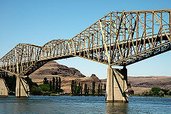 |
1927, 1968 | 1982-07-16 | Lyons Ferry 46°35′28"N 118°13′28"W |
Columbia | cantilever truss bridge |
| South Hamma Hamma River Bridge |  |
1924 | 1982-07-16 | Eldon Eldon, Washington Eldon is an unincorporated community in Mason County, Washington, United States. Eldon is located along U.S. Route 101 on the scenic Hood Canal... 47°32′11"N 123°2′28"W |
Mason | tied-arch bridge |
| South Puyallup River Bridge South Puyallup River Bridge The South Puyallup River Bridge was built in 1930-31 in Mount Rainier National Park as part of the West Side Road project, planned to link the park's Nisqually and Carbon River entrances. The stone-faced reinforced concrete bridge was designed by the National Park Service and the Bureau of Public... |
 |
1931 | 1991-03-13 | Nisqually Entrance 46°48′29"N 121°53′26"W |
Pierce Pierce County, Washington right|thumb|[[Tacoma, Washington|Tacoma]] - Seat of Pierce CountyPierce County is the second most populous county in the U.S. state of Washington. Formed out of Thurston County on December 22, 1852, by the legislature of Oregon Territory... |
Rustic style |
| Spokane River Bridge at Fort Spokane |  |
1941 | 1995-03-28 | Hunters Hunters, Washington Hunters is an unincorporate community in Stevens County, Washington, United States. The population for its zip code was 306 at the 2000 census.-Demographics:As of the census of 2000, there were 306 people, and 135 households residing in the zip code... 47°54′30"N 118°18′59"W |
Lincoln | Steel Through Truss |
| Spokane River Bridge at Long Lake Dam | 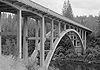 |
1949 | 1995-05-24 | Rearden 47°50′19"N 117°51′5"W |
Lincoln, Stevens | Arch |
| St. Andrews Creek Bridge St. Andrews Creek Bridge TheSt. Andrews Creek Bridge was built in 1930-31 as part of the West Side Road in Mount Rainier National Park. The bridge spans and is almost wide, carrying a two-lane road on a stone-faced concrete bridge... |
 |
1931 | 1991-03-13 | Nisqually Entrance 46°50′10"N 121°54′15"W |
Pierce Pierce County, Washington right|thumb|[[Tacoma, Washington|Tacoma]] - Seat of Pierce CountyPierce County is the second most populous county in the U.S. state of Washington. Formed out of Thurston County on December 22, 1852, by the legislature of Oregon Territory... |
Rustic style |
| Sunset Boulevard Bridge | 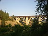 |
1911 | 1982-07-16 | Spokane Spokane, Washington Spokane is a city located in the Northwestern United States in the state of Washington. It is the largest city of Spokane County of which it is also the county seat, and the metropolitan center of the Inland Northwest region... 47°39′0"N 117°26′48"W |
Spokane Spokane County, Washington Spokane County is a county located in the U.S. state of Washington, named after the Spokane tribe. As of the 2010 census the population was 471,221, making it the fourth most populous county in Washington state. The largest city and county seat is Spokane, the second largest city in the state,... |
|
| Tacoma Narrows Bridge Ruins (Galloping Gertie) Tacoma Narrows Bridge (1940) The 1940 Tacoma Narrows Bridge was the first incarnation of the Tacoma Narrows Bridge, a suspension bridge in the U.S. state of Washington that spanned the Tacoma Narrows strait of Puget Sound between Tacoma and the Kitsap Peninsula. It opened to traffic on July 1, 1940, and dramatically collapsed... |
1940 | 1992-08-31 | Tacoma Tacoma, Washington Tacoma is a mid-sized urban port city and the county seat of Pierce County, Washington, United States. The city is on Washington's Puget Sound, southwest of Seattle, northeast of the state capital, Olympia, and northwest of Mount Rainier National Park. The population was 198,397, according to... |
Pierce Pierce County, Washington right|thumb|[[Tacoma, Washington|Tacoma]] - Seat of Pierce CountyPierce County is the second most populous county in the U.S. state of Washington. Formed out of Thurston County on December 22, 1852, by the legislature of Oregon Territory... |
||
| Toppenish-Zillah Bridge | 1947 | 1995-05-24 | Toppenish Toppenish, Washington Toppenish is a city in Yakima County, Washington, in the United States. As of the 2010 census, the city population was 8,949.-History:The General Allotment Act of 1887 granted an allotment of land to a woman of half Indian ancestry, Josephine Bowser Lillie, known as "The Mother of Toppenish"... 46°23′59"N 120°16′49"W |
Yakima Yakima County, Washington Yakima County is the second largest county by area in the U.S. state of Washington. It is named after the Yakama tribe of Native Americans. In the 2010 census, its population was 243,231... |
Box Girder | |
| University Bridge | 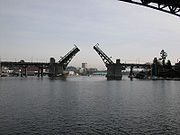 |
1915, 1919 | 1982-07-16 | Seattle Seattle, Washington Seattle is the county seat of King County, Washington. With 608,660 residents as of the 2010 Census, Seattle is the largest city in the Northwestern United States. The Seattle metropolitan area of about 3.4 million inhabitants is the 15th largest metropolitan area in the country... 47°39′12"N 122°19′8"W |
King King County, Washington King County is a county located in the U.S. state of Washington. The population in the 2010 census was 1,931,249. King is the most populous county in Washington, and the 14th most populous in the United States.... |
dbl-leaf trunnion bascule br |
| Vance Creek Bridge | 1929 | 1982-07-16 | Shelton Shelton, Washington Shelton is the county seat, of Mason County, Washington, United States. Shelton is the westernmost city on Puget Sound. The population was 9,834 at the 2010 census. In terms of population, the city is ranked 161 out of approximately 500 municipalities in Washington... 47°20′6"N 123°19′10"W |
Mason | ||
| Interstate Bridge Interstate Bridge The Interstate Bridge is a pair of nearly identical steel vertical-lift, through-truss bridges that carry Interstate 5 traffic over the Columbia River between Vancouver, Washington, and Portland, Oregon, in the United States... (Vancouver-Portland Bridge) |
1915–1917 | 1982-07-16 | Vancouver Vancouver, Washington Vancouver is a city on the north bank of the Columbia River in the U.S. state of Washington. Incorporated in 1857, it is the fourth largest city in the state with a 2010 census population of 161,791 as of April 1, 2010... 45°37′22"N 122°40′17"W |
Clark Clark County, Washington Clark County is a county located in the southwestern part of the U.S. state of Washington, across the Columbia River from Portland, Oregon.Clark County was the first county of Washington, named after William Clark of the Lewis and Clark Expedition... |
||
| Washington Street Bridge | 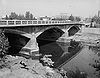 |
1908 | 1982-07-16 | Spokane Spokane, Washington Spokane is a city located in the Northwestern United States in the state of Washington. It is the largest city of Spokane County of which it is also the county seat, and the metropolitan center of the Inland Northwest region... 47°39′48"N 117°25′1"W |
Spokane Spokane County, Washington Spokane County is a county located in the U.S. state of Washington, named after the Spokane tribe. As of the 2010 census the population was 471,221, making it the fourth most populous county in Washington state. The largest city and county seat is Spokane, the second largest city in the state,... |
|
| West Monitor Bridge | 1907 | 1982-07-16 | Monitor Monitor, Washington Monitor is a small unincorporated community in Chelan County, Washington, United States. It is situated along the Wenatchee River about 8 miles upstream from its junction with the Columbia River in the fertile Wenatchee Valley.... 47°30′4"N 120°25′28"W |
Chelan | pinconnected Pratt truss br. | |
| White River Bridge White River Bridge The White River Bridge was built in 1929 in Mount Rainier National Park as part of the Yakima Park Road project. The new road was planned to open up access to the northeastern portion of the park. The bridge, spanning the White River was built by contractor John D... |
 |
1929 | 1991-03-13 | White River Entrance 46°53′53"N 121°37′4"W |
Pierce Pierce County, Washington right|thumb|[[Tacoma, Washington|Tacoma]] - Seat of Pierce CountyPierce County is the second most populous county in the U.S. state of Washington. Formed out of Thurston County on December 22, 1852, by the legislature of Oregon Territory... |
Rustic style |
| Winnifred Street Bridge Winnifred Street Bridge The Winnifred Street Bridge is a concrete box girder bridge in Ruston, Washington. It was built in 1941 by S. R. Gray. The bridge has a deck, and sits above railroad tracks in a ravine.... |
 |
1941 | 1995-03-28 | Ruston Ruston, Washington Ruston is a town in Pierce County, Washington, United States. The population was 749 at the 2010 census.Although it is nearly indistinguishable from the adjacent city of Tacoma, the predominantly residential area still retains its status as a separate municipality long after it ceased to be a... 47°17′52"N 122°30′43"W |
Pierce Pierce County, Washington right|thumb|[[Tacoma, Washington|Tacoma]] - Seat of Pierce CountyPierce County is the second most populous county in the U.S. state of Washington. Formed out of Thurston County on December 22, 1852, by the legislature of Oregon Territory... |
Concrete Box Girder |
| Yale Bridge Yale Bridge The Yale Bridge or Lewis River Bridge spans the Lewis River near Yale, Washington. It was built in 1932 by Cowlitz and Clark counties. The suspension bridge has a clear span of , with a total length of , replacing a previous steel truss bridge at the site... |
1932 | 1982-07-16 | Yale Yale, Washington Yale is an unincorporated community in Cowlitz County, Washington, United States. Named for Yale University, the only school teaching forestry in the 19th century, Yale is located in the Speelyai Creek Valley at the junction of State Route 503 and Lewis River Road... 45°57′40"N 122°22′18"W |
Clark Clark County, Washington Clark County is a county located in the southwestern part of the U.S. state of Washington, across the Columbia River from Portland, Oregon.Clark County was the first county of Washington, named after William Clark of the Lewis and Clark Expedition... |
short-span steel suspen. br. | |
| "Jack Knife" Bridge | 1913, 1914 | removed 1990-07-16 |
Everett Everett, Washington Everett is the county seat of and the largest city in Snohomish County, Washington, United States. Named for Everett Colby, son of founder Charles L. Colby, it lies north of Seattle. The city had a total population of 103,019 at the 2010 census, making it the 6th largest in the state and... |
Snohomish Snohomish County, Washington Snohomish County is a county located in the U.S. state of Washington. It is named after the Snohomish tribe. Since 2000, the county's population has grown from 606,024 to 713,335 residents , making it one of the fastest-growing in the state, ranking third in overall population after King and... |
Stra. Heel Trunnion Bascule | |
| Chow Chow Bridge | 1952 | removed 1988-04-25 |
Taholah Taholah, Washington Taholah is a census-designated place on the Quinault Indian Reservation, in Grays Harbor County, Washington, United States. Named for a Quinault chief in 1905, its population was 824 at the 2000 census... |
Grays Harbor Grays Harbor County, Washington Grays Harbor County is a county in the state of Washington, in the United States of America. As of 2010, the population was 72,797. The county seat is at Montesano, and its largest city is Aberdeen. The county is named after a large estuarine bay near its southwestern corner... |
cable-stayed bridge | |
| Doty Bridge | 1924–1926 | removed 1990-07-16 |
Doty Doty, Washington Doty is an unincorporated town between Dryad and Pe Ell in Washington State, US. C. A. Doty built a sawmill here around 1900, and the town that sprang up around it was named after him. The town once boasted the largest sawmill in Lewis County. There is a Post Office, a General Store, two... |
Lewis Lewis County, Washington Lewis County is a county located in the U.S. state of Washington. As of 2010, the population was 75,455. The county seat is at Chehalis, and its largest city is Centralia.... |
||
| Lacey V. Murrow Floating Bridge | 1940 | removed 1991-03-11 |
Seattle Seattle, Washington Seattle is the county seat of King County, Washington. With 608,660 residents as of the 2010 Census, Seattle is the largest city in the Northwestern United States. The Seattle metropolitan area of about 3.4 million inhabitants is the 15th largest metropolitan area in the country... |
King King County, Washington King County is a county located in the U.S. state of Washington. The population in the 2010 census was 1,931,249. King is the most populous county in Washington, and the 14th most populous in the United States.... |
Pontoon | |
| McClure Bridge | 1912 | removed 1990-07-16 |
Palouse Palouse, Washington Palouse is a city in Whitman County, Washington, United States. The population was 998 at the 2010 census. Palouse is named for the region of farmland in which it is situated, and was incorporated in 1888.-History:... |
Whitman Whitman County, Washington Whitman County is a county located in the U.S. state of Washington. As of the 2010 census, the population was 44,776, with the majority living in its largest city, Pullman, home to Washington State University, the state's land-grant university. The county seat is at Colfax.Whitman County was... |
Timber Pratt-truss | |
| North 4th and Dock Street Bridge | removed 1984-03-13 |
Tacoma Tacoma, Washington Tacoma is a mid-sized urban port city and the county seat of Pierce County, Washington, United States. The city is on Washington's Puget Sound, southwest of Seattle, northeast of the state capital, Olympia, and northwest of Mount Rainier National Park. The population was 198,397, according to... |
Pierce Pierce County, Washington right|thumb|[[Tacoma, Washington|Tacoma]] - Seat of Pierce CountyPierce County is the second most populous county in the U.S. state of Washington. Formed out of Thurston County on December 22, 1852, by the legislature of Oregon Territory... |
Pratt truss | ||
| Pasco-Kennewick Bridge | 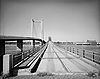 |
1922 | removed 1990-07-16 |
Pasco Pasco, Washington Pasco is a city in and the county seat of Franklin County, Washington, United States.Pasco is one of three cities that make up the Tri-Cities region of the state of Washington... |
Franklin | cantilever truss bridge |
| Prosser Steel Bridge | 1911 | removed 1990-07-16 |
Prosser Prosser, Washington Prosser is a city in and the county seat of Benton County, Washington, United States, along the Yakima River with only one zip code 99350. The population was 5,714 at the 2010 census.-History:... |
Benton Benton County, Washington Benton County is a county located in the south-central portion of the U.S. state of Washington. The Columbia River makes up the north, south, and east boundaries of the county. In 2010, its population was 175,177. The county seat is Prosser, and its largest city is Kennewick... |
||
| Weyerhaeuser Pe Ell Bridge | 1934 | removed 1990-07-16 |
Pe Ell Pe Ell, Washington Pe Ell is a town in Lewis County, Washington, United States. The population was 632 at the 2010 census.-History:Pe Ell was officially incorporated on March 9, 1906.... |
Lewis Lewis County, Washington Lewis County is a county located in the U.S. state of Washington. As of 2010, the population was 75,455. The county seat is at Chehalis, and its largest city is Centralia.... |
covered Howe pony truss br. | |
| Winslow Railroad Bridge | 1916, 1917 | removed 1999-12-15 |
Colville Colville, Washington Colville is a city in Stevens County, Washington, United States. The population was 4,673 at the 2010 census. It is the county seat of Stevens County.- History :... |
Stevens | Howe truss bridge | |
| Wishkah River Bridge | 1915 | removed 1990-07-16 |
Greenwood | Grays Harbor Grays Harbor County, Washington Grays Harbor County is a county in the state of Washington, in the United States of America. As of 2010, the population was 72,797. The county seat is at Montesano, and its largest city is Aberdeen. The county is named after a large estuarine bay near its southwestern corner... |
Warren through truss bridge |