
List of bridges on the National Register of Historic Places in Iowa
Encyclopedia
This is a list of bridge
s and tunnel
s on the National Register of Historic Places
in the U.S. state
of Iowa
.
Bridge
A bridge is a structure built to span physical obstacles such as a body of water, valley, or road, for the purpose of providing passage over the obstacle...
s and tunnel
Tunnel
A tunnel is an underground passageway, completely enclosed except for openings for egress, commonly at each end.A tunnel may be for foot or vehicular road traffic, for rail traffic, or for a canal. Some tunnels are aqueducts to supply water for consumption or for hydroelectric stations or are sewers...
s on the National Register of Historic Places
National Register of Historic Places
The National Register of Historic Places is the United States government's official list of districts, sites, buildings, structures, and objects deemed worthy of preservation...
in the U.S. state
U.S. state
A U.S. state is any one of the 50 federated states of the United States of America that share sovereignty with the federal government. Because of this shared sovereignty, an American is a citizen both of the federal entity and of his or her state of domicile. Four states use the official title of...
of Iowa
Iowa
Iowa is a state located in the Midwestern United States, an area often referred to as the "American Heartland". It derives its name from the Ioway people, one of the many American Indian tribes that occupied the state at the time of European exploration. Iowa was a part of the French colony of New...
.
| Name | Image | Built | Listed | Location | County | Type |
|---|---|---|---|---|---|---|
| 280th Street Bridge | 1898 | 1998-06-25 | Independence Independence, Iowa Independence is a city in and the county seat of Buchanan County, Iowa, United States. The population was 5,966 in the 2010 census, a decline from 6,014 in the 2000 census... 42°23′6"N 91°56′34"W |
Buchanan Buchanan County, Iowa -2010 census:The 2010 census recorded a population of 20,958 in the county, with a population density of . There were 8,968 housing units, of which 8,161 were occupied.-2000 census:... |
Pinned kingpost pony truss | |
| Adair Viaduct | 1923 | 1998-06-25 | Adair Adair, Iowa Adair is a city in Adair and Guthrie Counties in the U.S. state of Iowa. The population was 839 at the 2000 census.The Guthrie County portion of Adair is part of the Des Moines–West Des Moines Metropolitan Statistical Area.-History:... 41°29′56"N 94°38′23"W |
Adair | Concrete open spandrel arch | |
| Adel Bridge | 1882 | 2002-04-18 | Adel Adel, Iowa Adel is a city along the North Raccoon River in Dallas County in the U.S. state of Iowa. The population was 3,435 at the 2000 census. It is the county seat of Dallas County and the birthplace of 1939 Heisman Trophy winner Nile Kinnick.... 41°36′57"N 94°0′43"W |
Dallas Dallas County, Iowa -2010 census:The 2010 census recorded a population of 66,135 in the county, with a population density of . There were 27,260 housing units, of which 25,240 were occupied.-2000 census:... |
Pratt Through Truss | |
| Albright Bridge | 1907 | 1998-06-25 | Webster City Webster City, Iowa Webster City is a city in Hamilton County, Iowa, United States. The population was 8,070 at the United States 2010 Census. It is the county seat of Hamilton County. Webster City is known as 'Boone River Country' with the Boone River meandering along the east side of the city from north to south... 42°24′20"N 93°48′36"W |
Hamilton Hamilton County, Iowa -2010 census:The 2010 census recorded a population of 15,673 in the county, with a population density of . There were 7,219 housing units, of which 6,540 were occupied.-2000 census:... |
Pinned Pratt through truss | |
| Alden Bridge | 1936 | 1998-05-15 | Alden Alden, Iowa Alden is a city in Hardin County, Iowa, United States. The population was 904 at the 2000 census.-Geography:Alden's longitude and latitude coordinates in decimal form are 42.516867, -93.375809... 42°31′16"N 93°22′32"W |
Hardin Hardin County, Iowa -2010 census:The 2010 census recorded a population of 17,534 in the county, with a population density of . There were 8,224 housing units, of which 7,296 were occupied.-2000 census:... |
concrete rigid frame | |
| Ames Creek Bridge | 1912 | 1998-06-25 | De Witt 41°51′1"N 90°30′36"W |
Clinton Clinton County, Iowa -2010 census:The 2010 census recorded a population of 49,116 in the county, with a population density of . There were 21,733 housing units, of which 20,223 were occupied.-2000 census:... |
Concrete through girder | |
| Beaver Creek Bridge | 1946 | 1998-06-25 | Schleswig Schleswig, Iowa Schleswig is a city in Crawford County, Iowa, United States. The population was 833 at the 2000 census.Schleswig is named after the region of the same name in Germany and Denmark, from which the original settlers came.-Geography:... 42°11′48"N 95°30′54"W |
Crawford Crawford County, Iowa -2010 census:The 2010 census recorded a population of 17,096 in the county, with a population density of . There were 6,943 housing units, of which 6,413 were occupied.-2000 census:... |
Bowstring pony arch-truss | |
| Beaver Creek Bridge | 1919 | 1998-06-25 | Ogden Ogden, Iowa Ogden is a city in Yell Township, Boone County, Iowa, United States. The population was 2,023 at the 2000 census. It is part of the 'Boone, Iowa Micropolitan Statistical Area', which is a part of the larger 'Ames-Boone, Iowa Combined Statistical Area'.... 42°2′34"N 94°8′41"W |
Boone Boone County, Iowa -2010 census:The 2010 census recorded a population of 26,306 in the county, with a population density of . There were 11,756 housing units, of which 10,728 were occupied.-2000 census:... |
Concrete Marsh arch | |
| Beaver Creek Bridge | 1916 | 1998-06-25 | Perry Perry, Iowa Perry is a city in Dallas County, Iowa, United States, along the North Raccoon River. The population was 7,633 at the 2000 census. It is part of the Des Moines–West Des Moines Metropolitan Statistical Area.... 41°50′47"N 94°2′53"W |
Dallas Dallas County, Iowa -2010 census:The 2010 census recorded a population of 66,135 in the county, with a population density of . There were 27,260 housing units, of which 25,240 were occupied.-2000 census:... |
Concrete Marsh arch | |
| Bellefountain Bridge | 1898 | 1998-05-15 | Tracy Tracy, Iowa Tracy is an unincorporated community in eastern Marion County, Iowa, United States. It lies along local roads east of the city of Knoxville, the county seat of Marion County. Its elevation is 784 feet . Although Tracy is unincorporated, it has a post office with the ZIP code of 50256, which... 41°19′58"N 92°51′56"W |
Mahaska Mahaska County, Iowa -2010 census:The 2010 census recorded a population of 22,381 in the county, with a population density of . There were 9,766 housing units, of which 8,975 were occupied.-2000 census:... |
pinned Pratt through truss | |
| Berkhimer Bridge Berkhimer Bridge Berkhimer Bridge is a high truss bridge built in 1899 located near Humboldt, Iowa. It spans the Des Moines River for .-Status:Humboldt County Engineer Paul Jacobson speculated that Berkhimer Bridge may be closed due to an increase in traffic on the route. This is because the bridge is being used as... |
1899 | 1998-05-15 | Humboldt Humboldt, Iowa Humboldt is a city in Humboldt County, Iowa, United States. The population was 4,690 at the 2010 census, gaining 238 people since the 2000 census.- History :... 42°44′21"N 94°15′11"W |
Humboldt Humboldt County, Iowa -2010 census:The 2010 census recorded a population of 9,815 in the county, with a population density of . There were 4,684 housing units, of which 4,209 were occupied.-2000 census:... |
Pennsylvania through truss | |
| Bertram Bridge | 1891 | 1998-05-15 | Bertram Bertram, Iowa Bertram is a city in Linn County, Iowa, United States. The population was 681 at the 2000 census, although the official population was later revised to 263 when officials discovered that 418 students living in a Cornell College dormitory in nearby Mount Vernon had incorrectly been reported as... 41°57′23"N 91°31′36"W |
Linn Linn County, Iowa -2010 census:The 2010 census recorded a population of 211,226 in the county, with a population density of . There were 92,251 housing units, of which 86,134 were occupied.-2000 census:... |
pinned Pratt through truss | |
| Big Creek Bridge | 1891 | 1998-06-25 | Madrid Madrid, Iowa Madrid is a city in Douglas Township, Boone County, Iowa, United States. The population was 2,264 at the 2000 census. It is part of the 'Boone, Iowa Micropolitan Statistical Area', which is a part of the larger 'Ames-Boone, Iowa Combined Statistical Area'.... 41°53′33"N 93°45′1"W |
Boone Boone County, Iowa -2010 census:The 2010 census recorded a population of 26,306 in the county, with a population density of . There were 11,756 housing units, of which 10,728 were occupied.-2000 census:... |
Pinned Pratt pony truss | |
| Big Creek Bridge 2 | 1917 | 1998-06-25 | Madrid Madrid, Iowa Madrid is a city in Douglas Township, Boone County, Iowa, United States. The population was 2,264 at the 2000 census. It is part of the 'Boone, Iowa Micropolitan Statistical Area', which is a part of the larger 'Ames-Boone, Iowa Combined Statistical Area'.... 41°53′33"N 93°45′2"W |
Boone Boone County, Iowa -2010 census:The 2010 census recorded a population of 26,306 in the county, with a population density of . There were 11,756 housing units, of which 10,728 were occupied.-2000 census:... |
Concrete Marsh arch | |
| Big Slough Creek Bridge | 1937 | 1998-05-15 | Nichols Nichols, Iowa Nichols is a city in Muscatine County, Iowa, United States. The population was 374 at the 2000 census. It is part of the Muscatine Micropolitan Statistical Area.-Geography:Nichols is located at .... 41°28′38"N 91°20′53"W |
Muscatine Muscatine County, Iowa -2010 census:The 2010 census recorded a population of 42,745 in the county, with a population density of . There were 17,910 housing units, of which 16,412 were occupied.-2000 census:... |
concrete rigid frame | |
| Boone Bridge | 1927, 1928 | 1998-06-25 | Boone Boone, Iowa Boone is a city in and the county seat of Des Moines Township, Boone County, Iowa, United States. It is the principal city of the 'Boone, Iowa Micropolitan Statistical Area', which encompasses all of Boone County. This micropolitan statistical area, along with the 'Ames, Iowa Metropolitan... 42°2′32"N 93°56′0"W |
Boone Boone County, Iowa -2010 census:The 2010 census recorded a population of 26,306 in the county, with a population density of . There were 11,756 housing units, of which 10,728 were occupied.-2000 census:... |
Parker/Pratt through truss | |
| Boone Bridge 2 | 1910 | 1998-06-25 | Boone Boone, Iowa Boone is a city in and the county seat of Des Moines Township, Boone County, Iowa, United States. It is the principal city of the 'Boone, Iowa Micropolitan Statistical Area', which encompasses all of Boone County. This micropolitan statistical area, along with the 'Ames, Iowa Metropolitan... 42°3′47"N 93°58′13"W |
Boone Boone County, Iowa -2010 census:The 2010 census recorded a population of 26,306 in the county, with a population density of . There were 11,756 housing units, of which 10,728 were occupied.-2000 census:... |
Pennsylvania through truss | |
| Boone River Bridge | 1912 | 1998-05-15 | Goldfield Goldfield, Iowa Goldfield is a city in Wright County, Iowa, United States. The population was 680 at the 2000 census.-Geography:Goldfield's longitude and latitude coordinatesin decimal form are 42.734708, -93.920163... 42°51′26"N 93°56′46"W |
Wright Wright County, Iowa -2010 census:The 2010 census recorded a population of 13,229 in the county, with a population density of . There were 6,529 housing units, of which 5,625 were occupied.-2000 census:... |
riveted Warren pony truss | |
| Boone Viaduct |  |
1899–1901 | 1978-11-17 | Boone Boone, Iowa Boone is a city in and the county seat of Des Moines Township, Boone County, Iowa, United States. It is the principal city of the 'Boone, Iowa Micropolitan Statistical Area', which encompasses all of Boone County. This micropolitan statistical area, along with the 'Ames, Iowa Metropolitan... |
Boone Boone County, Iowa -2010 census:The 2010 census recorded a population of 26,306 in the county, with a population density of . There were 11,756 housing units, of which 10,728 were occupied.-2000 census:... |
Pratt deck truss |
| Bridge near New Sharon | 1998-05-15 | New Sharon New Sharon, Iowa New Sharon is a city in Mahaska County, Iowa, United States. The population was 1,301 at the 2000 census.-Geography:New Sharon is located at .... 41°22′26"N 92°43′51"W |
Mahaska Mahaska County, Iowa -2010 census:The 2010 census recorded a population of 22,381 in the county, with a population density of . There were 9,766 housing units, of which 8,975 were occupied.-2000 census:... |
pipe kingpst pony truss | ||
| Bridge near West Liberty | 1937 | 1998-05-15 | West Liberty West Liberty, Iowa West Liberty is a city in Muscatine County, Iowa, United States. The population was 3,332 at the 2000 census. It is part of the Muscatine Micropolitan Statistical Area.... 41°34′6"N 91°19′24"W |
Muscatine Muscatine County, Iowa -2010 census:The 2010 census recorded a population of 42,745 in the county, with a population density of . There were 17,910 housing units, of which 16,412 were occupied.-2000 census:... |
welded steel rigig frame | |
| Bridgeport Bridge | 1904 | 1998-05-15 | Denmark Denmark, Iowa Denmark is an unincorporated community in northeastern Lee County, Iowa, United States. It lies along Iowa Highway 16 north of the city of Fort Madison, the county seat of Lee County. Its elevation is 722 feet . Although Denmark is unincorporated, it has a post office, with the ZIP code of... 40°47′25"N 91°21′50"W |
Lee Lee County, Iowa -2010 census:The 2010 census recorded a population of 35,862 in the county, with a population density of . There were 16,205 housing units, of which 14,610 were occupied.-2000 census:... |
Pennsylvania through truss | |
| Brooke Creek Bridge Brooke Creek Bridge Brooke Creek Bridge is a bridge in Buena Vista County, Iowa. The bridge has an elevation of 396 meters. The bridge was added to the National Register of Historic Places in 1998. The historic significance of the bridge is in architecture and engineering.... |
1909 | 1998-06-25 | Sioux Rapids Sioux Rapids, Iowa Sioux Rapids is a city in Buena Vista County, Iowa, United States. The population was 720 at the 2000 census.-Geography:Sioux Rapids is located at... 42°50′11"N 95°17′8"W |
Buena Vista Buena Vista County, Iowa -2010 census:The 2010 census recorded a population of 20,260 in the county, with a population density of . There were 8,237 housing units, of which 7,522 were occupied.-2000 census:... |
Concrete spandrel arch | |
| Buck Grove Bridge | 1998-06-25 | Buck Grove Buck Grove, Iowa Buck Grove is a city in Crawford County, Iowa, United States. The population was 49 at the 2000 census.-Geography:Buck Grove is located at .According to the United States Census Bureau, the city has a total area of , all of it land.... 41°54′50"N 95°22′49"W |
Crawford Crawford County, Iowa -2010 census:The 2010 census recorded a population of 17,096 in the county, with a population density of . There were 6,943 housing units, of which 6,413 were occupied.-2000 census:... |
Bowstring pony arch-truss | ||
| Burlington Railroad Overpass | 1937 | 1998-05-15 | Chariton Chariton, Iowa Chariton is a city in and the county seat of Lucas County, Iowa, United States. The population was 4,573 at the 2000 census. It is the primary distribution center for, and former corporate seat of, the Hy-Vee supermarket chain.-History:... 41°2′27"N 93°21′57"W |
Lucas Lucas County, Iowa -2010 census:The 2010 census recorded a population of 8,898 in the county, with a population density of . There were 4,238 housing units, of which 3,689 were occupied.-2000 census:... |
three-hinge deck archtruss | |
| Burlington, Cedar Rapids, and Northern Railroad-Rock Rapids Station, Railroad Track and Bridge | 1886 | 1976-11-07 | Rock Rapids Rock Rapids, Iowa Rock Rapids is a city in Lyon County in the northwestern part of the U.S. state of Iowa, an area known for its strong Dutch heritage and conservative politics. It is the county seat of Lyon County and home to Central Lyon Schools. The population was 2,549 in the 2010 census, a decline from 2,573... 43°26′1"N 96°9′59"W |
Lyon Lyon County, Iowa -2010 census:The 2010 census recorded a population of 11,581 in the county, with a population density of . There were 4,848 housing units, of which 4,442 were occupied.-2000 census:... |
||
| Calamus Creek Bridge | 1905 | 1998-05-15 | Maxwell Maxwell, Iowa Maxwell is a city in Story County, Iowa, United States. The population was 807 at the 2000 census. It is part of the 'Ames, Iowa Metropolitan Statistical Area', which is a part of the larger 'Ames-Boone, Iowa Combined Statistical Area'.-Geography:... 41°53′4"N 93°22′54"W |
Story Story County, Iowa -2010 census:The 2010 census recorded a population of 89,542 in the county, with a population density of . There were 36,789 housing units, of which 34,736 were occupied.-2000 census:... |
concrete Luten arch | |
| Cascade Bridge | 1896 | 1998-06-25 | Burlington Burlington, Iowa Burlington is a city in, and the county seat of Des Moines County, Iowa, United States. The population was 25,663 in the 2010 census, a decline from the 26,839 population in the 2000 census. Burlington is the center of a micropolitan area including West Burlington, Iowa and Middletown, Iowa and... 40°46′52"N 91°5′54"W |
Des Moines Des Moines County, Iowa -2010 census:The 2010 census recorded a population of 40,325 in the county, with a population density of . There were 18,535 housing units, of which 17,003 were occupied.-2000 census:... |
Baltimore deck truss | |
| Chain Lakes Bridge | 1884 | 1998-05-15 | Hiawatha Hiawatha, Iowa Hiawatha is a city in Linn County, Iowa, United States. It is a suburb located north of Cedar Rapids and is part of the Cedar Rapids Metropolitan Statistical Area... 42°2′59"N 91°46′32"W |
Linn Linn County, Iowa -2010 census:The 2010 census recorded a population of 211,226 in the county, with a population density of . There were 92,251 housing units, of which 86,134 were occupied.-2000 census:... |
pinned Pratt through truss | |
| Chambers Ford Bridge | 1890 | 1998-05-15 | Chelsea Chelsea, Iowa Chelsea is a city in Tama County, Iowa. The population was 287 at the 2000 census. The town is located in the Iowa River Valley and has suffered severe damage in several floods.-Geography:... 41°53′1"N 92°20′9"W |
Tama Tama County, Iowa -2010 census:The 2010 census recorded a population of 17,767 in the county, with a population density of . There were 7,766 housing units, of which 6,947 were occupied.-2000 census:... |
pinned Pratt through truss | |
| Cherry Street Bridge | 1929 | 1998-06-25 | Shell Rock Shell Rock, Iowa Shell Rock is a city in Butler County, Iowa, United States, along the Shell Rock River. The population was 1,298 at the 2000 census. The city is located along the county's eastern border, between Butler and Bremer counties.-Geography:... 42°42′28"N 92°35′8"W |
Butler Butler County, Iowa -2010 census:The 2010 census recorded a population of 14,867 in the county, with a population density of . There were 6,682 housing units, of which 6,120 were occupied.-2000 census:... |
Concrete open-spandrel arch | |
| Chicago, Rock Island and Pacific Railroad Stone Arch Viaduct | 1868 | 1998-07-15 | Shelby Shelby, Iowa Shelby is a city in Pottawattamie and Shelby counties in the U.S. state of Iowa. The population was 696 at the 2000 census.-Geography:Shelby is located at .... 41°31′26"N 95°26′11"W |
Shelby Shelby County, Iowa -2010 census:The 2010 census recorded a population of 12,167 in the county, with a population density of . There were 5,542 housing units, of which 5,085 were occupied.-2000 census:... |
||
| CM and StP Railroad Underpass | 1903 | 1998-05-15 | Washington Washington, Iowa Washington is a city in and the county seat of Washington County, Iowa, United States. It is part of the Iowa City, Iowa Metropolitan Statistical Area. The population was 7,047 at the 2000 census.-History:... 41°17′36"N 91°43′28"W |
Washington | Riveted Warren deck truss | |
| Coal Creek Bridge | 1889 | 1998-05-15 | Carlisle Carlisle, Iowa Carlisle is a city in Warren and Polk counties in the U.S. state of Iowa. The population was 3,497 at the 2000 census. The city is part of the Des Moines–West Des Moines Metropolitan Statistical Area.... 41°25′44"N 93°20′46"W |
Warren | Pinned Pratt pony truss | |
| Coon Rapids Bridge | 1922, 1923 | 1998-06-25 | Coon Rapids Coon Rapids, Iowa Coon Rapids is a city in Carroll and Guthrie counties in the U.S. state of Iowa. The population was 1,305 at the 2010 census unchanged from the 2000 census. The small portion of Coon Rapids that lies in Guthrie County is part of the Des Moines–West Des Moines Metropolitan Statistical... 41°51′54"N 94°40′38"W |
Carroll Carroll County, Iowa -2010 census:The 2010 census recorded a population of 20,816 in the county, with a population density of . There were 9,376 housing units, of which 8,683 were occupied.-2000 census:... |
Riveted Warren deck truss | |
| Corbett's/Eby's Mill Bridge | 1871 | 1985-04-11 | Scotch Grove Scotch Grove, Iowa Scotch Grove is an unincorporated community in Jones County, Iowa, United States. Scotch Grove is located on Iowa Highway 38 southeast of Monticello and north of Center Junction.... 42°11′59"N 91°3′32"W |
Jones Jones County, Iowa -2010 census:The 2010 census recorded a population of 20,638 in the county, with a population density of . There were 8,911 housing units, of which 8,151 were occupied.-2000 census:... |
Arch beam truss | |
| Cornelia Lake Bridge | 1877 | 1998-05-15 | Clarion Clarion, Iowa Clarion is a city in and the county seat of Wright County, Iowa, United States. The population was 2,968 at the 2000 census.Clarion is the birthplace of the four-leaf clover emblem used by the 4-H Clubs of America, conceived of in 1907 by the local school superintendent, O.H... 42°47′31"N 93°41′38"W |
Wright Wright County, Iowa -2010 census:The 2010 census recorded a population of 13,229 in the county, with a population density of . There were 6,529 housing units, of which 5,625 were occupied.-2000 census:... |
Pinned Pratt pony truss | |
| County Line Bridge | 1893 | 1998-05-15 | Columbus Junction Columbus Junction, Iowa Columbus Junction is a city in Louisa County, Iowa, United States. The population was 1,900 at the 2000 census. It is part of the Muscatine Micropolitan Statistical Area.... 41°16′51"N 91°29′6"W |
Louisa Louisa County, Iowa -2010 census:The 2010 census recorded a population of 11,387 in the county, with a population density of . There were 5,002 housing units, of which 4,346 were occupied.-2000 census:... /Washington |
pinned Pratt through truss | |
| Court Avenue Bridge | 1918 | 1998-05-15 | Des Moines Des Moines, Iowa Des Moines is the capital and the most populous city in the US state of Iowa. It is also the county seat of Polk County. A small portion of the city extends into Warren County. It was incorporated on September 22, 1851, as Fort Des Moines which was shortened to "Des Moines" in 1857... 41°35′9"N 93°37′3"W |
Polk Polk County, Iowa Polk County is a county located in the U.S. state of Iowa. The population was 430,640 in the 2010 census, an increase from 374,601 in the 2000 census. The county seat is Des Moines, which is also the capital city of Iowa... |
filled spandral arch | |
| Cunningham Bridge | 1886 | 1998-05-15 | Bevington Bevington, Iowa Bevington is a city in Madison and Warren Counties in the U.S. state of Iowa. The population was 58 at the 2000 census. It is part of the Des Moines–West Des Moines Metropolitan Statistical Area.-Geography:... 41°24′6"N 93°51′40"W |
Madison Madison County, Iowa -2010 census:The 2010 census recorded a population of 15,679 in the county, with a population density of . There were 6,554 housing units, of which 6,025 were occupied.-2000 census:... |
pinned Pratt through truss | |
| Cutler-Donahue Covered Bridge | 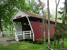 |
1871, 1970 | 1976-10-08 | Winterset Winterset, Iowa Winterset is a city in Madison County, Iowa, United States. The population was 4,768 at the 2000 census. It is the county seat of Madison County.... 41°19′52"N 94°0′31"W |
Madison Madison County, Iowa -2010 census:The 2010 census recorded a population of 15,679 in the county, with a population density of . There were 6,554 housing units, of which 6,025 were occupied.-2000 census:... |
covered bridge |
| Des Moines River Bridge | 1916 | 1998-05-15 | Swea City Swea City, Iowa Swea City is a city in Kossuth County, Iowa, United States. The population was 642 at the 2000 census.-History:In February 1893, the town of Reynolds became known as Swea City. Swea City was petitioned for incorporation on December 11, 1894 with a population of 161... 43°20′42"N 94°26′33"W |
Kossuth Kossuth County, Iowa -2010 census:The 2010 census recorded a population of 15,543 in the county, with a population density of . There were 7,486 housing units, of which 6,697 were occupied.-2000 census:... |
Marsh arch | |
| Des Moines River Bridge Des Moines River Bridge (Humboldt, Iowa) The Des Moines River Bridge in Humboldt, Iowa was a plate girder bridge built in 1939 located in Humboldt County, Iowa. It carried Iowa Highway 3 over the West Fork of the Des Moines River for . It was listed on the National Register of Historic Places.... |
1939 | 1998-05-15 | Humbolt 42°43′55"N 94°15′30"W |
Humboldt Humboldt County, Iowa -2010 census:The 2010 census recorded a population of 9,815 in the county, with a population density of . There were 4,684 housing units, of which 4,209 were occupied.-2000 census:... |
steel plate deck girderuss | |
| Dry Run Bridge | 1898 | 1998-06-25 | Littleport Littleport, Iowa Littleport is an unincorporated community and former city in Clayton County, Iowa, USA. After the Volga River flood of May 16, 1999, much of the town was destroyed and most residents moved away. At the 2000 Census, there were 26 residents... 42°45′10"N 91°22′8"W |
Clayton Clayton County, Iowa -2010 census:The 2010 census recorded a population of 18,129 in the county, with a population density of . There were 8,999 housing units, of which 7,599 were occupied.-2000 census:... |
Steel stringer | |
| Dunkerton Bridge | 1909 | 1998-06-25 | Dunkerton Dunkerton, Iowa Dunkerton is a city in Black Hawk County, Iowa, United States. The population was 749 at the 2000 census. It is part of the Waterloo–Cedar Falls Metropolitan Statistical Area.-History:... 42°34′23"N 92°9′38"W |
Black Hawk Black Hawk County, Iowa -2010 census:The 2010 census recorded a population of 131,090 in the county, with a population density of . There were 55,887 housing units, of which 52,470 were occupied.-2000 census:... |
Concrete spandrelarch | |
| East Indian Creek Bridge | 1912 | 1998-05-15 | Nevada Nevada, Iowa Nevada is a city in and the county seat of Story County, Iowa, United States. The population was 6,798 in the 2010 census, an increase from 6,658 in the 2000 census. It is also part of the 'Ames, Iowa Metropolitan Statistical Area', which is a part of the larger 'Ames-Boone, Iowa Combined... 41°58′31"N 93°23′13"W |
Story Story County, Iowa -2010 census:The 2010 census recorded a population of 89,542 in the county, with a population density of . There were 36,789 housing units, of which 34,736 were occupied.-2000 census:... |
conctete Luten arch | |
| East Soldier River Bridge | 1998-06-25 | Charter Oak Charter Oak, Iowa Charter Oak is a city in Crawford County, Iowa, United States, along the East Soldier River. The population was 530 at the 2000 census.-Geography:Charter Oak is located at .... 42°3′28"N 95°38′1"W |
Crawford Crawford County, Iowa -2010 census:The 2010 census recorded a population of 17,096 in the county, with a population density of . There were 6,943 housing units, of which 6,413 were occupied.-2000 census:... |
Bowstring pony arch-truss | ||
| Eisenhower Bridge | 1888 | 1998-05-15 | Milton Milton, Iowa Milton is a city in Van Buren County, Iowa, United States. The population was 550 at the 2000 census. The town was founded by settlers from Milton, Delaware in 1844.-Geography:Milton is located at .... 40°40′43"N 92°7′2"W |
Van Buren | Pinned Pratt through truss | |
| Eldorado Bridge | 1898, 1899 | 1998-06-25 | Eldorado 43°3′13"N 91°50′5"W |
Fayette Fayette County, Iowa -2010 census:The 2010 census recorded a population of 20,880 in the county, with a population density of . There were 9,558 housing units, of which 8,634 were occupied.-2000 census:... |
Pinned Camelback truss | |
| Elkader Keystone Bridge | 1888, 1889 | 1976-11-07 | Elkader Elkader, Iowa Elkader is a city in Clayton County, Iowa, United States. The population was 1,465 at the 2000 census. It is the county seat of Clayton County.-History:The city is named after Algerian leader Abd al-Qadir al-Jaza'iri... 42°51′17"N 91°24′13"W |
Clayton Clayton County, Iowa -2010 census:The 2010 census recorded a population of 18,129 in the county, with a population density of . There were 8,999 housing units, of which 7,599 were occupied.-2000 census:... |
stone arch bridge | |
| Ellsworth Ranch Bridge | 1895 | 1998-07-15 | Armstrong Armstrong, Iowa Armstrong is a city in Emmet County, Iowa, United States. The population was 979 at the 2000 census. It was originally known as Armstrong Grove.-Geography:Armstrong is located at .... 43°27′36"N 94°34′49"W |
Emmet Emmet County, Iowa -2010 census:The 2010 census recorded a population of 10,302 in the county, with a population density of . There were 4,758 housing units, of which 4,236 were occupied.-2000 census:... |
Pratt/Warren through truss | |
| Ely's Stone Bridge Ely's Stone Bridge Ely's Stone Bridge is a bridge that was listed on the National Register of Historic Places on March 7, 1979. The bridge was built across Deer Creek in 1893 by Ely Reuben, Sr., a farmer, and his son Ely Reuben, Jr. The bridge is a three-span arch bridge made of stone from the stream bed and... |
1893 | 1979-03-07 | Monticello Monticello, Iowa Monticello is a city in Jones County, Iowa, United States. As of the 2010 census, the city population was 3,796. It is part of the Cedar Rapids Metropolitan Statistical Area.-Geography:Monticello is located at... 42°15′24"N 91°13′31"W |
Jones Jones County, Iowa -2010 census:The 2010 census recorded a population of 20,638 in the county, with a population density of . There were 8,911 housing units, of which 8,151 were occupied.-2000 census:... |
||
| Eveland Bridge | 1876, 1877 | 1998-05-15 | Oskaloosa Oskaloosa, Iowa Oskaloosa is the county seat of Mahaska County, Iowa, United States. The population was 11,463 in the 2010 census, an increase from 10,938 in the 2000 census. -History:... 41°14′4"N 92°45′22"W |
Mahaska Mahaska County, Iowa -2010 census:The 2010 census recorded a population of 22,381 in the county, with a population density of . There were 9,766 housing units, of which 8,975 were occupied.-2000 census:... |
pinned Whipple through truss | |
| First Avenue Bridge | 1920 | 1998-05-15 | Cedar Rapids Cedar Rapids, Iowa Cedar Rapids is the second largest city in Iowa and is the county seat of Linn County. The city lies on both banks of the Cedar River, north of Iowa City and east of Des Moines, the state's capital and largest city... 41°58′36"N 91°40′20"W |
Linn Linn County, Iowa -2010 census:The 2010 census recorded a population of 211,226 in the county, with a population density of . There were 92,251 housing units, of which 86,134 were occupied.-2000 census:... |
open spandrel arch | |
| Fish Creek Bridge | 1894 | 1998-05-15 | Salem Salem, Iowa Salem is a city in Henry County, Iowa, United States. The population was 464 at the 2000 census.-Geography:Salem is located at .According to the United States Census Bureau, the city has a total area of , all of it land.... 40°51′14"N 91°34′51"W |
Henry Henry County, Iowa -2010 census:The 2010 census recorded a population of 20,145 in the county, with a population density of . There were 8,280 housing units, of which 7,666 were occupied.-2000 census:... |
pinned Pratt bedstead | |
| Flint River Bridge | 1883 | 1998-06-25 | Burlington Burlington, Iowa Burlington is a city in, and the county seat of Des Moines County, Iowa, United States. The population was 25,663 in the 2010 census, a decline from the 26,839 population in the 2000 census. Burlington is the center of a micropolitan area including West Burlington, Iowa and Middletown, Iowa and... 40°54′19"N 91°13′22"W |
Des Moines Des Moines County, Iowa -2010 census:The 2010 census recorded a population of 40,325 in the county, with a population density of . There were 18,535 housing units, of which 17,003 were occupied.-2000 census:... |
Pinned Pratt through truss | |
| Fort Atkinson Bridge | 1892 | 1998-05-15 | Fort Atkinson Fort Atkinson, Iowa Fort Atkinson is a city in Winneshiek County, Iowa, United States. The population was 389 at the 2000 census. It is home to the historic Fort Atkinson State Preserve and hosts a large annual fur-trapper rendezvous each September... 43°9′12"N 91°55′43"W |
Winneshiek Winneshiek County, Iowa -2010 census:The 2010 census recorded a population of 21,056 in the county, with a population density of . There were 8,721 housing units, of which 7,997 were occupied.-2000 census:... |
Pinned Pratt through truss | |
| Fort Madison Bridge |  |
1925, 1927 | 1999-08-27 | Fort Madison Fort Madison, Iowa Fort Madison, situated on the Mississippi River, is a city in and one of the county seats of Lee County, Iowa, United States. The other county seat is Keokuk. The population was 10,715 at the 2000 census... 40°37′16"N 91°17′15"W |
Lee Lee County, Iowa -2010 census:The 2010 census recorded a population of 35,862 in the county, with a population density of . There were 16,205 housing units, of which 14,610 were occupied.-2000 census:... |
Swing-span through truss |
| Fremont Mill Bridge Fremont Mill Bridge The Fremont Mill Bridge in Anamosa, Iowa was built in 1873. It was designed and/or built by Massillon Iron Bridge Company. It is a bowstring, through arch truss bridge. It was listed on the National Register of Historic Places in 1998.... |
1873 | 1998-05-15 | Anamosa Anamosa, Iowa As of the census of 2000, there were 5,494 people, 1,750 households, and 1,135 families residing in the city. The population density was 2,453.4 people per square mile . There were 1,884 housing units at an average density of 841.3 per square mile... 42°6′36"N 91°7′58"W |
Jones Jones County, Iowa -2010 census:The 2010 census recorded a population of 20,638 in the county, with a population density of . There were 8,911 housing units, of which 8,151 were occupied.-2000 census:... |
bowstring through arch truss | |
| Garnavillo Township Bridge | 1902 | 1998-06-25 | Garnavillo Garnavillo, Iowa Garnavillo is a city in Clayton County, Iowa, United States. The population was 754 at the 2000 census.-Geography:Garnavillo is located at .According to the United States Census Bureau, the city has a total area of , all of it land.... 42°51′47"N 91°16′57"W |
Clayton Clayton County, Iowa -2010 census:The 2010 census recorded a population of 18,129 in the county, with a population density of . There were 8,999 housing units, of which 7,599 were occupied.-2000 census:... |
Stone arch | |
| Garnavillo Township Culvert | 1899 | 1998-06-25 | Garnavillo Garnavillo, Iowa Garnavillo is a city in Clayton County, Iowa, United States. The population was 754 at the 2000 census.-Geography:Garnavillo is located at .According to the United States Census Bureau, the city has a total area of , all of it land.... 42°52′4"N 91°16′10"W |
Clayton Clayton County, Iowa -2010 census:The 2010 census recorded a population of 18,129 in the county, with a population density of . There were 8,999 housing units, of which 7,599 were occupied.-2000 census:... |
Stone arch culvert | |
| Garretson Outlet Bridge | 1913 | 1999-03-12 | Whiting Whiting, Iowa Whiting is a city in Monona County, Iowa, United States. The population was 707 at the 2000 census.-Geography:Whiting is located at .According to the United States Census Bureau, the city has a total area of , all of it land.... 42°12′16"N 96°6′24"W |
Monona Monona County, Iowa -2010 census:The 2010 census recorded a population of 9,243 in the county, with a population density of . There were 4,697 housing units, of which 4,050 were occupied.-2000 census:... |
Warren pony truss | |
| Gilliece Bridge | 1873, 1874 | 1998-05-15 | Bluffton 43°24′54"N 91°57′32"W |
Winneshiek Winneshiek County, Iowa -2010 census:The 2010 census recorded a population of 21,056 in the county, with a population density of . There were 8,721 housing units, of which 7,997 were occupied.-2000 census:... |
Bowstring through arch-truss | |
| Gipple's Quarry Bridge | 1893 | 1998-05-15 | Columbus Junction Columbus Junction, Iowa Columbus Junction is a city in Louisa County, Iowa, United States. The population was 1,900 at the 2000 census. It is part of the Muscatine Micropolitan Statistical Area.... 41°12′17"N 91°24′31"W |
Louisa Louisa County, Iowa -2010 census:The 2010 census recorded a population of 11,387 in the county, with a population density of . There were 5,002 housing units, of which 4,346 were occupied.-2000 census:... |
pinned Pratt through truss | |
| Goldfield Bridge | 1921 | 1998-05-15 | Goldfield Goldfield, Iowa Goldfield is a city in Wright County, Iowa, United States. The population was 680 at the 2000 census.-Geography:Goldfield's longitude and latitude coordinatesin decimal form are 42.734708, -93.920163... 42°44′14"N 93°55′29"W |
Wright Wright County, Iowa -2010 census:The 2010 census recorded a population of 13,229 in the county, with a population density of . There were 6,529 housing units, of which 5,625 were occupied.-2000 census:... |
Concrete deck girder | |
| Grand River Bridge | 1885 | 1998-05-15 | Arispe Arispe, Iowa Arispe is a city in Union County, Iowa, United States. The population was 89 at the 2000 census. It is closely related to the nearby town of Creston.-Geography:Arispe is located at .... 40°57′48"N 94°2′20"W |
Union | Pinned Pratt through truss | |
| Grand River Bridge | 1998-06-25 | Leon Leon, Iowa Leon is a city in Decatur County, Iowa, United States. The population was 1,983 at the 2000 census. It is the county seat of Decatur County.The city is located near the Little River Lake Recreation Area... 40°43′18"N 93°52′33"W |
Decatur Decatur County, Iowa -2010 census:The 2010 census recorded a population of 8,457 in the county, with a population density of . There were 3,834 housing units, of which 3,223 were occupied.-2000 census:... |
Pinned Pratt through truss | ||
| Green Mill Ford Bridge | 1871 | 1998-06-25 | Janesville Janesville, Iowa Janesville is a city in Black Hawk and Bremer counties in the U.S. state of Iowa. The population was 829 at the 2000 census. Janesville's population increased to 930 at the 2010 United States Census, an increase of 12.2%. It is part of the Waterloo–Cedar Falls Metropolitan Statistical... 42°40′20"N 92°25′44"W |
Bremer | Bowstring through arch-truss | |
| Hale Bridge | 1877, 1879 | 1998-05-15 | Oxford Junction Oxford Junction, Iowa Oxford Junction is a city in Jones County, Iowa, United States. The population was 573 at the 2000 census. It is part of the Cedar Rapids Metropolitan Statistical Area.-Geography:Oxford Junction is located at .... 42°0′17"N 91°3′52"W |
Jones Jones County, Iowa -2010 census:The 2010 census recorded a population of 20,638 in the county, with a population density of . There were 8,911 housing units, of which 8,151 were occupied.-2000 census:... |
bowstring through arch truss | |
| Hammond Bridge | 1894 | 1998-05-15 | Hamilton Hamilton, Iowa Hamilton is a city in Marion County, Iowa, United States. The population was 144 at the 2000 census.-Geography:Hamilton is located at .According to the United States Census Bureau, the city has a total area of , all of it land.... 41°10′39"N 93°0′50"W |
Marion Marion County, Iowa -2010 census:The 2010 census recorded a population of 33,309 in the county, with a population density of . There were 13,914 housing units, of which 12,723 were occupied.-2000 census:... |
Howe covered truss | |
| Harvey Railroad Bridge | 1878 | 1998-05-15 | Harvey Harvey, Iowa Harvey is a city in Marion County, Iowa, United States. The population was 277 at the 2000 census.- Geography :Harvey is located at .According to the United States Census Bureau, the city has a total area of , all land.... 41°19′2"N 92°54′36"W |
Marion Marion County, Iowa -2010 census:The 2010 census recorded a population of 33,309 in the county, with a population density of . There were 13,914 housing units, of which 12,723 were occupied.-2000 census:... |
pinned Pratt through truss | |
| Hawkeye Creek Bridge | 1909, 1910 | 1998-06-25 | Mediapolis Mediapolis, Iowa Mediapolis is a city in Des Moines County, Iowa, United States. The population was 1,644 at the 2000 census. It is part of the Burlington, IA–IL Micropolitan Statistical Area.-Geography:Mediapolis's longitude and latitude coordinates are .... 41°2′33"N 91°3′26"W |
Des Moines Des Moines County, Iowa -2010 census:The 2010 census recorded a population of 40,325 in the county, with a population density of . There were 18,535 housing units, of which 17,003 were occupied.-2000 census:... |
Riveted Pratt through truss | |
| Hawkeye Street Underpass | 1889 | 1998-06-25 | Nora Springs Nora Springs, Iowa Nora Springs is a city in Cerro Gordo and Floyd Counties in the U.S. state of Iowa, along the Shell Rock River. As of the 2000 census, the city population was 1,532.... 43°8′24"N 93°0′20"W |
Floyd Floyd County, Iowa -2010 census:The 2010 census recorded a population of 16,303 in the county, with a population density of . There were 7,526 housing units, of which 6,886 were occupied.-2000 census:... |
Stone masonry arch | |
| Herrold Bridge | 1921 | 1998-05-15 | Herrold 41°43′19"N 93°44′59"W |
Polk Polk County, Iowa Polk County is a county located in the U.S. state of Iowa. The population was 430,640 in the 2010 census, an increase from 374,601 in the 2000 census. The county seat is Des Moines, which is also the capital city of Iowa... |
concrete deck girder | |
| Hogback Covered Bridge | 1884 | 1976-08-28 | Winterset Winterset, Iowa Winterset is a city in Madison County, Iowa, United States. The population was 4,768 at the 2000 census. It is the county seat of Madison County.... 41°23′9"N 94°3′0"W |
Madison Madison County, Iowa -2010 census:The 2010 census recorded a population of 15,679 in the county, with a population density of . There were 6,554 housing units, of which 6,025 were occupied.-2000 census:... |
Town lattice | |
| Holliwell Covered Bridge Holliwell Bridge Holliwell Bridge is a wooden covered bridge in Madison County, Iowa. It was built in 1880 by Benton Jones and renovated in 1995 at a cost of $225,000. It is featured in the film The Bridges of Madison County.... |
 |
1880 | 1976-08-28 | Winterset Winterset, Iowa Winterset is a city in Madison County, Iowa, United States. The population was 4,768 at the 2000 census. It is the county seat of Madison County.... 41°19′21"N 93°57′33"W |
Madison Madison County, Iowa -2010 census:The 2010 census recorded a population of 15,679 in the county, with a population density of . There were 6,554 housing units, of which 6,025 were occupied.-2000 census:... |
Town lattice |
| IANR Railroad Underpass | 1887 | 1998-05-15 | Cedar Rapids Cedar Rapids, Iowa Cedar Rapids is the second largest city in Iowa and is the county seat of Linn County. The city lies on both banks of the Cedar River, north of Iowa City and east of Des Moines, the state's capital and largest city... 41°56′40"N 91°38′12"W |
Linn Linn County, Iowa -2010 census:The 2010 census recorded a population of 211,226 in the county, with a population density of . There were 92,251 housing units, of which 86,134 were occupied.-2000 census:... |
stone masonry arch | |
| Imes Covered Bridge Imes Bridge The Imes Bridge is a wooden covered bridge in Madison County, Iowa. Built in 1870, it was originally located over the Middle River. In 1887 it was moved to a spot over Clinton Creek, and in 1977 was moved again to its present site. It was renovated in 1997 for a cost of $31,807.... |
 |
1870, 1887, 1977 | 1979-02-09 | St. Charles St. Charles, Iowa St. Charles is a city in Madison County, Iowa, United States. The population was 619 at the 2000 census. It is part of the Des Moines–West Des Moines Metropolitan Statistical Area.-Geography:St... 41°17′18"N 93°47′56"W |
Madison Madison County, Iowa -2010 census:The 2010 census recorded a population of 15,679 in the county, with a population density of . There were 6,554 housing units, of which 6,025 were occupied.-2000 census:... |
covered bridge |
| Indian Creek Bridge | 1998-05-15 | Cedar Rapids Cedar Rapids, Iowa Cedar Rapids is the second largest city in Iowa and is the county seat of Linn County. The city lies on both banks of the Cedar River, north of Iowa City and east of Des Moines, the state's capital and largest city... 41°58′2"N 91°34′52"W |
Linn Linn County, Iowa -2010 census:The 2010 census recorded a population of 211,226 in the county, with a population density of . There were 92,251 housing units, of which 86,134 were occupied.-2000 census:... |
pinned Pratt through truss | ||
| Iowa Falls Bridge | 1928 | 1998-05-15 | Iowa Falls Iowa Falls, Iowa Iowa Falls is a city in Hardin County, Iowa, United States. Iowa Falls is the home of Ellsworth Community College. It is also a regional transportation center, located along U.S. Routes 20 and 65 and the Canadian National and Union Pacific Railroads. The population was 5,193 at the 2000 census. A... 42°31′6"N 93°15′46"W |
Hardin Hardin County, Iowa -2010 census:The 2010 census recorded a population of 17,534 in the county, with a population density of . There were 8,224 housing units, of which 7,296 were occupied.-2000 census:... |
open spandrel arch | |
| Jefferson Street Viaduct | 1935, 1936 | 1998-05-15 | Ottumwa Ottumwa, Iowa Ottumwa is a city in and the county seat of Wapello County, Iowa, United States. The population was 24,998 at the 2000 census. It is located in the southeastern part of Iowa, and the city is split into northern and southern halves by the Des Moines River.... 41°0′39"N 92°24′55"W |
Wapello Wapello County, Iowa -2010 census:The 2010 census recorded a population of 35,625 in the county, with a population density of . There were 16,098 housing units, of which 14,552 were occupied.-2000 census:... |
Riveted Warren deck truss | |
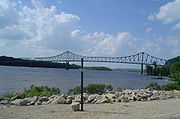
| Julien Dubuque Bridge Julien Dubuque Bridge The Julien Dubuque Bridge traverses the Mississippi River. It joins the cities of Dubuque, Iowa, and East Dubuque, Illinois. The bridge is part of the U.S. Highway 20 route... |
 |
1943 | 1999-08-27 | Dubuque Dubuque, Iowa Dubuque is a city in and the county seat of Dubuque County, Iowa, United States, located along the Mississippi River. In 2010 its population was 57,637, making it the ninth-largest city in the state and the county's population was 93,653.... 42°29′30"N 90°39′17"W |
Dubuque Dubuque County, Iowa Dubuque County is a county located in the U.S. state of Iowa. The population was 93,653 in the 2010 census, an increase from 89,143 in the 2000 census. The county seat is the city of Dubuque. Dubuque County is coterminous with the Dubuque, Iowa Metropolitan Statistical Area, and is the seventh... |
Cantilevered tied arch |
| Keigley Branch Bridge | 1913 | 1998-05-15 | Gilbert Gilbert, Iowa Gilbert is a city in Story County, Iowa, United States. The population was 987 at the 2000 census. It is part of the Ames, Iowa Metropolitan Statistical Area, which is a part of the larger Ames-Boone, Iowa Combined Statistical Area.-Geography:... 42°8′13"N 93°36′3"W |
Story Story County, Iowa -2010 census:The 2010 census recorded a population of 89,542 in the county, with a population density of . There were 36,789 housing units, of which 34,736 were occupied.-2000 census:... |
filled spandrel arch | |
| Kilbourn Bridge | 1908, 1909 | 1998-05-15 | Kilbourn 40°47′56"N 91°58′14"W |
Van Buren | Pinned Pratt through truss | |
| Kittyhawk Avenue Bridge | 1913 | 1998-06-25 | Carroll Carroll, Iowa -2010 census:The 2010 census recorded a population of 10,103 in the city, with a population density of . There were 4,698 housing units, of which 4,357 were occupied.... 42°1′47"N 94°53′52"W |
Carroll Carroll County, Iowa -2010 census:The 2010 census recorded a population of 20,816 in the county, with a population density of . There were 9,376 housing units, of which 8,683 were occupied.-2000 census:... |
Riveted Warren pony truss | |
| Klondike Bridge | 1913, 1914 | 1998-05-15 | Larchwood Larchwood, Iowa Larchwood is a city in Lyon County, Iowa, United States. The population was 788 at the 2000 census. Its main employer is the Novartis Animal Vaccines plant located southwest of the city.-History:... 43°23′16"N 96°31′18"W |
Lyon Lyon County, Iowa -2010 census:The 2010 census recorded a population of 11,581 in the county, with a population density of . There were 4,848 housing units, of which 4,442 were occupied.-2000 census:... |
Pratt through truss | |
| Lawrence Bridge | 1880 | 1998-05-15 | Jackson Junction Jackson Junction, Iowa Jackson Junction is a city in Winneshiek County, Iowa, United States. The population was 60 at the 2000 census. It is the home of Turkey Valley Community schools, which serves the nearby communities of Waucoma; Lawler; Fort Atkinson; St... 43°4′58"N 92°3′8"W |
Winneshiek Winneshiek County, Iowa -2010 census:The 2010 census recorded a population of 21,056 in the county, with a population density of . There were 8,721 housing units, of which 7,997 were occupied.-2000 census:... |
Pinned Pratt pony truss | |
| Le Grand Bridge (1914) Le Grand Bridge (1914) The Le Grand Bridge was built in 1914-1915. It is a concrete girder bridge that is one of the early examples of work of that type by the Iowa State Highway Commission.... |
1914, 1915 | 1998-05-15 | Le Grand Le Grand, Iowa Le Grand is a city in Marshall and Tama Counties in the U.S. state of Iowa. The population was 883 at the 2000 census.-Geography:Le Grand's longitude and latitude coordinatesin decimal form are 42.006211, -92.776497... 42°1′47"N 92°46′59"W |
Marshall Marshall County, Iowa -2010 census:The 2010 census recorded a population of 40,648 in the county, with a population density of . There were 16,831 housing units, of which 15,538 were occupied.-2000 census:... |
concrete deck girder | |
| Le Grand Bridge (1896) Le Grand Bridge (1896) The Le Grand Bridge in Le Grand, Iowa was built in 1896.It brings Abbott Avenue over a backwater of the Iowa River. Since Abbott Avenue is the border between Marshall and Tama County, the bridge is in two counties lengthwise... |
1896 | 1998-05-15 | Le Grand Le Grand, Iowa Le Grand is a city in Marshall and Tama Counties in the U.S. state of Iowa. The population was 883 at the 2000 census.-Geography:Le Grand's longitude and latitude coordinatesin decimal form are 42.006211, -92.776497... 42°1′54"N 92°45′58"W |
Tama Tama County, Iowa -2010 census:The 2010 census recorded a population of 17,767 in the county, with a population density of . There were 7,766 housing units, of which 6,947 were occupied.-2000 census:... |
pinned Pratt through truss | |
| Lincoln Highway Bridge Lincoln Highway Bridge (Tama, Iowa) The Lincoln Highway Bridge is located in Tama, Iowa along the historic Lincoln Highway. The bridge was built in 1914 and is listed on the National Register of Historic Places.... |
 |
1915 | 1978-03-30 | Tama Tama, Iowa Tama is a city in Tama County, Iowa, United States. The population was 2,731 at the 2000 census. Tama is located a few miles from the Meskwaki Settlement, Iowa's only significant Native American community. Tama was located on the historic Lincoln Highway and is home to an original Lincoln Highway... 41°57′52"N 92°33′47"W |
Tama Tama County, Iowa -2010 census:The 2010 census recorded a population of 17,767 in the county, with a population density of . There were 7,766 housing units, of which 6,947 were occupied.-2000 census:... |
Single-span slab bridge |
| Lincoln Highway-Little Beaver Creek Bridge | 1915 | 1993-03-29 | Grand Junction Grand Junction, Iowa Grand Junction is a city in Greene County, Iowa, United States. The population was 964 at the 2000 census.-Geography:Grand Junction is located at .... 42°2′57"N 94°10′37"W |
Greene Greene County, Iowa -2010 census:The 2010 census recorded a population of 9,336 in the county, with a population density of . There were 4,546 housing units, of which 3,996 were occupied.-2000 census:... |
Concrete slab bridge | |
| Little Sioux River Bridge | 1900, 1901 | 1998-06-25 | Spencer Spencer, Iowa Spencer is a city in the state of Iowa , and the county seat of Clay County . It is located at the confluence of the Little Sioux and Ocheyedan Rivers. The population was 11,233 in the 2010 census, a decline from 11,317 in the 2000 census. Spencer is famous as the home of the Clay County Fair,... 43°9′47"N 95°10′12"W |
Clay Clay County, Iowa -2010 census:The 2010 census recorded a population of 16,667 in the county, with a population density of . There were 8,062 housing units, of which 7,282 were occupied.-2000 census:... |
Pennsylvania through truss | |
| Lower Road Bridge | 1878 | 1998-05-15 | Anamosa Anamosa, Iowa As of the census of 2000, there were 5,494 people, 1,750 households, and 1,135 families residing in the city. The population density was 2,453.4 people per square mile . There were 1,884 housing units at an average density of 841.3 per square mile... 41°55′49"N 91°18′44"W |
Jones Jones County, Iowa -2010 census:The 2010 census recorded a population of 20,638 in the county, with a population density of . There were 8,911 housing units, of which 8,151 were occupied.-2000 census:... |
bowstring through arch truss | |
| Main Street Bridge | 1909, 1910 | 1999-03-12 | Charles City Charles City, Iowa Charles City is a city in Floyd County, Iowa, United States. The population was 7,652 at the 2010 census a decrease of 160, or 2%, from 7,812 at the 2000 census. It is the county seat of Floyd County. Charles City is a significant commercial and transportation center for the area, located on U.S... 43°3′48"N 92°40′35"W |
Floyd Floyd County, Iowa -2010 census:The 2010 census recorded a population of 16,303 in the county, with a population density of . There were 7,526 housing units, of which 6,886 were occupied.-2000 census:... |
Concrete spandrel arch | |
| Mallory Township Bridge | 1890 | 1998-06-25 | Osterdock Osterdock, Iowa Osterdock is a city located in Clayton County, Iowa. As of the 2000 census, the city had a total population of 50.- Geography :Osterdock is located at 42°43'47" North, 91°9'42" West .... 42°43′8"N 91°10′42"W |
Clayton Clayton County, Iowa -2010 census:The 2010 census recorded a population of 18,129 in the county, with a population density of . There were 8,999 housing units, of which 7,599 were occupied.-2000 census:... |
Pinned Pratt pony truss | |
| Marsh Rainbow Arch Bridge | 1914 | 1989-03-30 | Lake City Lake City, Iowa Lake City is a city in Calhoun County, Iowa, United States, founded in 1856. The population was 1,787 at the 2000 census. The sign coming into town proudly proclaims that Lake City has "Everything but a Lake."... 42°13′46"N 94°46′3"W |
Calhoun Calhoun County, Iowa -2010 census:The 2010 census recorded a population of 14,867 in the county, with a population density of . There were 5,108 housing units, of which 4,242 were occupied.-2000 census:... |
Triple rainbow arch | |
| Matsell Bridge | 1938, 1939 | 1998-05-15 | Springville Springville, Iowa Springville is a city in Linn County, Iowa, United States. The population was 1,074 at the 2010 census. It is part of the Cedar Rapids Metropolitan Statistical Area.-Geography:Springville is located at .... 42°7′51"N 91°22′57"W |
Linn Linn County, Iowa -2010 census:The 2010 census recorded a population of 211,226 in the county, with a population density of . There were 92,251 housing units, of which 86,134 were occupied.-2000 census:... |
continuous plate through gir | |
| McDowell Bridge | 1883 | 1998-05-15 | Montezuma Montezuma, Iowa Montezuma is a city in Poweshiek County, Iowa, United States. The population was 1,440 at the 2000 census. It is the county seat of Poweshiek County.-Geography:Montezuma's longitude and latitude coordinatesin decimal form are 41.584737, -92.525258... 41°31′14"N 92°40′32"W |
Poweshiek Poweshiek County, Iowa -2010 census:The 2010 census recorded a population of 18,914 in the county, with a population density of . There were 8,949 housing units, of which 7,555 were occupied.-2000 census:... |
bowstring through arch-truss | |
| Mederville Bridge | 1918 | 1998-06-25 | Mederville 42°45′50"N 91°25′17"W |
Clayton Clayton County, Iowa -2010 census:The 2010 census recorded a population of 18,129 in the county, with a population density of . There were 8,999 housing units, of which 7,599 were occupied.-2000 census:... |
Concrete open spandrel arch | |
| Melan Bridge | 1893, 1894 | 1974-10-18 | Rock Rapids Rock Rapids, Iowa Rock Rapids is a city in Lyon County in the northwestern part of the U.S. state of Iowa, an area known for its strong Dutch heritage and conservative politics. It is the county seat of Lyon County and home to Central Lyon Schools. The population was 2,549 in the 2010 census, a decline from 2,573... 43°25′49"N 96°9′19"W |
Lyon Lyon County, Iowa -2010 census:The 2010 census recorded a population of 11,581 in the county, with a population density of . There were 4,848 housing units, of which 4,442 were occupied.-2000 census:... |
Melan design | |
| Mill Creek Bridge | 1888, 1889 | 1998-06-25 | Clarence Clarence, Iowa Clarence is a city in Cedar County, Iowa, United States. The population was 1,008 at the 2000 census.- History :The community was originally called "Onion Grove" because of the widespread growth of wild onions in the area... 41°54′15"N 91°3′53"W |
Cedar Cedar County, Iowa -2010 census:The 2010 census recorded a population of 13,956 in the county, with a population density of . There were 8,064 housing units, of which 7,511 were occupied.-2000 census:... |
Pinned Pratt pony truss | |
| Mill Creek Bridge | 1891 | 1998-06-25 | Cherokee Cherokee, Iowa Cherokee is a city in Cherokee County, Iowa, United States. The population was 5,932 at the 2010 Census, up from 5,369 at the 2000 census. It is the county seat of Cherokee County. Cherokee is also the home of the Cherokee Mental Health Institute, under the Iowa Department of Human Services... 42°46′38"N 95°31′47"W |
Cherokee Cherokee County, Iowa -2010 census:The 2010 census recorded a population of 12,072 in the county, with a population density of . There were 5,777 housing units, of which 5,207 were occupied.-2000 census:... |
Pinned Pratt through truss | |
| Mill Race Bridge | 1892 | 1998-06-25 | West Union West Union, Iowa West Union is a city in Fayette County, Iowa, United States. The population was 2,549 at the 2000 census. It is the county seat of Fayette County... 43°4′38"N 91°53′19"W |
Fayette Fayette County, Iowa -2010 census:The 2010 census recorded a population of 20,880 in the county, with a population density of . There were 9,558 housing units, of which 8,634 were occupied.-2000 census:... |
Pinned Warren through truss | |
| Miller Bridge | 1884 | 1998-05-15 | Winterset Winterset, Iowa Winterset is a city in Madison County, Iowa, United States. The population was 4,768 at the 2000 census. It is the county seat of Madison County.... 41°24′45"N 93°56′34"W |
Madison Madison County, Iowa -2010 census:The 2010 census recorded a population of 15,679 in the county, with a population density of . There were 6,554 housing units, of which 6,025 were occupied.-2000 census:... |
pinned Pratt through truss | |
| Minerva Creek Bridge | 1910 | 1998-05-15 | Clemons Clemons, Iowa Clemons is a city in Marshall County, Iowa, United States. The population was 148 at the 2000 census.-Geography:Clemons is located at .According to the United States Census Bureau, the city has a total area of , all of it land.... 42°8′21"N 93°9′21"W |
Marshall Marshall County, Iowa -2010 census:The 2010 census recorded a population of 40,648 in the county, with a population density of . There were 16,831 housing units, of which 15,538 were occupied.-2000 census:... |
conctrete Luten arch | |
| Monona Township Culvert | 1899 | 1998-06-25 | Luana Luana, Iowa Luana is a city in Clayton County, Iowa, United States. The population was 249 at the 2000 census.The location of a large plant, Luana is located along US Highways 18 and 52 in northern Clayton County... 43°2′39"N 91°28′35"W |
Clayton Clayton County, Iowa -2010 census:The 2010 census recorded a population of 18,129 in the county, with a population density of . There were 8,999 housing units, of which 7,599 were occupied.-2000 census:... |
Stone arch culvert | |
| Monsrud Bridge | 1887 | 1998-06-25 | Waterville Waterville, Iowa Waterville is a city in Paint Creek Township, Allamakee County, Iowa, United States. The population was 145 at the 2000 census.-Geography:Waterville is located at .... 43°13′9"N 91°19′36"W |
Allamakee Allamakee County, Iowa -2010 census:The 2010 census recorded a population of 14,330 in the county, with a population density of . There were 7,617 housing units, of which 5,845 were occupied.-2000 census:... |
Bowstring pony arch-truss | |
| Moore's Ford Bridge (Iowa) | 1884 | 1998-05-15 | Monticello City 42°16′47"N 90°55′40"W |
Jones Jones County, Iowa -2010 census:The 2010 census recorded a population of 20,638 in the county, with a population density of . There were 8,911 housing units, of which 8,151 were occupied.-2000 census:... |
pinned Pratt through truss | |
| Morgan Bridge | 1891 | 1998-05-15 | Peru 41°10′16"N 93°55′55"W |
Madison Madison County, Iowa -2010 census:The 2010 census recorded a population of 15,679 in the county, with a population density of . There were 6,554 housing units, of which 6,025 were occupied.-2000 census:... |
pinned Pratt through truss | |
| Nishnabotna River Bridge | 1929, 1930 | 1998-05-15 | Henderson Henderson, Iowa Henderson is a city in Mills County, Iowa, United States. The population was 171 at the 2000 census.-Geography:Henderson is located at .According to the United States Census Bureau, the city has a total area of , all of it land.... 41°5′21"N 95°28′49"W |
Mills Mills County, Iowa -2010 census:The 2010 census recorded a population of 15,059 in the county, with a population density of . There were 6,109 housing units, of which 5,605 were occupied.-2000 census:... |
riveted Warren pony truss | |
| Nishnabotna River Bridge | 1999-03-12 | Manilla Manilla, Iowa Manilla is a city in Crawford County, Iowa, United States, along the West Branch of the West Nishnabotna River. The population was 839 at the 2000 census... 41°52′0"N 95°16′0"W |
Crawford Crawford County, Iowa -2010 census:The 2010 census recorded a population of 17,096 in the county, with a population density of . There were 6,943 housing units, of which 6,413 were occupied.-2000 census:... |
Bowstring pony arch-truss | ||
| Nishnabotna River Bridge | 1998-06-25 | Manilla Manilla, Iowa Manilla is a city in Crawford County, Iowa, United States, along the West Branch of the West Nishnabotna River. The population was 839 at the 2000 census... 41°56′8"N 95°13′8"W |
Crawford Crawford County, Iowa -2010 census:The 2010 census recorded a population of 17,096 in the county, with a population density of . There were 6,943 housing units, of which 6,413 were occupied.-2000 census:... |
Bowstring pony arch truss | ||
| Nodaway River Bridge | 1876 | 1998-05-15 | Grant Grant, Iowa Grant is a city in Montgomery County, Iowa, United States. The population was 102 at the 2000 census.-Geography:Grant is located at .... 41°8′52"N 95°2′31"W |
Montgomery Montgomery County, Iowa -2010 census:The 2010 census recorded a population of 10,740 in the county, with a population density of . There were 5,239 housing units, of which 4,558 were occupied.-2000 census:... |
Bowstring pony arch-truss | |
| North Skunk River Bridge | 1920 | 1998-05-15 | New Sharon New Sharon, Iowa New Sharon is a city in Mahaska County, Iowa, United States. The population was 1,301 at the 2000 census.-Geography:New Sharon is located at .... 41°29′41"N 92°38′0"W |
Mahaska Mahaska County, Iowa -2010 census:The 2010 census recorded a population of 22,381 in the county, with a population density of . There were 9,766 housing units, of which 8,975 were occupied.-2000 census:... |
pinned Parker through truss | |
| Oakland Mills Bridge | 1876 | 1998-05-15 | Oakland Mills State Park 40°56′7"N 91°37′9"W |
Henry Henry County, Iowa -2010 census:The 2010 census recorded a population of 20,145 in the county, with a population density of . There were 8,280 housing units, of which 7,666 were occupied.-2000 census:... |
pinned Pratt through truss | |
| Okoboji Bridge | 1909 | 1998-06-25 | Milford Milford, Iowa Milford is a city in Dickinson County, Iowa, United States. The population was 2,474 at the 2000 census. The town includes many businesses related to its location in the Iowa Great Lakes region.-Old Town:... 43°15′39"N 95°13′46"W |
Dickinson Dickinson County, Iowa -2010 census:The 2010 census recorded a population of 16,667 in the county, with a population density of . There were 12,849 housing units, of which 7,554 were occupied.-2000 census:... |
Pratt/Warren pony truss | |
| Olympic Avenue Bridge | 1913 | 1998-06-25 | Carroll Carroll, Iowa -2010 census:The 2010 census recorded a population of 10,103 in the city, with a population density of . There were 4,698 housing units, of which 4,357 were occupied.... 42°6′53"N 94°48′45"W |
Carroll Carroll County, Iowa -2010 census:The 2010 census recorded a population of 20,816 in the county, with a population density of . There were 9,376 housing units, of which 8,683 were occupied.-2000 census:... |
Riveted Warren pony truss | |
| Otranto Bridge | 1899 | 1998-05-15 | St. Ansgar St. Ansgar, Iowa St. Ansgar is a city in Mitchell County, Iowa, United States. The population was 1,031 at the 2000 census.-History:St. Ansgar is named for the patron saint of Scandinavia, a French Benedictine monk who Christianized much of Denmark, Sweden, and northern Germany between 830 and 865 A.D. The town is... 43°27′29"N 92°58′55"W |
Mitchell Mitchell County, Iowa -2010 census:The 2010 census recorded a population of 10,776 in the county, with a population density of . There were 4,850 housing units, of which 4,395 were occupied.-2000 census:According to the U.S... |
Camelback through truss | |
| Otter Creek Bridge | 1917 | 1998-06-25 | Oelwein Oelwein, Iowa As of the census of 2000, there were 6,692 people, 2,808 households, and 1,819 families residing in the city. The population density was 1,395.8 people per square mile . There were 3,040 housing units at an average density of 634.1 per square mile... 42°41′10"N 91°56′49"W |
Fayette Fayette County, Iowa -2010 census:The 2010 census recorded a population of 20,880 in the county, with a population density of . There were 9,558 housing units, of which 8,634 were occupied.-2000 census:... |
Concrete through girder | |
| Pine Mill Bridge | 1878 | 1998-05-15 | Muscatine Muscatine, Iowa Muscatine is a city in Muscatine County, Iowa, United States. The population was 22,886 in the 2010 census, an increase from 22,697 in the 2000 census. It is the county seat of Muscatine County... 41°28′36"N 90°52′56"W |
Muscatine Muscatine County, Iowa -2010 census:The 2010 census recorded a population of 42,745 in the county, with a population density of . There were 17,910 housing units, of which 16,412 were occupied.-2000 census:... |
pinned Pratt through truss | |
| Plattsmouth Bridge Plattsmouth Bridge . At the time it was the only bridge that was still open crossing the river for more than 100 miles from Omaha to St. Joseph, Missouri]]The Plattsmouth Bridge is a truss bridge over the Missouri River connecting Cass County, Nebraska and Mills County, Iowa via U.S. Route 34... |
 |
1929 | 1993-04-15 | Pacific Junction Pacific Junction, Iowa Pacific Junction is a city in Mills County, Iowa, United States. The population was 507 at the 2000 census.-History:"PJ" was established by the railroad in 1871 to serve as the western terminus of the Burlington and Missouri River Railroad, the eastern terminus of the Nebraska Burlington & Missouri... 41°0′2"N 95°51′58"W |
Mills Mills County, Iowa -2010 census:The 2010 census recorded a population of 15,059 in the county, with a population density of . There were 6,109 housing units, of which 5,605 were occupied.-2000 census:... |
Cantlevered through truss |
| Quail Avenue Bridge | 1913 | 1998-06-25 | Carroll Carroll, Iowa -2010 census:The 2010 census recorded a population of 10,103 in the city, with a population density of . There were 4,698 housing units, of which 4,357 were occupied.... 42°1′50"N 94°47′0"W |
Carroll Carroll County, Iowa -2010 census:The 2010 census recorded a population of 20,816 in the county, with a population density of . There were 9,376 housing units, of which 8,683 were occupied.-2000 census:... |
Riveted Warren pony truss | |
| Quarry Bridge Quarry Bridge The Quarry Bridge is located near Quarry, Iowa in Marshall County, Iowa. The bridge is also called the Iowa River Bridge. It was built in 1885 and has been listed on the National Register of Historic Places since 1998.... |
1885 | 1998-05-15 | Quarry Quarry, Iowa Quarry is a rural unincorporated community in Marshall County, Iowa, United States.- History :The village of Quarry was laid out by the Le Grand Quarry Company in 1868. The first building erected was a hotel. The first store was built by C.A. Philips in 1868. John Smith built the first residence in... 42°1′35"N 92°48′29"W |
Marshall Marshall County, Iowa -2010 census:The 2010 census recorded a population of 40,648 in the county, with a population density of . There were 16,831 housing units, of which 15,538 were occupied.-2000 census:... |
pinned Whipple through truss | |
| Read Township Culvert | 1899 | 1999-03-12 | Elkader Elkader, Iowa Elkader is a city in Clayton County, Iowa, United States. The population was 1,465 at the 2000 census. It is the county seat of Clayton County.-History:The city is named after Algerian leader Abd al-Qadir al-Jaza'iri... 42°50′1"N 91°19′8"W |
Clayton Clayton County, Iowa -2010 census:The 2010 census recorded a population of 18,129 in the county, with a population density of . There were 8,999 housing units, of which 7,599 were occupied.-2000 census:... |
Stone arch culvert | |
| Red Bridge | 1892 | 1998-05-15 | Monroe Monroe, Iowa Monroe is a city in Jasper County, Iowa, United States. The population was 1,808 at the 2000 census.-Geography:Monroe's longitude and latitude coordinatesin decimal form are 41.521880, -93.103492... 41°32′28"N 93°1′15"W |
Jasper Jasper County, Iowa -2010 census:The 2010 census recorded a population of 36,842 in the county, with a population density of . There were 16,181 housing units, of which 14,806 were occupied.-2000 census:... |
pinned Warren through truss | |
| Red Bridge | 1920 | 1998-06-25 | Postville Postville, Iowa Postville is a city in Allamakee and Clayton Counties in the U.S. state of Iowa. It lies near the junction of four counties and at the intersection of U.S. Routes 18 and 52 and Iowa Highway 51, with airport facilities in the neighboring communities of Waukon, Decorah, Monona, and Prairie du Chien.... 43°7′51"N 91°25′28"W |
Allamakee Allamakee County, Iowa -2010 census:The 2010 census recorded a population of 14,330 in the county, with a population density of . There were 7,617 housing units, of which 5,845 were occupied.-2000 census:... |
Timber/iron Pratt truss | |
| River Street Bridge | 1924 | 1998-05-15 | Iowa Falls Iowa Falls, Iowa Iowa Falls is a city in Hardin County, Iowa, United States. Iowa Falls is the home of Ellsworth Community College. It is also a regional transportation center, located along U.S. Routes 20 and 65 and the Canadian National and Union Pacific Railroads. The population was 5,193 at the 2000 census. A... 42°31′11"N 93°16′5"W |
Hardin Hardin County, Iowa -2010 census:The 2010 census recorded a population of 17,534 in the county, with a population density of . There were 8,224 housing units, of which 7,296 were occupied.-2000 census:... |
open spandrel arch | |
| River Street Bridge | 1912 | 1998-06-25 | Marble Rock Marble Rock, Iowa Marble Rock is a city in Floyd County, Iowa, United States, along the Shell Rock River. The population was 326 at the 2000 census.-Geography:Marble Rock is located at .... 42°58′2"N 92°52′5"W |
Floyd Floyd County, Iowa -2010 census:The 2010 census recorded a population of 16,303 in the county, with a population density of . There were 7,526 housing units, of which 6,886 were occupied.-2000 census:... |
Concrete deck girder | |
| Robin Avenue Bridge | 1913 | 1998-06-25 | Carroll Carroll, Iowa -2010 census:The 2010 census recorded a population of 10,103 in the city, with a population density of . There were 4,698 housing units, of which 4,357 were occupied.... 42°5′51"N 94°45′51"W |
Carroll Carroll County, Iowa -2010 census:The 2010 census recorded a population of 20,816 in the county, with a population density of . There were 9,376 housing units, of which 8,683 were occupied.-2000 census:... |
Steel Warren pony truss | |
| Rock Falls Bridge | 1929 | 1998-06-25 | Rock Falls Rock Falls, Iowa Rock Falls is a city in Cerro Gordo County, Iowa, United States, along the Shell Rock River. The population was 170 at the 2000 census. It is part of the Mason City Micropolitan Statistical Area.-Geography:Rock Falls is located at .... 43°12′24"N 93°5′4"W |
Cerro Gordo Cerro Gordo County, Iowa -2010 census:The 2010 census recorded a population of 44,151 in the county, with a population density of . There were 22,163 housing units, of which 19,350 were occupied.-2000 census:... |
Open spandrel arch | |
| Rockwell City Bridge | 1915 | 1998-06-25 | Rockwell City Rockwell City, Iowa Rockwell City is a city in Calhoun County, Iowa, United States. The population was 2,264 at the 2000 census. It is the county seat of Calhoun County.-Geography:Rockwell City is located at .... 42°23′57"N 94°36′25"W |
Calhoun Calhoun County, Iowa -2010 census:The 2010 census recorded a population of 14,867 in the county, with a population density of . There were 5,108 housing units, of which 4,242 were occupied.-2000 census:... |
Concrete Marsh arch | |
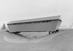
| Roseman Covered Bridge | 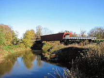 |
1883 | 1976-09-01 | Winterset Winterset, Iowa Winterset is a city in Madison County, Iowa, United States. The population was 4,768 at the 2000 census. It is the county seat of Madison County.... 41°17′31"N 94°9′5"W |
Madison Madison County, Iowa -2010 census:The 2010 census recorded a population of 15,679 in the county, with a population density of . There were 6,554 housing units, of which 6,025 were occupied.-2000 census:... |
Town lattice |
| Savanna-Sabula Bridge Savanna-Sabula Bridge The Savanna–Sabula Bridge is a truss bridge and causeway crossing the Mississippi River and connecting the city of Savanna, Illinois with the island city of Sabula, Iowa. The bridge carries U.S. Highway 52 over the river. It is also the terminus of both Iowa Highway 64 and Illinois Route 64... |
 |
1931, 1932 | 1999-08-27 | Sabula Sabula, Iowa Sabula is a city in Jackson County, Iowa, United States. The population was 670 at the 2000 census. Sabula is the site of Iowa's only island city. The island has a beach and a campground. It also has a harbor with boat docks and storage sheds to store some boats during the winter... 42°6′14"N 90°10′1"W |
Jackson Jackson County, Iowa -2010 census:The 2010 census recorded a population of 19,848 in the county, with a population density of . There were 9,415 housing units, of which 8,289 were occupied.-2000 census:... |
Cantilever through truss |
| Shell Rock Bridge | 1915 | 1999-03-12 | Shell Rock Shell Rock, Iowa Shell Rock is a city in Butler County, Iowa, United States, along the Shell Rock River. The population was 1,298 at the 2000 census. The city is located along the county's eastern border, between Butler and Bremer counties.-Geography:... 42°42′40"N 92°34′53"W |
Butler Butler County, Iowa -2010 census:The 2010 census recorded a population of 14,867 in the county, with a population density of . There were 6,682 housing units, of which 6,120 were occupied.-2000 census:... |
Concrete spandrel arch | |
| Shellsburg Bridge | 1915 | 1998-06-25 | Shellsburg Shellsburg, Iowa Shellsburg is a city in Benton County, Iowa, United States. The population was 938 at the 2000 census. It is part of the Cedar Rapids Metropolitan Statistical Area.-Geography:Shellsburg is located at .... 41°54′48"N 91°52′20"W |
Benton Benton County, Iowa -2010 census:The 2010 census recorded a population of 26,076 in the county, with a population density of . There were 11,095 housing units, of which 10,302 were occupied.-2000 census:... |
Concrete spandrel arch | |
| Skunk River Bridge | 1876, 1916 | 1998-05-15 | Ames Ames, Iowa Ames is a city located in the central part of the U.S. state of Iowa in Story County, and approximately north of Des Moines. The U.S. Census Bureau designates that Ames, Iowa metropolitan statistical area as encompassing all of Story County, and which, when combined with the Boone, Iowa... 41°59′12"N 93°35′13"W |
Story Story County, Iowa -2010 census:The 2010 census recorded a population of 89,542 in the county, with a population density of . There were 36,789 housing units, of which 34,736 were occupied.-2000 census:... |
pinned Warren through truss | |
| Snider Bridge | 1885 | 1998-06-25 | Corning Corning, Iowa As of the census of 2000, there were 1,783 people, 803 households, and 452 families residing in the city. The population density was 1,132.3 people per square mile . There were 880 housing units at an average density of 558.9 per square mile... 40°59′28"N 94°36′38"W |
Adams Adams County, Iowa -2010 census:The 2010 census recorded a population of 4,029 in the county, with a population density of . There were 2,010 housing units, of which 1,715 were occupied.-2000 census:... |
Pinned Pratt pony truss | |
| South Omaha Bridge | 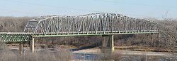 |
1933–1935 | 1992-06-29 | Council Bluffs Council Bluffs, Iowa Council Bluffs, known until 1852 as Kanesville, Iowathe historic starting point of the Mormon Trail and eventual northernmost anchor town of the other emigrant trailsis a city in and the county seat of Pottawattamie County, Iowa, United States and is on the east bank of the Missouri River across... 41°12′47"N 95°55′57"W |
Pottawattamie Pottawattamie County, Iowa Pottawattamie County is a county located in the U.S. state of Iowa. The population was 93,158 in the 2010 census, an increase from 87,704 in the 2000 census and is the second largest county by area in Iowa. The Pottawattamie county seat is located at Council Bluffs. It is one of three Iowa... |
Warren through truss |
| Southwest Fifth St. Bridge | 1898 | 1998-05-15 | Des Moines Des Moines, Iowa Des Moines is the capital and the most populous city in the US state of Iowa. It is also the county seat of Polk County. A small portion of the city extends into Warren County. It was incorporated on September 22, 1851, as Fort Des Moines which was shortened to "Des Moines" in 1857... 41°34′37"N 93°37′10"W |
Polk Polk County, Iowa Polk County is a county located in the U.S. state of Iowa. The population was 430,640 in the 2010 census, an increase from 374,601 in the 2000 census. The county seat is Des Moines, which is also the capital city of Iowa... |
pinned Pratt through truss | |
| Squaw Creek Bridge | 1917 | 1998-06-25 | Ridgeport 42°26′44"N 93°45′39"W |
Boone Boone County, Iowa -2010 census:The 2010 census recorded a population of 26,306 in the county, with a population density of . There were 11,756 housing units, of which 10,728 were occupied.-2000 census:... |
Concrete Marsh arch | |
| Squaw Creek Bridge 2 | 1918 | 1998-06-25 | Ridgeport 42°11′44"N 93°46′31"W |
Boone Boone County, Iowa -2010 census:The 2010 census recorded a population of 26,306 in the county, with a population density of . There were 11,756 housing units, of which 10,728 were occupied.-2000 census:... |
Concrete Marsh arch | |
| State Street Bridge | 1903 | 1998-06-25 | Mason City Mason City, Iowa Mason City is the county seat of Cerro Gordo County, Iowa, United States. The population was 28,079 in the 2010 census, a decline from 29,172 in the 2000 census. The Mason City Micropolitan Statistical Area includes all of Cerro Gordo and Worth counties.... 43°9′7"N 93°11′29"W |
Cerro Gordo Cerro Gordo County, Iowa -2010 census:The 2010 census recorded a population of 44,151 in the county, with a population density of . There were 22,163 housing units, of which 19,350 were occupied.-2000 census:... |
Filled spandrel arch | |
| Stewart Avenue Bridge | 1914 | 1998-06-25 | Mason City Mason City, Iowa Mason City is the county seat of Cerro Gordo County, Iowa, United States. The population was 28,079 in the 2010 census, a decline from 29,172 in the 2000 census. The Mason City Micropolitan Statistical Area includes all of Cerro Gordo and Worth counties.... 43°9′24"N 93°11′25"W |
Cerro Gordo Cerro Gordo County, Iowa -2010 census:The 2010 census recorded a population of 44,151 in the county, with a population density of . There were 22,163 housing units, of which 19,350 were occupied.-2000 census:... |
Filled spandrel arch | |
| Steyer Bridge | 1875 | 1983-01-04 | Decorah Decorah, Iowa Decorah is a city in and the county seat of Winneshiek County, Iowa, United States. The population was 8,172 at the 2000 census. Decorah is located at the intersection of State Highway 9 and U.S... 43°17′54"N 91°48′39"W |
Winneshiek Winneshiek County, Iowa -2010 census:The 2010 census recorded a population of 21,056 in the county, with a population density of . There were 8,721 housing units, of which 7,997 were occupied.-2000 census:... |
||
| Stoe Creek Bridge | 1913 | 1998-06-25 | Oelwein Oelwein, Iowa As of the census of 2000, there were 6,692 people, 2,808 households, and 1,819 families residing in the city. The population density was 1,395.8 people per square mile . There were 3,040 housing units at an average density of 634.1 per square mile... 42°47′30"N 92°0′8"W |
Fayette Fayette County, Iowa -2010 census:The 2010 census recorded a population of 20,880 in the county, with a population density of . There were 9,558 housing units, of which 8,634 were occupied.-2000 census:... |
Concrete through girder | |
| Storm Creek Bridge | 1913 | 1998-06-25 | Carroll Carroll, Iowa -2010 census:The 2010 census recorded a population of 10,103 in the city, with a population density of . There were 4,698 housing units, of which 4,357 were occupied.... 42°6′7"N 94°48′11"W |
Carroll Carroll County, Iowa -2010 census:The 2010 census recorded a population of 20,816 in the county, with a population density of . There were 9,376 housing units, of which 8,683 were occupied.-2000 census:... |
Steel Warren pony truss | |
| Storm Creek Bridge 2 | 1913 | 1998-06-25 | Carroll Carroll, Iowa -2010 census:The 2010 census recorded a population of 10,103 in the city, with a population density of . There were 4,698 housing units, of which 4,357 were occupied.... 42°4′42"N 94°46′49"W |
Carroll Carroll County, Iowa -2010 census:The 2010 census recorded a population of 20,816 in the county, with a population density of . There were 9,376 housing units, of which 8,683 were occupied.-2000 census:... |
Steel Warren pony truss | |
| Sumner Bridge | 1916, 1917 | 1998-06-25 | Sumner Sumner, Iowa Sumner is a city in Bremer County, Iowa, United States. The city is located along the county's eastern border, between Bremer and Fayette counties. The population was 2,106 at the 2000 census. The Bremer County portion of Sumner is part of the Waterloo–Cedar Falls Metropolitan Statistical Area... 43°4′39"N 91°53′21"W |
Fayette Fayette County, Iowa -2010 census:The 2010 census recorded a population of 20,880 in the county, with a population density of . There were 9,558 housing units, of which 8,634 were occupied.-2000 census:... |
Concrete deck girder | |
| Sutliff Bridge Sutliff Bridge The Sutliff Bridge is a bridge over the Cedar River at Sutliff, a Johnson County community near Lisbon, Iowa, United States. A Parker truss bridge, it was built in 1897 and 1898 at a cost of approximately $12,000... |
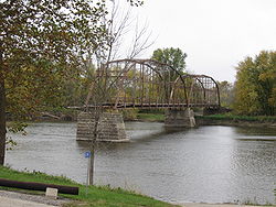 |
1897, 1898 | 1998-05-15 | Iowa City Iowa City, Iowa Iowa City is a city in Johnson County, State of Iowa. As of the 2010 Census, the city had a total population of about 67,862, making it the sixth-largest city in the state. Iowa City is the county seat of Johnson County and home to the University of Iowa... 41°50′33"N 91°1′59"W |
Johnson Johnson County, Iowa -2010 census:The 2010 census recorded a population of 130,882 in the county, with a population density of . There were 55,967 housing units, of which 52,715 were occupied.-2000 census:... |
pinned Parker through truss |
| Taylor's Ford Bridge | 1872 | 1998-06-25 | Independence Independence, Iowa Independence is a city in and the county seat of Buchanan County, Iowa, United States. The population was 5,966 in the 2010 census, a decline from 6,014 in the 2000 census... 42°23′58"N 91°48′46"W |
Buchanan Buchanan County, Iowa -2010 census:The 2010 census recorded a population of 20,958 in the county, with a population density of . There were 8,968 housing units, of which 8,161 were occupied.-2000 census:... |
Bowstring through arch-truss | |
| Ten Mile Creek Bridge | 1998-05-15 | Decorah Decorah, Iowa Decorah is a city in and the county seat of Winneshiek County, Iowa, United States. The population was 8,172 at the 2000 census. Decorah is located at the intersection of State Highway 9 and U.S... 43°20′17"N 91°53′18"W |
Winneshiek Winneshiek County, Iowa -2010 census:The 2010 census recorded a population of 21,056 in the county, with a population density of . There were 8,721 housing units, of which 7,997 were occupied.-2000 census:... |
Kingpost pony truss | ||
| Tremaine Bridge | 1902 | 1998-05-15 | Webster City Webster City, Iowa Webster City is a city in Hamilton County, Iowa, United States. The population was 8,070 at the United States 2010 Census. It is the county seat of Hamilton County. Webster City is known as 'Boone River Country' with the Boone River meandering along the east side of the city from north to south... 42°23′12"N 93°48′31"W |
Hamilton Hamilton County, Iowa -2010 census:The 2010 census recorded a population of 15,673 in the county, with a population density of . There were 7,219 housing units, of which 6,540 were occupied.-2000 census:... |
Camelback through truss | |
| Turkey River Bridge | 1873 | 1998-05-15 | Festina 43°0′17"N 91°54′10"W |
Winneshiek Winneshiek County, Iowa -2010 census:The 2010 census recorded a population of 21,056 in the county, with a population density of . There were 8,721 housing units, of which 7,997 were occupied.-2000 census:... |
Bowstring through arch-truss | |
| Twin Bridge | 1910 | 1998-06-25 | Fayette Fayette, Iowa Fayette is a city in Fayette County, Iowa, in the United States. As of the 2000 census, the city population was 1,300. It was named after the Marquis de la Fayette, French hero of the American Revolutionary War. Fayette is the home of Upper Iowa University, a small private college... 42°50′4"N 91°51′53"W |
Fayette Fayette County, Iowa -2010 census:The 2010 census recorded a population of 20,880 in the county, with a population density of . There were 9,558 housing units, of which 8,634 were occupied.-2000 census:... |
Concrete Luten arch | |
| Upper Bluffton Bridge | 1880 | 1998-05-15 | Bluffton 43°24′18"N 91°55′12"W |
Winneshiek Winneshiek County, Iowa -2010 census:The 2010 census recorded a population of 21,056 in the county, with a population density of . There were 8,721 housing units, of which 7,997 were occupied.-2000 census:... |
Pinned Pratt through truss | |
| Upper Iowa River Bridge | 1913, 1914 | 1998-06-25 | Dorchester Dorchester, Iowa Dorchester is an unincorporated community in northwestern Allamakee County, Iowa, United States. It lies along local roads just off Iowa Highway 76, north of the city of Waukon, the county seat of Allamakee County. Its elevation is 738 feet . Although Dorchester is unincorporated, it has a... 43°25′57"N 91°24′43"W |
Allamakee Allamakee County, Iowa -2010 census:The 2010 census recorded a population of 14,330 in the county, with a population density of . There were 7,617 housing units, of which 5,845 were occupied.-2000 census:... |
Riveted Pratt through truss | |
| Upper Paris Bridge | 1879 | 1998-05-15 | Coggin 42°14′40"N 91°35′4"W |
Linn Linn County, Iowa -2010 census:The 2010 census recorded a population of 211,226 in the county, with a population density of . There were 92,251 housing units, of which 86,134 were occupied.-2000 census:... |
pinned Whipple through truss | |
| Vine Street Bridge | 1910 | 1998-06-25 | West Union West Union, Iowa West Union is a city in Fayette County, Iowa, United States. The population was 2,549 at the 2000 census. It is the county seat of Fayette County... 42°57′33"N 91°49′9"W |
Fayette Fayette County, Iowa -2010 census:The 2010 census recorded a population of 20,880 in the county, with a population density of . There were 9,558 housing units, of which 8,634 were occupied.-2000 census:... |
Concrete Luten arch | |
| Wabash Railroad Bridge | 1882 | 1998-05-15 | Pella Pella, Iowa Pella is a city in Marion County, Iowa, United States. The population was 9,832 at the 2000 census. Pella is the home of Central College as well as several manufacturing companies, including Pella Corporation and Vermeer Manufacturing Company.- History :... 41°20′26"N 92°56′25"W |
Marion Marion County, Iowa -2010 census:The 2010 census recorded a population of 33,309 in the county, with a population density of . There were 13,914 housing units, of which 12,723 were occupied.-2000 census:... |
pinned Pratt through truss | |
| Wapsipinicon River Bridge | 1926, 1927 | 1998-06-25 | Independence Independence, Iowa Independence is a city in and the county seat of Buchanan County, Iowa, United States. The population was 5,966 in the 2010 census, a decline from 6,014 in the 2000 census... 42°27′31"N 91°53′27"W |
Buchanan Buchanan County, Iowa -2010 census:The 2010 census recorded a population of 20,958 in the county, with a population density of . There were 8,968 housing units, of which 8,161 were occupied.-2000 census:... |
Concrete spandrel arch | |
| Washington Avenue Bridge | 1934 | 1998-05-15 | Iowa Falls Iowa Falls, Iowa Iowa Falls is a city in Hardin County, Iowa, United States. Iowa Falls is the home of Ellsworth Community College. It is also a regional transportation center, located along U.S. Routes 20 and 65 and the Canadian National and Union Pacific Railroads. The population was 5,193 at the 2000 census. A... 42°31′11"N 93°16′16"W |
Hardin Hardin County, Iowa -2010 census:The 2010 census recorded a population of 17,534 in the county, with a population density of . There were 8,224 housing units, of which 7,296 were occupied.-2000 census:... |
open spandrel arch | |
| Washington Mill Bridge Washington Mill Bridge The Washington Mill Bridge is a road bridge crossing Lytle Creek near Bernard, Iowa that was built in 1877. It is a bowstring, through arch bridge, manufactured and/or built by the Massillon Bridge Company and by T.J. Donohue.... |
1877, 1878 | 1998-06-25 | Bernard Bernard, Iowa -2010 census:The 2010 census recorded a population of 112 in the city, with a population density of 1120/sq mi . There were 56 housing units, of which 50 were occupied.The racial makeup of the city in the 2010 census was 100.0% White American.... 42°18′15"N 90°46′49"W |
Dubuque Dubuque County, Iowa Dubuque County is a county located in the U.S. state of Iowa. The population was 93,653 in the 2010 census, an increase from 89,143 in the 2000 census. The county seat is the city of Dubuque. Dubuque County is coterminous with the Dubuque, Iowa Metropolitan Statistical Area, and is the seventh... |
Bowstring through arch-truss | |
| West Auburn Bridge | 1880, 1881 | 1998-06-25 | West Union West Union, Iowa West Union is a city in Fayette County, Iowa, United States. The population was 2,549 at the 2000 census. It is the county seat of Fayette County... 43°0′59"N 91°52′43"W |
Fayette Fayette County, Iowa -2010 census:The 2010 census recorded a population of 20,880 in the county, with a population density of . There were 9,558 housing units, of which 8,634 were occupied.-2000 census:... |
Pinned Whipple through truss | |
| White Water Creek Bridge | 1868 | 1998-06-25 | Bernard Bernard, Iowa -2010 census:The 2010 census recorded a population of 112 in the city, with a population density of 1120/sq mi . There were 56 housing units, of which 50 were occupied.The racial makeup of the city in the 2010 census was 100.0% White American.... 42°18′16"N 90°54′41"W |
Dubuque Dubuque County, Iowa Dubuque County is a county located in the U.S. state of Iowa. The population was 93,653 in the 2010 census, an increase from 89,143 in the 2000 census. The county seat is the city of Dubuque. Dubuque County is coterminous with the Dubuque, Iowa Metropolitan Statistical Area, and is the seventh... |
Pinned Pratt through truss | |
| Winnebago River Bridge | 1926 | 1998-06-25 | Mason City Mason City, Iowa Mason City is the county seat of Cerro Gordo County, Iowa, United States. The population was 28,079 in the 2010 census, a decline from 29,172 in the 2000 census. The Mason City Micropolitan Statistical Area includes all of Cerro Gordo and Worth counties.... 43°11′35"N 93°12′37"W |
Cerro Gordo Cerro Gordo County, Iowa -2010 census:The 2010 census recorded a population of 44,151 in the county, with a population density of . There were 22,163 housing units, of which 19,350 were occupied.-2000 census:... |
Concrete deck girder | |
| Yellow Smoke Park Bridge | 1998-06-25 | Denison Denison, Iowa Denison is a city in Crawford County, Iowa, United States, along the Boyer River. The population was 7,339 at the 2000 census. It is the county seat of Crawford County.-Geography:Denison is located at .... 42°0′31"N 95°19′38"W |
Crawford Crawford County, Iowa -2010 census:The 2010 census recorded a population of 17,096 in the county, with a population density of . There were 6,943 housing units, of which 6,413 were occupied.-2000 census:... |
Bowstring pony arch-truss | ||
| Cedar Covered Bridge | 1920 | removed 2002-10-18 |
Winterset Winterset, Iowa Winterset is a city in Madison County, Iowa, United States. The population was 4,768 at the 2000 census. It is the county seat of Madison County.... |
Madison Madison County, Iowa -2010 census:The 2010 census recorded a population of 15,679 in the county, with a population density of . There were 6,554 housing units, of which 6,025 were occupied.-2000 census:... |
covered bridge | |
| Clay Avenue Bridge | 1910 | removed 2002-05-08 |
Drakesville Drakesville, Iowa Drakesville is a city in Davis County, Iowa, United States. The population was 185 at the 2000 census.-Geography:Drakesville is located at .According to the United States Census Bureau, the city has a total area of , all of it land.... |
Davis Davis County, Iowa -2010 census:The 2010 census recorded a population of 8,753 in the county, with a population density of . There were 3,600 housing units, of which 3,201 were occupied.-2000 census:... |
Riveted Warren beadstead | |
| County Road Bridge 15 | 1905 | removed 2003-12-15 |
Elkader Elkader, Iowa Elkader is a city in Clayton County, Iowa, United States. The population was 1,465 at the 2000 census. It is the county seat of Clayton County.-History:The city is named after Algerian leader Abd al-Qadir al-Jaza'iri... |
Clayton Clayton County, Iowa -2010 census:The 2010 census recorded a population of 18,129 in the county, with a population density of . There were 8,999 housing units, of which 7,599 were occupied.-2000 census:... |
Stone arch | |
| Crane Creek Bridge | 1910, 1911 | removed 2003-11-03 |
Waterloo Waterloo, Iowa Waterloo is a city in and the county seat of Black Hawk County, Iowa, United States. As of the 2010 United States Census the population decreased by 0.5% to 68,406. Waterloo is part of the Waterloo – Cedar Falls Metropolitan Statistical Area, and is the more populous of the two... |
Black Hawk Black Hawk County, Iowa -2010 census:The 2010 census recorded a population of 131,090 in the county, with a population density of . There were 55,887 housing units, of which 52,470 were occupied.-2000 census:... |
Riveted camelback pony-truss | |
| Delta Covered Bridge | 1867, 1869 | removed 2003-11-03 |
Delta Delta, Iowa Delta is a city in Keokuk County, Iowa, United States. The population was 410 at the 2000 census.-Geography:Delta is located at .According to the United States Census Bureau, the city has a total area of , all of it land.... |
Keokuk Keokuk County, Iowa -2010 census:The 2010 census recorded a population of 10,511 in the county, with a population density of . There were 4,931 housing units, of which 4,408 were occupied.-2000 census:... |
||
| Freeport Bowstring Arch Bridge | 1879 | 1984-04-19 2008-9-10 |
Freeport 43°18′10"N 91°44′22"W |
Winneshiek Winneshiek County, Iowa -2010 census:The 2010 census recorded a population of 21,056 in the county, with a population density of . There were 8,721 housing units, of which 7,997 were occupied.-2000 census:... |
Hexagonal Plate Channel Arch | |
| Indian Creek Bridge II | 1888, 1889 | removed 1999-03-11 |
Marion Marion, Iowa Marion is a city in Linn County, Iowa, United States. The population was 26,294 at the 2000 census and was estimated at 32,172 in 2007. The city is part of the Cedar Rapids Metropolitan Statistical Area.- History :... |
Linn Linn County, Iowa -2010 census:The 2010 census recorded a population of 211,226 in the county, with a population density of . There were 92,251 housing units, of which 86,134 were occupied.-2000 census:... |
pinned Pratt through truss | |
| Keosauqua Bridge | 1938, 1939 | 1998-05-15 removed 2008-9-10 | Keosauqua Keosauqua, Iowa Keosauqua is a city in Van Buren County, Iowa, United States. The population was 1,066 at the 2000 census. It is the county seat of Van Buren County.-History:... 40°43′40"N 91°57′35"W |
Van Buren | Riveted Warren through truss | |
| McBride Covered Bridge | 1871 | removed 1987-09-23 |
Winterset Winterset, Iowa Winterset is a city in Madison County, Iowa, United States. The population was 4,768 at the 2000 census. It is the county seat of Madison County.... |
Madison Madison County, Iowa -2010 census:The 2010 census recorded a population of 15,679 in the county, with a population density of . There were 6,554 housing units, of which 6,025 were occupied.-2000 census:... |
Town lattice | |
| Otter Creek Bridge | 1870 | removed 2004-06-22 |
Hazleton Hazleton, Iowa Hazleton is a city in Buchanan County, Iowa, United States. The population was 950 at the 2000 census.-Geography:Hazleton is located at .... |
Buchanan Buchanan County, Iowa -2010 census:The 2010 census recorded a population of 20,958 in the county, with a population density of . There were 8,968 housing units, of which 8,161 were occupied.-2000 census:... |
Bolted Pratt pony truss | |
| Otterville Bridge | 1875, 1876 | removed 2002-01-14 |
Independence Independence, Iowa Independence is a city in and the county seat of Buchanan County, Iowa, United States. The population was 5,966 in the 2010 census, a decline from 6,014 in the 2000 census... |
Buchanan Buchanan County, Iowa -2010 census:The 2010 census recorded a population of 20,958 in the county, with a population density of . There were 8,968 housing units, of which 8,161 were occupied.-2000 census:... |
Pinned Pratt through truss | |
| Rubio Bridge | 1904 | removed 2002-11-11 |
Rubio Rubio, Iowa Rubio is an unincorporated community in Washington County, Iowa, United States. It is located on County Highway G67, three miles northwest of Richland, at 41.221164N, -91.938143W.-History:... |
Washington | Pennsylvania through truss | |
| Soper's Mill Bridge | 1876 | removed 2003-12-15 |
Ames Ames, Iowa Ames is a city located in the central part of the U.S. state of Iowa in Story County, and approximately north of Des Moines. The U.S. Census Bureau designates that Ames, Iowa metropolitan statistical area as encompassing all of Story County, and which, when combined with the Boone, Iowa... |
Story Story County, Iowa -2010 census:The 2010 census recorded a population of 89,542 in the county, with a population density of . There were 36,789 housing units, of which 34,736 were occupied.-2000 census:... |
Pony bowstring truss bridge | |
| Suspension Bridge | 1906 | 1989-10-30 removed 2009-1-09 | Charles City Charles City, Iowa Charles City is a city in Floyd County, Iowa, United States. The population was 7,652 at the 2010 census a decrease of 160, or 2%, from 7,812 at the 2000 census. It is the county seat of Floyd County. Charles City is a significant commercial and transportation center for the area, located on U.S... 43°4′15"N 92°41′10"W |
Floyd Floyd County, Iowa -2010 census:The 2010 census recorded a population of 16,303 in the county, with a population density of . There were 7,526 housing units, of which 6,886 were occupied.-2000 census:... |
Suspension foot bridge | |
| Toledo Bridge | 1912 | 1998-05-15 removed 2009-1-9 |
Toledo Toledo, Iowa Toledo is a city in and the county seat of Tama County, Iowa, United States. The population was 2,539 at the 2000 census.-Geography:Toledo is located at .... 41°59′32"N 92°35′30"W |
Tama Tama County, Iowa -2010 census:The 2010 census recorded a population of 17,767 in the county, with a population density of . There were 7,766 housing units, of which 6,947 were occupied.-2000 census:... |
riveted Pratt through truss | |
| Welsh Bridge | 1905 | removed 2003-12-15 |
Somers Somers, Iowa Somers is a city in Calhoun County, Iowa, United States. The population was 165 at the 2000 census.-Geography:Somers is located at .According to the United States Census Bureau, the city has a total area of , all of it land.... |
Calhoun Calhoun County, Iowa -2010 census:The 2010 census recorded a population of 14,867 in the county, with a population density of . There were 5,108 housing units, of which 4,242 were occupied.-2000 census:... |
Riveted Warren pony truss | |
| Yellow Spring Creek Bridge | 1916, 1917 | removed 2003-12-15 |
Mediapolis Mediapolis, Iowa Mediapolis is a city in Des Moines County, Iowa, United States. The population was 1,644 at the 2000 census. It is part of the Burlington, IA–IL Micropolitan Statistical Area.-Geography:Mediapolis's longitude and latitude coordinates are .... |
Des Moines Des Moines County, Iowa -2010 census:The 2010 census recorded a population of 40,325 in the county, with a population density of . There were 18,535 housing units, of which 17,003 were occupied.-2000 census:... |
Concrete Marsh arch |