

List of Registered Historic Places in Kings County, New York
Encyclopedia
List of the National Register of Historic Places listings in Kings County, New York
This is intended to be a complete list of properties and districts listed on the National Register of Historic Places
National Register of Historic Places
The National Register of Historic Places is the United States government's official list of districts, sites, buildings, structures, and objects deemed worthy of preservation...
in Brooklyn (Kings County), New York
Brooklyn
Brooklyn is the most populous of New York City's five boroughs, with nearly 2.6 million residents, and the second-largest in area. Since 1896, Brooklyn has had the same boundaries as Kings County, which is now the most populous county in New York State and the second-most densely populated...
. The locations of National Register properties and districts (at least for all showing latitude and longitude coordinates below) may be seen in a Google map by clicking on "Map of all coordinates".
Current listings
| # | Landmark name | Image | Date listed | Location | City or Town | Summary |
|---|---|---|---|---|---|---|
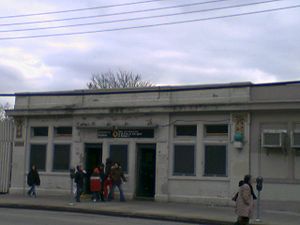
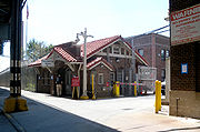
| 1 | 15th Street – Prospect Park Subway station ( trains) | 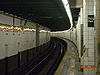 |
15th St./Prospect Park W and SW 40°39′37"N 73°58′49"W |
Brooklyn Brooklyn Brooklyn is the most populous of New York City's five boroughs, with nearly 2.6 million residents, and the second-largest in area. Since 1896, Brooklyn has had the same boundaries as Kings County, which is now the most populous county in New York State and the second-most densely populated... |
||
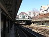
| 2 | Fourth Avenue Subway station ( trains) |  |
Bet. 3rd and 4th Aves., and 10th and 11th Sts. 40°40′13"N 73°59′24"W |
Brooklyn Brooklyn Brooklyn is the most populous of New York City's five boroughs, with nearly 2.6 million residents, and the second-largest in area. Since 1896, Brooklyn has had the same boundaries as Kings County, which is now the most populous county in New York State and the second-most densely populated... |
||
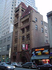
| 3 | 68th Police Precinct Station House and Stable 68th Police Precinct Station House and Stable The 68th Police Precinct Station House and Stable is a historic police station and stable located at Brooklyn in New York, New York. The two buildings were completed in 1886. The station house is a three story brick building with carved stone detailing in the Romanesque Revival style. It... |
4302 4th Ave. 40°39′1"N 74°0′34"W |
Sunset Park, Brooklyn Sunset Park, Brooklyn Sunset Park is a neighborhood in the western section of the New York City borough of Brooklyn, USA. It is bounded by Greenwood Heights to the north, Borough Park to the east, Bay Ridge to the south, and Upper New York Bay to the west... |
|||
| 4 | 75th Police Precinct Station House 75th Police Precinct Station House 75th Police Precinct Station House is a historic police station located at Brooklyn in New York, New York. It was built in 1886 and is a three story, yellow brick building above a sandstone foundation and watertable in the Romanesque Revival style. It features a round corner tower and... |
484 Liberty Ave. 40°40′29"N 73°53′33"W |
Brooklyn Brooklyn Brooklyn is the most populous of New York City's five boroughs, with nearly 2.6 million residents, and the second-largest in area. Since 1896, Brooklyn has had the same boundaries as Kings County, which is now the most populous county in New York State and the second-most densely populated... |
|||
| 5 | 83rd Precinct Police Station and Stable 83rd Precinct Police Station and Stable The 83rd Precinct Police Station and Stable is a historic police station and stable located at the corner of DeKalb and Wilson Avenues in Brooklyn, New York City. It was built in 1894 in the Romanesque Revival style.... |
 |
179 Wilson Ave. 40°42′6"N 73°55′25"W |
New York New York City New York is the most populous city in the United States and the center of the New York Metropolitan Area, one of the most populous metropolitan areas in the world. New York exerts a significant impact upon global commerce, finance, media, art, fashion, research, technology, education, and... |
||
| 6 | Ninth Avenue Ninth Avenue (BMT West End Line) Ninth Avenue is a bi-level express station on the BMT West End Line of the New York City Subway, located at the intersection of Ninth Avenue and 39th Street in Brooklyn. Each level has three tracks and two island platforms. The upper level serves the BMT West End Line while the lower level formerly... Subway station ( train) |
 |
38th St. and 9th Ave. near the jct. of New Utrecht Ave. 40°38′47"N 73°59′41"W |
Sunset Park Sunset Park, Brooklyn Sunset Park is a neighborhood in the western section of the New York City borough of Brooklyn, USA. It is bounded by Greenwood Heights to the north, Borough Park to the east, Bay Ridge to the south, and Upper New York Bay to the west... |
||
| 7 | Albemarle-Kenmore Terraces Historic District Albemarle-Kenmore Terraces Historic District Albemarle-Kenmore Terraces Historic District is a national historic district in Flatbush, Brooklyn, New York, New York. It consists of 32 contributing residential buildings built between 1916 and 1920 in a neo-Federal style... |
Albemarle Terrace, Kenmore Terrace , and E. 21st St. 40°39′3"N 73°57′33"W |
Flatbush Flatbush, Brooklyn Flatbush is a community of the Borough of Brooklyn, a part of New York City, consisting of several neighborhoods.The name Flatbush is an Anglicization of the Dutch language Vlacke bos .... |
|||
| 8 | Andrews United Methodist Church Andrews United Methodist Church Andrews United Methodist Church is a historic Methodist church at 95 Richmond Street in Cypress Hills, Brooklyn, New York, New York. It was built in 1893 and is a one story, asymmetrical orange brick church in the Queen Anne style. It features a massive rose window on the front facade and a three... |
95 Richmond St. 40°41′7"N 73°52′38"W |
East New York East New York, Brooklyn East New York is a residential neighborhood located in the Eastern section of the borough of Brooklyn in New York City, United States. The neighborhood is part of Brooklyn Community Board 5... |
(misfiled by NRIS in New York county, but belongs here) | ||
| 9 | Astral Apartments Astral Apartments Astral Apartments is a historic apartment building located in Greenpoint, Brooklyn, New York, New York.The Astral was built in 1885-1886 as affordable housing for employees of Charles Pratt's Astral Oil Works. It is a massive brick and terra cotta building in the Queen Anne style. It features a... |
 |
184 Franklin St. 40°43′54"N 73°57′28"W |
Greenpoint Greenpoint, Brooklyn Greenpoint is the northernmost neighborhood in the New York City borough of Brooklyn. It is bordered on the southwest by Williamsburg at the Bushwick inlet, on the southeast by the Brooklyn-Queens Expressway and East Williamsburg, on the north by Newtown Creek and Long Island City, Queens at the... |
||
| 10 | Atlantic Avenue Control House | Flatbush and Atlantic Aves. 40°41′4"N 73°58′42"W |
Downtown Brooklyn Downtown Brooklyn Downtown Brooklyn is the third largest central business district in New York City , and is located in the northwestern section of the borough of Brooklyn... |
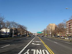
|||
| 11 | Atlantic Avenue Subway station ( trains) | Jct. of Flatbush Ave. at Atlantic and 4th Aves. 40°41′5"N 73°58′42"W |
Downtown Brooklyn Downtown Brooklyn Downtown Brooklyn is the third largest central business district in New York City , and is located in the northwestern section of the borough of Brooklyn... |
|||
| 12 | Atlantic Avenue Tunnel | 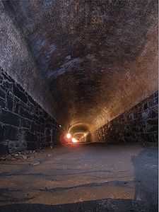 |
Below Atlantic Ave. between Boerum Pl. and Columbia St. 40°41′30"N 74°0′0"W |
Cobble Hill Cobble Hill, Brooklyn Cobble Hill is a neighborhood in the New York City borough of Brooklyn, USA. Bordered by Atlantic Avenue on the north, Hicks Street to the west, Smith Street on the east and Degraw Street to the south, Cobble Hill sits adjacent to Boerum Hill and Brooklyn Heights with Carroll Gardens to the south... |
||
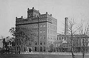
| 13 | Austin, Nichols and Company Warehouse Austin, Nichols and Company Warehouse The Austin, Nichols and Company Warehouse at 184 Kent Ave. in Brooklyn, New York was built in 1915. It was designated a New York City Landmark in 2005 and later listed on the National Register of Historic Places in 2007.... |
184 Kent Ave. 40°43′7"N 73°57′54"W |
Williamsburg Williamsburg, Brooklyn Williamsburg is a neighborhood in the New York City borough of Brooklyn, bordering Greenpoint to the north, Bedford-Stuyvesant to the south, Bushwick to the east and the East River to the west. The neighborhood is part of Brooklyn Community Board 1. The neighborhood is served by the NYPD's 90th ... |
|||
| 14 | Avenue U Avenue U (BMT Sea Beach Line) Avenue U is a local station on the BMT Sea Beach Line of the New York City Subway. Located at the intersection of Avenue U and West 7th Street, it is served by the N train at all times.... Subway station ( train) |
 |
Bet. Ave. U and Ave. T and 7th and 8th Sts. 40°35′50"N 73°58′46"W |
Brooklyn Brooklyn Brooklyn is the most populous of New York City's five boroughs, with nearly 2.6 million residents, and the second-largest in area. Since 1896, Brooklyn has had the same boundaries as Kings County, which is now the most populous county in New York State and the second-most densely populated... |
||
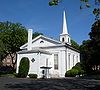
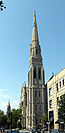
| 15 | Baptist Temple (Brooklyn, New York) Baptist Temple (Brooklyn, New York) Baptist Temple is a historic Baptist church at 360 Schermerhorn Street in Brooklyn, New York, New York. It was built in 1893-1894 in the Romanesque Revival style and rebuilt after a fire in 1917-1918. It has a brownstone base and superstructure faced with subtly textured brick with brownstone trim... |
360 Schermerhorn St. 40°41′11"N 73°58′50"W |
Downtown Brooklyn Downtown Brooklyn Downtown Brooklyn is the third largest central business district in New York City , and is located in the northwestern section of the borough of Brooklyn... |
|||
| 16 | Bay Parkway Bay Parkway (BMT West End Line) Bay Parkway is an express station on the BMT West End Line of the New York City Subway, located in Brooklyn at the intersection of Bay Parkway and 86th Street, in Bensonhurst, Brooklyn. The station is served by the D train at all times.This station was the terminus for the M train from 1987 to... Subway station ( train) |
Above Bay Parkway at 86th St. 40°36′6"N 73°59′40"W |
Brooklyn Brooklyn Brooklyn is the most populous of New York City's five boroughs, with nearly 2.6 million residents, and the second-largest in area. Since 1896, Brooklyn has had the same boundaries as Kings County, which is now the most populous county in New York State and the second-most densely populated... |
|||
| 17 | Bay Ridge United Methodist Church Bay Ridge United Methodist Church Bay Ridge United Methodist Church, originally known as Grace Methodist Episcopal Church, was a historic Methodist church at 7002 Fourth Avenue and Ovington Avenue in Bay Ridge, Brooklyn, New York, New York. It was built in 1899 in the Romanesque style. It was built of green serpentine stone and... |
7002 Fourth St. 40°38′1"N 74°1′29"W |
Bay Ridge Bay Ridge, Brooklyn Bay Ridge is a neighborhood in the southwest corner of the New York City borough of Brooklyn, USA. It is bounded by Sunset Park on the north, Seventh Avenue and Dyker Heights on the east, The Narrows Strait, which partially houses the Belt Parkway, on the west and 86th Street and Fort Hamilton on... |
Razed October 21, 2008 | ||
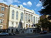
| 18 | Beth El Jewish Center of Flatbush Beth El Jewish Center of Flatbush Beth El Jewish Center of Flatbush is a historic synagogue at 1981 Homecrest Ave. in Flatbush, Brooklyn, New York, New York. It was built in 1927 and is a two story plus basement, rectangular red brick building with decorative white glazed terra cotta trim. It has a tripartite front facade with a... |
1981 Homecrest Ave. 40°36′3.63"N 73°57′34.66"W |
Flatbush Flatbush, Brooklyn Flatbush is a community of the Borough of Brooklyn, a part of New York City, consisting of several neighborhoods.The name Flatbush is an Anglicization of the Dutch language Vlacke bos .... |
New listing; refnum# 09000377 | ||
| 19 | Beverley Road Beverley Road (BMT Brighton Line) Beverley Road is a local station on the BMT Brighton Line of the New York City Subway. It is located over a private right-of-way at Beverley Road between Marlborough Road and East 16th Street in the neighborhood of Flatbush, Brooklyn... Subway station ( trains) |
 |
Beverley Rd. at Marlborough Rd. 40°38′39"N 73°57′53"W |
Flatbush Flatbush, Brooklyn Flatbush is a community of the Borough of Brooklyn, a part of New York City, consisting of several neighborhoods.The name Flatbush is an Anglicization of the Dutch language Vlacke bos .... |
||
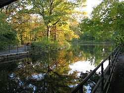
| 20 | Boathouse on the Lullwater of the Lake in Prospect Park Boathouse on the Lullwater of the Lake in Prospect Park Boathouse on the Lullwater of the Lake in Prospect Park is located in the eastern part of Prospect Park on the northeast shore of The Lake, southeast of the Ravine District in Brooklyn, New York... |
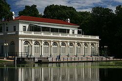 |
Prospect Park 40°39′39"N 73°57′55"W |
Prospect Park (Brooklyn) Prospect Park Prospect Park may refer to:* Prospect Park , a park in Brooklyn, New York, United States* Prospect Park , a park in Troy, New York, United States... |
||
| 21 | Boerum Hill Historic District Boerum Hill Historic District Boerum Hill Historic District is a national historic district in Boerum Hill, Brooklyn, New York, New York. It consists of 238 contributing residential rowhouses and a few commercial buildings built between 1845 and 1890... |
Roughly bounded by Pacific, Wyckoff, Bergen, Nevins, Bond and Hoyt Sts. 40°41′7"N 73°59′13"W |
Boerum Hill | |||
| 22 | Borough Hall Subway station ( trains) | 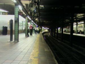 |
Jct. of Joralemon, Court and Adams Sts. 40°41′32"N 73°59′27"W |
Downtown Brooklyn Downtown Brooklyn Downtown Brooklyn is the third largest central business district in New York City , and is located in the northwestern section of the borough of Brooklyn... |
||
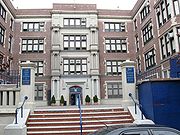
| 23 | Boy's High School | 832 Marcy Ave. 40°41′4"N 73°56′54"W |
Bedford-Stuyvesant | |||
| 24 | Brooklyn Academy of Music Brooklyn Academy of Music Brooklyn Academy of Music is a major performing arts venue in Brooklyn, a borough of New York City, United States, known as a center for progressive and avant garde performance.... |
 |
30 Lafayette Ave. 40°41′11"N 73°58′41"W |
Fort Greene Fort Greene, Brooklyn Fort Greene is a neighborhood in the New York City borough of Brooklyn. Part of Brooklyn Community Board 2, Fort Greene is listed on the New York State Registry and on the National Register of Historic Places, and is a New York City-designated Historic District... |
||
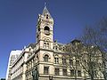
| 25 | Brooklyn Borough Hall Brooklyn Borough Hall Brooklyn Borough Hall was designed in 1835 by architect Gamaliel King, and constructed under the supervision of superintendent Stephen Haynes. It was completed in 1849 to be used as the City Hall of the City of Brooklyn... |
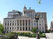 |
209 Joralemon St. 40°41′34"N 73°59′27"W |
Downtown Brooklyn Downtown Brooklyn Downtown Brooklyn is the third largest central business district in New York City , and is located in the northwestern section of the borough of Brooklyn... |
||
| 26 | Brooklyn Bridge Brooklyn Bridge The Brooklyn Bridge is one of the oldest suspension bridges in the United States. Completed in 1883, it connects the New York City boroughs of Manhattan and Brooklyn by spanning the East River... |
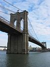 |
Across the East River from Brooklyn to Manhattan 40°42′23"N 73°59′51"W |
Brooklyn Brooklyn Brooklyn is the most populous of New York City's five boroughs, with nearly 2.6 million residents, and the second-largest in area. Since 1896, Brooklyn has had the same boundaries as Kings County, which is now the most populous county in New York State and the second-most densely populated... |
||
| 27 | Brooklyn Heights Historic District Brooklyn Heights Historic District Brooklyn Heights Historic District is a historic district that comprises much of Brooklyn Heights. It was named a National Historic Landmark in January, 1965, designated a New York City Landmark in November, 1965, and added to the National Register of Historic Places in October, 1966.The district... |
 |
Borough of Brooklyn, bounded by Atlantic Ave., Court and Fulton Sts. and the East River 40°41′48"N 73°59′48"W |
Brooklyn Heights | ||
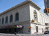
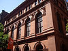
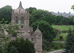
| 28 | Brooklyn Historical Society Brooklyn Historical Society Building The Brooklyn Historical Society Building is a National Historic Landmark building at 128 Pierrepont Street in Brooklyn Heights Historic District. It was designed by George B... |
 |
128 Pierrepont St. 40°41′41"N 73°59′34"W |
Brooklyn Heights | ||
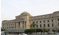
| 29 | Brooklyn Museum Brooklyn Museum The Brooklyn Museum is an encyclopedia art museum located in the New York City borough of Brooklyn. At 560,000 square feet, the museum holds New York City's second largest art collection with roughly 1.5 million works.... |
 |
Eastern Parkway and Washington Ave. 40°40′14"N 73°57′51"W |
Prospect Heights, Brooklyn Prospect Heights, Brooklyn Prospect Heights is a neighborhood in the northwest of the New York City borough of Brooklyn. The traditional boundaries are Flatbush Avenue to the west, Atlantic Avenue to the north, Eastern Parkway to the south, and Washington Avenue to the east... |
||
| 30 | Brooklyn Public Library-Central Building | 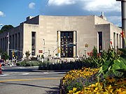 |
Grand Army Plaza 40°40′20"N 73°58′7"W |
Brooklyn Brooklyn Brooklyn is the most populous of New York City's five boroughs, with nearly 2.6 million residents, and the second-largest in area. Since 1896, Brooklyn has had the same boundaries as Kings County, which is now the most populous county in New York State and the second-most densely populated... |
||
| 31 | Brooklyn Trust Company Building Brooklyn Trust Company The Brooklyn Trust Company was a New York City bank.The company was chartered in 1866. In 1873 it had difficulties resulting in a brief suspension of operations. Between 1913 and 1930 the company acquired five other banks through mergers. The company merged into the Manufacturers Trust Company on... |
 |
177 Montague St. 40°41′39.43"N 73°59′32.64"W |
Brooklyn Heights | New listing; refnum 09000632 | |
| 32 | Buildings at 375-379 Flatbush Avenue and 185-187 Sterling Place Buildings at 375-379 Flatbush Avenue and 185-187 Sterling Place Buildings at 375-379 Flatbush Avenue and 185-187 Sterling Place is a historic group of four commercial and residential buildings located in Prospect Heights, Brooklyn, New York, New York. The speculative buildings were built in 1885 and are in the late Italianate style with Queen Anne and Neo-Grec... |
375-379 Flatbush Ave. and 185-187 Sterling Pl. 40°40′36"N 73°58′19"W |
Brooklyn Park Slope, Brooklyn Park Slope is a neighborhood in western Brooklyn, New York City's most populous borough. Park Slope is roughly bounded by Prospect Park West to the east, Fourth Avenue to the west, Flatbush Avenue to the north, and 15th Street to the south, though other definitions are sometimes offered. Generally... |
|||
| 33 | Carroll Gardens Historic District Carroll Gardens Historic District Carroll Gardens Historic District is a national historic district in Carroll Gardens, Brooklyn, New York, New York. It consists of 134 contributing residential rowhouses built between the 1860s and 1880s. They are two and three story brownstone buildings in neo-Grec and late Italianate styles... |
Carroll and President Sts. between Smith and Hoyt Sts. 40°40′47"N 73°59′25"W |
Carroll Gardens Carroll Gardens, Brooklyn Carroll Gardens is a neighborhood in the New York City borough of Brooklyn, USA. The area is named for Charles Carroll, a revolutionary war veteran who was also the only Roman Catholic signer of the Declaration of Independence... |
|||
| 34 | Casemate Fort, Whiting Quadrangle Casemate Fort, Whiting Quadrangle Casemate Fort, Whiting Quadrangle, also known as "Old Casemate," Officers Club Bldg. #207, Sentry Booth #220, and Fort Hamilton Community Club, is a historic building located in Fort Hamilton, Brooklyn, New York, New York. The old fort was designed in 1819 and built between 1825 and 1836. It is a... |
Fort Hamilton, off NY 27 40°36′31"N 74°1′58"W |
Brooklyn Brooklyn Brooklyn is the most populous of New York City's five boroughs, with nearly 2.6 million residents, and the second-largest in area. Since 1896, Brooklyn has had the same boundaries as Kings County, which is now the most populous county in New York State and the second-most densely populated... |
|||
| 35 | Christ Evangelical English Lutheran Church Christ Evangelical English Lutheran Church Christ Evangelical English Lutheran Church, also known as Rugged Cross Baptist Church, is a historic Evangelical Lutheran church at 1084 Lafayette Avenue, 11221, in Bedford-Stuyvesant, Brooklyn, New York, New York. It was built in 1898-1899 in the Romanesque Revival style. It is faced in cream... |
1084 Lafayette Ave. 40°41′32"N 73°55′45"W |
Brooklyn Brooklyn Brooklyn is the most populous of New York City's five boroughs, with nearly 2.6 million residents, and the second-largest in area. Since 1896, Brooklyn has had the same boundaries as Kings County, which is now the most populous county in New York State and the second-most densely populated... |
|||
| 36 | Church of the Holy Innocents Church of the Holy Innocents (Brooklyn, New York) Church of the Holy Innocents is a historic Roman Catholic church at 279 E. 17th St. in Flatbush, Brooklyn, New York, New York. The church was built in 1923 in the Late Gothic Revival style. It is built of granite with limestone trim. It concists of a tall, clerestoried nave with gable roof, lower... |
279 E. 17th St. 40°38′39"N 73°57′46"W |
Flatbush Flatbush Flatbush or Flat Bush can refer to a number of places:*Flatbush, Brooklyn, a community of Brooklyn, New York City, United States*Flatbush, New Zealand, a suburb of Manukau City, New Zealand... |
|||
| 37 | Clinton Hill Historic District Clinton Hill Historic District Clinton Hill Historic District is a national historic district in Clinton Hill, Brooklyn, New York, New York. It consists of 1,063 contributing, largely residential buildings built between the 1840s and 1930 in popular contemporary and revival styles. Buildings include freestanding mansions, row... |
Roughly bounded by Willoughby and Grand Aves., Fulton St. and Vanderbilt Ave. 40°41′14"N 73°57′55"W |
Clinton Hill Clinton Hill, Brooklyn Clinton Hill is a neighborhood in the north-central portion of the borough of Brooklyn in New York City. It is bordered on the east by Bedford-Stuyvesant, on the west by Fort Greene, on the north by Wallabout Bay and on the south by Prospect Heights... |
|||
| 38 | Clinton Hill South Historic District Clinton Hill South Historic District Clinton Hill South Historic District is a national historic district in Clinton Hill, Brooklyn, New York, New York. It consists of 246 contributing, largely residential buildings built between the 1850s and 1922. It includes fine examples of Neo-Grec style row houses... |
Roughly Lefferts and Brevoort Pl. between Washington Ave. and Bedford Pl. 40°40′50"N 73°57′32"W |
Clinton Hill Clinton Hill, Brooklyn Clinton Hill is a neighborhood in the north-central portion of the borough of Brooklyn in New York City. It is bordered on the east by Bedford-Stuyvesant, on the west by Fort Greene, on the north by Wallabout Bay and on the south by Prospect Heights... |
|||
| 39 | Cobble Hill Historic District Cobble Hill Historic District Cobble Hill Historic District is a national historic district in Cobble Hill, Brooklyn, New York, New York. It consists of 796 contributing, largely residential buildings built between the 1830s and 1920s. It includes fine examples of Greek Revival, Italianate, and Queen Anne style row houses... |
 |
Roughly bounded by Atlantic Ave., Court, Degraw and Hicks Sts. 40°41′21"N 73°59′47"W |
Cobble Hill Cobble Hill, Brooklyn Cobble Hill is a neighborhood in the New York City borough of Brooklyn, USA. Bordered by Atlantic Avenue on the north, Hicks Street to the west, Smith Street on the east and Degraw Street to the south, Cobble Hill sits adjacent to Boerum Hill and Brooklyn Heights with Carroll Gardens to the south... |
||
| 40 | Coney Island Fire Station Pumping Station Coney Island Fire Station Pumping Station Coney Island Fire Station Pumping Station is a historic pumping station located in Brooklyn, New York, New York. It was built in 1938 in the Moderne style. It is a one story, elliptical shaped building faced in limestone. It sits on a granite base and has projecting porticos and metal doorways.It... |
2301 Neptune Ave. 40°34′43"N 73°59′31"W |
Coney Island Coney Island Coney Island is a peninsula and beach on the Atlantic Ocean in southern Brooklyn, New York, United States. The site was formerly an outer barrier island, but became partially connected to the mainland by landfill.... |
|||
| 41 | Coney Island Yard Electric Motor Repair Shop Coney Island Yard Electric Motor Repair Shop Coney Island Yard Electric Motor Repair Shop is a historic motor repair shop for subway trains located at the Coney Island Complex in Coney Island, Brooklyn, New York, New York... |
SW corner of Avenue X and Shell Rd. 40°35′23"N 73°58′31"W |
Brooklyn Brooklyn Brooklyn is the most populous of New York City's five boroughs, with nearly 2.6 million residents, and the second-largest in area. Since 1896, Brooklyn has had the same boundaries as Kings County, which is now the most populous county in New York State and the second-most densely populated... |
|||
| 42 | Coney Island Yard Gatehouse Coney Island Yard Gatehouse Coney Island Yard Gatehouse is a historic gatehouse located at the Coney Island Complex in Coney Island, Brooklyn, New York, New York. It was built about 1929 and is a small masonry building with prominent clay tile roof with deep overhanging eaves.... |
 |
SW corner of Shell Rd. and Avenue X 40°35′22"N 73°58′30"W |
Brooklyn Brooklyn Brooklyn is the most populous of New York City's five boroughs, with nearly 2.6 million residents, and the second-largest in area. Since 1896, Brooklyn has had the same boundaries as Kings County, which is now the most populous county in New York State and the second-most densely populated... |
||
| 43 | Congregation Beth Israel Congregation Beth Israel (Brooklyn, New York) Congregation Beth Israel, known since 1970 as Mt. Zion Church of God 7th Day, is a former synagogue at 203 E. 37th St. in East Flatbush, Brooklyn, New York, New York. It was built in 1928 and is a two story, rectangular buff brick building with Romanesque and Classical Revival style elements. It... |
203 E. 37th St. 40°39′8.07"N 73°56′34.52"W |
Brooklyn Brooklyn Brooklyn is the most populous of New York City's five boroughs, with nearly 2.6 million residents, and the second-largest in area. Since 1896, Brooklyn has had the same boundaries as Kings County, which is now the most populous county in New York State and the second-most densely populated... |
|||
| 44 | Congregational Church of the Evangel Congregational Church of the Evangel Congregational Church of the Evangel is a historic Congregational church at 1950 Bedford Ave. in Flatbush, Brooklyn, New York, New York. It was built in 1916-1917 and is an asymmetrically massed Late Gothic Revival style building. It is constructed of gray-green random quarry faced ashlar with... |
1950 Bedford Ave. 40°39′26.74"N 73°57′23.67"W |
Brooklyn Brooklyn Brooklyn is the most populous of New York City's five boroughs, with nearly 2.6 million residents, and the second-largest in area. Since 1896, Brooklyn has had the same boundaries as Kings County, which is now the most populous county in New York State and the second-most densely populated... |
New listing; refnum 09001081 | ||
| 45 | Congregation Tifereth Israel | 1320 Eight Ave. 40°39′47"N 73°58′56"W |
Brooklyn Brooklyn Brooklyn is the most populous of New York City's five boroughs, with nearly 2.6 million residents, and the second-largest in area. Since 1896, Brooklyn has had the same boundaries as Kings County, which is now the most populous county in New York State and the second-most densely populated... |
|||
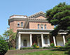
| 46 | William B. Cronyn House William B. Cronyn House William B. Cronyn House, also known as the House at 271 Ninth Street, is a historic home located in Brooklyn, New York, New York. It was built in 1856 and is a three story Second Empire style dwelling with a slate covered mansard roof... |
271 9th St. 40°40′11"N 73°59′16"W |
New York New York City New York is the most populous city in the United States and the center of the New York Metropolitan Area, one of the most populous metropolitan areas in the world. New York exerts a significant impact upon global commerce, finance, media, art, fashion, research, technology, education, and... |
|||
| 47 | Cuyler Presbyterian Church Cuyler Presbyterian Church Cuyler Presbyterian Church, also known as Cuyler Chapel and Cuyler Presbyterian Church and Parsonage, is a historic Presbyterian church at 358-360 Pacific Street in Brooklyn, New York, New York. It was designed by noted architect Edward Sargent... |
358-360 Pacific St. 40°41′12"N 73°59′13"W |
Brooklyn Brooklyn Brooklyn is the most populous of New York City's five boroughs, with nearly 2.6 million residents, and the second-largest in area. Since 1896, Brooklyn has had the same boundaries as Kings County, which is now the most populous county in New York State and the second-most densely populated... |
|||
| 48 | Cyclone Roller Coaster Coney Island Cyclone The Coney Island Cyclone is a historic hybrid roller coaster in the Coney Island section of Brooklyn, New York City. On June 18, 1975, Dewey and Jerome Albert, owners of Astroland Park, contracted to operate the Cyclone under an agreement with New York City... |
 |
834 Surf Ave. at W. 10th St. 40°34′30"N 73°58′44"W |
Coney Island Coney Island Coney Island is a peninsula and beach on the Atlantic Ocean in southern Brooklyn, New York, United States. The site was formerly an outer barrier island, but became partially connected to the mainland by landfill.... |
||
| 49 | Cypress Avenue West Historic District Cypress Avenue West Historic District Cypress Avenue West Historic District is a national historic district in Ridgewood, Queens, New York. It includes 440 contributing buildings built between 1888 and 1906. They consist mainly of brick two and three story row houses with one apartment per floor and three story tenements with two... |
Roughly bounded by St. Nicholas and Seneca Aves., Linden and Stockholm Sts. 40°42′14.75"N 73°54′46.46"W |
New York New York City New York is the most populous city in the United States and the center of the New York Metropolitan Area, one of the most populous metropolitan areas in the world. New York exerts a significant impact upon global commerce, finance, media, art, fashion, research, technology, education, and... |
|||
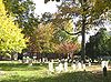
| 50 | Cypress Hills National Cemetery Cypress Hills National Cemetery Cypress Hills National Cemetery is the only United States National Cemetery in New York City and has more than 21,100 interments of veterans and civilians. There are 24 Medal of Honor recipients buried in the cemetery, including three men who won the award twice... |
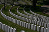 |
625 Jamaica Ave. 40°41′13.91"N 73°52′55.49"W |
Brooklyn Brooklyn Brooklyn is the most populous of New York City's five boroughs, with nearly 2.6 million residents, and the second-largest in area. Since 1896, Brooklyn has had the same boundaries as Kings County, which is now the most populous county in New York State and the second-most densely populated... |
||
| 51 | Ditmas Park Historic District Ditmas Park Historic District Ditmas Park Historic District is a national historic district in Ditmas Park, Brooklyn, New York, New York. It consists of 172 contributing, largely residential buildings built between 1902 and 1914. It includes fine examples of Colonial Revival, Bungalow/Craftsman, and Queen Anne style single... |
Bounded by Marlborough Rd., Dorchester, Ocean, and Newkirk Aves. 40°38′19"N 73°57′40"W |
Ditmas Park Ditmas Park, Brooklyn Ditmas Park is a neighborhood in western Flatbush in the New York City borough of Brooklyn, east of Kensington, and is one of three Flatbush neighborhoods which have been officially designated Historic Districts... |
|||
| 52 | DUMBO Industrial District DUMBO Industrial District DUMBO Industrial District is a historic industrial complex and national historic district in Brooklyn, New York, New York. The complex consists of 95 contributing 19th and early 20th century industrial and warehouse buildings, Belgian block streets, and its location on the East River by the... |
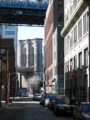 |
Roughly bounded by Main and Washington Sts, East River, John St., Bridge and Jay Sts., and Front and York Sts. 40°42′11"N 73°59′17"W |
DUMBO | ||
| 53 | East Midwood Jewish Center East Midwood Jewish Center East Midwood Jewish Center is a Conservative synagogue located at 1625 Ocean Avenue, Midwood, Brooklyn, New York City.Organized in 1924, the congregation's Renaissance revival building typified the large multi-purpose synagogue centers being built at the time, and was from the 1990s until 2010 the... |
 |
1625 Ocean Ave. 40°37′20"N 73°57′20"W |
Midwood Midwood, Brooklyn Midwood is a neighborhood in the south central part of the New York City borough of Brooklyn, New York, USA, roughly halfway between Prospect Park and Coney Island. The neighborhood is within Community District 14... |
||
| 54 | Eastern Parkway | 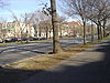 |
Eastern Pkwy from Grand Army Plaza to Ralph Ave. 40°40′14"N 73°58′8"W |
Brooklyn Brooklyn Brooklyn is the most populous of New York City's five boroughs, with nearly 2.6 million residents, and the second-largest in area. Since 1896, Brooklyn has had the same boundaries as Kings County, which is now the most populous county in New York State and the second-most densely populated... |
||
| 55 | Eighth Avenue (14th Brooklyn Regiment) Armory Eighth Avenue (14th Brooklyn Regiment) Armory Eighth Avenue Armory, also known as the Park Slope Armory, is a historic National Guard armory building located in Park Slope, Brooklyn, New York, New York. It is a brick and stone castle-like structure completed in 1893, and designed to be reminiscent of medieval military structures in Europe... |
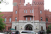 |
1402 Eighth Ave. 40°39′46"N 73°59′0"W |
Park Slope Park Slope, Brooklyn Park Slope is a neighborhood in western Brooklyn, New York City's most populous borough. Park Slope is roughly bounded by Prospect Park West to the east, Fourth Avenue to the west, Flatbush Avenue to the north, and 15th Street to the south, though other definitions are sometimes offered. Generally... |
Former home of 14th Brooklyn Regiment 14th Regiment (New York State Militia) The 14th Regiment New York State Militia was a volunteer militia regiment from the City of Brooklyn, New York. It is primarily known for its service in the American Civil War from April 1861 to May 1864, although it later served in the Spanish American War and World War I .In the Civil War, the... . |
|
| 56 | Emmanuel Baptist Church Emmanuel Baptist Church (Brooklyn, New York) Emmanuel Baptist Church is a Baptist church in the Clinton Hill neighborhood of Brooklyn, New York on the northwest corner of Lafayette Avenue and St. James Place. It was built 1887 to designs by architect Francis H. Kimball in the Gothic Revival style "as a synthesis of the cathedral type and the... |
279 LaFayette Ave. 40°41′17"N 73°58′10"W |
Brooklyn Brooklyn Brooklyn is the most populous of New York City's five boroughs, with nearly 2.6 million residents, and the second-largest in area. Since 1896, Brooklyn has had the same boundaries as Kings County, which is now the most populous county in New York State and the second-most densely populated... |
|||
| 57 | Erasmus Hall Academy Erasmus Hall High School Erasmus Hall Campus High School is a four-year public high school in the New York City borough of Brooklyn, United States operated by the New York City Department of Education.... |
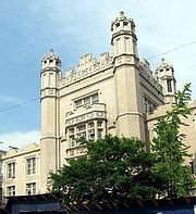 |
Between Flatbush, Bedford, Church, and Snyder Aves. 40°38′58"N 73°57′28"W |
Flatbush Flatbush Flatbush or Flat Bush can refer to a number of places:*Flatbush, Brooklyn, a community of Brooklyn, New York City, United States*Flatbush, New Zealand, a suburb of Manukau City, New Zealand... |
||
| 58 | Evergreens Cemetery |  |
1629 Bushwick Ave. 40°41′4.3122"N 73°54′4.3122"W |
Brooklyn Brooklyn Brooklyn is the most populous of New York City's five boroughs, with nearly 2.6 million residents, and the second-largest in area. Since 1896, Brooklyn has had the same boundaries as Kings County, which is now the most populous county in New York State and the second-most densely populated... |
||
| 59 | Federal Building and Post Office Federal Building and Post Office (New York, New York) The U.S. Post Office and Courthouse is a historic main post office, courthouse, and Federal office building in Brooklyn, New York. It is a courthouse for the United States District Court for the Southern District of New York, although it is across the street from and in the jurisdiction of the... |
 |
271 Cadman Plaza, E. 40°41′44"N 73°59′24"W |
Downtown Brooklyn Downtown Brooklyn Downtown Brooklyn is the third largest central business district in New York City , and is located in the northwestern section of the borough of Brooklyn... |
||
| 60 | Feuchtwanger Stable Feuchtwanger Stable Feuchtwanger Stable is a historic stable building located in Fort Greene, Brooklyn, New York, New York. It was built in 1888 in the Romanesque Revival style. It is a three story brick structure trimmed with stone and terra cotta... |
159 Carlton Ave. 40°41′34"N 73°58′22"W |
Brooklyn Brooklyn Brooklyn is the most populous of New York City's five boroughs, with nearly 2.6 million residents, and the second-largest in area. Since 1896, Brooklyn has had the same boundaries as Kings County, which is now the most populous county in New York State and the second-most densely populated... |
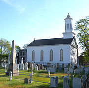
|||
| 61 | Flatbush Dutch Reformed Church Complex Flatbush Dutch Reformed Church Complex Flatbush Dutch Reformed Church Complex, also referred to more simply as the Flatbush Reformed Church, is a historic Dutch Reformed church at 890 Flatbush Avenue and 2101-2103 Kenmore Terrace in Flatbush, Brooklyn, New York. The complex consists of the church, church house, parsonage, and cemetery.... |
 |
890 Flatbush Ave. and 2101-2103 Kenmore Terr. 40°39′0"N 73°57′33"W |
Flatbush Flatbush, Brooklyn Flatbush is a community of the Borough of Brooklyn, a part of New York City, consisting of several neighborhoods.The name Flatbush is an Anglicization of the Dutch language Vlacke bos .... |
||
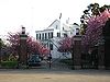
| 62 | Flatbush Town Hall Flatbush Town Hall Flatbush Town Hall is a historic town hall located in Flatbush, Brooklyn, New York, New York. It was built in 1874-1875 and is a two story masonry building on a stone foundation in the Gothic Revival style. It features a three story bell tower with a steep hip roof... |
35 Snyder Ave. 40°38′56"N 73°57′26"W |
Flatbush Flatbush Flatbush or Flat Bush can refer to a number of places:*Flatbush, Brooklyn, a community of Brooklyn, New York City, United States*Flatbush, New Zealand, a suburb of Manukau City, New Zealand... |
|||
| 63 | Flatlands Dutch Reformed Church Flatlands Dutch Reformed Church Flatlands Dutch Reformed Church, also known as Flatlands Reformed Church, is a historic Dutch Reformed church at Kings Highway and E. 40th Street in Flatlands, Brooklyn, New York, New York. The complex consists of the church, administration building, and cemetery. The congregation was founded in... |
 |
Kings Hwy. and E. 40th St. 40°37′26"N 73°56′13"W |
Flatlands Flatlands, Brooklyn Flatlands is a neighborhood in the New York City borough of Brooklyn. The area is part of Brooklyn Community Board 18.One of the original five Dutch towns on Long Island , this neighborhood was originally known as Nieuw Amersfoort, after the Dutch city of Amersfoort, but the name was changed to... |
||
| 64 | Floyd Bennett Field Historic District | 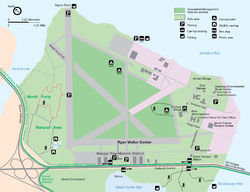 |
Flatbush Ave. 40°35′17"N 73°53′32"W |
Brooklyn Brooklyn Brooklyn is the most populous of New York City's five boroughs, with nearly 2.6 million residents, and the second-largest in area. Since 1896, Brooklyn has had the same boundaries as Kings County, which is now the most populous county in New York State and the second-most densely populated... |
||
| 65 | Fort Greene Historic District Fort Greene Historic District Fort Greene Historic District is a national historic district in Fort Greene, Brooklyn, New York, New York. It consists of 1,158 contributing buildings, two contributing sites, one contributing object, and two contributing structures... |
; boundary increase | Roughly bounded by Ft. Greene Pl., Fulton St., Vanderbilt and Myrtle Aves. 40°41′19"N 73°58′19"W |
Fort Greene, Brooklyn Fort Greene, Brooklyn Fort Greene is a neighborhood in the New York City borough of Brooklyn. Part of Brooklyn Community Board 2, Fort Greene is listed on the New York State Registry and on the National Register of Historic Places, and is a New York City-designated Historic District... |
||
| 66 | Friends Meetinghouse and School Friends Meetinghouse and School Friends Meetinghouse and School is a historic Quaker meeting house at 110 Schermerhorn Street in Downtown Brooklyn, New York, New York. The meeting house is a -story building built of red brick with brownstone details. The meeting house was built in 1857... |
110 Schermerhorn St. 40°41′23"N 73°59′24"W |
Downtown Brooklyn Downtown Brooklyn Downtown Brooklyn is the third largest central business district in New York City , and is located in the northwestern section of the borough of Brooklyn... |
|||
| 67 | Fulton Ferry District Fulton Ferry District Fulton Ferry District is a national historic district in Fulton Ferry, Brooklyn, New York, New York. It consists of 15 contributing buildings built between 1830 and 1895. They are an assortment of commercial and commercial / residential brick buildings ranging from two to four stories in height,... |
Roughly bounded by the East River and Washington, Water, Front, and Doughty Sts. 40°42′12"N 73°59′35"W |
Fulton Ferry, Brooklyn Fulton Ferry, Brooklyn Fulton Ferry is a neighborhood in the New York City borough of Brooklyn. The neighborhood is named for a prominent ferry line crossing the East River between Manhattan and Brooklyn, and is also the name of the ferry slip on the Brooklyn side... |
|||
| 68 | Gage and Tollner Restaurant Gage and Tollner Gage and Tollner was a restaurant on Fulton Street in Downtown Brooklyn. It had been in business since 1879 and in the same location since 1892 until it closed on February 14, 2004. The Brownstone where it was housed has been in existence since 1875.... |
372 Fulton St. 40°41′28"N 73°59′17"W |
Downtown Brooklyn Downtown Brooklyn Downtown Brooklyn is the third largest central business district in New York City , and is located in the northwestern section of the borough of Brooklyn... |
|||
| 69 | Grecian Shelter Grecian Shelter Grecian Shelter, also known as Croquet Shelter, is a peristyle with Corinthian columns near the southern edge of Prospect Park in Brooklyn, New York. It was built in 1905 and was refurbished in 1966. It was listed on the National Register of Historic Places in 1972.... |
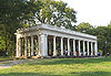 |
Prospect Park near Parkside Ave. 40°39′13"N 73°58′3"W |
Prospect Park | ||
| 70 | Green-Wood Cemetery Green-Wood Cemetery Green-Wood Cemetery was founded in 1838 as a rural cemetery in Brooklyn, Kings County , New York. It was granted National Historic Landmark status in 2006 by the U.S. Department of the Interior.-History:... |
 |
500 25th Street 40°39′8"N 73°59′26"W |
Brooklyn Brooklyn Brooklyn is the most populous of New York City's five boroughs, with nearly 2.6 million residents, and the second-largest in area. Since 1896, Brooklyn has had the same boundaries as Kings County, which is now the most populous county in New York State and the second-most densely populated... |
||
| 71 | Greenpoint Historic District Greenpoint Historic District Greenpoint Historic District is a national historic district in Greenpoint, Brooklyn, New York, New York. It consists of 363 contributing commercial and residential buildings built between 1850 and 1900... |
Roughly bounded by Kent, Calyer, Noble, and Franklin Sts., Clifford Pl. and Manhattan Ave. 40°43′43"N 73°57′20"W |
Greenpoint Greenpoint, Brooklyn Greenpoint is the northernmost neighborhood in the New York City borough of Brooklyn. It is bordered on the southwest by Williamsburg at the Bushwick inlet, on the southeast by the Brooklyn-Queens Expressway and East Williamsburg, on the north by Newtown Creek and Long Island City, Queens at the... |
|||
| 72 | Hanson Place Seventh Day Adventist Church Hanson Place Seventh Day Adventist Church Hanson Place Seventh Day Adventist Church, known until 1963 as Hanson Place Baptist Church, is a historic Seventh-day Adventist Church at 88 Hanson Place in Brooklyn in New York City. It was built between 1857 and 1860 and is a brick building on a brick foundation covered in stucco... |
88 Hanson Pl. 40°41′7"N 73°58′28"W |
New York New York City New York is the most populous city in the United States and the center of the New York Metropolitan Area, one of the most populous metropolitan areas in the world. New York exerts a significant impact upon global commerce, finance, media, art, fashion, research, technology, education, and... |
|||
| 73 | Holy Trinity Church (Protestant Episcopal) | 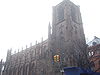 |
157 Montague St. 40°41′40"N 73°59′35"W |
Brooklyn Heights | ||
| 74 | Houses at 216-264 Ovington Ave. Houses at 216-264 Ovington Ave. Houses at 216-264 Ovington Ave. is a national historic district in Bay Ridge, Brooklyn, New York, New York. It consists of 20 contributing residential buildings built between 1908 and 1910. They are brownstone rowhouses with bowed fronts in the Neo-Renaissance style. The houses are two or three... |
216-264 Ovington Ave. 40°38′5"N 74°1′42"W |
Brooklyn Brooklyn Brooklyn is the most populous of New York City's five boroughs, with nearly 2.6 million residents, and the second-largest in area. Since 1896, Brooklyn has had the same boundaries as Kings County, which is now the most populous county in New York State and the second-most densely populated... |
|||
| 75 | Hubbard House Hubbard House (Brooklyn, New York) Hubbard House, also known as Hubbard-Lucchelli House and Theresa Luchchelli House, is a historic home located in Brooklyn, New York, New York. It is believed to have been built between 1825 and 1838. It is a small, white Dutch Colonial–style farmhouse. It consists of two sections: a -story,... |
2138 McDonald Ave. 40°36′0"N 73°58′25"W |
Brooklyn Brooklyn Brooklyn is the most populous of New York City's five boroughs, with nearly 2.6 million residents, and the second-largest in area. Since 1896, Brooklyn has had the same boundaries as Kings County, which is now the most populous county in New York State and the second-most densely populated... |
|||
| 76 | Hunterfly Road Historic District | 1698, 1700, 1702, 1704, 1706, 1708 Bergen St. 40°40′28"N 73°55′35"W |
Weeksville, Brooklyn Weeksville, Brooklyn Weeksville is a neighborhood founded by African American freedmen in what is now Brooklyn, New York, United States, part of the present-day neighborhood of Crown Heights.-History:... |
|||
| 77 | Immanuel Congregational Church Immanuel Congregational Church Immanuel Congregational Church, also known as St. Mark's Congregational Church and known since 1945 as Union Baptist Church, is a historic Congregational church at 461 Decatur Street in Bedford-Stuyvesant, Brooklyn, New York, New York. It was built in 1898 and is a two story masonry building in the... |
461 Decatur St. 40°40′57"N 73°55′30"W |
Bedford–Stuyvesant | |||
| 78 | Industrial Complex at 221 McKibbin Street Industrial Complex at 221 McKibbin Street Industrial Complex at 221 McKibbin Street is a historic industrial complex in East Williamsburg, Brooklyn, New York, New York. The complex consists of ten interconnected structures built between about 1845 and 1951. The most prominent building is the three story brick spinning house of the H.... |
221 McKibbin St. 40°42′19.5"N 73°56′19.09"W |
Brooklyn Bushwick, Brooklyn Bushwick is a neighborhood in the northern part of the New York City borough of Brooklyn. The neighborhood, formerly Brooklyn's 18th Ward, is now part of Brooklyn Community Board 4... |
|||
| 79 | Jewish Center of Kings Highway Jewish Center of Kings Highway Jewish Center of Kings Highway is a historic synagogue at 1202-1218 Ave. P in Flatbush, Brooklyn, New York, New York. The synagogue was built between 1928 and 1930 and is a two story with basement building faced in brick. It features a cast stone temple front with four engaged Corinthian order... |
1202-1218 Ave. P 40°36′36.46"N 73°57′39.45"W |
Brooklyn Brooklyn Brooklyn is the most populous of New York City's five boroughs, with nearly 2.6 million residents, and the second-largest in area. Since 1896, Brooklyn has had the same boundaries as Kings County, which is now the most populous county in New York State and the second-most densely populated... |
New listing; refnum 10000009 | ||
| 80 | Kings County Savings Bank Kings County Savings Bank Kings County Savings Bank is a New York City Landmarks Preservation Commission-designated building in the Williamsburg, Brooklyn section of New York City. It is an example of French Second Empire-style architecture. Construction of the building began in 1860, to designs of William H... |
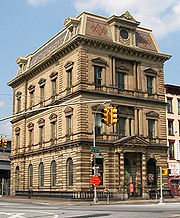 |
135 Broadway 40°42′37"N 73°57′51"W |
Williamsburg Williamsburg, Brooklyn Williamsburg is a neighborhood in the New York City borough of Brooklyn, bordering Greenpoint to the north, Bedford-Stuyvesant to the south, Bushwick to the east and the East River to the west. The neighborhood is part of Brooklyn Community Board 1. The neighborhood is served by the NYPD's 90th ... |
||
| 81 | Kingsway Jewish Center Kingsway Jewish Center Kingsway Jewish Center is a historic synagogue at 2810 Nostrand Ave. in Midwood, Brooklyn, New York, New York. The Center complex includes the synagogue , school block , and catering hall wing . The synagogue features a series of 18 windows designed by Abstract Expressionist artist Adolph Gottlieb... |
2810 Nostrand Ave. 40°36′57.12"N 73°56′41.21"W |
Brooklyn | New listing; refnum 10000010 | ||
| 82 | Knickerbocker Field Club Knickerbocker Field Club Knickerbocker Field Club is a historic tennis clubhouse located in Flatbush, Brooklyn, New York, New York. It was built in 1892 and is the sole surviving building associated with the Tennis Court development. It is a long, two story Colonial Revival style building sheathed in clapboard and shingles... |
114 E. 18th St. 40°38′52"N 73°57′49"W |
New York New York City New York is the most populous city in the United States and the center of the New York Metropolitan Area, one of the most populous metropolitan areas in the world. New York exerts a significant impact upon global commerce, finance, media, art, fashion, research, technology, education, and... |
|||
| 83 | Kol Israel Synagogue Kol Israel Synagogue Kol Israel Synagogue is a historic synagogue at 603 St. John's Place in Crown Heights, Brooklyn, New York, New York. It was built in 1928 and is a vernacular "tenement synagogue." It is a small, two story rectangular building faced in random laid fieldstone.... |
603 St. John's Place 40°40′22.23"N 73°57′29.47"W |
Brooklyn Brooklyn Brooklyn is the most populous of New York City's five boroughs, with nearly 2.6 million residents, and the second-largest in area. Since 1896, Brooklyn has had the same boundaries as Kings County, which is now the most populous county in New York State and the second-most densely populated... |
New listing; refnum 09000966 | ||
| 84 | Lefferts Manor Historic District Lefferts Manor Historic District Lefferts Manor Historic District is a national historic district in Prospect Lefferts Gardens, Flatbush, Brooklyn, New York, New York. It consists of 667 contributing buildings and one contributing site built between 1896 and 1935 on the subdivision established by James Lefferts in 1896... |
Roughly bounded by Lincoln Rd., Fenimore St., Rogers Ave. and Flatbush Ave. 40°39′26"N 73°57′26"W |
Prospect Lefferts Gardens | |||
| 85 | Lefferts-Laidlaw House Lefferts-Laidlaw House Lefferts-Laidlaw House is a historic home located in Wallabout, Brooklyn, New York, New York. It was built about 1840 and is a two story frame building in the Greek Revival style. It consists of a two story central section with one story south ell and two story rear extension... |
136 Clinton St. 40°41′37"N 73°58′10"W |
Brooklyn Heights | |||
| 86 | Lincoln Club Lincoln Club Lincoln Club, also known as Mechanics Temple, Independent Order of Mechanics of the Western Hemisphere, is a historic clubhouse located in Clinton Hill, Brooklyn, New York, New York. It was built between 1886 and 1889 and is a -story Queen Anne style masonry building. It is built of Roman brick... |
65 Putnam Ave. 40°40′59"N 73°57′35"W |
Brooklyn Brooklyn Brooklyn is the most populous of New York City's five boroughs, with nearly 2.6 million residents, and the second-largest in area. Since 1896, Brooklyn has had the same boundaries as Kings County, which is now the most populous county in New York State and the second-most densely populated... |
|||
| 87 | Litchfield Villa Litchfield Villa Litchfield Villa is an Italianate mansion built in 1854 on a large private estate that has since become part of Prospect Park, Brooklyn.The villa was designed by Alexander Jackson Davis, America's leading architect of the fashionable Italianate style for railroad and real estate developer Edwin... |
 |
Prospect Park W. and 5th St. 40°40′8"N 73°58′26"W |
Prospect Park | ||
| 88 | Hendrick I. Lott House Hendrick I. Lott House The Hendrick I. Lott House is a historic home located at 1940 East 36th Street, resting in the neighborhood known as Marine Park, in the New York City borough of Brooklyn, there lies one of the oldest Dutch Colonial farmhouses in Kings County. It is listed on the National Register of Historic... |
 |
1940 E. 36th St. 40°36′37"N 73°55′58"W |
Marine Park Marine Park Marine Park is a neighborhood located in the New York City borough of Brooklyn, that lies between Mill Basin and Gerritsen Beach. The neighborhood is mostly squared off in area by Gerritsen Avenue, Flatbush Avenue, Avenue U and Kings Highway. It partly surrounds the eponymous park. The neighborhood... |
||
| 89 | Magen David Synagogue | 2017 67th St. 40°36′54"N 73°59′12"W |
Bensonhurst | |||
| 90 | Manhattan Bridge Manhattan Bridge The Manhattan Bridge is a suspension bridge that crosses the East River in New York City, connecting Lower Manhattan with Brooklyn . It was the last of the three suspension bridges built across the lower East River, following the Brooklyn and the Williamsburg bridges... |
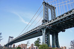 |
Spans East River between Front and Canal St. 40°42′36"N 73°59′18"W |
Downtown Brooklyn Downtown Brooklyn Downtown Brooklyn is the third largest central business district in New York City , and is located in the northwestern section of the borough of Brooklyn... |
||
| 91 | Msgnr McGolrick Park McGolrick Park Monsignor McGolrick Park is located in Greenpoint, Brooklyn, between Driggs Avenue to the south, Russell Street to the west, Nassau Avenue to the north, and Monitor Street to the east.-History:... and Shelter Pavilion |
 |
Bounded by Nassau and Driggs Aves., Russell and Monitor Sts. 40°43′28"N 73°56′38"W |
Greenpoint Greenpoint, Brooklyn Greenpoint is the northernmost neighborhood in the New York City borough of Brooklyn. It is bordered on the southwest by Williamsburg at the Bushwick inlet, on the southeast by the Brooklyn-Queens Expressway and East Williamsburg, on the north by Newtown Creek and Long Island City, Queens at the... |
||
| 92 | New England Congregational Church and Rectory | 177-179 S. 9th St. 40°42′31"N 73°57′45"W |
Williamsburg Williamsburg, Brooklyn Williamsburg is a neighborhood in the New York City borough of Brooklyn, bordering Greenpoint to the north, Bedford-Stuyvesant to the south, Bushwick to the east and the East River to the west. The neighborhood is part of Brooklyn Community Board 1. The neighborhood is served by the NYPD's 90th ... |
|||
| 93 | New Lots Reformed Church and Cemetery New Lots Reformed Church and Cemetery New Lots Reformed Church and Cemetery is a historic Dutch Reformed church and cemetery at 630 New Lots Avenue in New Lots, Brooklyn, New York, New York. It was built in 1823-1824 and is a small, rectangular wood frame building sheathed in clapboard. It has a pitched gable roof and sits on a rough... |
 |
630 New Lots Ave. 40°39′53"N 73°53′8"W |
New Lots New Lots, Brooklyn New Lots is a sub-section of the East New York neighborhood in the eastern part of the New York City borough of Brooklyn. It was known as the Town of New Lots from 1852 when the area seceded from the Town of Flatbush until it was annexed in 1886 as the 26th Ward of Brooklyn. The population is... |
||
| 94 | New Utrecht Avenue Subway station ( train) | 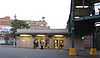 |
Beneath the jct. of New Utrecht Ave. with 15th Ave. and 62nd St. 40°37′29"N 73°59′48"W |
Brooklyn Brooklyn Brooklyn is the most populous of New York City's five boroughs, with nearly 2.6 million residents, and the second-largest in area. Since 1896, Brooklyn has had the same boundaries as Kings County, which is now the most populous county in New York State and the second-most densely populated... |
||
| 95 | New Utrecht Reformed Church New Utrecht Reformed Church New Utrecht Reformed Church is the fourth oldest church in Brooklyn, New York. The church was established in 1677 in the town of New Utrecht and is affiliated with the Reformed Church in America, a Protestant denomination. The present church was built in 1828 of stones taken from the original... and Buildings |
 |
18th Ave. and 83rd St. 40°36′30"N 74°0′3"W |
New Utrecht New Utrecht, Brooklyn New Utrecht was the last of six towns to be founded in what is today the borough of Brooklyn in New York City. It was named after the city of Utrecht, Netherlands. In 1652 Cornelius van Werckhoven, a surveyor born in Utrecht and a principal investor in the Dutch West India Company, began purchasing... |
||
| 96 | New York Congregational Home for the Aged New York Congregational Home for the Aged New York Congregational Home for the Aged, also known as New York Congregational Center for Community Life, is a historic care facility associated with the Congregational church at 123 Linden Boulevard in Flatbush, Brooklyn, New York, New York. It is a three story brick institutional building in... |
123 Linden Blvd. 40°39′8.73"N 73°57′15.03"W |
Brooklyn Brooklyn Brooklyn is the most populous of New York City's five boroughs, with nearly 2.6 million residents, and the second-largest in area. Since 1896, Brooklyn has had the same boundaries as Kings County, which is now the most populous county in New York State and the second-most densely populated... |
New listing: refnum #08001033 | ||
| 97 | Ocean Parkway Ocean Parkway (Brooklyn) Ocean Parkway is a broad boulevard in the west central portion of the borough of Brooklyn in New York City.-Route description:Ocean Parkway extends over a distance of about five miles , running almost north to south from the vicinity of Prospect Park to Brighton Beach... |
 |
From Church Ave. to Seabreeze Ave. 40°36′19"N 73°58′11"W |
Brooklyn Brooklyn Brooklyn is the most populous of New York City's five boroughs, with nearly 2.6 million residents, and the second-largest in area. Since 1896, Brooklyn has had the same boundaries as Kings County, which is now the most populous county in New York State and the second-most densely populated... |
||
| 98 | Ocean Parkway Jewish Center Ocean Parkway Jewish Center Ocean Parkway Jewish Center is a historic synagogue at 550 Ocean Pkwy. in Kensington, Brooklyn, New York, New York. It was built between 1924 and 1926 and is a three story plus basement and attic, stone clad Neoclassical style building. It has a two story addition... |
550 Ocean Pkwy. 40°38′4.24"N 73°58′23.01"W |
Brooklyn Brooklyn Brooklyn is the most populous of New York City's five boroughs, with nearly 2.6 million residents, and the second-largest in area. Since 1896, Brooklyn has had the same boundaries as Kings County, which is now the most populous county in New York State and the second-most densely populated... |
New listing; refnum 09001082 | ||
| 99 | Ocean Parkway Ocean Parkway (BMT Brighton Line) Ocean Parkway is an express station on the New York City Subway's BMT Brighton Line. Located at Brighton Beach Avenue and Ocean Parkway in Brighton Beach, Brooklyn, it is served by the Q train at all times.-Layout:... Subway station ( train) |
 |
Above jct. of Brighton Beach Ave. and Ocean Pkwy 40°34′35"N 73°58′8"W |
Brighton Beach | ||
| 100 | Old Brooklyn Fire Headquarters Brooklyn Fire Headquarters The Brooklyn Fire Headquarters, also known as Old Brooklyn Fire Headquarters, is a historic building in Brooklyn, New York. Designed by Frank Freeman and built in 1892, it was used as a fire station until the 1970s, after which it was converted into housing apartments... |
 |
365-367 Jay St. 40°41′34"N 73°59′15"W |
Downtown Brooklyn Downtown Brooklyn Downtown Brooklyn is the third largest central business district in New York City , and is located in the northwestern section of the borough of Brooklyn... |
||
| 101 | Old First Reformed Church (Brooklyn, New York) Old First Reformed Church (Brooklyn, New York) Old First Reformed Church is a historic Dutch Reformed church at 729 Carroll Street in Park Slope, Brooklyn, New York, New York. The congregation was founded in 1654. The current church building was constructed in 1888-1891 and is a Late Gothic Revival style Indiana limestone building on a granite... |
 |
729 Carroll St. 40°40′24"N 73°58′37"W |
Park Slope Park Slope, Brooklyn Park Slope is a neighborhood in western Brooklyn, New York City's most populous borough. Park Slope is roughly bounded by Prospect Park West to the east, Fourth Avenue to the west, Flatbush Avenue to the north, and 15th Street to the south, though other definitions are sometimes offered. Generally... |
||
| 102 | Old Gravesend Cemetery Old Gravesend Cemetery Old Gravesend Cemetery is a historic cemetery at Gravesend Neck Road and McDonald Avenue in Gravesend, Brooklyn, New York, New York. The cemetery was founded about 1658 and contains the graves of a number of the original patentees and their families... |
Gravesend Neck Rd. and MacDonald Ave. 40°35′41"N 73°58′30"W |
Gravesend Gravesend, Brooklyn Gravesend is a neighborhood in the south-central section of the New York City borough of Brooklyn, USA.The derivation of the name is unclear. Some speculate that it was named after the English seaport of Gravesend, Kent. An alternative explanation suggests that it was named by Willem Kieft for the... |
|||
| 103 | Parachute Jump Parachute Jump The Parachute Jump is a defunct amusement ride in Coney Island, Brooklyn, New York, whose iconic open-frame steel structure remains a Brooklyn landmark. tall and weighing 170 tons , it has been called the "Eiffel Tower of Brooklyn"... |
 |
Coney Island 40°34′21"N 73°59′6"W |
Coney Island Coney Island Coney Island is a peninsula and beach on the Atlantic Ocean in southern Brooklyn, New York, United States. The site was formerly an outer barrier island, but became partially connected to the mainland by landfill.... |
||
| 104 | Park Slope Historic District Park Slope Historic District Park Slope Historic District is a national historic district in Park Slope, Brooklyn, New York, New York. It consists of 1,802 contributing buildings built between 1862 and about 1920. The 33 block district is almost exclusively residential and located adjacent to Prospect Park... |
 |
Roughly bounded by Prospect Park West, Berkeley Pl., 15th St., 6th, 7th and Flatbush Aves. 40°40′8"N 73°58′35"W |
Park Slope Park Slope, Brooklyn Park Slope is a neighborhood in western Brooklyn, New York City's most populous borough. Park Slope is roughly bounded by Prospect Park West to the east, Fourth Avenue to the west, Flatbush Avenue to the north, and 15th Street to the south, though other definitions are sometimes offered. Generally... |
||
| 105 | Parkway Theatre Parkway Theatre Parkway Theatre, known since 1952 as the Holy House of Prayer for All People, is a historic former theater at 1768 St. John's Pl. in Brownsville, Brooklyn, New York, New York. It was built in 1928 and is a steel frame and concrete building faced in buff colored brick with terra cotta trim. It... |
1768 St. John's Pl. 40°40′11.55"N 73°55′7.58"W |
Brooklyn | New listing; refnum 10000136 | ||
| 106 | Plymouth Church of the Pilgrims Plymouth Church of the Pilgrims Plymouth Church of the Pilgrims is a church in Brooklyn Heights, Brooklyn, New York City. It was a station of the Underground Railroad, and the pulpit of Henry Ward Beecher, its first pastor... |
 |
75 Hicks St. 40°41′57"N 73°59′37"W |
Brooklyn Heights | ||
| 107 | Pratt Institute Historic District Pratt Institute Pratt Institute is a private art college in New York City located in Brooklyn, New York, with satellite campuses in Manhattan and Utica. Pratt is one of the leading undergraduate art schools in the United States and offers programs in Architecture, Graphic Design, History of Art and Design,... |
 |
Roughly bounded by Hall St., Dekalb Ave., Willoughby St. and Emerson Pl. 40°41′28"N 73°57′50"W |
Clinton Hill Clinton Hill, Brooklyn Clinton Hill is a neighborhood in the north-central portion of the borough of Brooklyn in New York City. It is bordered on the east by Bedford-Stuyvesant, on the west by Fort Greene, on the north by Wallabout Bay and on the south by Prospect Heights... |
||
| 108 | Prospect Hall | 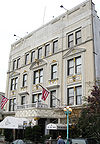 |
263 Prospect Ave. 40°39′49"N 73°59′24"W |
Prospect Heights Prospect Heights, Brooklyn Prospect Heights is a neighborhood in the northwest of the New York City borough of Brooklyn. The traditional boundaries are Flatbush Avenue to the west, Atlantic Avenue to the north, Eastern Parkway to the south, and Washington Avenue to the east... |
||
| 109 | Prospect Heights Historic District Prospect Heights Historic District (New York, New York) Prospect Heights Historic District is a national historic district in Prospect Heights, Brooklyn, New York, New York. It consists of 305 contributing buildings built between 1865 and about 1900. The district is almost exclusively residential and includes a variety of single family rowhouses and... |
Roughly bounded by Pacific and Bergen Sts., Flatbush and Vanderbilt Aves., and Park Pl. 40°40′44"N 73°58′20"W |
Brooklyn Brooklyn Brooklyn is the most populous of New York City's five boroughs, with nearly 2.6 million residents, and the second-largest in area. Since 1896, Brooklyn has had the same boundaries as Kings County, which is now the most populous county in New York State and the second-most densely populated... |
|||
| 110 | Prospect Park Prospect Park (Brooklyn) Prospect Park is a 585-acre public park in the New York City borough of Brooklyn located between Park Slope, Prospect-Lefferts Gardens, Kensington, Windsor Terrace and Flatbush Avenue, Grand Army Plaza and the Brooklyn Botanic Garden... |
 |
Bounded by Parkside, Ocean and Flatbush Aves., Prospect Park W. and Prospect SW. 40°39′34"N 73°58′14"W |
Brooklyn Brooklyn Brooklyn is the most populous of New York City's five boroughs, with nearly 2.6 million residents, and the second-largest in area. Since 1896, Brooklyn has had the same boundaries as Kings County, which is now the most populous county in New York State and the second-most densely populated... |
||
| 111 | Prospect Park South Historic District Prospect Park South, Brooklyn Prospect Park South is a neighborhood in the New York City borough of Brooklyn, within the community of Flatbush. It is bordered by Church Avenue to the north, the Brighton Line of the New York City Subway to the east, Beverley Road to the south, and between Stratford Road and Coney Island Avenue... |
Roughly bounded by BMT RR Tracks, Beverly Rd., and Coney Island and Church Aves. 40°38′46"N 73°58′1"W |
Flatbush Flatbush, Brooklyn Flatbush is a community of the Borough of Brooklyn, a part of New York City, consisting of several neighborhoods.The name Flatbush is an Anglicization of the Dutch language Vlacke bos .... |
|||
| 112 | Public Bath No. 7 Public Bath No. 7 Public Bath No. 7 is a historic bathhouse located in Brooklyn, New York, New York. It was built between 1906 and 1910 and is constructed of white glazed brick and limestone colored terra cotta blocks. The design is based on a Renaissance palazzo. It measures three bays by five bays... |
227-231 Fourth Ave. 40°40′36"N 73°59′0"W |
Park Slope Park Slope, Brooklyn Park Slope is a neighborhood in western Brooklyn, New York City's most populous borough. Park Slope is roughly bounded by Prospect Park West to the east, Fourth Avenue to the west, Flatbush Avenue to the north, and 15th Street to the south, though other definitions are sometimes offered. Generally... |
|||
| 113 | Public School 108 Public School 108 Public School 108 is a historic school building located in Cypress Hills, Brooklyn, New York, New York. It was designed by James W. Naughton and built in 1895. It is a three story, brick building trimmed in Lake Superior sandstone in the Romanesque Revival style. It has an attic fourth floor... |
200 Lindwood St. 40°40′52"N 73°53′5"W |
New York New York City New York is the most populous city in the United States and the center of the New York Metropolitan Area, one of the most populous metropolitan areas in the world. New York exerts a significant impact upon global commerce, finance, media, art, fashion, research, technology, education, and... |
|||
| 114 | Public School 111 and Public School 9 Annex Public School 111 and Public School 9 Annex Public School 111 and Public School 9 Annex are two historic school buildings located in Prospect Heights, Brooklyn, New York, New York. Public School 111 consists of a central, two story gabled section flanked by two story wings. The central section dates to 1867 and the wings were added in 1887.... |
249 Sterling Place and 251 Sterling Place 40°40′35"N 73°58′11"W |
Fort Greene Fort Greene, Brooklyn Fort Greene is a neighborhood in the New York City borough of Brooklyn. Part of Brooklyn Community Board 2, Fort Greene is listed on the New York State Registry and on the National Register of Historic Places, and is a New York City-designated Historic District... |
|||
| 115 | Public School 39 Public School 39 Public School 39, also known as Henry Bristow School, is a historic school building located in Park Slope, Brooklyn, New York, New York. It was built in 1876-1877 and is a three story symmetrical brick and stone building combining features of the Italianate and Second Empire styles. The main... |
417 6th Ave. 40°40′7"N 73°59′2"W |
Park Slope Park Slope, Brooklyn Park Slope is a neighborhood in western Brooklyn, New York City's most populous borough. Park Slope is roughly bounded by Prospect Park West to the east, Fourth Avenue to the west, Flatbush Avenue to the north, and 15th Street to the south, though other definitions are sometimes offered. Generally... |
|||
| 116 | Public School 65K Public School 65K Public School 65K is a historic school building located in Cypress Hills, Brooklyn, New York, New York. It was originally built in 1870 and significantly expanded in 1889 to designs by James W. Naughton. It is a two story, brick building on a stone base in the Romanesque Revival style... |
158 Richmond St. 40°40′59"N 73°52′40"W |
Brooklyn Brooklyn Brooklyn is the most populous of New York City's five boroughs, with nearly 2.6 million residents, and the second-largest in area. Since 1896, Brooklyn has had the same boundaries as Kings County, which is now the most populous county in New York State and the second-most densely populated... |
|||
| 117 | Public School 7 Public School 7 Public School 7 is a historic school building located in Brooklyn, New York, New York. It was built in 1882 to designs by James W. Naughton. It is a three story, "I" shaped masonry building faced with pressed brick and trimmed in sandstone. It consists of a three bay center section flanked by a... |
131-143 York St. 40°42′6"N 73°59′9"W |
New York New York City New York is the most populous city in the United States and the center of the New York Metropolitan Area, one of the most populous metropolitan areas in the world. New York exerts a significant impact upon global commerce, finance, media, art, fashion, research, technology, education, and... |
|||
| 118 | Public School 71K Public School 71K Public School 71K is a historic school building located in Williamsburgh, Brooklyn, New York, New York. It was built in 1888-1889 to designs by James W. Naughton. It is a symmetrical three story, brick building with stone trim in the Second Empire style... |
119 Heyward St. 40°42′6"N 73°57′24"W |
New York New York City New York is the most populous city in the United States and the center of the New York Metropolitan Area, one of the most populous metropolitan areas in the world. New York exerts a significant impact upon global commerce, finance, media, art, fashion, research, technology, education, and... |
|||
| 119 | Quarters A Quarters A, Brooklyn Navy Yard Quarters A, Brooklyn Navy Yard was the residence of the commander of the Brooklyn Navy Yard. It was home to Commodore Matthew C. Perry at the time of his opening of Japan... |
 |
U.S. Naval Facility 40°42′8.57"N 73°58′49.19"W |
Brooklyn Navy Yard Brooklyn Navy Yard The United States Navy Yard, New York–better known as the Brooklyn Navy Yard or the New York Naval Shipyard –was an American shipyard located in Brooklyn, northeast of the Battery on the East River in Wallabout Basin, a semicircular bend of the river across from Corlear's Hook in Manhattan... |
||
| 120 | John Rankin House John Rankin House (Brooklyn, New York) John Rankin House is a historic home located in Carroll Gardens, Brooklyn, New York, New York. It was built in 1839 and is a three-story, square brick building on a stone foundation in the Greek Revival style. The interior features a massive mahogany stairway with paneled wainscotting.It was... |
440 Clinton St. 40°40′53"N 73°59′56"W |
Carroll Gardens Carroll Gardens, Brooklyn Carroll Gardens is a neighborhood in the New York City borough of Brooklyn, USA. The area is named for Charles Carroll, a revolutionary war veteran who was also the only Roman Catholic signer of the Declaration of Independence... |
|||
| 121 | Renaissance Apartments Renaissance Apartments Renaissance Apartments is a historic apartment building located at Hancock Street and Nostrand Avenue in Bedford-Stuyvesant, Brooklyn, New York, New York. It was built in 1892 and is a five story masonry building in the French Renaissance style. It features elaborately decorated principal facades... |
480 Nostrand Ave. 40°40′56"N 73°57′2"W |
Brooklyn Brooklyn Brooklyn is the most populous of New York City's five boroughs, with nearly 2.6 million residents, and the second-largest in area. Since 1896, Brooklyn has had the same boundaries as Kings County, which is now the most populous county in New York State and the second-most densely populated... |
|||
| 122 | John Roosevelt "Jackie" Robinson House Jackie Robinson House Jackie Robinson House was a Brooklyn home of baseball great Jackie Robinson from 1947 when he was earned Rookie of the Year with the Brooklyn Dodgers through 1949 when he was voted Most Valuable Player. It was declared a National Historic Landmark in 1976.... |
 |
5224 Tilden St. 40°38′54"N 73°54′54"W |
East Flatbush, Brooklyn East Flatbush, Brooklyn East Flatbush is a neighborhood in the New York City borough of Brooklyn. The area is part of Brooklyn Community Board 17 Though the borders of East Flatbush are highly subjective, its northern border is roughly at Empire Boulevard and East New York Avenue east of East 91st Street, its southern... |
||
| 123 | Rockwood Chocolate Factory Historic District Rockwood Chocolate Factory Historic District Rockwood Chocolate Factory Historic District is a historic industrial complex and national historic district in Fort Greene, Brooklyn, New York, New York. The complex consists of 16 contributing buildings built between 1891 and 1928. The largest and oldest building dates to 1891 and is located... |
54-88 Washington, 13-53 Waverly, and 255-275 Park Aves. 40°41′47"N 73°58′6"W |
Fort Greene Fort Greene, Brooklyn Fort Greene is a neighborhood in the New York City borough of Brooklyn. Part of Brooklyn Community Board 2, Fort Greene is listed on the New York State Registry and on the National Register of Historic Places, and is a New York City-designated Historic District... |
|||
| 124 | Russian Orthodox Cathedral of the Transfiguration of Our Lord Russian Orthodox Cathedral of the Transfiguration of Our Lord Russian Orthodox Cathedral of the Transfiguration of Our Lord is a historic Russian Orthodox cathedral at 228 N. 12th Street in Williamsburg, Brooklyn, New York, New York. It was built between 1916 and 1921 to the designs by Louis Allmendiger. The plan is based on a Greek cross and is designed in... |
|
228 N. 12th St. 40°43′10"N 73°57′14"W |
Greenpoint Greenpoint, Brooklyn Greenpoint is the northernmost neighborhood in the New York City borough of Brooklyn. It is bordered on the southwest by Williamsburg at the Bushwick inlet, on the southeast by the Brooklyn-Queens Expressway and East Williamsburg, on the north by Newtown Creek and Long Island City, Queens at the... |
||
| 125 | Saitta House | 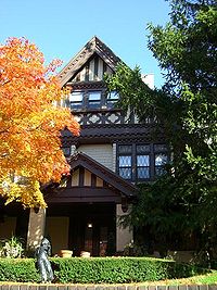 |
1135 84th St. 40°37′2"N 74°0′59"W |
Dyker Heights Dyker Heights, Brooklyn Dyker Heights is a residential neighborhood in the southwest corner of the Borough of Brooklyn in New York City, USA. It is sandwiched among Bay Ridge, Bensonhurst, and Gravesend Bay. According to the Post Office, Dyker Heights is bounded to the west by Interstate 278, to the north by Bay Ridge... |
||
| 126 | Senator Street Historic District Senator Street Historic District Senator Street Historic District is a national historic district in Bay Ridge, Brooklyn, New York, New York. It consists of 40 contributing residential buildings built between 1906 and 1912. They are all three story brownstone rowhouses in the Neo-Renaissance style... |
318-370 and 317-347 Senator St. 40°37′50"N 74°1′30"W |
Brooklyn Brooklyn Brooklyn is the most populous of New York City's five boroughs, with nearly 2.6 million residents, and the second-largest in area. Since 1896, Brooklyn has had the same boundaries as Kings County, which is now the most populous county in New York State and the second-most densely populated... |
|||
| 127 | Shaari Zedek Synagogue Shaari Zedek Synagogue Shaari Zedek Synagogue, also known as Congregation Achavat Achim and since 1944 as St. Leonard's Church, is a historic synagogue at 767 Putnam Ave. in Bedford-Stuyvesant, Brooklyn, New York. It was built in 1909–1910 and is a two story rectangular brick building with cast stone trim.It was listed... |
767 Putnam Ave. 40°41′11.19"N 73°55′51.24"W |
Brooklyn | New listing; refnum 09000968 | ||
| 128 | South Bushwick Reformed Protestant Dutch Church Complex South Bushwick Reformed Protestant Dutch Church Complex South Bushwick Reformed Protestant Dutch Church Complex, also known as the "White Church", is a historic Dutch Reformed church in Bushwick, Brooklyn, New York, New York. The complex consists of the church and attached Sunday School building. The church was organized in 1851 by members of the... |
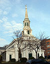 |
855-857 Bushwick Ave. 40°41′39"N 73°55′34"W |
South Bushwick | ||
| 129 | South Congregational Church | President and Court Sts. 40°40′55"N 73°59′48"W |
South Brooklyn South Brooklyn South Brooklyn is a region or composite neighborhood in the New York City borough of Brooklyn, encompassing areas of Cobble Hill, Red Hook, Gowanus, Park Slope, and Boerum Hill. Thus it is roughly encompassed by Brooklyn Community Board 6, which in turn approximates the southern half of the 18th... |
|||
| 130 | St. Bartholomew's Protestant Episcopal Church and Rectory St. Bartholomew's Protestant Episcopal Church and Rectory St. Bartholomew's Protestant Episcopal Church and Rectory is a historic Episcopal church and rectory located at 1227 Pacific St., east of Bedford Avenue in Crown Heights, Brooklyn, New York, New York. It was built in 1886 in the Romanesque Revival style. It is constructed of brick with stone trim... |
1227 Pacific St. 40°40′41"N 73°57′9"W |
Crown Heights Crown Heights, Brooklyn Crown Heights is a neighborhood in the central portion of the New York City borough of Brooklyn. The main thoroughfare through this neighborhood is Eastern Parkway, a tree-lined boulevard designed by Frederick Law Olmsted extending two miles east-west.Originally, the area was known as Crow Hill.... |
|||
| 131 | St. George's Protestant Episcopal Church | 800 Marcy Ave. 40°41′10"N 73°56′54"W |
Bedford-Stuyvesant Bedford-Stuyvesant, Brooklyn Bedford-Stuyvesant is a neighborhood in the central portion of the New York City borough of Brooklyn. Formed in 1930, the neighborhood is part of Brooklyn Community Board 3, Brooklyn Community Board 8 and Brooklyn Community Board 16. The neighborhood is patrolled by the NYPD's 79th and 81st... |
|||
| 132 | St. Luke's Protestant Episcopal Church St. Luke's Protestant Episcopal Church (Brooklyn, New York) The Church of St. Luke and St. Matthew, founded as St. Luke's Protestant Episcopal Church, is a historic Episcopal congregation in New York City, New York. It is located at 520 Clinton Avenue, between Fulton Street and Atlantic Avenue in the Clinton Hill-Fort Greene area of Brooklyn.St. Luke's was... |
520 Clinton Ave. 40°40′57"N 73°58′4"W |
Clinton Hill Clinton Hill, Brooklyn Clinton Hill is a neighborhood in the north-central portion of the borough of Brooklyn in New York City. It is bordered on the east by Bedford-Stuyvesant, on the west by Fort Greene, on the north by Wallabout Bay and on the south by Prospect Heights... |
|||
| 133 | St. Mary's Episcopal Church St. Mary's Episcopal Church (New York, New York) St. Mary's Episcopal Church is a historic Episcopal church at 230 Classon Avenue in Clinton Hill, Brooklyn, New York, New York. It was built in 1858 in the Gothic Revival style. It is constructed of Belleville brownstone. It features a square tower with polygonal extension and a broach spire. ... |
230 Classon Ave. 40°41′34"N 73°57′42"W |
Clinton Hill Clinton Hill, Brooklyn Clinton Hill is a neighborhood in the north-central portion of the borough of Brooklyn in New York City. It is bordered on the east by Bedford-Stuyvesant, on the west by Fort Greene, on the north by Wallabout Bay and on the south by Prospect Heights... |
|||
| 134 | St. Paul's Protestant Episcopal Church St. Paul's Church (Carroll Gardens, Brooklyn) St. Paul's Church, Carroll Gardens, also known as St. Paul's Episcopal Church, is a parish of the Episcopal Church in the Anglo-Catholic tradition. It is part of the Episcopal Diocese of Long Island and the Episcopal Church in the United States of America, part of the worldwide Anglican Communion... |
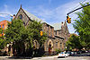 |
199 Carroll St. 40°40′55"N 73°58′25"W |
South Brooklyn South Brooklyn South Brooklyn is a region or composite neighborhood in the New York City borough of Brooklyn, encompassing areas of Cobble Hill, Red Hook, Gowanus, Park Slope, and Boerum Hill. Thus it is roughly encompassed by Brooklyn Community Board 6, which in turn approximates the southern half of the 18th... |
||
| 135 | State Street Houses State Street Houses State Street Houses is a national historic district in Downtown Brooklyn, New York, New York. It consists of 23 contributing residential buildings built between 1847 and the mid-1870s. The rowhouses are three stories high on raised basements and feature the same cornice lines and similar window... |
291-299, 290-324 State St. 40°41′19"N 73°59′16"W |
Downtown Downtown Brooklyn Downtown Brooklyn is the third largest central business district in New York City , and is located in the northwestern section of the borough of Brooklyn... |
|||
| 136 | Stoothoff-Baxter-Kouwenhaven House Stoothoff-Baxter-Kouwenhaven House Stoothoff-Baxter-Kouwenhaven House is a historic home located in Flatlands, Brooklyn, New York, New York. The original section was built in 1747 and the larger main portion dates to 1811. A kitchen wing was added in 1880. It is one and one half stories with steeply pitched gable roofs, curved... |
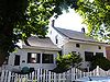 |
1640 E. 48th St. 40°37′12"N 73°55′44"W |
Flatlands Flatlands, Brooklyn Flatlands is a neighborhood in the New York City borough of Brooklyn. The area is part of Brooklyn Community Board 18.One of the original five Dutch towns on Long Island , this neighborhood was originally known as Nieuw Amersfoort, after the Dutch city of Amersfoort, but the name was changed to... |
||
| 137 | Stuyvesant Heights Historic District Stuyvesant Heights Historic District Stuyvesant Heights Historic District is a national historic district in Bedford-Stuyvesant, Brooklyn, New York, New York. It consists of 577 contributing residential buildings built between about 1870 and 1900. The district encompasses 17 individual blocks... |
; expansion | Roughly bounded by Macon, Tompkins, Decatur, Lewis, Chauncey, and Stuyvesant 40°40′52"N 73°56′14"W |
Bedford-Stuyvesant Bedford-Stuyvesant, Brooklyn Bedford-Stuyvesant is a neighborhood in the central portion of the New York City borough of Brooklyn. Formed in 1930, the neighborhood is part of Brooklyn Community Board 3, Brooklyn Community Board 8 and Brooklyn Community Board 16. The neighborhood is patrolled by the NYPD's 79th and 81st... |
||
| 138 | Substation 401 Substation 401 Substation #401 is a historic New York City Subway substation located in Brooklyn, New York, New York, on the BMT Jamaica Line east of its Cleveland Street station. It was built in 1901 and is a Beaux Arts style structure.... |
3046 Fulton St. bet. Essex St. and Shepherd Ave. 40°40′49"N 73°52′59"W |
East New York East New York, Brooklyn East New York is a residential neighborhood located in the Eastern section of the borough of Brooklyn in New York City, United States. The neighborhood is part of Brooklyn Community Board 5... |
|||
| 139 | Sunset Park Historic District Sunset Park, Brooklyn Sunset Park is a neighborhood in the western section of the New York City borough of Brooklyn, USA. It is bounded by Greenwood Heights to the north, Borough Park to the east, Bay Ridge to the south, and Upper New York Bay to the west... |
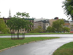 |
Roughly bounded by Fourth Ave., Thirty-eighth St., Seventh Ave. and Sixty-fourth St. 40°38′38"N 74°0′28"W |
Sunset Park Sunset Park, Brooklyn Sunset Park is a neighborhood in the western section of the New York City borough of Brooklyn, USA. It is bounded by Greenwood Heights to the north, Borough Park to the east, Bay Ridge to the south, and Upper New York Bay to the west... |
||
| 140 | Temple Beth El of Borough Park Temple Beth El of Borough Park Temple Beth El of Borough Park, now known as Young Israel Beth El of Borough Park, is a historic synagogue at 4802 15th Ave. in Borough Park, Brooklyn, New York, New York. It was built between 1920 and 1923 and is a three story building with Moorish and Egyptian design influences.It was listed on... |
4802 15th Ave. 40°37′58.59"N 73°59′13.71"W |
Borough Park Borough Park, Brooklyn Borough Park , is a neighborhood in the southwestern part of the borough of Brooklyn, in New York City in the United States.... |
New listing, refnum 10000224 | ||
| 141 | Twenty third Regiment Armory Twenty third Regiment Armory Twenty third Regiment Armory is a historic National Guard armory building located in Crown Heights, Brooklyn, New York, New York. It is a brick and stone castle-like structure built between 1891 and 1895, designed to be reminiscent of medieval military structures in Europe in the Romanesque... |
1322 Bedford Ave. 40°40′43"N 73°57′16"W |
Brooklyn Brooklyn Brooklyn is the most populous of New York City's five boroughs, with nearly 2.6 million residents, and the second-largest in area. Since 1896, Brooklyn has had the same boundaries as Kings County, which is now the most populous county in New York State and the second-most densely populated... |
|||
| 142 | U.S. Army Military Ocean Terminal Brooklyn Army Terminal The Brooklyn Army Terminal is large complex of piers, docks, warehouses, cranes, rail sidings and cargo loading equipment on between 58th and 63rd Street in Sunset Park, Brooklyn. During World War II, the terminal was responsible for shipment of 85% of army equipment and personnel overseas;... |
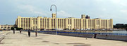 |
58th-65th St. and 2nd Ave. 40°38′41"N 74°1′40"W |
Sunset Park Sunset Park, Brooklyn Sunset Park is a neighborhood in the western section of the New York City borough of Brooklyn, USA. It is bounded by Greenwood Heights to the north, Borough Park to the east, Bay Ridge to the south, and Upper New York Bay to the west... |
||
| 143 | US Post Office-Flatbush Station United States Post Office (Flatbush, Brooklyn) US Post Office-Flatbush Station is a historic post office building located at Flatbush in Brooklyn, New York, United States. It was built in 1936, and designed by consulting architect Lorimer Rich for the Office of the Supervising Architect... |
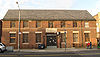 |
2273 Church Ave. 40°39′2"N 73°57′24"W |
Flatbush Flatbush, Brooklyn Flatbush is a community of the Borough of Brooklyn, a part of New York City, consisting of several neighborhoods.The name Flatbush is an Anglicization of the Dutch language Vlacke bos .... |
||
| 144 | US Post Office-Kensington United States Post Office (Kensington, Brooklyn) US Post Office-Kensington is a historic post office building located at Kensington in Brooklyn, New York, United States. It was built in 1935, and designed by consulting architect Lorimer Rich for the Office of the Supervising Architect. The building is a two story, six bay wide brick building in... |
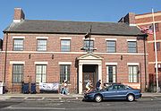 |
421 McDonald Ave. 40°38′37"N 73°58′47"W |
Kensington Kensington, Brooklyn Kensington is a neighborhood in the center of the New York City borough of Brooklyn. It is the area south of Prospect Park and the Green-Wood Cemetery. It is bordered by Coney Island Avenue to the east, Fort Hamilton Parkway and Caton Avenue to the north, McDonald Avenue and 37th Street to the... |
||
| 145 | US Post Office-Metropolitan Station United States Post Office (Williamsburg, Brooklyn) US Post Office-Metropolitan Station, originally known as Station "A," is a historic post office building located at Williamsburg in Brooklyn, New York, United States. It was built in 1936, and is one of a number of post offices in New York designed by the Office of the Supervising Architect under... |
47 Debevoise St. 40°42′6"N 73°56′30"W |
Williamsburg Williamsburg, Brooklyn Williamsburg is a neighborhood in the New York City borough of Brooklyn, bordering Greenpoint to the north, Bedford-Stuyvesant to the south, Bushwick to the east and the East River to the west. The neighborhood is part of Brooklyn Community Board 1. The neighborhood is served by the NYPD's 90th ... |
|||
| 146 | US Post Office-Parkville Station United States Post Office (Bensonhurst, Brooklyn) US Post Office-Parkville Station, originally known as Station "Y," is a historic post office building located at Bensonhurst in Brooklyn, New York, United States. It was built in 1936, and designed by consulting architect Carroll H. Pratt for the Office of the Supervising Architect... |
6618 20th Ave. 40°36′56"N 73°59′15"W |
Bensonhurst Bensonhurst, Brooklyn Bensonhurst is a neighborhood located in the southwestern part of the New York City borough of Brooklyn.-Geography:Sometimes erroneously thought to include all or parts of such neighborhoods as Bath Beach, Dyker Heights, and Borough Park, or to be defined by the streets where the concentration of... |
|||
| 147 | Joost Van Nuyse House Joost Van Nuyse House Joost Van Nuyse House, also known as the Ditmas Coe House, is a historic home located in Flatlands, Brooklyn, New York, New York. The original section was built in 1744 and enlarged between 1793 and 1806. It was moved to its present site in 1925... |
1128 E. 34th St. 40°37′41"N 73°56′38"W |
Flatlands Flatlands, Brooklyn Flatlands is a neighborhood in the New York City borough of Brooklyn. The area is part of Brooklyn Community Board 18.One of the original five Dutch towns on Long Island , this neighborhood was originally known as Nieuw Amersfoort, after the Dutch city of Amersfoort, but the name was changed to... |
|||
| 148 | Wallabout Historic District | 73-83 & 123-141 Cleremont Ave.; 74-148 & 75-143 Clinton Ave.; 381-387, 403-421 & 455-461 Myrtle Ave.; 74-132 & 69-149 Vanderbilt Ave. 40°41′40"N 73°58′12"W |
Wallabout Wallabout Wallabout dates back to the 17th century. It is one of the oldest areas of Brooklyn, in the area that was once Wallabout Bay but has largely been filled in and is now the Brooklyn Navy Yard. It is a mixed use area with an array of old wood frame buildings, public housing, brick townhouses and... |
Surviving frame houses from 17th century; one of oldest areas of borough. | ||
| 149 | Weir Greenhouse Weir Greenhouse Weir Greenhouse is a historic greenhouse located in Sunset Park, Brooklyn, New York, New York. It was originally built in 1880 and significantly rebuilt and enlarged in 1895. It is a rectangular, wood frame and galvanized iron building with projecting bays and domes in the Victorian commercial... |
750-751-5th Ave. 40°39′32"N 73°59′47"W |
Sunset Park Sunset Park -Places in the United States:*Sunset Park, Las Vegas, Nevada, a park*Sunset Park, Brooklyn, New York, a neighborhood and namesake park*Sunset Park, Santa Monica, California, a neighborhood... |
|||
| 150 | Williamsburgh Savings Bank Williamsburgh Savings Bank The Williamsburgh Savings Bank was an important institution in Brooklyn, New York, from the mid-19th to the mid-20th centuries. A series of bank mergers brought it into the HSBC group late in the 20th century... |
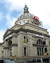 |
175 Broadway 40°42′36"N 73°57′42"W |
Williamsburg Williamsburg, Brooklyn Williamsburg is a neighborhood in the New York City borough of Brooklyn, bordering Greenpoint to the north, Bedford-Stuyvesant to the south, Bushwick to the east and the East River to the west. The neighborhood is part of Brooklyn Community Board 1. The neighborhood is served by the NYPD's 90th ... |
||
| 151 | Willoughby-Suydam Historic District Willoughby-Suydam Historic District Willoughby-Suydam Historic District is a national historic district in Brooklyn, New York, New York. It consists of 50 contributing residential buildings built between 1902 and 1904. They are three story brick tenements that have two apartments per floor... |
Suydam St., Willoughby, St. Nicholas, and Wyckoff Aves. 40°42′21"N 73°55′14"W |
Brooklyn Brooklyn Brooklyn is the most populous of New York City's five boroughs, with nearly 2.6 million residents, and the second-largest in area. Since 1896, Brooklyn has had the same boundaries as Kings County, which is now the most populous county in New York State and the second-most densely populated... |
|||
| 152 | Wilson Avenue Wilson Avenue (BMT Canarsie Line) Wilson Avenue is a station on the BMT Canarsie Line of the New York City Subway. Located at the intersection of Wilson Avenue and Moffat Street in Brooklyn, it is served by the L train at all times.- Layout :The station's design has some unusual features... Subway station ( train) |
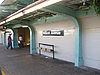 |
Chauncey St. at Wilson Ave. 40°41′19"N 73°54′17"W |
Bushwick Bushwick, Brooklyn Bushwick is a neighborhood in the northern part of the New York City borough of Brooklyn. The neighborhood, formerly Brooklyn's 18th Ward, is now part of Brooklyn Community Board 4... |
||
| 153 | Pieter Wyckoff House Wyckoff House The Wyckoff House, or Pieter Claesen Wyckoff House is located at 5816 Clarendon Road in the Flatbush area of Brooklyn. The house itself is located in Milton Fidler Park. The house is estimated to have been built in 1652, it is the oldest surviving example of a Dutch saltbox frame house in America,... |
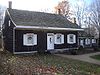 |
5902 Canarsie Lane 40°38′40"N 73°55′16"W |
Flatbush Flatbush, Brooklyn Flatbush is a community of the Borough of Brooklyn, a part of New York City, consisting of several neighborhoods.The name Flatbush is an Anglicization of the Dutch language Vlacke bos .... |
||
| 154 | Wyckoff-Bennett Homestead Wyckoff-Bennett Homestead Wyckoff-Bennett Homestead, located at 1669 E. 22nd Street in Brooklyn, New York, is a National Historic Landmark. It is believed to have been built before 1766. During the American Revolution, it housed Hessian soldiers, two of whom, Captain Toepfer of the Ditfourth regiment and Lieut. M... |
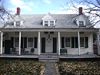 |
1669 E. 22nd St. 40°36′39"N 73°57′7"W |
Brooklyn Brooklyn Brooklyn is the most populous of New York City's five boroughs, with nearly 2.6 million residents, and the second-largest in area. Since 1896, Brooklyn has had the same boundaries as Kings County, which is now the most populous county in New York State and the second-most densely populated... |
||
| 155 | Young Israel of Flatbush Young Israel of Flatbush Young Israel of Flatbush is a historic synagogue at 1012 Avenue I in the Midwood section of Brooklyn, New York, New York. It was built between 1925 and 1929 and is a three story Moorish-inspired style building faced in polychromatic patterned brick... |
1012 Avenue I 40°37′36.93"N 73°57′57.35"W |
Flatbush Flatbush, Brooklyn Flatbush is a community of the Borough of Brooklyn, a part of New York City, consisting of several neighborhoods.The name Flatbush is an Anglicization of the Dutch language Vlacke bos .... |
New listing; refnum 10000011 |
See also
- Statewide: National Register of Historic Places listings in New York
- Citywide: Manhattan, Queens, Staten Island, Bronx
- List of New York City Designated Landmarks in Brooklyn