
.gif)
John Street (Markham)
Encyclopedia
John Street is an east-west arterial road in the Town of Markham
, Ontario
. It is one of the oldest roads in the Township
of Markham and forms the backbone of the 200 year old community of Thornhill
.
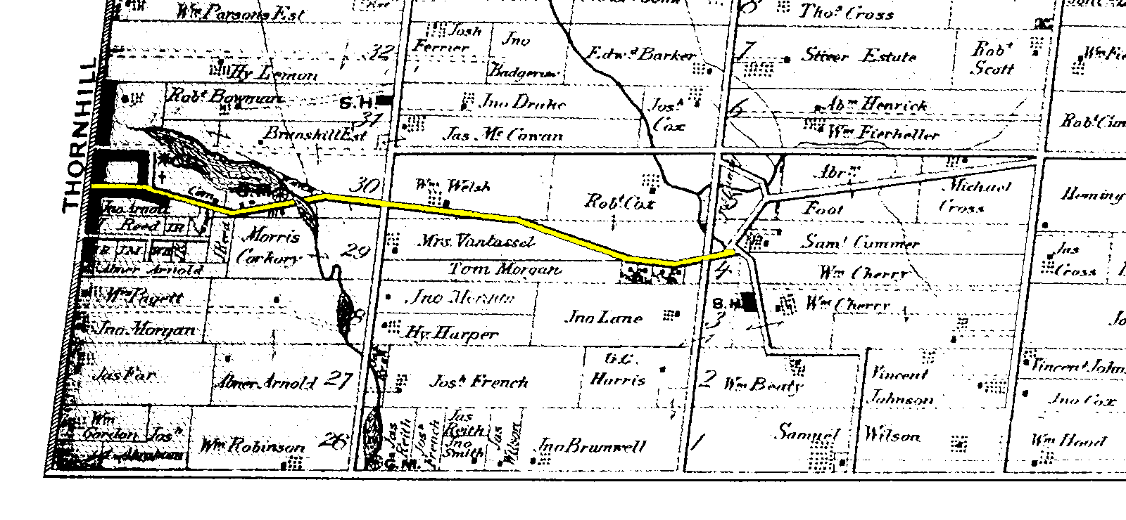
The street originally ran east from Yonge Street across a tributary of the Don River, at which point it branched north to what is now Leslie Street and south on German Mills Road. This was a travelled road which did not match the alignment of any concession road
or lot line and was constructed along the most convenient route to farms and mills to serve the needs of the inhabitants at that time. In the late 20th century an extension was made across Highway 404 and through an industrial area to connect to Woodbine Avenue
, east of which it joins with Esna Park Drive.
John Street has had a major impact in shaping the community; the parallel Green Lane/14th Avenue east-west road allowance has never been fully opened and Leslie Street still diverts from the route laid out by the township survey to join Don Mills Road near the former easterly end of John Street.
road between Woodbine Avenue and Bayview Avenue
, and more like a suburban road near Yonge Street
, due to the influence of Old Thornhill. The road was re-paved recently in 2006. John Street serves to relieve traffic on Steeles Avenue
, and Highway 7. John Street also serves as an extension of York Regional Road 71 (14th Avenue). Some other roads that are marked York Regional Road 71 are Alden Road, Esna Park Drive and parts of Centre Street in the City of Vaughan.
John Street has four lanes between Woodbine Avenue and Bayview Avenue, which means there are two lanes per direction. During that section of the road, there are occasional traffic lights. This part of John Street has one bridge, and one steep valley. Between Leslie Street, and Bayview Avenue, the street heads into a steep valley, and rise up again shortly to meet Aileen Road. During that part of the road, John Street has 7 intersections with traffic light
. The road is fairly straight, and heads towards the northwest direction.
Between Bayview Avenue and Yonge Street, John Street is two lanes wide. During that section of the road, there are several stop signs. This part of John street goes up and down through valleys and ridge
s. As it approaches to Pomona Mills Park, the landscape
becomes more level. During this section of the road, the roadway is very narrow with a sign near Yonge Street, warning people that roads could be dangerous at times because the street is very narrow.
Between Woodbine Avenue and Ontario Highway 404, all zonings are industrial. Between Highway 404 and Bayview Avenue, a mix of light railroad industrial and medium-density residence along the road. When the road approaches to [Yonge Street, light residential areas are found.
 This road, along with any side streets in Thornhill, are one of the oldest roads in Markham, with over 200 years of history. The road is believed to be built in the 19th century, named after John Colborne. Colborne Street, immediately south of John Street, was also named after John Colborne. John Street was believed to be built around 1828-1836. Prior to that, Thornhill was a little community with houses along Yonge Street
. John Street allowed eastward developments. The development of Thornhill in the 19th century stopped at what is nowadays Henderson Avenue, and along the section of John Street between Yonge Street and Henderson Avenue are developments from that time. The area is now preserved under the Town of Markham's Heritage Department. Along John Street in this area, the road signs are labelled as "Old Thornhill Circa 1794". This part of John Street is also considered as the heart of Old Thornhill.
The road is also home to the Sutton Frizzel's house. Originally located on Yonge and Royal Orchard, it was moved in the 20th century due to the widening of Yonge Street. It was built by the Tory Loyalist in the 19th century, and its original occupants played a significant role in the Rebellions of 1837
.
In the 20th century, as Markham's population rapidly grows, John Street was extended to its current length, with modern housing along the road.
In 2004, the corner of John and Bayview is under redevelopment of medium dense residential. This new redevelopment is referred to as "Olde Thornhill Village".
operates the YRT Route #2 (Milliken), servicing almost the entire route of John Street east of Henderson Avenue. In addition, the Toronto Transit Commission
also serves the industrial park near the east end of John Street with TTC Route #224C.
Markham, Ontario
Markham is a town in the Regional Municipality of York, located within the Greater Toronto Area of Southern Ontario, Canada. The population was 261,573 at the 2006 Canadian census...
, Ontario
Ontario
Ontario is a province of Canada, located in east-central Canada. It is Canada's most populous province and second largest in total area. It is home to the nation's most populous city, Toronto, and the nation's capital, Ottawa....
. It is one of the oldest roads in the Township
Township (Canada)
The term township generally means the district or area associated with a town. However in some systems no town needs to be involved. The specific use of the term to describe political subdivisions has varied by country, usually to describe a local rural or semi-rural government within the county...
of Markham and forms the backbone of the 200 year old community of Thornhill
Thornhill, Ontario
Thornhill is a community in the Greater Toronto Area of Southern Ontario, Canada, located on the northern border of the city of Toronto. Once a municipal village, Thornhill is now a community and postal designation geographically split into two municipalities along Yonge Street, the city of...
.
The street originally ran east from Yonge Street across a tributary of the Don River, at which point it branched north to what is now Leslie Street and south on German Mills Road. This was a travelled road which did not match the alignment of any concession road
Concession road
In Upper and Lower Canada, concession roads were laid out by the colonial government through undeveloped land to define lots to be developed; the name comes from a Lower Canadian French term for a row of lots. Concession roads are straight, and follow an approximately square grid, usually oriented...
or lot line and was constructed along the most convenient route to farms and mills to serve the needs of the inhabitants at that time. In the late 20th century an extension was made across Highway 404 and through an industrial area to connect to Woodbine Avenue
Woodbine Avenue (Ontario)
Woodbine Avenue consists of two north-south road sections in central Ontario:# The southern section in Toronto begins near Ashbridges Bay on the shore of Lake Ontario, at Lake Shore Boulevard...
, east of which it joins with Esna Park Drive.
John Street has had a major impact in shaping the community; the parallel Green Lane/14th Avenue east-west road allowance has never been fully opened and Leslie Street still diverts from the route laid out by the township survey to join Don Mills Road near the former easterly end of John Street.
Description
John Street is complete and paved. It is a modern urbanUrban area
An urban area is characterized by higher population density and vast human features in comparison to areas surrounding it. Urban areas may be cities, towns or conurbations, but the term is not commonly extended to rural settlements such as villages and hamlets.Urban areas are created and further...
road between Woodbine Avenue and Bayview Avenue
Bayview Avenue
Bayview Avenue is a major north-south route in the Greater Toronto Area of Ontario. North of Toronto, in York Region, Bayview is also designated as York Regional Road 34.-History:...
, and more like a suburban road near Yonge Street
Yonge Street
Yonge Street is a major arterial route connecting the shores of Lake Ontario in Toronto to Lake Simcoe, a gateway to the Upper Great Lakes. It was formerly listed in the Guinness Book of Records as the longest street in the world at , and the construction of Yonge Street is designated an "Event of...
, due to the influence of Old Thornhill. The road was re-paved recently in 2006. John Street serves to relieve traffic on Steeles Avenue
Steeles Avenue
Steeles Avenue is an east-west street that forms the northern city limit of Toronto and the southern limit of York Region, Ontario, Canada. It stretches across the western Greater Toronto Area from Milborough Townline in Halton Region east to the Scarborough-Pickering limit. It runs for within...
, and Highway 7. John Street also serves as an extension of York Regional Road 71 (14th Avenue). Some other roads that are marked York Regional Road 71 are Alden Road, Esna Park Drive and parts of Centre Street in the City of Vaughan.
John Street has four lanes between Woodbine Avenue and Bayview Avenue, which means there are two lanes per direction. During that section of the road, there are occasional traffic lights. This part of John Street has one bridge, and one steep valley. Between Leslie Street, and Bayview Avenue, the street heads into a steep valley, and rise up again shortly to meet Aileen Road. During that part of the road, John Street has 7 intersections with traffic light
Traffic light
Traffic lights, which may also be known as stoplights, traffic lamps, traffic signals, signal lights, robots or semaphore, are signalling devices positioned at road intersections, pedestrian crossings and other locations to control competing flows of traffic...
. The road is fairly straight, and heads towards the northwest direction.
Between Bayview Avenue and Yonge Street, John Street is two lanes wide. During that section of the road, there are several stop signs. This part of John street goes up and down through valleys and ridge
Ridge
A ridge is a geological feature consisting of a chain of mountains or hills that form a continuous elevated crest for some distance. Ridges are usually termed hills or mountains as well, depending on size. There are several main types of ridges:...
s. As it approaches to Pomona Mills Park, the landscape
Landscape
Landscape comprises the visible features of an area of land, including the physical elements of landforms such as mountains, hills, water bodies such as rivers, lakes, ponds and the sea, living elements of land cover including indigenous vegetation, human elements including different forms of...
becomes more level. During this section of the road, the roadway is very narrow with a sign near Yonge Street, warning people that roads could be dangerous at times because the street is very narrow.
Between Woodbine Avenue and Ontario Highway 404, all zonings are industrial. Between Highway 404 and Bayview Avenue, a mix of light railroad industrial and medium-density residence along the road. When the road approaches to [Yonge Street, light residential areas are found.
History
Yonge Street
Yonge Street is a major arterial route connecting the shores of Lake Ontario in Toronto to Lake Simcoe, a gateway to the Upper Great Lakes. It was formerly listed in the Guinness Book of Records as the longest street in the world at , and the construction of Yonge Street is designated an "Event of...
. John Street allowed eastward developments. The development of Thornhill in the 19th century stopped at what is nowadays Henderson Avenue, and along the section of John Street between Yonge Street and Henderson Avenue are developments from that time. The area is now preserved under the Town of Markham's Heritage Department. Along John Street in this area, the road signs are labelled as "Old Thornhill Circa 1794". This part of John Street is also considered as the heart of Old Thornhill.
The road is also home to the Sutton Frizzel's house. Originally located on Yonge and Royal Orchard, it was moved in the 20th century due to the widening of Yonge Street. It was built by the Tory Loyalist in the 19th century, and its original occupants played a significant role in the Rebellions of 1837
Rebellions of 1837
The Rebellions of 1837 were a pair of Canadian armed uprisings that occurred in 1837 and 1838 in response to frustrations in political reform. A key shared goal was the allowance of responsible government, which was eventually achieved in the incident's aftermath.-Rebellions:The rebellions started...
.
In the 20th century, as Markham's population rapidly grows, John Street was extended to its current length, with modern housing along the road.
In 2004, the corner of John and Bayview is under redevelopment of medium dense residential. This new redevelopment is referred to as "Olde Thornhill Village".
Landmarks
- Sutton Frizzell's House, 18 John Street.
- Thornhll Cemetery (1867)
- Pomona Mills Park
- Thornhill Community Centre has two ice rinks rink, 3 community halls, an auditorium and a library.
- John Welsh House (known as Thornlea), 288 John Street, now 'Santorini Bar & Grill'
- Thornhill Square Shopping Centre, 300 John Street, now mostly demolished and replaced by a Townhouse development.
- R.J. Clathworthy Arena is equipped with one ice rink.
- Bishops Cross Park has a major baseball and soccer field, along with playgrounds and running track.
Public transit
The York Region TransitYork Region Transit
York Region Transit is the public transit operator in York Region, Ontario, Canada. Its headquarters are in Richmond Hill, at 50 High Tech Road....
operates the YRT Route #2 (Milliken), servicing almost the entire route of John Street east of Henderson Avenue. In addition, the Toronto Transit Commission
Toronto Transit Commission
-Island Ferry:The ferry service to the Toronto Islands was operated by the TTC from 1927 until 1962, when it was transferred to the Metro Parks and Culture department. Since 1998, the ferry service is run by Toronto Parks and Recreation.-Gray Coach:...
also serves the industrial park near the east end of John Street with TTC Route #224C.
Intersecting roads
 Woodbine Avenue, where the street terminates, and changes its name to Esna Park Drive.
- Nolan Court
- Steelcase Road
 Highway 404
 Don Mills Road / Leslie Street
- Rockingham Court
- Chestnut Gate
- Cottonwood Court
- Dawn Hill Trail
- Bayview Fairways Drive
- Aileen Road
- Porterfield Crescent
 Bayview Avenue, John Street becomes a collector road west of Bayview AvenueBayview AvenueBayview Avenue is a major north-south route in the Greater Toronto Area of Ontario. North of Toronto, in York Region, Bayview is also designated as York Regional Road 34.-History:...
- Bayfield Gate / Candice Gate
- Johnson Street
- Henderson Avenue
- Deanbank Drive
- Leahill Drive
- Summer Lane
- Paul Street
- Church Lane
- Marie Court
- Confederation Way / Dudley Avenue
 Yonge Street, where the street terminates.