
Jataí
Encyclopedia
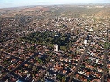
Jataí is a municipality
in southern Goiás
state, Brazil
. Its population was 88,048 (2010) in a total area of 7,174.2 km². (10/10/2002) Jataí is a major producer of agricultural products, including soybeans, rice, and corn. It has the largest herd of cattle in the state and is a large producer of poultry and swine. In 2000 it was the 6th largest municipality in area in the state.
is 316 km. away. Highway connections are made by BR-060 / Abadia de Goiás
/ Guapó
/ Indiara
/ Acreúna
/ Santo Antônio da Barra
/ Rio Verde
. See Sepin
Geographical limits: Caiapônia
, Mineiros
, Itarumã
, Aparecida do Rio Doce
, Caçu
, Cachoeira Alta
, Rio Verde
, Mineiros
and Serranópolis
.
Jataí is part of the Southwest Goiás Microregion
, which has a population of 330,490 inhabitants in 18 cities and a total area of 56,293.30 km².
Period of rain: October to April.
Period of drought: May to September.
Temperature: average minimum and maximum in June (coldest month) is: 11°C - 27°C. In September (hottest month): 18°C - 35°C. Temperatures can reach as high as 38°C and as low as 2°C during the year. A surprising 0°C was recorded on July 18, 2000.
Precipitation: rainfall of approximately 1,800mm, but badly distributed throughout the year.
Rivers: Claro, São Pedro, Doce, Ariranha e Paraíso.
The water is supplied by the Claro river and distributed to the population after treatment.
(1)Estimated by logistic method
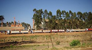 Jataí has a number of small-sized commercial establishments and service-providing enterprises. Its economy is mostly based on agriculture (soy, rice, corn, beans, and bananas), cattle, pig, and chicken raising, although commerce and transformation industries—especially the clothing industry—play an important role, they are highly dependent on the town's agribusiness. In 2005 the biggest employer was commerce with 3,811 workers, followed by public administration with 2,969 workers, and industry with 2,828 workers. (IBGE)
 There are three institutes of higher education, including a campus of the Federal University of Goiás. This campus features 9 courses distributed in three academic units: the Center of Human Sciences, Letters, and Exact Sciences, the Center of Physical Education and the Center of Agricultural and Biological Sciences.
In the health sector there were four hospitals, 11 clinics, and one maternity.
In communications there were 5 radio stations and two local television stations. In addition there were 2 newspapers.
The Human Development Index
Data are from 2000
For the complete list see Frigoletto
Municipality
A municipality is essentially an urban administrative division having corporate status and usually powers of self-government. It can also be used to mean the governing body of a municipality. A municipality is a general-purpose administrative subdivision, as opposed to a special-purpose district...
in southern Goiás
Goiás
Goiás is a state of Brazil, located in the central part of the country. The name Goiás comes from the name of an indigenous community...
state, Brazil
Brazil
Brazil , officially the Federative Republic of Brazil , is the largest country in South America. It is the world's fifth largest country, both by geographical area and by population with over 192 million people...
. Its population was 88,048 (2010) in a total area of 7,174.2 km². (10/10/2002) Jataí is a major producer of agricultural products, including soybeans, rice, and corn. It has the largest herd of cattle in the state and is a large producer of poultry and swine. In 2000 it was the 6th largest municipality in area in the state.
Location
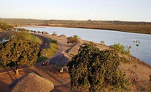
It is located in the southwest part of the state at the confluence of the São Pedro and Claro rivers. The state capital of GoiâniaGoiânia
-Climate:The city has a tropical wet and dry climate with an average temperature of . There's a wet season, from October to April, and a dry one, from May to September. Annual rainfall is around 1,520 mm....
is 316 km. away. Highway connections are made by BR-060 / Abadia de Goiás
Abadia de Goiás
Abadia de Goiás is a small town and municipality in central Goiás state, Brazil, located on the western edge of the Goiânia metropolitan area.-Geographical Data:The distance to Goiânia is 27 km...
/ Guapó
Guapó
Guapó is a small town and municipality in central Goiás state, Brazil. The population was 13,586 and the total area of the municipality was 517.0 km² .Guapó is part of the Goiânia Microregion...
/ Indiara
Indiara
Indiara is a small city and municipality in central-south Goiás state, Brazil. Indiara is a large producer of soybeans and cotton.-Location:Indiara is located in the Vale do Rio dos Bois and has municipal boundaries with:*north: Palmeiras de Goiás...
/ Acreúna
Acreúna
Acreúna is a small city and municipality in western Goiás state, Brazil.-Location:Acreúna is located in the statistical micro-region of Vale do Rio dos Bois, southwest of the state capital, Goiânia, on BR-060, which links Goiânia with Rio Verde...
/ Santo Antônio da Barra
Santo Antônio da Barra
Santo Antônio da Barra is a municipality in southwest Goiás state, Brazil. The population was 4,544 in a total area of 451.6 km². The elevation of the municipal seat is 650 meters. Santo Antônio is a large producer of poultry....
/ Rio Verde
Rio Verde, Goiás
Rio Verde is a city and municipality in the Brazilian state of Goiás. It is a fast-growing center and is the largest producer of grains in the state.-Location:...
. See Sepin
Geographical limits: Caiapônia
Caiapônia
Caiapônia is a small town and municipality in south-central Goiás state, Brazil. It has the third largest cattle herd in the state and is a major producer of grains. The town is also known as Torres Do Rio Bonito or just Rio Bonito.-Geography:...
, Mineiros
Mineiros
Mineiros is a city in the southwest of the state of Goiás, Brazil. Mineiros is the westernmost city in Goiás and a great producer of cattle, soybeans, and corn....
, Itarumã
Itarumã
Itarumã is a small town and municipality in south Goiás state, Brazil. , it has a population of 6,298. Itarumã is a large producer of cattle with a herd of almost three hundred thousand head.-Location:...
, Aparecida do Rio Doce
Aparecida do Rio Doce
right|250pxAparecida do Rio Doce is a small town and municipality in southwest Goiás state, Brazil.-Geography:The municipality of Aparecida do Rio Doce belongs to the Sudoeste de Goiás Microregion and is 208 km. from the state capital, Goiânia. Connections are made by BR-060 / Guapó / Indiara...
, Caçu
Caçu
Caçu is a small town and municipality in southwest Goiás state, Brazil.-Location:Caçu is part of the Quirinópolis Microregion. It is located 330 kilometers from the state capital, Goiânia and is crossed by highway GO-206, which links the city with Quirinópolis...
, Cachoeira Alta
Cachoeira Alta
Cachoeira Alta is a small town and municipality in south Goiás state, Brazil. The population was 8,103 inhabitants in 2007 in a total area of 1659.4 km². Cachoeira Alta has one of the largest cattle herds in the state.-Location:...
, Rio Verde
Rio Verde
Rio Verde can mean the following:-Brazil:* Rio Verde, Goiás* Lucas do Rio Verde* Conceição do Rio Verde* Rio Verde de Mato Grosso-Brazil:29 rivers including:* Verde River...
, Mineiros
Mineiros
Mineiros is a city in the southwest of the state of Goiás, Brazil. Mineiros is the westernmost city in Goiás and a great producer of cattle, soybeans, and corn....
and Serranópolis
Serranópolis
Serranópolis is a small town and municipality in southeast Goiás state, Brazil. It is one of the largest municipalities in the state in area and one of the most sparsely inhabited. It is a large producer of cattle and soybeans.-Location:...
.
Jataí is part of the Southwest Goiás Microregion
Southwest Goiás Microregion
Sudoeste de Goiás Microregion is a region in southwest Goiás state, Brazil. It includes 18 municipalities with a population of 397,387 in a total area of 56,293.30 km² . The population density was 7.06 inhabitants/km² . The largest towns are Jataí, Santa Helena de Goiás, and Rio Verde...
, which has a population of 330,490 inhabitants in 18 cities and a total area of 56,293.30 km².
Climate
Climate: Tropical mesothermic, with two seasons well defined by the seasonal regime of rain.Period of rain: October to April.
Period of drought: May to September.
Temperature: average minimum and maximum in June (coldest month) is: 11°C - 27°C. In September (hottest month): 18°C - 35°C. Temperatures can reach as high as 38°C and as low as 2°C during the year. A surprising 0°C was recorded on July 18, 2000.
Precipitation: rainfall of approximately 1,800mm, but badly distributed throughout the year.
Rivers
The municipality is located in the Serra do Caiapó, which divides the basins of the Araguaia and the Parnaíba rivers. Its hydro graphic network belongs to the basin of the Paraná, being composed of tributaries on the right bank of the Parnaíba.Rivers: Claro, São Pedro, Doce, Ariranha e Paraíso.
The water is supplied by the Claro river and distributed to the population after treatment.
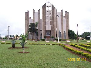
History
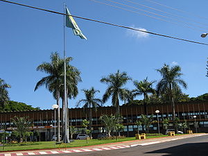
The history of Jataí, like that of all the southwest of Goiás, makes up the last phase of the expansion of cattle. In 1836 José Manoel Vilela, from Minas Gerais, came from the east, crossing the Rio Verde. He set up a cattle ranch on the banks of the Rio Claro. Soon a settlement was formed with the name "Paraíso". In 1864 a district was formed with the name Paraíso de Jataí. The first church was built in 1867. In 1882 the municipality of Paraíso was created. Later, in 1885, the name was changed to Jataí.Political data
- Mayor: HUMBERTO MACHADO
- Vice-mayor: RENI GARCIA
- Number of councilmembers: 10
- Total number of eligible voters: 57,325 (2007)
Demographic data
- Population density: 11.07 inhab/km² (2003)
- Population in 1980: 53,394 (42,840 urban and 10,554 rural)
- Population in 1991: 65,957 (55,593 urban and 10,364 rural)
- Population in 2003: 79,398 (73,202 urban and 6,196 rural) (1)
- Population in 2007: 81,972 (1)
(1)Estimated by logistic method
- Population growth rate 1991/1996: 0.96.%
- Population growth rate 1991/2000: 1.51.%
- Population growth rate 1996/2000: 2.19.%
- Population growth rate 2000/2007: 1.19%
Economy
Economic data
- Number of Industrial Establishments: 139 (2007)
- Industrial District: Distrito Agroindustrial - DAIJA (Sept/2007)
- Meat-packing Plants/Egg collection: Gale Agroindustrial S/A (07/06/2005)
- Dairies: - Laticínios Dallas Ind. e Com. Ltda.; - Agromilk Indústria e Comércio de Laticínios Ltda.; - Dairy Partners Americas Manufacturing Brasil (07/06/2005)
- Banking Establishments: - -Banco ABN AMRO Real S.A. -Banco do Brasil S.A.(2) - BRADESCO S.A (2) - CEF - Banco Itaú S.A.(2) - HSBC Bank Brasil S.A –Banco Múltiplo (August 2007)
- Number of Retail Commercial Establishments: 1,124 (2007)
- Motor vehicles: 13,671 automobiles, 1,535 trucks, 3,248 pickup trucks, and 7,742 motorcycles. (2007)
Multinational Enterprises in Jataí
- ADMArcher Daniels MidlandThe Archer Daniels Midland Company is a conglomerate headquartered in Decatur, Illinois. ADM operates more than 270 plants worldwide, where cereal grains and oilseeds are processed into products used in food, beverage, nutraceutical, industrial and animal feed markets worldwide.ADM was named the...
- More of Food processing company the World Headquartered in United StatesUnited StatesThe United States of America is a federal constitutional republic comprising fifty states and a federal district...
. - Foods Brasil SA - 2 Greater of food processing company in Brazil.
- CosanCosanCosan is a public company, a Brazilian conglomerate producer of bioethanol, sugar and energy.-Biography:Cosan began in 1936 in Piracicaba city in State of São Paulo, with the founding of its first factory for milling of sugar cane...
- national leader in the sugar-alcohol sector, the largest producer of sugar and ethanol in the world. - LOUIS DREYFUS COMMODITIES - Improved processing of food in Europe with Headquartered in FranceFranceThe French Republic , The French Republic , The French Republic , (commonly known as France , is a unitary semi-presidential republic in Western Europe with several overseas territories and islands located on other continents and in the Indian, Pacific, and Atlantic oceans. Metropolitan France...
. - NestleNestléNestlé S.A. is the world's largest food and nutrition company. Founded and headquartered in Vevey, Switzerland, Nestlé originated in a 1905 merger of the Anglo-Swiss Milk Company, established in 1867 by brothers George Page and Charles Page, and Farine Lactée Henri Nestlé, founded in 1866 by Henri...
- Processing of Foods Headquartered in SwitzerlandSwitzerlandSwitzerland name of one of the Swiss cantons. ; ; ; or ), in its full name the Swiss Confederation , is a federal republic consisting of 26 cantons, with Bern as the seat of the federal authorities. The country is situated in Western Europe,Or Central Europe depending on the definition....
.
Animal raising (2006)
- Poultry: (head) 2,479,000
- Cattle (head) 323,000
- Swine: (head) 30,000
- Milk cows (head): 42,300
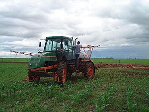
Agricultural data (2006)
- Farms: 1,590
- Planted area: 218,670 hectares
- Natural Pasture: 200,445 hectares
- Woodland and Forest: 96,712 hectares
- Persons occupied related to the farm owner: 3,013
- Persons occupied not related to the farm owner: 3,060
- Main crops: soybeans (20,000 hectares), corn (108,000 hectares),soybeans (230,000 hectares), sorghum (26,000 hectares, sunflowers, and wheat.
Infrastructure
In the health sector there were four hospitals, 11 clinics, and one maternity.
In communications there were 5 radio stations and two local television stations. In addition there were 2 newspapers.
Education (2006)
- Schools in activity: 64 with 24,600 students
- Higher education: - Centro de Ensino Superior de Jataí-CESUT - Campus Jataí da Universidade Federal de Goiás - Pólo Universitário da UEG - Centro Federal de Educação Tecnológica de Jataí – CEFET-GO
- Literacy Rate: 89.8%
Health (2007)
- Hospitals: 5
- Beds: 198
- Walk-in health clinics: 27
- Infant mortality rate: 17.77 (in 1,000 live births)
The Human Development IndexHuman Development IndexThe Human Development Index is a composite statistic used to rank countries by level of "human development" and separate "very high human development", "high human development", "medium human development", and "low human development" countries...
- MHDI: 0.793
- State ranking: 15 (out of 242 municipalities)
- National ranking: 740 (out of 5,507 municipalities)
Data are from 2000
For the complete list see Frigoletto
External links
Sources of data