
Cachoeira Alta
Encyclopedia
| Cachoeira Alta | |
|---|---|
| State | Goiás Goiás Goiás is a state of Brazil, located in the central part of the country. The name Goiás comes from the name of an indigenous community... |
| Coordinates: | 18°45′21"S 50°55′56"W |
| Area: | 1,654.3 km² |
| Population: | 8,103 (2007) |
| Elevation: | 483m above sea level |
| Postcode (CEP): | 75870-000 |
| Became a city: | 1953 |
| Mayor: | Clovis de Oliveira (2005–2009) |
| IBGE statistical Microregion: | Quirinópolis Microregion Quirinópolis Microregion The Quirinópolis Microregion is a region in south Goiás state, Brazil. It includes 8 municipalities with a population of 95,094 and a total area of 16,117.60 km². The population density was 5.89 km²... |
| Distance to Goiânia Goiânia -Climate:The city has a tropical wet and dry climate with an average temperature of . There's a wet season, from October to April, and a dry one, from May to September. Annual rainfall is around 1,520 mm.... : |
356 km. |
| Website: | none |
Town
A town is a human settlement larger than a village but smaller than a city. The size a settlement must be in order to be called a "town" varies considerably in different parts of the world, so that, for example, many American "small towns" seem to British people to be no more than villages, while...
and municipality
Municipality
A municipality is essentially an urban administrative division having corporate status and usually powers of self-government. It can also be used to mean the governing body of a municipality. A municipality is a general-purpose administrative subdivision, as opposed to a special-purpose district...
in south Goiás
Goiás
Goiás is a state of Brazil, located in the central part of the country. The name Goiás comes from the name of an indigenous community...
state, Brazil
Brazil
Brazil , officially the Federative Republic of Brazil , is the largest country in South America. It is the world's fifth largest country, both by geographical area and by population with over 192 million people...
. The population was 8,103 inhabitants in 2007 in a total area of 1659.4 km². Cachoeira Alta has one of the largest cattle herds in the state.
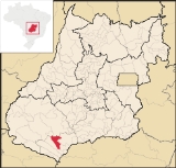
Location
Cachoeira Alta is located in the Quirinópolis MicroregionQuirinópolis Microregion
The Quirinópolis Microregion is a region in south Goiás state, Brazil. It includes 8 municipalities with a population of 95,094 and a total area of 16,117.60 km². The population density was 5.89 km²...
in an unpopulated area of the south of the state. Some of the largest municipalities in total area are located here. There are road connections with Aparecida do Rio Doce
Aparecida do Rio Doce
right|250pxAparecida do Rio Doce is a small town and municipality in southwest Goiás state, Brazil.-Geography:The municipality of Aparecida do Rio Doce belongs to the Sudoeste de Goiás Microregion and is 208 km. from the state capital, Goiânia. Connections are made by BR-060 / Guapó / Indiara...
, 57 km. to the north; and Paranaiguara
Paranaiguara
Paranaiguara is a small town and municipality in south Goiás state, Brazil.-Location and Geography:Paranaiguara is in the Quirinópolis Microregion, whose most important city is Quirinópolis. The distance to the state capital, Goiânia, is 351 km. Highway connections are made by BR-060 /...
, 37 km. to the southeast.
The distance to the state capital, Goiânia
Goiânia
-Climate:The city has a tropical wet and dry climate with an average temperature of . There's a wet season, from October to April, and a dry one, from May to September. Annual rainfall is around 1,520 mm....
, is 356 km. Highway connections are made by BR-060 / Guapó
Guapó
Guapó is a small town and municipality in central Goiás state, Brazil. The population was 13,586 and the total area of the municipality was 517.0 km² .Guapó is part of the Goiânia Microregion...
/ Indiara
Indiara
Indiara is a small city and municipality in central-south Goiás state, Brazil. Indiara is a large producer of soybeans and cotton.-Location:Indiara is located in the Vale do Rio dos Bois and has municipal boundaries with:*north: Palmeiras de Goiás...
/ Acreúna
Acreúna
Acreúna is a small city and municipality in western Goiás state, Brazil.-Location:Acreúna is located in the statistical micro-region of Vale do Rio dos Bois, southwest of the state capital, Goiânia, on BR-060, which links Goiânia with Rio Verde...
/ Rio Verde
Rio Verde, Goiás
Rio Verde is a city and municipality in the Brazilian state of Goiás. It is a fast-growing center and is the largest producer of grains in the state.-Location:...
/ GO-174 / GO-422 / Aparecida do Rio Doce
Aparecida do Rio Doce
right|250pxAparecida do Rio Doce is a small town and municipality in southwest Goiás state, Brazil.-Geography:The municipality of Aparecida do Rio Doce belongs to the Sudoeste de Goiás Microregion and is 208 km. from the state capital, Goiânia. Connections are made by BR-060 / Guapó / Indiara...
/ BR-364. See Sepin
Neighboring municipalities are:
- north and east: QuirinópolisQuirinópolisQuirinópolis is a small city and municipality in south Goiás state, Brazil. It is a large producer of cattle and agricultural products.-Location:...
and Aparecida do Rio DoceAparecida do Rio Doceright|250pxAparecida do Rio Doce is a small town and municipality in southwest Goiás state, Brazil.-Geography:The municipality of Aparecida do Rio Doce belongs to the Sudoeste de Goiás Microregion and is 208 km. from the state capital, Goiânia. Connections are made by BR-060 / Guapó / Indiara... - south and west: CaçuCaçuCaçu is a small town and municipality in southwest Goiás state, Brazil.-Location:Caçu is part of the Quirinópolis Microregion. It is located 330 kilometers from the state capital, Goiânia and is crossed by highway GO-206, which links the city with Quirinópolis...
- east: ParanaiguaraParanaiguaraParanaiguara is a small town and municipality in south Goiás state, Brazil.-Location and Geography:Paranaiguara is in the Quirinópolis Microregion, whose most important city is Quirinópolis. The distance to the state capital, Goiânia, is 351 km. Highway connections are made by BR-060 /...
Demographics
- Population density in 2007: 4.90 inhab/km²
- Population growth rate 1996/2007: -0.19.%
- Total population in 2007: 8,103
- Total population in 1980: 9,243
- Urban population in 2007: 5,965
- Rural population in 2007: 2,138
(Sepin/IBGE)
The economy
The economy is based on cattle raising for meat and milk production, and agriculture, especially the planting of corn and rice. The cattle herd was 163,000 head including 12,000 milking cows in 2006.Economic Data
- Industrial establishments: 17
- Retail commercial establishments: 124
- Financial establishments: Banco do Brasil S.A. (August/2007)
- Meat packing plants: Arantes Alimentos Ltda. (22/05/2006)
- Dairies: Laticínios Sabor Goiano Ltda., Agrolima Indústria e Comércio de Laticínio Ltda., Indústria e Comércio de Laticínio Estrela do Oriente Ltda., Goiásminas Indústria de Laticínios Ltda. (22/05/2006)
Main agricultural production in planted area
- Rice: 80 ha.
- Banana: 16 ha.
- Rubber (coagulated): 140 ha.
- Manioc: 50 ha.
- Corn: 400 ha.
Farm Data (2006) in ha.
- Number of farms: 718
- Total area: 138,781
- Area of permanent crops: 346
- Area of perennial crops: 1,573
- Area of natural pasture: 106,800
- Persons dependent on farming: 1,430
- Farms with tractors: 195 IBGE
Health and education
The infant mortality rate was 28.90 (2000) while the literacy rate was 84.4% (2000). There were 11 schools with 2,213 students and 02 hospitals with 41 beds.Municipal Human Development Index
Human Development Index
The Human Development Index is a composite statistic used to rank countries by level of "human development" and separate "very high human development", "high human development", "medium human development", and "low human development" countries...
: 0.737
- State ranking: 116 (out of 242 municipalities in 2000)
- National ranking: 2,245 (out of 5,507 municipalities in 2000) See Frigoletto
History
The first European settlement on record occurred in 1876 when Manoel Batista Barroso, travelling medicine salesman, and Gabriel Paula do Amaral, settled on the right bank of the Cachoeira Alta River, five kilometers above where it meets the Rio Claro. In 1920 the town had grown and was officially called Cachoeira Alta, because of the river. In 1931 it became a district belonging to Rio VerdeRio Verde, Goiás
Rio Verde is a city and municipality in the Brazilian state of Goiás. It is a fast-growing center and is the largest producer of grains in the state.-Location:...
, being raised to municipal status in 1953.
See also
- List of municipalities in Goiás
- Quirinópolis MicroregionQuirinópolis MicroregionThe Quirinópolis Microregion is a region in south Goiás state, Brazil. It includes 8 municipalities with a population of 95,094 and a total area of 16,117.60 km². The population density was 5.89 km²...
- Microregions of Goiás