

Januária
Encyclopedia
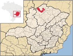
Minas Gerais
Minas Gerais is one of the 26 states of Brazil, of which it is the second most populous, the third richest, and the fourth largest in area. Minas Gerais is the Brazilian state with the largest number of Presidents of Brazil, the current one, Dilma Rousseff, being one of them. The capital is the...
state, Brazil
Brazil
Brazil , officially the Federative Republic of Brazil , is the largest country in South America. It is the world's fifth largest country, both by geographical area and by population with over 192 million people...
. It is located on the left bank of the São Francisco River
São Francisco River
The São Francisco is a river in Brazil. With a length of , it is the longest river that runs entirely in Brazilian territory, and the fourth longest in South America and overall in Brazil...
. The population was 64,985 inhabitants (IBGE 2007) and the area of the municipality was 6,691 km² (2007).
Municipal limits
Januária is limited in the north by the state of BahiaBahia
Bahia is one of the 26 states of Brazil, and is located in the northeastern part of the country on the Atlantic coast. It is the fourth most populous Brazilian state after São Paulo, Minas Gerais and Rio de Janeiro, and the fifth-largest in size...
, Bonito de Minas
Bonito de Minas
Bonito de Minas is a municipality in the northeast of the Brazilian state of Minas Gerais. As of 2007 the population was 8,787 in a total area of 3,901 km². The elevation is 629 meters. It became a municipality in 1997. The postal code is 39490-000....
and Cônego Marinho
Cônego Marinho
Cônego Marinho is a municipality in the north of the state of Minas Gerais in Brazil. As of 2007 the population was 6,279 in an area of 1,618 km².*The elevation of the municipal seat is 637 meters.*It became a municipality in 1997....
, in the south with São Francisco
São Francisco
São Francisco is one of the 48 neighborhoods in which the Brazilian city of Niterói is divided.Its name derives from the church consecrated to Saint Francis Xavier and references to it can be found as early as the 17th century...
, in the east with Pedras de Maria da Cruz
Pedras de Maria da Cruz
Pedras de Maria da Cruz is a municipality in the north of the state of Minas Gerais in Brazil. As of 2007 the population was 10,976 in an area of 1,520 km². The elevation of the municipal seat is 476 meters. It became a municipality in 1993...
and Itacarambi
Itacarambi
Itacarambi is a municipality in the north of the state of Minas Gerais in Brazil. As of 2007 the population was 17,626 in an area of 1,252 km².*The elevation of the municipal seat is 445 meters.*It became a municipality in 1962....
, and in the west with Chapada Gaúcha
Chapada Gaúcha
Chapada Gaúcha is a municipality in the northern region of Minas Gerais, Brazil. The population in 2007 was 10,266 in an area of 3,215 km². The elevation of the municipal seat is 872 meters. It became a municipality in 1997. The postal code is 39314-000.-Location:Chapada Gaúcha is part of...
.
Microregion
Januária is also a statistical microregion (number 31) consisting of 16 municipalities: Bonito de MinasBonito de Minas
Bonito de Minas is a municipality in the northeast of the Brazilian state of Minas Gerais. As of 2007 the population was 8,787 in a total area of 3,901 km². The elevation is 629 meters. It became a municipality in 1997. The postal code is 39490-000....
, Chapada Gaúcha
Chapada Gaúcha
Chapada Gaúcha is a municipality in the northern region of Minas Gerais, Brazil. The population in 2007 was 10,266 in an area of 3,215 km². The elevation of the municipal seat is 872 meters. It became a municipality in 1997. The postal code is 39314-000.-Location:Chapada Gaúcha is part of...
, Cônego Marinho
Cônego Marinho
Cônego Marinho is a municipality in the north of the state of Minas Gerais in Brazil. As of 2007 the population was 6,279 in an area of 1,618 km².*The elevation of the municipal seat is 637 meters.*It became a municipality in 1997....
, Icaraí de Minas
Icaraí de Minas
Icaraí de Minas is a municipality in the north of the state of Minas Gerais in Brazil. As of 2007 the population was 10,331 in an area of 617 km².*The elevation of the municipal seat is 595 meters.*It became a municipality in 1993....
, Itacarambi
Itacarambi
Itacarambi is a municipality in the north of the state of Minas Gerais in Brazil. As of 2007 the population was 17,626 in an area of 1,252 km².*The elevation of the municipal seat is 445 meters.*It became a municipality in 1962....
, Januária, Juvenília
Juvenília
Juvenília is a municipality in the north of the state of Minas Gerais in Brazil. As of 2007 the population was 17,626 in an area of 1,252 km².*The elevation of the municipal seat is 445 meters.*It became a municipality in 1962....
, Manga
Manga, Minas Gerais
Manga is a municipality in the north of the state of Minas Gerais in Brazil. As of 2007 the population was 20,903 in an area of 1,968 km².*The elevation of the municipal seat is 445 meters.*It became a municipality in 1997*The postal code is 39467-000...
, Matias Cardoso
Matias Cardoso
Matias Cardoso is a municipality in the north of the state of Minas Gerais in Brazil. As of 2007 the population was 10,270 in an area of 1,938 km².*The elevation of the municipal seat is 472 meters.*It became a municipality in 1993...
, Miravânia
Miravânia
Miravânia is a municipality in the north of the state of Minas Gerais in Brazil. As of 2007 the population was 4,708 in an area of 603 km².*The elevation of the municipal seat is 632 meters.*It became a municipality in 1997...
, Montalvânia
Montalvânia
Montalvânia is a municipality in the northernmost point of the state of Minas Gerais in Brazil. As of 2008 the population was 16,265 in an area of 1,484.388 km². The elevation of the municipal seat is 510 meters, the postal code is 39495-000 and it is located in the microregion of Januária-...
, Pedras de Maria da Cruz
Pedras de Maria da Cruz
Pedras de Maria da Cruz is a municipality in the north of the state of Minas Gerais in Brazil. As of 2007 the population was 10,976 in an area of 1,520 km². The elevation of the municipal seat is 476 meters. It became a municipality in 1993...
, Pintópolis
Pintópolis
Pintópolis is a municipality in the north of the state of Minas Gerais in Brazil. As of 2007 the population was 7,727 in an area of 1,238 km². The elevation of the municipal seat is 493 meters. It became a municipality in 1997. The postal code is 39317-000....
, São Francisco
São Francisco, Minas Gerais
For São Francisco in the state of Pernambuco see São Francisco, PernambucoSão Francisco is a municipality in the north of the state of Minas Gerais in Brazil. As of 2007 the population was 52,985 in an area of 3,300 km². The elevation of the municipal seat is 695 meters. It became a...
, São João das Missões
São João das Missões
São João das Missões is a municipality in the north of the Brazilian state of Minas Gerais. As of 2007 the population was 10,769 in a total area of 675 km². The elevation is 501 meters. It became a municipality in 1997....
, and Urucuia
Urucuia
Urucuia is a municipality in the north of the state of Minas Gerais in Brazil. As of 2007 the population was 11,376 in an area of 2,072 km². The elevation of the municipal seat is 498 meters. It became a municipality in 1993...
. The area is 15,945.80 km² and the population was 246,071 in 2000.
Districts
Due to the size of the municipality there are several districts. They are Brejo do Amparo, Levinópolis, Pandeiros, Riacho da Cruz, São Joaquim, Tejuco, and Várzea Bonita.Geography
With an elevation of 454.87 meters the average annual temperature is 26º. Temperatures vary between maximums of 38º and 12.6º. The climate is tropical with transition to semi-arid and its vegetation is composed of cerradoCerrado
The Cerrado, is a vast tropical savanna ecoregion of Brazil, particularly in the states of Gioas and Minas Gerais...
(savanna) and clusters of caatinga
Caatinga
Caatinga is a type of vegetation, and an ecoregion characterized by this vegetation in the northeastern part of Brazil. The name "Caatinga" is a Tupi word meaning "white forest" or "white vegetation"...
(thorn bush). The size of the municipality ranks it among the 75 largest municipalities of the state of Minas Gerais.
Communications
The most important route of communication with the rest of the state is the BR-135. A modern bridge has substituted the ferry on the river. The distance to Belo HorizonteBelo Horizonte
Belo Horizonte is the capital of and largest city in the state of Minas Gerais, located in the southeastern region of Brazil. It is the third largest metropolitan area in the country...
, the state capital, is 613 km.
Januária lies in an agro-pastoral region. Some changes have been implemented in recent years such as irrigation, soybean cultivation, and the decline of cotton cultivation.
Economic activities
Important crops are sugar cane (from which it inherited the fame of having one of the best rums in Brazil), corn, manioc and beans. Mango, breadfruit, coconut, orange, avocado, cashew, and bananas are also produced.Like almost all the cities in this area of Minas Gerais cattle raising is an important economic activity. In 2006 there were 62,000 head—small when the size of the municipality is taken into consideration.
Small industries produce rum, vinegar, cotton by-products, shoes, and furniture.
Motor vehicles in 2007
- Automobiles: 2,271
- Pickup trucks: 584
- Number of inhabitants per motor vehicle: 23
Main crops in area 2006
- Rice: 600 ha.
- Corn: 3,000 ha.
- Manioc: 2,500 ha.
- Beans: 2,500 ha.
- Sugarcane: 500 ha.
Farm data for 2006
- Number of farms: 3,349
- Agricultural area: 120,016 ha.
- Planted area: 9,700 ha.
- Area of natural pasture: 55, 113 ha.
- Workers related to the producer: 10,147
- Workers not related to the producer: 1,050
- Number of farms with tractors: 97
From this data we can see that the planted area is small compared to the total agricultural area and that there are many people still living in the rural zone of the municipality. The number of tractors per farm was very low.
Health and Education (2005)
- Hospitals: 2 with 113 beds
- Health clinics: 21
- Primary schools: 95
- Primary school enrollment: 15,411
- Middle schools: 13
- Middle school enrollment: 239
History
The first explorers arrived in 1553 looking for gold. They were led by Castelhano Francisco Bruza de Espinosa and Padre João de Apicuelta Navarro. The first settlement was called Brejo do Salgado, due to the salinity of the streams and the marshes. The first sugarcane mill was set up and soon a chapel followed dedicated to Nossa Senhora do Amparo. In 1833 Brejo do Salgado became a "vila", or town and the seat was transferred to the left bank of the São Francisco River, the name being changed to Januária, in homage to Princess Januária, daughter of the Emperor Pedro I. In 1860 Januária was elevated to the category of city. The surrounding area was immense with several districts such as São Caetano do Japoré (today the city of MangaManga
Manga is the Japanese word for "comics" and consists of comics and print cartoons . In the West, the term "manga" has been appropriated to refer specifically to comics created in Japan, or by Japanese authors, in the Japanese language and conforming to the style developed in Japan in the late 19th...
), São João das Missões, Jacaré (today the city of Itacarambi
Itacarambi
Itacarambi is a municipality in the north of the state of Minas Gerais in Brazil. As of 2007 the population was 17,626 in an area of 1,252 km².*The elevation of the municipal seat is 445 meters.*It became a municipality in 1962....
), Conceição de Morrinhos (today the city of Matias Cardoso
Matias Cardoso
Matias Cardoso is a municipality in the north of the state of Minas Gerais in Brazil. As of 2007 the population was 10,270 in an area of 1,938 km².*The elevation of the municipal seat is 472 meters.*It became a municipality in 1993...
), Mocambo (today a district of Levinópolis) all created in 1903.
Districts created and lost
- In 1911 the district of Pedras de Maria da Cruz was created.
- In 1923 the districts of MangaMangaManga is the Japanese word for "comics" and consists of comics and print cartoons . In the West, the term "manga" has been appropriated to refer specifically to comics created in Japan, or by Japanese authors, in the Japanese language and conforming to the style developed in Japan in the late 19th...
and Matias CardosoMatias CardosoMatias Cardoso is a municipality in the north of the state of Minas Gerais in Brazil. As of 2007 the population was 10,270 in an area of 1,938 km².*The elevation of the municipal seat is 472 meters.*It became a municipality in 1993...
were lost but the district of Cônego Marinho was added. - In 1938 the district of Missões was created
- In 1953 Riacho da Cruz (ex-Bela Vista) was created.
- In 1962 the districts of ItacarambiItacarambiItacarambi is a municipality in the north of the state of Minas Gerais in Brazil. As of 2007 the population was 17,626 in an area of 1,252 km².*The elevation of the municipal seat is 445 meters.*It became a municipality in 1962....
and MissõesMissõesMissões or Missões do Uruguai is the region located in the Northwestern part of the Brazilian state of Rio Grande do Sul, close to the border between Brazil and Argentina....
were lost. - In 1976 the districts of Bonito, São Joaquim and Tejuco were created
- In 1982, São Pedro das Tabocas was created.
- In 1992 the district of Pedras de Maria da Cruz (hoje Maria da Cruz) was lost
- In 1995 the districts of Bonito (today the city of Bonito de MinasBonito de MinasBonito de Minas is a municipality in the northeast of the Brazilian state of Minas Gerais. As of 2007 the population was 8,787 in a total area of 3,901 km². The elevation is 629 meters. It became a municipality in 1997. The postal code is 39490-000....
) and Cônego Marinho (today the city of Cônego MarinhoCônego MarinhoCônego Marinho is a municipality in the north of the state of Minas Gerais in Brazil. As of 2007 the population was 6,279 in an area of 1,618 km².*The elevation of the municipal seat is 637 meters.*It became a municipality in 1997....
) were created.
Tourism
The location on the banks of one of the most important rivers in Brazil opens up many recreational possibilities. In the months of July, August, and September when the river is low and relatively clean there are extensive beaches along the river sought after by swimmers and sunbathers. Nearby there is a fifteen meter high waterfall called the Cachoeira de Pandeiros which has a large area for swimming. In the city itself the nineteenth century architecture has been preserved in many government buildings and private houses, with the most important being the Casa da Memoria (1910) and the City Hall (1890).External links
in Portuguese:- JaNu AR - O Melhor de Januária & Região na Web incomplete
- Serviços de Informática em Januária
- SESC/MG LACES e Pousada Januária
- Prefeitura de Januária little practical information
- Hotel in Januária
- Camara Municipal de Januária incomplete in most areas.
- Romtech Soluções em Informática e Serviços