

Matias Cardoso
Encyclopedia
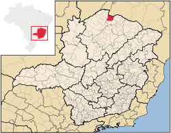
Minas Gerais
Minas Gerais is one of the 26 states of Brazil, of which it is the second most populous, the third richest, and the fourth largest in area. Minas Gerais is the Brazilian state with the largest number of Presidents of Brazil, the current one, Dilma Rousseff, being one of them. The capital is the...
in Brazil
Brazil
Brazil , officially the Federative Republic of Brazil , is the largest country in South America. It is the world's fifth largest country, both by geographical area and by population with over 192 million people...
. As of 2007 the population was 10,270 in an area of 1,938 km².
- The elevation of the municipal seat is 472 meters.
- It became a municipality in 1993
- The postal code (CEP) is 39478-000
- Statistical microregion: JanuáriaJanuáriaJanuária, known as "The Queen of the Beautiful Waters" is a city and municipality in northern Minas Gerais state, Brazil. It is located on the left bank of the São Francisco River...
Matias Cardoso is located on the right bank of the São Francisco River
São Francisco River
The São Francisco is a river in Brazil. With a length of , it is the longest river that runs entirely in Brazilian territory, and the fourth longest in South America and overall in Brazil...
. It is 10 km. south of Manga
Manga, Minas Gerais
Manga is a municipality in the north of the state of Minas Gerais in Brazil. As of 2007 the population was 20,903 in an area of 1,968 km².*The elevation of the municipal seat is 445 meters.*It became a municipality in 1997*The postal code is 39467-000...
and is 72 km. northwest of Jaíba
Jaíba
Jaíba is a municipality in the north of the Brazilian state of Minas Gerais. As of 2007 the population was 30,386 in a total area of 2,733 km². The elevation is 475 meters. It became a municipality in 1993. The postal code is 39508-000....
.
The economy is based on agriculture with emphasis on cattle raising. There were 46,000 head in 2006. The main agricultural crops were cotton, peanuts, corn, manioc, sorghum, sugarcane, and mamona--castor oil plant. The GDP was R$37,034,000 in 2005.
This municipality is extremely isolated from major population centers and suffers from drought and poor soils. It is one of the poorest in the state and in the country.
- Municipal Human Development IndexHuman Development IndexThe Human Development Index is a composite statistic used to rank countries by level of "human development" and separate "very high human development", "high human development", "medium human development", and "low human development" countries...
: .602 (2000) - State ranking: 831 out of 853 municipalities as of 2000
- National ranking: 4,618 out of 5,138 municipalities as of 2000
(For the complete list see Frigoletto)
- Illiteracy rate: 32.51% (older than 16)--the rate for the state was 11.96% (2000)
- Infant mortality rate: 12.20--the rate for the state was 17.40 (2000)
- Urbanization rate: 43%--the rate for the state was 80% (2000)
- Urban area connected to sewers: 2.4%--the state percentage was 81.39% (2000)
- Urban area with garbage collection: 34.06%--the state percentage was 91.37 (2000)
- Health clinics: 4